 Block
From the record
4 National Register listings published here, 3 of them National Historic Landmarks.
Sources: the National Register database, National Park Service
98 topographic sheets cover 37 settlements here, and 4 properties are on the National Register of Historic Places.
4 National Register listings published here, 3 of them National Historic Landmarks.
Sources: the National Register database, National Park Service
Every property in this county listed on the National Register of Historic Places, with the year it was listed and the federal nomination document.
| Photograph | Property | Type | Listed | Reference |
|---|---|---|---|---|
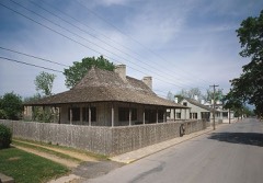 | Louis Bolduc House | building | 1969 | 69000305 |
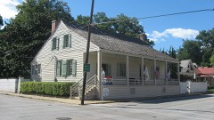 | Jacques Dubreuil Guibourd House | building | 1969 | 69000307 |
 | Ste. Genevieve Historic District | district | 1966 | 66000892 |
 | Ste. Genevieve Historic District | district | 2002 | 02000357 |
Every wildfire the federal occurrence database records inside this county: 46 of them, burning about 388 acres. None started naturally and 2 were recorded as arson. Each settlement page carries the fires within five miles of it.
| Reported cause | Fires |
|---|---|
| Missing data/not specified/undetermined | 32 |
| Debris and open burning | 5 |
| Recreation and ceremony | 3 |
| Power generation/transmission/distribution | 2 |
| Arson/incendiarism | 2 |
| Railroad operations and maintenance | 1 |
| Equipment and vehicle use | 1 |
The five largest, by the area the report gives. Two of them were set deliberately.
| Date | Cause | Size | Reported by | Name on the report |
|---|---|---|---|---|
| 19 November 1992 | Recreation and ceremony | 110 acres | Missouri Department of Conservation | not named |
| 10 March 2004 | Debris and open burning | 40 acres | Mark Twain National Forest | WOMACK |
| 8 March 1992 | Railroad operations and maintenance | 30 acres | Missouri Department of Conservation | not named |
| 19 March 1995 | Arson/incendiarism | 30 acres | Missouri Department of Conservation | not named |
| 8 March 2020 | Debris and open burning | 27 acres | Missouri Department of Conservation | 190195-09526-03082020-1530 |
| 12 March 1994 | Debris and open burning | 25 acres | Missouri Department of Conservation | not named |
| 19 November 2020 | Missing data/not specified/undetermined | 21 acres | Missouri Department of Conservation | 241055-09502-11192020-2350 |
| 9 January 2012 | Arson/incendiarism | 20 acres | Mark Twain National Forest | COUNTY LINE |
Every settlement page carries the fires within five miles of it - see the settlement index below.
The NOAA Storm Events Database holds 202 reports for this county, causing 2 deaths, 8 injuries and about $817,500 in recorded property damage. Each settlement page carries the reports that name it.
| Kind of event | Reports |
|---|---|
| Thunderstorm Wind | 94 |
| Hail | 70 |
| Flash Flood | 15 |
| Tornado | 13 |
| Lightning | 5 |
| Flood | 4 |
| Heavy Rain | 1 |
The most serious of them, by death, then injury, then recorded damage. The accounts are quoted exactly as the forecast office filed them.
| When | Event | Place named | Harm | What the report says |
|---|---|---|---|---|
| May 1996 | Flash Flood | Countywide | 2 killed, 2 hurt, $20,000 | no account filed |
| May 1995 | Tornado (F2) | Festus to | 3 hurt, $195,000 | Hail damaged several cars and large trees were blown down. |
| March 2006 | Tornado (F2) | Womack | 2 hurt | The fourth tornado from the Southeast Missouri supercell formed in extreme southwest Ste. Genevieve County and went on to be the longest and strongest of the four tornadoes. The tornado formed about 9:20 pm CST just east of Route WW and one mile north of Holmes Road. On Kramer Road, just off Route N, the tornado produced F2 damage that was at least 400 yards wide. A double wide mobile home was rolled about 150 yards and completely destroyed. Two occupants suffered serious injuries. Two other mobile homes in the area were also destroyed, along with two barns, a machine shed and a detached garage. The tornado continued northeast and tracked into northern Perry County. |
| October 2021 | Tornado (EF3) | Avon | 1 hurt | The 400+ yard wide tornado crossed the St. Francois County/Ste. Genevieve County line just north of Green Acres Lane. The tornado then traveled to the northeast crossing Route F multiple times as it traveled towards Coffman. Numerous trees were snapped or uprooted along this path, a number of farm outbuildings and barns were damaged or destroyed, and several homes suffered partial roof damage. The worst damage occurred to a home on Route AA just north of Route F. This home was completely destroyed. All of the walls were completely blown into the rear of the foundation and the roof was totally removed. Little anchoring was evident to the walls. One minor injury occurred to a male at the residence who found shelter in the pantry area. Tree damage in this area was some of the worst noted with every tree snapped or sheared supporting an EF-3 damage rating to the home. Another home on McDaniel Road just north of Route F sustained severe damage. The roof was completely removed and a large portion of the northeast walls were removed. Little if any anchoring of the walls was evident which supported an EF-2 damage rating. Numerous power poles and trees were snapped along Route F as the tornado traveled to the northeast into Coffman. Crown Valley Brewing and Distilling suffered minor damage, however the building on the north side of Route F was heavily damaged, rated at EF-1. A small building adjacent to the main Coffman Baptist Church was completely destroyed with debris blown into the main church building. There was no anchoring evident in this small building and damage was rated at EF-1. The tornado continued to the east-northeast crossing Madden Creek. The last detectable damage and thus end point was around 4 miles east-northeast of Coffman, southeast of Brands Lake near Goat Hill Trail. Overall, the tornado was rated EF3 with a path length of 16.74 miles and a max path width of 450 yards (St. Francois/Ste. Genevieve Counties). |
| December 2015 | Flash Flood | Thurman | $300,000 | Between 4 and 6 inches of rain fell over Ste. Genevieve County in a 48 hour period. The heaviest rain fell in the early morning hours of December 28th causing flash flooding. Numerous roads were flooded including Routes C, J and V, as well as US Highway 61 from Route M to Route H. Around 22 structures were either damaged or destroyed by the flash flooding. Damage was estimated around $300,000. |
| April 1998 | Tornado (F1) | Lawrenceton | $60,000 | no account filed |
| May 2024 | Thunderstorm Wind | Bloomsdale | $50,000 | Broadcast media reported 65 mph winds in Bloomsdale. Large trees fell in town with one falling on a house. There was a widespread power outage reported in Ste. Genevieve and surrounding areas. Lots of small limbs were down as well. |
| August 2024 | Thunderstorm Wind | New Offenburg | $40,000 | A Facebook user reported a collapsed large park pavilion and included a picture. After analysis, NWS concluded that the pavilion was lacking structural integrity. The thunderstorm winds that felled the structure are estimated to be between 40 and 50 mph. |
| April 2025 | Flash Flood | Kinsey | $30,000 | Fourche a Du Clos flooded over Highway Y at Jackson School Road deeming it impassable through the first low bottom bridge headed eastbound. A water rescue was reported at this location. On April 5th, water was reported over the roadway near Missouri 32. During the event, portions of Ste. Genevieve County received 3.75 to 6.25 inches of rainfall. |
| March 1972 | Tornado (F1) | not stated | $25,000 | no account filed |
| March 1952 | Tornado (F2) | not stated | $25,000 | no account filed |
| May 2022 | Thunderstorm Wind | St Marys | $20,000 | Thunderstorm winds blew down several trees onto Highway Z just southwest of St. Mary. In St. Mary, a tree fell onto an unoccupied car, causing major damage. |
| June 2008 | Flood | Brickeys | $10,000 | The Mississippi River crested at 39.46 feet at Chester, Illinois (across the river from Ste. Genevieve County) on 7/01/2008. This is the tenth highest crest ever recorded. Even though it was the tenth highest flood of record, damage was minimal. Some county roads near the river were closed and farm land in the river bottoms were flooded. Agricultural losses in the County were estimated at $3.8 million. |
| July 2003 | Thunderstorm Wind | Ste Genevieve | $10,000 | Thunderstorm wind gusts downed some trees. One large tree fell on a home and two cars. |
| May 2024 | Thunderstorm Wind | Coffman | $5,000 | A large portion of a metal barn roof was removed near Coffman. |
| August 2021 | Thunderstorm Wind | Ste Genevieve | $5,000 | Thunderstorm winds blew down numerous tree limbs in Ste. Genevieve. In St. Mary, a couple of trees were blown down. |
| October 2010 | Lightning | Ste Genevieve | $5,000 | As storms moved through the area, lightning struck the tower at the Ste. Genevieve County 911 Dispatch Center. It knocked out the center's radios and one of its two telephone consoles and did damage to computers. Everything was back up and running by Thursday evening, about 48 hours after the lightning strike. |
| March 1996 | Thunderstorm Wind | Ste Genevieve | $5,000 | no account filed |
| May 1995 | Hail | were slightly injured | $3,500 | Hail damaged several cars and large trees were blown down. |
| November 1984 | Tornado (F1) | not stated | $2,500 | no account filed |
| September 2007 | Lightning | Ste Genevieve | $2,000 | Lightning struck the 911 tower in Ste. Genevieve. It knocked out fuses, fried two computer circuit boards and took out all the dispatch phones. Service was not back up til the next day. |
| June 1995 | Thunderstorm Wind | Ste. Genevieve | $1,300 | One mobile home sustained damage and several large trees were knocked down. |
| June 2013 | Flood | Brickeys | $1,000 | no account filed |
| May 1995 | Thunderstorm Wind | Weingarten | $900 | The county sheriff reported downed power lines with power outages. |
| April 1993 | Thunderstorm Wind | Ste. Genevieve | $500 | The county sheriff reported that numerous large tree limbs were knocked down. |
| May 1995 | Thunderstorm Wind | Ste. Genevieve | $400 | Hail damaged several cars and large trees were blown down. |
| May 1995 | Thunderstorm Wind | Ste Genevieve | $200 | Several large trees were blown down. |
| June 1995 | Thunderstorm Wind | Ste. Genevieve | $200 | Large trees were blown down. |
| March 2026 | Thunderstorm Wind | Ste Genevieve | - | Thunderstorm winds caused tree damage of an unknown extent in Ste. Genevieve County. |
| March 2026 | Thunderstorm Wind | Thurman | - | Thunderstorm winds caused debris from trees to cover the roadway of Highway D just north of Highway O. |
| May 2025 | Hail | Ste Genevieve | - | Quarter sized hail fell at US 61 and Market Street in Ste. Genevieve. |
| May 2025 | Thunderstorm Wind | Kinsey | - | Thunderstorm winds uprooted, snapped, and topped numerous large trees west and northwest of Bloomsdale. This wind damage is separate from a confirmed tornado that occurred nearby. |
| May 2025 | Tornado (EF0) | Kinsey | - | A brief tornado touched down near Dry Fork, uprooting trees. From there the tornado tracked northeast, causing more tree damage before dissipating near Cindy Lane. |
| April 2025 | Thunderstorm Wind | New Offenburg | - | Thunderstorm winds knocked a tree down over the road at Missouri Route O and Highway 32. |
| July 2023 | Thunderstorm Wind | Ste Genevieve | - | Thunderstorm winds blew down a large tree damaging an unoccupied car in Ste. Genevieve. In Saint Mary, several large tree limbs were blown down around town. |
| April 2022 | Hail | Minnith | - | Numerous reports of large hail. A few of the hail stones were 2 inches in diameter. |
| October 2021 | Tornado (EF2) | St Marys | - | The next tornado from this supercell began around 2 miles southwest of St. Mary between State Route Z and Saline Creek. The tornado destroyed several farm outbuildings shortly after touching down and also further northeast on St. Marys Church Road. Numerous trees were uprooted or snapped in St. Mary along with damage to 28 homes. The worst damage in St. Mary occurred along Church Street where one home lost its entire roof, and the roof was removed from a large portion of the St. Mary Antique Mall. This damage was rated EF-2. The tornado continued to the northeast moving through the flood plain and crossed the Mississippi River into Illinois just north of the Menard Correctional Center. |
| March 2020 | Thunderstorm Wind | Zell | - | Thunderstorm winds blew down several trees and blew an awning off of a residence just north of U.S. Highway 61. |
| July 2020 | Thunderstorm Wind | Ste Genevieve | - | Thunderstorm winds blew down several trees, tree limbs and power lines on the west side of town. Also, a building had a portion of its roof blown off. |
| May 2018 | Thunderstorm Wind | Bloomsdale | - | Thunderstorm winds blew a large tree down. |
| May 2018 | Flash Flood | Clearwater | - | Up to 5 inches of rain fell in a short amount of time over southern portions of Ste. Genevieve County. Several roads were flooded and Saline Creek was out of its banks where it runs parallel to Boyd Road. |
| August 2018 | Flash Flood | Womack | - | Up to five inches of rain fell in a short amount of time causing flash flooding. Coldwater and Alexander Creeks were well above bankfull, flooding nearby roadways. |
| June 2018 | Thunderstorm Wind | Thomure | - | Thunderstorm winds blew down several large tree limbs. One of the limbs blocked a roadway. |
| December 2018 | Thunderstorm Wind | Womack | - | Thunderstorm winds blew down several trees across southern portions of Ste. Genevieve County. |
| April 2017 | Flash Flood | Womack | - | Between four and eight inches of rain fell causing widespread flash flooding. Numerous roads were flooded including Route C near Weingarten, and Highways A and B west and southwest of Ste. Genevieve. |
| May 2017 | Thunderstorm Wind | Womack | - | Thunderstorm winds blew down numerous trees, tree limbs and power lines in the southern portions of Ste. Genevieve County. |
| July 2016 | Thunderstorm Wind | Sprott | - | A line of severe storms moved across Ste. Genevieve County. Numerous trees, tree limbs and power lines were blown down countywide, especially between Farmington and Ste. Genevieve. |
| May 2016 | Thunderstorm Wind | Bloomsdale | - | Thunderstorm winds blew down several large trees around town. |
| May 2016 | Thunderstorm Wind | Ste Genevieve | - | Thunderstorm winds blew down several large trees around town. One large tree fell onto U.S. Highway 61, blocking one lane. |
| May 2016 | Hail | Weingarten | - | Golfball size hail fell at Hawn State Park. |
| July 2016 | Thunderstorm Wind | Bloomsdale | - | Thunderstorm winds blew down several large trees and power lines around town. |
| July 2016 | Thunderstorm Wind | Weingarten | - | Thunderstorm winds blew down numerous trees, tree limbs and power lines down between Weingarten and Ste. Genevieve. |
| April 2015 | Flash Flood | Minnith | - | Up to three inches of rain fell into a short amount of time causing flash flooding. Several roads were flooded. Highway N just southwest of intersection with Minnith Road was washed out when Saline Creek overflowed its banks. |
| April 2015 | Flash Flood | Bloomsdale | - | Up to three inches of rain fell in a short amount of time causing flash flooding. Several roads were flooded including Route Y southwest of Bloomsdale. |
| May 2015 | Thunderstorm Wind | Bloomsdale | - | Thunderstorm winds snapped a pecan tree. |
| May 2015 | Thunderstorm Wind | Thurman | - | Several power lines were blown down and a couple of homes in the Seven Falls Subdivision sustained minor roof damage. |
| May 2014 | Thunderstorm Wind | Minnith | - | Thunderstorm winds blew down several large trees. Also, an old barn was blown down. |
| April 2013 | Thunderstorm Wind | Zell | - | Thunderstorm winds blew over a couple of empty semi trailers at a business on Kimmel Lake Road just south of Highway O. A couple of large tree limbs were blown down as well. |
| May 2013 | Thunderstorm Wind | St Marys | - | Thunderstorm winds split a three foot diameter tree and blew down numerous large tree limbs around town. |
| May 2013 | Thunderstorm Wind | Avon | - | Thunderstorm winds blew down two large trees, partially blocking Highway F near intersection with Highway MM. |
The Survey's mineral resources record lists 77 workings inside this county. 2 still produce and 75 are closed or unrecorded. Each settlement page carries the workings within five miles of it.
| Commodity | Workings |
|---|---|
| Stone, Crushed/Broken | 35 |
| Copper | 8 |
| Lead | 6 |
| Feldspar | 5 |
| Lead, Zinc | 5 |
| Iron | 4 |
| Sand and Gravel, Construction | 2 |
| Gold | 2 |
| Silver, Iron, Lead | 1 |
| Copper, Iron, Lead, Nickel, Cobalt | 1 |
| Clay | 1 |
| Copper, Lead, Nickel, Zinc | 1 |
| Gold, Iron | 1 |
| Cobalt, Copper, Lead, Nickel | 1 |
The least common of them first, because a county's hundredth gravel pit says nothing its first ten did not.
| Where | Site | Commodity | Status | Recorded |
|---|---|---|---|---|
| Frank Scott Diggings | Gold, Iron | Past Producer | ||
| Inkley Marble Quarry | Marble, Dimension, Stone, Crushed/Broken | Past Producer | ||
| Peerless Mine and Mill | Calcium | Producer | ||
| Sainte Genevieve | Copper, Silver, Iron, Lead | Past Producer | 1863, 1876, 1916 | |
| Unknown - Iron-Pb-Ni-Cu-Co | Copper, Iron, Lead, Nickel, Cobalt | Past Producer | ||
| Unknown - Lead-Cobalt-Nickel-Copper | Cobalt, Copper, Lead, Nickel | Past Producer | ||
| Unknown - Lead-Zinc-Copper-Iron | Copper, Iron, Lead, Zinc | Past Producer | ||
| Unknown - Ls Dimension | Limestone, Dimension | Past Producer | ||
| Unknown - Manganese | Manganese | Past Producer | ||
| Unknown - Stone Misc Dim | Stone, Dimension | Past Producer | ||
| Vogts Prospect | Copper, Lead, Nickel, Zinc | Prospect | ||
| Wulfords Pit | Clay | Past Producer | ||
| Unknown - Gold | Gold | Prospect | ||
| Unknown - Gold | Gold | Prospect | ||
| Unknown - S+G | Sand and Gravel, Construction | Past Producer | ||
| Unknown - S+G | Sand and Gravel, Construction | Past Producer | ||
| Naeger Bank | Iron | Past Producer | ||
| Peter Naeger Prospect | Iron | Past Producer | ||
| Smith Prospect | Iron | Prospect | ||
| Unknown - Iron | Iron | Past Producer | ||
| Avon Mine | Lead, Zinc | Past Producer | ||
| Dobschutz Diggings | Feldspar | Past Producer | ||
| Niedringhaus Deposit | Feldspar | Past Producer | ||
| Pratte Diggings | Feldspar | Past Producer | ||
| Unknown - Feldspar | Feldspar | Past Producer | ||
| Unknown - Feldspar | Feldspar | Prospect | ||
| Unknown - Lead-Zinc | Lead, Zinc | Past Producer | ||
| Unknown - Lead-Zinc | Lead, Zinc | Past Producer | ||
| Unknown - Lead-Zinc | Lead, Zinc | Past Producer | ||
| Woodward + Turner Shaft | Lead, Zinc | Past Producer | ||
| Avon Prospect | Lead | Past Producer | 1848 | |
| Saline Valley Mine | Lead | Past Producer | ||
| Ste. Genevieve Mines (Cornwall, Chicago, Swansea, Crow, Herzog) | Copper, Lead | Past Producer | 1863, 1876 | |
| Unknown - Lead | Lead | Past Producer | ||
| Unknown - Lead | Lead | Past Producer | ||
| Unknown - Lead | Lead | Past Producer | ||
| Cornwall Copper Mine | Copper | Past Producer | 1863, 1876 | |
| Cornwall Copper Mines | Copper | Past Producer | ||
| Herzog Mine | Copper | Past Producer | ||
| Swansea Copper Mine | Copper | Past Producer | 1863, 1876 | |
| Swansea Mine | Copper | Past Producer | ||
| Unknown - Copper | Copper | Past Producer | ||
| Byington Quarry | Stone, Crushed/Broken | Past Producer | ||
| Carrans Quarry | Stone, Crushed/Broken | Past Producer | ||
| Golden Vein Quarry | Stone, Crushed/Broken | Past Producer | ||
| Inkley Quarry | Stone, Crushed/Broken | Past Producer | ||
| Roth Quarry | Stone, Crushed/Broken | Past Producer | ||
| Southern Missouri Quarry | Stone, Crushed/Broken | Past Producer | ||
| Udding Quarry | Stone, Crushed/Broken | Past Producer | ||
| Udding Quarry | Stone, Crushed/Broken | Producer | ||
| Unknown - Ls | Stone, Crushed/Broken | Past Producer | ||
| Unknown - Ls | Stone, Crushed/Broken | Past Producer | ||
| Unknown - Ls | Stone, Crushed/Broken | Past Producer | ||
| Unknown - Ls | Stone, Crushed/Broken | Past Producer | ||
| Unknown - Ls | Stone, Crushed/Broken | Past Producer | ||
| Unknown - Ls | Stone, Crushed/Broken | Past Producer | ||
| Unknown - Ls | Stone, Crushed/Broken | Past Producer | ||
| Unknown - Ls | Stone, Crushed/Broken | Past Producer | ||
| Unknown - Ls | Stone, Crushed/Broken | Past Producer | ||
| Unknown - Ls | Stone, Crushed/Broken | Past Producer | ||
| Unknown - Ls | Stone, Crushed/Broken | Past Producer | ||
| Unknown - Ls | Stone, Crushed/Broken | Past Producer | ||
| Unknown - Ls | Stone, Crushed/Broken | Past Producer | ||
| Unknown - Ls | Stone, Crushed/Broken | Past Producer | ||
| Unknown - Ls | Stone, Crushed/Broken | Past Producer | ||
| Unknown - Ls | Stone, Crushed/Broken | Past Producer | ||
| Unknown - Ls | Stone, Crushed/Broken | Past Producer | ||
| Unknown - Ls | Stone, Crushed/Broken | Past Producer | ||
| Unknown - Ls | Stone, Crushed/Broken | Past Producer | ||
| Unknown - Ls | Stone, Crushed/Broken | Past Producer | ||
| Unknown - Ls | Stone, Crushed/Broken | Past Producer | ||
| Unknown - Ls | Stone, Crushed/Broken | Past Producer | ||
| Unknown - Ls | Stone, Crushed/Broken | Past Producer | ||
| Unknown - Ls | Stone, Crushed/Broken | Past Producer | ||
| Unknown - Sandstone | Stone, Crushed/Broken | Past Producer | ||
| Unknown - Sandstone | Stone, Crushed/Broken | Past Producer | ||
| Weiler Marble Quarry Number One | Stone, Crushed/Broken | Past Producer |
Named settlements recorded in the Geographic Names Information System, each with the topographic sheets covering it. Villages, hamlets and abandoned places alike. Each is shown with the nearest named watercourse or landform and the survey quadrangle it falls on.
Jackson township · 63627 · On Carpenter Branch · Bloomsdale quadrangle
19 sheets, 1915 to 1993
Jackson township · 63627 · In Brickeys Hollow · Bloomsdale quadrangle
19 sheets, 1915 to 1993
Saline township · 63670 · On Coldwater Creek · Coffman quadrangle
19 sheets, 1907 to 2002
Jackson township · 63627 · Near Staples Hollow · Bloomsdale quadrangle
19 sheets, 1915 to 1993
Saline township · 63670 · Near Cheesebrough Hill · Coffman quadrangle
19 sheets, 1907 to 2002
Ste. Genevieve township · 63670 · On Hogg Creek · Weingarten quadrangle
18 sheets, 1907 to 1989
Ste. Genevieve township · 63670 · On Dodge Creek · Kaskaskia quadrangle
24 sheets, 1915 to 1993
Union township · 63670 · On North Fork Jonca Creek · Sprott quadrangle
18 sheets, 1904 to 1989
Ste. Genevieve township · 63670 · On Hickory Creek · Weingarten quadrangle
18 sheets, 1907 to 1989
Jackson township · 63627 · Near Pinhook Hollow · Lawrenceton quadrangle
19 sheets, 1904 to 1989
Ste. Genevieve township · 63670 · Prairie du Rocher quadrangle
19 sheets, 1915 to 1993
Union township · 63670 · Near Little Vine Hill · Lawrenceton quadrangle
19 sheets, 1904 to 1989
Union township · 63670 · On South Fork Jonca Creek · Sprott quadrangle
18 sheets, 1904 to 1989
Beauvais township · 63673 · Near Cottonwood Hollow · Minnith quadrangle
19 sheets, 1907 to 2000
Ste. Genevieve township · 63670 · Near Bois Brule Bottom · Sainte Genevieve quadrangle
19 sheets, 1907 to 1993
Ste. Genevieve township · 63670 · Near Lick Hollow · Weingarten quadrangle
18 sheets, 1907 to 1989
Ste. Genevieve township · 63670 · On Dodge Creek · Sainte Genevieve quadrangle
19 sheets, 1907 to 1993
Beauvais township · 63670 · On Flint Bottom Creek · Minnith quadrangle
19 sheets, 1907 to 2000
Union township · 63670 · On Hickory Creek · Weingarten quadrangle
18 sheets, 1907 to 1989
Ste. Genevieve township · 63670 · On Valle Spring Branch · Sainte Genevieve quadrangle
19 sheets, 1907 to 1993
Ste. Genevieve township · 63670 · On North Gabouri Creek · Sainte Genevieve quadrangle
19 sheets, 1907 to 1993
Ste. Genevieve township · 63670 · On Coal Creek · Weingarten quadrangle
18 sheets, 1907 to 1989