 Block
From the record
10 National Register listings published here.
Sources: the National Register database, National Park Service
61 topographic sheets cover 28 settlements here, and 10 properties are on the National Register of Historic Places.
10 National Register listings published here.
Sources: the National Register database, National Park Service
Every property in this county listed on the National Register of Historic Places, with the year it was listed and the federal nomination document.
| Photograph | Property | Type | Listed | Reference |
|---|---|---|---|---|
| Borgmann Mill | building | 1970 | 70000351 | |
| Flanders Callaway House | building | 1969 | 69000127 | |
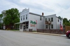 | Herman H. Fortmann Building | building | 2006 | 06000332 |
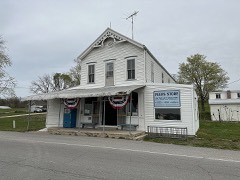 | Glosemeyer General Store | building | 2018 | 100002039 |
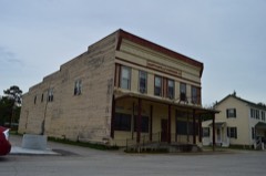 | Marthasville Hardware Building | building | 2008 | 08000020 |
 | Ernst Schowengerdt House | building | 1980 | 80002397 |
 | Southwestern Bell Repeater Station-Wright City | building | 2007 | 07000039 |
| Starke-Meinershagen-Boeke Rural Historic District | district | 1998 | 97001611 | |
| Treloar Mercantile and Farmer's Bank of Treloar HD | district | 2022 | 100007419 | |
| Warren County Courthouse and Circuit Court Building | district | 1972 | 72000733 |
Every wildfire the federal occurrence database records inside this county: 127 of them, burning about 742 acres. 4 started naturally and none was recorded as arson. Each settlement page carries the fires within five miles of it.
| Reported cause | Fires |
|---|---|
| Debris and open burning | 67 |
| Missing data/not specified/undetermined | 36 |
| Equipment and vehicle use | 9 |
| Natural | 4 |
| Smoking | 4 |
| Recreation and ceremony | 3 |
| Railroad operations and maintenance | 2 |
| Power generation/transmission/distribution | 1 |
| Misuse of fire by a minor | 1 |
The five largest, by the area the report gives. None of them was recorded as arson.
| Date | Cause | Size | Reported by | Name on the report |
|---|---|---|---|---|
| 3 April 2005 | Missing data/not specified/undetermined | 265 acres | Missouri Department of Conservation | LITTLE LOST CREEK |
| 1 May 2018 | Missing data/not specified/undetermined | 185 acres | Missouri Department of Conservation | 176951-07003-05012018-0850 |
| 7 March 2020 | Missing data/not specified/undetermined | 21 acres | Missouri Department of Conservation | 190172-10952-03072020-1555 |
| 21 March 1997 | Missing data/not specified/undetermined | 20 acres | Missouri Department of Conservation | not named |
| 16 April 1997 | Debris and open burning | 15 acres | Missouri Department of Conservation | not named |
| 17 June 2020 | Equipment and vehicle use | 13 acres | Missouri Department of Conservation | 220627-10928-06172020-1858 |
| 23 November 2017 | Debris and open burning | 12 acres | Missouri Department of Conservation | not named |
| 20 November 2017 | Missing data/not specified/undetermined | 10 acres | Missouri Department of Conservation | not named |
Every settlement page carries the fires within five miles of it - see the settlement index below.
The NOAA Storm Events Database holds 283 reports for this county, causing 1 death, 10 injuries and about $3,389,400 in recorded property damage. Each settlement page carries the reports that name it.
| Kind of event | Reports |
|---|---|
| Thunderstorm Wind | 122 |
| Hail | 110 |
| Flash Flood | 23 |
| Tornado | 15 |
| Flood | 6 |
| Lightning | 3 |
| Heavy Rain | 3 |
| Funnel Cloud | 1 |
The most serious of them, by death, then injury, then recorded damage. The accounts are quoted exactly as the forecast office filed them.
| When | Event | Place named | Harm | What the report says |
|---|---|---|---|---|
| June 1981 | Tornado (F2) | not stated | 1 killed, 6 hurt, $250,000 | no account filed |
| May 1983 | Tornado (F2) | not stated | 3 hurt, $2,500,000 | no account filed |
| July 2023 | Thunderstorm Wind | Case | 1 hurt | Thunderstorm winds blew a tree down onto a bridge that crosses Bear Creek, about 4 miles south southwest of High Hill. About 4 miles northeast of Jonesburg, a tree fell onto an occupied car causing moderate injuries to the occupant. |
| August 1990 | Tornado (F1) | not stated | $250,000 | no account filed |
| June 1982 | Tornado (F1) | not stated | $250,000 | no account filed |
| August 2021 | Thunderstorm Wind | Warrenton | $30,000 | Thunderstorm winds peeled off a portion of a flat roof on Daniel Boone Elementary School in the Warren County R-III School District. |
| July 2022 | Flash Flood | Pendleton | $25,000 | Up to 10 inches of rain fell in a 6 to 10 hour period causing flash flooding. Numerous roads were flooded including Highway A at the intersection with Highway W, Morsey Center Road about half a mile east of Highway A, and State Highway 47 just south of Powerline Road. Culvert was washed away on Pin Oak Church Road just east of y intersection near New Truxton Road, making the road impassable. |
| July 1971 | Tornado (F1) | not stated | $25,000 | no account filed |
| April 2001 | Tornado (F0) | Wright City | $20,000 | A small tornado formed briefly just west of Wright City. One mobile home on a sales lot was overturned. |
| July 2021 | Thunderstorm Wind | Warrenton O Sllvn Ar | $15,000 | A swath of wind damage across portions of Warren County. Several manufactured homes sustained minor damage to underpinning, tie downs and supports, about 3 miles north northeast of Warrenton. In Warrenton, a large sign near a shopping center was damaged. Several trees were blown down in and around Warrenton, one of which was about 3 feet in diameter. Just southwest of Wright City, a tree was topped and a small shed was moved several feet. |
| August 2022 | Thunderstorm Wind | Peers | $5,000 | Thunderstorm winds blew down several large trees onto Highway 94 just west of Marthasville. |
| April 1994 | Thunderstorm Wind | Marthasville | $5,000 | A local newspaper reported wind damage to several homes in town and farms both west and east of town. Several large trees were blown down and a shed was demolished killing a calf on a farm about one mile west of Marthasville. In town, several television attennas were knocked down and at least one garage door was blown off. |
| April 1994 | Thunderstorm Wind | Wright City | $5,000 | Numerous trees and power lines were knocked down, along with reports of one-inch-diameter hail. Reported by ham radio spotters. |
| September 2023 | Thunderstorm Wind | Pendleton | $3,000 | One cell amidst a group of disorganized convection produced wind gusts strong enough to bring down multiple power poles along I-70 very near the Montgomery and Warren county line. |
| August 2021 | Thunderstorm Wind | Concord Hill | $2,000 | Thunderstorm winds blew down several power lines between Hopewell and Marthasville. |
| July 1995 | Thunderstorm Wind | Warrenton | $2,000 | Wind gusts blew car windows out along County Road A. |
| August 2024 | Thunderstorm Wind | New Truxton | $500 | Thunderstorm winds knocked a powerline and a tree down along Powerline Road between Missouri Highway A and Missouri Route 47. |
| September 1993 | Thunderstorm Wind | Pendleton | $500 | The Missouri Highway Patrol reported power poles and lines down on County Road A north of Interstate 70. Ham Radio spotters reported power lines and trees down at New Truxton. Wind gusts to 58 mph were reported north of Warrenton a few minutes later. |
| September 1993 | Thunderstorm Wind | New Truxton | $500 | The Missouri Highway Patrol reported power poles and lines down on County Road A north of Interstate 70. Ham Radio spotters reported power lines and trees down at New Truxton. Wind gusts to 58 mph were reported north of Warrenton a few minutes later. |
| April 1998 | Tornado (F0) | Warrenton | $500 | no account filed |
| April 1995 | Thunderstorm Wind | Holstein | $200 | The county sheriff reported numerous large trees down over the southern part of the county at 1750 CST. A weather spotter also reported large trees down in Warrenton several minutes later. |
| April 1995 | Thunderstorm Wind | Warrenton | $200 | The county sheriff reported numerous large trees down over the southern part of the county at 1750 CST. A weather spotter also reported large trees down in Warrenton several minutes later. |
| April 2026 | Tornado (EF1) | Bernheimer | - | The tornado crossed the Missouri River into Warren County south of Pinckney, and moved north-north east, dissipating along Smith Creek Road. Tree damage was observed along the path, with the worst damage consisting of uprooted trees, resulting in estimated wind speeds of approximately 90 mph. |
| April 2026 | Tornado (EF0) | Peers | - | A Tornado Debris Signature off of the KLSX radar continued into Warren County from Franklin County. Ground survey was unable to find damage directly associated with tornado, but NWS GIS Mutual Aid analysis of high resolution satellite imagery was able to find tree damage consistent with an EF-0 tornado. |
| May 2025 | Hail | Marthasville | - | The Warren County emergency manager reported golf ball sized hail at Marthasville. |
| April 2025 | Flood | Wright City | - | A member of the public measured 1.32 inches having fallen 1 mile southwest of Warrenton just before reports of flooding started coming in. All reports came from the emergency manager and all locations listed typically flood when heavy rain falls. Spots include: Highway O at Walnut Crest, Highway F at South Stracks Church Road, Schreckengast Road at Cedar Lake Cellars, and Highway J at BMC Stone Quarry. |
| March 2024 | Hail | Case | - | Widespread large hail up to three inches in diameter fell across the southern half of Warren County, including the following towns: Pendelton, Warrenton, Truesdale, Innsbrook and Wright City. |
| March 2024 | Thunderstorm Wind | Pendleton | - | A swath of damaging winds extended from 3 miles west of Warrenton through the town of Warrenton. Numerous large trees were snapped off, as well as numerous tree limbs. Also, the roof of a mobile home was torn off and one house sustained roof damage when a tree limb speared a hole in the roof. |
| March 2024 | Thunderstorm Wind | Warrenton O Sllvn Ar | - | Thunderstorm winds snapped off several large tree limbs and blew down a tree that was a foot in diameter across the road. |
| June 2024 | Thunderstorm Wind | Wright City | - | Thunderstorm winds snapped a weak tree at its base at Coorperative Way just south of I-70. |
| April 2024 | Thunderstorm Wind | New Truxton | - | A trained spotter reported tree damage across Highway A with lots of debris. |
| July 2023 | Thunderstorm Wind | Pendleton | - | Thunderstorm winds blew a tree onto power lines at Highway EE and Wild Flower Lane. |
| September 2023 | Hail | Warrenton | - | An intensifying discrete thunderstorm produced quarter sized hail along I-70 in Warren County. This storm went on to produce up to golf ball sized hail just after crossing the border into St. Charles County. |
| April 2023 | Hail | Warrenton O Sllvn Ar | - | A wide swath of large hail from about 3 miles north of Warrenton to about 3 miles north of Wright City. |
| July 2023 | Thunderstorm Wind | Marthasville | - | Thunderstorm winds blew down power lines in Marthasville as well as a couple of trees and numerous tree limbs. In Dutzow, numerous trees and power lines were blown down. |
| July 2023 | Thunderstorm Wind | Warrenton O Sllvn Ar | - | Thunderstorm winds blew down numerous trees and power lines along a stretch of Highway 47 between Warrenton and the Warren/Lincoln County line south of Hawk Point. |
| March 2022 | Thunderstorm Wind | Wright City | - | Thunderstorm winds blew down several trees as well as numerous tree limbs around town. Also, several fences were damaged. |
| June 2021 | Thunderstorm Wind | Warrenton O Sllvn Ar | - | Thunderstorm winds destroyed an old pole barn on the south side of I-70, between Warrenton and Wright City. |
| June 2021 | Flash Flood | Pendleton | - | Up to four inches of rain fell in about a 6 hour period causing flash flooding. Several roads were flooded including the intersection of Highway B and West Veterans Memorial Parkway. |
| June 2021 | Flash Flood | New Truxton | - | Up to five inches of rain fell in a short amount of time causing flash flooding. Numerous roads were flooded including the intersection of Highway U and Booneslick Road, at the intersection of Highway B and Veterans Memorial Parkway and on State Highway 47 at Willow Road. A swift water rescue had to be performed on Township Line Road near where it crosses Big Creek. Another water rescue took place at the intersection of Highway W and Powerline Road. No injuries were reported. |
| March 2020 | Hail | Pendleton | - | Large hail up to baseball size was reported in Warren County along the I-70 corridor. The large hail was reported in Warrenton and Wrights City. |
| July 2020 | Flash Flood | Case | - | Up to four inches of rain fell in a short amount of time causing flash flooding across the southern portions of Warren County. In Treloar, several roads were flooded as well as a couple of basements. Also, Highway N was closed due to high water and several roads in the Concord Hill area were flooded. |
| January 2020 | Flash Flood | New Truxton | - | Betwen 2 and 4 inches of rain fell in a short amount of time causing flash flooding across parts of Warren County. MODOT closed Route A where it goes over Camp Creek due to the creek rising well out of it's banks flooding the roadway. Several other secondary roads were flooded as well. |
| January 2020 | Thunderstorm Wind | Truesdale | - | Thunderstorm winds blew down numerous tree limbs across the Innsbrook area. |
| August 2020 | Flash Flood | Wright City | - | Up to four inches of rain fell in about a two and a half hour time period causing flash flooding. Several roads were flooded in and around the Wright City area, including the intersection of State Highways M and H. One road, Roelker Road south of intersection with Appaloosa Way, was completely washed out from the flash flood. Also, Edgewater Circle was flooded in several locations and sustained minor damage. |
| March 2019 | Hail | Warrenton | - | Via Twitter and Snapchat videos of hail covering I-70 west of Warrenton. At least one inch stones were seen on camera. |
| March 2019 | Hail | Pendleton | - | A wide swath of large hail fell between Jonesburg and Warrenton. Some of the hail stones were up to golf ball size. |
| August 2019 | Flash Flood | Pendleton | - | Up to 6 inches of rain fell in a short amount of time causing flash flooding across a large portion of Warren County. Numerous roads were flooded including Highway 47, especially north of Warrenton. MODOT closed both Route TT between Highway 94 and Route T and Route D in Marthasville due to flash flooding. At least one swift water rescue was performed near Marthasville due to the flash flooding. |
| October 2018 | Funnel Cloud | New Truxton | - | Trained spotters tracked what they thought was a tornado. The spotters recorded the event but the trees along the horizon obscured the bottom of the funnel. NWS St. Louis sent a survey team to the area and could not find any evidence of a tornado, so this has been classified as a funnel cloud. |
| May 2017 | Thunderstorm Wind | Warrenton | - | Thunderstorm winds blew down numerous trees, tree limbs and power lines around town. A couple of the fallen tree limbs caused minor roof damage to several buildings. |
| March 2017 | Tornado (EF1) | Case | - | After crossing into Warren County from Montgomery County, it destroyed a barn and garage on Engemann Farm Road. The tornado continued east causing damage to trees along Case Road and then expanded as it crossed Massas Creek Road to nearly 150 yards. It is at this point that the greatest tree damage occurred with numerous trees uprooted, twisted and snapped in a convergent pattern near the creek. The tornado then crossed Highway B and Centennial Drive with more large trees uprooted and some minor damage to outbuildings and residences noted. The tornado continued east, destroying a pole barn west of Hickory Health Ranch Road, and uprooting more trees along State Highway EE and Missouri Highway U. The tornado crossed Highway 47 south of Warrenton causing roof damage to a building of a private campground and then dissipated east of the campground in rural Warren County. Overall, there was a continuous path of damage observed from Rhineland (Montgomery County) to two miles south southeast of Warrenton, Missouri (east of Missouri Highway 47- Warren County). It was rated EF1 with a path length of 21 miles and a max path width of 150 yards. |
| April 2017 | Thunderstorm Wind | Pendleton | - | A wide swath of damaging winds was along and south of I-70 in Warren County. In Holstein, a tree was blocking Mill Road near intersection with Highway N. A tree was blocking Highway EE at intersection with Pendleton Forest Road, about 6 miles southeast of Jonesburg. In Dutzow, a tree was on fire and power lines were blown down onto Highway TT at intersection with Highway 94. About 3 miles south of Wright City, a tree was blown down blocking the intersection of Highways M and F. Also, another tree was blown down onto Highway OO just east of intersection with Highway M. |
| April 2016 | Thunderstorm Wind | Holstein | - | Thunderstorm winds blew down several trees in Treloar. |
| April 2016 | Thunderstorm Wind | Hopewell | - | An enhanced area of wind damage was surveyed from 6 miles north-northwest of Marthasville (Warren County) to 1 mile north of Defiance (St. Charles County). The area of wind damage was roughly 3 miles wide and 20.5 miles long. Thousands of trees were either topped, snapped or uprooted in this swath. Many roads were blocked in this area due to fallen trees and power lines. There was also several outbuildings that lost roofs and residences that suffered minor damage. The wind is estimated to have been as high as 80 mph and lasted upward of 5 minutes according to eyewitness accounts. |
| April 2016 | Thunderstorm Wind | Dutzow | - | Thunderstorm winds blew down numerous trees just east of Innsbrook. |
| April 2016 | Tornado (EF1) | Bernheimer | - | A tornado caused significant tree damage across portions of southwestern Warren County. The tornado touched down on River Ridge Lane and traveled to the east southeast. The most significant damage occurred along Bernheimer Road where up to 100 large trees were snapped and twisted in a convergent pattern to the east-southeast. From there the tornado crossed Highway 94 at least 3 times. Eventually the tornado lifted and dissipated just east of Howard Branch Road, just north of intersection with Smith Green Road. The tornado was rated EF1, with a path length of 5.46 miles and a max path width of 100 yards. |
| May 2016 | Thunderstorm Wind | Warrenton | - | Thunderstorm winds blew down a couple of trees onto Highway U. |
| July 2016 | Thunderstorm Wind | Truesdale | - | Thunderstorm winds blew down several large trees in Innsbrook. |
| April 2015 | Hail | Marthasville | - | Numerous reports of large hail in southeastern Warren County. Most were around an inch, though two inch hail was reported 4 miles east of Marthasville. |
| April 2015 | Flash Flood | Dutzow | - | Between 2 and 4 inches of rain fell in a short amount of time causing flash flooding. Several roads were flooded including Highway TT just north of Dutzow. |
The Survey's mineral resources record lists 303 workings inside this county. 4 still produce and 299 are closed or unrecorded. Each settlement page carries the workings within five miles of it.
| Commodity | Workings |
|---|---|
| Clay | 177 |
| Fire Clay (Refractory) | 84 |
| Stone, Crushed/Broken | 28 |
| Sand and Gravel, Construction | 13 |
| Copper | 1 |
The least common of them first, because a county's hundredth gravel pit says nothing its first ten did not.
| Where | Site | Commodity | Status | Recorded |
|---|---|---|---|---|
| (Facility) Warrenton Copper Refinery | Copper | Plant | ||
| Unknown - S&G | Sand and Gravel, Construction | Past Producer | ||
| Unknown - S&G | Sand and Gravel, Construction | Past Producer | ||
| Unknown - S&G | Sand and Gravel, Construction | Past Producer | ||
| Unknown - S&G | Sand and Gravel, Construction | Past Producer | ||
| Unknown - S&G | Sand and Gravel, Construction | Past Producer | ||
| Unknown - S&G | Sand and Gravel, Construction | Past Producer | ||
| Unknown - S&G | Sand and Gravel, Construction | Past Producer | ||
| Unknown - S&G | Sand and Gravel, Construction | Past Producer | ||
| Unknown - S&G | Sand and Gravel, Construction | Past Producer | ||
| Unknown - S&G | Sand and Gravel, Construction | Past Producer | ||
| Unknown - S&G | Sand and Gravel, Construction | Past Producer | ||
| Unknown - S&G | Sand and Gravel, Construction | Past Producer | ||
| Unknown - S&G | Sand and Gravel, Construction | Past Producer | ||
| Dutzow Quarry & Plant | Stone, Crushed/Broken | Producer | ||
| Eichmeyer Quarry | Stone, Crushed/Broken | Past Producer | ||
| J.S.Heady Quarry | Stone, Crushed/Broken | Past Producer | ||
| Meyer Quarry | Stone, Crushed/Broken | Producer | ||
| Missouri Limestone Quarry & Plant | Stone, Crushed/Broken | Producer | ||
| Ridder Quarry | Stone, Crushed/Broken | Past Producer | ||
| Saak Quarry | Stone, Crushed/Broken | Past Producer | ||
| Unknown - Ls | Stone, Crushed/Broken | Past Producer | ||
| Unknown - Ls | Stone, Crushed/Broken | Past Producer | ||
| Unknown - Ls | Stone, Crushed/Broken | Past Producer | ||
| Unknown - Ls | Stone, Crushed/Broken | Past Producer | ||
| Unknown - Ls | Stone, Crushed/Broken | Past Producer | ||
| Unknown - Ls | Stone, Crushed/Broken | Past Producer | ||
| Unknown - Ls | Stone, Crushed/Broken | Past Producer | ||
| Unknown - Ls | Stone, Crushed/Broken | Past Producer | ||
| Unknown - Ls | Stone, Crushed/Broken | Past Producer | ||
| Unknown - Ls | Stone, Crushed/Broken | Past Producer | ||
| Unknown - Ls. | Stone, Crushed/Broken | Past Producer | ||
| Unknown - Ls. | Stone, Crushed/Broken | Past Producer | ||
| Unknown - Ls. | Stone, Crushed/Broken | Past Producer | ||
| Unknown - Ls. | Stone, Crushed/Broken | Past Producer | ||
| Unknown - Ls. | Stone, Crushed/Broken | Past Producer | ||
| Unknown - Ls. | Stone, Crushed/Broken | Past Producer | ||
| Unknown - Ls. | Stone, Crushed/Broken | Past Producer | ||
| Unknown - Ls. | Stone, Crushed/Broken | Past Producer | ||
| Unknown - Ls. | Stone, Crushed/Broken | Past Producer | ||
| Unknown - Ls. | Stone, Crushed/Broken | Past Producer | ||
| Unknown - Ls. | Stone, Crushed/Broken | Past Producer | ||
| Andrew Lepp Pit | Fire Clay (Refractory) | Past Producer | ||
| Coleman Pit #3 | Fire Clay (Refractory) | Past Producer | ||
| Cuno Pit | Fire Clay (Refractory) | Past Producer | ||
| Fahrmeyer Pit #2 | Fire Clay (Refractory) | Past Producer | ||
| Frank Schwartz Pit | Fire Clay (Refractory) | Past Producer | ||
| Haberthier Pit #2 | Fire Clay (Refractory) | Past Producer | ||
| Hambach Pit | Fire Clay (Refractory) | Past Producer | ||
| James Kelley Pit | Fire Clay (Refractory) | Past Producer | ||
| Kniggie Pit | Fire Clay (Refractory) | Past Producer | ||
| Lineback Pit #2 | Fire Clay (Refractory) | Past Producer | ||
| Logan Pit #1 | Fire Clay (Refractory) | Past Producer | ||
| Logan Pit #2 | Fire Clay (Refractory) | Past Producer | ||
| Mcdowell & Mischlispy Clay Pits | Fire Clay (Refractory) | Past Producer | ||
| Mexico Pit -And- 4 Unknown Claypits | Fire Clay (Refractory) | Past Producer | ||
| Meyer Pits 1 and 2 | Fire Clay (Refractory) | Past Producer | ||
| Potthust Clay Pits | Fire Clay (Refractory) | Past Producer | ||
| Remschner Pit | Fire Clay (Refractory) | Past Producer | ||
| Remschner and Jones Pits | Fire Clay (Refractory) | Past Producer | ||
| Unknown - Clay | Fire Clay (Refractory) | Past Producer | ||
| Unknown - Clay | Fire Clay (Refractory) | Past Producer | ||
| Unknown - Clay | Fire Clay (Refractory) | Past Producer | ||
| Unknown - Clay | Fire Clay (Refractory) | Past Producer | ||
| Unknown - Clay | Fire Clay (Refractory) | Past Producer | ||
| Unknown - Clay | Fire Clay (Refractory) | Past Producer | ||
| Unknown - Clay | Fire Clay (Refractory) | Past Producer | ||
| Unknown - Clay | Fire Clay (Refractory) | Past Producer | ||
| Unknown - Clay | Fire Clay (Refractory) | Past Producer | ||
| Unknown - Clay | Fire Clay (Refractory) | Past Producer | ||
| Unknown - Clay | Fire Clay (Refractory) | Past Producer | ||
| Unknown - Clay | Fire Clay (Refractory) | Past Producer | ||
| Unknown - Clay | Fire Clay (Refractory) | Past Producer | ||
| Unknown - Clay | Fire Clay (Refractory) | Past Producer | ||
| Unknown - Clay | Fire Clay (Refractory) | Past Producer | ||
| Unknown - Clay | Fire Clay (Refractory) | Past Producer | ||
| Unknown - Clay | Fire Clay (Refractory) | Past Producer | ||
| Unknown - Clay | Fire Clay (Refractory) | Past Producer | ||
| Unknown - Clay | Fire Clay (Refractory) | Past Producer | ||
| Unknown - Clay | Fire Clay (Refractory) | Past Producer | ||
| Unknown - Clay | Fire Clay (Refractory) | Past Producer | ||
| Unknown - Clay | Fire Clay (Refractory) | Past Producer | ||
| Unknown - Clay | Fire Clay (Refractory) | Past Producer | ||
| Unknown - Clay | Fire Clay (Refractory) | Past Producer | ||
| Unknown - Clay | Fire Clay (Refractory) | Past Producer | ||
| Unknown - Clay | Fire Clay (Refractory) | Past Producer | ||
| Unknown - Clay | Fire Clay (Refractory) | Past Producer | ||
| Unknown - Clay | Fire Clay (Refractory) | Past Producer | ||
| Unknown - Clay | Fire Clay (Refractory) | Past Producer | ||
| Unknown - Clay | Fire Clay (Refractory) | Past Producer | ||
| Unknown - Clay | Fire Clay (Refractory) | Past Producer | ||
| Unknown - Clay | Fire Clay (Refractory) | Past Producer | ||
| Unknown - Clay | Fire Clay (Refractory) | Past Producer | ||
| Unknown - Clay | Fire Clay (Refractory) | Past Producer | ||
| Unknown - Clay | Fire Clay (Refractory) | Past Producer | ||
| Unknown - Clay | Fire Clay (Refractory) | Past Producer | ||
| Unknown - Clay | Fire Clay (Refractory) | Past Producer | ||
| Unknown - Clay | Fire Clay (Refractory) | Past Producer | ||
| Unknown - Clay | Fire Clay (Refractory) | Past Producer | ||
| Unknown - Clay | Fire Clay (Refractory) | Unknown | ||
| Unknown - Clay | Fire Clay (Refractory) | Past Producer | ||
| Unknown - Clay | Fire Clay (Refractory) | Past Producer | ||
| Unknown - Clay | Fire Clay (Refractory) | Past Producer | ||
| Unknown - Clay | Fire Clay (Refractory) | Past Producer | ||
| Unknown - Clay | Fire Clay (Refractory) | Past Producer | ||
| Unknown - Clay | Fire Clay (Refractory) | Past Producer | ||
| Unknown - Clay | Fire Clay (Refractory) | Past Producer | ||
| Unknown - Clay | Fire Clay (Refractory) | Past Producer | ||
| Unknown - Clay | Fire Clay (Refractory) | Past Producer | ||
| Unknown - Clay | Fire Clay (Refractory) | Past Producer | ||
| Unknown - Clay | Fire Clay (Refractory) | Past Producer | ||
| Unknown - Clay | Fire Clay (Refractory) | Past Producer | ||
| Unknown - Clay | Fire Clay (Refractory) | Past Producer | ||
| Unknown - Clay | Fire Clay (Refractory) | Past Producer | ||
| Unknown - Clay Pits | Fire Clay (Refractory) | Past Producer | ||
| Unknown - Clay Pits | Fire Clay (Refractory) | Past Producer | ||
| Unknown - Clay Pits | Fire Clay (Refractory) | Past Producer | ||
| Unknown - Clay Pits | Fire Clay (Refractory) | Past Producer | ||
| Unknown - Clay Pits | Fire Clay (Refractory) | Past Producer | ||
| Unknown - Clay Pits | Fire Clay (Refractory) | Past Producer | ||
| Unknown - Clay Pits | Fire Clay (Refractory) | Past Producer | ||
| Unknown - Clay Pits | Fire Clay (Refractory) | Past Producer | ||
| Unknown - Claypits | Fire Clay (Refractory) | Past Producer | ||
| Walsh Pit | Fire Clay (Refractory) | Past Producer | ||
| Wegner Pit | Fire Clay (Refractory) | Past Producer | ||
| Wm. Dothage Pit | Fire Clay (Refractory) | Past Producer | ||
| Anton Jordan Pit #1 | Clay | Past Producer | ||
| Anton Jordan Pit #2 | Clay | Past Producer | ||
| Anton Jordan Pit #3 | Clay | Past Producer | ||
| Bauman Number Eight Pit | Clay | Past Producer | ||
| Bauman Number Four | Clay | Past Producer | ||
| Bauman Number Fourteen Pit | Clay | Past Producer | ||
| Bauman Number Nine Pit | Clay | Past Producer | ||
| Bauman Number One Pit | Clay | Past Producer | ||
| Bauman Number Two Pit | Clay | Past Producer | ||
| Bockhorst Pit | Clay | Past Producer | ||
| Braun # 1 Pit | Clay | Past Producer | ||
| Coleman Pit #1 | Clay | Past Producer | ||
| Coleman Pit #2 | Clay | Past Producer | ||
| Connels China Clay Pit | Clay | Past Producer | ||
| Fahrmeyer Pits #1 | Clay | Past Producer | ||
| Fred Bolleger Pit | Clay | Past Producer | ||
| Gerding # 3 Pit | Clay | Past Producer | ||
| Gerding # 7 Pit | Clay | Past Producer | ||
| Groeper Pit | Clay | Past Producer | ||
| Haberthier Pit #1 | Clay | Past Producer | ||
| Haberthier-Turner Pit | Clay | Past Producer | ||
| Hawkins Pit #1 | Clay | Past Producer | ||
| Hawkins Pit #2 | Clay | Past Producer | ||
| Henry Krueger Pit | Clay | Past Producer | ||
| Hollenbeck - Abrolat Pit | Clay | Past Producer | ||
| J.D.Benus Pit | Clay | Past Producer | ||
| James A. Garber Pit | Clay | Past Producer | ||
| Linneback Pit #1 | Clay | Past Producer | ||
| Mohrhaus Pit | Clay | Past Producer | ||
| Nellick Pits | Clay | Past Producer | ||
| Niessing Pit | Clay | Past Producer | ||
| Polston # 2 Pit | Clay | Past Producer | ||
| Polston # 3 Pit | Clay | Past Producer | ||
| Polston # 5 Pit | Clay | Past Producer | ||
| Polston # 9 Pit | Clay | Past Producer | ||
| Reed Pit | Clay | Past Producer | ||
| Requar Pit # 1 | Clay | Past Producer | ||
| Requar Pit # 2 | Clay | Past Producer | ||
| Rowe Pit # 1 | Clay | Past Producer | ||
| Rowe Pit # 2 | Clay | Past Producer | ||
| Schmidt Pit | Clay | Past Producer | ||
| Smith Pit | Clay | Past Producer | ||
| Sprick Pit | Clay | Past Producer | ||
| Thoroughman Pit | Clay | Past Producer | ||
| Unknown - Clay | Clay | Past Producer | ||
| Unknown - Clay | Clay | Past Producer | ||
| Unknown - Clay | Clay | Past Producer | ||
| Unknown - Clay | Clay | Past Producer | ||
| Unknown - Clay | Clay | Past Producer | ||
| Unknown - Clay | Clay | Past Producer | ||
| Unknown - Clay | Clay | Past Producer | ||
| Unknown - Clay | Clay | Past Producer | ||
| Unknown - Clay | Clay | Past Producer | ||
| Unknown - Clay | Clay | Past Producer | ||
| Unknown - Clay | Clay | Past Producer | ||
| Unknown - Clay | Clay | Past Producer | ||
| Unknown - Clay | Clay | Past Producer | ||
| Unknown - Clay | Clay | Past Producer | ||
| Unknown - Clay | Clay | Past Producer | ||
| Unknown - Clay | Clay | Past Producer | ||
| Unknown - Clay | Clay | Past Producer | ||
| Unknown - Clay | Clay | Past Producer | ||
| Unknown - Clay | Clay | Past Producer | ||
| Unknown - Clay | Clay | Past Producer | ||
| Unknown - Clay | Clay | Past Producer | ||
| Unknown - Clay | Clay | Past Producer | ||
| Unknown - Clay | Clay | Past Producer | ||
| Unknown - Clay | Clay | Past Producer | ||
| Unknown - Clay | Clay | Past Producer | ||
| Unknown - Clay | Clay | Past Producer | ||
| Unknown - Clay | Clay | Past Producer | ||
| Unknown - Clay | Clay | Past Producer | ||
| Unknown - Clay | Clay | Past Producer | ||
| Unknown - Clay | Clay | Past Producer | ||
| Unknown - Clay | Clay | Past Producer | ||
| Unknown - Clay | Clay | Past Producer | ||
| Unknown - Clay | Clay | Past Producer | ||
| Unknown - Clay | Clay | Past Producer | ||
| Unknown - Clay | Clay | Past Producer | ||
| Unknown - Clay | Clay | Past Producer | ||
| Unknown - Clay | Clay | Past Producer | ||
| Unknown - Clay | Clay | Past Producer | ||
| Unknown - Clay | Clay | Past Producer | ||
| Unknown - Clay | Clay | Past Producer | ||
| Unknown - Clay | Clay | Past Producer | ||
| Unknown - Clay | Clay | Past Producer | ||
| Unknown - Clay | Clay | Past Producer | ||
| Unknown - Clay | Clay | Past Producer | ||
| Unknown - Clay | Clay | Past Producer | ||
| Unknown - Clay | Clay | Past Producer | ||
| Unknown - Clay | Clay | Past Producer | ||
| Unknown - Clay | Clay | Past Producer | ||
| Unknown - Clay | Clay | Past Producer | ||
| Unknown - Clay | Clay | Unknown | ||
| Unknown - Clay | Clay | Past Producer | ||
| Unknown - Clay | Clay | Past Producer | ||
| Unknown - Clay | Clay | Past Producer | ||
| Unknown - Clay | Clay | Past Producer | ||
| Unknown - Clay | Clay | Past Producer | ||
| Unknown - Clay | Clay | Past Producer | ||
| Unknown - Clay | Clay | Past Producer | ||
| Unknown - Clay | Clay | Past Producer | ||
| Unknown - Clay | Clay | Past Producer | ||
| Unknown - Clay | Clay | Past Producer | ||
| Unknown - Clay | Clay | Past Producer | ||
| Unknown - Clay | Clay | Past Producer | ||
| Unknown - Clay | Clay | Past Producer | ||
| Unknown - Clay | Clay | Past Producer | ||
| Unknown - Clay | Clay | Past Producer | ||
| Unknown - Clay | Clay | Past Producer | ||
| Unknown - Clay | Clay | Past Producer | ||
| Unknown - Clay | Clay | Past Producer | ||
| Unknown - Clay | Clay | Past Producer | ||
| Unknown - Clay | Clay | Past Producer | ||
| Unknown - Clay | Clay | Past Producer | ||
| Unknown - Clay | Clay | Past Producer | ||
| Unknown - Clay | Clay | Past Producer | ||
| Unknown - Clay | Clay | Past Producer | ||
| Unknown - Clay | Clay | Past Producer | ||
| Unknown - Clay | Clay | Past Producer | ||
| Unknown - Clay | Clay | Past Producer | ||
| Unknown - Clay | Clay | Past Producer | ||
| Unknown - Clay | Clay | Past Producer | ||
| Unknown - Clay | Clay | Past Producer | ||
| Unknown - Clay | Clay | Past Producer | ||
| Unknown - Clay | Clay | Past Producer | ||
| Unknown - Clay | Clay | Past Producer | ||
| Unknown - Clay | Clay | Past Producer | ||
| Unknown - Clay | Clay | Past Producer | ||
| Unknown - Clay | Clay | Past Producer | ||
| Unknown - Clay | Clay | Past Producer | ||
| Unknown - Clay | Clay | Past Producer | ||
| Unknown - Clay | Clay | Past Producer | ||
| Unknown - Clay | Clay | Past Producer | ||
| Unknown - Clay | Clay | Past Producer | ||
| Unknown - Clay | Clay | Past Producer | ||
| Unknown - Clay | Clay | Past Producer | ||
| Unknown - Clay | Clay | Past Producer | ||
| Unknown - Clay | Clay | Past Producer | ||
| Unknown - Clay | Clay | Past Producer | ||
| Unknown - Clay | Clay | Past Producer | ||
| Unknown - Clay | Clay | Past Producer | ||
| Unknown - Clay | Clay | Past Producer | ||
| Unknown - Clay | Clay | Past Producer | ||
| Unknown - Clay | Clay | Past Producer | ||
| Unknown - Clay | Clay | Past Producer | ||
| Unknown - Clay | Clay | Past Producer | ||
| Unknown - Clay | Clay | Past Producer | ||
| Unknown - Clay | Clay | Past Producer | ||
| Unknown - Clay | Clay | Past Producer | ||
| Unknown - Clay | Clay | Past Producer | ||
| Unknown - Clay | Clay | Past Producer | ||
| Unknown - Clay | Clay | Past Producer | ||
| Unknown - Clay | Clay | Past Producer | ||
| Unknown - Clay | Clay | Past Producer | ||
| Unknown - Clay | Clay | Past Producer | ||
| Unknown - Clay | Clay | Past Producer | ||
| Unknown - Clay | Clay | Past Producer | ||
| Unknown - Clay | Clay | Past Producer | ||
| Unknown - Clay | Clay | Past Producer | ||
| Unknown - Clay | Clay | Past Producer | ||
| Unknown - Clay | Clay | Past Producer | ||
| Unknown - Clay | Clay | Past Producer | ||
| Unknown - Clay | Clay | Past Producer | ||
| Unknown - Clay | Clay | Past Producer | ||
| Unknown - Clay | Clay | Past Producer | ||
| Unknown - Clay | Clay | Past Producer | ||
| Unknown - Clay | Clay | Past Producer | ||
| Unknown - Clay | Clay | Past Producer | ||
| Unknown - Clay | Clay | Past Producer | ||
| Unknown - Clay Pits 2 | Clay | Past Producer | ||
| Unknown-Clay | Clay | Past Producer | ||
| Wahl Mines One and Three | Clay | Past Producer | ||
| William Thurman Pit | Clay | Past Producer | ||
| Wm. Handling Pit | Clay | Past Producer | ||
| Yeager Pit | Clay | Past Producer | ||
| Yocum Pit | Clay | Past Producer |
Named settlements recorded in the Geographic Names Information System, each with the topographic sheets covering it. Villages, hamlets and abandoned places alike. Each is shown with the nearest named watercourse or landform and the survey quadrangle it falls on.
Bridgeport township · 63363 · On Millam Creek · Pinnacle Lake quadrangle
21 sheets, 1890 to 1985
No longer a settlement
Charrette township · 63383 · On Little Dry Fork · Treloar quadrangle
21 sheets, 1890 to 1985
Charrette township · 63357 · Near Grand Canyon · Marthasville quadrangle
21 sheets, 1890 to 1985
No longer a settlement
Charrette township · 63357 · On Lake Creek · Washington East quadrangle
21 sheets, 1903 to 1985
Charrette township · 63357 · On Stuecken Branch · Treloar quadrangle
21 sheets, 1890 to 1985
Charrette township · 63357 · On Hopewell Creek · Treloar quadrangle
21 sheets, 1890 to 1985
Pinckney township · 63357 · Treloar quadrangle
21 sheets, 1890 to 1985
No longer a settlement
South Elkhorn township · 63383 · On Utch Branch · Warrenton quadrangle
21 sheets, 1890 to 1985
Pinckney township · 63383 · Near Clarks Hollow · Warrenton quadrangle
21 sheets, 1890 to 1985
Charrette township · 63357 · On Tuque Creek · Marthasville quadrangle
21 sheets, 1890 to 1985
Camp Branch township · 63381 · On Camp Branch · Hawk Point quadrangle
21 sheets, 1890 to 1985
No longer a settlement
Camp Branch township · 63381 · On Rock Branch · Hawk Point quadrangle
21 sheets, 1890 to 1985
North Elkhorn township · 63383 · On Pendleton Gore Ridge · Warrenton quadrangle
21 sheets, 1890 to 1985
Camp Branch township · 63381 · On Camp Branch · Bellflower South quadrangle
20 sheets, 1890 to 1985
Camp Branch township · 63383 · Hawk Point quadrangle
21 sheets, 1890 to 1985
No longer a settlement
Charrette township · 63357 · On Charrette Creek · Washington East quadrangle
21 sheets, 1903 to 1985
Charrette township · 63357 · On Stuecken Branch · Treloar quadrangle
21 sheets, 1890 to 1985
Hickory Grove township · 63390 · Near Skunk Hollow · Wright City quadrangle
21 sheets, 1890 to 1985
The vanished settlements of Warren County: the places named above that are no longer on the map.