 Block
Cameron, Missouri
14 topographic sheets cover this place, the earliest surveyed in 1924 and the latest in 1986. It stands in Shoal Township. It lies in ZIP code area 64429. The Survey maps it on the Cameron East quadrangle. 8,513 people lived here at the 2020 count. It stands 1,033 feet above sea level.
Population over time
2 figuresCameron fell from 9,933 to 8,513 between 2010 and 2020. These are the recorded population figures Wikidata holds for this place, reached through the Geographic Names Information System number this page is keyed on rather than by name, so they belong to this place and not to another of the same name. Most are census counts, but not all are: an early figure may be a founding or settlement estimate, and an estimate published within five years of a census is left out. The change column is computed, and is left blank where more than 20 years separate a figure from the one before it, because a gap that long is not a change between two counts.
| Year | People | Change |
|---|---|---|
| 2010 | 9,933 | |
| 2020 | 8,513 | -1,420 (-14%) |
Topographic sheets covering this place
7 surveys from 14 printed sheetsMatched by testing this settlement's coordinate against the published boundary of every sheet in the United States Geological Survey's historical collection. Each opens the scanned sheet at the Survey.
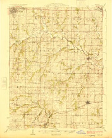
- 1924 USGS Polo quadrangle1:62500, 2 printings
- 1950 USGS Kansas City quadrangle1:250000
- 1954 USGS Kansas City quadrangle1:250000
- 1956 USGS Kansas City quadrangle1:250000, 4 printings
- 1960 USGS Kansas City quadrangle1:250000, 3 printings
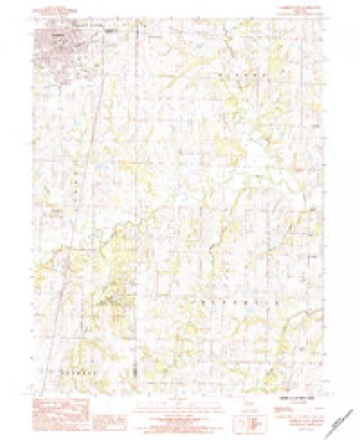
- 1984 USGS Cameron East quadrangle1:24000
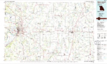
- 1986 USGS Saint Joseph quadrangle1:100000, 2 printings




In the county-history sources
871 words on this townshipThe History of Clinton County, Missouri : Containing a History of the County, Its Cities, Towns, Etc., Biographical Sketches of Its Citizens, Clinton County in the Late War, General and Local Statistics, Portraits of Early Settlers and Prominent Men, History of Missouri, Map of Clinton County, Etc., Etc, published 1881 names this settlement in its chapter on Shoal Township. These are the passages that mention it, exactly as the scans read.
a representative citizen of the town of Cameron, was born in Clinton County. Ohio, January I, 1844. He is the only child of Elijah Walker, and was born after the death of his father. His mother's maiden name was Nancy J. Rannels. She died in New Antioch, Ohio, in 1S60. The early opportunities enjoyed b\- her only son \vere such as were afforded in the common schools of his neighborhood. He soon, however, displayed that spirit of enterprise and power of application which has resulted in ranking him with the successful business men of his count}-. At the early age of thirteen years, he took his first step in the acti\e battle of life, and engaged as a clerk in a countr)' store, at a salary of eight and one-tliird dollars per month. He then attended the high school of Martinsville, Ohio, and, subsequent!)', took a course in r>arlett"s Commercial College. Cincinnati. During the following winter he taught a district school in his own state. Teaching, however, was not destined to be the busitiess of his life. The taste for mercantile j.'ursuits. fostered in earl)- \outh, soon de\"eloped a succe.^s which determined his future coiir.-^c. 'IVinplcil by the \()icc<)f rumor, uhich early proclaimed in lii> hcarini; the vast ami varied resources of the distant west, and nKjre especially the ^-rowing importance of Western Missouri, he determined to try his fortune in the i^^reat land of promise and on the 12th da>' of April, iS'.^, landed in Cameron, ^lissouri. Soon after his arrival, he entered the service of the Ilannibcd and St. Joseph Railroad Company, in the cai)acity of telegrai)h operator, ai^ent, etc. Here he remained tliree years. Durini^^ that period he hchl an interest in the lumber and ac,n-icultural implement business as a member of the firm of C. E. Packard &; Co. The business of this firm soon increased to such an extent that Mr. Walker was forced to relinquish his railroad agency, and devote his entire attention to his mercantile business. Shortly after, the firm chanc^ed, becoming- Walker & Shaw, dealers in lumber, building material and agricultural implements, and doing the largest business of the kind in the city. His accuracy as a business man, coupled with his ever sustained reputation for integrity, no less than his frank address and unassuming demeanor, have secured IMr. Walker friends among men of all classes, and achieved for him a success which few, with his otherwise unaided opportunities, have succeeded in accomplishing. In the summer of 1869. he visited Danville, Illinois, v.-here. on the 15th of June of the same \ ear, he married Miss Cornelia A. Caldwell, daughter of George L. Caldwell. Esq., of that city. He soon after returned with his bride to Cameron. June 14, 1871, their only child, Jennie R. Walker, was born. On the resignation of Judge Cooper, Mr. Walker was, unsolicited by himself, appointed April 5, 1870, by Goxernor McClurg. to the vacancy thus occasioned on the county bench. The same popularity which marked his private life characterized his official career. In April, 1875, Judge Walker was elected a member of the town board of trustees. He was re-elected to the same position four times, serving uninterruptedly a period of five years. He also filled the position of cit\- treasurer. Januar>- I, 1875. Judge Walker purchased of his present partner, Captain J. S. Rogers, a half interest in the Park Bank, of Cameron, one of the reliable institutions of this county, and has since devoted his attention to this interest. He is a prominent and active member of the ^Masonic order in Cameron, and has filled successively the positions of Worshipful Master of Cameron Lodge No. 296, A. F. and A. M., High Priest of Cameron R.^val Arch Chapter No. 67, and Thrice Illustrious Master of a Council of Royal and Select IMasters. He has also been Junior Warden of Kadosh Commandery of Knights Templar, which was originally established in Hamilton, Caldwell County, and moved thence to Cameron. Judge Walker is also a member of the convention of Annointed High Priests of the state.
Machine-read from a century-old scan, so expect the errors a machine makes: misspelled names, dropped words, stray characters.
Read the whole chapter on Shoal Township - it names this place 1 more 1 time.
Fires near this place
38 since 1995Regional context, not property-specific evidence. The federal wildfire occurrence database lists 38 fires within 5 miles of Cameron between 1995 and 2020, burning about 343 acres in total. None started naturally. 1 was recorded as arson. Distance is straight-line from the map coordinates, so a fire counted here may appear on a neighbouring settlement's page as well.
| Reported cause | Fires |
|---|---|
| Debris and open burning | 29 |
| Missing data/not specified/undetermined | 7 |
| Arson/incendiarism | 1 |
| Equipment and vehicle use | 1 |
The most recent of them, most recent first, with the day each was reported and the service that recorded it.
| Date | Cause | Size | Reported by | Name on the report |
|---|---|---|---|---|
| 21 July 2018 | Debris and open burning | 2.5 acres | Missouri Department of Conservation | 177831-02581-07212018-1748 |
| 21 July 2018 | Debris and open burning | 3.4 acres | Missouri Department of Conservation | 177830-02581-07212018-1416 |
| 1 July 2018 | Debris and open burning | under an acre | Missouri Department of Conservation | 177829-02581-07012018-2149 |
| 29 June 2002 | Arson/incendiarism | 2.0 acres | Missouri Department of Conservation | not named |
| 29 June 2002 | Debris and open burning | 1.0 acres | Missouri Department of Conservation | not named |
| 15 June 2018 | Debris and open burning | 1.4 acres | Missouri Department of Conservation | 177828-02581-06152018-1247 |
| 14 June 2018 | Debris and open burning | 25 acres | Missouri Department of Conservation | 177827-02581-06142018-1514 |
| 2 May 2002 | Debris and open burning | 1.0 acres | Missouri Department of Conservation | not named |
Settlements close enough to share some of these fires:
Mines and quarries near this place
10 of 22 shownRegional context, not property-specific evidence. The federal mineral resources record lists 22 workings within 5 miles of Cameron: 22 past producers. None of them still produces. What was taken out: Stone, Crushed/Broken. Distance is straight-line from the map coordinates, so a quarry counted here may appear on a neighbouring settlement's page as well.
| Where | Site | Commodity | Status | Recorded |
|---|---|---|---|---|
| Cameron Quarry | Stone, Crushed/Broken | Past Producer | ||
| Everett Q #2 | Stone, Crushed/Broken | Past Producer | ||
| Malloa Quarry | Stone, Crushed/Broken | Past Producer | ||
| Unk | Stone, Crushed/Broken | Past Producer | ||
| Unk | Stone, Crushed/Broken | Past Producer | ||
| Unk | Stone, Crushed/Broken | Past Producer | ||
| Unk | Stone, Crushed/Broken | Past Producer | ||
| Unk | Stone, Crushed/Broken | Past Producer | ||
| Unk | Stone, Crushed/Broken | Past Producer | ||
| Unk | Stone, Crushed/Broken | Past Producer |
Storms near this place
43 since 1993Regional context, not property-specific evidence. The National Weather Service names Cameron in 43 storm reports between 1993 and 2024: 27 hail, 14 thunderstorm wind, 1 tornado, 1 flood. No death or injury is recorded in these reports. Each account below is quoted exactly as the forecast office filed it, from the NOAA Storm Events Database, and each date opens the federal record of that event.
| When | Event | Place named | Harm | What the report says |
|---|---|---|---|---|
| April 1994 | Thunderstorm Wind | Cameron | $500,000 | Several barns and farm buildings were blown down or heavily damaged across the county. Numerous hogs and cattle were killed in the Cameron area when hay barns were completely demolished. Houses were also damaged in the city of Cameron where vinyl siding was blown off and business signs were blown down. |
| October 1998 | Thunderstorm Wind | Cameron | $50,000 | Minor roof damage was reported to several homes, and several porches and outbuildings weredestroyed. |
| May 1993 | Tornado (F1) | Cameron | $50,000 | Trees were uprooted and power lines knocked down as a tornado touched down north of Turney and travelled to five miles southwest of Cameron. |
| September 1993 | Thunderstorm Wind | Cameron | $50,000 | Trees and power lines were blown down. |
| June 2005 | Thunderstorm Wind | Cameron | $1,000 | Trees and power lines down. |
| July 2024 | Thunderstorm Wind | Cameron | - | Tree limbs downed in Cameron. |
| May 2024 | Thunderstorm Wind | Cameron | - | Social media report and photos of tree damage (including one tree uprooted) near Route BB. |
| July 2023 | Thunderstorm Wind | Cameron | - | Estimated 60 mph winds on the southeast side of Cameron. |
| July 2022 | Thunderstorm Wind | Cameron | - | A trained spotter reported 61 mph wind near Cameron. |
| June 2011 | Thunderstorm Wind | Cameron | - | Thunderstorm wind gusts were estimated up to 60 mph. |
| August 2011 | Thunderstorm Wind | Cameron | - | Thunderstorm wind gusts were estimated up to 60 mph. |
| May 2007 | Flood | Cameron | - | The Chariton River near Prairie Hill crested at 19.66 feet, or 4.66 feet above flood stage. |
| June 2003 | Thunderstorm Wind | Cameron | - | Many tree and tree limbs reported down. |
| May 1998 | Hail | Cameron | - | Dime-size hail was reported by a spotter at Cameron. |
| June 1998 | Hail | Cameron | - | The Clinton County Sheriff's Office reported golfball-size hail in Cameron. The large hail resulted in several reports of broken windows. |
| June 1998 | Hail | Cameron | - | Missouri Highway Patrol reported golfball-size hail in Cameron. |
| June 1998 | Hail | Cameron | - | Golfball-size hail was reported by the public along I-35 in Cameron. |
| June 1994 | Hail | Cameron | - | Hail reached golf ball-size. |
| June 2010 | Hail | Cameron | - | no account filed |
| June 2008 | Thunderstorm Wind | Cameron | - | no account filed |
| July 2008 | Hail | Cameron | - | no account filed |
| March 2006 | Hail | Cameron | - | no account filed |
| March 2006 | Hail | Cameron | - | no account filed |
| March 2006 | Hail | Cameron | - | no account filed |
| June 2005 | Hail | Cameron | - | no account filed |
| May 2004 | Hail | Cameron | - | no account filed |
| April 2003 | Hail | Cameron | - | no account filed |
| April 2003 | Hail | Cameron | - | no account filed |
| April 2003 | Hail | Cameron | - | no account filed |
| May 2002 | Hail | Cameron | - | no account filed |
| May 2002 | Thunderstorm Wind | Cameron | - | no account filed |
| June 2001 | Hail | Cameron | - | no account filed |
| June 2001 | Hail | Cameron | - | no account filed |
| August 2001 | Hail | Cameron | - | no account filed |
| March 2000 | Hail | Cameron | - | no account filed |
| September 2000 | Hail | Cameron | - | no account filed |
| September 2000 | Hail | Cameron | - | no account filed |
| April 2000 | Hail | Cameron | - | no account filed |
| June 2000 | Hail | Cameron | - | no account filed |
| June 1996 | Hail | Cameron | - | no account filed |
| June 1996 | Thunderstorm Wind | Cameron | - | no account filed |
| April 1995 | Hail | Cameron | - | no account filed |
| September 1993 | Hail | Cameron | - | no account filed |
Nearest settlements
The eight closest, with where each one stands in the county. Distances are straight-line, computed from the Geographic Names Information System coordinates.
| Map | Place | Distance | Sheets |
|---|---|---|---|
| Keystone (historical) | 5.2 miles | 16 | |
| Osborn | 6.1 miles | 16 | |
| West Keystone | 6.1 miles | 16 | |
| Moors | 8.1 miles | 16 | |
| Turney | 8.4 miles | 16 | |
| Maple Hill | 9.2 miles | 16 | |
| Plainview | 10.0 miles | 14 | |
| Perrin | 10.2 miles | 16 |
Elsewhere
Matched on this settlement's Geographic Names Information System number rather than its name, so it cannot be a different place of the same name in another state.
| Wikipedia article on Cameron | An encyclopaedic summary. Its text is share-alike, so it is linked here rather than copied. |
| Wikidata item Q956909 | The structured record the population and elevation above come from. Public domain (CC0). |
Provenance
This settlement is recorded in the Geographic Names Information System as feature 766153. The sheet list is computed by point-in-boundary test against the United States Geological Survey's historical topographic inventory. Both are works of the United States government and carry no copyright under 17 U.S.C. 105.
Wildfire. Short, Karen C. 2022. Spatial wildfire occurrence data for the United States, 1992-2020 [FPA_FOD_20221014]. 6th Edition. Fort Collins, CO: Forest Service Research Data Archive. https://doi.org/10.2737/RDS-2013-0009.6 Collected with United States Government funding and usable without additional permissions or fees.
Mines and quarries. USGS Mineral Resources Data System (MRDS) https://mrdata.usgs.gov/mrds/ A work of the United States government, no copyright under 17 U.S.C. 105.
Storms. NOAA National Centers for Environmental Information, Storm Events Database https://www.ncei.noaa.gov/stormevents/ A work of the United States government, no copyright under 17 U.S.C. 105. Narratives are quoted verbatim from the National Weather Service report and are not edited or summarised.