 Block
Chillicothe, Missouri
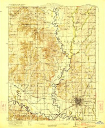
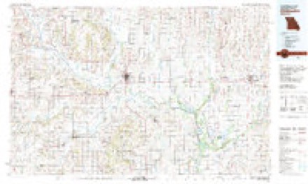
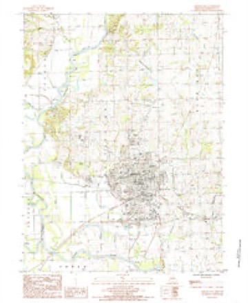
12 topographic sheets cover this place, the earliest surveyed in 1921 and the latest in 1984. It stands in Chillicothe Township. It lies in ZIP code area 64601. The Survey maps it on the Chillicothe quadrangle. 9,107 people lived here at the 2020 count. It stands 797 feet above sea level.
Research this city
On record in Chillicothe
Buildings and businesses the archive holds for this place. Each opens its own page, with the source record it came from.
On the National Register 3 records
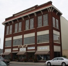 Chillicothe Commercial Historic Districtlisted 2002
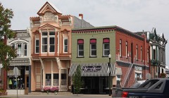 Courthouse Square Historic Districtlisted 2002
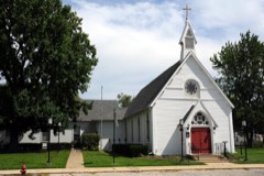 Grace Episcopal Church and Buildinglisted 1980
Population over time
3 figuresChillicothe grew from 994 to 9,107 between 1860 and 2020. These are the recorded population figures Wikidata holds for this place, reached through the Geographic Names Information System number this page is keyed on rather than by name, so they belong to this place and not to another of the same name. Most are census counts, but not all are: an early figure may be a founding or settlement estimate, and an estimate published within five years of a census is left out. The change column is computed, and is left blank where more than 20 years separate a figure from the one before it, because a gap that long is not a change between two counts.
| Year | People | Change |
|---|---|---|
| 1860 | 994 | |
| 2010 | 9,515 | |
| 2020 | 9,107 | -408 (-4%) |
Topographic sheets covering this place
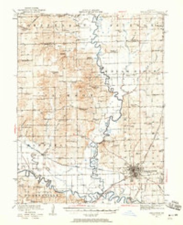
8 surveys from 12 printed sheetsMatched by testing this settlement's coordinate against the published boundary of every sheet in the United States Geological Survey's historical collection. Each opens the scanned sheet at the Survey.
- 1921 USGS Chillicothe quadrangle1:62500, 2 printings
- 1923 USGS Chillicothe quadrangle1:62500, 2 printings
- 1953 USGS Moberly quadrangle1:250000
- 1954 USGS Moberly quadrangle1:250000, 3 printings
- 1957 USGS Moberly quadrangle1:250000
- 1960 USGS Moberly quadrangle1:250000
- 1981 USGS Chillicothe quadrangle1:100000
- 1984 USGS Chillicothe quadrangle1:24000




In the county-history sources
12,700 words on this townshipPast and Present of Livingston County, Missouri : a Record of Settlement, Organization, Progress and Achievement, published 1913 names this settlement in its chapter on Chillicothe Township. These are the passages that mention it, exactly as the scans read.
On the 7th of August, 1837, the county court, then in session at Joseph Cox's, took the first steps toward laying out and establishing the town of Chillicothe. On this day John Graves was appointed to "lay ofif into lots the county seat, where the commissioners appointed by the State Legislature shall locate it." It was also ordered that the county seat "shall be denominated and known by the name of Chillicothe." The town was named for Chillicothe, Ohio, the county seat of Ross county.
Passage source: Past and Present of Livingston County, Missouri : a Record of Settlement, Organization, Progress and Achievement, published 1913.
Not until July 15, 1839, was Chillicothe selected and designated as the county seat of Livingston county, although it had been virtually the county's capital for some time. On the day named, however, the commissioners, who were E. W. Warren, Samuel Williams and Geo. W. Folger, all of Carroll county, selected the southwest quarter of section 36, township 58, range 24, as the county seat, as being "the most eligible location for said county seat," and its site according with the provisions of the organizing act, in lying "within three miles of the center of said county."
Passage source: Past and Present of Livingston County, Missouri : a Record of Settlement, Organization, Progress and Achievement, published 1913.
On August 13, 185 1, Chillicothe was first incorporated by petition of two-thirds of the inhabitants and the first board of trustees were W. Y. Slack, John T. Green, John Graves, J. H. B. Manning and W. C. Samuel. By an act of the legislature, approved March i, 1855, the town was then incorporated as a city. February 26, 1869, by an act of the legislature the town was constituted a corporation by the name and style of the city of Chillicothe and declaring the original charter and all subsequent amendatory acts thereto amended.
Passage source: Past and Present of Livingston County, Missouri : a Record of Settlement, Organization, Progress and Achievement, published 1913.
Machine-read from a century-old scan, so expect the errors a machine makes: misspelled names, dropped words, stray characters.
Read the whole chapter on Chillicothe Township - it names this place 68 more 68 times.
Fires near this place
19 since 1999Regional context, not property-specific evidence. The federal wildfire occurrence database lists 19 fires within 5 miles of Chillicothe between 1999 and 2020, burning about 76 acres in total. None started naturally. None was recorded as arson. Distance is straight-line from the map coordinates, so a fire counted here may appear on a neighbouring settlement's page as well.
| Reported cause | Fires |
|---|---|
| Debris and open burning | 15 |
| Missing data/not specified/undetermined | 3 |
| Equipment and vehicle use | 1 |
The most recent of them, most recent first, with the day each was reported and the service that recorded it.
| Date | Cause | Size | Reported by | Name on the report |
|---|---|---|---|---|
| 3 September 1999 | Debris and open burning | 2.0 acres | Missouri Department of Conservation | not named |
| 24 May 2018 | Debris and open burning | under an acre | Missouri Department of Conservation | 177017-05996-05242018-0040 |
| 19 May 2018 | Debris and open burning | under an acre | Missouri Department of Conservation | 177016-05996-05192018-1959 |
| 22 April 2019 | Debris and open burning | under an acre | Missouri Department of Conservation | 178835-05996-04222019-2209 |
| 22 April 2018 | Debris and open burning | under an acre | Missouri Department of Conservation | 176693-05996-04222018-1621 |
| 17 April 2018 | Debris and open burning | under an acre | Missouri Department of Conservation | 176691-05996-04172018-1944 |
| 15 April 2019 | Debris and open burning | 1.0 acres | Missouri Department of Conservation | 178573-05996-04152019-2155 |
| 15 April 2019 | Debris and open burning | under an acre | Missouri Department of Conservation | 178574-05996-04152019-2014 |
Settlements close enough to share some of these fires:
Mines and quarries near this place
1 within 5 milesRegional context, not property-specific evidence. The federal mineral resources record lists 1 working within 5 miles of Chillicothe: 1 past producer. None of them still produces. What was taken out: Stone, Crushed/Broken. Distance is straight-line from the map coordinates, so a quarry counted here may appear on a neighbouring settlement's page as well.
| Where | Site | Commodity | Status | Recorded |
|---|---|---|---|---|
| Unknown | Stone, Crushed/Broken | Past Producer |
Storms near this place
60 of 102 shownRegional context, not property-specific evidence. The National Weather Service names Chillicothe in 102 storm reports between 1995 and 2024: 45 hail, 40 thunderstorm wind, 8 flood, 6 flash flood. No death or injury is recorded in these reports. Each account below is quoted exactly as the forecast office filed it, from the NOAA Storm Events Database, and each date opens the federal record of that event.
| When | Event | Place named | Harm | What the report says |
|---|---|---|---|---|
| May 2004 | Tornado (F1) | Chillicothe | $1,700,000 | A tornado struck just south of Chillicothe where highway 65 crosses Shoal Creek, east-northeast to approximately 3 miles east of Chillicothe. Isolated areas of F1 magnitude tornado damage were observed, especially along CR255. Widespread straight-line wind damage also noted along the path of this tornado. Witnesses described seeing what appeared to be a 6-mile wide lowering with intermittent vortices touching the ground. |
| September 2001 | Thunderstorm Wind | Chillicothe | $500,000 | The MetLife blimp that broke from its mast in Kansas City, came to a rest on private property. The blimp accompanied a squall line nearly 60 miles before crashing. The blimp was severely damaged and there was minor damage to a truck on the ground. |
| April 1999 | Tornado (F1) | Chillicothe | $250,000 | The tornado touched down 7 miles east of Chillicothe, detroying a maching shed and downing several telephone poles and trees. Before dissipating 7 miles north of Wheeling, a pole barn, grain bin, and a small garage was destroyed near the point where the tornado lifted. |
| April 2006 | Hail | Chillicothe | $250,000 | no account filed |
| June 1998 | Thunderstorm Wind | Chillicothe | $100,000 | Missouri State Troopers reported several trees blown down as a result of severe thunderstorm winds along D Highway 9 miles southwest of Chillicothe. |
| June 1995 | Thunderstorm Wind | Chillicothe | $10,000 | Strong winds knocked down large tree limbs in Chillicothe. A few power lines were downed by the limbs, and a tree fell into a house, creating a large hole. Street flooding also occurred with 1.18 inches of rain in just 25 minutes. |
| June 2005 | Thunderstorm Wind | Chillicothe | $5,000 | Roof off of barn and upstairs house window blown out. |
| June 2011 | Thunderstorm Wind | Chillicothe | $4,000 | Numerous power lines were reported down. Thunderstorm wind gusts were estimated up to 60 mph. |
| May 2013 | Thunderstorm Wind | Chillicothe | $2,000 | Power poles were reported down, with thunderstorm wind gusts estimated up to 70 mph. |
| April 2010 | Thunderstorm Wind | Chillicothe | $2,000 | A large oak tree fell on an outbuilding, crushing everything inside. |
| August 2010 | Thunderstorm Wind | Chillicothe | $1,000 | Powerlines were reported down across the town. Thunderstorm wind gusts were estimated up to 60 mph. |
| April 2009 | Thunderstorm Wind | Chillicothe | $1,000 | A roof was blown off a 50X80 foot building onto a road. |
| March 2012 | Thunderstorm Wind | Chillicothe | $750 | Thunderstorm wind gusts were estimated up to 60 mph. A few strips of siding were blown off a house. A privacy fence was partially blown down. A six inch diameter tree was blown over. |
| June 2010 | Thunderstorm Wind | Chillicothe | $500 | Tree limbs and power lines were reported down, with cable and phone service out. |
| April 2009 | Thunderstorm Wind | Chillicothe | $500 | A billboard was blown over at the intersection of Highway 65 and Highway 190. |
| July 2010 | Thunderstorm Wind | Chillicothe | $200 | A large tree and power line were reported down in Chillicothe. Thunderstorm wind gusts were estimated up to 60 mph. |
| June 2024 | Thunderstorm Wind | Chillicothe | - | Estimated gusts up to 60 mph in Chillicothe. |
| September 2023 | Hail | Chillicothe | - | Quarter sized hail reported in Chillicothe. |
| July 2023 | Thunderstorm Wind | Chillicothe | - | Large tree limbs downed across Chillicothe. |
| March 2022 | Hail | Chillicothe | - | This report came in via social media. |
| August 2021 | Thunderstorm Wind | Chillicothe | - | Several large tree limbs around 4 to 6 inches in diameter broke. Power outages were also reported with this storm. |
| June 2019 | Thunderstorm Wind | Chillicothe | - | ASOS measured 60 mph wind. |
| August 2019 | Thunderstorm Wind | Chillicothe | - | Public reported 60 mph wind. |
| May 2018 | Thunderstorm Wind | Chillicothe | - | Numerous trees were down and structures were damaged in Chillicothe. It is unknown the exact breadth of the damage or costs of the damage. |
| July 2017 | Flood | Chillicothe | - | Water over the road on 3rd Street near the old prison property caused a vehicle to stall. |
| July 2017 | Thunderstorm Wind | Chillicothe | - | A tree of unknown size and condition was blown onto a box trailer. |
| March 2017 | Thunderstorm Wind | Chillicothe | - | The public called in a report of 60 to 70 mph winds near Chillicothe. |
| August 2016 | Flash Flood | Chillicothe | - | Water was flowing over several roads in Chillicothe as a result of heavy rain. |
| July 2016 | Thunderstorm Wind | Chillicothe | - | Media reports a few large tree limbs, around 3 to 4 inches in diameter, were down. |
| August 2015 | Flood | Chillicothe | - | Water was covering a low water crossing at Cedar Crest Lane and North Fair Street in Chillicothe. |
| November 2015 | Thunderstorm Wind | Chillicothe | - | Winds of 65 mph were estimated to have caused 4 inch tree limbs to break. |
| April 2014 | Thunderstorm Wind | Chillicothe | - | Tree limbs blown down with quarter sized hail also reported. |
| April 2014 | Hail | Chillicothe | - | Strong winds were also reported. |
| July 2014 | Thunderstorm Wind | Chillicothe | - | A large tree limb was reported snapped on Locust Street in Chillicothe, Missouri. |
| June 2014 | Thunderstorm Wind | Chillicothe | - | A spotter estimated 60 mph winds. |
| June 2013 | Thunderstorm Wind | Chillicothe | - | Thunderstorm wind gusts were estimated up to 60 mph. |
| June 2013 | Thunderstorm Wind | Chillicothe | - | Thunderstorm wind gusts were estimated up to 75 mph. |
| June 2013 | Thunderstorm Wind | Chillicothe | - | Thunderstorm wind gusts were estimated up to 65 mph. |
| June 2012 | Thunderstorm Wind | Chillicothe | - | Several 4 to 6 inch diameter tree limbs were reported down. Thunderstorm wind gusts were estimated up to 60 mph. |
| February 2012 | Thunderstorm Wind | Chillicothe | - | Thunderstorm wind gusts were estimated up to 60 mph. Pea sized hail was also reported. |
| June 2011 | Thunderstorm Wind | Chillicothe | - | Thunderstorm wind gusts were estimated up to 60 mph. |
| May 2010 | Heavy Rain | Chillicothe | - | Spotter measured 2.10 inches of rain in 70 minutes. |
| May 2010 | Flash Flood | Chillicothe | - | Water was reported over the road, at the intersection of Clay Street and Easton Street. |
| May 2009 | Flash Flood | Chillicothe | - | Up to 10 inches of rain, caused flash flooding over Highway 65, south of Chillicothe. |
| August 2009 | Flash Flood | Chillicothe | - | Up to eight inches of running water, was reported on Highway 65, south of Chillicothe. |
| March 2008 | Flood | Chillicothe | - | The Grand River near Chillicothe crested at 32.35 feet, or 8.35 feet above flood stage. |
| December 2008 | Flood | Chillicothe | - | The Grand River near Chillicothe crested at 30.56 feet, or 6.56 feet above flood stage. |
| April 2008 | Flood | Chillicothe | - | The Grand River near Chillicothe crested at 26.88 feet, or 2.88 feet above flood stage. |
| April 2007 | Flood | Chillicothe | - | The Grand River near Chillicothe crested at 24.44 feet, or 0.44 feet above flood stage. |
| May 2007 | Flood | Chillicothe | - | The Grand River near Chillicothe crested at 37.14 feet, or 13.14 feet above flood stage. This was the third highest crest ever on May 10, 2007. |
| November 2007 | Hail | Chillicothe | - | Hail with a diameter 0.75 to 0.88 inches was reported. |
| February 2007 | Flood | Chillicothe | - | The Grand River near Chillicothe crested at 25.75 feet, or 1.75 feet above flood stage. |
| June 2005 | Flash Flood | Chillicothe | - | Water over Route V and on Highway 65. |
| August 2004 | Flash Flood | Chillicothe | - | Highway 136 closed due to water over the roadway. |
| September 2000 | Thunderstorm Wind | Chillicothe | - | Numerous downed trees and power lines were reported in Chillicothe. |
| June 1998 | Hail | Chillicothe | - | Golfball-size hail was reported during a severe thunderstorm by the Livingston County Sheriff's Office at Chillicothe. |
| September 1997 | Thunderstorm Wind | Chillicothe | - | A HAM radio operator reported a 60 MPH wind gust at Chillicothe. The sheriff's department reported downed large trees in the southwest part of Chillicothe and also in the downtown section. |
| July 1995 | Hail | Chillicothe | - | Quarter-size hail was reported at Chillicothe. |
| May 2018 | Hail | Chillicothe | - | no account filed |
| March 2017 | Hail | Chillicothe | - | no account filed |
Nearest settlements
The eight closest, with where each one stands in the county. Distances are straight-line, computed from the Geographic Names Information System coordinates.
| Map | Place | Distance | Sheets |
|---|---|---|---|
| Cleary | 3.8 miles | 13 | |
| Cream Ridge | 4.8 miles | 14 | |
| Norville | 5.1 miles | 14 | |
| Utica | 5.3 miles | 13 | |
| Sturges | 6.3 miles | 12 | |
| Corner Campbell School | 7.2 miles | 15 | |
| Springhill | 7.3 miles | 12 | |
| Cavendish | 8.0 miles | 15 |
Elsewhere
Matched on this settlement's Geographic Names Information System number rather than its name, so it cannot be a different place of the same name in another state.
| Wikipedia article on Chillicothe | An encyclopaedic summary. Its text is share-alike, so it is linked here rather than copied. |
| Wikidata item Q959568 | The structured record the population and elevation above come from. Public domain (CC0). |
Provenance
This settlement is recorded in the Geographic Names Information System as feature 715783. The sheet list is computed by point-in-boundary test against the United States Geological Survey's historical topographic inventory. Both are works of the United States government and carry no copyright under 17 U.S.C. 105.
Wildfire. Short, Karen C. 2022. Spatial wildfire occurrence data for the United States, 1992-2020 [FPA_FOD_20221014]. 6th Edition. Fort Collins, CO: Forest Service Research Data Archive. https://doi.org/10.2737/RDS-2013-0009.6 Collected with United States Government funding and usable without additional permissions or fees.
Mines and quarries. USGS Mineral Resources Data System (MRDS) https://mrdata.usgs.gov/mrds/ A work of the United States government, no copyright under 17 U.S.C. 105.
Storms. NOAA National Centers for Environmental Information, Storm Events Database https://www.ncei.noaa.gov/stormevents/ A work of the United States government, no copyright under 17 U.S.C. 105. Narratives are quoted verbatim from the National Weather Service report and are not edited or summarised.