 Block
Dexter, Missouri
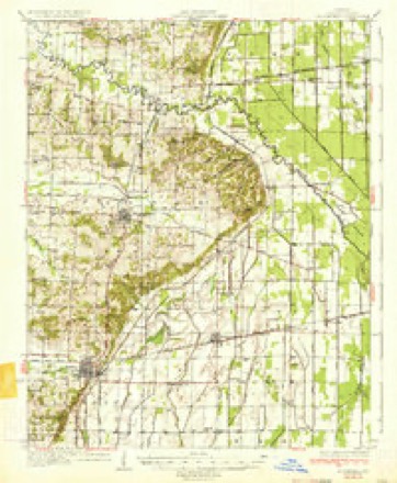
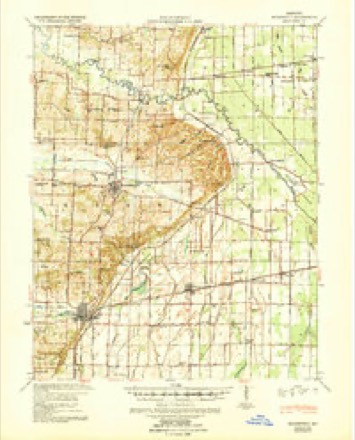
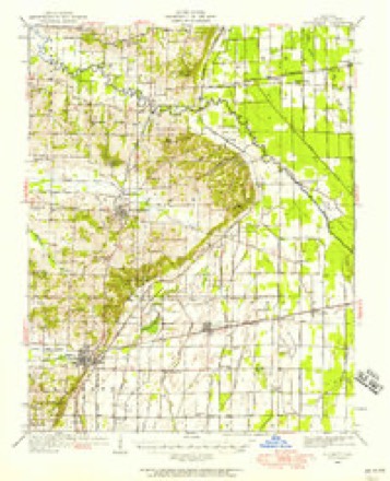
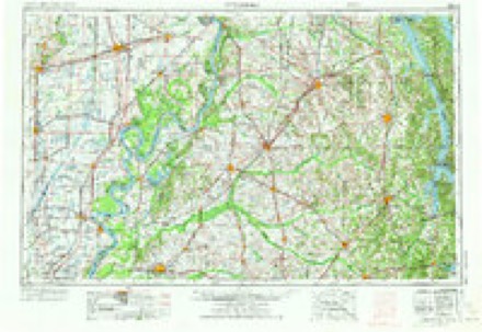
15 topographic sheets cover this place, the earliest surveyed in 1934 and the latest in 1985. It stands in Liberty Township. It lies in ZIP code area 63841. It stands on Dexter Creek. The Survey maps it on the Dexter quadrangle. 7,927 people lived here at the 2020 count. It stands 371 feet above sea level.
Research this city
On record in Dexter
Buildings and businesses the archive holds for this place. Each opens its own page, with the source record it came from.
On the National Register 1 record
 Dexter Gymnasiumlisted 2001
Population over time
3 figuresDexter grew from 489 to 7,927 between 1880 and 2020. These are the recorded population figures Wikidata holds for this place, reached through the Geographic Names Information System number this page is keyed on rather than by name, so they belong to this place and not to another of the same name. Most are census counts, but not all are: an early figure may be a founding or settlement estimate, and an estimate published within five years of a census is left out. The change column is computed, and is left blank where more than 20 years separate a figure from the one before it, because a gap that long is not a change between two counts.
| Year | People | Change |
|---|---|---|
| 1880 | 489 | |
| 2010 | 7,864 | |
| 2020 | 7,927 | +63 (+1%) |
Topographic sheets covering this place
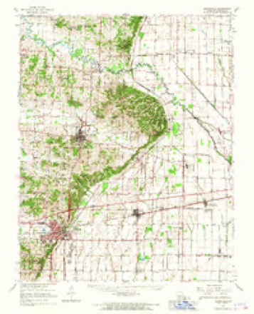
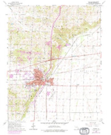
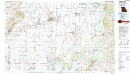
7 surveys from 15 printed sheetsMatched by testing this settlement's coordinate against the published boundary of every sheet in the United States Geological Survey's historical collection. Each opens the scanned sheet at the Survey.
- 1934 USGS Bloomfield quadrangle1:62500, 3 printings
- 1939 USGS Bloomfield quadrangle1:62500
- 1949 USGS Bloomfield quadrangle1:62500
- 1956 USGS Dyersburg quadrangle1:250000, 4 printings
- 1963 USGS Bloomfield quadrangle1:62500
- 1963 USGS Dexter quadrangle1:24000, 3 printings
- 1985 USGS Sikeston quadrangle1:100000, 2 printings
Fires near this place
21 since 2016Regional context, not property-specific evidence. The federal wildfire occurrence database lists 21 fires within 5 miles of Dexter between 2016 and 2020, burning about 63 acres in total. None started naturally. None was recorded as arson. Distance is straight-line from the map coordinates, so a fire counted here may appear on a neighbouring settlement's page as well.
| Reported cause | Fires |
|---|---|
| Debris and open burning | 10 |
| Missing data/not specified/undetermined | 9 |
| Equipment and vehicle use | 1 |
| Recreation and ceremony | 1 |
The most recent of them, most recent first, with the day each was reported and the service that recorded it.
| Date | Cause | Size | Reported by | Name on the report |
|---|---|---|---|---|
| 22 September 2019 | Debris and open burning | under an acre | Missouri Department of Conservation | 179268-10395-09222019-1250 |
| 7 August 2018 | Missing data/not specified/undetermined | 2.4 acres | Missouri Department of Conservation | 177386-10395-08072018-1237 |
| 23 August 2018 | Debris and open burning | under an acre | Missouri Department of Conservation | 177475-10395-08232018-1708 |
| 17 August 2019 | Missing data/not specified/undetermined | 3.1 acres | Missouri Department of Conservation | 179039-10395-08172019-1405 |
| 23 June 2020 | Equipment and vehicle use | under an acre | Missouri Department of Conservation | 210550-10395-06232020-1805 |
| 13 June 2020 | Missing data/not specified/undetermined | under an acre | Missouri Department of Conservation | 210528-10395-06132020-1700 |
| 16 May 2020 | Missing data/not specified/undetermined | under an acre | Missouri Department of Conservation | 210526-10395-05162020-1735 |
| 29 April 2018 | Debris and open burning | under an acre | Missouri Department of Conservation | 176826-10395-04292018-1450 |
Settlements close enough to share some of these fires:
Mines and quarries near this place
10 of 45 shownRegional context, not property-specific evidence. The federal mineral resources record lists 45 workings within 5 miles of Dexter: 40 past producers, 5 producers. 5 still produce. What was taken out: Sand and Gravel, Construction, Clay. Distance is straight-line from the map coordinates, so a quarry counted here may appear on a neighbouring settlement's page as well.
| Where | Site | Commodity | Status | Recorded |
|---|---|---|---|---|
| Unk | Clay | Past Producer | ||
| Unk | Clay | Past Producer | ||
| 3 Wofford Mine | Sand and Gravel, Construction | Past Producer | ||
| Brown Sand & Gravel-Pit & Plant | Sand and Gravel, Construction | Producer | ||
| Lemons Pit + Plant | Sand and Gravel, Construction | Producer | ||
| Liberty Township Pit + Plant | Sand and Gravel, Construction | Producer | ||
| Musgraves Gravel Pit | Sand and Gravel, Construction | Past Producer | ||
| Temple Pit | Sand and Gravel, Construction | Producer | ||
| Unk | Sand and Gravel, Construction | Past Producer | ||
| Unk | Sand and Gravel, Construction | Past Producer |
Storms near this place
60 of 83 shownRegional context, not property-specific evidence. The National Weather Service names Dexter in 83 storm reports between 1995 and 2025: 36 thunderstorm wind, 26 hail, 6 funnel cloud, 6 tornado. The reports record 1 death and 1 injury. Each account below is quoted exactly as the forecast office filed it, from the NOAA Storm Events Database, and each date opens the federal record of that event.
| When | Event | Place named | Harm | What the report says |
|---|---|---|---|---|
| April 2006 | Thunderstorm Wind | Dexter | 1 killed, 1 hurt, $400,000 | A 42-year-old man was killed when his mobile home was overturned in the Circle City area, which is just north of U.S. Highway 60 east of Dexter. His 12-year-old son was slightly injured. The mobile home was rolled and became pinned against a large tree. A National Weather Service site survey indicated that straight-line winds from 70 to 80 MPH were responsible for a path of widespread damage from Dexter eastward to Circle City, which is almost to the county line. In Dexter, considerable damage occurred. Numerous trees were blown down, and many roofs were damaged. The city received nearly 150 calls concerning downed trees. Trees fell on at least three cars and two trucks. Just in the three Dexter city parks, about a dozen trees were down. Power was out in parts of Dexter for up to two days. Part of the roof of a convenience store was blown off, and a storage shed was destroyed. Two vehicles at the convenience store were damaged by the roof. Dexter city hall sustained minor damage. An amateur radio antenna was bent 90 degrees. In Essex, which is between Dexter and Circle City, several homes and businesses had sections of shingles blown off. Some trees were snapped or uprooted. About 250,000 dollars damage occurred to agricultural equipment and machinery at two agribusinesses near Essex. |
| July 2021 | Tornado (EF2) | Dexter | $2,000,000 | The tornado first touched down along Highway AD, just north of the interchange with U.S. Highway 60. The tornado then tracked east-southeast across Highways 60 and 25 through the city of Dexter. At least 150 homes were damaged. At least one home sustained major loss of roof decking, and a half dozen or less homes had major damage mainly due to fallen trees. Most damage was loss of shingles and siding and facia. Several mobile homes were heavily damaged or destroyed. One mobile home was flipped on its roof. Several garages were blown from their foundations. A few large buildings sustained major damage, including major loss of roof structures. A hospital sustained major damage with several windows blown in, ceiling panels blown down, and one attached structure blown away from the hospital. Several vehicles at the hospital had their windows blown out or were otherwise damaged from flying debris. Hundreds of trees were uprooted or snapped. Peak winds were estimated near 120 mph. |
| March 2006 | Tornado (F1) | Dexter | $900,000 | The tornado nearly paralleled U.S. Route 60 in a commercial district just north of downtown Dexter. At the beginning of the damage path, a Wal-Mart store and a car dealership were struck. The Wal-Mart sustained significant damage to its roof and auto shop bay doors. Between the Wal-Mart and the car dealership, light standards anchored by concrete three feet into the ground were pulled out. At the car dealership, about 50 cars were damaged by wind-blown debris and hail, with windows broken. At a mobile home dealership, an unsecured mobile home trailer was turned on its side and pushed next to another trailer. A church lost its steeple and 4 to 6 feet of its roof, and brick fascia was damaged. A second church near Highway 60 sustained damage to the upper portions of the front wall. A restaurant next to the church sustained structural damage when the upper portion of a wall was blown in. Two residences received moderate damage, and a heavy equipment shed was blown down. A motel reported that eight units lost parts of their roofs. Several billboards on Highway 60 were heavily damaged. A utility pole was snapped off. Peak winds were estimated near 80 MPH. Much of the damage occurred underneath the location of a funnel cloud that was photographed by a citizen. The condensation portion (or visible portion) of the funnel cloud was not touching ground in the photo. A second weaker and shorter-lived vortex touched down within a mile to the north-northwest, causing relatively slight damage to a few structures. |
| May 2024 | Thunderstorm Wind | Dexter | $350,000 | A destructive straight-line wind event moved into Dexter, Missouri early morning. This surge of stronger winds appears to have led to the organization of a fairly long track EF-2 tornado that began near U.S. 60 and Main Street. The city road maintenance building sustained significant damage as well as a restaurant in the area. Hundreds of trees were snapped and uprooted and many trees fell onto buildings and caused damage. Peak winds were estimated at 100 mph. |
| February 2019 | Thunderstorm Wind | Dexter | $250,000 | A National Weather Service storm survey found straight-line wind damage in Dexter. Estimated peak winds were near 90 mph. The damage started on the southwest side of Dexter and ended on the northeast side of Dexter. The damage path length was 3.1 miles, and the maximum width was 0.75 miles. Numerous trees were uprooted or snapped. Some trees fell onto homes. Several homes sustained shingle loss or partial roof damage. About a dozen cars on a moving freight train carrying empty and full metal shipping containers were derailed. Several storage sheds at a lumber company were damaged. A tractor-trailer rig was overturned at a loading dock. A couple businesses had large advertising signs blown down. |
| May 2024 | Tornado (EF2) | Dexter | $125,000 | An EF-2 tornado began on the east side of Dexter. Moving east-northeast, the tornado downed numerous trees along its path. Northeast of Essex, the tornado downed a few large wooden power transmission lines. The tornado then turned to the northeast and eventually north-northeast, crossing the Little River into Scott County. Estimated peak winds in Stoddard County, and for the tornado as a whole, were 125 mph. |
| January 1999 | Thunderstorm Wind | Dexter | $75,000 | Very strong thunderstorm winds blew outbuildings over, destroyed a mobile home, and blew windows out of a service station. Trees were down, including some on houses. At a gas station on Highway AD, the station's canopy was destroyed and the front glass door was blown out. An empty fuel storage tank was overturned. Debris from the station damaged several houses just north of the service station. |
| July 2009 | Thunderstorm Wind | Dexter | $70,000 | Just north of Highway 60 in the northwest part of town, a fence was damaged, and shingles were blown off the roof of a nearby business. Numerous tree limbs were down across town. About a half dozen utility poles were broken. Several tree limbs up to six inches in diameter were broken across the county. |
| August 2022 | Thunderstorm Wind | Dexter | $65,000 | A tree fell onto a house. Shingles were blown off another house. The roof was blown off of one business. Power lines were down in at least six different locations in town. About 3500 customers were without power. |
| May 2017 | Thunderstorm Wind | Dexter | $65,000 | Roofs were blown off a movie theater and car wash. Several homes in the same area sustained roof damage. |
| June 2019 | Thunderstorm Wind | Dexter | $50,000 | A line of thunderstorms produced damaging winds across Stoddard County, mainly from Dexter north across the Bloomfield area. Trees were down off County Road 227 north-northwest of Bloomfield. Several trees were uprooted or snapped in Dexter. A large tree limb was down south of Advance. |
| May 2019 | Thunderstorm Wind | Dexter | $50,000 | An area of scattered thunderstorm wind damage occurred across the Dexter-Bloomfield area. The area of most concentrated damage was along and north of Highway E from about three to seven miles east of Bloomfield. At least a dozen power poles were broken. Dozens of trees were uprooted, and numerous limbs were broken. |
| April 2011 | Tornado (EF0) | Dexter | $50,000 | A large storage building was destroyed. A garage and shed at a nearby residence was destroyed. A house roof was damaged by a falling tree. Peak winds were estimated near 75 mph. The average path width was 75 yards. |
| October 2007 | Thunderstorm Wind | Dexter | $50,000 | In Dexter, a grocery store was partially unroofed. Numerous tree limbs and power lines were down. One large limb landed on a vehicle. Numerous trees were blown down in Bernie. |
| January 1999 | Tornado (F1) | Dexter | $50,000 | The brief tornado touchdown overturned a mobile home, causing extensive damage. A tool shed was blown away, utility poles were down, and trees were uprooted. Top winds were estimated near 80 MPH. |
| July 2016 | Thunderstorm Wind | Dexter | $35,000 | A metal roof was ripped off a downtown Dexter business. Power was out in the business district. Trees were blown down north and south of Dexter. |
| May 2020 | Thunderstorm Wind | Dexter | $30,000 | From Dexter to Bernie, trees were snapped. In Bernie, shingles were blown off a roof, and branches were down. |
| March 2017 | Thunderstorm Wind | Dexter | $30,000 | Widespread damaging winds occurred in western and southern Stoddard County. Four miles west-southwest of Dexter, several trees were uprooted, and shingles were blown off a house. An anchored trampoline was blown into a tree. In Bernie, a roof was off a grocery store, and a pine tree was snapped. |
| June 2011 | Thunderstorm Wind | Dexter | $30,000 | A shop building was destroyed. The front doors of the repair shop were open, which allowed the wind to lift the roof off and damage the east wall. Just prior to the damage, an apparent gustnado was videotaped west of the damage site. A swirl of dust and loose debris was headed toward the general direction of the shop building. |
| July 1995 | Thunderstorm Wind | Dexter | $30,000 | The roof of a trailer was blown off and several trees were downed. |
| May 2016 | Thunderstorm Wind | Dexter | $20,000 | Trees up to four feet in diameter were uprooted and snapped. One tree was snapped two feet from the base. Shingles were blown off. Power lines were down on a city street. |
| March 1997 | Flash Flood | Dexter | $20,000 | no account filed |
| April 2021 | Thunderstorm Wind | Dexter | $15,000 | A tree fell and caused damage to three cars and a lawn mower. |
| January 2012 | Thunderstorm Wind | Dexter | $15,000 | A large sign, about the size and height of a billboard sign, fell onto a vacant restaurant. The building sustained significant damage. |
| February 2003 | Thunderstorm Wind | Dexter | $15,000 | Shingles were torn off a home near the New Madrid County line. About a half dozen trees were blown down in Dexter. |
| June 2018 | Thunderstorm Wind | Dexter | $10,000 | A concrete storage shed was heavily damaged in Dexter. Bleachers were blown over at a ball field in Bernie. |
| March 2017 | Thunderstorm Wind | Dexter | $10,000 | Damaging winds occurred in the Dexter/Bloomfield area. A wind gust to 61 mph was measured by a Davis weather station in Dexter. A couple miles east of Bloomfield, there was considerable shingle damage to one house. A small outbuilding was toppled. |
| April 1997 | Thunderstorm Wind | Dexter | $10,000 | no account filed |
| January 1996 | Thunderstorm Wind | Dexter | $8,000 | no account filed |
| January 2000 | Thunderstorm Wind | Dexter | $6,000 | A kennel was destroyed, and trees were down. |
| April 1999 | Thunderstorm Wind | Dexter | $6,000 | Trees were blown down on County Road 624 in Dexter. Trees and power lines were down on County Road 512 just north of Bloomfield. |
| June 2009 | Thunderstorm Wind | Dexter | $5,000 | Shingles were blown off a couple houses. |
| January 2008 | Thunderstorm Wind | Dexter | $5,000 | Several utility poles were snapped along Highway 114. |
| July 2004 | Thunderstorm Wind | Dexter | $5,000 | Several trees were blown down, including some at East Park. The roof of a back deck was damaged. |
| February 2001 | Thunderstorm Wind | Dexter | $5,000 | Trees and power lines were down across the southern part of the county. |
| September 2006 | Thunderstorm Wind | Dexter | $4,000 | An 18-inch diameter tree fell, damaging an adjacent neighbor's porch. Highway road signs were blown down along U.S. Highway 60. |
| April 1995 | Thunderstorm Wind | Dexter | $3,000 | A roof and grain bin was damaged. |
| December 1996 | Thunderstorm Wind | Dexter | $3,000 | no account filed |
| March 2022 | Thunderstorm Wind | Dexter | $2,000 | A tree and power lines were down on Highway D. |
| August 2011 | Lightning | Dexter | $2,000 | A tree in the yard of a home was struck by lightning. The bolt splintered the large tree in half, shooting wood as far as 70 feet. |
| July 1997 | Thunderstorm Wind | Dexter | $2,000 | Scattered trees were down across the county. Trees were across two rural roads, and downed power lines were across three roads. |
| July 2022 | Thunderstorm Wind | Dexter | $1,000 | One tree was reported down. |
| March 2025 | Hail | Dexter | - | Hail to the size of quarters fell in Dexter. |
| May 2025 | Hail | Dexter | - | Hail measured to nickel size was reported at Hwy AD in Dexter. |
| April 2018 | Hail | Dexter | - | A severe thunderstorm produced a swath of large hail across the Dexter area. The hailstones ranged from the size of quarters to golf balls. |
| December 2016 | Flood | Dexter | - | A trained spotter reported a four-hour accumulation of 2.20 inches. Three-quarters of an inch fell within ten minutes. Street flooding was reported in Dexter. |
| July 2015 | Heavy Rain | Dexter | - | A trained spotter in Bernie reported 1.3 inches within 40 minutes. Just southwest of Dexter, 0.9 inch fell in 25 minutes. |
| September 2014 | Funnel Cloud | Dexter | - | A very narrow, rope-like funnel cloud was photographed near Dexter. The funnel cloud was associated with an isolated convective rain shower. No thunder was reported with the parent convective cell. |
| January 2013 | Funnel Cloud | Dexter | - | A funnel cloud was reported by an off-duty deputy sheriff. |
| February 2011 | Heavy Rain | Dexter | - | At least a couple of roads were underwater, including portions of Business Highway 60. Rainfall rates were around one-half inch per hour. |
| April 2011 | Hail | Dexter | - | The duration of the hail was about two minutes. |
| April 2008 | Hail | Dexter | - | Dime size hail occurred on U.S. Highway 60. |
| April 2008 | Hail | Dexter | - | Penny size hail was reported in and just south of Dexter. Quarter size hail occurred at Bernie. |
| January 2007 | Flash Flood | Dexter | - | Most secondary roads had 2 to 3 inches of standing water. Some gravel roads had as much as one foot of standing water. High water signs were posted on some roads. Most of the flooded roads were in the southern half of the county. |
| May 2007 | Tornado (EF0) | Dexter | - | The tornado was videotaped and photographed over open farm country. Accounts from witnesses indicated the tornado touched down at least twice for two to three minutes at a time. Although a debris cloud was visible in photos, no damage of any kind was found on the nearly treeless landscape. The tornado first touched down near Highway D several miles east of its intersection with Highway 25. The tornado lifted a couple miles south of Essex. |
| May 2003 | Hail | Dexter | - | Hail ranged from dime size in Dexter to golf-ball size about 2.5 miles outside town. |
| March 2002 | Hail | Dexter | - | Dime to half-dollar size hail fell in Dexter for several minutes. |
| April 2002 | Funnel Cloud | Dexter | - | The funnel cloud was observed near the northern city limits of Dexter, at the junction of Highway 25 and U.S. Route 60. |
| February 2001 | Flood | Dexter | - | A foot of water was over several spots on Route F between Aid and U.S. 60. |
| July 2001 | Thunderstorm Wind | Dexter | - | Numerous tree tops were sheared off by thunderstorm winds. |
Nearest settlements
The eight closest, with where each one stands in the county. Distances are straight-line, computed from the Geographic Names Information System coordinates.
| Map | Place | Distance | Sheets |
|---|---|---|---|
| Stoddard | 4.1 miles | 11 | |
| Miller (historical) | 5.2 miles | 9 | |
| Essex | 5.2 miles | 13 | |
| Frisco | 5.7 miles | 13 | |
| Pyletown | 5.9 miles | 9 | |
| Bunker Hill | 6.2 miles | 9 | |
| Bloomfield | 6.4 miles | 15 | |
| Redd | 6.5 miles | 11 |
Elsewhere
Matched on this settlement's Geographic Names Information System number rather than its name, so it cannot be a different place of the same name in another state.
| Wikipedia article on Dexter | An encyclopaedic summary. Its text is share-alike, so it is linked here rather than copied. |
| Wikidata item Q963451 | The structured record the population and elevation above come from. Public domain (CC0). |
Provenance
This settlement is recorded in the Geographic Names Information System as feature 716871. The sheet list is computed by point-in-boundary test against the United States Geological Survey's historical topographic inventory. Both are works of the United States government and carry no copyright under 17 U.S.C. 105.
Wildfire. Short, Karen C. 2022. Spatial wildfire occurrence data for the United States, 1992-2020 [FPA_FOD_20221014]. 6th Edition. Fort Collins, CO: Forest Service Research Data Archive. https://doi.org/10.2737/RDS-2013-0009.6 Collected with United States Government funding and usable without additional permissions or fees.
Mines and quarries. USGS Mineral Resources Data System (MRDS) https://mrdata.usgs.gov/mrds/ A work of the United States government, no copyright under 17 U.S.C. 105.
Storms. NOAA National Centers for Environmental Information, Storm Events Database https://www.ncei.noaa.gov/stormevents/ A work of the United States government, no copyright under 17 U.S.C. 105. Narratives are quoted verbatim from the National Weather Service report and are not edited or summarised.