 Block
Doniphan, Missouri
12 topographic sheets cover this place, the earliest surveyed in 1939 and the latest in 1983. It stands in Doniphan Township. It lies in ZIP code area 63935. It stands on Quick Creek. The Survey maps it on the Doniphan South quadrangle. 1,781 people lived here at the 2020 count. It stands 400 feet above sea level.
Research this city
On record in Doniphan
Buildings and businesses the archive holds for this place. Each opens its own page, with the source record it came from.
On the National Register 3 records
 Randolph Columbus Barrett Houselisted 1976
 Ripley County Courthouselisted 1976
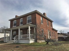 Ripley County Jail, Sheriff's Office and Sheriff's Residencelisted 1991
Population over time
2 figuresDoniphan fell from 1,997 to 1,781 between 2010 and 2020. These are the recorded population figures Wikidata holds for this place, reached through the Geographic Names Information System number this page is keyed on rather than by name, so they belong to this place and not to another of the same name. Most are census counts, but not all are: an early figure may be a founding or settlement estimate, and an estimate published within five years of a census is left out. The change column is computed, and is left blank where more than 20 years separate a figure from the one before it, because a gap that long is not a change between two counts.
| Year | People | Change |
|---|---|---|
| 2010 | 1,997 | |
| 2020 | 1,781 | -216 (-11%) |
Topographic sheets covering this place
7 surveys from 12 printed sheetsMatched by testing this settlement's coordinate against the published boundary of every sheet in the United States Geological Survey's historical collection. Each opens the scanned sheet at the Survey.
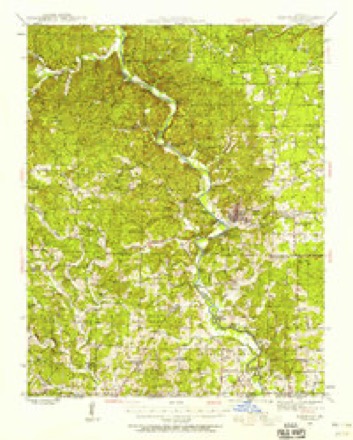
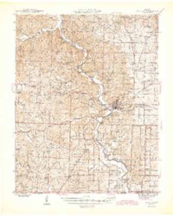
- 1939 USGS Doniphan quadrangle1:62500, 3 printings
- 1945 USGS Doniphan quadrangle1:62500, 2 printings
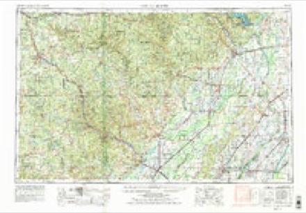
- 1957 USGS Poplar Bluff quadrangle1:250000, 3 printings
- 1959 USGS Poplar Bluff quadrangle1:250000
- 1960 USGS Poplar Bluff quadrangle1:250000
- 1980 USGS Doniphan South quadrangle1:24000
- 1983 USGS Poplar Bluff quadrangle1:100000

Fires near this place
56 since 1992Regional context, not property-specific evidence. The federal wildfire occurrence database lists 56 fires within 5 miles of Doniphan between 1992 and 2020, burning about 236 acres in total. None started naturally. 10 were recorded as arson. Distance is straight-line from the map coordinates, so a fire counted here may appear on a neighbouring settlement's page as well.
| Reported cause | Fires |
|---|---|
| Debris and open burning | 28 |
| Arson/incendiarism | 10 |
| Missing data/not specified/undetermined | 8 |
| Equipment and vehicle use | 7 |
| Smoking | 2 |
| Power generation/transmission/distribution | 1 |
The most recent of them, most recent first, with the day each was reported and the service that recorded it.
| Date | Cause | Size | Reported by | Name on the report |
|---|---|---|---|---|
| 5 September 2011 | Missing data/not specified/undetermined | 1.0 acres | Missouri Department of Conservation | not named |
| 16 September 1992 | Debris and open burning | 1.0 acres | Missouri Department of Conservation | not named |
| 12 September 1998 | Arson/incendiarism | 12 acres | Mark Twain National Forest | DEER LEAP |
| 12 September 1993 | Debris and open burning | 1.0 acres | Missouri Department of Conservation | not named |
| 7 July 1997 | Debris and open burning | 1.0 acres | Missouri Department of Conservation | not named |
| 25 July 1993 | Debris and open burning | 1.0 acres | Missouri Department of Conservation | not named |
| 12 July 1997 | Missing data/not specified/undetermined | 1.0 acres | Missouri Department of Conservation | not named |
| 8 April 2009 | Missing data/not specified/undetermined | 10 acres | Mark Twain National Forest | PAYNE |
Settlements close enough to share some of these fires:
Mines and quarries near this place
10 of 13 shownRegional context, not property-specific evidence. The federal mineral resources record lists 13 workings within 5 miles of Doniphan: 9 past producers, 2 prospects, 2 producers. 2 still produce. What was taken out: Sand and Gravel, Construction, Iron. Distance is straight-line from the map coordinates, so a quarry counted here may appear on a neighbouring settlement's page as well.
| Where | Site | Commodity | Status | Recorded |
|---|---|---|---|---|
| Asel Ponder Land | Iron | Past Producer | ||
| C H Martin Land No 2 | Iron | Prospect | ||
| D B Young Bank | Iron | Prospect | ||
| D K Ponder Land | Iron | Past Producer | ||
| Unknown - Iron | Iron | Past Producer | ||
| Luther Cobb S&G | Sand and Gravel, Construction | Producer | ||
| T.L. Wright Pit | Sand and Gravel, Construction | Producer | ||
| Unknown - S+G | Sand and Gravel, Construction | Past Producer | ||
| Unknown - S+G | Sand and Gravel, Construction | Past Producer | ||
| Unknown - S+G | Sand and Gravel, Construction | Past Producer |
Storms near this place
60 of 141 shownRegional context, not property-specific evidence. The National Weather Service names Doniphan in 141 storm reports between 1995 and 2025: 51 hail, 43 thunderstorm wind, 22 flood, 17 flash flood. No death or injury is recorded in these reports. Each account below is quoted exactly as the forecast office filed it, from the NOAA Storm Events Database, and each date opens the federal record of that event.
| When | Event | Place named | Harm | What the report says |
|---|---|---|---|---|
| March 2008 | Flood | Doniphan | $600,000 | Major flooding of the Current River occurred. At the Doniphan gage, the river crested at 24.11 feet on March 19 at 1 P.M. CDT. Flood stage there is 13 feet, and major flooding begins at 22 feet. This flood crest ranked as the fifth highest in over 100 years of records. More than 15 businesses in Doniphan were closed, and the city hall and police stations were inaccessible due to high water. Several homes were damaged in town. Three people were stuck on the roof of their mobile home in Doniphan. Rescue efforts were hampered by a bridge which was too low to the water for boats to pass. People were evacuated by boat from houses in the downtown area. |
| April 2011 | Flood | Doniphan | $250,000 | Major flooding occurred on the Current River. At the Doniphan river gage, the river crested at 23.76 feet, which was the fifth highest reading on record. About 15 homes were evacuated by boat. Swift water rescue teams were called into the region from as far as Sikeston and Cape Girardeau to assist with flash flood rescues as well as river flood rescues. One of the teams rescued a couple who were stranded in their vehicle. Several businesses were flooded, including a couple of resorts on the river. Much of downtown Doniphan was flooded. Red Cross shelters were opened. The entrance into Doniphan on Highway 142 was closed because of flooding. |
| December 2015 | Flood | Doniphan | $200,000 | Major flooding occurred along the Current River. At the Doniphan river gage, the river crested at 22.82 feet around 5 A.M. CST on the 30th. Flood stage there is 13 feet. Jefferson Street, along which the police station and courthouse is located, became impassable due to flooding. About a dozen homes were evacuated. Several businesses were flooded, including a couple of resorts on the river. Parts of downtown Doniphan were flooded. The entrance into Doniphan on Highway 142 was flooded. |
| May 2009 | Flash Flood | Doniphan | $150,000 | Flash flooding in Doniphan resulted in the evacuation of ten people trapped in flooded homes near Quick Creek. Since the flooding rains occurred on the heels of a damaging macroburst earlier in the day, water damage occurred where roofs had not been adequately tarped. The county courthouse in Doniphan sustained major water damage. Major flooding occurred at the high school in Doniphan, where every classroom was flooded and the asphalt parking lots buckled. A watermark on the outside of the main high school building was 18 inches above ground level. Homes near the high school were flooded. Leaks caused minor water damage at the elementary and middle schools. A grocery market was flooded. Flash flooding of Quick Creek in Doniphan caused significant damage. At least one vehicle was totally submerged, and floodwater came several feet up the sides of a house and garage. All secondary roads were covered with water, and 50 percent of the primary roads were covered. A woman and child were rescued from their vehicle that was submerged in waist-deep water. The 24-hour rainfall at Doniphan was 5.03 inches. |
| October 2007 | Thunderstorm Wind | Doniphan | $120,000 | In Doniphan, numerous trees and power lines were blown down. One of the trees partially landed on a home, causing moderate damage. A mobile home was damaged. A vacant building sustained roof damage and a broken window. A wind gust to 56 MPH was measured in Doniphan. Near Flatwoods, a barn was blown away on BB Highway. On Highway 21 North, a tree fell on some cars and a house. On County Road 142 east of Doniphan, siding was blown off a trailer, and numerous trees and power lines were down. Near Naylor, numerous treetops were blown onto Route W. |
| November 2024 | Flood | Doniphan | $100,000 | River levels on the Current River at Doniphan rose into minor flood with an initial crest during the morning hours of the 6th, with a surge of water pushing river levels well into moderate flood cresting at 21 feet early morning on the 7th. River levels dropped below flood stage by the evening hours on the 7th. Nearby streets flooding and some structures were inundated with water near Doniphan. |
| May 2021 | Thunderstorm Wind | Doniphan | $100,000 | There was plenty of tree damage in and near Doniphan, along with power outages. At one point, about 1700 utility customers or 25 percent of the county was without power. A large tree was down on a home in Doniphan. |
| April 1996 | Tornado (F2) | Doniphan | $100,000 | no account filed |
| April 1996 | Thunderstorm Wind | Doniphan | $80,000 | no account filed |
| February 2019 | Thunderstorm Wind | Doniphan | $75,000 | A damage survey conducted by the National Weather Service revealed scattered damage caused by straight-line thunderstorm winds. Estimated peak winds were 75 mph. The damage area paralleled Missouri Highway 142 right through the center of the city from 0.5 mile north of Doniphan to one mile south of Doniphan. The maximum width of the damage area was 1.5 miles. Scattered tree damage occurred across Doniphan, including a large pine tree that was uprooted. A carport was turned and damaged. Several metal flat-bottom fishing boats were overturned at a boat shop. A glass door was shattered at the boat shop. A power pole was snapped near a house that sustained light roof and fence damage. |
| June 2019 | Flash Flood | Doniphan | $50,000 | Swiftly moving water was observed on streets in Doniphan. The high school and elementary school were both damaged by flooding. |
| October 2009 | Flood | Doniphan | $40,000 | Moderate flooding occurred on the Current River. At the Doniphan river gage, the river crested at 18.92 feet late in the afternoon of the 31st. Flood stage there is 13 feet. There was considerable flooding of parking lots and streets adjacent to the river. In Doniphan, two vans parked near the river were flooded up to the windshield. Riverside Park in Doniphan was flooded. Water begins to flood homes in Doniphan at a stage of 18 feet. |
| April 2017 | Thunderstorm Wind | Doniphan | $35,000 | Moderate damage occurred to three homes, mostly due to trees falling onto roofs. Another home received minor damage due to a power line weatherhead being pulled from the structure by a downed tree. Two vehicles were damaged by falling trees. One vehicle received minor damage, and the other was moderately damaged. Numerous trees were uprooted or snapped. The damage area was both north and south of Highway 142 near the intersection of County Road 24. |
| April 2023 | Thunderstorm Wind | Doniphan | $25,000 | The metal roof was removed from a house on Highway 160. A tree fell on another house. |
| May 2019 | Thunderstorm Wind | Doniphan | $25,000 | Many trees were blown down throughout the county, including the city of Doniphan. One home in Doniphan sustained roof damage from a fallen tree. Numerous power outages were reported. The automated Doniphan fire weather observation site measured a wind gust to 65 mph. A trained spotter in Flatwoods estimated winds gusted to 60 mph. |
| April 2014 | Thunderstorm Wind | Doniphan | $20,000 | Multiple trees were blown down. |
| June 2011 | Thunderstorm Wind | Doniphan | $20,000 | Numerous trees were down in town. A wind gust to 63 mph was measured. |
| March 2023 | Flood | Doniphan | $15,000 | Moderate flooding occurred on the Current River. On the Doniphan river gage, the river crested at 19.08 feet at mid-morning on the 26th. Flood stage is 13 feet. Water flooded a couple of homes in Doniphan. There was considerable flooding of low-lying woods and fields. |
| May 2020 | Thunderstorm Wind | Doniphan | $15,000 | Numerous trees were down on the north side of Doniphan. |
| July 2006 | Flash Flood | Doniphan | $15,000 | Thunderstorms with periods of heavy rainfall over several days saturated the ground, leading to flash flooding. Two separate gages in Doniphan, an automated gage and a co-op observer's gage, measured 7.5 to 8 inches of rain over a 48-hour period. Flooding was reported across low-lying areas in Doniphan, affecting some streets and a school. A vehicle was abandoned due to high water. A dumpster was carried into a ditch. Some creeks were out of their banks. |
| July 2016 | Thunderstorm Wind | Doniphan | $10,000 | Emergency management personnel estimated wind gusts to at least 60 mph in Doniphan. Scattered trees were blown down across the county, some of which blocked roads. |
| September 2006 | Thunderstorm Wind | Doniphan | $10,000 | Several trees were blown down. One large tree landed on a pickup truck. Another tree landed on a carport. |
| May 1999 | Thunderstorm Wind | Doniphan | $10,000 | Numerous trees were down and a barn was destroyed. |
| March 1998 | Hail | Doniphan | $10,000 | A severe thunderstorm cell over Ripley County produced large hail. Hail the size of baseballs occurred 2 miles north of Doniphan on Highway 21. |
| April 2011 | Thunderstorm Wind | Doniphan | $9,000 | Two trees fell on a feeder line on U.S. Highway 160, knocking out power to 750 customers. |
| January 1996 | Thunderstorm Wind | Doniphan | $8,000 | no account filed |
| May 2024 | Thunderstorm Wind | Doniphan | $6,000 | A tree fell on power lines on 21S, just south of 21S-5. |
| February 2006 | Thunderstorm Wind | Doniphan | $6,000 | About 6 miles south of Doniphan, two barns were damaged, and a house sustained roof damage. Trees were blown down throughout the community of Doniphan and several miles south of town. |
| July 2022 | Thunderstorm Wind | Doniphan | $5,000 | The Ripley County Sheriff Department reported trees down. |
| March 2015 | Thunderstorm Wind | Doniphan | $5,000 | Two trees were blown down on U.S. Highway 160 West. |
| June 2001 | Thunderstorm Wind | Doniphan | $5,000 | Roof and outbuilding damage was reported near Doniphan. |
| August 1999 | Thunderstorm Wind | Doniphan | $5,000 | Trees were down on roads and power lines. The diameter of the trees was 8 to 9 inches. |
| July 1997 | Hail | Doniphan | $5,000 | Golf ball hail was reported at the intersection of Highway 21N and K. |
| July 2002 | Flash Flood | Doniphan | $4,000 | Flooding occurred in and near the Gatewood and Briar areas. One foot of water was over Highway 160 just west of State Highway C. On Highway 142 west, a motorist was trapped between two flooded creeks. The flash flooding was caused by a nearly stationary complex of thunderstorms that produced an estimated 3 to 5 inches of rain in a few hours. |
| July 1997 | Thunderstorm Wind | Doniphan | $4,000 | Numerous trees were down across the county. |
| July 1997 | Thunderstorm Wind | Doniphan | $4,000 | Trees were down. |
| May 2015 | Thunderstorm Wind | Doniphan | $3,000 | Trees were blown down on JJ Highway. |
| June 2013 | Flood | Doniphan | $3,000 | Minor flooding occurred on the Current River at Doniphan. Low-lying fields, woodlands, and river access roads were flooded. |
| June 2005 | Thunderstorm Wind | Doniphan | $3,000 | Trees and power lines were blown down. At least one large oak tree was uprooted. |
| October 1996 | Thunderstorm Wind | Doniphan | $2,000 | no account filed |
| July 2021 | Thunderstorm Wind | Doniphan | $1,000 | A tree was down on Y Highway. |
| October 2019 | Thunderstorm Wind | Doniphan | $1,000 | The wind gust was reported by law enforcement. |
| April 2017 | Thunderstorm Wind | Doniphan | $1,000 | A tree was down along Highway K4. |
| March 2025 | Hail | Doniphan | - | Quarter size hail occurred in Doniphan. |
| March 2023 | Flood | Doniphan | - | Minor flooding occurred on the Current River on the west side of Doniphan. Some low-lying woods and fields were flooded. |
| May 2021 | Flash Flood | Doniphan | - | Several roads in the county flooded. |
| July 2021 | Hail | Doniphan | - | Pea to nickel hail lasted about five minutes. |
| March 2020 | Flood | Doniphan | - | Minor flooding occurred on the Current River. Low-lying woods and bottomland fields were inundated. |
| January 2020 | Flood | Doniphan | - | Minor flooding occurred on the Current River. Some low-lying woods and fields were underwater. |
| July 2020 | Flash Flood | Doniphan | - | Several city streets around Doniphan were closed by flash flooding. The automated observing system at the Doniphan fire weather station measured 2.11 inches in an hour. |
| July 2019 | Flash Flood | Doniphan | - | Numerous roads were flooded across the county. |
| February 2018 | Flood | Doniphan | - | Minor flooding occurred on the Current River. Some low-lying woods and fields near the river were inundated. |
| April 2017 | Flood | Doniphan | - | A record-breaking flood began on the Current River on the 30th. The river rose rapidly above flood stage, climbing about 20 feet in 24 hours. The river exceeded its highest level on record around midday on the 30th. The old record was established in 1904. The river continued rising further above the record during the night of the 30th. Roads and bridges were closed, and many buildings were flooded in Doniphan. The river continued rising at the end of April. |
| September 2016 | Flood | Doniphan | - | Street flooding occurred in Doniphan. An automated rain gage measured 2.25 inches in less than an hour. |
| July 2016 | Flood | Doniphan | - | Ditches and small streams were overflowing. |
| May 2015 | Hail | Doniphan | - | Dime-size hail was reported at the corner of U.S. Highway 160 and State Highway 21. |
| August 2015 | Heavy Rain | Doniphan | - | The mesonet station on the Current River near Doniphan measured 2.34 inches during the morning hours. |
| November 2015 | Heavy Rain | Doniphan | - | The automated rain gage at the Doniphan fire weather station in the Mark Twain National Forest measured 4.99 inches in the past 48 hours. |
| April 2014 | Hail | Doniphan | - | Wind gusts to 45 mph accompanied the hail. |
| August 2012 | Thunderstorm Wind | Doniphan | - | A wind gust to 68 mph was measured. |
Nearest settlements
The eight closest, with where each one stands in the county. Distances are straight-line, computed from the Geographic Names Information System coordinates.
Elsewhere
Matched on this settlement's Geographic Names Information System number rather than its name, so it cannot be a different place of the same name in another state.
| Wikipedia article on Doniphan | An encyclopaedic summary. Its text is share-alike, so it is linked here rather than copied. |
| Wikidata item Q962358 | The structured record the population and elevation above come from. Public domain (CC0). |
Provenance
This settlement is recorded in the Geographic Names Information System as feature 749678. The sheet list is computed by point-in-boundary test against the United States Geological Survey's historical topographic inventory. Both are works of the United States government and carry no copyright under 17 U.S.C. 105.
Wildfire. Short, Karen C. 2022. Spatial wildfire occurrence data for the United States, 1992-2020 [FPA_FOD_20221014]. 6th Edition. Fort Collins, CO: Forest Service Research Data Archive. https://doi.org/10.2737/RDS-2013-0009.6 Collected with United States Government funding and usable without additional permissions or fees.
Mines and quarries. USGS Mineral Resources Data System (MRDS) https://mrdata.usgs.gov/mrds/ A work of the United States government, no copyright under 17 U.S.C. 105.
Storms. NOAA National Centers for Environmental Information, Storm Events Database https://www.ncei.noaa.gov/stormevents/ A work of the United States government, no copyright under 17 U.S.C. 105. Narratives are quoted verbatim from the National Weather Service report and are not edited or summarised.