 Block
Florida, Missouri
16 topographic sheets cover this place, the earliest surveyed in 1890 and the latest in 1986. It stands in Jefferson Township. It lies in ZIP code area 65283. It stands on Carr Branch. The Survey maps it on the Florida quadrangle. 5 people lived here at the 2020 count. It stands 659 feet above sea level.
On record in Florida
Buildings and businesses the archive holds for this place. Each opens its own page, with the source record it came from.
On the National Register 2 records
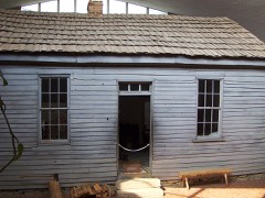 Mark Twain Birthplace Cabinlisted 1969
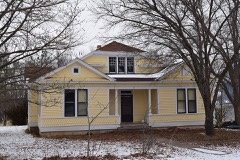 Merritt Violette Houselisted 1983
Topographic sheets covering this place
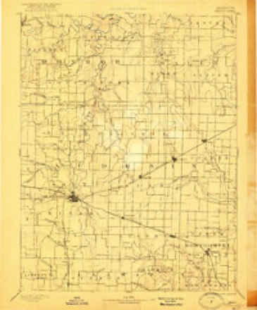
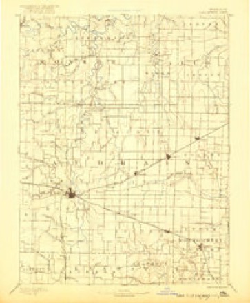
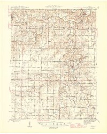
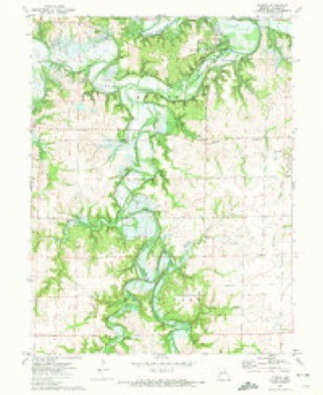
7 surveys from 16 printed sheetsMatched by testing this settlement's coordinate against the published boundary of every sheet in the United States Geological Survey's historical collection. Each opens the scanned sheet at the Survey.
- 1890 USGS Mexico quadrangle1:125000, 4 printings
- 1890 USGS Perry quadrangle1:125000
- 1945 USGS Florida quadrangle1:62500, 3 printings
- 1948 USGS Quincy quadrangle1:250000, 2 printings
- 1956 USGS Quincy quadrangle1:250000, 3 printings
- 1972 USGS Florida quadrangle1:24000
- 1986 USGS Mexico quadrangle1:100000, 2 printings
In the county-history sources
3,218 words on this townshipHistory of Monroe and Shelby Counties, Missouri, published 1884 names this settlement in its chapter on Jefferson Township. These are the passages that mention it, exactly as the scans read.
The business done by the mills from 1845 to 1860, was perhaps the largest milling business ever done in the county. Large quantities of flour were hauled regularly to Hannibal and Mexico, and shipped from thence to St. Louis, until the Hickman flour was well known at one time in that city. Hugh A. Hickman ran out several boats loaded with flour to Louisiana, on the Mississippi, at the mouth of Salt river, and brought back one boat lightly loaded with sugar, cofl'ee and other articles of merchandise. Florida was declared the head of navigation on Salt river, and was thought by those brave and ambitious pioneers to be a favorable point for the founding of a great commercial town. The town was accordingly laid ofi" by Maj. Wm. N. Penu, Hugh A.
Passage source: History of Monroe and Shelby Counties, Missouri, published 1884.
Hickman and others, and although the bright dreams which swelled the hearts of these noble pioneers were not realized, Florida has always held the rank of a respectable and enterprising village. From this point and vicinity have emanated some of the most prominent business men of North-east Missouri, as well as Mark Twain, a writer of national reputation, and probably the most celebrated humorist ever produced by the United States.
Passage source: History of Monroe and Shelby Counties, Missouri, published 1884.
The first store in the vicinity was kept by Maj. Penn for a man named Roundtree, at Stice's mill, and was in operation there in 1831. He afterwards removed to Florida, and from thence to Paris, where he. acted for more than 20 years as county clerk. Since the formation of Florida there has been a great number of men engaged in the mercantile business in the place, with varying success. Prominent among the old merchants were John A. Quarles, R. H. Buchanan, Milton Wilkerson, Presley Wilkerson and Mason Wilkerson. They have all crossed the dark river save Uncle Mace, who still lives in the town, and engaged in bee culture, a business in which he is quite an expert.
Passage source: History of Monroe and Shelby Counties, Missouri, published 1884.
Machine-read from a century-old scan, so expect the errors a machine makes: misspelled names, dropped words, stray characters.
Read the whole chapter on Jefferson Township - it names this place 5 more 5 times.
Fires near this place
2 since 1995Regional context, not property-specific evidence. The federal wildfire occurrence database lists 2 fires within 5 miles of Florida between 1995 and 1997, burning about 32 acres in total. None started naturally. None was recorded as arson. Distance is straight-line from the map coordinates, so a fire counted here may appear on a neighbouring settlement's page as well.
| Reported cause | Fires |
|---|---|
| Debris and open burning | 1 |
| Recreation and ceremony | 1 |
The most recent of them, most recent first, with the day each was reported and the service that recorded it.
| Date | Cause | Size | Reported by | Name on the report |
|---|---|---|---|---|
| 7 April 1995 | Debris and open burning | 7.0 acres | Missouri Department of Conservation | not named |
| 18 February 1997 | Recreation and ceremony | 25 acres | Missouri Department of Conservation | not named |
Settlements close enough to share some of these fires:
Mines and quarries near this place
3 within 5 milesRegional context, not property-specific evidence. The federal mineral resources record lists 3 workings within 5 miles of Florida: 3 past producers. None of them still produces. What was taken out: Clay, Stone, Crushed/Broken, Sand and Gravel, Construction. Distance is straight-line from the map coordinates, so a quarry counted here may appear on a neighbouring settlement's page as well.
| Where | Site | Commodity | Status | Recorded |
|---|---|---|---|---|
| Mcclain Quarry | Stone, Crushed/Broken | Past Producer | ||
| Unknown | Clay | Past Producer | ||
| Unknown | Sand and Gravel, Construction | Past Producer |
Storms near this place
5 since 1999Regional context, not property-specific evidence. The National Weather Service names Florida in 5 storm reports between 1999 and 2013: 3 thunderstorm wind, 2 hail. No death or injury is recorded in these reports. Each account below is quoted exactly as the forecast office filed it, from the NOAA Storm Events Database, and each date opens the federal record of that event.
| When | Event | Place named | Harm | What the report says |
|---|---|---|---|---|
| May 2013 | Thunderstorm Wind | Florida | - | Several large tree limbs were blown down. |
| October 2007 | Thunderstorm Wind | Florida | - | Several trees were blown down in the Mark Twain State Park's Puma Campground. One tree landed on a small camping trailer causing minor damage. None of the 4 occupants were injured by the fallen tree. Also, the park office sustained minor damage. |
| May 2003 | Hail | Florida | - | The Sheriff Department reported 3/4 inch hail. |
| July 2002 | Thunderstorm Wind | Florida | - | Amateur Radio spotters reported trees down on Route U. |
| January 1999 | Hail | Florida | - | no account filed |
Nearest settlements
The eight closest, with where each one stands in the county. Distances are straight-line, computed from the Geographic Names Information System coordinates.
| Map | Place | Distance | Sheets |
|---|---|---|---|
| Buzzards Roost | 1.6 miles | 16 | |
| Leich Ford | 2.7 miles | 11 | |
| Victor | 3.5 miles | 16 | |
| Stoutsville | 5.3 miles | 11 | |
| Indian Creek | 7.0 miles | 11 | |
| Strother | 7.1 miles | 16 | |
| Clapper | 7.4 miles | 11 | |
| Goss | 8.4 miles | 11 |
Elsewhere
Matched on this settlement's Geographic Names Information System number rather than its name, so it cannot be a different place of the same name in another state.
| Wikipedia article on Florida | An encyclopaedic summary. Its text is share-alike, so it is linked here rather than copied. |
| Wikidata item Q537803 | The structured record the population and elevation above come from. Public domain (CC0). |
Provenance
This settlement is recorded in the Geographic Names Information System as feature 718036. The sheet list is computed by point-in-boundary test against the United States Geological Survey's historical topographic inventory. Both are works of the United States government and carry no copyright under 17 U.S.C. 105.
Wildfire. Short, Karen C. 2022. Spatial wildfire occurrence data for the United States, 1992-2020 [FPA_FOD_20221014]. 6th Edition. Fort Collins, CO: Forest Service Research Data Archive. https://doi.org/10.2737/RDS-2013-0009.6 Collected with United States Government funding and usable without additional permissions or fees.
Mines and quarries. USGS Mineral Resources Data System (MRDS) https://mrdata.usgs.gov/mrds/ A work of the United States government, no copyright under 17 U.S.C. 105.
Storms. NOAA National Centers for Environmental Information, Storm Events Database https://www.ncei.noaa.gov/stormevents/ A work of the United States government, no copyright under 17 U.S.C. 105. Narratives are quoted verbatim from the National Weather Service report and are not edited or summarised.