 Block
Lathrop, Missouri
16 topographic sheets cover this place, the earliest surveyed in 1925 and the latest in 1986. It stands in Lathrop Township. It lies in ZIP code area 64465. The Survey maps it on the Lathrop quadrangle. 2,271 people lived here at the 2020 count. It stands 1,063 feet above sea level.
Population over time
2 figuresLathrop grew from 2,086 to 2,271 between 2010 and 2020. These are the recorded population figures Wikidata holds for this place, reached through the Geographic Names Information System number this page is keyed on rather than by name, so they belong to this place and not to another of the same name. Most are census counts, but not all are: an early figure may be a founding or settlement estimate, and an estimate published within five years of a census is left out. The change column is computed, and is left blank where more than 20 years separate a figure from the one before it, because a gap that long is not a change between two counts.
| Year | People | Change |
|---|---|---|
| 2010 | 2,086 | |
| 2020 | 2,271 | +185 (+9%) |
Topographic sheets covering this place
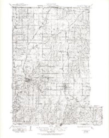
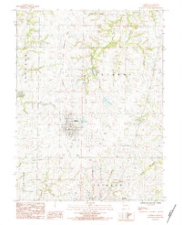
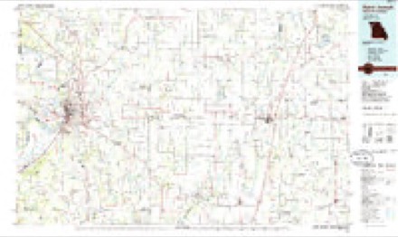
7 surveys from 16 printed sheetsMatched by testing this settlement's coordinate against the published boundary of every sheet in the United States Geological Survey's historical collection. Each opens the scanned sheet at the Survey.
- 1925 USGS Plattsburg quadrangle1:62500, 4 printings
- 1950 USGS Kansas City quadrangle1:250000
- 1954 USGS Kansas City quadrangle1:250000
- 1956 USGS Kansas City quadrangle1:250000, 4 printings
- 1960 USGS Kansas City quadrangle1:250000, 3 printings
- 1984 USGS Lathrop quadrangle1:24000
- 1986 USGS Saint Joseph quadrangle1:100000, 2 printings




In the county-history sources
12,502 words on this townshipThe History of Clinton County, Missouri : Containing a History of the County, Its Cities, Towns, Etc., Biographical Sketches of Its Citizens, Clinton County in the Late War, General and Local Statistics, Portraits of Early Settlers and Prominent Men, History of Missouri, Map of Clinton County, Etc., Etc, published 1881 names this settlement in its chapter on Lathrop Township. These are the passages that mention it, exactly as the scans read.
Kingston Sentinel, wliore he learned tlic jirintcrs' trade. He has worked at that business in St. Joseph, Davenport (lowaj. New York, Philadelphia, and St. Louis, and has became a proficient workman. In 1S74. he bought the Caldwell Citizen of Kingston and published it for three years. In 1S77, after selling out. he took charge of a drug store for eighteen months. During all these years he had been reading law at his leisv'.re ho'irs, and in the fall of 1S78 he entered the law oftice of Chapman & Hoskinson, when he studied hard for two years and in 1880 was admitted to practice b)- Judge Hroudders, of the Seventeenth Judicial Circuit. In April, 1880, after being admitted, he went to Lathrop, Clinton Count}-, and started the Lathrop Ilerakl, in the jjublication of which he has done a successful business, and secured a large circulation. In Tune, 1880, he was appointed one of the census enumerators for this count}-, and received the diploma offered for the most correct, s\-stematic. and neatly executed returns of the seventh supervisor's district of the state, consisting of 304 enumeration districts.
farmer and stock feeder, section 31, post office Lathrop. The subject of this sketch is a native of Michigan, and was born on a farm on the 2d day of August, 1832. He received a good common school education, and. at the age of eighteen, went to California, where he spent two years, and then returned to his home and made his parents a visit of several months. He next removed to Minnesota, and farmed for ten years. Closing out business, he located at Rockford, near Grand Rapids, ^lichigan, de\oting his time to the grocery business, in connection with farming. This he continued for twel\-e }-ears, when he closed out and went to Sherman, Texas, entering into the hotel and grocer}- busines.^. After som.e two years, he unfortunately lost by fire property to the amount of $6,000, including all household and personal effects. Remo\'- ing to P2mporia, Kansas, he remained two }-ears, and there gave his children a good education. He then moved to Clinton County in 1880, where he now resides, owning a fine farm of lOO acres, v.-ell improxed. Mr. C. was united in marriage, on the i8th da}- of August, 1857, with Miss Laura Scorell, a native of Schuyler County, New York. The family consists of five children : Fred, Mary J., John L., Eva G. and Xcllie.
farmer, stock feeder and dealer, is the owner of 320 acres of land in section 35. He was born in Lathrop Township, Clinton County, Missouri, December, 1849, and there received a good common school education. He then attended the State L^niversity at Columbia, Missouri, where he prepared himself for a useful business life. He was married to Miss Susan Cooper in June, 1874. She was the daughter of E. W. Cooper. Esq., a pioneer and a respected citi/.en of Lathrop. They have three children, Dorsey, Elgi, and William. The subject of this sketch is a son of John Douglass, among the earliest and now one of the most prosperous farmers in the county. The early training which he received at home has greatly enabled him to conduct his large farm and stock business in a profitable and economical manner. His land is stocked with good herds, he having from fifty to 150 head of cattle, besides a lar^'e number of hogs. He bought his larm of the railroad company, it then being; a part of the company's addition to the city of Lathrop. Mr. Douglass firsl settled on eight)- acres just south of the city, where he set out one of the most beautiful orchards in the county. Both of the railroads ran through the farm, and on that account he. sold it.
Machine-read from a century-old scan, so expect the errors a machine makes: misspelled names, dropped words, stray characters.
Read the whole chapter on Lathrop Township - it names this place 20 more 20 times.
Fires near this place
17 since 1995Regional context, not property-specific evidence. The federal wildfire occurrence database lists 17 fires within 5 miles of Lathrop between 1995 and 2018, burning about 107 acres in total. None started naturally. None was recorded as arson. Distance is straight-line from the map coordinates, so a fire counted here may appear on a neighbouring settlement's page as well.
| Reported cause | Fires |
|---|---|
| Missing data/not specified/undetermined | 7 |
| Debris and open burning | 5 |
| Smoking | 2 |
| Recreation and ceremony | 1 |
| Fireworks | 1 |
| Other causes | 1 |
The most recent of them, most recent first, with the day each was reported and the service that recorded it.
| Date | Cause | Size | Reported by | Name on the report |
|---|---|---|---|---|
| 6 August 2018 | Smoking | under an acre | Missouri Department of Conservation | 177628-02515-08062018-0928 |
| 22 August 2018 | Smoking | 4.2 acres | Missouri Department of Conservation | 177629-02515-08222018-1720 |
| 4 July 2018 | Fireworks | 2.1 acres | Missouri Department of Conservation | 177625-02515-07042018-1811 |
| 4 April 2018 | Other causes | 25 acres | Missouri Department of Conservation | 177624-02515-04042018-1736 |
| 27 April 2018 | Missing data/not specified/undetermined | 2.2 acres | Missouri Department of Conservation | 177622-02515-04272018-1030 |
| 14 April 1995 | Debris and open burning | 2.0 acres | Missouri Department of Conservation | not named |
| 14 April 1995 | Debris and open burning | 6.0 acres | Missouri Department of Conservation | not named |
| 6 March 1995 | Debris and open burning | 7.0 acres | Missouri Department of Conservation | not named |
Settlements close enough to share some of these fires:
Mines and quarries near this place
10 of 20 shownRegional context, not property-specific evidence. The federal mineral resources record lists 20 workings within 5 miles of Lathrop: 18 past producers, 2 producers. 2 still produce. What was taken out: Stone, Crushed/Broken, Sand and Gravel, Construction. Distance is straight-line from the map coordinates, so a quarry counted here may appear on a neighbouring settlement's page as well.
| Where | Site | Commodity | Status | Recorded |
|---|---|---|---|---|
| Unk | Sand and Gravel, Construction | Past Producer | ||
| Everett Quarry # 1 | Stone, Crushed/Broken | Producer | ||
| Everett Quarry #20 | Stone, Crushed/Broken | Producer | ||
| Unk | Stone, Crushed/Broken | Past Producer | ||
| Unk | Stone, Crushed/Broken | Past Producer | ||
| Unk | Stone, Crushed/Broken | Past Producer | ||
| Unk | Stone, Crushed/Broken | Past Producer | ||
| Unk | Stone, Crushed/Broken | Past Producer | ||
| Unk | Stone, Crushed/Broken | Past Producer | ||
| Unk | Stone, Crushed/Broken | Past Producer |
Storms near this place
39 since 1993Regional context, not property-specific evidence. The National Weather Service names Lathrop in 39 storm reports between 1993 and 2025: 21 thunderstorm wind, 17 hail, 1 tornado. The reports record 1 injury. Each account below is quoted exactly as the forecast office filed it, from the NOAA Storm Events Database, and each date opens the federal record of that event.
| When | Event | Place named | Harm | What the report says |
|---|---|---|---|---|
| June 2013 | Thunderstorm Wind | Lathrop | 1 hurt | A tree was blown over, causing a minor hip injury to a person, at the Lathrop Fairgrounds. Thunderstorm wind gusts were estimated up to 60 mph. |
| July 1999 | Thunderstorm Wind | Lathrop | $10,000 | Several trees were downed along Interstate 35. Debris from a nearby outbuilding was blown onto the interstate. |
| June 1994 | Hail | Lathrop | $5,000 | Hail reached golf ball-size. |
| August 2016 | Tornado (EF0) | Lathrop | $2,000 | Emergency Management reported a funnel three-quarters of the way to the surface, with dust whirls and an occasional power flash. A video sent to the office via Twitter showed what appears to be a weak tornado with a truncated funnel and dust whirls at the surface. Since the tornado did not have a continuous path and since it was relegated mostly to open fields the damage was minimized to tree limbs and a few power lines. |
| June 2004 | Thunderstorm Wind | Lathrop | $2,000 | power lines down. |
| June 2004 | Thunderstorm Wind | Lathrop | $2,000 | 10 to 16 inch trees and power lines down. |
| May 2025 | Hail | Lathrop | - | Social media report of quarter sized hail in Lathrop. |
| June 2023 | Hail | Lathrop | - | Golf ball sized hail was reported along Interstate 35 east of Lathrop. |
| June 2021 | Thunderstorm Wind | Lathrop | - | Several large oak trees were blown over. The owner of the trees estimated 70 to 80 mph wind. |
| June 2021 | Thunderstorm Wind | Lathrop | - | A ten inch tree limb was down near Lathrop. |
| July 2020 | Thunderstorm Wind | Lathrop | - | Some of the framing for a church construction project was blown down. |
| March 2017 | Thunderstorm Wind | Lathrop | - | Power lines down on HWY 33 just south of Lathrop. |
| August 2016 | Thunderstorm Wind | Lathrop | - | Eight to ten inch tree limbs were broken in Lathrop from thunderstorm winds. |
| August 2016 | Thunderstorm Wind | Lathrop | - | Inflow winds into a storm near Lathrop caused 60 mph winds. |
| June 2015 | Thunderstorm Wind | Lathrop | - | A trained spotter reported a 60 mph wind gust. |
| September 2012 | Thunderstorm Wind | Lathrop | - | Thunderstorm wind gusts were estimated up to 60 mph, and caused 4 to 5 inch tree limbs to be blown down. |
| April 2010 | Thunderstorm Wind | Lathrop | - | Thunderstorm wind gusts to 70 mph were estimated in downtown Lathrop. |
| June 2009 | Thunderstorm Wind | Lathrop | - | Trees were reported down. |
| August 2006 | Thunderstorm Wind | Lathrop | - | Trees down in town. |
| August 2005 | Thunderstorm Wind | Lathrop | - | Large tree downed on road. |
| June 2000 | Thunderstorm Wind | Lathrop | - | Wind gusts were estimated at 60 mph by law enforcement officials. |
| June 2000 | Thunderstorm Wind | Lathrop | - | A ham radio operator estimated wind gusts at 70 mph. |
| August 2000 | Thunderstorm Wind | Lathrop | - | An 18 inch diameter tree limb was downed. |
| July 1995 | Hail | Lathrop | - | Severe thunderstorms moved across western and central sections of Clinton County producing large hail. Golf ball-size hail was reported at Gower and tennis ball-size hail was reported at Plattsburg. In Lathrop an inch and a quarter-size hail was reported. |
| April 1993 | Hail | Lathrop | - | Large hail was reported at the intersection of Highway 116 and Interstate 35. |
| April 2019 | Hail | Lathrop | - | no account filed |
| August 2017 | Hail | Lathrop | - | no account filed |
| March 2017 | Hail | Lathrop | - | no account filed |
| April 2016 | Hail | Lathrop | - | no account filed |
| May 2016 | Hail | Lathrop | - | no account filed |
| May 2016 | Hail | Lathrop | - | no account filed |
| April 2005 | Hail | Lathrop | - | no account filed |
| July 2004 | Hail | Lathrop | - | no account filed |
| April 2003 | Hail | Lathrop | - | no account filed |
| April 2003 | Hail | Lathrop | - | no account filed |
| April 2003 | Hail | Lathrop | - | no account filed |
| April 2003 | Hail | Lathrop | - | no account filed |
| June 2001 | Thunderstorm Wind | Lathrop | - | no account filed |
| June 2001 | Thunderstorm Wind | Lathrop | - | no account filed |
Nearest settlements
The eight closest, with where each one stands in the county. Distances are straight-line, computed from the Geographic Names Information System coordinates.
| Map | Place | Distance | Sheets |
|---|---|---|---|
| Guyton | 2.4 miles | 16 | |
| Wexford | 3.5 miles | 16 | |
| Converse | 4.4 miles | 22 | |
| Lake Arrowhead | 4.5 miles | 22 | |
| Turney | 6.0 miles | 16 | |
| Plainview | 6.0 miles | 14 | |
| Haynesville | 6.0 miles | 22 | |
| Barnesville | 6.1 miles | 14 |
Elsewhere
Matched on this settlement's Geographic Names Information System number rather than its name, so it cannot be a different place of the same name in another state.
| Wikipedia article on Lathrop | An encyclopaedic summary. Its text is share-alike, so it is linked here rather than copied. |
| Wikidata item Q962468 | The structured record the population and elevation above come from. Public domain (CC0). |
Provenance
This settlement is recorded in the Geographic Names Information System as feature 720826. The sheet list is computed by point-in-boundary test against the United States Geological Survey's historical topographic inventory. Both are works of the United States government and carry no copyright under 17 U.S.C. 105.
Wildfire. Short, Karen C. 2022. Spatial wildfire occurrence data for the United States, 1992-2020 [FPA_FOD_20221014]. 6th Edition. Fort Collins, CO: Forest Service Research Data Archive. https://doi.org/10.2737/RDS-2013-0009.6 Collected with United States Government funding and usable without additional permissions or fees.
Mines and quarries. USGS Mineral Resources Data System (MRDS) https://mrdata.usgs.gov/mrds/ A work of the United States government, no copyright under 17 U.S.C. 105.
Storms. NOAA National Centers for Environmental Information, Storm Events Database https://www.ncei.noaa.gov/stormevents/ A work of the United States government, no copyright under 17 U.S.C. 105. Narratives are quoted verbatim from the National Weather Service report and are not edited or summarised.