 Block
Lesterville, Missouri
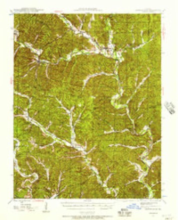
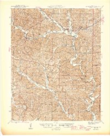
18 topographic sheets cover this place, the earliest surveyed in 1943 and the latest in 1989. It stands in Lesterville Township. It lies in ZIP code area 63654. It stands on West Fork Black River. The Survey maps it on the Lesterville quadrangle. It stands 722 feet above sea level.
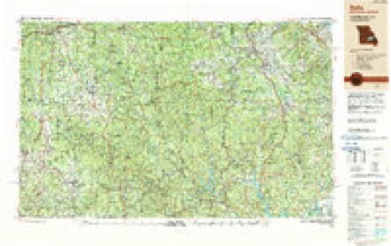
Topographic sheets covering this place
13 surveys from 18 printed sheetsMatched by testing this settlement's coordinate against the published boundary of every sheet in the United States Geological Survey's historical collection. Each opens the scanned sheet at the Survey.
- 1943 USGS Lesterville quadrangle1:62500, 2 printings
- 1946 USGS Lesterville quadrangle1:62500, 2 printings
- 1949 USGS Rolla quadrangle1:250000
- 1953 USGS Rolla quadrangle1:250000
- 1954 USGS Rolla quadrangle1:250000, 2 printings
- 1958 USGS Rolla quadrangle1:250000
- 1959 USGS Rolla quadrangle1:250000
- 1960 USGS Rolla quadrangle1:250000
- 1966 USGS Rolla quadrangle1:250000
- 1968 USGS Lesterville quadrangle1:24000, 2 printings
- 1971 USGS Rolla quadrangle1:250000
- 1986 USGS Piedmont quadrangle1:100000, 2 printings
- 1989 USGS Rolla quadrangle1:250000
Fires near this place
27 since 1992Regional context, not property-specific evidence. The federal wildfire occurrence database lists 27 fires within 5 miles of Lesterville between 1992 and 2019, burning about 782 acres in total. None started naturally. 6 were recorded as arson. Distance is straight-line from the map coordinates, so a fire counted here may appear on a neighbouring settlement's page as well.
| Reported cause | Fires |
|---|---|
| Debris and open burning | 17 |
| Arson/incendiarism | 6 |
| Missing data/not specified/undetermined | 3 |
| Recreation and ceremony | 1 |
The most recent of them, most recent first, with the day each was reported and the service that recorded it.
| Date | Cause | Size | Reported by | Name on the report |
|---|---|---|---|---|
| 17 May 1997 | Debris and open burning | 8.0 acres | Missouri Department of Conservation | not named |
| 7 April 2013 | Debris and open burning | 1.0 acres | Missouri Department of Conservation | not named |
| 22 April 2019 | Debris and open burning | 4.5 acres | Missouri Department of Conservation | 178612-00000-04222019-1515 |
| 18 April 1995 | Missing data/not specified/undetermined | 19 acres | Missouri Department of Conservation | not named |
| 12 April 2013 | Debris and open burning | 1.0 acres | Missouri Department of Conservation | not named |
| 7 March 1992 | Debris and open burning | 50 acres | Missouri Department of Conservation | not named |
| 31 March 1997 | Debris and open burning | 3.0 acres | Missouri Department of Conservation | not named |
| 25 March 1995 | Debris and open burning | 7.0 acres | Missouri Department of Conservation | not named |
Settlements close enough to share some of these fires:
Mines and quarries near this place
10 of 12 shownRegional context, not property-specific evidence. The federal mineral resources record lists 12 workings within 5 miles of Lesterville: 9 past producers, 2 prospects, 1 producer. 1 still produces. What was taken out: Sand and Gravel, Construction, Iron, Stone, Crushed/Broken, Lead. Distance is straight-line from the map coordinates, so a quarry counted here may appear on a neighbouring settlement's page as well.
| Where | Site | Commodity | Status | Recorded |
|---|---|---|---|---|
| Unknown Lead | Lead | Past Producer | ||
| Unknown Manganese | Manganese | Past Producer | ||
| Unknown Ls | Stone, Crushed/Broken | Past Producer | ||
| Unknown Ls | Stone, Crushed/Broken | Past Producer | ||
| Collins Prospect Number 1 | Iron | Prospect | ||
| Collins Prospect Number 2 | Iron | Prospect | ||
| Drennen Plant | Sand and Gravel, Construction | Producer | ||
| Kipp Prospect | Iron | Past Producer | ||
| Unknown Iron | Iron | Past Producer | ||
| Unknown S&G | Sand and Gravel, Construction | Past Producer |
Storms near this place
20 since 1993Regional context, not property-specific evidence. The National Weather Service names Lesterville in 20 storm reports between 1993 and 2025: 10 thunderstorm wind, 5 hail, 3 flash flood, 2 lightning. No death or injury is recorded in these reports. Each account below is quoted exactly as the forecast office filed it, from the NOAA Storm Events Database, and each date opens the federal record of that event.
| When | Event | Place named | Harm | What the report says |
|---|---|---|---|---|
| August 2007 | Lightning | Lesterville | $55,000 | Lightning struck an electrical box on a house near Lesterville. The house caught fire and burned to the ground. No injuries were reported. |
| September 2007 | Flash Flood | Lesterville | $2,000 | Two to three inches of rain fell over a short amount of time on ground that was already saturated from previous rains in the past 24 hours. The sheriff's department evacuated Twin Landings Camping Park, just north of Lesterville, at 533 pm due to over a foot of water on the roads and the threat of additional rains. Also, later in the evening several trees fell down onto Highway 21 in Lesterville because of the saturated soils. |
| April 2025 | Thunderstorm Wind | Lesterville | - | Thunderstorm winds downed trees over Highway N and Highway 21 near Lesterville. |
| August 2025 | Thunderstorm Wind | Lesterville | - | Thunderstorm winds snapped a large tree branch and removed large patches of shingles from a house. |
| May 2017 | Thunderstorm Wind | Lesterville | - | Thunderstorm winds blew down numerous trees and tree limbs in the Lesterville area. |
| September 2012 | Thunderstorm Wind | Lesterville | - | Thunderstorm winds blew down several small trees as well as numerous large tree limbs around town. |
| July 2011 | Thunderstorm Wind | Lesterville | - | Thunderstorm winds snapped off a large tree and blew down numerous tree limbs. Some siding was blown off of a house. |
| August 2009 | Flash Flood | Lesterville | - | Up to 6 inches of rain fell in a short amount of time causing flash flooding. Two feet of flowing water covered Highway U east of Lesterville. |
| June 2009 | Thunderstorm Wind | Lesterville | - | Thunderstorm winds blew down several large trees onto Highway N just northwest of Lesterville and onto Highway 49 just east of Lesterville. |
| September 2005 | Lightning | Lesterville | - | A lightning strike took our the entire telephone system in Lesterville. Service was restored about Noon CDT. |
| November 2005 | Thunderstorm Wind | Lesterville | - | The local newspaper reported several large trees down in the Lesterville area. |
| December 2005 | Flash Flood | Lesterville | - | On December 14, 2005, between approximately 5:15 - 5:30 a.m. CST, the Upper Reservoir of the AmerenUE Taum Sauk Hydroelectric Plant failed. About 1 billion gallons of water rushed down the side of Proffit Mountain to the East Fork of the Black River which flows through Johnson's Shut-Ins State Park. The rush of water destroyed virtually everything in its path leaving nothing but bare bedrock on the mountainside immediately downstream from the break. The Superintendent of Johnson's Shut-Ins State Park, his wife and three children were injured when the flood water completely swept away their home which was located on Highway N near the entrance to the park. The three children were taken to a St. Louis hospital in critical condition, but all have recovered. There was nothing left of the home except for a foundation filled with water. A dump truck filled with zinc, a tractor-trailer carrying logs, and a car were swept off Highway N by the water as well. The occupants were not injured.Johnson's Shut-Ins State Park suffered major damage. The park store, a campground, and a playground were filled with trees, rocks and other debris. Hundreds of yards of wooden walkways were damaged. Picnic tables were swept away and a layer of mud covered much of the park. The park is a major recreation area during the spring and summer months. At peak times, there are a couple thousand people in the park. Luckily, there was no one in the park at the time of the flood.The East Fork of the Black River flows through Johnson's Shut-Ins State Park to the Lower Taum Sauk Reservoir. The Lower Reservoir held most of the incoming water, with the excess water flowing over the dam spillway. There was minimal damage to the Lower Reservoir. In an interesting side note: the annual dam break exercise for the facility was scheduled for 12:30 p.m. CST that day. |
| August 2003 | Hail | Lesterville | - | The Sheriff Department reported 1 inch hail. |
| April 1993 | Hail | Lesterville | - | The Johnson Shut-In State Park reported 0.75-inch-diameter hail. |
| March 2023 | Hail | Lesterville | - | no account filed |
| May 2017 | Thunderstorm Wind | Lesterville | - | no account filed |
| September 2012 | Hail | Lesterville | - | no account filed |
| February 2012 | Hail | Lesterville | - | no account filed |
| June 1999 | Thunderstorm Wind | Lesterville | - | no account filed |
| May 1998 | Thunderstorm Wind | Lesterville | - | no account filed |
Nearest settlements
The eight closest, with where each one stands in the county. Distances are straight-line, computed from the Geographic Names Information System coordinates.
| Map | Place | Distance | Sheets |
|---|---|---|---|
| Lake Springs | 2.6 miles | 18 | |
| Pinkley (historical) | 3.5 miles | 21 | |
| Smithboro | 4.4 miles | 18 | |
| Centerville | 6.2 miles | 20 | |
| Black | 7.2 miles | 19 | |
| Monterey | 8.2 miles | 21 | |
| Redford | 9.7 miles | 18 | |
| Munger | 10.2 miles | 21 |
Elsewhere
Matched on this settlement's Geographic Names Information System number rather than its name, so it cannot be a different place of the same name in another state.
| Wikipedia article on Lesterville | An encyclopaedic summary. Its text is share-alike, so it is linked here rather than copied. |
| Wikidata item Q263770 | The structured record the population and elevation above come from. Public domain (CC0). |
Provenance
This settlement is recorded in the Geographic Names Information System as feature 720923. The sheet list is computed by point-in-boundary test against the United States Geological Survey's historical topographic inventory. Both are works of the United States government and carry no copyright under 17 U.S.C. 105.
Wildfire. Short, Karen C. 2022. Spatial wildfire occurrence data for the United States, 1992-2020 [FPA_FOD_20221014]. 6th Edition. Fort Collins, CO: Forest Service Research Data Archive. https://doi.org/10.2737/RDS-2013-0009.6 Collected with United States Government funding and usable without additional permissions or fees.
Mines and quarries. USGS Mineral Resources Data System (MRDS) https://mrdata.usgs.gov/mrds/ A work of the United States government, no copyright under 17 U.S.C. 105.
Storms. NOAA National Centers for Environmental Information, Storm Events Database https://www.ncei.noaa.gov/stormevents/ A work of the United States government, no copyright under 17 U.S.C. 105. Narratives are quoted verbatim from the National Weather Service report and are not edited or summarised.