 Block
Longwood, Missouri
18 topographic sheets cover this place, the earliest surveyed in 1887 and the latest in 1983. It stands in Longwood Township. It lies in ZIP code area 65340. It stands on Long Grove Branch. The Survey maps it on the Longwood quadrangle. It stands 801 feet above sea level.
Topographic sheets covering this place
9 surveys from 18 printed sheetsMatched by testing this settlement's coordinate against the published boundary of every sheet in the United States Geological Survey's historical collection. Each opens the scanned sheet at the Survey.
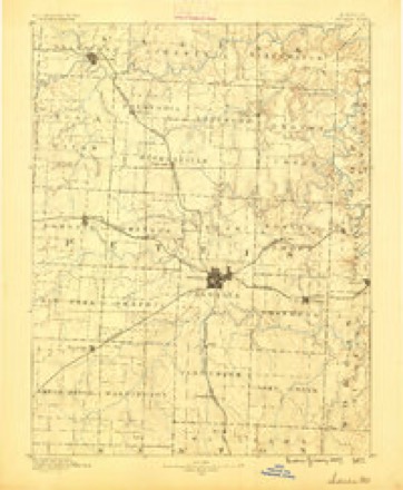
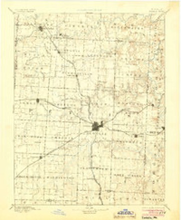
- 1887 USGS Sedalia quadrangle1:125000
- 1894 USGS Sedalia quadrangle1:125000, 5 printings
- 1947 USGS Jefferson City quadrangle1:250000
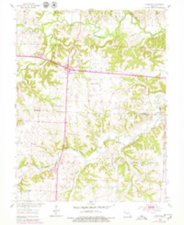
- 1953 USGS Longwood quadrangle1:24000, 2 printings
- 1954 USGS Jefferson City quadrangle1:250000, 2 printings
- 1955 USGS Jefferson City quadrangle1:250000, 4 printings
- 1958 USGS Jefferson City quadrangle1:250000
- 1959 USGS Jefferson City quadrangle1:250000
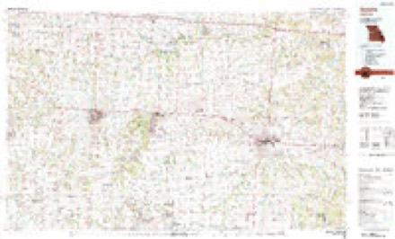
- 1983 USGS Sedalia quadrangle1:100000





In the county-history sources
7,400 words on this townshipThe History of Pettis County, Missouri, Including an Authentic History of Sedalia, Other Towns and Townships, Together with ... Biographical Sketches .., published 1882 names this settlement in its chapter on Longwood Township. These are the passages that mention it, exactly as the scans read.
Situated in the northwestern part of the township is the pleasant little village of Longwood, with 125 inhabitants. From this place the township takes its name. It has several stores, shops, one church building and a good school house in course of erection. Mail is received daily from Sedalia. The town has no railroad, but had it one giving rapid communication with its neighboring towns, it would be one of the most pleasant little places in which to make a home, that it has been the writer's privilege to visit. It is just at the edge of a splendid stretch of timber, and on high, rolling ground, and everything in the way of pleasant scenery around it to make it attractive. Its business men are: James Roberts, postmaster, and general merchandise. Mr. Roberts has been postmaster ontinuously tor the past twenty years. Sale & Hoffman, dry goods, (S^ B. Sale the senior partner is a senior member of a St. Louis firm.) Daniel E. Wilcox, dry goods, groceries and drugs; A. B. Caton, dry goods, groceries and drugs; John Sinchaugh, saddler; S. G. Hanley, blacksmith; A. C. Chaney, blacksmith; Jacob Eappel, shoemaker; J. A. Rawlette, bricklayer; E. G. Frazier, M. E. Minisler, R. Slomer, carpenters; Judge I). E. Ore ar, notary public; John Morris, carpenter; Henry Barnhoft', carpenter.
Passage source: The History of Pettis County, Missouri, Including an Authentic History of Sedalia, Other Towns and Townships, Together with ... Biographical Sketches .., published 1882.
Was born in Clay County, Ky., in the year 1809. His parents were natives of Virginia, both of whom died in the State of Kentucky, his father aged eighty-six and his mother forty-five years. Mr. Baker was married in 1835, to Miss Nancy Rout, who onl}^ lived ten years. In the year 1846, he was again married to Miss Lydia Montgomery, of Kentucky, her father being a native of Maryland, and her mother of England. He is the father of six children, one son and five daughters, all of whom are married except two, and residing in the county. One of his daughters is the wife of Henry Y. Fields, County Clerk of Pettis County, Missouri. Mr. B. came to Pettis County in 18.55, and purchased a magnificent farm of 400 acres, lying fifteen miles north of the city ot Sedalia, near what is known as the Independence and Boonville trail. This farm was formerly owned bv Dr. Ferris, and it was at this place that the first post-office was established, bearing the name of Longwood. He has disposed of a part of his land, but has retained 264 acres, 220 acres of which is in a high state of cultivation, well improved with good fences, a large and commodious dwelling, in the center of a magnificent lawn, and surrounded by a growth of magnificent shade trees. The lawn, garden, vinevard and orchard indicate the presence and care of a master in fruit and garden culture, and landscaping. He has forty acres of fine timber,, quite a portion of which is black walnut. His farm consists of what is termed mulatto soil, high rolling prairie, and divided into oblong fields of a convenient size for farming and grazing purposes. He grows from fifty to one hundred acres of com, and from thirty to fifty acres of wheat, averaging from sixteen to twenty-five bushels to the acre. The place is watered by good wells and ponds. Mr. B. is a popular and influential man, characterized by sterling sense, unimpeachable integrity, and commands a high appreciation by all who know him.
Passage source: The History of Pettis County, Missouri, Including an Authentic History of Sedalia, Other Towns and Townships, Together with ... Biographical Sketches .., published 1882.
Residence at Green Lawn Academy; post-office, Longwood. He is one of the pioneer doctors of Pettis County, and was born in Virginia, on April 11, 1827. His father was a prominent man in Virginia. He moved to Saline County, Mo., in 1839, and there owned a large farm. ^The sub- ject of this sketch came with his father to Missouri, and has since lived in the State. His grandfather was an officer in the Revolutionary War; was also in the war of" 1812. In 1855-6 he was in Louisville, Ky. He graduated in the spring of 1856 at the Medical College at Louisville, Ky. He then went to Illinois, where he practiced his profession for a few years; then returned to Missouri and practiced in the northeast part of the State, retiring in 1858 to the old homestead in Saline County. About the year 1860 he moved to Longwood, where he practiced during the war, his field of labor being from the Lamine to Houstonia, and some five or ten miles around. He has changed locations a few times, but has been all the time in the county. He was married in 1851 to Miss Mary K. Ward. By this union they have been blessed with five children, three of whom are dead. The two Hving are: James S., who is now studying medicine, and Minnie L.
Passage source: The History of Pettis County, Missouri, Including an Authentic History of Sedalia, Other Towns and Townships, Together with ... Biographical Sketches .., published 1882.
Machine-read from a century-old scan, so expect the errors a machine makes: misspelled names, dropped words, stray characters.
Read the whole chapter on Longwood Township - it names this place 7 more 7 times.
Fires near this place
3 since 1994Regional context, not property-specific evidence. The federal wildfire occurrence database lists 3 fires within 5 miles of Longwood between 1994 and 2019, burning about 26 acres in total. None started naturally. None was recorded as arson. Distance is straight-line from the map coordinates, so a fire counted here may appear on a neighbouring settlement's page as well.
| Reported cause | Fires |
|---|---|
| Smoking | 2 |
| Missing data/not specified/undetermined | 1 |
The most recent of them, most recent first, with the day each was reported and the service that recorded it.
| Date | Cause | Size | Reported by | Name on the report |
|---|---|---|---|---|
| 22 April 2019 | Smoking | under an acre | Missouri Department of Conservation | 179317-02729-04222019-0900 |
| 4 February 1994 | Smoking | 25 acres | Missouri Department of Conservation | not named |
| 31 January 2018 | Missing data/not specified/undetermined | under an acre | Missouri Department of Conservation | 176178-80001-01312018-1306 |
Settlements close enough to share some of these fires:
Mines and quarries near this place
4 within 5 milesRegional context, not property-specific evidence. The federal mineral resources record lists 4 workings within 5 miles of Longwood: 4 past producers. None of them still produces. What was taken out: Stone, Crushed/Broken, Barium-Barite. Distance is straight-line from the map coordinates, so a quarry counted here may appear on a neighbouring settlement's page as well.
| Where | Site | Commodity | Status | Recorded |
|---|---|---|---|---|
| Schantz Barite Mine | Barium-Barite | Past Producer | ||
| Unknown - Barite | Barium-Barite | Past Producer | ||
| Unknown - Ls | Stone, Crushed/Broken | Past Producer | ||
| Unknown - Ls | Stone, Crushed/Broken | Past Producer |
Storms near this place
8 since 2000Regional context, not property-specific evidence. The National Weather Service names Longwood in 8 storm reports between 2000 and 2022: 3 thunderstorm wind, 3 hail, 2 flash flood. No death or injury is recorded in these reports. Each account below is quoted exactly as the forecast office filed it, from the NOAA Storm Events Database, and each date opens the federal record of that event.
| When | Event | Place named | Harm | What the report says |
|---|---|---|---|---|
| May 2000 | Thunderstorm Wind | Longwood | $10,000 | Thunderstorm wind gusts of 80 mph damaged property and trees in rural Pettis County. One homeowner reported that the glass had been blown out of a storm door, and outbuildings sustained minor damage. A second homeowner reported extensive shingle damage to his roof, and many uprooted or damaged trees on his property. Also, a hay feeder ring was found hundreds of yards from its original position, apparently carried by the thunderstorm winds. |
| June 2022 | Thunderstorm Wind | Longwood | - | There was some structural damage to a home and vehicle near Crain and Anderson Roads. |
| August 2016 | Flash Flood | Longwood | - | Water was running over Highway 65 north of Sedalia. |
| June 2007 | Flash Flood | Longwood | - | Flooding was reported across the intersection of HWY 65 and State Route BB. |
| June 2005 | Hail | Longwood | - | no account filed |
| March 2003 | Hail | Longwood | - | no account filed |
| June 2003 | Thunderstorm Wind | Longwood | - | no account filed |
| April 2001 | Hail | Longwood | - | no account filed |
Nearest settlements
The eight closest, with where each one stands in the county. Distances are straight-line, computed from the Geographic Names Information System coordinates.
| Map | Place | Distance | Sheets |
|---|---|---|---|
| Postal | 4.6 miles | 18 | |
| Tedieville | 5.6 miles | 23 | |
| Newland | 6.2 miles | 18 | |
| Hughesville | 7.9 miles | 23 | |
| Houstonia | 10.0 miles | 23 | |
| Beaman | 10.0 miles | 18 | |
| Georgetown | 10.3 miles | 18 | |
| Dresden | 13.4 miles | 23 |
Elsewhere
Matched on this settlement's Geographic Names Information System number rather than its name, so it cannot be a different place of the same name in another state.
| Wikipedia article on Longwood | An encyclopaedic summary. Its text is share-alike, so it is linked here rather than copied. |
| Wikidata item Q14704428 | The structured record the population and elevation above come from. Public domain (CC0). |
Provenance
This settlement is recorded in the Geographic Names Information System as feature 729770. The sheet list is computed by point-in-boundary test against the United States Geological Survey's historical topographic inventory. Both are works of the United States government and carry no copyright under 17 U.S.C. 105.
Wildfire. Short, Karen C. 2022. Spatial wildfire occurrence data for the United States, 1992-2020 [FPA_FOD_20221014]. 6th Edition. Fort Collins, CO: Forest Service Research Data Archive. https://doi.org/10.2737/RDS-2013-0009.6 Collected with United States Government funding and usable without additional permissions or fees.
Mines and quarries. USGS Mineral Resources Data System (MRDS) https://mrdata.usgs.gov/mrds/ A work of the United States government, no copyright under 17 U.S.C. 105.
Storms. NOAA National Centers for Environmental Information, Storm Events Database https://www.ncei.noaa.gov/stormevents/ A work of the United States government, no copyright under 17 U.S.C. 105. Narratives are quoted verbatim from the National Weather Service report and are not edited or summarised.