 Block
Maryville, Missouri
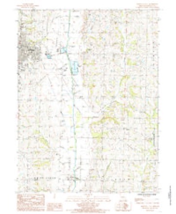
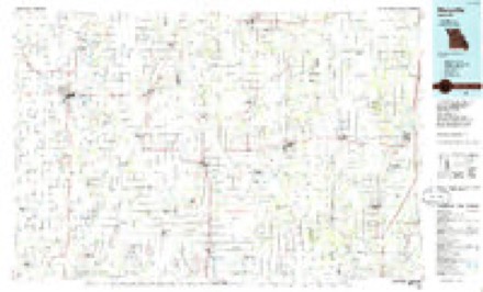
11 topographic sheets cover this place, the earliest surveyed in 1943 and the latest in 1986. It stands in Polk Township. It lies in ZIP code area 64468. The Survey maps it on the Maryville East quadrangle. 10,633 people lived here at the 2020 count. It stands 1,152 feet above sea level.
Research this city
On record in Maryville
Buildings and businesses the archive holds for this place. Each opens its own page, with the source record it came from.
On the National Register 7 records
 Nodaway County Courthouselisted 1979
- Administration Buildinglisted 2010
- Big Pumplisted 1980
- Caleb Burns Houselisted 1980
- Frank Houselisted 1983
- Thomas Gaunt Houselisted 1979
- Maryville Post Officelisted 2022
Population over time
2 figuresMaryville fell from 11,972 to 10,633 between 2010 and 2020. These are the recorded population figures Wikidata holds for this place, reached through the Geographic Names Information System number this page is keyed on rather than by name, so they belong to this place and not to another of the same name. Most are census counts, but not all are: an early figure may be a founding or settlement estimate, and an estimate published within five years of a census is left out. The change column is computed, and is left blank where more than 20 years separate a figure from the one before it, because a gap that long is not a change between two counts.
| Year | People | Change |
|---|---|---|
| 2010 | 11,972 | |
| 2020 | 10,633 | -1,339 (-11%) |
Topographic sheets covering this place
6 surveys from 11 printed sheetsMatched by testing this settlement's coordinate against the published boundary of every sheet in the United States Geological Survey's historical collection. Each opens the scanned sheet at the Survey.
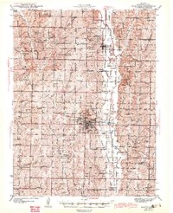
- 1943 USGS Maryville quadrangle1:62500, 3 printings
- 1955 USGS Nebraska City quadrangle1:250000, 3 printings
- 1957 USGS Nebraska City quadrangle1:250000
- 1958 USGS Nebraska City quadrangle1:250000
- 1985 USGS Maryville East quadrangle1:24000
- 1986 USGS Maryville quadrangle1:100000, 2 printings
In the county-history sources
15,029 words on this townshipThe History of Nodaway County, Missouri, Containing a History of the County, Its Cities, Towns, Etc., Biographical Sketches of Its Citizens, published 1882 names this settlement in its chapter on Polk Township. These are the passages that mention it, exactly as the scans read.
The physical features of the township are somewhat uniform, but present enough variety for the highest agricultural uses and for a^sthetical purposes. The land lies gently sloping toward the south, so that the streams have a southern flow. About one-third of the distance from the eastern boundary flows the One Hundred and Two River through the township from north to south, its main affluents being the Mowry, Mozingo and White Cloud. The valley of the One Hundred and Two River varies from half a mile to a mile in width, and belts of timber are found all along this stream, affording all the usual varieties known in Northwest Missouri. White Cloud Creek flows through the western portion of the township, making an elbow toward the west, and is fairly wooded as far north as Maryville. A water shed runs across the northwestern corner of the township and passes partly down the western side, dividing the headwaters of the Wrhite Cloud from the
Passage source: The History of Nodaway County, Missouri, Containing a History of the County, Its Cities, Towns, Etc., Biographical Sketches of Its Citizens, published 1882.
The first settlements in Polk Township were made along the One Hundred and Two River and the White Cloud. Thomas Adams was the first settler in the township. He came from some of the lower counties of Missouri in 1840, and took a claim in the north part of what is now the city of Maryville. He built a cabin in the grove which has since received the name of Adams' Grove. This grove contains 1,000 acres of land, and the timber is made up largely of Burr oak. Mr. Adams cleared twenty acres of land and opened a little farm. In 1849, he sold out and went to Texas.
Passage source: The History of Nodaway County, Missouri, Containing a History of the County, Its Cities, Towns, Etc., Biographical Sketches of Its Citizens, published 1882.
Noah Garren came in 1840, and located in a grove on the ridge four miles southeast of Maryville, and one mile east of the One Hundred and Two River. He lived there until 1849, when he moved to the northeast part of Nodaway County.'
Passage source: The History of Nodaway County, Missouri, Containing a History of the County, Its Cities, Towns, Etc., Biographical Sketches of Its Citizens, published 1882.
Machine-read from a century-old scan, so expect the errors a machine makes: misspelled names, dropped words, stray characters.
Read the whole chapter on Polk Township - it names this place 79 more 79 times.
Fires near this place
11 since 1993Regional context, not property-specific evidence. The federal wildfire occurrence database lists 11 fires within 5 miles of Maryville between 1993 and 2018, burning about 16 acres in total. None started naturally. None was recorded as arson. Distance is straight-line from the map coordinates, so a fire counted here may appear on a neighbouring settlement's page as well.
| Reported cause | Fires |
|---|---|
| Missing data/not specified/undetermined | 6 |
| Debris and open burning | 4 |
| Equipment and vehicle use | 1 |
The most recent of them, most recent first, with the day each was reported and the service that recorded it.
| Date | Cause | Size | Reported by | Name on the report |
|---|---|---|---|---|
| 12 September 1993 | Equipment and vehicle use | 7.0 acres | Missouri Department of Conservation | not named |
| 6 April 2018 | Missing data/not specified/undetermined | under an acre | Missouri Department of Conservation | 176789-07437-04062018-0019 |
| 5 April 2018 | Debris and open burning | 1.1 acres | Missouri Department of Conservation | 176781-07437-04052018-1742 |
| 4 April 2018 | Missing data/not specified/undetermined | under an acre | Missouri Department of Conservation | 176780-07437-04042018-0422 |
| 17 April 2018 | Missing data/not specified/undetermined | under an acre | Missouri Department of Conservation | 176791-07437-04172018-1851 |
| 11 April 2018 | Missing data/not specified/undetermined | under an acre | Missouri Department of Conservation | 176790-07437-04112018-1544 |
| 3 March 2018 | Missing data/not specified/undetermined | under an acre | Missouri Department of Conservation | 176377-07437-03032018-1608 |
| 27 March 2018 | Missing data/not specified/undetermined | under an acre | Missouri Department of Conservation | 176779-07437-03272018-0827 |
Settlements close enough to share some of these fires:
Mines and quarries near this place
5 within 5 milesRegional context, not property-specific evidence. The federal mineral resources record lists 5 workings within 5 miles of Maryville: 5 past producers. None of them still produces. What was taken out: Sand and Gravel, Construction. Distance is straight-line from the map coordinates, so a quarry counted here may appear on a neighbouring settlement's page as well.
Storms near this place
60 of 86 shownRegional context, not property-specific evidence. The National Weather Service names Maryville in 86 storm reports between 1993 and 2025: 47 hail, 29 thunderstorm wind, 5 flash flood, 2 flood. The reports record 1 death. Each account below is quoted exactly as the forecast office filed it, from the NOAA Storm Events Database, and each date opens the federal record of that event.
| When | Event | Place named | Harm | What the report says |
|---|---|---|---|---|
| August 2018 | Lightning | Maryville | 1 killed | From KSHB 41 Action News: A 35-year-old Maryville, Missouri man died Tuesday afternoon after he was struck and killed by lightning while fishing. Maryville Public Safety officers were dispatched around 12:30 to the City Reservoir on a 9-1-1 call. When they arrived, they located Ryen Browning dead on the scene. An initial investigation indicated that Browning was fishing from the bank when he was struck by lightning.||Link to Article: https://www.kshb.com/news/state/missouri/missouri-man-struck-killed-by-lightning-while-fishing . |
| August 2011 | Thunderstorm Wind | Maryville | $1,000,000 | Numerous homes suffered siding, window, and roof damage across the city of Maryville. Corn fields were flattened. Thunderstorm wind gusts were estimated up to 80 mph. |
| May 2000 | Tornado (F1) | Maryville | $50,000 | A tornado touched down 1.5 smiles south of Maryville and traveled north for approximately one mile, damaging or destroying three farm outbuildings 1 mile south of Maryville. The homeowner witnessed the brief tornadic spin-up, and observed rotation in the debris as the tornado moved through the area. |
| June 1994 | Thunderstorm Wind | Maryville | $50,000 | Two seperate thunderstorms produced an estimated $10 million in damage to nearly 45,000 acres after large hail fell. The first swath of hail was about 5 miles wide from Burlington Junction to Grahm. The second swath was about a mile wide and 15 miles long. The storm also downed trees and power lines throughout parts of the county. A roof was torn off a nursing home in Maryville with other buildings damaged in Arkoe. |
| April 2008 | Thunderstorm Wind | Maryville | $10,000 | Roof was blown off a home and a shed was blown over. |
| March 2005 | Thunderstorm Wind | Maryville | $10,000 | One barn had roof blown off. One building suffered minor damage. Trees had some damage and a few power lines were downed. |
| August 2006 | Thunderstorm Wind | Maryville | $5,000 | Roof partially torn off home. Window blown out of a home. Several trees down. |
| June 2011 | Thunderstorm Wind | Maryville | $3,000 | Tree was blown down on a car, with thunderstorm wind gusts estimated up to 60 mph. |
| June 2010 | Thunderstorm Wind | Maryville | $2,000 | One two foot diameter tree was blown over. Some siding and shingles were taken off homes. Winds were estimated up to 60 mph. There were also power outages observed. |
| April 2009 | Thunderstorm Wind | Maryville | $2,000 | The Maryville Municipal Airport was reported to have sustained some minor damage. |
| July 2010 | Thunderstorm Wind | Maryville | $1,000 | Thunderstorm wind gusts were estimated to 60 mph. Numerous trees and power lines were reported down. |
| July 1995 | Thunderstorm Wind | Maryville | $1,000 | Severe thunderstorm winds produced 60 mph gusts two miles east of Maryville. Large tree limbs were reported down. |
| June 2025 | Heavy Rain | Maryville | - | Two day rainfall total from Maryville of 5.68 inches of rain. |
| June 2024 | Thunderstorm Wind | Maryville | - | Downed power lines and power outages reported on the north side of Maryville. |
| April 2023 | Hail | Maryville | - | Quarter sized hail was reported in Maryville. |
| April 2023 | Hail | Maryville | - | Ping pong ball sized hail was reported at the NW MO University Campus in Maryville. |
| June 2023 | Thunderstorm Wind | Maryville | - | Tree limbs on the order of 4 to 6 inches in diameter downed with power out in Maryville. |
| May 2023 | Hail | Maryville | - | Quarter sized hail was reported on the south side of Maryville. |
| December 2021 | Thunderstorm Wind | Maryville | - | Powerlines and trees down across town. Storm also produced 1.75 inch hail in Maryville. |
| December 2021 | Hail | Maryville | - | Along with the golf ball sized hail there were powerlines and trees down across town. |
| June 2020 | Thunderstorm Wind | Maryville | - | Public reported small objects moved around in Maryville. |
| August 2018 | Thunderstorm Wind | Maryville | - | A trained spotter reported 60 mph wind. |
| May 2018 | Thunderstorm Wind | Maryville | - | An AWOS station near Maryville recorded a 61 mph wind gust. |
| July 2016 | Thunderstorm Wind | Maryville | - | Northwest Missouri State University Police reported via social media that several trees were down across campus. |
| July 2016 | Thunderstorm Wind | Maryville | - | Power lines were snapped and small out buildings were destroyed along South Main Street near Volunteer Avenue in Maryville. |
| July 2016 | Thunderstorm Wind | Maryville | - | Power was out and large trees of unknown diameter and conditions were down across town. |
| May 2015 | Flash Flood | Maryville | - | Street flooding in the city of Maryville. |
| August 2015 | Flash Flood | Maryville | - | Heavy rain caused some water to run over Main Street in Maryville. Highway 71 north of Maryville was closed due to the water running over the road. |
| July 2015 | Flash Flood | Maryville | - | Photos of water flowing over roads in a residential neighborhood were sent via social media. |
| June 2015 | Thunderstorm Wind | Maryville | - | Powerlines were down on Liberty Road north of Mozingo Lake. |
| June 2012 | Thunderstorm Wind | Maryville | - | The AWOS in Maryville measured a thunderstorm wind gust at 58 mph. |
| June 2012 | Thunderstorm Wind | Maryville | - | The AWOS in Maryville measured a thunderstorm wind gust at 59 mph. Trees were were reported down along Highway AB. |
| August 2011 | Thunderstorm Wind | Maryville | - | Thunderstorm wind gusts were estimated up to 70 mph. |
| August 2011 | Thunderstorm Wind | Maryville | - | Thunderstorm wind gusts were estimated up to 60 mph. |
| June 2009 | Thunderstorm Wind | Maryville | - | A few trees were knocked over and numerous tree branches were down, especially around the Northwest Missouri State campus. |
| May 2008 | Flood | Maryville | - | The 102 River near Maryville crested at 19.38 feet, or 1.38 feet above flood stage. |
| August 2007 | Thunderstorm Wind | Maryville | - | A wind gust to 53 knots, was Measured at the Maryville airport /KEVU/ AWOS. |
| August 2006 | Flood | Maryville | - | The 102 River at Maryville crested at 20.08 feet, or 2.08 feet above flood stage. |
| March 2005 | Thunderstorm Wind | Maryville | - | Thunderstorm winds broke off 18 to 24 inch tree limbs. |
| September 1998 | Hail | Maryville | - | One inch diameter hail was reported by the county sheriff's office during a severe thunderstorm in Maryville. |
| July 1998 | Hail | Maryville | - | The Nodaway County Sheriff's Office reported dime-size hail at Maryville during a severe thunderstorm. |
| March 1998 | Hail | Maryville | - | A severe weather spotter reported dime-size hail during a severe thunderstorm in Maryville. |
| April 2023 | Hail | Maryville | - | no account filed |
| July 2021 | Hail | Maryville | - | no account filed |
| August 2018 | Hail | Maryville | - | no account filed |
| March 2017 | Hail | Maryville | - | no account filed |
| August 2015 | Hail | Maryville | - | no account filed |
| April 2013 | Hail | Maryville | - | no account filed |
| August 2011 | Hail | Maryville | - | no account filed |
| September 2010 | Hail | Maryville | - | no account filed |
| July 2010 | Thunderstorm Wind | Maryville | - | no account filed |
| March 2009 | Hail | Maryville | - | no account filed |
| July 2008 | Hail | Maryville | - | no account filed |
| April 2008 | Hail | Maryville | - | no account filed |
| March 2008 | Hail | Maryville | - | no account filed |
| March 2006 | Hail | Maryville | - | no account filed |
| June 2005 | Hail | Maryville | - | no account filed |
| May 2004 | Hail | Maryville | - | no account filed |
| May 2004 | Hail | Maryville | - | no account filed |
| May 2004 | Hail | Maryville | - | no account filed |
Nearest settlements
The eight closest, with where each one stands in the county. Distances are straight-line, computed from the Geographic Names Information System coordinates.
| Map | Place | Distance | Sheets |
|---|---|---|---|
| Bell Grove | 3.7 miles | 11 | |
| Wilcox | 6.2 miles | 11 | |
| Bedison | 6.3 miles | 11 | |
| Arkoe | 6.5 miles | 11 | |
| Pickering | 7.4 miles | 11 | |
| Whitecloud | 9.6 miles | 12 | |
| Orrsburg | 9.9 miles | 11 | |
| Pumpkin Center | 10.1 miles | 12 |
Elsewhere
Matched on this settlement's Geographic Names Information System number rather than its name, so it cannot be a different place of the same name in another state.
| Wikipedia article on Maryville | An encyclopaedic summary. Its text is share-alike, so it is linked here rather than copied. |
| Wikidata item Q957284 | The structured record the population and elevation above come from. Public domain (CC0). |
Provenance
This settlement is recorded in the Geographic Names Information System as feature 721948. The sheet list is computed by point-in-boundary test against the United States Geological Survey's historical topographic inventory. Both are works of the United States government and carry no copyright under 17 U.S.C. 105.
Wildfire. Short, Karen C. 2022. Spatial wildfire occurrence data for the United States, 1992-2020 [FPA_FOD_20221014]. 6th Edition. Fort Collins, CO: Forest Service Research Data Archive. https://doi.org/10.2737/RDS-2013-0009.6 Collected with United States Government funding and usable without additional permissions or fees.
Mines and quarries. USGS Mineral Resources Data System (MRDS) https://mrdata.usgs.gov/mrds/ A work of the United States government, no copyright under 17 U.S.C. 105.
Storms. NOAA National Centers for Environmental Information, Storm Events Database https://www.ncei.noaa.gov/stormevents/ A work of the United States government, no copyright under 17 U.S.C. 105. Narratives are quoted verbatim from the National Weather Service report and are not edited or summarised.