 Block
Montevallo, Missouri
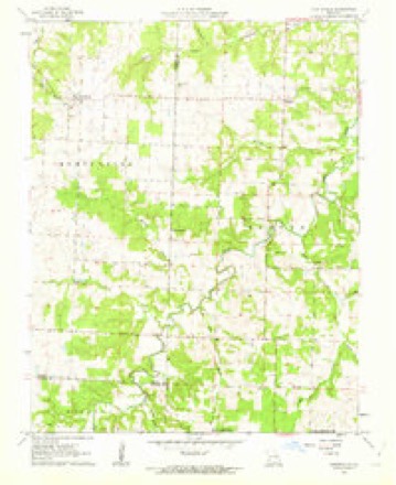
17 topographic sheets cover this place, the earliest surveyed in 1886 and the latest in 1991. It stands in Montevallo Township. It lies in ZIP code area 64767. The Survey maps it on the Montevallo quadrangle.
Topographic sheets covering this place
10 surveys from 17 printed sheetsMatched by testing this settlement's coordinate against the published boundary of every sheet in the United States Geological Survey's historical collection. Each opens the scanned sheet at the Survey.
- 1886 USGS Nevada quadrangle1:125000
- 1894 USGS Nevada quadrangle1:125000, 5 printings
- 1947 USGS Joplin quadrangle1:250000
- 1949 USGS Joplin quadrangle1:250000
- 1954 USGS Joplin quadrangle1:250000, 3 printings
- 1958 USGS Joplin quadrangle1:250000
- 1959 USGS Joplin quadrangle1:250000
- 1962 USGS Montevallo quadrangle1:24000, 2 printings
- 1986 USGS Nevada quadrangle1:100000
- 1991 USGS Nevada quadrangle1:100000
In the county-history sources
8,462 words on this townshipHistory of Vernon County, Missouri : Past and Present, Including an Account of the Cities, Towns and Villages of the County, published 1911 names this settlement in its chapter on Montevallo Township. These are the passages that mention it, exactly as the scans read.
McCarty's branch, which takes its rise in Barton county and flows northward through the western tier of sections in this township and empties into Clear creek, and Horse creek, which cuts across the southeast corner, are the leading streams in Montevallo. Mulberry branch, Pea branch, and Mill branch are in the northwest, and McDougal's branch (or "Little Cynthia") is in the southeast, emptying into Horse creek, near the Cedar county line.
Passage source: History of Vernon County, Missouri : Past and Present, Including an Account of the Cities, Towns and Villages of the County, published 1911.
In the northern part of the township Joseph Martin settled on the site of Old Montevallo about the year 1840. He and his sons were famous grindstone makers in early clays. They used the Clear creek sandstone and hauled their wares to Independence and Lexington sometimes, where they readily exchanged them for merchandise of various sorts. Martin died at Old Montevallo,
Passage source: History of Vernon County, Missouri : Past and Present, Including an Account of the Cities, Towns and Villages of the County, published 1911.
Like their neighbors in other portions of the country, the first settlers in Montevallo township enjoyed a sort of from-handto-mouth existence. Few cultivated more than twenty acres of land: a forty-acre tract was a "big farm." Stock was generally raised, but there were no large herds or flocks, and not much pains taken or expense incurred with either hogs or cattle. Hogs ran in the timber, and were uniformly mast-fattened. Some¬ times, a week or two before slaughtering time, they were shut up and fed on corn to "harden" the fat; for the fat portions of mast-fed pork "drip" badly - that is, the lard oozes out, except in extreme cold weather, and keeps the meat in bad condition.
Passage source: History of Vernon County, Missouri : Past and Present, Including an Account of the Cities, Towns and Villages of the County, published 1911.
Machine-read from a century-old scan, so expect the errors a machine makes: misspelled names, dropped words, stray characters.
Read the whole chapter on Montevallo Township - it names this place 28 more 28 times.
Fires near this place
8 since 1992Regional context, not property-specific evidence. The federal wildfire occurrence database lists 8 fires within 5 miles of Montevallo between 1992 and 2015, burning about 254 acres in total. None started naturally. None was recorded as arson. Distance is straight-line from the map coordinates, so a fire counted here may appear on a neighbouring settlement's page as well.
| Reported cause | Fires |
|---|---|
| Debris and open burning | 5 |
| Missing data/not specified/undetermined | 3 |
The most recent of them, most recent first, with the day each was reported and the service that recorded it.
| Date | Cause | Size | Reported by | Name on the report |
|---|---|---|---|---|
| 16 July 2013 | Missing data/not specified/undetermined | 1.0 acres | Missouri Department of Conservation | not named |
| 5 April 1992 | Debris and open burning | 1.0 acres | Missouri Department of Conservation | not named |
| 2 April 1997 | Debris and open burning | 5.0 acres | Missouri Department of Conservation | not named |
| 3 February 1992 | Debris and open burning | 2.0 acres | Missouri Department of Conservation | not named |
| 15 February 2015 | Debris and open burning | 5.0 acres | Missouri Department of Conservation | 118332-10882-02152015-1435 |
| 15 February 1994 | Missing data/not specified/undetermined | 30 acres | Missouri Department of Conservation | not named |
| 26 December 1992 | Debris and open burning | 200 acres | Missouri Department of Conservation | not named |
| 15 January 2015 | Missing data/not specified/undetermined | 10 acres | Missouri Department of Conservation | 116550-10882-01152015-1644 |
Settlements close enough to share some of these fires:
Mines and quarries near this place
5 within 5 milesRegional context, not property-specific evidence. The federal mineral resources record lists 5 workings within 5 miles of Montevallo: 3 past producers, 2 producers. 2 still produce. What was taken out: Stone, Crushed/Broken, Sand and Gravel, Construction. Distance is straight-line from the map coordinates, so a quarry counted here may appear on a neighbouring settlement's page as well.
| Where | Site | Commodity | Status | Recorded |
|---|---|---|---|---|
| Unknown - S&G | Sand and Gravel, Construction | Past Producer | ||
| Unknown - S&G | Sand and Gravel, Construction | Past Producer | ||
| Montevallo Limestone Mill No.8 | Stone, Crushed/Broken | Producer | ||
| Montevallo Quarry No.8 | Stone, Crushed/Broken | Producer | ||
| Unknown - Ls. | Stone, Crushed/Broken | Past Producer |
Storms near this place
8 since 1998Regional context, not property-specific evidence. The National Weather Service names Montevallo in 8 storm reports between 1998 and 2023: 4 thunderstorm wind, 3 hail, 1 tornado. No death or injury is recorded in these reports. Each account below is quoted exactly as the forecast office filed it, from the NOAA Storm Events Database, and each date opens the federal record of that event.
| When | Event | Place named | Harm | What the report says |
|---|---|---|---|---|
| April 2022 | Hail | Montevallo | $1,000,000 | Half dollar sized hail was reported via MPing. Hail combined with an estimated 50 mph winds damaged 300-400 vehicles along with numerous roofs. |
| May 2023 | Thunderstorm Wind | Montevallo | $40,000 | Several trees were reported down on power lines causing power outages. |
| August 2018 | Tornado (EF0) | Montevallo | $5,000 | A National Weather Service survey determined that an EF-0 tornado struck a barn resulting in damage to the roof. |
| September 1998 | Thunderstorm Wind | Montevallo | $1,000 | no account filed |
| May 2011 | Thunderstorm Wind | Montevallo | - | Sixty to seventy mph wind gust were reported by spotter. |
| May 2018 | Hail | Montevallo | - | no account filed |
| June 2009 | Hail | Montevallo | - | no account filed |
| June 2007 | Thunderstorm Wind | Montevallo | - | no account filed |
Nearest settlements
The eight closest, with where each one stands in the county. Distances are straight-line, computed from the Geographic Names Information System coordinates.
| Map | Place | Distance | Sheets |
|---|---|---|---|
| Bellamy | 4.8 miles | 17 | |
| Sandstone | 5.4 miles | 20 | |
| Zodiac | 5.5 miles | 17 | |
| Rousertown | 6.9 miles | 17 | |
| Greene Springs (historical) | 7.3 miles | 20 | |
| Pashaw (historical) | 7.9 miles | 19 | |
| Dederick | 9.1 miles | 20 | |
| Oak Ridge | 9.4 miles | 20 |
Elsewhere
Matched on this settlement's Geographic Names Information System number rather than its name, so it cannot be a different place of the same name in another state.
| Wikipedia article on Montevallo | An encyclopaedic summary. Its text is share-alike, so it is linked here rather than copied. |
| Wikidata item Q12894580 | The structured record the population and elevation above come from. Public domain (CC0). |
Provenance
This settlement is recorded in the Geographic Names Information System as feature 722539. The sheet list is computed by point-in-boundary test against the United States Geological Survey's historical topographic inventory. Both are works of the United States government and carry no copyright under 17 U.S.C. 105.
Wildfire. Short, Karen C. 2022. Spatial wildfire occurrence data for the United States, 1992-2020 [FPA_FOD_20221014]. 6th Edition. Fort Collins, CO: Forest Service Research Data Archive. https://doi.org/10.2737/RDS-2013-0009.6 Collected with United States Government funding and usable without additional permissions or fees.
Mines and quarries. USGS Mineral Resources Data System (MRDS) https://mrdata.usgs.gov/mrds/ A work of the United States government, no copyright under 17 U.S.C. 105.
Storms. NOAA National Centers for Environmental Information, Storm Events Database https://www.ncei.noaa.gov/stormevents/ A work of the United States government, no copyright under 17 U.S.C. 105. Narratives are quoted verbatim from the National Weather Service report and are not edited or summarised.