 Block
New Madrid, Missouri
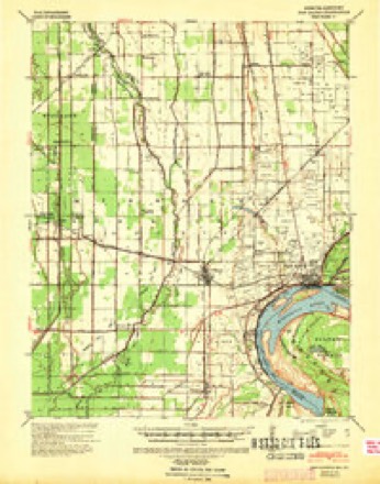
15 topographic sheets cover this place, the earliest surveyed in 1939 and the latest in 1985. It stands in New Madrid Township. It lies in ZIP code area 63869. It stands on Saint Johns Bayou. The Survey maps it on the New Madrid quadrangle. 2,787 people lived here at the 2020 count. It stands 295 feet above sea level.
Research this city
On record in New Madrid
Buildings and businesses the archive holds for this place. Each opens its own page, with the source record it came from.
On the National Register 1 record
- Hunter-Dawson Houselisted 2012
Population over time
2 figuresNew Madrid fell from 3,116 to 2,787 between 2010 and 2020. These are the recorded population figures Wikidata holds for this place, reached through the Geographic Names Information System number this page is keyed on rather than by name, so they belong to this place and not to another of the same name. Most are census counts, but not all are: an early figure may be a founding or settlement estimate, and an estimate published within five years of a census is left out. The change column is computed, and is left blank where more than 20 years separate a figure from the one before it, because a gap that long is not a change between two counts.
| Year | People | Change |
|---|---|---|
| 2010 | 3,116 | |
| 2020 | 2,787 | -329 (-11%) |
Topographic sheets covering this place
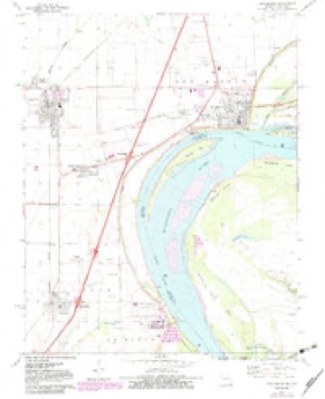
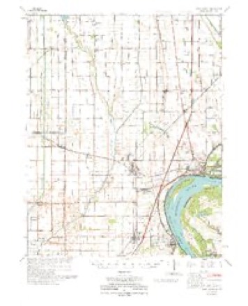
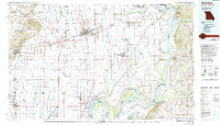
7 surveys from 15 printed sheetsMatched by testing this settlement's coordinate against the published boundary of every sheet in the United States Geological Survey's historical collection. Each opens the scanned sheet at the Survey.
- 1939 USGS New Madrid quadrangle1:62500
- 1951 USGS New Madrid SE quadrangle1:24000, 3 printings
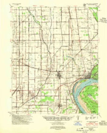
- 1954 USGS New Madrid quadrangle1:62500, 2 printings
- 1956 USGS Dyersburg quadrangle1:250000, 4 printings
- 1971 USGS New Madrid quadrangle1:24000, 2 printings
- 1973 USGS New Madrid quadrangle1:62500
- 1985 USGS Sikeston quadrangle1:100000, 2 printings
Fires near this place
2 since 2006Regional context, not property-specific evidence. The federal wildfire occurrence database lists 2 fires within 5 miles of New Madrid between 2006 and 2017, burning about 58 acres in total. None started naturally. None was recorded as arson. Distance is straight-line from the map coordinates, so a fire counted here may appear on a neighbouring settlement's page as well.
| Reported cause | Fires |
|---|---|
| Missing data/not specified/undetermined | 1 |
| Debris and open burning | 1 |
The most recent of them, most recent first, with the day each was reported and the service that recorded it.
| Date | Cause | Size | Reported by | Name on the report |
|---|---|---|---|---|
| 8 January 2006 | Missing data/not specified/undetermined | 57 acres | Kentucky Division of Forestry | not named |
| 29 January 2017 | Debris and open burning | 1.0 acres | Missouri Department of Conservation | not named |
Settlements close enough to share some of these fires:
Mines and quarries near this place
6 within 5 milesRegional context, not property-specific evidence. The federal mineral resources record lists 6 workings within 5 miles of New Madrid: 6 past producers. None of them still produces. What was taken out: Sand and Gravel, Construction. Distance is straight-line from the map coordinates, so a quarry counted here may appear on a neighbouring settlement's page as well.
| Where | Site | Commodity | Status | Recorded |
|---|---|---|---|---|
| Borrow Pit | Sand and Gravel, Construction | Past Producer | ||
| Borrow Pit | Sand and Gravel, Construction | Past Producer | ||
| Borrow Pit | Sand and Gravel, Construction | Past Producer | ||
| Borrow Pit | Sand and Gravel, Construction | Past Producer | ||
| Borrow Pit | Sand and Gravel, Construction | Past Producer | ||
| Borrow Pit | Sand and Gravel, Construction | Past Producer |
Storms near this place
60 of 75 shownRegional context, not property-specific evidence. The National Weather Service names New Madrid in 75 storm reports between 1993 and 2025: 39 flood, 17 thunderstorm wind, 12 hail, 4 flash flood. The reports record 1 death and 1 injury. Each account below is quoted exactly as the forecast office filed it, from the NOAA Storm Events Database, and each date opens the federal record of that event.
| When | Event | Place named | Harm | What the report says |
|---|---|---|---|---|
| March 1997 | Flash Flood | New Madrid | 1 killed, 1 hurt, $6,000 | no account filed |
| May 2011 | Flood | New Madrid | $500,000 | Record flooding occurred on the Mississippi River. At the New Madrid river gage, the flood crest of 48.35 feet on the night of May 5 broke the previous record (set in 1937) by a few inches. The levee protecting the city of New Madrid held the water back, but seepwater caused a number of problems. Many city streets were damaged in New Madrid, including the formation of sinkholes once the water receded. One home was damaged by the seepwater, with water about an inch deep. Some basements were flooded with seepwater. Outside the levee system, the sewer treatment plant for New Madrid was in danger of being flooded. Floodfighting efforts were effective in saving the plant. Interstate 55 was reduced to one lane in both directions at the St. Johns Bayou due to sandbagging operations. |
| March 2017 | Thunderstorm Wind | New Madrid | $50,000 | On the south side of New Madrid along the Mississippi River riverfront, winds estimated near 85 mph caused the partial collapse of two large wood-frame metal sheds. There were also some tree branches down in the area. There was spotty wind damage elsewhere in New Madrid, including metal roofing blown off a house on the northwest side of town. All of this damage was caused by the same supercell storm that spawned the EF-2 tornado minutes later along the Mississippi River levee. There was spotty wind damage elsewhere in New Madrid, including metal roofing blown off a house on the northwest side of town. |
| June 2014 | Thunderstorm Wind | New Madrid | $50,000 | The roof was blown off one home, and there was shingle damage at another home. Trees and power lines were blown down. A tree fell on a mobile home, trapping a person inside for a short period of time. |
| May 1993 | Thunderstorm Wind | New Madrid | $50,000 | Several trees and power lines were blown down and a roof was torn off a gas station in New Madrid. A mobile home was overturned in Howardville by high wind. Reported by the county sheriff office. |
| March 2019 | Flood | New Madrid | $30,000 | Moderate flooding continued on the Mississippi River from February. At the New Madrid river gage, the river crested at 42.99 feet on March 2. This crest was one of the five highest since the Flood of 1937, but it was several feet lower than the Flood of 2011. Flood stage is 34 feet. The impacts were mainly flooded agricultural fields, river access roads, and a couple of state highways outside the levee system. Since the crop season was not underway, the extensive field flooding caused little crop damage. |
| July 2019 | Flood | New Madrid | $30,000 | Minor flooding of the Mississippi River affected some cropland, as well as county roads near the river. |
| October 2021 | Thunderstorm Wind | New Madrid | $25,000 | The roof of an old, vacant, dilapidated apartment building was damaged. Part of the roof was ripped off the one-story building, landing on the wall of a neighboring residence. Some branches were down elsewhere in the city. |
| May 2019 | Thunderstorm Wind | New Madrid | $25,000 | Emergency management officials estimated 70 mph winds downed trees. |
| April 1997 | Thunderstorm Wind | New Madrid | $25,000 | no account filed |
| April 2020 | Flood | New Madrid | $20,000 | Moderate flooding was observed on the Mississippi River. At the New Madrid gage, the river crested at 40.17 feet early on April 1. Flood stage there is 34 feet. Considerable flooding of low-lying fields and farmland occurred, in addition to some bottomland secondary roads. |
| January 2016 | Flood | New Madrid | $20,000 | Moderate flooding of the Mississippi River continued into January. At the New Madrid river gage, the river crested at 43.05 feet on the 4th. Flood stage there is 34 feet. This flood was similar to the flood of March, 1997, when the river crested at 42.94 feet. There was considerable flooding of cropland unprotected by levees. Numerous county roads were flooded. The National Guard was deployed to a small part of the county for security purposes. |
| August 2011 | Thunderstorm Wind | New Madrid | $17,000 | Utility poles were blown over in at least two places. |
| June 2014 | Tornado (EF1) | New Madrid | $10,000 | The tornado moved southeast across the Mississippi River from extreme western Fulton County, Kentucky into extreme southeast New Madrid County, Missouri. Hundreds of trees were snapped. Corn fields were flattened. No structures were in the path of the tornado. Peak winds were estimated near 110 mph. The tornado then moved southeast into Lake County, Tennessee. |
| May 1997 | Thunderstorm Wind | New Madrid | $10,000 | Trees and power poles were down. |
| May 2017 | Flood | New Madrid | $8,000 | Minor flooding occurred on the Mississippi River. There was considerable flooding of low-lying cropland. Some county roads and riverside parks were inundated. |
| May 2006 | Thunderstorm Wind | New Madrid | $7,000 | Many trees and power lines were down. Some parts of the city were without power for 5 to 6 hours. |
| July 2023 | Thunderstorm Wind | New Madrid | $5,000 | Trees were down on power lines. |
| March 2021 | Flood | New Madrid | $5,000 | Minor flooding of the Mississippi River caused inundation of some low-lying fields and farmland. |
| April 2002 | Thunderstorm Wind | New Madrid | $5,000 | Numerous trees and power poles were down. |
| July 1997 | Thunderstorm Wind | New Madrid | $5,000 | Trees and power lines were down. |
| October 2007 | Thunderstorm Wind | New Madrid | $4,000 | Two trees were blown down associated with a band of thunderstorms and heavy rain. |
| June 2019 | Thunderstorm Wind | New Madrid | $500 | A large tree branch was broken off. |
| February 2025 | Flood | New Madrid | - | Minor flooding of city streets occurred in New Madrid. |
| August 2023 | Flash Flood | New Madrid | - | Water was over portions of U.S. Highway 61 near New Madrid. |
| January 2020 | Flood | New Madrid | - | Minor flooding occurred on the Mississippi River. Low-lying fields and woods along the river were inundated. |
| March 2020 | Flood | New Madrid | - | Minor flooding occurred on the Mississippi River. Low-lying fields and farmland near the river were inundated. The river was still rising at the end of the month. |
| May 2020 | Flood | New Madrid | - | Minor flooding of the Mississippi River began on the last day of the month. The flooding was minor, consisting of flooded fields, low-lying access roads, and some riverside parkland. Some minor crop damage likely occurred. |
| April 2019 | Flood | New Madrid | - | Minor flooding occurred along the Mississippi River. Low-lying fields and woodlands in the flood plain were inundated. A few river access roads outside the levee system were flooded. |
| February 2019 | Flood | New Madrid | - | Moderate flooding occurred on the Mississippi River. The river level was still rising at the end of the month. The impacts during February were mainly flooded agricultural fields and river access roads outside the levee system. |
| June 2019 | Flood | New Madrid | - | Minor flooding of the Mississippi River affected some cropland, as well as county roads near the river. |
| May 2019 | Flash Flood | New Madrid | - | Extensive flash flooding was reported in New Madrid. Water was over numerous roads, including U.S. Highway 61 in front of the high school. Two CoCoRaHS (Community Collaborative Rain, Hail, and Snow) observers measured 7 to 7.5 inches of rain in the 24-hour period ending at 6 A.M. on the 30th. |
| May 2019 | Flood | New Madrid | - | Minor flooding continued from April into late May along the Mississippi River. The flooding along this portion of the river (below the confluence with the Ohio River) was generally minor and shorter-lived than places to the north. The flood crest dampened out as it moved down the river, so that only minor flooding of low-lying woods and fields was observed. A few roads were flooded. |
| February 2018 | Flood | New Madrid | - | Moderate flooding developed on the Mississippi River. There was extensive flooding of agricultural land, however most of the cropland was dormant during the winter. Some low-lying roads were affected. The river continued rising into March. |
| March 2018 | Flood | New Madrid | - | Moderate flooding continued on the Mississippi River from late February. There was extensive flooding of agricultural land, however most of the cropland was dormant during the winter. Some low-lying roads were affected. At New Madrid, the river crested at 41.41 feet on the 5th. Flood stage there is 34 feet. |
| May 2018 | Flood | New Madrid | - | Numerous streets in the city of New Madrid were blocked or closed due to standing water. |
| July 2015 | Flood | New Madrid | - | Minor flooding occurred along the Mississippi River. Mainly agricultural bottomland and surrounding low-lying areas were flooded. |
| March 2015 | Flood | New Madrid | - | Minor flooding occurred on the Mississippi River. At the New Madrid river gage, the river crested at 35.72 feet on the 22nd. Flood stage is 34 feet. Bottomland fields in the river flood plain were underwater. |
| December 2015 | Flood | New Madrid | - | The Mississippi River rose above flood stage late in the month, but the crest did not occur until early January. In December, there was flooding of low-lying fields and woodlands. |
| April 2014 | Flood | New Madrid | - | Some roads remained underwater through the day following thunderstorms the previous night. |
| April 2013 | Flood | New Madrid | - | The Mississippi River rose above flood stage in the New Madrid area. Bottomland fields were flooded. The river continued rising into early May. |
| May 2013 | Flood | New Madrid | - | Minor flooding of the Mississippi River persisted through most of May in the New Madrid area. Bottomland fields were flooded. |
| December 2011 | Heavy Rain | New Madrid | - | A total of 4.24 inches was reported by the co-operative observer. |
| June 2011 | Flood | New Madrid | - | The Mississippi River fell below flood stage at New Madrid for the first time since April 19. The flooding in June was relatively very minor compared to the historic flooding in April and May. Levees protecting parts of the county were detonated by the U.S. Army Corps of Engineers in early May. The levees were opened as part of the activation of the New Madrid Floodway. The floodway was opened to relieve pressure on levees along the lower Ohio River and parts of the Mississippi River. Some of the floodway land is located in New Madrid County. Flooding caused by the intentional levee breaks ended in June, allowing many residents to return to their property. |
| April 2011 | Flood | New Madrid | - | Major flooding was in progress on the Mississippi River by the end of the month. The river continued rising into early May. |
| January 2010 | Flood | New Madrid | - | Minor flooding occurred on the Mississippi River. At the New Madrid gage, the river crested at 34.44 feet on the 31st. Flood stage there is 34 feet. Some low-lying fields near the river were inundated. The river remained above flood stage into early February. |
| February 2010 | Flood | New Madrid | - | At the New Madrid gage on the Mississippi, the river crested in late January. However, some bottomland fields and river access trails remained under water for the first couple days of February. |
| May 2010 | Flood | New Madrid | - | Minor flooding occurred along the Mississippi River near New Madrid. Mainly bottomland fields were affected. Highway 162 was closed in the river bottoms south of New Madrid. |
| December 2009 | Flood | New Madrid | - | A few state roads were closed due to flooding, including sections of Routes D and E. |
| October 2009 | Heavy Rain | New Madrid | - | Water was over a few roads. No closures were reported. |
| April 2008 | Flood | New Madrid | - | Moderate flooding of the Mississippi River occurred. At New Madrid, the river remained above flood stage from mid March through late April. The crest in April was 40.72 feet on the 16th. Flood stage at New Madrid is 34 feet. Many low-lying areas were flooded, primarily farm fields. State Routes 162 and WW were closed in places near the river. Since planting season was not underway when flooding began, there was little if any crop damage. |
| January 2007 | Flash Flood | New Madrid | - | Street flooding was reported in the city. |
| August 2003 | Thunderstorm Wind | New Madrid | - | A co-operative observer reported several trees down and winds of at least 60 MPH. |
| October 2001 | Thunderstorm Wind | New Madrid | - | Trees and large limbs were blown down. |
| May 1998 | Hail | New Madrid | - | Hail from quarter to golf ball size fell for about ten minutes in New Madrid. |
| August 1998 | Flood | New Madrid | - | A nearly stationary cluster of thunderstorms produced excessive rainfall over a small part of New Madrid County. The heaviest rainfall occurred just east of New Madrid in the New Madrid Bend area along the Mississippi River. However, amounts as high as 2 inches per hour in the city of New Madrid resulted in minor street flooding. |
| April 1994 | Hail | New Madrid | - | Reported by the county sheriff. |
| March 2022 | Flood | New Madrid | - | no account filed |
| March 2020 | Flood | New Madrid | - | no account filed |
| February 2020 | Flood | New Madrid | - | no account filed |
Nearest settlements
The eight closest, with where each one stands in the county. Distances are straight-line, computed from the Geographic Names Information System coordinates.
| Map | Place | Distance | Sheets |
|---|---|---|---|
| Howardville | 4.1 miles | 15 | |
| Otis | 4.4 miles | 15 | |
| Ristine | 4.4 miles | 11 | |
| Cody (historical) | 4.6 miles | 15 | |
| Lilbourn | 4.7 miles | 15 | |
| North Lilbourn | 5.0 miles | 15 | |
| La Forge | 5.9 miles | 11 | |
| Sky | 6.1 miles | 11 |
Elsewhere
Matched on this settlement's Geographic Names Information System number rather than its name, so it cannot be a different place of the same name in another state.
| Wikipedia article on New Madrid | An encyclopaedic summary. Its text is share-alike, so it is linked here rather than copied. |
| Wikidata item Q963427 | The structured record the population and elevation above come from. Public domain (CC0). |
Provenance
This settlement is recorded in the Geographic Names Information System as feature 723282. The sheet list is computed by point-in-boundary test against the United States Geological Survey's historical topographic inventory. Both are works of the United States government and carry no copyright under 17 U.S.C. 105.
Wildfire. Short, Karen C. 2022. Spatial wildfire occurrence data for the United States, 1992-2020 [FPA_FOD_20221014]. 6th Edition. Fort Collins, CO: Forest Service Research Data Archive. https://doi.org/10.2737/RDS-2013-0009.6 Collected with United States Government funding and usable without additional permissions or fees.
Mines and quarries. USGS Mineral Resources Data System (MRDS) https://mrdata.usgs.gov/mrds/ A work of the United States government, no copyright under 17 U.S.C. 105.
Storms. NOAA National Centers for Environmental Information, Storm Events Database https://www.ncei.noaa.gov/stormevents/ A work of the United States government, no copyright under 17 U.S.C. 105. Narratives are quoted verbatim from the National Weather Service report and are not edited or summarised.