 Block
Stringtown, Missouri
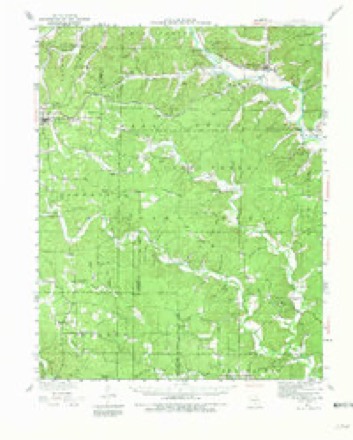
13 topographic sheets cover this place, the earliest surveyed in 1934 and the latest in 1983. It stands in Beaver Dam Township. It lies in ZIP code area 63901. It lies near Oak Ridge. The Survey maps it on the Stringtown quadrangle.
Topographic sheets covering this place
8 surveys from 13 printed sheetsMatched by testing this settlement's coordinate against the published boundary of every sheet in the United States Geological Survey's historical collection. Each opens the scanned sheet at the Survey.
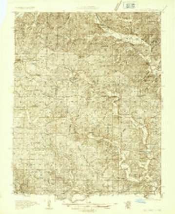
- 1934 USGS Williamsville quadrangle1:62500, 3 printings
- 1934 USGS Williamsville quadrangle1:48000
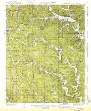
- 1940 USGS Williamsville quadrangle1:62500, 2 printings
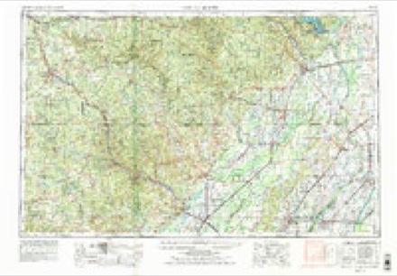
- 1957 USGS Poplar Bluff quadrangle1:250000, 3 printings
- 1959 USGS Poplar Bluff quadrangle1:250000
- 1960 USGS Poplar Bluff quadrangle1:250000
- 1980 USGS Stringtown quadrangle1:24000
- 1983 USGS Poplar Bluff quadrangle1:100000
Fires near this place
42 since 1992Regional context, not property-specific evidence. The federal wildfire occurrence database lists 42 fires within 5 miles of Stringtown between 1992 and 2020, burning about 1,481 acres in total. None started naturally. 9 were recorded as arson. Distance is straight-line from the map coordinates, so a fire counted here may appear on a neighbouring settlement's page as well.
| Reported cause | Fires |
|---|---|
| Missing data/not specified/undetermined | 23 |
| Arson/incendiarism | 9 |
| Debris and open burning | 5 |
| Equipment and vehicle use | 3 |
| Power generation/transmission/distribution | 2 |
The most recent of them, most recent first, with the day each was reported and the service that recorded it.
| Date | Cause | Size | Reported by | Name on the report |
|---|---|---|---|---|
| 17 September 1996 | Debris and open burning | 1.0 acres | Missouri Department of Conservation | not named |
| 28 August 2018 | Missing data/not specified/undetermined | under an acre | Missouri Department of Conservation | 178113-01201-08282018-1540 |
| 8 July 2019 | Missing data/not specified/undetermined | under an acre | Missouri Department of Conservation | 179006-01201-07082019-1719 |
| 22 July 2018 | Missing data/not specified/undetermined | 1.8 acres | Missouri Department of Conservation | 177990-01201-07222018-1056 |
| 11 July 2018 | Missing data/not specified/undetermined | 2.0 acres | Missouri Department of Conservation | 177986-01201-07112018-1340 |
| 2 May 2012 | Arson/incendiarism | 31 acres | Mark Twain National Forest | SMOKEY HOLLOW |
| 5 April 1995 | Arson/incendiarism | 4.0 acres | Mark Twain National Forest | PP HIGHWAY |
| 4 April 2000 | Arson/incendiarism | 138 acres | Mark Twain National Forest | PIPEGATE |
Settlements close enough to share some of these fires:
Mines and quarries near this place
6 within 5 milesRegional context, not property-specific evidence. The federal mineral resources record lists 6 workings within 5 miles of Stringtown: 4 prospects, 2 past producers. None of them still produces. What was taken out: Iron. Distance is straight-line from the map coordinates, so a quarry counted here may appear on a neighbouring settlement's page as well.
| Where | Site | Commodity | Status | Recorded |
|---|---|---|---|---|
| Government Land Number One | Iron | Past Producer | ||
| King Bee Ranch | Iron | Past Producer | ||
| Mo Lumber & Min Co Tract Number 10 | Iron | Prospect | ||
| Mo Lumber & Min Co Tract Number 11 | Iron | Prospect | ||
| Mo Lumber & Min Co Tract Number 12 | Iron | Prospect | ||
| Mo Lumber + Mining Co Tract No 13 | Iron | Prospect |
Storms near this place
23 since 1996Regional context, not property-specific evidence. The National Weather Service names Stringtown in 23 storm reports between 1996 and 2025: 7 hail, 6 tornado, 4 thunderstorm wind, 3 flood. The reports record 4 deaths and 1 injury. Each account below is quoted exactly as the forecast office filed it, from the NOAA Storm Events Database, and each date opens the federal record of that event.
| When | Event | Place named | Harm | What the report says |
|---|---|---|---|---|
| October 2009 | Flood | Stringtown | 3 killed, 1 hurt | Flooding of roads and creeks was fairly widespread. Numerous county roads were under water. A portion of Highway N was closed. Several water rescues were conducted as motorists drove into flooded areas. Three teenagers drowned after their vehicle went into a flooded creek following a crash with another vehicle. The three high school students were in a vehicle that overturned in a flooded creek after colliding with another vehicle on Highway PP. One of the vehicles hydroplaned and struck the other. The three victims were trapped in the overturned vehicle and had to be extricated. The driver of the other vehicle also went into the water but was able to escape with only minor injuries. The incident occurred on the west edge of Poplar Bluff. |
| March 2025 | Tornado (EF3) | Stringtown | 1 killed, $15,000,000 | An EF-3 tornado started along County Road 462 southeast of Stringtown and moved east northeast along County Road 450 all the way into Poplar Bluff. On the way it damaged numerous trees and did significant damage to several homes. Right as it crossed U.S. 67 on the northwest side of Poplar Bluff it struck a church and a nearby mobile home park. One person was killed when their mobile home was destroyed. It then did mainly roof damage to numerous buildings as it continued east northeast through town. It crossed U.S. 60 and headed northeast and completely destroyed a home on Highway T. It eventually dissipated as it reached County Road 572 northwest of Rombauer or just east of Saint Francois. Hundreds of trees were damaged. The estimated peak wind was 145 mph. |
| March 2008 | Flood | Stringtown | $2,000,000 | Historic flooding struck much of Butler County. At least 1,000 people in the county were displaced from their homes by flooding. U.S. Coast Guard boats and helicopters from as far away as New Orleans assisted in evacuation efforts. The helicopters airlifted 37 people and six dogs to safety. Several of those evacuated were from Coon Island. In northwest parts of the county, an elderly couple along JJ Highway were stranded on the roof of their home. An industrial park was inaccessible due to flooding of Pike Creek. Numerous evacuations were conducted by law enforcement and fire personnel. Broken levees along the Black River and other rivers inundated large parts of the county. Several families in Qulin were forced from their homes, although it was not immediately clear which river or creek was causing the flooding. Long-time local residents had never witnessed such an event. Shelters were established at the Black River coliseum, a church, and a family center. About 70 percent of the roads in the county were impassable at one point. Countywide, at least 142 homes were damaged, and 26 were destroyed. |
| December 2010 | Tornado (EF2) | Stringtown | $250,000 | The tornado briefly touched down in the vicinity of a residence along County Road 421. About one-third of the roof of the well-built residence was removed, landing about 1,000 feet away in a field. Seven people were in the residence at the time. They were not in the basement, but nobody was injured. Other damage consisted of several uprooted and snapped trees, shingles off a small shed, a damaged antenna tower, and damaged fences. A National Weather Service damage survey indicated a convergent orientation to the debris. Peak winds in this tornado were estimated around 120 mph. The average path width was 50 yards. |
| May 2017 | Tornado (EF0) | Stringtown | $40,000 | The tornado began near the intersection of Highway PP and County Road 429 in the Mark Twain National Forest. The tornado was on the ground for four minutes. It lifted before crossing U.S. Highway 67 west of Poplar Bluff. Several trees were uprooted, and numerous limbs were broken. At least two homes received minor damage due to falling trees. At least six homes received shingle damage. Peak winds were estimated near 85 mph. A trained spotter witnessed the funnel in the area. This tornado was from the same supercell storm that produced large hail from the Ellsinore area of Carter County to areas north of Poplar Bluff. |
| March 1996 | Tornado (F1) | Stringtown | $40,000 | no account filed |
| March 1996 | Thunderstorm Wind | Stringtown | $30,000 | no account filed |
| April 2014 | Tornado (EF0) | Stringtown | $17,000 | A double wide mobile home had about half of its roof blown off. A couple of trees and tree limbs were blown down. This weak tornado occurred on Missouri Highway M west of Poplar Bluff. Peak winds were estimated near 80 mph. |
| March 2020 | Tornado (EF0) | Stringtown | $5,000 | A few trees and tree limbs were down along PP Highway and County Roads 415 and 426. Peak winds were estimated near 75 mph based on a NWS damage survey. |
| June 1998 | Thunderstorm Wind | Stringtown | $4,000 | An area about a mile wide and four miles long received heavy tree damage. About ten large trees were blown down across county roads. |
| August 2019 | Thunderstorm Wind | Stringtown | $2,000 | A tree was down on County Road 450. A power line was down on County Road 461. |
| July 2004 | Thunderstorm Wind | Stringtown | $2,000 | Large trees were blown onto power lines. |
| May 2024 | Hail | Stringtown | - | Emergency management reported that they have received many reports of dime, quarter, and ping pong ball sized hail across the county was reported in many locations as a tail end of a line supercell tracked near U.S. 60. |
| August 2021 | Flash Flood | Stringtown | - | Numerous ditches were overflowing across the northwest part of Butler County, causing street flooding. About two miles southwest of Poplar Bluff, a rainfall amount of 3.1 inches was measured in three hours. |
| April 2017 | Flash Flood | Stringtown | - | Numerous roads in the southern part of the county were impassable due to high water, including a portion of U.S. Highway 160. Flash flooding of Cane Creek resulted in swiftly flowing water over a portion of M Highway near Stringtown. An observer about seven miles northwest of Poplar Bluff measured 4.72 inches in six hours. |
| December 2009 | Flood | Stringtown | - | Numerous state roads were closed due to flooding. State Route 51 was closed near Highway FF. State Route 53 was closed at Route 51. State Route AA was closed at Route 51. State Route CC was closed between Highways 51 and 53. State Route DD was closed at Route 51. Sections of Routes H, FF, N, OO, U, and UU were also closed. |
| March 2020 | Hail | Stringtown | - | no account filed |
| April 2020 | Hail | Stringtown | - | no account filed |
| August 2019 | Hail | Stringtown | - | no account filed |
| April 2006 | Hail | Stringtown | - | no account filed |
| May 2006 | Funnel Cloud | Stringtown | - | no account filed |
| May 1996 | Hail | Stringtown | - | no account filed |
| March 1996 | Hail | Stringtown | - | no account filed |
Nearest settlements
The eight closest, with where each one stands in the county. Distances are straight-line, computed from the Geographic Names Information System coordinates.
| Map | Place | Distance | Sheets |
|---|---|---|---|
| Belcher (historical) | 2.1 miles | 12 | |
| Milltown | 2.1 miles | 13 | |
| Lone Hill | 4.3 miles | 12 | |
| Roxie (historical) | 4.4 miles | 12 | |
| Halloran | 5.9 miles | 13 | |
| Green Forest | 6.3 miles | 15 | |
| Cedar Valley | 6.9 miles | 15 | |
| Shady Dell | 7.5 miles | 15 |
Elsewhere
Matched on this settlement's Geographic Names Information System number rather than its name, so it cannot be a different place of the same name in another state.
| Wikipedia article on Stringtown | An encyclopaedic summary. Its text is share-alike, so it is linked here rather than copied. |
| Wikidata item Q27984116 | The structured record the population and elevation above come from. Public domain (CC0). |
Provenance
This settlement is recorded in the Geographic Names Information System as feature 752399. The sheet list is computed by point-in-boundary test against the United States Geological Survey's historical topographic inventory. Both are works of the United States government and carry no copyright under 17 U.S.C. 105.
Wildfire. Short, Karen C. 2022. Spatial wildfire occurrence data for the United States, 1992-2020 [FPA_FOD_20221014]. 6th Edition. Fort Collins, CO: Forest Service Research Data Archive. https://doi.org/10.2737/RDS-2013-0009.6 Collected with United States Government funding and usable without additional permissions or fees.
Mines and quarries. USGS Mineral Resources Data System (MRDS) https://mrdata.usgs.gov/mrds/ A work of the United States government, no copyright under 17 U.S.C. 105.
Storms. NOAA National Centers for Environmental Information, Storm Events Database https://www.ncei.noaa.gov/stormevents/ A work of the United States government, no copyright under 17 U.S.C. 105. Narratives are quoted verbatim from the National Weather Service report and are not edited or summarised.