 Block
Tindall, Missouri
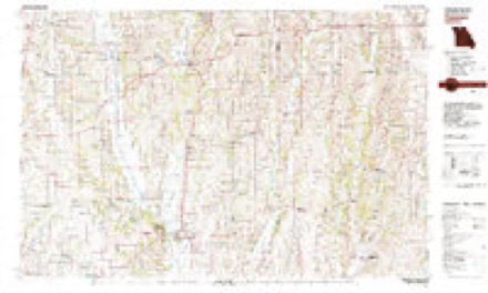
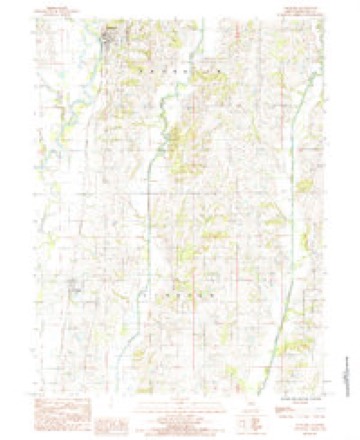
9 topographic sheets cover this place, the earliest surveyed in 1948 and the latest in 1984. It stands in Lincoln Township. It lies in ZIP code area 64683. The Survey maps it on the Spickard quadrangle. 46 people lived here at the 2020 count. It stands 791 feet above sea level.
Population over time
2 figuresTindall fell from 77 to 46 between 2010 and 2020. These are the recorded population figures Wikidata holds for this place, reached through the Geographic Names Information System number this page is keyed on rather than by name, so they belong to this place and not to another of the same name. Most are census counts, but not all are: an early figure may be a founding or settlement estimate, and an estimate published within five years of a census is left out. The change column is computed, and is left blank where more than 20 years separate a figure from the one before it, because a gap that long is not a change between two counts.
| Year | People | Change |
|---|---|---|
| 2010 | 77 | |
| 2020 | 46 | -31 (-40%) |
Topographic sheets covering this place
6 surveys from 9 printed sheetsMatched by testing this settlement's coordinate against the published boundary of every sheet in the United States Geological Survey's historical collection. Each opens the scanned sheet at the Survey.
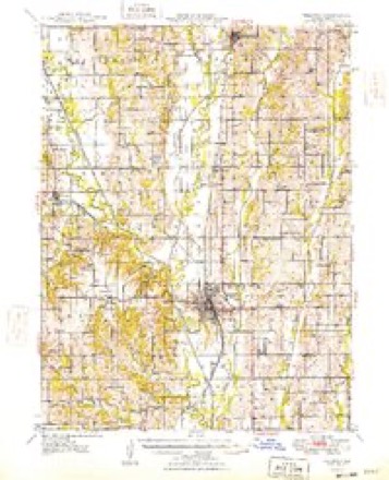
- 1948 USGS Trenton quadrangle1:62500, 2 printings
- 1954 USGS Centerville quadrangle1:250000, 3 printings
- 1957 USGS Centerville quadrangle1:250000
- 1958 USGS Centerville quadrangle1:250000
- 1981 USGS Trenton quadrangle1:100000
- 1984 USGS Spickard quadrangle1:24000
What happened here
An account from the chapter on Lincoln township. The inset identifies its exact source book and publication year.
E. A. Israel
A native of Belmont connt}^, Ohio, was born March 22, 1826, and son of Clary Israel and Mary (Moore) Israel, both of Ohio birth. His father was killed accidentally by the falling of a tree, in 1855, and his mother died in 1869. When he was seven years of age his parents moved to Morgan county, Ohio, and he remained there till 1871, when he came to Grundy county.
In the county-history sources
19,131 words on this townshipThe History of Grundy County, Missouri : an Encyclopedia of Useful Information, and a Compendium of Actual Facts. It Contains a Condensed History of the State of Missouri and Its Chief Cities ... ; Its Pioneer Record, War History, Resources, Biographical Sketches, published 1881 names this settlement in its chapter on Lincoln Township. These are the passages that mention it, exactly as the scans read.
The county court met in its regular term, November, 1872, for the purpose of organizing the county into municipal districts, as required by the new township organization law, which had become the law of the State. Its bounds were defined by the judges as follows: All of township No. 62, of range 24-, and sections 5, 6, 7, 8, 17, 18, 19, 20, 29, 30^ 31 and 32, of township No. 62, and range 23, was to be known as Lincoln township. There are no towns of note in the district, and but one known by name, Tindall. It is a railroad station, has a depot building, six houses, a good-sized corn-crib, and a small cattle-yard. It is situated on rather low ground, the houses are comfortable, the gardens of good size, and the door-yards covering any amount of land required. This is Tindall, the metropolis of Lincoln township. Its mayor and council, city marshal, railroad station agent and postmaster is represented in the person of J. P. Ward, a thorough business man and a courteous gentleman.
Passage source: The History of Grundy County, Missouri : an Encyclopedia of Useful Information, and a Compendium of Actual Facts. It Contains a Condensed History of the State of Missouri and Its Chief Cities ... ; Its Pioneer Record, War History, Resources, Biographical Sketches, published 1881.
Is a native of Tioga county, New York, and was born November 27, 1839. He is a son of Henry and Catharine Blow, both natives of New York, and who are -still (in 1881) residents of Tioga county. He lived there until twenty-four years of age, and there received his education. In 1863 he moved to Lapeer county, Michigan, resided there six years, and was there married to Miss Margaret Hodges, May 24, 1864. She was born in Lapeer county, Michigan, May 2, 1841. In 1868 he moved to Grundy county and located where he now and has ever since lived, engaged in farming. He started in life poor, but by hard labor and the assistaiice of a noble companion has secured a beautiful and pleasant home. They have six children: Charles Henry, born September 1, 1865; Maroey, born April 11, 1867; Frank, born October 5, 1870; Minard, born January 30, 1873; Merritt, born May 24, 1874; and James, born December 16, 1879. While in Michigan he was an active member of the A. F. & A. M. His farm is located near Tindall Station on the Rock Island road. He also owns a large interest in a saw-mill in Mercer county, to the attention of which he devotes a great deal of his time.
Passage source: The History of Grundy County, Missouri : an Encyclopedia of Useful Information, and a Compendium of Actual Facts. It Contains a Condensed History of the State of Missouri and Its Chief Cities ... ; Its Pioneer Record, War History, Resources, Biographical Sketches, published 1881.
Payne, November 21, 1824. She was born in Tennessee, October 25, 1799., They moved to Grundy county, in 1838, and lived here until 1868, then, moved to Chillicothe, where he died, March 10, 1874, and his wife died at her son, B. B. Cornwell's, February, 25, 1880. W. T. Cornwell and his family were ver^' early settlers in Grundy county and with but little means, yet by indomitable energy he overcome all the difficulties that environ the new settler and in a short time converted the wilderness into a beautiful home and gathered around him many of the comforts of life. He was a fine type of the old Virginia gentleman and died leaving a host of warm friends. B. B. Cornwell married Miss Ellen B. (Jochran, November 28, 1850. She was a native of Daviess county, Missouri, born February 13, 1834. Her father was a native of Ken tuck}', and her mother of Missouri. Eight children have been born to Mr. and Mrs. Cornwell; namely, William W., born October 4, 1851; Minerva, July 18, 1854; Abel C, March 9, 1858; Aurelius D., January 21, 1860; Samuel T., January 27, 1862; Lawrence P., November 17, 1863; Robert N., June 5, 1866; and David B., born June 6, 1856, and died February 24, 1857. Mr. Cornwell owns a farm of one hundred and sixty acres. He served as postmaster at Tindall for ten years; is an active worker in educational matters, and is highly respected and esteemed as a worthy citizen.
Passage source: The History of Grundy County, Missouri : an Encyclopedia of Useful Information, and a Compendium of Actual Facts. It Contains a Condensed History of the State of Missouri and Its Chief Cities ... ; Its Pioneer Record, War History, Resources, Biographical Sketches, published 1881.
Machine-read from a century-old scan, so expect the errors a machine makes: misspelled names, dropped words, stray characters.
Read the whole chapter on Lincoln Township - it names this place 1 more 1 time.
Fires near this place
5 since 2018Regional context, not property-specific evidence. The federal wildfire occurrence database lists 5 fires within 5 miles of Tindall between 2018 and 2020, burning about 10 acres in total. None started naturally. None was recorded as arson. Distance is straight-line from the map coordinates, so a fire counted here may appear on a neighbouring settlement's page as well.
| Reported cause | Fires |
|---|---|
| Missing data/not specified/undetermined | 5 |
The most recent of them, most recent first, with the day each was reported and the service that recorded it.
| Date | Cause | Size | Reported by | Name on the report |
|---|---|---|---|---|
| 7 April 2019 | Missing data/not specified/undetermined | 5.5 acres | Missouri Department of Conservation | 178650-04067-04072019-2005 |
| 12 April 2019 | Missing data/not specified/undetermined | 1.4 acres | Missouri Department of Conservation | 178826-04067-04122019-1510 |
| 6 March 2020 | Missing data/not specified/undetermined | 2.7 acres | Missouri Department of Conservation | 190304-04067-03062020-1725 |
| 5 March 2020 | Missing data/not specified/undetermined | under an acre | Missouri Department of Conservation | 190303-04067-03052020-1645 |
| 16 March 2018 | Missing data/not specified/undetermined | under an acre | Missouri Department of Conservation | 177152-04067-03162018-0448 |
Settlements close enough to share some of these fires:
Mines and quarries near this place
3 within 5 milesRegional context, not property-specific evidence. The federal mineral resources record lists 3 workings within 5 miles of Tindall: 3 past producers. None of them still produces. What was taken out: Stone, Crushed/Broken. Distance is straight-line from the map coordinates, so a quarry counted here may appear on a neighbouring settlement's page as well.
| Where | Site | Commodity | Status | Recorded |
|---|---|---|---|---|
| Harrison Twp Quarry | Stone, Crushed/Broken | Past Producer | ||
| Unk | Stone, Crushed/Broken | Past Producer | ||
| Unk | Stone, Crushed/Broken | Past Producer |
Storms near this place
10 since 1998Regional context, not property-specific evidence. The National Weather Service names Tindall in 10 storm reports between 1998 and 2023: 5 hail, 4 thunderstorm wind, 1 tornado. No death or injury is recorded in these reports. Each account below is quoted exactly as the forecast office filed it, from the NOAA Storm Events Database, and each date opens the federal record of that event.
| When | Event | Place named | Harm | What the report says |
|---|---|---|---|---|
| June 2023 | Thunderstorm Wind | Tindall | - | Measured wind gust of 62 mph in Tindall. |
| August 2023 | Hail | Tindall | - | Quarter sized hail was reported just south of Tindall. |
| June 2021 | Tornado (EF0) | Tindall | - | An embedded QLCS tornado moved through rural parts of Grundy County. The bulk of the damage as powerlines and trees, with minor structure damage. |
| November 2015 | Thunderstorm Wind | Tindall | - | The emergency manager for Grundy County reported sheet metal damage near Tindall from 60 to 70 mph winds. |
| June 2011 | Thunderstorm Wind | Tindall | - | Tree was reported down and blocking Highway 65. Thunderstorm wind gusts were estimated up to 60 mph. |
| June 1998 | Hail | Tindall | - | Golfball-size hail was reported in Tindall by a Trenton radio station. |
| May 2019 | Hail | Tindall | - | no account filed |
| June 2017 | Hail | Tindall | - | no account filed |
| April 2009 | Hail | Tindall | - | no account filed |
| March 2002 | Thunderstorm Wind | Tindall | - | no account filed |
Nearest settlements
The eight closest, with where each one stands in the county. Distances are straight-line, computed from the Geographic Names Information System coordinates.
Elsewhere
Matched on this settlement's Geographic Names Information System number rather than its name, so it cannot be a different place of the same name in another state.
| Wikipedia article on Tindall | An encyclopaedic summary. Its text is share-alike, so it is linked here rather than copied. |
| Wikidata item Q965195 | The structured record the population and elevation above come from. Public domain (CC0). |
Provenance
This settlement is recorded in the Geographic Names Information System as feature 730230. The sheet list is computed by point-in-boundary test against the United States Geological Survey's historical topographic inventory. Both are works of the United States government and carry no copyright under 17 U.S.C. 105.
Wildfire. Short, Karen C. 2022. Spatial wildfire occurrence data for the United States, 1992-2020 [FPA_FOD_20221014]. 6th Edition. Fort Collins, CO: Forest Service Research Data Archive. https://doi.org/10.2737/RDS-2013-0009.6 Collected with United States Government funding and usable without additional permissions or fees.
Mines and quarries. USGS Mineral Resources Data System (MRDS) https://mrdata.usgs.gov/mrds/ A work of the United States government, no copyright under 17 U.S.C. 105.
Storms. NOAA National Centers for Environmental Information, Storm Events Database https://www.ncei.noaa.gov/stormevents/ A work of the United States government, no copyright under 17 U.S.C. 105. Narratives are quoted verbatim from the National Weather Service report and are not edited or summarised.