 Block
Tower Grove, Missouri
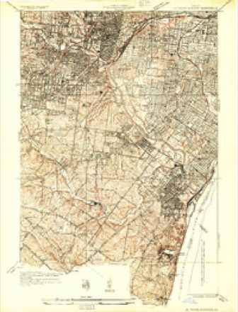
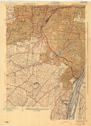
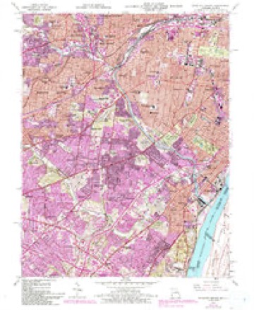
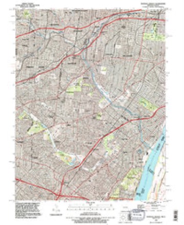
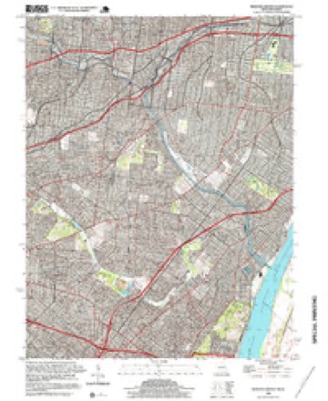
23 topographic sheets cover this place, the earliest surveyed in 1933 and the latest in 1998. It stands in St. Louis City. It lies in ZIP code area 63110. The Survey maps it on the Webster Groves quadrangle.
Research this city
Topographic sheets covering this place
11 surveys from 23 printed sheetsMatched by testing this settlement's coordinate against the published boundary of every sheet in the United States Geological Survey's historical collection. Each opens the scanned sheet at the Survey.
- 1933 USGS Jefferson Barracks quadrangle1:24000
- 1941 USGS Jefferson Barracks quadrangle1:24000, 3 printings
- 1949 USGS Saint Louis quadrangle1:250000
- 1949 USGS St. Louis quadrangle1:250000
- 1954 USGS Webster Groves quadrangle1:24000, 5 printings
- 1962 USGS St. Louis quadrangle1:250000
- 1963 USGS St. Louis quadrangle1:250000, 4 printings
- 1966 USGS St. Louis quadrangle1:250000
- 1985 USGS St Louis quadrangle1:100000, 3 printings
- 1993 USGS Webster Groves quadrangle1:24000
- 1998 USGS Webster Groves quadrangle1:24000, 2 printings






In the county-history sources
163,964 words on this townshipJournal of the Missouri State Convention, Held at the City of St. Louis, October, 1861, published 1861 names this settlement in its chapter on St. Louis City. These are the passages that mention it, exactly as the scans read.
Truly, " these are brave words." It is impossible not to pardon something, as Burke said of the New England people, to the spirit of liberty, or to the loyal allegiance which the gentleman professes to hold, in these evil times, to " the principles O/THE FATHERS. So, too, the gentleman told us about the proposition to make Patrick Henry Dictator when he was already Governor of Virginia; and about that "republican dagger" which "his friend Corbin" was going to plant in his heart. It haphappens that it was not Corbin, but Gary, whom the gentleman meant; and the "republican dagger" is a bit of rhetoric which history does not put into his mouth. But I prefer, Mr. President, to look into the practice, or at least the acts and doings, of " the Fathers ;" and the gentleman must read the history of his country - or relate it - a little more accurately, if I am to follow him. What did the Fathers of the Revolution think about martial law in times of civil war - about the habeas corpus - about a military Dictator? What did they think about the "weakness" which such remedies bring, according to this, their faithful student and follower ? I beg to read a dry statement of facts, from the first volume of Curtis' History of the Constitution of the United States, at page 99 :
Passage source: Journal of the Missouri State Convention, Held at the City of St. Louis, October, 1861, published 1861.
" Washington felt that the time had come, when to his single hands must be given all the military authority and power which the Continental Union of America held in trust for the liberties of the country. On the 20th of December, therefore, he wrote to the President of Congress a memorable letter asking for extraordinary powers, but displaying at the same time all the modesty and high principle of his character.
Passage source: Journal of the Missouri State Convention, Held at the City of St. Louis, October, 1861, published 1861.
" To this appeal Congress at once responded in a manner suited to the exigency. On the 27th of December, 1776, they passed a resolution vesting in Gen. Washington ample and complete power to raise and collect together in the most speedy and effectual manner, from all or any of the United States, sixteen battalions of infantry in addition to those already voted; * * * to take, wherever he might be, whatever he might want for the use of the army, if the inhabitants would not sell it, allowing a reasonable price for the same ; to arrest and conjlne persons who should refuse to receive the Continental currency, or were otherwise disaffected to the American cause; and to return to the States of which such persons were citizens their names and the nature of their offences, together with the witnesses to prove them. These powers were vested in the Commanderin-Chief for the space of six months from the date of the resolve, unless sooner revoked by Congress."
Passage source: Journal of the Missouri State Convention, Held at the City of St. Louis, October, 1861, published 1861.
Machine-read from a century-old scan, so expect the errors a machine makes: misspelled names, dropped words, stray characters.
Read the whole chapter on St. Louis City - it names this place 2 more 2 times.
Fires near this place
3 since 2006Regional context, not property-specific evidence. The federal wildfire occurrence database lists 3 fires within 5 miles of Tower Grove between 2006 and 2014, burning about 2 acres in total. None started naturally. None was recorded as arson. Distance is straight-line from the map coordinates, so a fire counted here may appear on a neighbouring settlement's page as well.
| Reported cause | Fires |
|---|---|
| Missing data/not specified/undetermined | 2 |
| Misuse of fire by a minor | 1 |
The most recent of them, most recent first, with the day each was reported and the service that recorded it.
| Date | Cause | Size | Reported by | Name on the report |
|---|---|---|---|---|
| 22 March 2014 | Misuse of fire by a minor | 1.0 acres | Missouri Department of Conservation | not named |
| 27 February 2006 | Missing data/not specified/undetermined | under an acre | Missouri State Fire Marshal's Office | not named |
| 9 October 2006 | Missing data/not specified/undetermined | 1.0 acres | Missouri State Fire Marshal's Office | not named |
Settlements close enough to share some of these fires:
Mines and quarries near this place
10 of 107 shownRegional context, not property-specific evidence. The federal mineral resources record lists 107 workings within 5 miles of Tower Grove: 102 past producers, 3 producers, 1 plant, 1 prospect. 4 still produce. What was taken out: Stone, Crushed/Broken, Clay, Fire Clay (Refractory), Sand and Gravel, Construction. Distance is straight-line from the map coordinates, so a quarry counted here may appear on a neighbouring settlement's page as well.
| Where | Site | Commodity | Status | Recorded |
|---|---|---|---|---|
| Bambrick-Bates Constr. Co. Quarry 1 | Clay, Stone, Crushed/Broken | Past Producer | ||
| Delore Barite Mill | Barium-Barite | Producer | ||
| Hypothetical Lead Mine | Lead, Silver, Zinc, Cobalt, Copper, Nickel, Cadmium | Prospect | Underground | |
| Krummel and Buchner Mine | Coal, Fire Clay (Refractory) | Past Producer | ||
| St Louis Perlite Plant | Perlite | Producer | ||
| Parker-Russell Fireclay Mine | Fire Clay (Refractory), Coal | Past Producer | ||
| Superior Dredge and Mill | Sand and Gravel, Construction | Plant | ||
| Tole and Thorp Fireclay Mine | Fire Clay (Refractory), Coal | Past Producer | ||
| Unknown - S&G | Sand and Gravel, Construction | Past Producer | ||
| Coffin Mine | Fire Clay (Refractory) | Past Producer |
Storms near this place
44 since 2005Regional context, not property-specific evidence. The National Weather Service names Tower Grove in 44 storm reports between 2005 and 2026: 20 thunderstorm wind, 16 hail, 4 flash flood, 2 lightning. The reports record 5 deaths and 41 injuries. Each account below is quoted exactly as the forecast office filed it, from the NOAA Storm Events Database, and each date opens the federal record of that event.
| When | Event | Place named | Harm | What the report says |
|---|---|---|---|---|
| May 2025 | Tornado (EF0) | Tower Grove | 4 killed, 38 hurt, $1,600,000,000 | The tornado was its widest and strongest in St. Louis City. After it crossed into the City, the tornado caused major tree and structural damage in and around Forest Park and its northern neighborhoods. The then EF-3 tornado continued northeast into North St. Louis City where 4 individuals lost their lives. Continuing northeast still, the tornado began to weaken. Overall, thousands of buildings were damaged in St. Louis City costing an estimated $1.6 billion in damages. |
| July 2023 | Thunderstorm Wind | Tower Grove | 1 killed, $500,000 | Widespread wind damage across the northern portions of the city as a line of storms moved through. Numerous large trees, tree limbs, power poles and power lines were blown down. A woman who was waiting for the storm to pass was killed when a large tree was blown over, crushing the car in the alley of the 4100 block of Chouteau Avenue. Two historical cemeteries, Calvary and Bellefontaine, sustained widespread damage. Around 100 trees at Calvary and nearly 40 significant trees and 100 smaller ones at Bellefontaine, were either uprooted or snapped off near the base, as well as numerous tree limbs. Several gravestones were either damaged or destroyed by fallen trees and/or tree limbs. A large tree was uprooted in the 3000 block of Longfellow Boulevard, landing on a house causing major roof damage. A couple of power poles were snapped off along Hall Street. Over 100,000 customers (St. Louis County/St. Louis City) were without power due to this storm. It took a little over 4 days to restore power to all of them. |
| May 2010 | Lightning | Tower Grove | 2 hurt | Lightning struck a tree on the southwest side of Forest Park. Part of the tree fell onto an occupied car. Three people were in the car at the time. Two people sustained minor injuries, with one of them being take to the hospital nearby for observation. |
| July 2010 | Lightning | Tower Grove | 1 hurt | A 50 year old woman was struck by lightning while working outside near the Jewel Box in Forest Park. She was sitting on the back of a truck with her feet touching the ground when she was struck. The lightning went up her foot and through her legs. She was alert and conscious when the paramedics arrived but was taken to a local hospital for evaluation. |
| May 2016 | Thunderstorm Wind | Tower Grove | $500,000 | As the line of severe storms moved through St. Louis, there were numerous large trees blown down on the west side of town in and around Forest Park. One large tree was blown down in the 6900 block of Dale Avenue, landing on 3 homes. One sustained major damage with the back half of the home crushed. No one was home at the time, but their dog was briefly trapped and was rescued unharmed. The two other homes hit sustained moderate damage. Also, several large trees were blown down in Tower Grove Park area. One large tree landed on an unoccupied pickup truck, destroying it. |
| May 2025 | Flash Flood | Tower Grove | $100,000 | Two of three lanes of I-64 westbound at Forest Park and Hampton became flooded and impassable. Several cars became stuck in flood water. This is a low spot and typically has high water when heavy rain falls. |
| April 2026 | Thunderstorm Wind | Tower Grove | - | Thunderstorm winds downed one power line on McCausland and one small tree at IKEA. |
| June 2023 | Thunderstorm Wind | Tower Grove | - | Thunderstorm winds damaged a large section of the roof and one wall on a church. Also, several trees and numerous tree limbs were blown down in the Sherman Park area. |
| August 2021 | Thunderstorm Wind | Tower Grove | - | Damaging thunderstorm winds moved across the western and southern portions of the City of St. Louis. Several trees and numerous tree limbs were blown down. Several trees were blown down across McCausland Avenue. |
| August 2020 | Thunderstorm Wind | Tower Grove | - | Thunderstorm winds blew down up to 40 large trees, numerous tree limbs and power lines across portions of the city. A power pole was blown down in the 3800 block of Shaw Boulevard. Several unoccupied vehicles sustained damage from fallen trees and tree limbs. |
| August 2020 | Flash Flood | Tower Grove | - | Up to four inches of rain fell in a two hour period causing flash flooding. Several roads were flooded in the southern portions of the city including Watson Road and roads on the eastern end of Carondelet Park near Interstate 55. |
| July 2019 | Thunderstorm Wind | Tower Grove | - | Thunderstorm winds blew several power lines and a large tree on the northwest side of the city. |
| May 2018 | Thunderstorm Wind | Tower Grove | - | Thunderstorm winds blew down numerous tree limbs and a couple of trees. One of the trees fell onto a power line near Franz Park. |
| July 2018 | Thunderstorm Wind | Tower Grove | - | Several trees, numerous tree limbs and a streetlight were blown across the city. In Forest Park, numerous large tree limbs were blown down. A large tree was snapped off at it's base near the intersection of Union Boulevard and Washington Place, just north of Forest Park. |
| November 2017 | Hail | Tower Grove | - | Large hail was reported on the north side of Forest Park. |
| August 2016 | Flash Flood | Tower Grove | - | Up to 6 inches fell across portions of the city of St. Louis. The soil was already saturated from previous rain events, so flash flooding occurred. Several roads were flooded. Also, the rail yard flooded south of downtown near Tucker Boulevard. |
| July 2015 | Thunderstorm Wind | Tower Grove | - | Thunderstorm winds blew down several large trees and numerous tree limbs in Forest Park. Also, a tree was blown down onto two homes causing moderate damage. |
| August 2014 | Thunderstorm Wind | Tower Grove | - | Thunderstorm winds damaged a couple of windows on the Forest Park campus of St. Louis Community College. |
| April 2014 | Thunderstorm Wind | Tower Grove | - | Thunderstorm winds blew down several large trees on the north side of St. Louis. One tree fell onto two homes in the 4200 block of Darby causing moderate damage. Just northeast of this area, an industrial building had a wall and part of its roof blown down. No injuries were reported. |
| April 2013 | Thunderstorm Wind | Tower Grove | - | Thunderstorm winds partially uplifted a large spruce tree onto a house on Sublette Avenue just south of Columbia Avenue. Also, a home on Columbia Avenue, just east of Sublette Avenue, had minor roof damage. |
| April 2013 | Tornado (EF0) | Tower Grove | - | A weak tornado touched down near the intersection of 59th Street and Reber Place in the city of St. Louis. It moved to the northeast across Dalton and January Avenues before lifting along Columbia Avenue. Many trees were snapped and numerous homes and garages/sheds were damaged along the path of the tornado. The most extensive damage occurred to several homes and a garage near and just east of the intersection of January Avenue and Columbia Avenue. One house on Columbia Avenue lost the entire east facing side of the roof. Pieces of the roof and insulation were scattered north and east along Columbia Avenue. Several cars were badly damaged along Columbia Avenue due to the falling debris. No injuries were reported. The overall rating for the tornado was EF0. The maximum path width was 50 yards and the path length was a quarter of a mile. |
| April 2012 | Hail | Tower Grove | - | A swath of large hail fell over central portions of the city of St. Louis. Three inch hail was reported at the Edward Jones Dome with golfball sized hail reported at the intersection of Tucker Boulevard and Market Street as well as at the intersection of Hampton Avenue and Interstate 44. |
| April 2012 | Hail | Tower Grove | - | Another swath of large hail was reported over the northern portions of the city of St. Louis. The biggest stones were three inches in diameter. |
| February 2011 | Thunderstorm Wind | Tower Grove | - | Thunderstorm winds blew down several large power lines onto Interstate 44 closing traffic in both directions for a number of hours. |
| May 2011 | Thunderstorm Wind | Tower Grove | - | Thunderstorm winds blew down numerous trees, tree limbs and power lines. One twenty inch diameter tree and blocked traffic at Arsenal Street and Brannon Avenue. |
| May 2011 | Hail | Tower Grove | - | A swath of large hail, some as large as softballs, fell across southern portions of the city. There was considerable damage to plants and trees at the Missouri Botanical Gardens near Tower Grove Park. |
| May 2011 | Flash Flood | Tower Grove | - | Between one and two inches of rain fell in a very short period of time causing flash flooding. There was 6 inches of water over Manchester Road just east of intersection with Hampton Avenue. |
| May 2010 | Thunderstorm Wind | Tower Grove | - | Thunderstorm winds blew down a large tree, as well as several large tree limbs, onto Skinker Boulevard near Fauquier Drive, blocking it for a time. |
| June 2009 | Thunderstorm Wind | Tower Grove | - | Thunderstorm winds blew the top out of a large tree on Skinker Blvd. near Washington University. |
| July 2007 | Hail | Tower Grove | - | Storm spotters reported hail up to 1 1/4 inch in South St. Louis. |
| July 2006 | Thunderstorm Wind | Tower Grove | - | The thunderstorm winds blew over 114 trees and hacked off thousands of branches in the 289 acre Tower Grove Park. Also, as many as 100 severely damaged trees may need to be chopped down. |
| June 2005 | Thunderstorm Wind | Tower Grove | - | The public reported large tree limbs down in south St. Louis. A stop sign was blown down along Iowa Street. |
| April 2026 | Hail | Tower Grove | - | no account filed |
| April 2026 | Hail | Tower Grove | - | no account filed |
| April 2026 | Hail | Tower Grove | - | no account filed |
| April 2026 | Hail | Tower Grove | - | no account filed |
| April 2026 | Hail | Tower Grove | - | no account filed |
| March 2025 | Hail | Tower Grove | - | no account filed |
| July 2023 | Thunderstorm Wind | Tower Grove | - | no account filed |
| June 2023 | Hail | Tower Grove | - | no account filed |
| May 2018 | Hail | Tower Grove | - | no account filed |
| April 2018 | Hail | Tower Grove | - | no account filed |
| June 2015 | Hail | Tower Grove | - | no account filed |
| July 2007 | Hail | Tower Grove | - | no account filed |
Nearest settlements
The eight closest, with where each one stands in the county. Distances are straight-line, computed from the Geographic Names Information System coordinates.
| Map | Place | Distance | Sheets |
|---|---|---|---|
| Kings Oak | 0.3 miles | 20 | |
| Forest Park Southeast | 0.6 miles | 20 | |
| Rock Springs | 0.7 miles | 20 | |
| The Hill | 0.8 miles | 23 | |
| Gratiot | 0.8 miles | 23 | |
| Cheltenham | 1.0 miles | 20 | |
| Shaw | 1.2 miles | 27 | |
| Tiffany | 1.4 miles | 27 |
Elsewhere
Matched on this settlement's Geographic Names Information System number rather than its name, so it cannot be a different place of the same name in another state.
| Wikidata item Q122589100 | The structured record the population and elevation above come from. Public domain (CC0). |
Provenance
This settlement is recorded in the Geographic Names Information System as feature 765789. The sheet list is computed by point-in-boundary test against the United States Geological Survey's historical topographic inventory. Both are works of the United States government and carry no copyright under 17 U.S.C. 105.
Wildfire. Short, Karen C. 2022. Spatial wildfire occurrence data for the United States, 1992-2020 [FPA_FOD_20221014]. 6th Edition. Fort Collins, CO: Forest Service Research Data Archive. https://doi.org/10.2737/RDS-2013-0009.6 Collected with United States Government funding and usable without additional permissions or fees.
Mines and quarries. USGS Mineral Resources Data System (MRDS) https://mrdata.usgs.gov/mrds/ A work of the United States government, no copyright under 17 U.S.C. 105.
Storms. NOAA National Centers for Environmental Information, Storm Events Database https://www.ncei.noaa.gov/stormevents/ A work of the United States government, no copyright under 17 U.S.C. 105. Narratives are quoted verbatim from the National Weather Service report and are not edited or summarised.