 Block
Weaubleau, Missouri
17 topographic sheets cover this place, the earliest surveyed in 1886 and the latest in 1991. It stands in Weaubleau Township. It lies in ZIP code area 65774. The Survey maps it on the Weaubleau quadrangle. 378 people lived here at the 2020 count. It stands 978 feet above sea level.
On record in Weaubleau
Buildings and businesses the archive holds for this place. Each opens its own page, with the source record it came from.
On the National Register 1 record
- Christian and Rosina Gerber Farmsteadlisted 2023
Population over time
2 figuresWeaubleau fell from 418 to 378 between 2010 and 2020. These are the recorded population figures Wikidata holds for this place, reached through the Geographic Names Information System number this page is keyed on rather than by name, so they belong to this place and not to another of the same name. Most are census counts, but not all are: an early figure may be a founding or settlement estimate, and an estimate published within five years of a census is left out. The change column is computed, and is left blank where more than 20 years separate a figure from the one before it, because a gap that long is not a change between two counts.
| Year | People | Change |
|---|---|---|
| 2010 | 418 | |
| 2020 | 378 | -40 (-10%) |
Topographic sheets covering this place
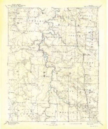
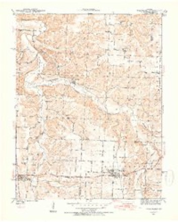
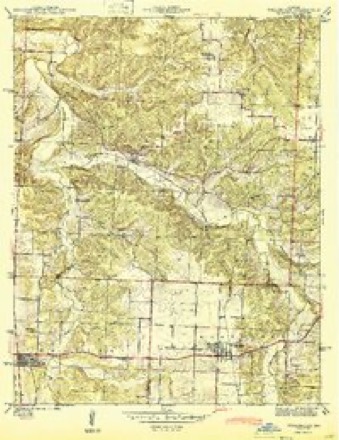
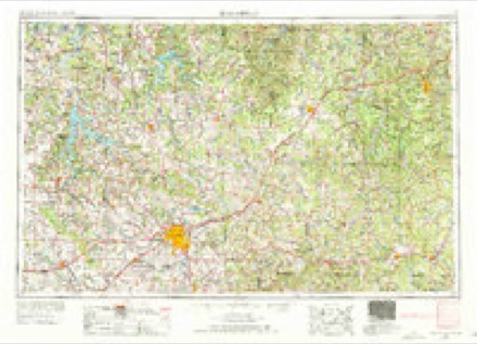
8 surveys from 17 printed sheetsMatched by testing this settlement's coordinate against the published boundary of every sheet in the United States Geological Survey's historical collection. Each opens the scanned sheet at the Survey.
- 1886 USGS Stockton quadrangle1:125000, 3 printings
- 1940 USGS Weaubleau quadrangle1:24000, 2 printings
- 1944 USGS Weaubleau quadrangle1:24000, 2 printings
- 1954 USGS Springfield quadrangle1:250000, 6 printings
- 1958 USGS Springfield quadrangle1:250000
- 1959 USGS Springfield quadrangle1:250000
- 1984 USGS Bolivar quadrangle1:100000
- 1991 USGS Weaubleau quadrangle1:24000
In the county-history sources
1,917 words on this townshipWilson's History of Hickory County, published 1909 names this settlement in its chapter on Weaubleau Township. These are the passages that mention it, exactly as the scans read.
This town is situated on lands in Section 11, Township 36, Range 24, entered by William Hawkins October 23, 1840. It was the earliest land entry in the Township, except two, the East half of the Northeast quarter of Section 1, and the other a part of the N. M. Durnell old farm Southeast of town. These entries were made in 1838 and 1839. The first town survey was made at the instance of Rev. Emerson Barber, by Patrick Chancellor, County Surveyor, December 3, 1880. on the Northeast fourth of the Northeast fourth of the Southwest quarter Section 11, and the name given to it was "Haren." The first addition to the town was caused to be surveyed by A. A. John, August 20, 1883, by Patrick Chancellor. This survey was an addition to *'Haren," and was not described as being on any forty acres, but was said to be South of ."Haren." The next addition was made by Robert Dey, who caused lots to be surveyed on the Southwest fourth of the Southeast of the Northwest quarter of Section 11, May 29, 1886, by Patrick Chancellor. This was also named as an addition to "Haren," and on the same date William D. Harryman and Calvin Hartley caused to be surveyed 22 lots on the Southwest fourth of the Southeast fourth of the Northwest quarter of Section 11, lying South o! Dey's addition, and described as the South half of blocks 5 and 8, of Dey's addition, and known as the town of Weaubleau. The college addition was surveyed and platted on the Southeast fourth of the Northwest quarter of Section 11, July 28-29, 1893. Gentry's addition was surveyed and platted June 10, 1898, by P. M. Burns, Surveyor of Polk county, and is described as being part of the Northwest fourth of the Southeast quarter and part of the Southwest fourth of the Northeast quarter of Section 11. Upton & Leonard's addition, made by Joseph B. Upton and Ben F. Leonard, was surveyed by Patrick Chancellor. March 8-11, 1898, and is located on the South two-thirds of the North half of the Southeast quarter of Section 11. Broadway Heights addition was made by Ben F. Leonard and B. T. Perriman, and was surveyed by Rev. Green M. Botts, County Surveyor of Polk county, June 2, 1904, and is located on the Northwest fourth of the Southwestquarterof Section 12, Township 36, Range 24.
Passage source: Wilson's History of Hickory County, published 1909.
The first man who sold goods in Weaubleau, or what is now Weaubleau, was Jeff Sharp. He had a little store building and store there as early as 1871. It stood West or Northwest of the Institute building. About that time the first brick College building was erected in the tall grass where it now stands, and is used for a Christian church and other purposes. The principal contributors to this College building were: John Whitaker, Joseph Whitaker, Thomas Whitaker, Sr., William Swink, Francis Yoast, Dr. A. C. Marquis, Hon. Samuel S. Burr, dette, Thomas J. Tucker, C. M. Largent, George W.Durnell,^ Sr., and Monroe Durnell. After the walls of the building were, up a wind storm blew the second story down, and that made quite a hitch about getting it rebuilt and ready for school. The Principals of the school in the old Institute building were: Prof.
Passage source: Wilson's History of Hickory County, published 1909.
A. Hawkins now is. Mr. John continued in business until 1894. L. D. John built and went into business in 1886 at or near where he is now doing business. There were built about 1881 or 1882, two buildings near the old mill place, perhaps on the Southeast corner of the Southeast fourth of the Northeast quarter of Section 10, and in one of them William D. Harryman and Calvin Hartley sold goods, and in the other a hotel was kept by an old man by the name of Hardy, father-in-law og William E. Crouch. Harryman & Hartley quit business there about 1885, and built a business house with I. 0. 0. F. hall in the second story about a quarter of a mile East of there. An I. 0. 0. F. Lodge was organized in 1883, but it was organized in the second story of the College building. The first public school building stood North and near where the old College building stands, and a larger and better school building was built in 1884, in the Northwest part of town. Perhaps Charles G. McMahan first kept hotel in the town, but John Baynham was there in a hotel where Mr. Pruett now runs the Commercial hotel about 1882. Robert Orr and John 0. James were also there in the hotel business, and not far from that time, before, perhaps, William E. Crouch kept hotel East of the old mill place. August W. Doerman, came there about 1884, and went into business and continued in business until about the first of the year 1887. Along about these years Thomas H. Bird, Patric Chancellor, and James J. Ramsey, were in the mercantile business there. Had not A. A. John, L. D. John and Weaubleau Christian Institute been there after the flouring mill was removed and other men whom we have named went out of business, the town would have been almost abandoned. The conditions were very discourageing for the school for some time. There were not a great many such prosperous farmers, and large well cultivated farms in the neighborhood of the town in those years, and not a railroad nearer than Appleton City, and Clinton. But this was not allowed to be continued. In 1892, enterprising citizens of the town and neighborhood laid plans and determined, to awaken an interest in the high school, and put new life into the town. This was carried out in 1893, by the laying out of the College addition to the town into lots, streets and alleys on July 28-29, 1893. and the building of the present commodious, and convenient College building at the North end of town, away from the business center. The association that represented the builders was incorporated by the Circuit Court of Hickory County, November 23, 1893, with William E. Crouch, Robert Dey, Thomas J. Tucker, C. M. Largent, and Thomas H. Houser as Trustees. Before the completion of the new College building the town began to grow, new residences and new business houses were built, and the town put on a great amount of new life, but only gradually, until the Kansas City, Osceola, and Southern Railroad, now Frisco, came in August 13, 1898. This put entirely new hfe and many new people in the town. Prior to the coming of the Railroad the Baptist people had erected a commodious church building in the West part of town. The residences and business houses built in anticipation of the coming of the railroad, and immediately after the arrival of its trains are too numerous to mention. August 13, 1898, was a boom day for Weaubleau. In the spring or early summer of 1898, the T. A. Miller Lumber Co., put in a lumber yard and in the fall ot 1898, B. F. Tucker, an enterprising, and wealthy young man, who was born, raised and educated there, put in a lumber yard and is there in busi^ ness now, he having purchased the stock of the T. A. Miller Cd. In 1904-5, Mrs. Margaret J. Forshe, who had been in the hotel business almost from girlhood, erected a handsome, roomy hotel on the North side of the main street leading from the main business part of town to the depot, which she sold to Thomas J. McCracken in 1906. Also in the years 1904-5, William H. Nichols, with the assistance of others, erected near the Frisco depot, a fine, large, steam, full roller process, flouring mill which has done a large business since its erection. It has now passed into the hands of John P. Monroe & Son, the large stock feeders of Weaubleau Township. A large, convenient brick public school building was built in 1902, and the Methodist Episcopal church people, and people of the Christian church (sometimes called Cahipbellites) have nice, commodious church buildings, while the other Christian church, (sometimes called New Lights) keep in repair and use the lower story of the old Institute building as a place of worship.
Passage source: Wilson's History of Hickory County, published 1909.
Machine-read from a century-old scan, so expect the errors a machine makes: misspelled names, dropped words, stray characters.
Read the whole chapter on Weaubleau Township - it names this place 2 more 2 times.
Fires near this place
29 since 1992Regional context, not property-specific evidence. The federal wildfire occurrence database lists 29 fires within 5 miles of Weaubleau between 1992 and 2018, burning about 829 acres in total. None started naturally. 3 were recorded as arson. Distance is straight-line from the map coordinates, so a fire counted here may appear on a neighbouring settlement's page as well.
| Reported cause | Fires |
|---|---|
| Debris and open burning | 19 |
| Missing data/not specified/undetermined | 7 |
| Arson/incendiarism | 3 |
The most recent of them, most recent first, with the day each was reported and the service that recorded it.
| Date | Cause | Size | Reported by | Name on the report |
|---|---|---|---|---|
| 3 September 1999 | Debris and open burning | 3.0 acres | Missouri Department of Conservation | not named |
| 20 July 1997 | Debris and open burning | 1.0 acres | Missouri Department of Conservation | not named |
| 2 May 1992 | Debris and open burning | 1.0 acres | Missouri Department of Conservation | not named |
| 10 April 2018 | Debris and open burning | 13 acres | Missouri Department of Conservation | 177537-09339-04102018-1442 |
| 10 April 2014 | Debris and open burning | 180 acres | Missouri Department of Conservation | not named |
| 9 March 1994 | Arson/incendiarism | 1.0 acres | Missouri Department of Conservation | not named |
| 5 March 1994 | Debris and open burning | 20 acres | Missouri Department of Conservation | not named |
| 31 March 2015 | Missing data/not specified/undetermined | under an acre | Missouri Department of Conservation | 127677-09339-03312015-2040 |
Settlements close enough to share some of these fires:
Mines and quarries near this place
7 within 5 milesRegional context, not property-specific evidence. The federal mineral resources record lists 7 workings within 5 miles of Weaubleau: 7 past producers. None of them still produces. What was taken out: Stone, Crushed/Broken, Barium-Barite. Distance is straight-line from the map coordinates, so a quarry counted here may appear on a neighbouring settlement's page as well.
| Where | Site | Commodity | Status | Recorded |
|---|---|---|---|---|
| Unknown - Barite | Barium-Barite | Past Producer | ||
| Nelson Brothers Quarry | Stone, Crushed/Broken | Past Producer | ||
| Unknown - Ls | Stone, Crushed/Broken | Past Producer | ||
| Unknown - Ls | Stone, Crushed/Broken | Past Producer | ||
| Unknown - Ls | Stone, Crushed/Broken | Past Producer | ||
| Unknown - Ls | Stone, Crushed/Broken | Past Producer | ||
| Unknown - Ls. | Stone, Crushed/Broken | Past Producer |
Storms near this place
33 since 1995Regional context, not property-specific evidence. The National Weather Service names Weaubleau in 33 storm reports between 1995 and 2025: 14 thunderstorm wind, 11 hail, 3 tornado, 3 flash flood. The reports record 1 injury. Each account below is quoted exactly as the forecast office filed it, from the NOAA Storm Events Database, and each date opens the federal record of that event.
| When | Event | Place named | Harm | What the report says |
|---|---|---|---|---|
| December 2002 | Tornado (F1) | Weaubleau | 1 hurt, $43,000 | no account filed |
| March 2017 | Thunderstorm Wind | Weaubleau | $20,000 | Several power poles were snapped. A recreational vehicle camper and garage was destroyed. A home sustained moderate roof damage with a chimney collapsed. |
| May 1995 | Tornado (F1) | Weaubleau | $20,000 | A county sheriff reported that a tornado touched down one mile west of Weaubleau near the Saint Clair County line. The tornado damaged a farm house, barn, shed and several utility poles. Specifics of the tornado's path were estimated based on damage reports. |
| September 2023 | Thunderstorm Wind | Weaubleau | $5,000 | Minor roof damage was reported to an older model mobile home. |
| April 2012 | Tornado (EF0) | Weaubleau | $5,000 | A weak tornado briefly touched down between Panther Creek along Farm Road 11 and Highway 123 in far southwest Hickory County. The tornado uprooted trees and destroyed a barn. Maximum winds were estimated at 70 mph. |
| March 2008 | Thunderstorm Wind | Weaubleau | $5,000 | Severe thunderstorm winds downed power lines and poles along Highway O. |
| May 2013 | Thunderstorm Wind | Weaubleau | $2,000 | Minor damage was reported to the roof of the City Hall. |
| May 2010 | Thunderstorm Wind | Weaubleau | $1,000 | Severe thunderstorm wind gusts knocked down a large tree along Highway H. This tree destroyed a section of a fence, cauing cattle to get loose along the highway. |
| September 2025 | Hail | Weaubleau | - | Hail to the size of quarters fell in Weaubleau. |
| July 2023 | Thunderstorm Wind | Weaubleau | - | A Mesonet site recorded a wind gust of 65 mph. |
| July 2023 | Thunderstorm Wind | Weaubleau | - | A few large limbs were reported down. |
| March 2021 | Flood | Weaubleau | - | High water was flowing over Highway 54 in several locations in and around the town of Weaubleau. |
| March 2008 | Flood | Weaubleau | - | This flooding is a continuation of the flash flooding. Poor drainage areas continued to flood roadways and lowlands near rivers and creeks. |
| April 2008 | Flash Flood | Weaubleau | - | One to two inches of rain fell over Hickory County. All low areas that typically flood during periods of excessive rainfall were flooded. |
| March 2008 | Flash Flood | Weaubleau | - | Three to four inches of rain fell over Hickory County. Widespread flooding occurred in low lying areas along streams and river systems. Numerous county roads also flooded. |
| May 2007 | Flash Flood | Weaubleau | - | Numerous low lying roads within the western half of the county were inundated with flash flooding. |
| June 2005 | Thunderstorm Wind | Weaubleau | - | Severe thunderstorm wind gusts downed trees and powerlines. |
| June 2005 | Thunderstorm Wind | Weaubleau | - | Severe thunderstorm wind gusts downed a large tree into a power line. Power was out in the community of Weaubleau. |
| November 2005 | Thunderstorm Wind | Weaubleau | - | Severe thunderstorm wind gusts downed a few trees along Highway 123 near the Polk and Hickory County line. This wind damage impacted areas of northern Polk County as well. |
| August 2005 | Thunderstorm Wind | Weaubleau | - | Downburst winds downed a few trees. |
| June 1995 | Thunderstorm Wind | Weaubleau | - | County sheriff reported that strong winds knocked down several trees. |
| May 2017 | Hail | Weaubleau | - | no account filed |
| November 2010 | Hail | Weaubleau | - | no account filed |
| June 2005 | Hail | Weaubleau | - | no account filed |
| March 2000 | Hail | Weaubleau | - | no account filed |
| September 2000 | Hail | Weaubleau | - | no account filed |
| April 1998 | Hail | Weaubleau | - | no account filed |
| June 1998 | Hail | Weaubleau | - | no account filed |
| June 1998 | Hail | Weaubleau | - | no account filed |
| July 1996 | Thunderstorm Wind | Weaubleau | - | no account filed |
| March 1996 | Hail | Weaubleau | - | no account filed |
| July 1996 | Thunderstorm Wind | Weaubleau | - | no account filed |
| July 1996 | Hail | Weaubleau | - | no account filed |
Nearest settlements
The eight closest, with where each one stands in the county. Distances are straight-line, computed from the Geographic Names Information System coordinates.
| Map | Place | Distance | Sheets |
|---|---|---|---|
| Butcher | 5.5 miles | 20 | |
| Elkton | 6.7 miles | 25 | |
| Wheatland | 8.4 miles | 20 | |
| Quincy | 8.9 miles | 20 | |
| Galmey | 9.5 miles | 20 | |
| Hermitage | 12.5 miles | 20 | |
| White Cloud | 12.7 miles | 20 | |
| Carsons Corner | 12.8 miles | 20 |
Elsewhere
Matched on this settlement's Geographic Names Information System number rather than its name, so it cannot be a different place of the same name in another state.
| Wikipedia article on Weaubleau | An encyclopaedic summary. Its text is share-alike, so it is linked here rather than copied. |
| Wikidata item Q960401 | The structured record the population and elevation above come from. Public domain (CC0). |
Provenance
This settlement is recorded in the Geographic Names Information System as feature 728443. The sheet list is computed by point-in-boundary test against the United States Geological Survey's historical topographic inventory. Both are works of the United States government and carry no copyright under 17 U.S.C. 105.
Wildfire. Short, Karen C. 2022. Spatial wildfire occurrence data for the United States, 1992-2020 [FPA_FOD_20221014]. 6th Edition. Fort Collins, CO: Forest Service Research Data Archive. https://doi.org/10.2737/RDS-2013-0009.6 Collected with United States Government funding and usable without additional permissions or fees.
Mines and quarries. USGS Mineral Resources Data System (MRDS) https://mrdata.usgs.gov/mrds/ A work of the United States government, no copyright under 17 U.S.C. 105.
Storms. NOAA National Centers for Environmental Information, Storm Events Database https://www.ncei.noaa.gov/stormevents/ A work of the United States government, no copyright under 17 U.S.C. 105. Narratives are quoted verbatim from the National Weather Service report and are not edited or summarised.