 Block
From the record
One of 7 National Register listings published here for Grundy County · listed in 2018 · category: Building.
Sources: the National Register database, National Park Service
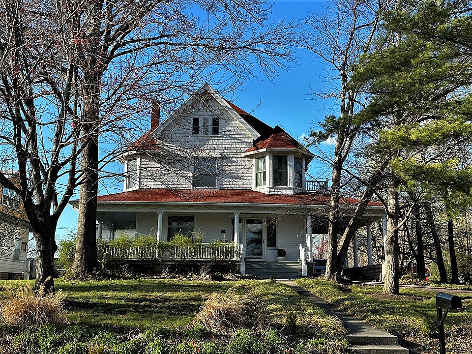
Listed on the National Register of Historic Places in 2018.
One of 7 National Register listings published here for Grundy County · listed in 2018 · category: Building.
Sources: the National Register database, National Park Service
Regional context, not property-specific evidence. The federal mineral resources record lists 31 workings within 5 miles of George Wolz House: 27 past producers, 4 producers. 4 still produce. What was taken out: Stone, Crushed/Broken, Sand and Gravel, Construction. Distance is straight-line from the map coordinates, so a quarry counted here may appear on a neighbouring settlement's page as well.
| Where | Site | Commodity | Status | Recorded |
|---|---|---|---|---|
| Thompson - Weldon Sand Pit / Plant | Sand and Gravel, Construction | Producer | ||
| Unk | Sand and Gravel, Construction | Past Producer | ||
| Unk | Sand and Gravel, Construction | Past Producer | ||
| Unk | Sand and Gravel, Construction | Past Producer | ||
| Unk | Sand and Gravel, Construction | Past Producer | ||
| Unk | Sand and Gravel, Construction | Past Producer | ||
| Unk | Sand and Gravel, Construction | Past Producer | ||
| Unk | Sand and Gravel, Construction | Past Producer | ||
| Cole Quarry | Stone, Crushed/Broken | Past Producer | ||
| Harrison Twp Quarry | Stone, Crushed/Broken | Past Producer |
Regional context, not property-specific evidence. The National Weather Service names Trenton, the town this property stands in, in 113 storm reports between 1993 and 2025: 52 hail, 47 thunderstorm wind, 11 flash flood, 2 tornado. No death or injury is recorded in these reports. Each account below is quoted exactly as the forecast office filed it, from the NOAA Storm Events Database, and each date opens the federal record of that event.
| When | Event | Place named | Harm | What the report says |
|---|---|---|---|---|
| May 2004 | Hail | Trenton | $300,000 | There was extensive damage to roofs and cars. Power lines were also reported down. |
| August 1993 | Thunderstorm Wind | Trenton | $50,000 | Numerous trees and power lines were blown down. |
| June 2004 | Thunderstorm Wind | Trenton | $10,000 | Tree landed on house. |
| November 2015 | Thunderstorm Wind | Trenton | $5,000 | A large portion of a shingled roof was blown off along Route W. |
| June 2011 | Thunderstorm Wind | Trenton | $3,000 | Thunderstorm wind gusts were estimated up to 80 mph. Power lines were snapped and an outbuilding was destroyed. |
| July 2001 | Thunderstorm Wind | Trenton | $3,000 | Ham radio reported 3/4 inch hail and wind gusts to 80 mph. Trees up to 2 feet in diameter blown down. |
| August 2015 | Thunderstorm Wind | Trenton | $2,000 | A tree and a power pole was snapped. The damage was confined to a 3 block radius. |
| August 2006 | Thunderstorm Wind | Trenton | $2,000 | Shingles off roofs and pine trees uprooted. |
| April 2001 | Thunderstorm Wind | Trenton | $1,000 | Broadcast media reported windows blown out of a garage. |
| September 2001 | Thunderstorm Wind | Trenton | $1,000 | Power lines down throughout town. |
| May 2025 | Thunderstorm Wind | Trenton | - | Downed wires and power outages near and south of Trenton. |
| March 2025 | Thunderstorm Wind | Trenton | - | Radio station in Trenton reports 70 mph wind gusts. |
| April 2024 | Hail | Trenton | - | Quarter sized hail was reported just southeast of Trenton. |
| June 2024 | Thunderstorm Wind | Trenton | - | Estimated gusts up to 60 mph with power outages reported in Trenton. |
| March 2023 | Thunderstorm Wind | Trenton | - | A tree and powerlines were knocked down. |
| May 2023 | Tornado (EF0) | Trenton | - | A storm chaser in Trenton caught a brief tornado on video. This tornado did some visible damage to a local church, but that damage was mostly superficial as the brick facade crumbled off the face of the building. No injuries were reported. |
| June 2023 | Thunderstorm Wind | Trenton | - | Tree branches downed in Trenton. |
| August 2023 | Hail | Trenton | - | Quarter sized hail was reported southwest of Trenton. |
| August 2023 | Hail | Trenton | - | Quarter sized hail was reported southwest of Trenton. |
| May 2023 | Hail | Trenton | - | Golf ball size hail was reported in Trenton. |
| June 2022 | Thunderstorm Wind | Trenton | - | Half of a large tree was blown down near Trenton. |
| June 2021 | Thunderstorm Wind | Trenton | - | Numerous trees were down across Trenton after 60 to 70 mph wind went through the city. |
| December 2021 | Thunderstorm Wind | Trenton | - | Numerous trees and powerlines were blown down in Trenton. A roof was also blown off of a structure. |
| May 2020 | Flash Flood | Trenton | - | Highway W was impassible due to high water coming off Wolf Creek. |
| June 2019 | Thunderstorm Wind | Trenton | - | Several structures were damaged near Trenton. Several power lines were also down. |
| May 2019 | Flash Flood | Trenton | - | Water was flowing over several roads in Trenton. |
| July 2017 | Flash Flood | Trenton | - | Ellison and 4th Street were covered in running water in Trenton. |
| June 2017 | Thunderstorm Wind | Trenton | - | There were several reports of trees and power poles down across Trenton. |
| June 2017 | Thunderstorm Wind | Trenton | - | A tree was blocking Crowder Road at Mable Street. |
| August 2016 | Flash Flood | Trenton | - | Several feet of water was covering intersections in Trenton that normally do not flood. |
| August 2016 | Thunderstorm Wind | Trenton | - | A tree of unknown size or condition snapped in half and fell on some power lines in Trenton. |
| May 2014 | Hail | Trenton | - | Softball sized hail was reported near Crowder State Park. Power lines were also reported down in West Trenton at 5:15 PM. |
| July 2014 | Thunderstorm Wind | Trenton | - | A large tree limb was reported snapped and laying across Lulu St. in Trenton. |
| July 2014 | Thunderstorm Wind | Trenton | - | A large tree was snapped and laying across Crowder Road, near Trenton. |
| June 2011 | Flash Flood | Trenton | - | One to two feet of water, was reported flowing over Highway W. |
| June 2008 | Flash Flood | Trenton | - | A significant amount of water was flowing over Route 6, to the west of Trenton. |
| May 2007 | Flash Flood | Trenton | - | Several roads have water flowing over them due to the heavy rains. |
| August 2006 | Thunderstorm Wind | Trenton | - | Tree blown over onto Highway 6. |
| August 2006 | Thunderstorm Wind | Trenton | - | Several trees blown down near County Road P and Highway 6 junction. |
| May 2004 | Tornado (F0) | Trenton | - | Brief tornado touchdown near 146/128 interchange. |
| August 2004 | Flash Flood | Trenton | - | Water is up to 2 feet deep across County Road F. |
| August 2004 | Flash Flood | Trenton | - | Several creeks out of their banks near the municipal airport and Crowder State Park. |
| June 2003 | Thunderstorm Wind | Trenton | - | Tree 5 to 10 inches in diameter blown down. |
| April 2001 | Thunderstorm Wind | Trenton | - | Broadcast media reported large trees down. |
| April 2001 | Thunderstorm Wind | Trenton | - | Public reported large trees down on highway 6. |
| May 2001 | Flash Flood | Trenton | - | Law enforcement reported 1.5 feet of water over highway 65. |
| June 2001 | Hail | Trenton | - | Ham radio operator reported thunderstorm wind gusts to 57 knots and hail to one inch. |
| June 2000 | Thunderstorm Wind | Trenton | - | Two large trees were downed in Trenton. |
| September 2000 | Thunderstorm Wind | Trenton | - | Amateur radio operators reported downed trees near the intersection of Y and O Highways northeast of Trenton. |
| August 2000 | Thunderstorm Wind | Trenton | - | Numerous 4-8 inch diameter tree limbs and one tree were downed on the southwest side of Trenton. |
| June 1998 | Flood | Trenton | - | Up to 3.5 inches of rain fell during thunderstorms over Grundy County. Several intersections were reported flooded in Trenton. |
| July 1995 | Hail | Trenton | - | The Grundy County Sheriff Department reported dime-size hail near Trenton. |
| July 1995 | Hail | Trenton | - | Golf ball-size hail was reported 12 miles west of Trenton. |
| July 1995 | Hail | Trenton | - | Golf ball-size hail was reported 15 miles Northeast of Trenton. |
| March 2023 | Hail | Trenton | - | no account filed |
| March 2022 | Hail | Trenton | - | no account filed |
| June 2019 | Hail | Trenton | - | no account filed |
| August 2019 | Hail | Trenton | - | no account filed |
| September 2019 | Hail | Trenton | - | no account filed |
| April 2017 | Hail | Trenton | - | no account filed |
No historic map-sheet match is published for this property yet. That does not mean no map exists. This record needs a coordinate-quality review before it can be joined to a sheet boundary. Browse the county's mapped places while that work is pending.
Other National Register properties close enough to walk or drive between, ordered by distance from this one. Both positions come from the same geocoding pass that matched these properties to their map sheets.
| Photograph | Property | Distance | Listed |
|---|---|---|---|
 | Plaza Hotel | 0.4 miles | 2001 |
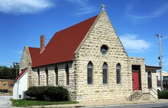 | St. Philip's Episcopal Church | 0.5 miles | 1979 |
 | Jewett Norris Library | 0.9 miles | 1984 |
 | Trenton High School | 1.0 miles | 2010 |
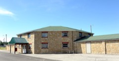 | WPA Stock Barn and Pavilion | 1.2 miles | 1994 |
| Crowder State Park Vehicle Bridge | 2.4 miles | 1985 |
| National Archives record | The nomination case file for reference 100002690 in Record Group 79. |
| Grundy County | All 7 listed properties in this county. |