 Block
From the record
One of 4 National Register listings published here for Holt County · listed in 1979 · category: Building.
Sources: the case file at the National Archives · the National Register database, National Park Service · the Wikipedia article
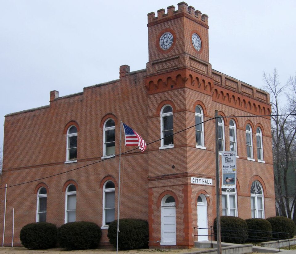
Listed on the National Register of Historic Places in 1979.
One of 4 National Register listings published here for Holt County · listed in 1979 · category: Building.
Sources: the case file at the National Archives · the National Register database, National Park Service · the Wikipedia article
The chapter on Forest Township in Holt County, Its Soil, Climate, and the Advantages It Offers to Immigration .., published 1869; History of Holt County, Missouri : from the Time of the Platte Purchase to the End of the Year 1916 : Preceded by a Short History of Missouri : Supplemented by Biographical Sketches of Prominent Citizens, published 1917 names Forest City. This is what it says, exactly as the scans read.
In the year 1857 a company of enterprising gentlemen purchased a tract of land on the west boundary of Holt County, adjoining the Missouri river, for the purpose of laying out a town site. Eoads were already in existence leading from the point selected in all directions and to every important settlement in the county. These roads in connection with the Missouri river which here aftbrded agood landing, lead the company to expect that their town once started would soon control a large portion of the produce trade of the county. With this view the tract of land was surveyed and the first lot sale took place on the 15th day of May, 1857. Forest City was in existence - stores and dwellings sprung up rapidly, and the expectations of the company were more than realized. Forest City became at once the mart for the principal part of the produce of the county. Hundreds of waggons brought in the hemp and corn raised in every neighborhood, and no obstacle seemed likely to prevent Forest City from becoming one of the leading trading points in North West Missouri. The rebellion broke out ; it had here as everywhere else where it was a reality, a blighting effect ; it had this effect on Forest City. Two fifths of the original inhabitants of Holt county were in sympathy with the rebellion, the most of these left the county (luring that period but few of whom have ever returned ; Tvhilst the majority of the able bodied Union men were enlisted in the Union armies. Agriculture was neglected - trade was nominal ; and as the county did not improve, certainly the towns could not prosper. But the war ended, trade slowly revived and Forest City began to resume her old place in the trade. Now the railroad from St. Joseph to Council Bluffs is completed running through Forest City, and has opened for us and brought us in connection with two of the best markets in the United States, during every season of the year : further, it has opened for us the Great West.
Passage source: Holt County, Its Soil, Climate, and the Advantages It Offers to Immigration .., published 1869.
The only town in Forest Township is Forest City, which for many years has been one of the most important shipping points on the main line of the C. B. & Q. Railroad between St. Joseph and Omaha. It is connected with Oregon, the countyseat by interurban road, a complete history of which will be found in the chapter devoted to railroads. For many years, practically all the merchandise sold in the southern part of the county, was distributed from Forest City. Before the railroad was built, the town was an important point for Missouri River steamboats.
Passage source: History of Holt County, Missouri : from the Time of the Platte Purchase to the End of the Year 1916 : Preceded by a Short History of Missouri : Supplemented by Biographical Sketches of Prominent Citizens, published 1917.
Machine-read from a century-old scan, so expect the errors a machine makes: misspelled names, dropped words, stray characters.
Read the whole chapter on Forest Township - 7,475 words on its settlement, mills, schools and churches.
Regional context, not property-specific evidence. The federal wildfire occurrence database lists 2 fires within 5 miles of City Hall between 2004 and 2016, burning about 24 acres in total. None started naturally. None was recorded as arson. Distance is straight-line from the map coordinates, so a fire counted here may appear on a neighbouring settlement's page as well.
| Reported cause | Fires |
|---|---|
| Equipment and vehicle use | 1 |
| Debris and open burning | 1 |
The most recent of them, most recent first, with the day each was reported and the service that recorded it.
| Date | Cause | Size | Reported by | Name on the report |
|---|---|---|---|---|
| 22 March 2004 | Debris and open burning | 22 acres | Squaw Creek National Wildlife Refuge | BONE YARD |
| 20 February 2016 | Equipment and vehicle use | 2.0 acres | Kansas Forest Service | 6 |
Regional context, not property-specific evidence. The federal mineral resources record lists 16 workings within 5 miles of City Hall: 13 past producers, 2 unknowns, 1 producer. 1 still produces. What was taken out: Stone, Crushed/Broken. Distance is straight-line from the map coordinates, so a quarry counted here may appear on a neighbouring settlement's page as well.
| Where | Site | Commodity | Status | Recorded |
|---|---|---|---|---|
| Oregon Quarry | Stone, Crushed/Broken | Producer | ||
| Unk | Stone, Crushed/Broken | Past Producer | ||
| Unk | Stone, Crushed/Broken | Past Producer | ||
| Unk | Stone, Crushed/Broken | Past Producer | ||
| Unk | Stone, Crushed/Broken | Past Producer | ||
| Unk | Stone, Crushed/Broken | Unknown | ||
| Unk | Stone, Crushed/Broken | Past Producer | ||
| Unk | Stone, Crushed/Broken | Past Producer | ||
| Unk | Stone, Crushed/Broken | Unknown | ||
| Unk | Stone, Crushed/Broken | Past Producer |
Regional context, not property-specific evidence. The National Weather Service names Forest City, the town this property stands in, in 15 storm reports between 1998 and 2019: 6 hail, 5 thunderstorm wind, 4 flash flood. No death or injury is recorded in these reports. Each account below is quoted exactly as the forecast office filed it, from the NOAA Storm Events Database, and each date opens the federal record of that event.
| When | Event | Place named | Harm | What the report says |
|---|---|---|---|---|
| June 2009 | Hail | Forest City | $25,000 | no account filed |
| May 2013 | Thunderstorm Wind | Forest City | $2,000 | Thunderstorm wind gusts were estimated up to 60 mph, with windows blown out of a residence. |
| June 2009 | Thunderstorm Wind | Forest City | $2,000 | Trees and powerlines were reported down on Highway 11, between Oregon and Forest City. |
| March 2017 | Thunderstorm Wind | Forest City | - | Sheriff reported downed trees between Forest City and Oregon. |
| May 2011 | Flash Flood | Forest City | - | Heavy rains caused flash flooding with water covering Highway 111. |
| August 2011 | Thunderstorm Wind | Forest City | - | Thunderstorm wind gusts were estimated up to 65 mph. |
| June 2010 | Flash Flood | Forest City | - | Route 111 north of Forest City was closed due to flash flooding. |
| June 2009 | Flash Flood | Forest City | - | Flash flooding was observed on several roads, due to the heavy rains. |
| June 2009 | Flash Flood | Forest City | - | Highway 111 near the bridge coming out of Forest City was flooded. |
| May 1998 | Thunderstorm Wind | Forest City | - | Severe thunderstorm winds downed large trees in Forest City. |
| August 2019 | Hail | Forest City | - | no account filed |
| June 2009 | Hail | Forest City | - | no account filed |
| June 2009 | Hail | Forest City | - | no account filed |
| June 2009 | Hail | Forest City | - | no account filed |
| June 2005 | Hail | Forest City | - | no account filed |
No historic map-sheet match is published for this property yet. That does not mean no map exists. This record needs a coordinate-quality review before it can be joined to a sheet boundary. Browse the county's mapped places while that work is pending.
Other National Register properties close enough to walk or drive between, ordered by distance from this one. Both positions come from the same geocoding pass that matched these properties to their map sheets.
| Photograph | Property | Distance | Listed |
|---|---|---|---|
| Carroll Stagecoach Inn | 7.0 miles | 1983 |
| National Archives record | The nomination case file for reference 79001362 in Record Group 79. |
| Wikipedia article | Community-written account of this property, licensed CC BY-SA. |
| Holt County | All 4 listed properties in this county. |