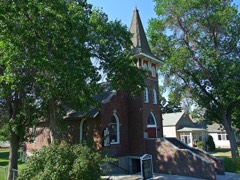
Block
From the record
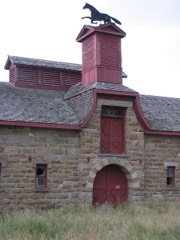
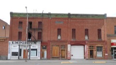
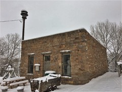
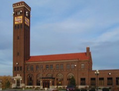
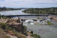
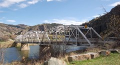
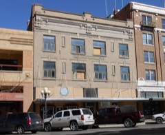
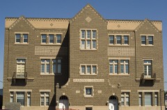
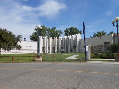
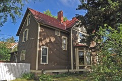
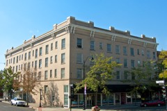
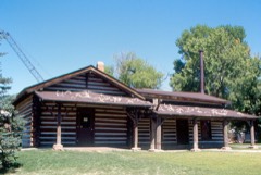
43 National Register listings published here, 2 of them National Historic Landmarks.
Sources: the National Register database, National Park Service
153 topographic sheets cover 73 settlements here, and 43 properties are on the National Register of Historic Places.
43 National Register listings published here, 2 of them National Historic Landmarks.
Sources: the National Register database, National Park Service
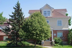
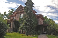
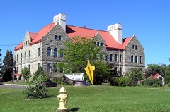
Every property in this county listed on the National Register of Historic Places, with the year it was listed and the federal nomination document.
Every wildfire the federal occurrence database records inside this county: 377 of them, burning about 29,686 acres. 136 started naturally and 2 were recorded as arson. Each settlement page carries the fires within five miles of it.
| Reported cause | Fires |
|---|---|
| Natural | 136 |
| Missing data/not specified/undetermined | 110 |
| Equipment and vehicle use | 35 |
| Debris and open burning | 24 |
| Power generation/transmission/distribution | 20 |
| Recreation and ceremony | 18 |
| Fireworks | 18 |
| Smoking | 4 |
| Other causes | 4 |
| Misuse of fire by a minor | 3 |
| Railroad operations and maintenance | 2 |
| Arson/incendiarism | 2 |
| Firearms and explosives use | 1 |
The five largest, by the area the report gives. None of them was recorded as arson.
| Date | Cause | Size | Reported by | Name on the report |
|---|---|---|---|---|
| 2 September 2019 | Missing data/not specified/undetermined | 7,000 acres | Central Land Office | STUCKEY RD MA |
| 26 July 2016 | Missing data/not specified/undetermined | 5,662 acres | Central Land Office | VINEYARD 2 |
| 22 July 2012 | Natural | 3,176 acres | Central Land Office | MISSION ROAD |
| 24 August 2017 | Missing data/not specified/undetermined | 2,500 acres | Central Land Office | SAND COULEE |
| 3 September 2001 | Misuse of fire by a minor | 1,684 acres | Helena - Lewis and Clark National Forest | MONARCH |
| 18 July 2007 | Natural | 1,527 acres | Central Land Office | NOVAK |
| 10 October 1996 | Equipment and vehicle use | 1,100 acres | Central Land Office | CASCADE BUTTE |
| 10 August 2006 | Natural | 1,000 acres | Central Land Office | SQUARE BUTTE |
Every settlement page carries the fires within five miles of it - see the settlement index below.
The NOAA Storm Events Database holds 620 reports for this county, causing 2 deaths, 3 injuries and about $2,039,130 in recorded property damage. Each settlement page carries the reports that name it.
| Kind of event | Reports |
|---|---|
| Thunderstorm Wind | 274 |
| Hail | 253 |
| Heavy Rain | 37 |
| Flash Flood | 15 |
| Flood | 15 |
| Tornado | 12 |
| Funnel Cloud | 8 |
| Lightning | 4 |
| Wildfire | 1 |
| High Wind | 1 |
The most serious of them, by death, then injury, then recorded damage. The accounts are quoted exactly as the forecast office filed them.
| When | Event | Place named | Harm | What the report says |
|---|---|---|---|---|
| May 2023 | Flood | Armington | 2 killed, $60,000 | BTCM8, Belt Creek near Monarch, crested at 6.79 feet on May 17th. Water levels resulted in strong currents that claimed the lives of two men visiting from Canada. The two men went into the fast moving water to retrieve their dog. The dog made it to shore, but the two men were pulled downstream and ultimately drowned. Water levels also flooded a portion of Sluice Boxes State Park's entrance parking lot as well as fields and yards from Sluice Boxes northward to Armington. A house in Neihart was flooded near the area were O'Brien Creek enters Belt Creek. |
| June 2004 | Lightning | Great Falls | 1 hurt, $10,000 | no account filed |
| August 2004 | Hail | Great Falls | 1 hurt | no account filed |
| July 1990 | Thunderstorm Wind | not stated | 1 hurt | no account filed |
| May 1994 | Thunderstorm Wind | Neihart | $500,000 | Many Pines campground was damaged by a strong downburst., |
| June 2003 | Flash Flood | Sandcoulee | $250,000 | no account filed |
| July 1978 | Tornado | not stated | $250,000 | no account filed |
| July 1978 | Tornado | not stated | $250,000 | no account filed |
| July 1978 | Tornado | not stated | $250,000 | no account filed |
| June 1977 | Tornado | not stated | $250,000 | no account filed |
| June 2003 | Thunderstorm Wind | Sun River | $60,000 | no account filed |
| June 2023 | Flash Flood | Fields | $50,000 | Water and debris rushed across several areas of Wilson Butte Road resulted in damage and impacts. Water flowed out of the rockier boulder terrain on the east side of the road, crossed the road with water depth being 2 to 3 feet deep at times. Water and debris entered at least two homes. One culvert was completely washed out with drainage pipes unearthed. Some wheat crops were flattened. NWS Employee that lives along the road had water enter their basement. Wilson Butte Road was impassable for approximately an hour. |
| January 2000 | Thunderstorm Wind | Great Falls | $30,000 | Roof torn off mobile home...trailer tipped over...power outages. |
| July 1998 | Tornado (F1) | Vaughn | $28,000 | 1 INCH HAIL |
| July 1988 | Tornado (F1) | not stated | $25,000 | no account filed |
| August 2019 | Lightning | Great Falls | $10,000 | Great Falls Fire department reported a structure fire caused by lightning striking a tree and adjacent house. The department received the report shortly after 10 AM. The timing of the lightning strike was determined by the lightning detection network. Also, the property damage cost was estimated. |
| August 2003 | Thunderstorm Wind | Manchester | $5,000 | no account filed |
| April 2008 | Thunderstorm Wind | Ft Shaw | $3,000 | Gust of wind out ahead of a thunderstorm produced concentrated area of damage at a farm. Large aluminum trailer was flipped over. Metal sheeting from roof of lean-to structure was lifted and carried 50 yards. All debris carried off toward the northeast. |
| June 1961 | Tornado | not stated | $2,500 | no account filed |
| June 2004 | Hail | Ulm | $2,000 | no account filed |
| June 1996 | Hail | Simms | $1,600 | no account filed |
| May 2025 | Thunderstorm Wind | (Gtf)Great Falls Arpt | $1,000 | Corrects previous non-thunderstorm wind dmg report from 2 SW Great Falls to Thunderstorm Wind Dmg. Large conifer tree snapped and down on Cherry Dr in Fox Farm area. |
| September 1998 | Thunderstorm Wind | Vaughn | $1,000 | no account filed |
| June 1958 | Tornado | not stated | $30 | no account filed |
| May 2025 | Thunderstorm Wind | Great Falls | - | A 63 mph wind gust measured at a ambient weather station on NW side of Great Falls. |
| May 2025 | Thunderstorm Wind | Great Falls | - | A 65 mph gust measured at Ambient weather station on west side of Great Falls. |
| May 2025 | Thunderstorm Wind | (Gtf)Great Falls Arpt | - | A 68 mph gust measured at NWS Great Falls (corrected from Non-Tstm Gust to Tstm gust). |
| May 2025 | Thunderstorm Wind | Great Falls | - | A 63 mph gust at Ambient weather station. |
| May 2025 | Thunderstorm Wind | Great Falls | - | A 59 mph gust at ambient weather station (corrected from Non-Tstm Gust to Tstm gust). |
| May 2025 | Thunderstorm Wind | Great Falls | - | A 58 mph gust at Ambient weather station (corrected from Non-Tstm Gust to Tstm gust). |
| June 2025 | Thunderstorm Wind | Great Falls | - | Ambient weather sensor in northern Cascade county measured a 59 mph gust. |
| August 2025 | Thunderstorm Wind | Ulm | - | AWOS station K1IM India measured the gust. |
| August 2025 | Thunderstorm Wind | Ft Shaw | - | MT mesonet station Sun River SE. |
| August 2025 | Thunderstorm Wind | Rainbow | - | Ambient weather station. Sustained winds were 55 mph at the time of observation. |
| August 2025 | Thunderstorm Wind | (Gtf)Great Falls Arpt | - | Asos station Kgtf Great Falls Airport. |
| August 2025 | Thunderstorm Wind | Great Falls | - | Ambient weather station north of Great Falls. |
| June 2025 | Hail | Ashuelot | - | Mping report of quarter sized hail. |
| June 2025 | Hail | Ashuelot | - | Quarter size hail reported by member of the public. |
| June 2025 | Hail | Great Falls | - | Quarter size hail reported. Damage to vehicles and RV reported as well. |
| June 2025 | Hail | Great Falls | - | Public report with image of quarter sized hail next to a quarter for reference. |
| June 2025 | Hail | Great Falls | - | Quarter sized hail reported. |
| June 2025 | Hail | Portage | - | Trained spotter reports quarter size hail along with 30 to 50 mph winds along highway 87 north of the Republic Services Landfill and south of Dent Bridge Road. |
| June 2025 | Hail | Great Falls | - | Social media report of three quarter of an inch to an inch sized hail. |
| June 2025 | Hail | Great Falls | - | Social media report of 1 inch hail. Time and location estimated. |
| June 2025 | Hail | Great Falls | - | Quarter sized hail reported. |
| June 2025 | Hail | Portage | - | Trained spotter reports quarter size to slightly larger than quarter size hail. |
| June 2025 | Thunderstorm Wind | Great Falls | - | Ambient weather station measured gust. |
| July 2025 | Hail | Campsite | - | Corrects previous hail report from 9 WNW Monarch. Facebook report of 1 inch hail in Tiger Butte. |
| July 2025 | Hail | Campsite | - | Facebook report of 1 inch hail in Tiger Butte. |
| July 2025 | Hail | Great Falls | - | Public reported 1 inch hail. Time of report estimated via radar. |
| July 2025 | Flash Flood | (Gtf)Great Falls Arpt | - | There was a report of 6 inches of flowing water in the street in northwest Great Falls. Garbage cans floating down the street. There was another report of water covering 15th Street North in Black Eagle. No specific damages or injuries were reported from the flooding. |
| December 2025 | Thunderstorm Wind | (Gtf)Great Falls Arpt | - | RSOIS equipment at wfo Great Falls measured a 62 mph gust associated with a convective shower. |
| December 2025 | Thunderstorm Wind | (Gtf)Great Falls Arpt | - | ASOS station KGTF Great Falls Airport. A few lighting strikes developed south of town after the initial gust blew through. |
| June 2024 | Hail | Salem | - | Time and location estimated. Hail stones between 1 and 1.5 inches were observed. |
| June 2024 | Thunderstorm Wind | Great Falls | - | A gust of 70 mph was measured north of Great Falls. Location is estimated. |
| August 2024 | Thunderstorm Wind | Ulm | - | AWOS station K1IM India measured a severe gust. |
| August 2024 | Thunderstorm Wind | Ulm | - | Ambient Weather Sensor measured gust. |
| August 2024 | Thunderstorm Wind | Eden | - | Mesonet station FW1843 measured a severe gust 10 miles WSW of Stockett. |
| August 2024 | Thunderstorm Wind | (Gtf)Great Falls Arpt | - | ASOS station KGTF Great Falls Airport measured a sever gust. |
| August 2024 | Thunderstorm Wind | Sun River | - | Ambient weather sensor measured a severe gust. |
The Survey's mineral resources record lists 134 workings inside this county. 10 still produce and 124 are closed or unrecorded. Each settlement page carries the workings within five miles of it.
| Commodity | Workings |
|---|---|
| Silver | 52 |
| Lead | 21 |
| Gold | 10 |
| Lead, Zinc | 10 |
| Sand and Gravel, Construction | 10 |
| Zinc, Lead | 9 |
| Iron | 7 |
| Silver, Lead, Zinc | 6 |
| Gypsum-Anhydrite | 6 |
| Zinc, Silver | 6 |
| Lead, Zinc, Silver | 5 |
| Gold, Copper | 4 |
| Silver, Lead | 4 |
| Clay | 4 |
The least common of them first, because a county's hundredth gravel pit says nothing its first ten did not.
| Where | Site | Commodity | Status | Recorded |
|---|---|---|---|---|
| Albright Deposit | Limestone, Dimension | Occurrence | ||
| Albright Group | Gold, Iron | Prospect | ||
| Belt Clay | Silica, Iron, Aluminum, Water, Free | Past Producer | 1905 | |
| Big Ben | Silver, Molybdenum | Occurrence | 1922 | |
| Big Ben Molybdenum | Molybdenum, Copper, Tungsten, Lead | Occurrence | 1922 | |
| Big Seven Mine | Silver, Gold, Copper, Lead, Molybdenum, Zinc | Past Producer | 1892 | |
| Blackbird | Silver, Gold, Zinc, Lead | Past Producer | 1890 | |
| Boss Mine | Lead, Zinc, Silver, Copper, Iron | Past Producer | Chalcopyrite, Galena, Proustite, Pyrargyrite, Sphalerite | |
| Broadwater Mine | Silver, Lead, Zinc, Copper, Gold | Past Producer | 1881, 1886 | |
| Cascade Quarry | Stone | Producer | ||
| Dacotah Mine | Lead, Zinc, Silver, Gold | Past Producer | 1883, 1891 | |
| Harner & Davis Prospect | Lead, Manganese, Silver, Zinc | Prospect | ||
| Hegener | Molybdenum, Lead, Copper, Silver | Occurrence | Chalcopyrite, Galena, Molybdenite, Sphalerite | |
| Hegener Group | Silver, Zinc, Lead, Gold, Copper | Past Producer | ||
| Ingersoll | Silver, Lead, Zinc, Gold | Past Producer | 1888 | |
| Iron Mountain | Zinc, Silver, Iron | Prospect | ||
| Lexington Mine | Silver, Lead, Zinc, Molybdenum | Past Producer | 1891 | |
| Lexington Mine | Copper, Silver, Zinc, Gold, Molybdenum | Past Producer | 1891 | |
| Lucky Boy Pegmatite | Mica | Prospect | ||
| Monarch Stone Quarry | Stone, Dimension | Unknown | ||
| Neihart | Silver, Lead, Copper, Gold, Zinc, Molybdenum | Producer | Antimony, Arsenic, Chalcopyrite, Galena, Pyrite, Sphalerite, Tetrahedrite | |
| Ponderosa Mine | Silver, Copper, Lead, Zinc | Past Producer | ||
| Queen of the Hills Mine | Silver, Lead, Zinc, Gold, Copper, Barium-Barite | Past Producer | 1881 | |
| Rochester | Zinc, Lead, Silver | Past Producer | ||
| Ruth Mary and Fitzpatrick | Silver, Copper, Lead, Zinc, Gold | Past Producer | ||
| Silver Dyke Mine | Lead, Copper, Silver, Zinc, Gold | Past Producer | 1875, 1921 | |
| Thorson Hoover Creek | Silica | Occurrence | ||
| Benton Mine | Zinc, Silver, Lead, Gold | Past Producer | 1891 | |
| Big Ben Deposits | Molybdenum | Prospect | 1922 | |
| Big Snowy Claim | Silver, Lead, Gold | Occurrence | ||
| Big Snowy Mine | Silver, Lead, Gold | Unknown | ||
| Bull of the Woods Mine | Silver, Gold, Lead | Past Producer | ||
| Eighty Eight | Silver, Zinc, Lead, Copper | Past Producer | ||
| Florence Mine | Silver, Lead, Gold, Copper, Zinc | Past Producer | 1886, 1893 | |
| Graham & Hollowbush | Silver, Lead, Copper | Past Producer | ||
| Hartley | Zinc, Silver, Lead, Gold | Past Producer | 1883, 1901 | |
| Ixl | Silver, Gold, Lead | Past Producer | ||
| Lizzie | Silver, Lead, Gold, Zinc | Past Producer | ||
| Luckystrike | Lead, Silver, Gold | Unknown | ||
| New Alicia & New Rodwell Claims | Silver, Zinc, Lead, Copper | Prospect | 1923 | |
| Nilson | Silver, Lead, Copper | Past Producer | ||
| Silver Belt | Silver, Lead, Gold, Zinc | Past Producer | ||
| Star Group | Silver, Lead, Gold, Copper, Zinc | Past Producer | 1925 | |
| Titanium Occurrence | Iron, REE, Titanium | Occurrence | ||
| Titanium Occurrence | Iron, Titanium, REE | Occurrence | ||
| Titanium-Iron Occurrence | Iron, REE, Titanium | Occurrence | ||
| Titanium-Iron Occurrence | Iron, Titanium, REE | Occurrence | ||
| Venus | Zinc, Lead | Occurrence | ||
| (Facility) Great Falls Refinery | Copper, Silver | Plant | ||
| Black Diamond | Silver, Zinc, Lead, Gold | Past Producer | ||
| Boss Mine | Gold, Zinc, Silver, Lead | Past Producer | ||
| Compromise Claim | Lead, Silver, Zinc | Past Producer | ||
| Copes | Lead, Silver, Zinc | Prospect | ||
| Equator Mine | Lead, Silver, Zinc | Past Producer | ||
| Evening Star | Zinc, Silver, Lead | Past Producer | ||
| Fairplay Mine | Silver, Zinc, Lead, Gold | Past Producer | ||
| Florence Mine | Silver, Lead, Zinc, Copper | Past Producer | 1886, 1893 | |
| Gavander | Silver, Zinc, Lead, Gold | Past Producer | ||
| Great Falls Bentonite | Bentonite | Unknown | ||
| Minute Man Group | Copper, Lead, Zinc, Silver | Past Producer | ||
| Morning Star Mine | Gold, Zinc, Silver, Lead | Past Producer | ||
| Unnamed Location | Bentonite | Occurrence | ||
| Unnamed Location | Bentonite | Occurrence | ||
| Broken Hill | Gold, Silver, Lead | Past Producer | ||
| Dacotah Mine | Lead, Zinc, Silver, Gold, Copper | Past Producer | 1883, 1891 | |
| Dakotah Mine | Silver, Lead, Zinc, Gold, Copper | Past Producer | 1883 | |
| Hartley Mine | Lead, Zinc, Silver, Gold, Copper | Past Producer | 1883, 1901 | |
| Treasurelite Shale Mine | Clay | Prospect | ||
| Unnamed Location | Clay | Occurrence | ||
| Unnamed Location | Clay | Occurrence | ||
| Unnamed Location | Clay | Occurrence | ||
| Cornucopia Mining Group | Gold, Lead, Zinc, Silver | Past Producer | ||
| Boss and Atlantus Claims | Silver, Lead, Zinc, Gold | Past Producer | 1884, 1956 | |
| Compromise | Lead, Zinc, Silver | Past Producer | ||
| Cowboy | Lead, Zinc, Silver | Prospect | ||
| Dawn and Foster | Lead, Zinc, Silver | Prospect | ||
| East Bench Deposit | Gypsum-Anhydrite | Occurrence | ||
| Florence Mine | Silver, Lead, Zinc | Past Producer | 1886, 1893 | |
| Fred Remmington Property | Gypsum-Anhydrite | Prospect | ||
| Galt-Queen | Lead, Zinc, Silver | Past Producer | 1881 | |
| Goodman Deposit | Gypsum-Anhydrite | Occurrence | ||
| Hatchet | Lead, Zinc, Silver | Prospect | ||
| Riceville Gypsum Deposit | Gypsum-Anhydrite | Prospect | ||
| Savage | Lead, Zinc, Silver | Past Producer | 1885 | |
| Unnamed Location | Gypsum-Anhydrite | Occurrence | ||
| Unnamed Location | Gypsum-Anhydrite | Occurrence | ||
| Great Falls Slag Dump | Iron | Unknown | ||
| Hurricane and Tornado | Iron | Occurrence | 1887 | |
| Sand Coulee It | Iron | Unknown | ||
| Bon Ton-Fairplay | Silver, Zinc, Lead | Prospect | ||
| Broadwater | Silver, Zinc, Lead | Past Producer | ||
| Champion B | Silver, Zinc, Lead | Past Producer | ||
| Double X Xx | Silver, Zinc, Lead | Past Producer | ||
| Queen of the Hills | Silver, Zinc, Lead | Past Producer | ||
| Sherman | Silver, Zinc, Lead | Past Producer | ||
| Silver Bell | Silver, Zinc, Lead | Past Producer | ||
| Tom Hendricks | Silver, Zinc, Lead | Past Producer | ||
| Whippoorwill Mine | Silver, Zinc, Lead | Past Producer | ||
| Boss Mine | Silver, Lead, Zinc | Occurrence | ||
| Concentrated and Monarch | Silver, Lead, Zinc | Past Producer | ||
| Cumberland | Silver, Lead, Zinc | Prospect | ||
| Eureka | Silver, Gold | Past Producer | ||
| Flood Pit | Sand and Gravel, Construction | Past Producer | ||
| Frisco | Silver, Lead, Zinc | Past Producer | ||
| Hoover Creek Quarry | Sand and Gravel, Construction | Producer | ||
| Johannesburg | Gold | Occurrence | ||
| Johnson Pit | Sand and Gravel, Construction | Producer | ||
| Kraus Pit | Sand and Gravel, Construction | Past Producer | ||
| Leroy | Gold | Past Producer | ||
| Maud S. | Silver, Lead, Zinc | Past Producer | ||
| Missouri River Pit and Plant | Sand and Gravel, Construction | Producer | ||
| Montana Sand and Gravel | Sand and Gravel, Construction | Producer | ||
| Moulton Mine | Silver, Lead, Zinc | Producer | 1882, 1895 | |
| Mountain Chief | Silver, Lead, Zinc | Past Producer | ||
| Richem Pit | Sand and Gravel, Construction | Producer | ||
| Ripple | Silver, Lead, Zinc | Past Producer | ||
| Rock Creek | Silver, Lead, Zinc | Past Producer | ||
| Savoy Quarry | Sand and Gravel, Construction | Producer | ||
| Silver Horn | Gold, Silver | Occurrence | ||
| Spotted Horse | Gold, Silver | Prospect | ||
| Star Fraction Mine | Silver, Lead, Zinc | Occurrence | ||
| Vaughn Sand and Gravel Pit | Sand and Gravel, Construction | Past Producer | ||
| Zook No. 1 | Sand and Gravel, Construction | Past Producer | ||
| Blizzard | Silver, Lead | Past Producer | ||
| Hidden Treasure | Silver, Lead | Past Producer | ||
| London | Silver, Lead | Past Producer | ||
| Mogul Lode Mine | Silver, Lead | Unknown | ||
| Nevada | Silver, Lead | Unknown | ||
| Peabody | Silver, Lead | Past Producer | 1888 | |
| Pride of the West | Lead, Silver | Unknown | ||
| Star Mine | Silver, Lead | Prospect | ||
| Sunshine Mine | Silver, Lead | Occurrence | ||
| Spoofer Mine | Silver | Past Producer | ||
| Star Mill | Silver | Past Producer |
Named settlements recorded in the Geographic Names Information System, each with the topographic sheets covering it. Villages, hamlets and abandoned places alike. Each is shown with the nearest named watercourse or landform and the survey quadrangle it falls on.
Belt census division · 59412 · Near Dicks Gulch · Riceville quadrangle
14 sheets, 1890 to 1995
No longer a settlement
Belt census division · 59412 · In Armington Coulee · Armington quadrangle
15 sheets, 1890 to 1984
Belt census division · 59412 · On Big Otter Creek · Armington quadrangle
15 sheets, 1890 to 1984
Belt census division · 59405 · Near Red Coulee · Waltham quadrangle
16 sheets, 1890 to 1984
Belt census division · 59412 · Near French Coulee · Belt quadrangle
15 sheets, 1890 to 1984
No longer a settlement
Great Falls North census division · 59404 · Benton Lake East quadrangle
15 sheets, 1886 to 1976
No longer a settlement
Eden-Stockett census division · 59472 · Southeast Great Falls quadrangle
16 sheets, 1886 to 1976
Great Falls North census division · 59414 · Near Smelter Hill · Northwest Great Falls quadrangle
16 sheets, 1886 to 1976
Belt census division · 59412 · Near Marion Coulee · Blythe quadrangle
15 sheets, 1890 to 1984
Great Falls census division · 59401 · Near Smelter Hill · Northeast Great Falls quadrangle
16 sheets, 1886 to 1976
No longer a settlement
Belt census division · 59405 · Fife quadrangle
15 sheets, 1886 to 1976
No longer a settlement
Cascade census division · 59421 · On Knapp Creek · Cascade quadrangle
15 sheets, 1886 to 1983
Sun River Valley census division · 59421 · Cascade Colony quadrangle
13 sheets, 1886 to 1983
Cascade census division · 59421 · On Flat Creek · Truly quadrangle
12 sheets, 1886 to 1976
Eden-Stockett census division · 59480 · On Cottonwood Creek · Southeast Great Falls quadrangle
16 sheets, 1886 to 1976
Monarch-Neihart census division · 59463 · On Spruce Creek · Barker quadrangle
16 sheets, 1890 to 1995
No longer a settlement
Great Falls census division · 59404 · Near Sacajawea Island · Northwest Great Falls quadrangle
16 sheets, 1886 to 1976
Eden-Stockett census division · 59405 · Southwest Great Falls quadrangle
14 sheets, 1886 to 1976
No longer a settlement
Great Falls North census division · 59404 · Near Watson Coulee · Northwest Great Falls quadrangle
16 sheets, 1886 to 1976
Eden-Stockett census division · 59480 · On Half Breed Creek · Evans quadrangle
12 sheets, 1886 to 1995
Great Falls census division · 59485 · Fair Haven Colony quadrangle
16 sheets, 1886 to 1983
Eden-Stockett census division · 59405 · Near Spring Coulee · Southeast Great Falls quadrangle
16 sheets, 1886 to 1976
Great Falls census division · 59404 · Near Buckshot Island · Southwest Great Falls quadrangle
14 sheets, 1886 to 1976
No longer a settlement
Sun River Valley census division · 59443 · On Adobe Creek · Fort Shaw quadrangle
15 sheets, 1886 to 1983
Great Falls census division · 59485 · Ulm quadrangle
16 sheets, 1886 to 1983
No longer a settlement
Eden-Stockett census division · 59405 · Near Johnson Flats · Southeast Great Falls quadrangle
16 sheets, 1886 to 1976
Great Falls census division · 59405 · On Gibson Flats · Southeast Great Falls quadrangle
16 sheets, 1886 to 1976
Eden-Stockett census division · 59480 · In Giffen Coulee · Stockett quadrangle
14 sheets, 1886 to 1976
Great Falls census division · 59405 · On Sun River · Northwest Great Falls quadrangle
16 sheets, 1886 to 1976
Great Falls census division · 59404 · On Sun River · Northwest Great Falls quadrangle
16 sheets, 1886 to 1976
No longer a settlement
Great Falls North census division · 59414 · Near Smelter Hill · Northwest Great Falls quadrangle
16 sheets, 1886 to 1976
No longer a settlement
Great Falls North census division · 59404 · Manchester quadrangle
15 sheets, 1886 to 1976
Monarch-Neihart census division · 59463 · Monarch NE quadrangle
14 sheets, 1890 to 1995
No longer a settlement
Cascade census division · 59421 · Near Eagle Rock · Mid Canon quadrangle
12 sheets, 1886 to 1976
Cascade census division · 59405 · On Coal Creek · Millegan quadrangle
12 sheets, 1886 to 1995
Monarch-Neihart census division · 59463 · In Monarch Canyon · Monarch quadrangle
16 sheets, 1890 to 1995
Monarch-Neihart census division · 59465 · On Johnston Creek · Neihart quadrangle
20 sheets, 1886 to 1995
Great Falls North census division · 59414 · Near Indian Butte · Northwest Great Falls quadrangle
16 sheets, 1886 to 1976
No longer a settlement
Eden-Stockett census division · 59472 · Near Sand Coulee · Southeast Great Falls quadrangle
16 sheets, 1886 to 1976
Sun River Valley census division · 59477 · Bowmans Corners NE quadrangle
10 sheets, 1943 to 1993
Belt census division · 59412 · Mahoney Hill quadrangle
14 sheets, 1886 to 1976
Great Falls North census division · 59404 · Northeast Great Falls quadrangle
19 sheets, 1886 to 1976
Belt census division · 59412 · Near Nasen Coulee · Riceville quadrangle
14 sheets, 1890 to 1995
Great Falls census division · 59485 · Near Nelson Island · Nelson Island quadrangle
15 sheets, 1886 to 1983
Belt census division · 59405 · Near West Fork Rogers Coulee · Waltham quadrangle
16 sheets, 1890 to 1984
Cascade census division · 59421 · Cascade quadrangle
15 sheets, 1886 to 1983
No longer a settlement
Cascade census division · 59421 · Near Saddleback Butte · Telegraph Mountain quadrangle
13 sheets, 1886 to 1983
Belt census division · 59405 · Near West Fork Rogers Coulee · Morony Dam quadrangle
18 sheets, 1886 to 1976
Eden-Stockett census division · 59472 · Near Mining Coulee · Southeast Great Falls quadrangle
16 sheets, 1886 to 1976
Great Falls North census division · 59404 · Northeast Great Falls quadrangle
19 sheets, 1886 to 1976
Sun River Valley census division · 59477 · On Simms Creek · Simms quadrangle
13 sheets, 1886 to 1983
Great Falls North census division · 59414 · On Smelter Hill · Northwest Great Falls quadrangle
16 sheets, 1886 to 1976
Eden-Stockett census division · 59480 · Near Number Five Coulee · Stockett quadrangle
14 sheets, 1886 to 1976
Great Falls North census division · 59404 · Manchester quadrangle
15 sheets, 1886 to 1976
Eden-Stockett census division · 59480 · On Middle Fork Sand Coulee Creek · Mahoney Hill quadrangle
14 sheets, 1886 to 1976
Eden-Stockett census division · 59472 · Near Sand Coulee · Southeast Great Falls quadrangle
16 sheets, 1886 to 1976
Cascade census division · 59421 · Near Cannonball Coulee · Truly quadrangle
12 sheets, 1886 to 1976
Sun River Valley census division · 59487 · On Muddy Creek · Vaughn quadrangle
14 sheets, 1886 to 1983
Great Falls North census division · 59404 · Northwest Great Falls quadrangle
16 sheets, 1886 to 1976
No longer a settlement
The vanished settlements of Cascade County: the places named above that are no longer on the map.