 Block
From the record
18 National Register listings published here.
Sources: the National Register database, National Park Service
47 topographic sheets cover 24 settlements here, and 18 properties are on the National Register of Historic Places.
18 National Register listings published here.
Sources: the National Register database, National Park Service
Every property in this county listed on the National Register of Historic Places, with the year it was listed and the federal nomination document.
| Photograph | Property | Type | Listed | Reference |
|---|---|---|---|---|
| Carriage House Historic District | district | 1991 | 91000720 | |
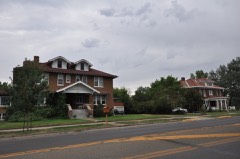 | East Main Street Residential Historic District | district | 1990 | 89002171 |
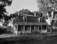 | Fort Keogh | site | 1978 | 78001680 |
 | William Harmon House | building | 1986 | 86002747 |
 | Holy Rosary Hospital | building | 2009 | 08001324 |
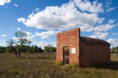 | Ismay Jail | building | 1997 | 97000501 |
| Locate Creek Bridge | structure | 2012 | 12000170 | |
 | Main Street Historic District | district | 1989 | 89000808 |
 | Miles City Steam Laundry | building | 1979 | 79001400 |
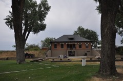 | Miles City Waterworks Building and Pumping Plant Park | building | 1979 | 79003723 |
 | George M. Miles House | building | 1982 | 82003161 |
 | Mountain States Telephone and Telegraph Company | building | 1988 | 88001118 |
 | Northern Pacific Railway Depot | building | 2010 | 10000132 |
 | Olive Hotel | building | 1988 | 88001117 |
 | Thomas and Beulah Shore House | building | 2003 | 03001299 |
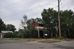 | Walrond and Elizabeth Snell House | building | 2003 | 03000923 |
 | US Post Office-Miles City Main | building | 1986 | 86000686 |
 | Ursuline Convent of the Sacred Heart | building | 1992 | 92000115 |
Every wildfire the federal occurrence database records inside this county: 445 of them, burning about 203,807 acres. 298 started naturally and none was recorded as arson. Each settlement page carries the fires within five miles of it.
| Reported cause | Fires |
|---|---|
| Natural | 298 |
| Equipment and vehicle use | 59 |
| Missing data/not specified/undetermined | 51 |
| Recreation and ceremony | 12 |
| Power generation/transmission/distribution | 8 |
| Debris and open burning | 5 |
| Railroad operations and maintenance | 4 |
| Fireworks | 4 |
| Smoking | 2 |
| Misuse of fire by a minor | 1 |
| Firearms and explosives use | 1 |
The five largest, by the area the report gives. None of them was recorded as arson.
| Date | Cause | Size | Reported by | Name on the report |
|---|---|---|---|---|
| 17 August 1996 | Natural | 62,000 acres | Eastern Land Office | POWDERVILLE |
| 31 August 1998 | Natural | 20,921 acres | Miles City Field Office | BRADSHAW |
| 10 August 2007 | Natural | 15,546 acres | Miles City Field Office | OKERMAN |
| 7 July 2017 | Equipment and vehicle use | 7,730 acres | Miles City Field Office | CROW ROCK |
| 30 August 2017 | Equipment and vehicle use | 7,590 acres | Eastern Land Office | SNAKE |
| 10 August 2007 | Natural | 6,692 acres | Miles City Field Office | WOLF CREEK |
| 13 August 2003 | Natural | 5,774 acres | Eastern Land Office | SWAIN |
| 2 September 2020 | Natural | 4,698 acres | Custer County | ZOOK |
Every settlement page carries the fires within five miles of it - see the settlement index below.
The NOAA Storm Events Database holds 544 reports for this county, causing 2 deaths, 6 injuries and about $2,894,000 in recorded property damage. Each settlement page carries the reports that name it.
| Kind of event | Reports |
|---|---|
| Thunderstorm Wind | 254 |
| Hail | 239 |
| Flash Flood | 20 |
| Flood | 10 |
| Tornado | 8 |
| Heavy Rain | 7 |
| Funnel Cloud | 5 |
| Lightning | 1 |
The most serious of them, by death, then injury, then recorded damage. The accounts are quoted exactly as the forecast office filed them.
| When | Event | Place named | Harm | What the report says |
|---|---|---|---|---|
| July 2016 | Thunderstorm Wind | Kinsey | 1 killed, 1 hurt | A semi truck was blown off Interstate 94 at Mile Marker 156. The driver of the semi was injured. |
| June 1999 | Lightning | Mizpah | 1 killed | A 14 year-old boy was struck and killed by lightning while standing on a front tire of a tractor in a field. |
| July 2024 | Thunderstorm Wind | Miles City | 3 hurt | Several injuries occurred due to trees falling on them and vehicles. At least one person was hospitalized. |
| July 2000 | Thunderstorm Wind | Miles City | 2 hurt, $5,000 | 2 inch diameter hail. Crop and window damage. Foot of water over Frontage Road along Interstate 94. Interstate 94 closed for one hour due to water over the road. Car accident near mile marker 160 with two injuries. |
| May 2011 | Flood | Knowlton | $1,100,000 | Significant flooding occurred on creeks and streams across Custer County with numerous county roads flooded, closing roads and resulting in significant damage. At the height of the flooding, emergency only travel was advised due to the magnitude of the event. The Powder River near Locate rose above flood stage from May 10th through May 23rd. The river crested four times at 11.29 feet, 11.70 feet, 11.27 feet and 9.28 feet on the 10th, 21st, 22nd and 23rd respectively. In addition, Pumpkin Creek was reported to be flowing over Highway 59 southeast of Miles City. Pumpkin Creek had a record crest of 13.98 feet on May 20th and 21st. The Yellowstone River at Miles City went above flood stage from May 22nd through May 29th. The river crested at 14.74 feet on the 24th and 14.53 feet on the 29th. The Tongue River at Miles City rose above flood stage from May 11th through May 23rd and crested at a record 13.99 feet on May 21st. Damage estimates based on FEMA reviews and Individual Assistance approvals. |
| July 1998 | Flash Flood | Miles City | $1,000,000 | Several streets were closed in Miles City because of flash flooding. Basements of several homes and businesses were flooded. |
| May 1989 | Tornado (F0) | not stated | $250,000 | no account filed |
| August 1995 | Thunderstorm Wind | Miles City | $180,000 | The roof of a house was torn off by thunderstorm winds. Another house had part of it's roof torn off. A shed was also blown over and a garage was damaged. Several trees were blown down. Estimated damage was $180 thousand. Winds up to 50 mph were recorded at the airport around this time. The time is estimated. |
| May 2010 | Flood | Kinsey | $130,000 | Heavy rains on the 24th and 25th caused widespread low land flooding across rural Custer County, mainly south of Miles City. Heavy rainfall also caused numerous roads and culverts to wash out in Custer County. A five day total of 4.08 inches at Volborg was reported on the 25th . On the morning of May 25th, a cooperative observer reported that Pumpkin Creek was out of its banks 5 miles north of Volborg with low land flooding. In addition, runoff from recent heavy rains also caused water levels to rise on the Tongue River below the Twelve Mile Dam. |
| July 2010 | Thunderstorm Wind | Miles City | $60,000 | Please see Episode Narrative. |
| July 2010 | Thunderstorm Wind | Miles City | $60,000 | Please see Episode Narrative. |
| July 1999 | Thunderstorm Wind | Miles City | $50,000 | Thunderstorm wind gusts of at least 48 mph caused several trees and a billboard to be blown down, a camping trailer to be blown over and some broken windows in and around Miles City. |
| July 1965 | Tornado (F2) | not stated | $25,000 | no account filed |
| July 2000 | Thunderstorm Wind | Miles City | $10,000 | 11 telephone poles snapped from 1-mile wide microburst on Kinsey Road |
| June 1995 | Thunderstorm Wind | Miles City | $9,000 | Thunderstorm winds damaged a porch and a garage at a residence 10 miles northeast of Miles City. Also, a mobile home was tipped over...crushing and killing a horse. |
| August 1993 | Thunderstorm Wind | Miles City | $5,000 | no account filed |
| June 1991 | Tornado (F0) | not stated | $2,500 | no account filed |
| July 2000 | Thunderstorm Wind | Miles City | $2,000 | Several trees downed |
| June 1995 | Thunderstorm Wind | Miles City | $2,000 | Several large trees were knocked down in Miles City. |
| July 2000 | Thunderstorm Wind | Miles City | $1,000 | Window blown out of home |
| July 1998 | Thunderstorm Wind | Mizpah | $1,000 | A spotter reported winds gusts to 60 mph which blew branches off trees and shingles off of a roof. |
| July 1998 | Thunderstorm Wind | Mizpah | $1,000 | A spotter reported winds gusts to 60 mph which blew branches off trees and shingles off of a roof. This storm also produced 1.57 inches of rainfall in 30 minutes. |
| August 1993 | Hail | Miles City | $500 | no account filed |
| August 2025 | Thunderstorm Wind | Miles City | - | Tree downed into powerlines. |
| August 2025 | Thunderstorm Wind | Miles City Arpt | - | Asos weather station kmls at Miles City airport. |
| August 2025 | Thunderstorm Wind | Miles City Arpt | - | From airport asos station kmls at Miles City. |
| June 2025 | Flood | Miles City | - | Widespread street flooding across the city. Lots of standing water under overpasses. |
| June 2025 | Thunderstorm Wind | Miles City Arpt | - | Reported by Miles City asos. |
| June 2025 | Hail | Miles City | - | Facebook Report . |
| June 2025 | Hail | Miles City | - | Hail report. |
| June 2025 | Hail | Miles City | - | Report from mping. |
| July 2025 | Hail | Ismay | - | Measured hail. |
| July 2025 | Hail | Ismay | - | Quarter size hail reported. |
| July 2025 | Hail | Sheffield | - | Report from mping. |
| July 2025 | Hail | Volborg | - | Report from mping. |
| July 2025 | Hail | Volborg | - | Measured by spotter. |
| July 2025 | Thunderstorm Wind | Kinsey | - | Estimated 3 to 4 inch diameter tree limbs broken. |
| July 2025 | Thunderstorm Wind | Knowlton | - | Estimated gust by a spotter. |
| July 2025 | Thunderstorm Wind | Ft Keogh | - | Spotter reported their screen door was completely ripped off its hinges. |
| July 2025 | Thunderstorm Wind | Miles City Arpt | - | Asos weather station at Miles City Airport. |
| July 2024 | Thunderstorm Wind | Miles City | - | Tree and powerline damage, along with power outages, were reported throughout Miles City. |
| July 2024 | Thunderstorm Wind | Miles City Arpt | - | Tree limb damage and shingle damage was reported. |
| July 2024 | Thunderstorm Wind | Miles City Arpt | - | Power poles were snapped and 3 inch diameter tree limbs were broken. |
| July 2024 | Thunderstorm Wind | Miles City | - | Trees were uprooted and a roof was blown off a house. |
| June 2024 | Thunderstorm Wind | Ft Keogh | - | A cottonwood tree branch 2 1/2 inches in diameter was snapped. |
| July 2023 | Thunderstorm Wind | Miles City | - | A large Cottonwood tree was downed. |
| May 2023 | Flash Flood | Miles City | - | A RV Park flooded with water running across nearby roads, drainages and culverts. Some culverts were damaged. |
| August 2023 | Flood | Miles City Arpt | - | Street flooding occurred across portions of Miles City. |
| August 2023 | Thunderstorm Wind | Miles City | - | Tree damage was reported. A tree was snapped off at the base and uprooted. Multiple 4-12 inch diameter branches were broken. |
| August 2023 | Thunderstorm Wind | Miles City | - | An 18 inch diameter, dead tree was snapped. |
| July 2023 | Thunderstorm Wind | Miles City | - | Tree limbs of 3 to 4 inches in diameter were broken. |
| July 2022 | Thunderstorm Wind | Kinsey | - | Tree branches 4 and 6 inches in diameter were broken at mile markers 13 and 14 on Kinsey Road. |
| June 2021 | Thunderstorm Wind | Miles City Arpt | - | Winds gusted to 60 mph at the Miles City Airport. |
| July 2021 | Thunderstorm Wind | Ft Keogh | - | Tree branches 4 inches in diameter were broken. |
| July 2021 | Thunderstorm Wind | Miles City | - | Tree limbs 6 inches in diameter were broken. |
| May 2020 | Hail | Miles City | - | A windshield was cracked. |
| May 2020 | Hail | Kinsey | - | This storm produced a wall cloud. A storm chaser vehicle was destroyed on I-94. |
| May 2020 | Thunderstorm Wind | Kinsey | - | A semi tipped over on I-94. In addition, 1 foot diameter trees were downed. |
| May 2020 | Thunderstorm Wind | Miles City Arpt | - | A wind gust of 66 mph was recorded at the Miles City Airport. |
| May 2020 | Hail | Miles City | - | The hail covered the ground. |
The Survey's mineral resources record lists 4 workings inside this county. 1 still produces and 3 are closed or unrecorded. Each settlement page carries the workings within five miles of it.
| Commodity | Workings |
|---|---|
| Uranium | 1 |
| Gold, Platinum | 1 |
| Silver | 1 |
| Sand and Gravel, Construction | 1 |
The least common of them first, because a county's hundredth gravel pit says nothing its first ten did not.
| Where | Site | Commodity | Status | Recorded |
|---|---|---|---|---|
| Eckart Portable Crusher | Sand and Gravel, Construction | Past Producer | ||
| Miles City | Gold, Platinum | Occurrence | Stream Placer | |
| Unknown | Uranium | Occurrence | ||
| Yellowstone Hill Pit and Plant | Silver | Producer |
Named settlements recorded in the Geographic Names Information System, each with the topographic sheets covering it. Villages, hamlets and abandoned places alike. Each is shown with the nearest named watercourse or landform and the survey quadrangle it falls on.
South Custer census division · 59351 · On Rough Creek · Beebe quadrangle
8 sheets, 1953 to 1980
North Custer census division · 59338 · On Saugus Creek · Kinsey NE quadrangle
8 sheets, 1953 to 1980
South Custer census division · 59301 · On Pumpkin Creek · Horse Creek quadrangle
8 sheets, 1953 to 1980
No longer a settlement
South Custer census division · 59301 · On Prat Creek · Circle L Creek quadrangle
8 sheets, 1953 to 1980
No longer a settlement
Shirley-Ismay census division · 59336 · Foundation Spring quadrangle
8 sheets, 1953 to 1981
No longer a settlement
South Custer census division · 59301 · On Cheever Creek · Garland School quadrangle
8 sheets, 1953 to 1980
North Custer census division · 59301 · Horse Creek Hill quadrangle
8 sheets, 1953 to 1980
No longer a settlement
South Custer census division · 59301 · Near Reynold Draw · Horton quadrangle
9 sheets, 1954 to 1983
Shirley-Ismay census division · 59336 · On Station Creek · Ismay South quadrangle
8 sheets, 1953 to 1981
South Custer census division · 59301 · On Kitty Spring Creek · Tepee Butte quadrangle
8 sheets, 1953 to 1980
No longer a settlement
North Custer census division · 59338 · On Muster Creek · Kinsey quadrangle
9 sheets, 1953 to 1980
Miles City census division · 59301 · On Tongue River · Miles City quadrangle
9 sheets, 1953 to 1980
South Custer census division · 59301 · On Hay Creek · Mizpah quadrangle
8 sheets, 1953 to 1980
South Custer census division · 59301 · Moon Creek School quadrangle
8 sheets, 1954 to 1983
No longer a settlement
Shirley-Ismay census division · 59336 · Near Cut Coulee · Pennock Creek quadrangle
8 sheets, 1953 to 1980
No longer a settlement
Miles City census division · 59301 · On Moon Creek · Horton quadrangle
9 sheets, 1954 to 1983
Miles City census division · 59301 · On Whitetail Creek · Horton quadrangle
9 sheets, 1954 to 1983
No longer a settlement
Shirley-Ismay census division · 59301 · On Dead Horse Creek · Shirley quadrangle
8 sheets, 1953 to 1980
Miles City census division · 59301 · On Alkali Creek · Miles City quadrangle
9 sheets, 1953 to 1980
Miles City census division · 59301 · On Coal Creek · Lignite Creek quadrangle
9 sheets, 1953 to 1980
South Custer census division · 59351 · On Shelter Creek · Volborg quadrangle
7 sheets, 1954 to 1973
Miles City census division · 59301 · Near Carbon Hill · Miles City quadrangle
9 sheets, 1953 to 1980
The vanished settlements of Custer County: the places named above that are no longer on the map.