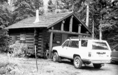
Block
From the record
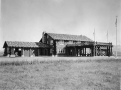
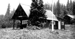
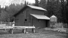
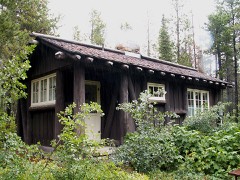
29 National Register listings published here, 2 of them National Historic Landmarks.
Sources: the National Register database, National Park Service
84 topographic sheets cover 41 settlements here, and 29 properties are on the National Register of Historic Places.
29 National Register listings published here, 2 of them National Historic Landmarks.
Sources: the National Register database, National Park Service
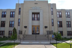
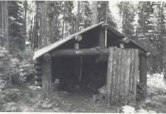
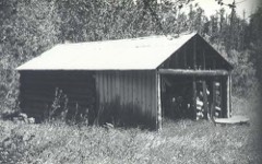
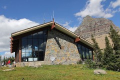
Every property in this county listed on the National Register of Historic Places, with the year it was listed and the federal nomination document.
Every wildfire the federal occurrence database records inside this county: 2,336 of them, burning about 104,980 acres. 144 started naturally and 112 were recorded as arson. Each settlement page carries the fires within five miles of it.
| Reported cause | Fires |
|---|---|
| Fireworks | 618 |
| Missing data/not specified/undetermined | 400 |
| Debris and open burning | 263 |
| Recreation and ceremony | 216 |
| Equipment and vehicle use | 203 |
| Natural | 144 |
| Misuse of fire by a minor | 126 |
| Arson/incendiarism | 112 |
| Smoking | 110 |
| Railroad operations and maintenance | 70 |
| Other causes | 50 |
| Power generation/transmission/distribution | 23 |
| Firearms and explosives use | 1 |
The five largest, by the area the report gives. None of them was recorded as arson.
| Date | Cause | Size | Reported by | Name on the report |
|---|---|---|---|---|
| 28 July 2006 | Natural | 34,203 acres | Glacier National Park | RED EAGLE |
| 4 January 2012 | Debris and open burning | 12,000 acres | Blackfeet Agency | WYE FIRE |
| 19 October 2003 | Missing data/not specified/undetermined | 8,000 acres | Blackfeet Agency | PARDUE |
| 4 January 2012 | Power generation/transmission/distribution | 6,500 acres | Blackfeet Agency | BOY |
| 11 July 2002 | Natural | 6,300 acres | Blackfeet Agency | FOX CREEK |
| 21 July 2015 | Natural | 4,850 acres | Glacier National Park | REYNOLDS FIRE |
| 2 April 1992 | Smoking | 4,000 acres | Blackfeet Agency | RDOORECMPX |
| 14 August 1996 | Natural | 4,000 acres | Blackfeet Agency | SHARPSFIRE |
Every settlement page carries the fires within five miles of it - see the settlement index below.
The NOAA Storm Events Database holds 171 reports for this county, causing no deaths, 3 injuries and about $590,000 in recorded property damage. Each settlement page carries the reports that name it.
| Kind of event | Reports |
|---|---|
| Hail | 75 |
| Thunderstorm Wind | 49 |
| Heavy Rain | 32 |
| Flood | 6 |
| Tornado | 3 |
| Flash Flood | 2 |
| Funnel Cloud | 2 |
| Lightning | 1 |
| Debris Flow | 1 |
The most serious of them, by death, then injury, then recorded damage. The accounts are quoted exactly as the forecast office filed them.
| When | Event | Place named | Harm | What the report says |
|---|---|---|---|---|
| July 2013 | Lightning | St Mary | 3 hurt | Thunderstorms over Glacier Park injured 3 people hiking on the St Mary Falls trail. Time of event is estimated. |
| June 1994 | Tornado (F1) | Cut Bank | $500,000 | no account filed |
| June 2023 | Debris Flow | Kiowa | $50,000 | Glacier National Park reported that portions of Montana Highway 49 and the Looking Glass Highway were closed due to debris flows from heavy rain. |
| June 1977 | Tornado | not stated | $25,000 | no account filed |
| June 1994 | Thunderstorm Wind | Cut Bank | $5,000 | no account filed |
| July 1994 | Hail | Cut Bank | $5,000 | no account filed |
| May 1993 | Thunderstorm Wind | Cut Bank | $5,000 | no account filed |
| May 2025 | Thunderstorm Wind | Browning | - | Mesonet station MTBWG Browning measured a 61 mph wind gust. |
| June 2025 | Hail | Browning | - | Hail up to walnut size was reported. |
| June 2025 | Hail | Browning | - | Browning BIA reported large hail. Location is estimated. |
| August 2025 | Thunderstorm Wind | Spotted Robe | - | Montana mesonet station Dog Gun Lake E peak gust associated with a thunderstorm. |
| August 2025 | Thunderstorm Wind | Browning Starr Arpt | - | Montana mesonet station Wetzel NE peak gust from a thunderstorm. |
| August 2024 | Thunderstorm Wind | (Ctb)Cutbank Muni Ar | - | ASOS station KCTB Cut Bank Airport measured a severe caliber gust. |
| August 2023 | Thunderstorm Wind | (Ctb)Cutbank Muni Ar | - | ASOS station KCTB Cut Bank Airport measured a severe caliber gust. |
| June 2022 | Heavy Rain | Sundance | - | Eight hour rainfall total. |
| June 2022 | Heavy Rain | Family | - | Six hour rainfall total. |
| June 2022 | Heavy Rain | Blackfoot | - | Rain report from mesonet station shbm8 5.2 SE Browning. |
| June 2022 | Heavy Rain | St Mary | - | Rainfall report at mesonet station mrym8 Glacier Park St Marys. |
| June 2022 | Heavy Rain | Bison | - | Dcrm8 Deep Creek Raws. |
| June 2022 | Heavy Rain | Sundance | - | Total rain since Saturday. |
| July 2022 | Heavy Rain | Sundance | - | Report of 1 inches of rain 11 miles west of Cut Bank. |
| June 2022 | Heavy Rain | Browning | - | Browning Raws bgrm8. |
| June 2022 | Heavy Rain | Bison | - | Deep Creek Raws dcrm8. |
| June 2022 | Heavy Rain | Babb | - | Gtom8 19.7 nw Logan Pass. |
| June 2022 | Heavy Rain | (Ctb)Cutbank Muni Ar | - | Asos station kctb. |
| June 2022 | Heavy Rain | (Ctb)Cutbank Muni Ar | - | Asos station KCTB Cut Bank Airport rainfall. |
| June 2022 | Heavy Rain | Sundance | - | Updated rainfall report since Sunday evening. |
| June 2022 | Heavy Rain | St Mary | - | Glacier Park St Marys mrym8. |
| June 2022 | Heavy Rain | (Ctb)Cutbank Muni Ar | - | Updated value at asos kctb. |
| September 2022 | Thunderstorm Wind | Cutbank | - | Ambient weather station reported 60 knot wind gust with lightning detected. |
| September 2022 | Thunderstorm Wind | (Ctb)Cutbank Muni Ar | - | ASOS station KCTB Cut Bank Airport reported 59 knot wind gust. |
| September 2022 | Thunderstorm Wind | (Ctb)Cutbank Muni Ar | - | ASOS station KCTB Cut Bank Airport reported 55 knot wind gust. |
| June 2022 | Heavy Rain | Browning | - | Bgrm8 Browning raws. |
| September 2022 | Thunderstorm Wind | (Ctb)Cutbank Muni Ar | - | ASOS station KCTB Cut Bank Airport reported 60 knot wind gust. |
| September 2022 | Thunderstorm Wind | (Ctb)Cutbank Muni Ar | - | ASOS station KCTB Cut Bank Airport reported 59 knot wind gust. |
| September 2022 | Thunderstorm Wind | Del Bonita | - | Ambient weather station by LJ Johnson Farms in Cut Bank reported 57 knot wind gust. |
| June 2022 | Hail | Family | - | Social media report of ping pong ball sized hail. Location estimated. |
| June 2022 | Hail | Sundance | - | One inch hail falling on Friday evening in Glacier County. |
| June 2022 | Hail | Family | - | Public report of 1.25 inch hail. |
| June 2022 | Hail | Cutbank Arpt | - | Social media report of golf ball sized hail. Time was estimated via radar. |
| June 2022 | Hail | Cutbank Arpt | - | Image of hail sent via facebook. |
| June 2022 | Hail | Santa Rita | - | Public report of quarter sized hail. Time was estimated via radar. |
| July 2022 | Thunderstorm Wind | Del Bonita | - | Measured at LJ Johnson Farms via ambient weather. temp dropped from 75 degrees to 55 degrees with passage of storm. |
| July 2022 | Thunderstorm Wind | Bison | - | Mesonet station DCRM8 (Deep Creek Raws) measured a 62 mph wind gust. |
| July 2022 | Hail | Browning | - | Public reports via social media of 1.5 inch hail. Multiple reports of broken windows in the city of Browning. |
| July 2022 | Hail | Cutbank Arpt | - | Trained spotter reported large hail. Estimated time and hail size based on phone report. |
| July 2022 | Thunderstorm Wind | Sundance | - | Ambient weather station reports a 74 mph wind gust. |
| July 2022 | Thunderstorm Wind | Cutbank | - | Ambient weather station measured 81 mph wind gust 1 mile SW of Cut Bank. |
| July 2022 | Thunderstorm Wind | Sundance | - | Ambient weather station 15 miles W of Cut Bank measured 74 mph wind gust. |
| July 2022 | Thunderstorm Wind | (Ctb)Cutbank Muni Ar | - | ASOS station (Cut Bank Airport) measured 68 mph wind gust. |
| July 2022 | Thunderstorm Wind | (Ctb)Cutbank Muni Ar | - | ASOS station (Cut Bank Airport) measured 77 mph wind gust. |
| July 2022 | Thunderstorm Wind | Cutbank | - | Strong thunderstorm winds allowed hail of sub severe diameter to break windows. Spotter reported dime sized hail. Damage cost unknown. |
| July 2022 | Heavy Rain | St Mary | - | Mesonet station MRYM8 (Glacier National Park, St. Mary) 1 SSW MT US measured 1.34 inches of heavy rainfall. |
| June 2022 | Heavy Rain | Blackfoot | - | Shbm8 5.2 se Browning. |
| July 2021 | Thunderstorm Wind | (Ctb)Cutbank Muni Ar | - | KCTB measured a 55 kt (63 mph) thunderstorm wind gust. |
| July 2021 | Thunderstorm Wind | Cutbank | - | Power lines down and power outages reported throughout Cut Bank dur to the severe thunderstorm winds. |
| July 2021 | Hail | Santa Rita | - | Quarter size (1 inch diameter) hail west of Del Bonita. Hail size was estimated. |
| July 2021 | Hail | Santa Rita | - | Trained spotter reported golf ball sized hail. |
| July 2021 | Hail | Santa Rita | - | Damage to two vehicles from quarter size hail was reported by the public. |
| July 2021 | Hail | Santa Rita | - | Two neighbors north of spotter reported golf ball size hail with storm. |
The Survey's mineral resources record lists 86 workings inside this county. None of them still produces: all are closed or unrecorded. Each settlement page carries the workings within five miles of it.
| Commodity | Workings |
|---|---|
| Sand and Gravel, Construction | 63 |
| Iron | 22 |
| Titanium | 18 |
| Copper | 1 |
The least common of them first, because a county's hundredth gravel pit says nothing its first ten did not.
| Where | Site | Commodity | Status | Recorded |
|---|---|---|---|---|
| Cracker Lake Mine | Copper | Prospect | ||
| Badger Creek Deposits | Iron, Titanium | Occurrence | ||
| Bufflo Lake Deposit | Iron, Titanium | Occurrence | ||
| East Kiowa No. 2 Extension | Iron, Titanium | Occurrence | ||
| Iron Occurrence | Iron, Titanium | Occurrence | ||
| Iron-Titanium Occurrence | Iron, Titanium | Occurrence | ||
| Iron-Titanium Occurrence | Titanium, Iron | Occurrence | ||
| Kennedy Coulee | Iron, Titanium | Occurrence | ||
| Kiowa Junction Deposit | Iron, Titanium | Occurrence | ||
| Lower Kiowa Deposits | Titanium, Iron | Occurrence | ||
| North Browning | Iron, Titanium | Occurrence | ||
| Radar Station Deposit | Iron, Titanium | Occurrence | ||
| Rimrock Butte | Iron, Titanium | Occurrence | ||
| South Fork | Iron, Titanium | Occurrence | ||
| Star School Deposit | Iron, Titanium | Occurrence | ||
| Titanium Occurrence | Titanium, Iron | Occurrence | ||
| Titanium-Iron Occurrence | Iron, Titanium | Occurrence | ||
| Two Medicine Ridge | Iron, Titanium | Occurrence | ||
| Unnamed Location | Iron, Titanium | Occurrence | ||
| Cutbank Ridge | Iron | Occurrence | ||
| High Knob Deposit | Iron | Occurrence | ||
| Horse Lake | Iron | Occurrence | ||
| Titanium | Iron | Occurrence | ||
| Borrow Pit | Sand and Gravel, Construction | Unknown | ||
| Gravel Pit | Sand and Gravel, Construction | Unknown | ||
| Gravel Pit | Sand and Gravel, Construction | Unknown | ||
| Gravel Pit | Sand and Gravel, Construction | Unknown | ||
| Gravel Pit | Sand and Gravel, Construction | Unknown | ||
| Gravel Pit | Sand and Gravel, Construction | Unknown | ||
| Gravel Pit | Sand and Gravel, Construction | Unknown | ||
| Gravel Pit | Sand and Gravel, Construction | Unknown | ||
| Gravel Pit | Sand and Gravel, Construction | Unknown | ||
| Gravel Pit | Sand and Gravel, Construction | Unknown | ||
| Gravel Pit | Sand and Gravel, Construction | Unknown | ||
| Gravel Pit | Sand and Gravel, Construction | Unknown | ||
| Gravel Pit | Sand and Gravel, Construction | Unknown | ||
| Gravel Pit | Sand and Gravel, Construction | Unknown | ||
| Gravel Pit | Sand and Gravel, Construction | Unknown | ||
| Gravel Pit | Sand and Gravel, Construction | Unknown | ||
| Gravel Pit | Sand and Gravel, Construction | Unknown | ||
| Gravel Pit | Sand and Gravel, Construction | Unknown | ||
| Gravel Pit | Sand and Gravel, Construction | Unknown | ||
| Gravel Pit | Sand and Gravel, Construction | Unknown | ||
| Gravel Pit | Sand and Gravel, Construction | Unknown | ||
| Gravel Pit | Sand and Gravel, Construction | Unknown | ||
| Gravel Pit | Sand and Gravel, Construction | Unknown | ||
| Gravel Pit | Sand and Gravel, Construction | Unknown | ||
| Gravel Pit | Sand and Gravel, Construction | Unknown | ||
| Gravel Pit | Sand and Gravel, Construction | Unknown | ||
| Gravel Pit | Sand and Gravel, Construction | Unknown | ||
| Gravel Pit | Sand and Gravel, Construction | Unknown | ||
| Gravel Pit | Sand and Gravel, Construction | Unknown | ||
| Gravel Pit | Sand and Gravel, Construction | Unknown | ||
| Gravel Pit | Sand and Gravel, Construction | Unknown | ||
| Gravel Pit | Sand and Gravel, Construction | Unknown | ||
| Gravel Pit | Sand and Gravel, Construction | Unknown | ||
| Gravel Pit | Sand and Gravel, Construction | Unknown | ||
| Gravel Pit | Sand and Gravel, Construction | Unknown | ||
| Gravel Pit | Sand and Gravel, Construction | Unknown | ||
| Gravel Pit | Sand and Gravel, Construction | Unknown | ||
| Gravel Pit | Sand and Gravel, Construction | Unknown | ||
| Gravel Pit | Sand and Gravel, Construction | Unknown | ||
| Gravel Pit | Sand and Gravel, Construction | Unknown | ||
| Gravel Pit | Sand and Gravel, Construction | Unknown | ||
| Gravel Pit | Sand and Gravel, Construction | Unknown | ||
| Gravel Pit | Sand and Gravel, Construction | Unknown | ||
| Gravel Pit | Sand and Gravel, Construction | Unknown | ||
| Gravel Pit | Sand and Gravel, Construction | Unknown | ||
| Gravel Pit | Sand and Gravel, Construction | Unknown | ||
| Gravel Pit | Sand and Gravel, Construction | Unknown | ||
| Gravel Pit | Sand and Gravel, Construction | Unknown | ||
| Gravel Pit | Sand and Gravel, Construction | Unknown | ||
| Gravel Pit | Sand and Gravel, Construction | Unknown | ||
| Gravel Pit | Sand and Gravel, Construction | Unknown | ||
| Gravel Pit | Sand and Gravel, Construction | Unknown | ||
| Gravel Pit | Sand and Gravel, Construction | Unknown | ||
| Gravel Pit | Sand and Gravel, Construction | Unknown | ||
| Gravel Pit | Sand and Gravel, Construction | Unknown | ||
| Gravel Pit | Sand and Gravel, Construction | Unknown | ||
| Gravel Pit | Sand and Gravel, Construction | Unknown | ||
| Gravel Pit | Sand and Gravel, Construction | Unknown | ||
| Gravel Pit | Sand and Gravel, Construction | Unknown | ||
| Gravel Pit | Sand and Gravel, Construction | Unknown | ||
| Gravel Pit | Sand and Gravel, Construction | Unknown | ||
| Gravel Pit | Sand and Gravel, Construction | Unknown | ||
| Iron Occurrence | Sand and Gravel, Construction | Unknown |
Named settlements recorded in the Geographic Names Information System, each with the topographic sheets covering it. Villages, hamlets and abandoned places alike. Each is shown with the nearest named watercourse or landform and the survey quadrangle it falls on.
Glacier National Park census division · 59434 · On Canyon Creek · Lake Sherburne quadrangle
23 sheets, 1904 to 1968
No longer a settlement
Blackfeet Reservation census division · 59427 · Rimrock Ranch quadrangle
9 sheets, 1911 to 1984
Glacier National Park census division · 59434 · Dancing Lady Mountain quadrangle
12 sheets, 1913 to 1995
Blackfeet Reservation census division · 59417 · On Flatiron Creek · Blackfoot quadrangle
9 sheets, 1911 to 1984
Blackfeet Reservation census division · 59417 · On Depot Creek · Browning quadrangle
9 sheets, 1901 to 1968
Glacier National Park census division · 59434 · Lake Sherburne quadrangle
23 sheets, 1904 to 1968
Cut Bank census division · 59427 · Near Old Maids Coulee · Cut Bank quadrangle
13 sheets, 1907 to 1984
Blackfeet Reservation census division · 59427 · Del Bonita quadrangle
9 sheets, 1911 to 1984
Blackfeet Reservation census division · 59411 · On Davis Coulee · Wetzel quadrangle
9 sheets, 1901 to 1968
No longer a settlement
Blackfeet Reservation census division · 59434 · East Glacier Park quadrangle
11 sheets, 1913 to 1995
Blackfeet Reservation census division · 59434 · East Glacier Park quadrangle
11 sheets, 1913 to 1995
Glacier National Park census division · 59434 · On Summit Creek · Summit quadrangle
11 sheets, 1913 to 1995
Blackfeet Reservation census division · 59417 · Piegan quadrangle
11 sheets, 1914 to 1984
No longer a settlement
Blackfeet Reservation census division · 59427 · Fort Piegan quadrangle
9 sheets, 1911 to 1984
Blackfeet Reservation census division · 59427 · Near Rocky Buttes · Rocky Buttes quadrangle
9 sheets, 1911 to 1984
Blackfeet Reservation census division · 59427 · Gunsight quadrangle
12 sheets, 1907 to 1984
Blackfeet Reservation census division · 59417 · Near Two Medicine Ridge · Kiowa quadrangle
10 sheets, 1901 to 1968
Cut Bank census division · 59427 · Headlight Butte NE quadrangle
11 sheets, 1909 to 1984
No longer a settlement
Blackfeet Reservation census division · 59417 · Kipp Lake quadrangle
9 sheets, 1911 to 1984
Blackfeet Reservation census division · 59417 · Browning quadrangle
9 sheets, 1901 to 1968
Blackfeet Reservation census division · 59417 · Near Whitecalf Coulee · Piegan quadrangle
11 sheets, 1914 to 1984
Glacier National Park census division · 59434 · On Rose Creek · Rising Sun quadrangle
23 sheets, 1904 to 1968
Blackfeet Reservation census division · 59417 · On Divide Creek · Saint Mary quadrangle
11 sheets, 1901 to 1968
Blackfeet Reservation census division · 59427 · Near Gillam Coulee · Sundance quadrangle
9 sheets, 1911 to 1984
Glacier National Park census division · 59434 · Near Piegan Mountain · Logan Pass quadrangle
23 sheets, 1904 to 1968
Blackfeet Reservation census division · 59417 · On Depot Creek · Browning quadrangle
9 sheets, 1901 to 1968
Blackfeet Reservation census division · 59417 · On South Fork Cut Bank Creek · Starr School quadrangle
9 sheets, 1901 to 1968
Blackfeet Reservation census division · 59427 · Near Dubray Coulee · Emigrant Gap quadrangle
9 sheets, 1901 to 1968
No longer a settlement
Glacier National Park census division · 59434 · On Cataract Creek · Many Glacier quadrangle
24 sheets, 1904 to 1968
Cut Bank census division · 59427 · Headlight Butte quadrangle
11 sheets, 1909 to 1984
No longer a settlement
Blackfeet Reservation census division · 59417 · On Arnoux Creek · Wetzel quadrangle
9 sheets, 1901 to 1968
The vanished settlements of Glacier County: the places named above that are no longer on the map.