 Block
From the record
7 National Register listings published here.
Sources: the National Register database, National Park Service
24 topographic sheets cover 13 settlements here, and 7 properties are on the National Register of Historic Places.
7 National Register listings published here.
Sources: the National Register database, National Park Service
Every property in this county listed on the National Register of Historic Places, with the year it was listed and the federal nomination document.
| Photograph | Property | Type | Listed | Reference |
|---|---|---|---|---|
 | Adams Hotel | building | 2005 | 05001377 |
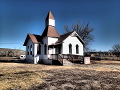 | Grace Lutheran Church of Barber | building | 1982 | 82003171 |
| Lavina School Historic District | district | 2023 | 100009087 | |
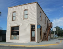 | Lavina State Bank | building | 2007 | 07001293 |
| Musselshell River Bridge | structure | 2025 | 100012496 | |
| Sims-Garfield Ranch | building | 1980 | 80002419 | |
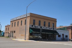 | Slayton Mercantile Co. | building | 2000 | 00001567 |
Every wildfire the federal occurrence database records inside this county: 48 of them, burning about 13,526 acres. 20 started naturally and none was recorded as arson. Each settlement page carries the fires within five miles of it.
| Reported cause | Fires |
|---|---|
| Natural | 20 |
| Missing data/not specified/undetermined | 18 |
| Equipment and vehicle use | 6 |
| Power generation/transmission/distribution | 2 |
| Smoking | 1 |
| Recreation and ceremony | 1 |
The five largest, by the area the report gives. None of them was recorded as arson.
| Date | Cause | Size | Reported by | Name on the report |
|---|---|---|---|---|
| 30 August 2008 | Natural | 3,558 acres | Northeastern Land Office | GOLDEN VALLEY COMPLEX |
| 14 August 2012 | Missing data/not specified/undetermined | 2,939 acres | Northeastern Land Office | ANDERSON |
| 14 May 2001 | Natural | 2,900 acres | Miles City Field Office | TWIN COULE |
| 9 September 1994 | Natural | 870 acres | North Central Montana District | SO SNOWIES |
| 14 September 2020 | Power generation/transmission/distribution | 814 acres | Golden Valley County | MIDDLE |
| 13 July 2012 | Missing data/not specified/undetermined | 389 acres | Northeastern Land Office | SHERAUD |
| 7 August 2005 | Natural | 295 acres | Northeastern Land Office | not named |
| 19 July 2013 | Missing data/not specified/undetermined | 264 acres | North Central Montana District | TODD |
Every settlement page carries the fires within five miles of it - see the settlement index below.
The NOAA Storm Events Database holds 156 reports for this county, causing no deaths, no injuries and about $50,000 in recorded property damage. Each settlement page carries the reports that name it.
| Kind of event | Reports |
|---|---|
| Hail | 123 |
| Thunderstorm Wind | 14 |
| Flash Flood | 8 |
| Flood | 6 |
| Funnel Cloud | 4 |
| Heavy Rain | 1 |
The most serious of them, by death, then injury, then recorded damage. The accounts are quoted exactly as the forecast office filed them.
| When | Event | Place named | Harm | What the report says |
|---|---|---|---|---|
| May 2011 | Flood | Sahara | $50,000 | Persistent rainfall combined with snowmelt in the mountains resulted in significant flooding along the Musselshell River and its tributaries, including the Ryegate area. The Musselshell River at the gauge at Lavina crested at a record 14.04 feet on May 25th. Extensive lowland flooding resulted along the Musselshell River as well as its tributaries. As the water on the Musselshell rose quickly on the 24th, floodwaters quickly inundated Highway 12 east of Ryegate (Slayton Underpass) and at the height of the event, water was over Highway 12 in 3 different locations. Approximately 10 homes required evacuations due to the rapidly rising flood waters. One resident canoed in/out of their home for 2 weeks straight. Extensive flooding was reported in both Ryegate and Lavina where numerous homes and businesses were under water. A grocery store in Ryegate reported 3 feet of water both in and outside their business. Numerous roads were closed by floodwaters with many washing out. A bridge was also washed out east of Lavina. Flooding persisted into the month of June. Damage estimates were based only on individual assistance approvals through FEMA. No dollar amount was available for infrastructure losses. |
| June 2025 | Hail | Ryegate | - | Time estimated by radar for hail. |
| July 2025 | Hail | Franklin | - | Reported by spotter. |
| June 2023 | Flash Flood | Ryegate | - | Flash flooding was reported in the town of Ryegate. |
| June 2023 | Flash Flood | Lavina Arpt | - | Numerous homes were reported flooded. In addition, water was reported flowing down Main Street. |
| May 2020 | Hail | Franklin | - | The hail lasted for 20 minutes. |
| March 2019 | Flood | Belmont | - | Flooding occurred across much of the southeastern portion of the county. Granary, Pained Robe, Custer-Gultch, and Rothemay and Williams roads were washed out in many areas. Culverts were also washed out. |
| May 2017 | Thunderstorm Wind | Lavina Arpt | - | Thunderstorm winds toppled a 12 foot elm tree. |
| May 2017 | Thunderstorm Wind | Lavina Arpt | - | A very large Cottonwood tree was toppled. In addition, an alfalfa crop was destroyed by wind-driven hail. |
| March 2014 | Flood | Barber | - | County officials and the Montana Department of Transportation reported significant flooding of streams and low lying areas across the area. The combination of rapid snow melt and ice resulted in high water levels along the Musselshell River from Harlowton to Shawmut...Ryegate and Lavina. In addition, some county roads were reported to be impassable. |
| March 2014 | Flood | Wallum | - | County officials and the Montana Department of Transportation reported small stream and low land flooding. Numerous roads and some highways were reported to have water flowing across them. The Montana Department of Transportation reported that Secondary 300 South of Ryegate off Highway 12 was closed because the bridge had washed away from the road. |
| July 2013 | Thunderstorm Wind | Ryegate Arpt | - | Strong wind gusts were ahead of the approaching thunderstorm. |
| July 2013 | Thunderstorm Wind | Ryegate | - | A lot of marble size hail accompanied the winds. |
| July 2013 | Hail | Barber | - | Some windows were broken. |
| July 2013 | Thunderstorm Wind | Ryegate | - | Microburst winds estimated at speeds upwards of 75 mph occurred in the vicinity of Ryegate. The microburst was a quarter mile wide and a mile long with the majority of the damage occurring in the town of Ryegate. Several structures were impacted with mostly minor roof damage. Numerous trees were impacted as large tree limbs were downed and several large pine trees uprooted. |
| June 2011 | Hail | Ryegate Arpt | - | A rancher reported the loss of 180 head of cattle as a result of running off a 200ft cliff to escape the hail. |
| June 2011 | Flash Flood | Ryegate | - | A thunderstorm producing between 5.00 and 5.5 inches of rain resulted in flash flooding and flooded homes in Ryegate. |
| June 2011 | Flood | Wallum | - | High flows along the Musselshell River from receding floodwaters from May quickly returned to flood as more heavy rainfall moved through the region. Rainfall amounts of 2 to 4 inches fell across most of Golden Valley County during the 6th and 7th of June. This caused rapid water runoff and more flooding similar to what was experienced in May. County officials indicated flooding in the town of Ryegate and water on Highway 12 near Ryegate. There were reports of several homes being flooded. In addition, a rancher 10 miles southwest of Ryegate received 5 inches of rain which washed out roads and caused flash flooding. |
| June 2011 | Flood | Sahara | - | Very heavy rainfall combined with high elevation snowmelt the second half of May 2011 maintained some flooding into June along the Musselshell River. See May 2011 Storm Data publication for details regarding the significant flood impacts and damage estimates on this particular flood event. |
| June 2010 | Hail | Sahara | - | Hail covered the ground and a half an inch of rain fell. |
| June 2010 | Thunderstorm Wind | Ryegate Arpt | - | An estimated wind gust of 60 mph was reported 5 miles south of Ryegate. |
| July 2009 | Flash Flood | Wallum | - | Heavy rain resulted in six inches of water to flow over the road at mile marker 127 on Highway 12. In addition, water also flowed over the roads south of Harlowton with cars reported to have hydroplaned on Highway 191 south of Harlowton. |
| July 2009 | Flash Flood | Wallum | - | Flooding was reported along Highway 12 from Ryegate to about 6 miles west of Ryegate near Barber. Water was flowing over the highway in spots. The flooding persisted until about 11 pm. |
| June 2008 | Funnel Cloud | Ryegate Arpt | - | Two funnel clouds were reported five miles south of Ryegate. |
| June 2008 | Thunderstorm Wind | Belmont | - | Thunderstorm wind gusts were estimated at 60 mph 7 miles south of Lavina. |
| June 2008 | Thunderstorm Wind | Belmont | - | Wind gusts of 60 mph were estimated 7 miles south of Lavina. |
| May 2007 | Thunderstorm Wind | Ryegate | - | A mobile home was destroyed. |
| June 2007 | Hail | Ryegate | - | Windows were broken by golf ball size hail. |
| June 2007 | Hail | Belmont | - | Crop damage was reported along with windows broken on the west side of the house. Hail drifts were also inside the house. Spotter also reported damaged windshields and roof. Estimated wind gust was 60 mph. |
| May 2005 | Heavy Rain | Ryegate | - | 1.05 inches of rain in 24 hours |
| May 2005 | Funnel Cloud | Lavina | - | Strongly rotating wall cloud/mesocyclone noted by two observers near the Golden Valley/Musselshell County line 15 miles north of Lavina. The wall cloud extended as much as halfway down to the ground, but no tornado was reported. |
| July 2004 | Flash Flood | Ryegate | - | Flash flooding on a ranch 10-15 miles east-southeast of the Snowy Mountains took out fenches. |
| July 2001 | Hail | Ryegate | - | Broken windows on car and house. Funnel cloud also spotted. |
| July 2001 | Flash Flood | Ryegate | - | Water covered a 1 mile stretch of roadway |
| August 1999 | Funnel Cloud | Lavina | - | Funnel clouds were reported near Lavina. |
| August 1999 | Hail | Lavina | - | Baseball size hail reported. |
| August 1999 | Hail | Lavina | - | Golf ball size hail reported. |
| August 1999 | Hail | Lavina | - | Quarter size hail reported. |
| June 1999 | Thunderstorm Wind | Ryegate | - | Spotter estimated wind gust of 70 mph. Several large branches were downed in Ryegate. |
| June 1999 | Hail | Lavina | - | Spotter report of dime size hail. |
| June 1999 | Hail | Ryegate | - | Spotter report of dime size hail. |
| July 1998 | Thunderstorm Wind | Lavina | - | A spotter reported a 60 mph wind gust. |
| June 1995 | Hail | Ryegate | - | Two inch hail broke windows on a house and truck. |
| June 1995 | Hail | Lavina | - | Two inch hail broke windows on a house and truck. |
| June 1995 | Hail | Lavina | - | Two inch hail broke windows on a house and truck. |
| May 2023 | Hail | Lavina | - | no account filed |
| July 2022 | Hail | Franklin | - | no account filed |
| July 2021 | Hail | Lavina Arpt | - | no account filed |
| July 2021 | Hail | Lavina | - | no account filed |
| May 2020 | Hail | Franklin | - | no account filed |
| May 2020 | Hail | Ryegate Arpt | - | no account filed |
| May 2020 | Hail | Ryegate | - | no account filed |
| May 2020 | Hail | Lavina Arpt | - | no account filed |
| July 2020 | Thunderstorm Wind | Belmont | - | no account filed |
| July 2020 | Hail | Barber | - | no account filed |
| July 2020 | Hail | Belmont | - | no account filed |
| July 2019 | Hail | Barber | - | no account filed |
| July 2019 | Hail | Ryegate | - | no account filed |
| July 2019 | Hail | Ryegate | - | no account filed |
| July 2019 | Hail | Franklin | - | no account filed |
The Survey's mineral resources record lists 3 workings inside this county. None of them still produces: all are closed or unrecorded. Each settlement page carries the workings within five miles of it.
| Commodity | Workings |
|---|---|
| Clay | 2 |
| Copper | 1 |
The least common of them first, because a county's hundredth gravel pit says nothing its first ten did not.
| Where | Site | Commodity | Status | Recorded |
|---|---|---|---|---|
| Uncle Sam | Copper | Prospect | ||
| Cade Ranch | Clay | Occurrence | ||
| Minnemann Ranch | Clay | Occurrence |
Named settlements recorded in the Geographic Names Information System, each with the topographic sheets covering it. Villages, hamlets and abandoned places alike. Each is shown with the nearest named watercourse or landform and the survey quadrangle it falls on.
Ryegate census division · 59074 · Deadmans Basin Reservoir quadrangle
11 sheets, 1889 to 1993
Ryegate census division · 59046 · On Ninemile Creek · Cushman quadrangle
11 sheets, 1889 to 1993
Ryegate census division · 59074 · Ryegate West quadrangle
11 sheets, 1889 to 1993
No longer a settlement
Lavina census division · 59046 · Emory School quadrangle
6 sheets, 1954 to 1993
No longer a settlement
Ryegate census division · 59074 · Ryegate West quadrangle
11 sheets, 1889 to 1993
Lavina census division · 59046 · On Big Coulee Creek · Lavina quadrangle
6 sheets, 1954 to 1979
Lavina census division · 59046 · Patterson Canyon quadrangle
12 sheets, 1889 to 1995
No longer a settlement
Ryegate census division · 59074 · Locomotive Butte quadrangle
11 sheets, 1889 to 1993
No longer a settlement
Ryegate census division · 59046 · On Ninemile Creek · Cushman quadrangle
11 sheets, 1889 to 1993
No longer a settlement
The vanished settlements of Golden Valley County: the places named above that are no longer on the map.