 Block
From the record
6 National Register listings published here.
Sources: the National Register database, National Park Service
80 topographic sheets cover 34 settlements here, and 6 properties are on the National Register of Historic Places.
6 National Register listings published here.
Sources: the National Register database, National Park Service
Every property in this county listed on the National Register of Historic Places, with the year it was listed and the federal nomination document.
| Photograph | Property | Type | Listed | Reference |
|---|---|---|---|---|
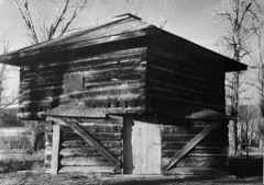 | Fort Logan and Blockhouse | site | 1970 | 70000360 |
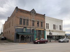 | Parberry Block East | building | 2009 | 09000237 |
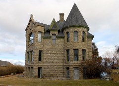 | Byron R. Sherman House | building | 1977 | 77000820 |
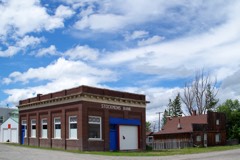 | Stockmen's Bank of Martinsdale | building | 2013 | 13000224 |
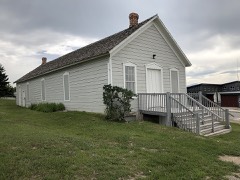 | Union League of America Hall | building | 1998 | 98001084 |
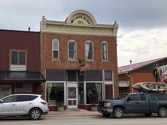 | Wellman Block | building | 1994 | 94000140 |
Every wildfire the federal occurrence database records inside this county: 330 of them, burning about 29,499 acres. 260 started naturally and 4 were recorded as arson. Each settlement page carries the fires within five miles of it.
| Reported cause | Fires |
|---|---|
| Natural | 260 |
| Recreation and ceremony | 18 |
| Equipment and vehicle use | 18 |
| Missing data/not specified/undetermined | 14 |
| Power generation/transmission/distribution | 7 |
| Debris and open burning | 5 |
| Smoking | 4 |
| Arson/incendiarism | 4 |
The five largest, by the area the report gives. None of them was recorded as arson.
| Date | Cause | Size | Reported by | Name on the report |
|---|---|---|---|---|
| 21 July 2017 | Debris and open burning | 7,090 acres | Central Land Office | CHINN |
| 10 September 2017 | Natural | 5,351 acres | Helena - Lewis and Clark National Forest | BLACKTAIL |
| 12 August 1996 | Equipment and vehicle use | 3,500 acres | Helena - Lewis and Clark National Forest | COYOTE |
| 3 September 2001 | Missing data/not specified/undetermined | 2,338 acres | Helena - Lewis and Clark National Forest | LOST FORK |
| 13 August 2003 | Natural | 2,106 acres | Helena - Lewis and Clark National Forest | ANT PARK |
| 9 September 1994 | Natural | 1,440 acres | Custer Gallatin National Forest | SMITH CREEK |
| 9 September 1994 | Missing data/not specified/undetermined | 1,390 acres | Central Land Office | 9-MILE-Y |
| 22 August 2003 | Equipment and vehicle use | 1,171 acres | Central Land Office | HAY FIELD |
Every settlement page carries the fires within five miles of it - see the settlement index below.
The NOAA Storm Events Database holds 87 reports for this county, causing no deaths, no injuries and about $75,000 in recorded property damage. Each settlement page carries the reports that name it.
| Kind of event | Reports |
|---|---|
| Hail | 45 |
| Thunderstorm Wind | 22 |
| Heavy Rain | 9 |
| Flood | 4 |
| Tornado | 3 |
| Flash Flood | 2 |
| Wildfire | 1 |
| Funnel Cloud | 1 |
The most serious of them, by death, then injury, then recorded damage. The accounts are quoted exactly as the forecast office filed them.
| When | Event | Place named | Harm | What the report says |
|---|---|---|---|---|
| July 2000 | Thunderstorm Wind | Ringling | $50,000 | Wind gust to 80kt...hail 1 inch...funnel cloud. |
| July 2000 | Thunderstorm Wind | Martinsdale | $25,000 | Wind gust to 80kt...hail 1.75 inches. |
| June 2025 | Thunderstorm Wind | White Sulphur Spgs | - | Mesonet station NCRM8 Newlan Creek RAWS. Time of gust is estimated using radar given the site reports a peak gust one time per hour. |
| June 2024 | Hail | Delpine | - | Hail up to half dollar sized at Showdown Ski Area. |
| June 2023 | Flash Flood | White Sulphur Spgs | - | Meagher County Sheriff's office reported that a portion of Highway 360 west of White Sulphur Springs was closed due to flooding on the roadways. |
| July 2023 | Thunderstorm Wind | Calkins | - | Measured via station MtDPC Deep Creek. |
| June 2022 | Heavy Rain | Ft Logan | - | Tt407 Firelab qd no. 2. |
| August 2022 | Hail | Delpine | - | Most hail was dime sized, with several quarter sized stones mixed in. |
| July 2022 | Heavy Rain | White Sulphur Spgs | - | Mesonet station measured 1.13 inches of heavy rainfall. |
| July 2022 | Heavy Rain | Ft Logan | - | Mesonet station stcm8 stringer creek - snotel station elevation. |
| July 2020 | Thunderstorm Wind | White Sulphur Spgs | - | Mesonet station K7S6 3.6 S White Sulphur Springs reported a thunderstorm wind gust of 53 kts (61 mph). |
| July 2020 | Hail | Ringling | - | Post Office reported ping pong ball size (1.5 inch diameter) hail. |
| July 2020 | Hail | Martinsdale | - | Member of public reported ping pong ball size (1.5 inch diameter) via Facebook. |
| August 2020 | Thunderstorm Wind | Ringling | - | Mesonet station mtdpc deep creek US-12 (mt dot). |
| May 2019 | Flood | Martinsdale | - | Meagher County Sheriff closed US-12 between Martinsdale and Two Dot Highway because of floodwater across the roadway. Floodwater was up to 4-feet deep. Exact duration of flooding unknown. |
| June 2019 | Thunderstorm Wind | White Slphr Spgs Arp | - | Report from 4 S White Sulphur Springs. Mesonet Station K7S6 White Sulphur Springs Airport. |
| August 2019 | Heavy Rain | White Sulphur Spgs | - | A trained spotter reported 1 inch of rainfall in 20 minutes. |
| August 2019 | Hail | Martinsdale | - | A trained spotter reported hail size of 1 inch in diameter. Also, hail cracked a windshield on a side by side and stripped most of the leaves from an aspen grove. the hail started as sporadic large stones but then smaller stones fell for over 20 minutes. |
| August 2019 | Heavy Rain | Martinsdale | - | A trained spotter reported 1.3 inches of rain for a storm total. |
| July 2019 | Hail | White Sulphur Spgs | - | Meagher County DES reported quarter to half dollar sized hail. |
| July 2019 | Hail | White Sulphur Spgs | - | Hail reported ranged from quarter to ping pong ball size. The spotter provided a photo of the hail stones. |
| June 2018 | Thunderstorm Wind | White Sulphur Spgs | - | White Sulphur Springs Airport AWOS recorded 59-mph peak gust from collapsing thunderstorm. |
| June 2015 | Flood | Delpine | - | Flooding in Northeastern Meagher County damaged a county road, fences and an irrigation pivot. |
| June 2015 | Heavy Rain | White Sulphur Spgs | - | A measurement of 2.11 inches of rain reported at Porphyry Peak RAWS site in the Little Belt Mountains. |
| June 2015 | Thunderstorm Wind | Calkins | - | A wind gust of 64 MPH was measure at the DOT sensor along Highway 12. |
| June 2015 | Flash Flood | White Slphr Spgs Arp | - | Debris flow over Four Mile Road has blocked the roadway. Location is just north of hte Grasshopper camp ground. |
| June 2015 | Heavy Rain | White Sulphur Spgs | - | ASOS reported 1.80 inches of rain over two hours. |
| August 2014 | Heavy Rain | White Sulphur Spgs | - | Heavy rain, measuring 0.96 inches, was reported. |
| August 2014 | Heavy Rain | Lingshire | - | Heavy rain, measuring 2.32 inches storm total, was reported. |
| June 2013 | Funnel Cloud | White Sulphur Spgs | - | Funnel cloud reported extending about 3/4 of the way from cloud base towards ground. Funnel dissipated after a few minutes. |
| September 2013 | Thunderstorm Wind | Martinsdale | - | Strong winds measuring 54KT (64MPH) were reported. |
| July 2013 | Hail | White Sulphur Spgs | - | Hail measuring 1.00 inches (quarter sized) was reported 8 mi W of White Sulphur Springs, MT. |
| July 2013 | Hail | Ringling | - | Hail measuring 1.00 inches (quarter sized) was reported 12 mi ENE of Ringling, MT. |
| June 2012 | Tornado (EF1) | White Sulphur Spgs | - | Tornado damage included a water tower at the water treatment facility that was almost completely destroyed. Additional buildings at the treatment facility were also severely damaged. Several homes and numerous trees were also damaged. |
| May 2011 | Flood | Ringling | - | Flooding occurred on Spring Creek Road. |
| June 2011 | Flood | Ringling | - | Flooding continued to affect area roads and communities until water receded to more normal levels. |
| August 2009 | Hail | White Sulphur Spgs | - | A thunderstorm dropped 1.75 inch diameter hail at White Sulphur Springs 20 WNW. |
| August 2009 | Thunderstorm Wind | White Sulphur Spgs | - | A thunderstorm downed several large trees across Montana Highway 89 south of Kings Hill. An estimated 80 trees were either uprooted or snapped off by estimated 60 mph downburst winds. |
| August 2009 | Hail | White Sulphur Spgs | - | A severe thunderstorm dropped 1.75 inch diameter hail at White Sulphur Springs 20WNW. |
| July 2009 | Hail | Ringling | - | A severe thunderstorm dropped 1 inch diameter hail at Ringling 12ENE. |
| July 2009 | Thunderstorm Wind | White Sulphur Spgs | - | A thunderstorm produced a wind gust to 61 mph at White Sulphur Springs 40NW. |
| July 2009 | Hail | White Sulphur Spgs | - | A thunderstorm dropped 1 inch diameter hail at White Sulphur Springs 33WNW. |
| July 2008 | Hail | Lennep | - | A severe thunderstorm dropped 1 inch diameter hail at Lennep 4NNW. |
| June 2007 | Hail | Lingshire | - | A severe thunderstorm dropped 2.50 inch diameter hail at Millegan 14SSE. |
| June 2007 | Hail | White Sulphur Spgs | - | A severe thunderstorm dropped .88 inch diameter hail at White Sulphur Springs 35NNW. |
| July 2002 | Hail | White Sulphur Spgs | - | A severe thunderstorm produced 1.00 inch hail at White Sulphur Springs 22 NE. |
| July 2002 | Thunderstorm Wind | White Slphr Spgs Arp | - | A severe thunderstorm produced a 75 mph wind gust at White Sulphur Springs. |
| June 2002 | Hail | White Sulphur Spgs | - | A severe thunderstorm produced 0.75 inch hail over the far northeastern section of Meagher County. |
| July 2002 | Hail | White Slphr Spgs Arp | - | A severe thunderstorm produced 1.75 inch hail at White Sulphur Springs 33NW. |
| July 2002 | Hail | White Slphr Spgs Arp | - | A severe thunderstorm produced 1.75 inch hail at White Sulphur Springs 27NW. |
| August 2002 | Hail | Ft Logan | - | A severe thunderstorm produced 0.75 inch hail in Fort Logan. |
| August 2002 | Hail | Lennep | - | A severe thunderstorm produced 0.88 inch hail at Lennep 6SW. |
| July 2001 | Hail | White Sulphur Spgs | - | Actual spotter location White Sulphur Springs 33 NW. |
| August 2001 | Thunderstorm Wind | White Sulphur Spgs | - | Actual event location White Sulphur Springs 22 NW...Estimated 52 kt winds damaged window screens by tearing them out of windows. |
| July 2001 | Thunderstorm Wind | White Sulphur Spgs | - | Actual event location White Sulphur Springs 18 NW. |
| July 2001 | Hail | Ringling | - | Reported by general public in Ringling...1 inch hail also reported by general public 3 SW of Ringling (also at 1645 MST). |
| July 2001 | Hail | Martinsdale | - | Actual event location Martinsdale 10 N...Slight damage to automobiles (monetary amount of damage unknown). |
| July 2001 | Hail | Martinsdale | - | Reported by spotter in Martinsdale. |
| August 2006 | Hail | Martinsdale | - | no account filed |
| June 2005 | Hail | Lennep | - | no account filed |
The Survey's mineral resources record lists 142 workings inside this county. 6 still produce and 136 are closed or unrecorded. Each settlement page carries the workings within five miles of it.
| Commodity | Workings |
|---|---|
| Gold | 34 |
| Lead | 27 |
| Pumice | 23 |
| Silver | 21 |
| Copper | 18 |
| Iron | 10 |
| Manganese | 7 |
| Zinc | 4 |
| Silver, Gold | 2 |
| Copper, Cobalt | 2 |
| Lead, Silver | 2 |
| Iron, Lead, Manganese, Silver | 2 |
| Manganese, Silver | 2 |
| Silver, Iron, Copper | 2 |
The least common of them first, because a county's hundredth gravel pit says nothing its first ten did not.
| Where | Site | Commodity | Status | Recorded |
|---|---|---|---|---|
| Alabama-Cleveland Mine | Silver, Zinc, Manganese, Lead | Prospect | 1888, 1917 | |
| Big Hat Lode | Gold, Silver | Occurrence | 1926 | |
| Blackhawk-Alice Property | Silver, Lead, Iron, Manganese | Past Producer | 1896 | |
| Broadway | Silver, Manganese, Lead, Iron | Prospect | 1900 | |
| Castle Mountain | Lead, Silver, Gold, Zinc, Copper, Manganese | Past Producer | 1864, 1888, 1961 | |
| Castle Mtn | Gold, Silver, Lead, Copper, Zinc, Manganese | Producer | Contact Metamorphic | |
| Cumberland Mine | Silver, Lead, Copper, Zinc | Past Producer | 1886, 1888 | |
| Etta Claim | Iron, Silver | Prospect | 1888 | |
| Hidden Treasure Claim | Lead, Silver, Manganese | Prospect | ||
| Iron Chief | Manganese, Lead, Iron, Silver | Past Producer | 1888, 1890 | |
| Iron-Titanium Occurrence | REE, Iron, Titanium | Occurrence | ||
| Jack Pine | Gold, Silver, Copper | Past Producer | ||
| King Group | Lead, Gold, Copper, Silver | Past Producer | ||
| Lynn Mine | Lead, Silver, Zinc | Past Producer | ||
| Maybe Mine | Gold, Zinc, Silver, Lead, Copper | Occurrence | ||
| Mcdaniel Copper Group | Copper, Silver, Lead, Barium-Barite | Prospect | ||
| White Sulphur Springs | Geothermal | Producer | ||
| Willow Creek Deposit | Silver, Titanium, Manganese, Iron, Gold | Past Producer | 1915, 1920 | |
| Yellowstone Mine | Lead, Zinc, Silver, Gold | Past Producer | 1886 | |
| Anna Lode | Silver, Gold | Occurrence | Vein | |
| Belle-Of-The-Castle | Silver, Iron, Copper | Past Producer | 1935, 1939 | |
| California | Iron, Lead, Manganese, Silver | Past Producer | 1889 | |
| Elsie Lode | Silver, Gold | Occurrence | 1929 | |
| Great Eastern & Great Western | Lead, Manganese, Silver | Unknown | ||
| Judge Mine | Lead, Silver | Past Producer | 1891 | |
| Jumbo Mine | Lead, Silver, Zinc | Past Producer | 1886 | |
| Legal Tender | Lead, Manganese, Silver | Prospect | ||
| Manger Gypsum | Gypsum-Anhydrite | Unknown | ||
| Merrimac | Iron, Lead, Manganese, Silver | Past Producer | 1889, 1892 | |
| Queen-Hensley Mine | Silver, Iron, Copper | Past Producer | 1900, 1902 | |
| Sheep Creek | Copper, Cobalt | Occurrence | Massive sulfide, Besshi | |
| Sheep Creek Deposit | Copper, Cobalt, Silver | Prospect | 1985 | |
| Smith River Gypsum | Gypsum-Anhydrite | Unknown | ||
| Spring Creek | Limestone, General | Unknown | ||
| Unname Limestone | Limestone, General | Unknown | ||
| Castle Lead | Lead, Zinc | Unknown | ||
| Copper State Mine | Lead, Zinc | Past Producer | ||
| Yellowstone Mine | Lead, Zinc | Past Producer | ||
| Alice Mine | Iron, Manganese | Prospect | ||
| Little Belt Mine | Manganese | Occurrence | ||
| Maxine Mine | Manganese | Past Producer | ||
| Songster | Manganese | Prospect | ||
| Victory | Manganese | Past Producer | ||
| White Sulphur Springs Manganese | Manganese | Prospect | ||
| William Hendrix Property | Manganese | Unknown | ||
| Camas Creek Pyroxenite Stock | Iron | Occurrence | 1966 | |
| Golden Eagle | Copper, Iron | Prospect | ||
| Iron Butte Mine | Iron | Producer | 1870, 1975 | |
| Iron Cliff | Iron | Occurrence | ||
| Parnell-Board-Of-Trade | Iron | Prospect | ||
| Placer Creek Deposit | Iron | Occurrence | ||
| Sheep Creek Iron | Iron | Producer | 1870, 1975 | |
| Twentieth Century Claim | Iron | Prospect | ||
| Whittaker 1901 Claim | Iron | Prospect | ||
| Biesel Mine | Copper | Occurrence | ||
| Bourbon | Gold, Copper | Unknown | ||
| Calumet-Jamison Hecla | Lead, Copper | Prospect | ||
| Clara Barton | Copper | Unknown | ||
| Copper Duke | Copper | Unknown | ||
| Copper Glance | Copper | Past Producer | ||
| Copper Queen | Copper | Past Producer | ||
| Copperopolis | Copper, Silver | Unknown | ||
| Milwaukee Mine | Silver, Copper | Prospect | ||
| Montana Copper Prospect | Copper | Unknown | ||
| Montcana Group | Copper | Prospect | ||
| New Deal & Jumbo Mines | Copper | Unknown | ||
| Stewart & Battle Creek | Copper | Unknown | ||
| Top Lode | Copper, Gold | Prospect | ||
| Vandor | Lead, Copper | Past Producer | ||
| Voss | Copper | Occurrence | ||
| Voss Mine | Copper | Prospect | ||
| American | Silver | Past Producer | ||
| Anna Lode | Silver, Gold | Unknown | ||
| Antelope | Silver | Prospect | ||
| Big Hat Lode | Gold, Silver | Unknown | ||
| Camp Robber Mine | Gold, Silver | Past Producer | ||
| Cumberland Mine | Lead, Silver | Past Producer | ||
| Excelsior Claim | Lead, Silver | Prospect | ||
| Felix Cexent | Lead, Silver | Unknown | ||
| Homestake Mine | Lead, Silver | Past Producer | ||
| Judge Mine | Lead, Silver | Past Producer | ||
| Jumbo Mine | Lead, Silver | Unknown | ||
| Lucky Dollar Mine | Lead, Silver | Past Producer | ||
| Powderly | Lead, Silver | Unknown | ||
| Princess | Lead, Silver | Past Producer | ||
| Silver Spoon | Lead, Silver | Prospect | ||
| Silver Star | Lead, Silver | Unknown | ||
| Solid Silver | Lead, Silver | Occurrence | ||
| Yellowstone Mine | Lead, Silver | Past Producer | ||
| Unnamed | Pumice | Occurrence | ||
| Unnamed Pumice | Pumice | Occurrence | ||
| Unnamed Pumice | Pumice | Occurrence | ||
| Unnamed Pumice | Pumice | Occurrence | ||
| Unnamed Pumice | Pumice | Occurrence | ||
| Unnamed Pumice | Pumice | Occurrence | ||
| Unnamed Pumice | Pumice | Occurrence | ||
| Unnamed Pumice | Pumice | Occurrence | ||
| Unnamed Pumice | Pumice | Occurrence | ||
| Unnamed Pumice | Pumice | Occurrence | ||
| Unnamed Pumice | Pumice | Occurrence | ||
| Unnamed Pumice | Pumice | Occurrence | ||
| Unnamed Pumice | Pumice | Occurrence | ||
| Unnamed Pumice | Pumice | Occurrence | ||
| Unnamed Pumice | Pumice | Occurrence | ||
| Unnamed Pumice | Pumice | Occurrence | ||
| Unnamed Pumice | Pumice | Occurrence | ||
| Unnamed Pumice | Pumice | Occurrence | ||
| Unnamed Pumice | Pumice | Occurrence | ||
| Unnamed Pumice | Pumice | Occurrence | ||
| Unnamed Pumice | Pumice | Occurrence | ||
| Unnamed Pumice | Pumice | Occurrence | ||
| Unnamed Pumice | Pumice | Occurrence | ||
| Black Butte Mine | Lead | Producer | ||
| Ducolin-Potter Prospect | Lead | Unknown | ||
| Grasshopper | Lead | Unknown | ||
| Skidoo | Lead | Past Producer | ||
| Atlanta Gulch | Gold | Occurrence | ||
| Beaver Creek | Gold | Unknown | ||
| Benton Gulch and Vermont | Gold | Unknown | ||
| Bigler Group | Gold | Past Producer | ||
| Blue Jay Placer | Gold | Past Producer | ||
| Camas Creek | Gold | Unknown | ||
| Camp Robber Placer | Gold | Past Producer | ||
| Elk Creek | Gold | Unknown | ||
| Exchange Placer Mine | Gold | Past Producer | ||
| Fir Springs Placer | Gold | Prospect | 1961 | |
| Honeysett, Bluestreak & Triangle Cl | Gold | Unknown | ||
| Hungry Hollow Placer | Gold | Producer | ||
| Lark Placer | Gold | Past Producer | ||
| Last Chance Placer | Gold | Past Producer | ||
| Little Joe No 1 Mine | Gold | Occurrence | ||
| Mary Sue Placer | Gold | Prospect | ||
| Placer Creek | Gold | Unknown | ||
| Rader Mine | Gold | Past Producer | ||
| Rich-Mich Placer | Gold | Past Producer | ||
| Snowbank | Gold | Past Producer | ||
| Terrible Placer | Gold | Past Producer | ||
| Thomas Creek | Gold | Occurrence | ||
| Thompson Creek | Gold | Unknown | ||
| Tom Mcmillin | Gold | Past Producer | ||
| Tom Mcmillin | Gold | Past Producer | ||
| Vermont Gulch Placer | Gold | Past Producer |
Named settlements recorded in the Geographic Names Information System, each with the topographic sheets covering it. Villages, hamlets and abandoned places alike. Each is shown with the nearest named watercourse or landform and the survey quadrangle it falls on.
Martinsdale-Ringling census division · 59642 · Near Woodchuck Ridge · Rimrock Divide quadrangle
18 sheets, 1886 to 1995
Martinsdale-Ringling census division · 59642 · Ringling quadrangle
18 sheets, 1886 to 1993
Martinsdale-Ringling census division · On Dry Fork Musselshell River · Hamen quadrangle
19 sheets, 1886 to 1993
White Sulphur Springs census division · 59645 · On Gipsy Creek · Gipsy Lake quadrangle
14 sheets, 1886 to 2001
White Sulphur Springs census division · 59645 · On Cottonwood Creek · Catlin Spring quadrangle
16 sheets, 1886 to 1993
No longer a settlement
Martinsdale-Ringling census division · 59053 · On Castle Creek · Castle Town quadrangle
19 sheets, 1886 to 1995
Martinsdale-Ringling census division · 59053 · On Brooks Creek · Checkerboard quadrangle
17 sheets, 1886 to 1995
Martinsdale-Ringling census division · 59053 · Near Picnic Canyon · Mud Creek quadrangle
18 sheets, 1886 to 1997
No longer a settlement
Martinsdale-Ringling census division · 59642 · On Lost Creek · Ringling quadrangle
18 sheets, 1886 to 1993
White Sulphur Springs census division · 59645 · On Bonine Creek · Kings Hill quadrangle
21 sheets, 1886 to 1995
White Sulphur Springs census division · 59645 · Fort Logan quadrangle
14 sheets, 1886 to 1995
Martinsdale-Ringling census division · 59053 · On South Fork Musselshell River · Martinsdale quadrangle
16 sheets, 1886 to 1993
No longer a settlement
Martinsdale-Ringling census division · 59053 · On Cottonwood Creek · Groveland quadrangle
17 sheets, 1886 to 1995
Martinsdale-Ringling census division · 59642 · On Durst Creek · Hamen quadrangle
19 sheets, 1886 to 1993
Martinsdale-Ringling census division · 59642 · On Woodson Creek · Hamen quadrangle
19 sheets, 1886 to 1993
White Sulphur Springs census division · 59645 · On Woods Gulch Creek · Hanson Reservoir quadrangle
13 sheets, 1886 to 1975
No longer a settlement
Martinsdale-Ringling census division · 59053 · On Alabaugh Creek · Lennep quadrangle
17 sheets, 1886 to 1995
White Sulphur Springs census division · 59645 · On Antelope Creek · Lingshire quadrangle
15 sheets, 1886 to 2001
Martinsdale-Ringling census division · 59642 · On Sourdough Creek · Hamen quadrangle
19 sheets, 1886 to 1993
White Sulphur Springs census division · 59645 · Gipsy Lake quadrangle
14 sheets, 1886 to 2001
Martinsdale-Ringling census division · 59053 · Martinsdale quadrangle
16 sheets, 1886 to 1993
Martinsdale-Ringling census division · 59642 · On Agate Creek · Ringling quadrangle
18 sheets, 1886 to 1993
Martinsdale-Ringling census division · 59642 · On Meadow Creek · Ringling quadrangle
18 sheets, 1886 to 1993
White Sulphur Springs census division · 59645 · On Wry Creek · Watson quadrangle
14 sheets, 1886 to 2001
Martinsdale-Ringling census division · 59642 · On Lost Creek · Ringling quadrangle
18 sheets, 1886 to 1993
Martinsdale-Ringling census division · 59053 · On Hamilton Creek · Castle Town quadrangle
19 sheets, 1886 to 1995
Martinsdale-Ringling census division · 59645 · On Battle Creek · Sixteen quadrangle
18 sheets, 1886 to 1993
White Sulphur Springs census division · 59645 · Alkali Lake quadrangle
13 sheets, 1886 to 1976
Martinsdale-Ringling census division · 59642 · On Billy Creek · Wolf Hill quadrangle
17 sheets, 1886 to 1993
Martinsdale-Ringling census division · 59642 · Near Rees Hills · Wolf Hill quadrangle
17 sheets, 1886 to 1993
White Sulphur Springs census division · 59645 · Near Kentucky Gulch · Watson quadrangle
14 sheets, 1886 to 2001
White Sulphur Springs census division · 59645 · On Spring Creek · White Sulphur Springs quadrangle
17 sheets, 1886 to 1995
White Sulphur Springs census division · 59645 · On Adams Creek · Moose Mountain quadrangle
18 sheets, 1886 to 1995
The vanished settlements of Meagher County: the places named above that are no longer on the map.