 Block
From the record
19 National Register listings published here.
Sources: the National Register database, National Park Service
67 topographic sheets cover 31 settlements here, and 19 properties are on the National Register of Historic Places.
19 National Register listings published here.
Sources: the National Register database, National Park Service
Every property in this county listed on the National Register of Historic Places, with the year it was listed and the federal nomination document.
| Photograph | Property | Type | Listed | Reference |
|---|---|---|---|---|
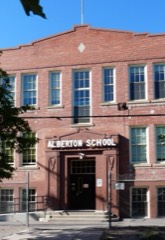 | Alberton School | building | 1997 | 96001599 |
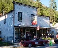 | Bestwick's Market | building | 1997 | 96001600 |
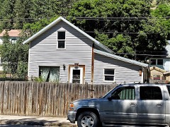 | Brinks House | building | 1997 | 96001601 |
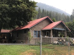 | Chadwick House | building | 1997 | 96001602 |
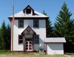 | DeBorgia Schoolhouse | building | 1979 | 79001405 |
| Gildersleeve Mine | district | 2002 | 02000723 | |
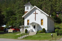 | Methodist Church of Alberton | building | 1997 | 96001604 |
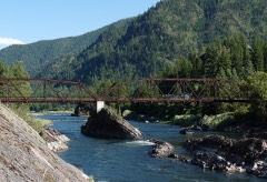 | Natural Pier Bridge | structure | 2010 | 09001182 |
| Point of Rocks Historic Transportaion Corridor | district | 2009 | 09000683 | |
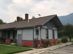 | Railroad Depot | building | 1997 | 96001603 |
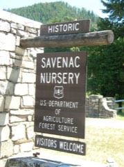 | Savenac Nursery Historic District | district | 1999 | 99000988 |
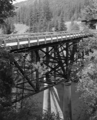 | Scenic Bridge | structure | 2010 | 09001183 |
| St. Regis Airway Beacon | structure | 2021 | 100007145 | |
| St. Regis Airway Beacon | structure | 2021 | 100007145 | |
| St. Regis Airway Beacon | structure | 2021 | 100007145 | |
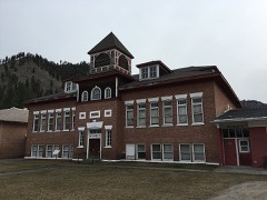 | Superior School | building | 1997 | 97000253 |
| Swanson Homestead | district | 2022 | 100008425 | |
| Thorn House | building | 1997 | 96001605 | |
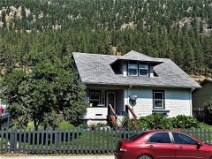 | Wilson House | building | 1997 | 96001606 |
Every wildfire the federal occurrence database records inside this county: 1,510 of them, burning about 119,922 acres. 934 started naturally and 12 were recorded as arson. Each settlement page carries the fires within five miles of it.
| Reported cause | Fires |
|---|---|
| Natural | 934 |
| Missing data/not specified/undetermined | 147 |
| Debris and open burning | 122 |
| Recreation and ceremony | 117 |
| Equipment and vehicle use | 57 |
| Railroad operations and maintenance | 49 |
| Power generation/transmission/distribution | 29 |
| Smoking | 15 |
| Fireworks | 14 |
| Arson/incendiarism | 12 |
| Misuse of fire by a minor | 8 |
| Other causes | 6 |
The five largest, by the area the report gives. None of them was recorded as arson.
| Date | Cause | Size | Reported by | Name on the report |
|---|---|---|---|---|
| 10 August 2003 | Natural | 33,948 acres | Lolo National Forest | THOMPSON CREEK |
| 16 July 2017 | Natural | 26,310 acres | Lolo National Forest | SUNRISE |
| 14 August 2015 | Natural | 13,351 acres | Lolo National Forest | WEST FORK FISH CREEK |
| 3 August 2000 | Natural | 10,000 acres | Lolo National Forest | FLAT FIRE |
| 4 August 2005 | Missing data/not specified/undetermined | 9,082 acres | Lolo National Forest | TARKIO |
| 14 July 2013 | Missing data/not specified/undetermined | 6,282 acres | Lolo National Forest | WEST MULLAN |
| 11 August 2000 | Natural | 5,730 acres | Lolo National Forest | LANDOWNER MNT |
| 6 August 2005 | Natural | 3,200 acres | Lolo National Forest | PROSPECT |
Every settlement page carries the fires within five miles of it - see the settlement index below.
The NOAA Storm Events Database holds 41 reports for this county, causing no deaths, 1 injury and about $4,408,000 in recorded property damage. Each settlement page carries the reports that name it.
| Kind of event | Reports |
|---|---|
| Thunderstorm Wind | 17 |
| Hail | 14 |
| Heavy Rain | 4 |
| Flood | 3 |
| Wildfire | 2 |
| Flash Flood | 1 |
The most serious of them, by death, then injury, then recorded damage. The accounts are quoted exactly as the forecast office filed them.
| When | Event | Place named | Harm | What the report says |
|---|---|---|---|---|
| July 2002 | Thunderstorm Wind | St Regis | 1 hurt, $360,000 | no account filed |
| December 2025 | Flood | Lookout | $4,000,000 | Heavy rain in the mountains caused flooding and significant erosion of forest service roads in western Mineral County. In the Superior Ranger District, the Deer Creek Bridge was compromised as the St. Regis River eroded the north bank, severely damaging the surrounding roadbed. Further west, reports from the Ward Creek drainage (National Forest Service Road 889) confirmed a complete washout, forcing the closure of a 7-mile stretch from Milepost 4.5 to 11.9. A hunter driving out of the mountains along Big Creek reported driving through feet of water at times and encountering falling trees that blocked the road. A plugged pipe at Milepost 1.5 up the East Fork of Big Creek caused the road to be completely covered with rock and debris. |
| June 2016 | Hail | Saltese | $20,000 | A business in Saltese, MT reported quarter or larger size hail. Winds blew down some tree limbs, and the hail dented cars. The worst part of the storm lasted about 15 minutes. |
| May 2018 | Thunderstorm Wind | Alberton | $15,000 | Strong winds caused several Ponderosa pine trees to be uprooted. These trees damaged a well house and an all-terrain vehicle. |
| July 2024 | Thunderstorm Wind | Rivulet | $5,000 | Frenchtown Rural Fire District rpeorted a structure fire after a pine tree crashed onto a power line in Alberton, causing the lines to arc. The Mineral County Disaster and Emergency Services reported that its phone lines were down. The severe winds of the derecho clipped the southeastern third of Mineral County. |
| June 2021 | Thunderstorm Wind | Cobden | $5,000 | Outflow winds from nearby thunderstorms knocked down 20 to 25 mature trees and blew siding off an outbuilding. |
| August 2015 | Thunderstorm Wind | Borax | $2,000 | A strong thunderstorm unleashed a small microburst that caused hundreds of trees to either snap in half or blow over at the Denna Mora Rest Area on Interstate 90 east of Lookout Pass. Two large fir and spruce trees with diameters up to 3 feet wide fell onto the eastbound lanes just to the northwest of the rest area obstructing the road at night. Approximately an hour later around 10 pm MDT, several vehicles hit the trees causing car damage, injuries and one fatality. A 21 year old male died after his vehicle collided with the topmost of the crisscrossed trees. |
| May 2015 | Hail | Bryson | $1,000 | An NWS Employee experienced torrential rainfall and 0.50 inch hail while driving on I-90. The hail lasted 5 min, and rain rates were so high cars on the 75 mph interstate slowed to around 25 mph for a few minutes due to reduced visibility. A nearby RAWS weather station reported 0.55 inches of rain from the storm shortly before it crossed I-90. |
| August 2019 | Hail | St Regis | - | Besides the golf ball-sized hail, the storm produced torrential rain which caused motorists to pull off to the side of Interstate 90. |
| August 2019 | Hail | St Regis | - | Two different reports of golf ball-sized hail in the St. Regis area. |
| March 2017 | Flood | St Regis | - | The St. Regis River at St. Regis peaked at the minor flood stage of 8.06 feet. |
| February 2017 | Heavy Rain | St Regis | - | Ponding water up to 3 feet deep near Saltese, MT on I-90 lead the Montana Dept. of Transportation to close the roadway for much of the day. Antecedent heavy low-elevation snow allowed for this event, as water was unable to drain off the sides of the road. After plows cut breaks in the snow berms, ponding decreased. Roads were reopened during the evening. |
| May 2015 | Hail | Southern Cross | - | A trained spotter reported mostly 0.50 inch to 0.75 inch hail, with a few nickel-sized hailstones (0.88 in). Winds were estimated to be gusting at 50 mph with the storm's passage. |
| May 2015 | Heavy Rain | St Regis | - | The Montana Mesonet weather station near St. Regis reported 0.80 inches of rain in one hour, from 2:02pm to 3:02pm local time. |
| May 2015 | Hail | Superior | - | A trained spotter reported penny-sized hail in Superior, with 0.50 inches of rain falling in 30 min. Winds estimated at 40 to 50 mph accompanied this report. |
| February 2015 | Heavy Rain | Henderson | - | Heavy rain caused a rockslide on February 7th that closed the westbound lanes of I-90 west of St Regis, MT. Several hundred small rocks and boulders had to be cleared from the road surface. No accidents were reported. Westbound lanes were closed for 2 days as traffic was forced to divert to the north via MT Hwy 135 and MT Hwy 200, thus increasing travel distance. By the afternoon of Feb 9th, one lane, two-way traffic had been set-up, ending the interstate re-route. |
| August 2014 | Flash Flood | Superior | - | Debris flows were reported in Club Gulch in Flat Creek, Pardee Creek and at Shaw Gulch with moderate road damage. |
| August 2013 | Thunderstorm Wind | Foraker | - | The Camels Hump lookout reported a measured wind gust to 58 mph during the early morning hours of August 26th. |
| June 2007 | Thunderstorm Wind | Alberton | - | Thunderstorm winds blew down 3 to 4 large trees. The trees had diameters estimated to be between 1 and 3 feet along the Oregon Lakes Trail. |
| June 2007 | Thunderstorm Wind | Superior | - | Thunderstorm winds were reported to have blown down several trees and large limbs down along Quartz-Lozeau road. |
| June 2007 | Thunderstorm Wind | Superior | - | Severe Thunderstorm downdraft winds blew several large trees down 5 miles west of Superior. |
| July 2007 | Hail | Tarkio | - | Golf ball size hail was reported to KECI TV Meteorologist from a weather spotter in Tarkio. |
| August 2006 | Thunderstorm Wind | Alberton | - | A tree was reported down over I-90. |
| August 2006 | Thunderstorm Wind | Superior | - | Two trees blew over onto a house. |
| July 1998 | Hail | Superior | - | Hail to 1.75 inches in diameter fell in a thunderstorm |
| June 2006 | Hail | Superior | - | no account filed |
| July 2006 | Hail | Haugan | - | no account filed |
| June 2006 | Hail | Alberton | - | no account filed |
| August 2006 | Thunderstorm Wind | Alberton | - | no account filed |
| June 2004 | Heavy Rain | Lookout | - | no account filed |
| August 2004 | Thunderstorm Wind | Superior | - | no account filed |
| August 2003 | Wildfire | Alberton | - | no account filed |
| August 2003 | Thunderstorm Wind | Deborgia | - | no account filed |
| August 2003 | Wildfire | Superior | - | no account filed |
| April 2002 | Flood | Superior | - | no account filed |
| August 1998 | Hail | Superior | - | no account filed |
| May 1997 | Thunderstorm Wind | Superior | - | no account filed |
| June 1992 | Hail | not stated | - | no account filed |
| April 1987 | Thunderstorm Wind | not stated | - | no account filed |
| June 1987 | Thunderstorm Wind | not stated | - | no account filed |
| July 1970 | Hail | not stated | - | no account filed |
The Survey's mineral resources record lists 261 workings inside this county. 26 still produce and 235 are closed or unrecorded. Each settlement page carries the workings within five miles of it.
| Commodity | Workings |
|---|---|
| Gold | 107 |
| Copper | 32 |
| Lead | 26 |
| Silver | 25 |
| Fluorine-Fluorite | 10 |
| Lead, Zinc | 9 |
| Lead, Silver | 8 |
| Barium-Barite | 7 |
| Copper, Lead | 6 |
| Uranium | 5 |
| Zinc, Copper | 4 |
| Silver, Gold | 4 |
| Silver, Copper | 4 |
| Zinc, Lead | 4 |
The least common of them first, because a county's hundredth gravel pit says nothing its first ten did not.
| Where | Site | Commodity | Status | Recorded |
|---|---|---|---|---|
| Amazon - Dixie Mine | Copper, Lead, Zinc, Silver, Gold | Past Producer | Gold, Silver | |
| American Gold Mine | Gold, Silver, Lead | Occurrence | Underground | |
| Bonanza Group | Gold, Barium-Barite, Copper, Lead, Silver | Past Producer | ||
| Bonanza Group Mine | Gold, Silver, Copper, Barium-Barite, Lead | Prospect | 1955 | |
| Coffee Pot Lode | Beryllium, Gemstone | Past Producer | ||
| Copper Rock Mine | Lead, Silver, Zinc, Copper | Occurrence | ||
| East Coeur D'Alene Silver | Copper, Lead, Silver, Zinc | Unknown | ||
| Gildersleeve Mine | Copper, Lead, Gold, Silver | Past Producer | ||
| Gildersleeve Mine | Gold, Silver, Lead, Copper, Barium-Barite | Past Producer | ||
| Hemlock Mine | Copper, Silver, Lead, Gold | Past Producer | ||
| Hoodoo Property | Lead, Zinc, Copper, Silver | Occurrence | ||
| Iron Mountain | Zinc, Silver, Lead | Past Producer | ||
| Iron Mountain Mine | Copper, Zinc, Gold, Lead, Silver, Antimony | Past Producer | 1889 | |
| Iron Mtn. | Lead, Zinc, Silver, Copper | Producer | Boulangerite, Galena, Sphalerite | |
| Keith Property | Uranium, Silver, Gold, Copper | Unknown | ||
| Last Chance | Zinc, Silver, Lead, Gold, Copper | Prospect | ||
| Last Chance Mine In Packer Creek District | Lead, Copper, Silver, Zinc, Gold | Occurrence | VEIN | |
| Little Anaconda | Silver, Zinc, Lead | Prospect | ||
| Little Pittsburg Mine | Silver, Copper, Lead, Antimony, Gold | Past Producer | Chalcopyrite | |
| Little Pittsburg Mine | Lead, Silver, Gold, Copper, Antimony | Unknown | ||
| Lucky Strike | Silver, Gold, Lead | Unknown | ||
| Nancy Lee Mine | Silver, Zinc, Lead, Gold | Past Producer | ||
| New Lenore Group | Lead, Gold, Copper, Silver | Occurrence | ||
| New Lenore Mine | Gold, Copper, Silver, Lead | Unknown | ||
| North Fork Claims 1, 2 & 3 | Lead, Zinc, Silver | Prospect | ||
| Packer Creek Barite Deposit | Barium-Barite, Lead | Occurrence | Barite, Galena | |
| Redemption #1 and #2 and Silver Streak Mines | Copper, Gold, Silver, Lead | Past Producer | Vein | |
| Redemption 1 & 2 | Gold, Copper, Lead, Silver | Past Producer | ||
| Rock Island | Zinc, Lead, Copper | Past Producer | ||
| Saltese Consolidated Mine | Lead, Zinc | Occurrence | ||
| Silver Cable | Zinc, Lead, Copper, Silver | Prospect | ||
| Silver Peak Group | Zinc, Copper, Lead, Silver | Prospect | ||
| Snowbird Mine | Fluorine-Fluorite, REE | Past Producer | 1956 | |
| Snowbird Mine | REE, Semiprecious Gemstone, Fluorine-Fluorite | Past Producer | 1956 | |
| Synidicate Prospect | Lead, Copper, Silver | Past Producer | Chalcocite, Galena, Silver, Tetrahedrite | |
| Valentine Mine | Lead, Zinc, Silver, Copper | Occurrence | ||
| Bryan | Silver, Lead, Copper | Prospect | ||
| Buster & J. B. Claims | Quartz | Prospect | ||
| Coffee Pot Lode | Beryllium | Occurrence | Emerald | |
| Crown Silver Group | Zinc, Copper, Lead | Prospect | ||
| Glen Metals Mining Co. Mine | Silver, Lead, Antimony | Occurrence | 1887 | |
| Hopkins Mine | Silver, Lead, Zinc | Occurrence | ||
| Iron Mask Mine | Lead, Silver, Copper, Zinc | Occurrence | Vein | |
| Keystone District | Zinc, Lead, Silver | Producer | VEINS AND SHEAR ZONES | |
| Keystone Mine | Silver, Lead, Copper | Past Producer | Vein | |
| King & Queen Mine | Silver, Gold, Zinc, Copper, Lead | Producer | Vein | |
| Nancy Lee Mine | Zinc, Lead, Silver | Producer | Galena, Sphalerite, Tetrahedrite | |
| North Fork Claims | Silver, Lead, Zinc | Occurrence | ||
| Prosperity Mine | Silver, Lead, Copper | Past Producer | ||
| Richmond Lexington Mining & Mill | Gold, Copper | Occurrence | ||
| Silver Bell Property | Lead, Copper, Zinc | Unknown | ||
| Snowbird | Fluorine-Fluorite, Quartz | Past Producer | 1956 | |
| Spitfire Mine | Gold, Copper, Silver | Unknown | ||
| Switchback Prospect | Gold, Copper | Occurrence | Chalcopyrite, Gold | |
| Syndicate Prospect | Silver, Lead, Copper | Past Producer | ||
| True Fissure | Silver, Lead | Prospect | ||
| Wisconsin Group | Gold, Copper, Silver | Occurrence | Vein | |
| Amador Mine | Copper, Gold, Silver | Unknown | ||
| Darby Mining and Milling Co. | Gold, Silver | Occurrence | ||
| East Coeur D'Alene Mine | Lead, Silver, Copper, Zinc | Occurrence | Vein | |
| Galligar Mine | Lead, Copper, Silver, Zinc | Unknown | ||
| Hemlock Mine | Copper, Silver, Lead, Gold | Producer | Galena | |
| Hemlock Prospect | Copper, Silver, Lead, Gold | Occurrence | Galena, Gold, Silver | |
| Hoodoo Mine | Lead, Copper, Silver, Zinc | Unknown | ||
| Last Chance Mine | Silver, Gold, Copper, Lead, Zinc | Past Producer | Chalcopyrite, Galena, Tetrahedrite | |
| Minnick Mine | Copper, Silver, Lead, Gold | Past Producer | Vein | |
| Monarch Mine | Silver, Copper, Gold | Occurrence | ||
| Nancy Lee Mine | Lead, Silver, Copper, Zinc, Gold | Past Producer | Chalcopyrite, Galena, Sphalerite | |
| Rock Island Mine | Copper, Lead, Zinc | Past Producer | Chalcopyrite, Chrysocolla, Galena, Malachite, Sphalerite | |
| Silver Bell Property | Copper, Lead, Zinc | Occurrence | Chalcopyrite, Galena, Sphalerite | |
| Spitfire Mine | Copper, Gold, Silver | Past Producer | Vein | |
| Texas Mine | Lead, Copper, Silver, Zinc | Occurrence | ||
| Van Ness Mine | Copper, Gold | Occurrence | ||
| Wabash Mine | Lead, Silver, Copper, Zinc | Occurrence | Vein | |
| Wolf Prospect | Silver, Copper, Gold | Past Producer | ||
| Amador Mine | Silver, Copper, Gold | Past Producer | 1913 | |
| Amazon-Dixie Mine | Copper, Zinc, Lead | Prospect | ||
| Black Traveler and Burlong Mines | Silver, Copper | Occurrence | Vein | |
| Boston Colby Property | Copper, Silver, Gold | Occurrence | Chalcopyrite, Gold, Silver | |
| Bryan Mine | Lead, Silver, Zinc, Copper | Past Producer | Vein | |
| Coeur D'Alene American | Lead, Silver, Zinc, Copper | Occurrence | Vein | |
| Deadwood Gulch Prospect | Lead, Zinc, Copper | Unknown | ||
| Hopkins Mine | Silver, Zinc, Lead | Occurrence | ||
| Hugo Mine | Copper, Silver, Gold | Past Producer | Vein | |
| Little Anaconda Group | Lead, Zinc, Silver, Copper | Producer | Chalcopyrite, Galena, Silver, Sphalerite | |
| M & C Claims | Silica | Producer | ||
| Mcintyre Portable Crusher #1 | Sand and Gravel, Construction | Past Producer | ||
| Mineral King - Tarbox Mine | Lead, Zinc, Copper, Silver, Gold | Occurrence | Vein | |
| Petty Creek Quartz | Silica | Past Producer | Quartz | |
| Quartz Creek Silica Rock Deposit | Silica | Past Producer | Quartz | |
| Silver Cable Mine | Zinc, Lead, Copper | Past Producer | Chalcopyrite, Galena, Sphalerite, Tetrahedrite | |
| Skyline Mine | Silica | Prospect | ||
| Snowdrift Prospect | Copper, Silver, Gold | Occurrence | ||
| Tarbox | Zinc, Lead | Prospect | ||
| Trout Creek | Silver, Gold | Producer | Placer | |
| Unnamed Gravel Pit | Sand and Gravel, Construction | Unknown | ||
| Unnamed Gravel Pit | Sand and Gravel, Construction | Unknown | ||
| Unnamed Gravel Pit | Sand and Gravel, Construction | Unknown | ||
| Upper Keesey Prospect | Lead, Zinc, Copper | Unknown | ||
| Wolf Prospect | Copper, Silver, Gold | Past Producer | ||
| Coeur D'Alene Cresent Mining Co | Uranium | Occurrence | ||
| Keith Prospect | Uranium | Occurrence | ||
| Waterhole Claims | Uranium | Occurrence | Vein | |
| Waterhole Claims | Uranium | Unknown | ||
| Agnes Property | Copper, Lead | Occurrence | Vein | |
| Buffalo Mine | Copper, Lead, Gold | Occurrence | Vein | |
| Buffalo Mine | Gold, Copper, Lead | Prospect | ||
| East Coeur D Alene Mine | Silver, Copper, Lead | Past Producer | ||
| Inland Mine | Copper, Lead | Producer | Vein | |
| Prosperity Group | Copper, Lead | Occurrence | Vein | |
| Montana Barite Pit | Barium-Barite | Producer | ||
| Mullen Barite | Barium-Barite | Past Producer | ||
| Mullen Barite Mine | Barium-Barite | Producer | Barite | |
| Packer Creek Barite Deposits | Barium-Barite, Lead | Occurrence | ||
| Pardee Creek | Barium-Barite | Unknown | ||
| Victor Mancini Property | Barium-Barite | Occurrence | ||
| Victor Mancini Property | Barium-Barite | Occurrence | ||
| Fox Copper Mine | Lead, Silver | Occurrence | Vein | |
| Golden Sunset Mine | Lead, Silver | Occurrence | ||
| K and K Mine | Lead, Silver | Prospect | Vein | |
| Rivers Creek Mine | Lead, Silver | Producer | Vein | |
| True Fissure Mine | Lead, Silver, Copper | Occurrence | Chalcopyrite, Galena | |
| Deadwood Gulch Prospect | Lead, Zinc, Copper | Occurrence | Chalcopyrite, Galena, Sphalerite | |
| Freezeout Pass Mine | Lead, Zinc | Occurrence | Vein | |
| Mountain Gem Mine | Silver, Lead, Zinc | Unknown | ||
| Night Owl Mine | Lead, Zinc, Silver, Copper | Past Producer | Vein | |
| Nite Owl Mine | Silver, Lead, Zinc | Unknown | ||
| Saltese Consolidated Mine | Lead, Zinc | Occurrence | ||
| Upper Keesey Prospect | Lead, Zinc, Copper | Occurrence | Chalcopyrite, Galena, Sphalerite | |
| Lime Gulch Prospect | Fluorine-Fluorite | Occurrence | 1944 | |
| Lime Gulch Prospect | Fluorine-Fluorite | Prospect | 1945 | |
| Lucky Jack | Fluorine-Fluorite | Past Producer | ||
| Snowbird | Fluorine-Fluorite | Producer | Fluorite | |
| Spar | Fluorine-Fluorite | Producer | Fluorite, Galena, Tetrahedrite | |
| Spar Mine | Fluorine-Fluorite | Past Producer | ||
| Spar Mine | Fluorine-Fluorite | Past Producer | 1943 | |
| Wilson Gulch Prospect | Fluorine-Fluorite | Past Producer | 1944 | |
| Black Traveler | Silver, Copper | Past Producer | ||
| Cedar Creek Placer | Gold, Silver | Producer | ||
| Darby Mining & Milling Company | Gold, Silver | Unknown | ||
| Deep Creek Mine | Gold, Silver | Past Producer | Surface/Underground | |
| Deep Creek Mine | Gold, Silver | Unknown | ||
| Gold Mountain Mines | Gold, Silver | Occurrence | ||
| Goldbug Mine | Gold, Silver | Past Producer | ||
| K & K Mine | Silver, Lead | Past Producer | ||
| Minnick Mine | Lead, Silver | Past Producer | ||
| Nancy Lee Mill | Silver | Past Producer | ||
| Nine Mile | Silver, Gold | Past Producer | ||
| Old Sierra | Gold, Silver | Past Producer | ||
| Rivers Creek Mine | Silver, Lead | Past Producer | ||
| Silver Streak | Lead, Silver | Unknown | ||
| Trout Creek Placer Mine | Gold, Silver | Past Producer | 1872 | |
| Danemora Mine | Lead, Copper | Producer | Vein | |
| Hgnes Property | Copper, Lead | Unknown | ||
| Meadow Mountain | Lead | Prospect | ||
| Meadow Mountain Mine | Lead | Occurrence | Galena | |
| Santa Rita Group | Lead | Occurrence | ||
| Santa Rita Group | Lead | Unknown | ||
| Silver Strand Property | Copper, Lead | Occurrence | Vein | |
| Silver Strand Property | Copper, Lead | Unknown | ||
| Wabash | Lead | Prospect | ||
| Aladdin Mine | Gold, Copper | Past Producer | Chalcopyrite, Silver | |
| Aladdin Mine | Gold, Copper | Unknown | ||
| Bald Mountain Prospect | Copper | Occurrence | Chalcopyrite | |
| Copper Rock Mine | Copper | Occurrence | Stratabound | |
| Deer Creek Mine | Gold, Copper | Past Producer | Chalcopyrite, Gold | |
| Dry Creek Mine | Copper | Past Producer | ||
| Dry Creek Mine | Copper | Past Producer | ||
| Graham Copper Prospect | Copper | Unknown | ||
| Grahm Prospect | Copper | Occurrence | 1965 | |
| New York Mine | Copper | Occurrence | Vein | |
| Richmond Lexington Mining & Milling | Gold, Copper | Unknown | ||
| Saltese Metals Mine | Copper | Unknown | ||
| Silver Creek Mine | Copper | Past Producer | Vein | |
| Silver Creek Mine | Copper | Past Producer | ||
| St. Lawrence Mine | Copper | Occurrence | Chalcopyrite | |
| St. Lawrence Mine | Copper | Unknown | ||
| Ace Placer | Gold | Occurrence | Placer | |
| Amended Sweeney, Amended Sunflower | Gold | Occurrence | Placer | |
| American Gold Mine | Gold | Unknown | ||
| Annie Laurie, Klondyke Placers | Gold | Occurrence | Placer | |
| Betty Placer | Gold | Occurrence | Placer | |
| Betty Placer | Gold | Past Producer | ||
| Big Creek | Gold | Past Producer | ||
| Big Creek Placer | Gold | Past Producer | Placer | |
| Big Day Placer | Gold | Occurrence | Placer | |
| Big Nugget Placer | Gold | Past Producer | ||
| Blue Jay Placer | Gold | Occurrence | Placer | |
| Boulder Gold Placer | Gold | Unknown | ||
| Carter Mining & Milling Co. Mine | Gold | Occurrence | Vein | |
| Cedar Creek District | Gold | Producer | ||
| Cedar Creek Placer Mine | Gold | Producer | 1869 | |
| Cedar Creek Placer Mines | Gold | Past Producer | ||
| Coleman Placers | Gold | Occurrence | Placer | |
| Copper King | Gold | Unknown | ||
| Deer Creek | Gold | Past Producer | ||
| Deer Creek Placer | Gold | Past Producer | Placer | |
| East Montreal Placer | Gold | Occurrence | Placer | |
| Eclipse and Van Ness Placer Claims | Gold | Producer | Placer | |
| F.D. Placer | Gold | Occurrence | ||
| Gentle Nudge Placer | Gold | Occurrence | Placer | |
| Gildersleeve Placer | Gold | Past Producer | ||
| Gold Chrome Mining Co. Prospect | Gold | Occurrence | Vein | |
| Gold Crown | Gold | Occurrence | ||
| Gold Crown | Gold | Unknown | ||
| Goldbug Mine | Gold | Occurrence | Gold | |
| High Channel Placer | Gold | Occurrence | Placer | |
| Highbar Placer | Gold | Occurrence | Placer | |
| Highbar Placer | Gold | Unknown | ||
| Hopeful Placer | Gold | Occurrence | 1899 | |
| Hungry Placer | Gold | Occurrence | Placer | |
| Jack | Gold | Occurrence | ||
| Jack | Gold | Unknown | ||
| Jewel Placer | Gold | Occurrence | Placer | |
| Last Chance | Gold | Past Producer | ||
| Little Joe Creek Placer | Gold | Past Producer | ||
| Little Joe Creek Placer Mines | Gold | Occurrence | Placer | |
| Lost Gulch Placer | Gold | Past Producer | ||
| Marietta Placer | Gold | Occurrence | Placer | |
| Meadow Creek Placer | Gold | Past Producer | ||
| Meadow Creek Placer | Gold | Past Producer | ||
| Meadow Creek Placer Mine | Gold | Producer | Placer | |
| Michigan Placer | Gold | Occurrence | Placer | |
| Mitsey Placer | Gold | Occurrence | Placer | |
| Oregon Creek Placer | Gold | Occurrence | Placer | |
| Oregon Creek Placer | Gold | Past Producer | ||
| Oro and Gold Thread Placer | Gold | Occurrence | Placer | |
| Quartz Creek Placer Mines | Gold | Past Producer | 1875 | |
| Quartz Creek Placers | Gold | Past Producer | ||
| Red Hawk Placer | Gold | Occurrence | Placer | |
| S. Fork of Trout Creek Placer | Gold | Unknown | ||
| Spar Mining Co Placer | Gold | Producer | Placer | |
| Stemwinder Placer | Gold | Past Producer | ||
| Stemwinder Placer Mine | Gold | Producer | Placer | |
| Stockholm Placer | Gold | Prospect | 1902 | |
| Straight Creek Placers | Gold | Occurrence | Placer | |
| Sturgen Placer | Gold | Occurrence | Placer | |
| Sunrise Creek Placer | Gold | Past Producer | Placer | |
| Sunrise Creek Placer | Gold | Past Producer | ||
| Superior Placer | Gold | Occurrence | Placer | |
| Swastika Placer | Gold | Past Producer | Placer | |
| Swastika Placer | Gold | Unknown | ||
| Tami Lynn 1-4 Placers | Gold | Occurrence | Placer | |
| Triangle Mine | Gold | Producer | Placer | |
| Triangle Mine | Gold | Past Producer | ||
| Trout Creek District | Gold | Producer | ||
| Trout Creek Placer Mines | Gold | Past Producer | 1872 | |
| Tucker Gulch Placer | Gold | Past Producer | ||
| Tucker Gulch Placers | Gold | Producer | Placer | |
| Two-Mile & Bear Creek Placers | Gold | Occurrence | Placer | |
| Unknown | Gold | Occurrence | Placer | |
| Unnamed Lode | Gold | Occurrence | Gold | |
| Unnamed Placer | Gold | Occurrence | Placer | |
| Unnamed Placer | Gold | Occurrence | Placer | |
| Unnamed Placer Mine | Gold | Unknown | ||
| Ward Creek Placer | Gold | Past Producer | ||
| Ward Creek Placer Mines | Gold | Occurrence | Placer | |
| Windfall Creek Placer | Gold | Producer | 1872 | |
| Windfall Creek Placers | Gold | Past Producer | ||
| Yellow Bucket Placer | Gold | Occurrence | Placer | |
| Zeloubob Nos. 1-3 Placers | Gold | Occurrence | Placer |
Named settlements recorded in the Geographic Names Information System, each with the topographic sheets covering it. Villages, hamlets and abandoned places alike. Each is shown with the nearest named watercourse or landform and the survey quadrangle it falls on.
Superior census division · 59872 · On Cedar Creek · Idaho Gulch quadrangle
8 sheets, 1956 to 1999
No longer a settlement
West End census division · 59830 · On Borax Creek · Lookout Pass quadrangle
17 sheets, 1901 to 1999
West End census division · 59867 · On Dominion Creek · Saltese quadrangle
12 sheets, 1914 to 1999
West End census division · 59866 · On Little Joe Creek · Boyd Mountain quadrangle
12 sheets, 1918 to 1999
No longer a settlement
West End census division · 59866 · On East Fork Twelvemile Creek · De Borgia South quadrangle
11 sheets, 1918 to 1999
Superior census division · 59872 · On Lost Creek · Wilson Gulch quadrangle
12 sheets, 1918 to 1999
No longer a settlement
Superior census division · 59872 · Near Berry Gulch · Idaho Gulch quadrangle
8 sheets, 1956 to 1999
No longer a settlement
Superior census division · 59872 · On Sunrise Creek · Lozeau quadrangle
8 sheets, 1956 to 1999
No longer a settlement
Alberton census division · 59820 · On Moose Creek · Stark South quadrangle
10 sheets, 1956 to 1999
Alberton census division · 59820 · On Moose Creek · Stark South quadrangle
10 sheets, 1956 to 1999
West End census division · 59830 · On West Twin Creek · De Borgia North quadrangle
11 sheets, 1918 to 1999
West End census division · 59866 · On Ward Creek · De Borgia South quadrangle
11 sheets, 1918 to 1999
West End census division · 59866 · On Twomile Creek · Boyd Mountain quadrangle
12 sheets, 1918 to 1999
West End census division · 59842 · On Timber Creek · Haugan quadrangle
11 sheets, 1918 to 1999
West End census division · 59842 · On Henderson Hill · De Borgia South quadrangle
11 sheets, 1918 to 1999
Superior census division · 59872 · Near Pack Gulch · Keystone Peak quadrangle
8 sheets, 1956 to 1999
Superior census division · 59872 · Near Welch Gulch · Idaho Gulch quadrangle
8 sheets, 1956 to 1999
Superior census division · 59872 · On Nemote Creek · Lozeau quadrangle
8 sheets, 1956 to 1999
Superior census division · 59872 · Near Camp Four Gulch · Idaho Gulch quadrangle
8 sheets, 1956 to 1999
West End census division · 59866 · On Saint Regis River · Saint Regis quadrangle
12 sheets, 1918 to 1999
West End census division · 59867 · On Silver Creek · Saltese quadrangle
12 sheets, 1914 to 1999
West End census division · 59830 · Near Copper Gulch · Lookout Pass quadrangle
17 sheets, 1901 to 1999
Superior census division · 59872 · On Keystone Creek · Superior quadrangle
8 sheets, 1956 to 1999
Superior census division · 59872 · On Flat Creek · Superior quadrangle
8 sheets, 1956 to 1999
Alberton census division · 59872 · Near McGinty Gulch · Tarkio quadrangle
9 sheets, 1956 to 1999
West End census division · 59866 · Near Tamarack Hill · Saint Regis quadrangle
12 sheets, 1918 to 1999
Superior census division · 59872 · On Second Creek · Lozeau quadrangle
8 sheets, 1956 to 1999
The vanished settlements of Mineral County: the places named above that are no longer on the map.