 Block
From the record
23 National Register listings published here.
Sources: the National Register database, National Park Service
105 topographic sheets cover 35 settlements here, and 23 properties are on the National Register of Historic Places.
23 National Register listings published here.
Sources: the National Register database, National Park Service
Every property in this county listed on the National Register of Historic Places, with the year it was listed and the federal nomination document.
| Photograph | Property | Type | Listed | Reference |
|---|---|---|---|---|
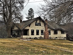 | Ainsworth House | building | 1986 | 86002771 |
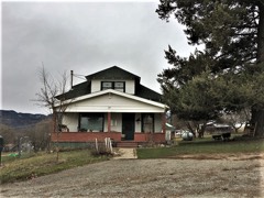 | Bedard House | building | 1986 | 86002783 |
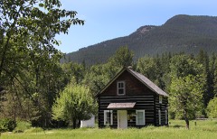 | Bull River Guard Station | building | 1990 | 90000990 |
| Cougar Peak Lookout | building | 2018 | 100002774 | |
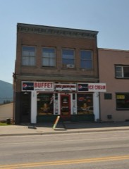 | Gem Saloon | building | 1986 | 86002767 |
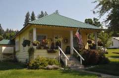 | Grandchamp House | building | 1986 | 86002776 |
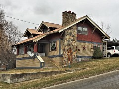 | Griffen House | building | 1986 | 86002779 |
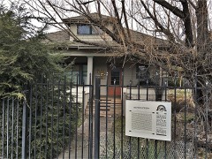 | House at 112 Park Street | building | 1986 | 86002778 |
| House at 916 Preston Avenue | building | 1986 | 86002777 | |
 | Hoyt House | building | 1986 | 86002780 |
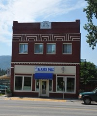 | IOOF Lodge | building | 1986 | 86002761 |
| Norby House | building | 1986 | 86002775 | |
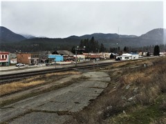 | Northern Pacific Warehouse | building | 1986 | 86002785 |
| Paradise School | building | 2021 | 100006231 | |
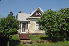 | Preston House | building | 1986 | 86002784 |
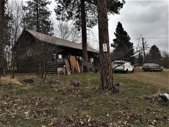 | Rinard House | building | 1986 | 86002782 |
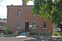 | Sanders County Jail | building | 1986 | 86002774 |
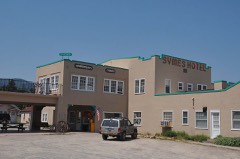 | Symes Hotel | building | 1998 | 98001363 |
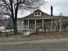 | Thayer House | building | 1986 | 86002781 |
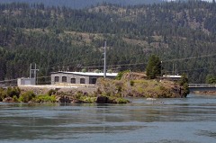 | Thompson Falls Hydroelectric Dam Historic District | district | 1986 | 86002756 |
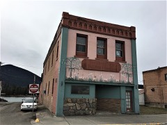 | Tourist Hotel | building | 1986 | 86002765 |
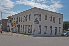 | Ward Hotel | building | 1986 | 86002769 |
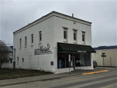 | Weber's Store | building | 1986 | 86002763 |
Every wildfire the federal occurrence database records inside this county: 2,681 of them, burning about 306,901 acres. 1,424 started naturally and 86 were recorded as arson. Each settlement page carries the fires within five miles of it.
| Reported cause | Fires |
|---|---|
| Natural | 1424 |
| Recreation and ceremony | 344 |
| Missing data/not specified/undetermined | 294 |
| Debris and open burning | 195 |
| Equipment and vehicle use | 115 |
| Railroad operations and maintenance | 108 |
| Arson/incendiarism | 86 |
| Power generation/transmission/distribution | 59 |
| Smoking | 23 |
| Fireworks | 22 |
| Misuse of fire by a minor | 7 |
| Other causes | 4 |
The five largest, by the area the report gives. One of them was set deliberately.
| Date | Cause | Size | Reported by | Name on the report |
|---|---|---|---|---|
| 31 July 2007 | Missing data/not specified/undetermined | 99,090 acres | Northwestern Land Office | CHIPPY CREEK |
| 31 July 2016 | Recreation and ceremony | 28,553 acres | Lolo National Forest | COPPER KING |
| 29 August 2017 | Natural | 24,816 acres | Lolo National Forest | SHEEP GAP |
| 30 August 2017 | Natural | 16,327 acres | Lolo National Forest | DEEP CREEK |
| 30 August 2017 | Natural | 13,887 acres | Kootenai National Forest | MOOSE PEAK |
| 4 August 2000 | Natural | 12,000 acres | Flathead Agency | CLEARDIVID |
| 13 August 2015 | Natural | 8,967 acres | Kootenai National Forest | NAPOLEON 1 |
| 28 August 2005 | Arson/incendiarism | 8,500 acres | Flathead Agency | SEEPAY#2 |
Every settlement page carries the fires within five miles of it - see the settlement index below.
The NOAA Storm Events Database holds 64 reports for this county, causing no deaths, 1 injury and about $226,000 in recorded property damage. Each settlement page carries the reports that name it.
| Kind of event | Reports |
|---|---|
| Thunderstorm Wind | 26 |
| Hail | 23 |
| Flood | 7 |
| Heavy Rain | 4 |
| Tornado | 1 |
| Wildfire | 1 |
| Flash Flood | 1 |
| Debris Flow | 1 |
The most serious of them, by death, then injury, then recorded damage. The accounts are quoted exactly as the forecast office filed them.
| When | Event | Place named | Harm | What the report says |
|---|---|---|---|---|
| March 2003 | Thunderstorm Wind | Paradise | 1 hurt, $5,000 | no account filed |
| December 2025 | Flood | Thompson Falls | $100,000 | At approximately 0400MST on December 11, a massive landslide occurred near Eagle View Lane, roughly 2 miles south-southwest of Bull Lake. The debris flow significantly damaged a residential garage, and the residents were unharmed. An Emergency Declaration was issued to address the lowland flooding and debris removal. Highway 56 near Bull Lake was forced to close between mileposts 16.7 and 17.2 after overwhelmed culverts allowed stream overflow to inundate the roadway. The emergency manager reported that over a dozen properties were isolated from Highway 56, either by a foot of water over access bridges or by an approximate 50-yard-wide flow of sediment-laden water separating residences from the main road. |A bridge on Montana Highway 471/Thompson Pass Road, near milepost 15, was washed out by Prospect Creek, resulting in a road closure. Prospect Creek also flooded the Prospect Creek campground at the Wild Coyote, located 7 miles up Prospect from Highway 200. |
| May 1994 | Thunderstorm Wind | Thompson Falls | $50,000 | no account filed |
| July 2007 | Thunderstorm Wind | Dixon | $30,000 | Spotter report from Dixon School of fences, power poles and large spruce trees with 2 1/2 diameter trunks broken and blown over. |
| August 2010 | Flash Flood | Camas | $15,000 | A slow moving thunderstorm dropped rainfall amounts of 1.59 inches up to an estimated 3.25 inches in a one to two hour period. Twenty five homes were flooded from runoff. One home owner had half their yard washed away with a shed also flooded. |
| March 2017 | Heavy Rain | (3th)Thompson Falls | $5,000 | White Pine Creek, located 12 miles northwest of Thompson Falls overflowed and damaged White Pine Creek road so bad that one resident was isolated from getting back to their home. Elk Creek road near Heron sustained damage during this event. |
| May 1993 | Hail | Thompson Falls | $5,000 | no account filed |
| May 1993 | Hail | Thompson Falls | $5,000 | no account filed |
| May 1993 | Thunderstorm Wind | not stated | $5,000 | no account filed |
| March 2014 | Flood | Hot Spgs Arpt | $4,000 | The DES coordinator for Sanders County reported that the Little Bitterroot River flooded with 2 to 3 feet of water observed in places. The Little Bitterroot Road from Anderson's Corner to Sloan's Bridge was closed for 4 days. According to a river gauge located at one of the river's headwaters, Mill Creek, the discharge rate peaked at 238 cubic feet per second at 3:15 pm MST on March 6. In 31 years, this value surpassed the previous record of 53 cubic feet per second set back in 1986. A local rancher reported that this was the worst flooding he had ever seen. In terms of damage, the Little Bitterroot Road experienced minor damage with several culverts that needed to be replaced while homes were spared. Observations were sparse in the region, but a COOP observer located 2 miles northwest of Heron reported a 48 hour precipitation total of 1.99 between March 9-10. The combination of above normal snowfall that fell across western Montana in February, warm day and night-time temperatures and the rainfall contributed to substantial snow-melt in this event. |
| July 2022 | Hail | Lone Pine | $1,000 | An owner of a general store reported large hail causing dented vehicles and trailers, holes in window screens, and damaged field crops. |
| August 2013 | Thunderstorm Wind | Thompson Falls | $500 | A member of the public reported a strong thunderstorm with heavy rain, lightning gusty winds that moved through between 2 and 3 am MDT. They received 0.75 total rainfall measured. |
| August 2013 | Thunderstorm Wind | Thompson Falls | $500 | A trained spotter reported that the power was out from 0230 to 0645 hrs MDT on August 26th. |
| May 2025 | Hail | Tuscor | - | A trained spotter reported 0.88 inch diameter hail. |
| May 2025 | Hail | Camas | - | A trained spotter reported pea to golf ball sized hail. |
| September 2024 | Thunderstorm Wind | Thompson Falls | - | Widespread power outage in Thompson Falls with up to 4000 thousand customers without power. There was also a downed tree at the bottom of Cherry Creek Road around 7:20pm. |
| May 2023 | Debris Flow | Snider | - | A thunderstorm containing very heavy rain moved directly over the Thorne Creek burn scar. Radar estimated 30 minute rainfall totals between 0.55 to 0.90 inches. A report was received from the forest service that a debris flow went over the Thompson River Road. |
| August 2022 | Thunderstorm Wind | Plains | - | Strong winds snapped large limbs, estimated near 4 inches in diameter, off trees. |
| May 2018 | Flood | Thompson Falls Arpt | - | Surface water from the Clark Fork River flooded the county road that accesses the sewage lagoons in Plains. The US Army Corps of Engineers had to construct levees to protect the sewage lagoons and they had to rep-rap county roads along the river to prevent roads from being washed out. |
| May 2018 | Flood | Thompson Falls | - | Low lying areas were flooded by the Clark Fork River between Thompson Falls and Plains. |
| May 2018 | Flood | Thompson Falls | - | The Clark Fork River again reached flood stage and caused flooding of the access road to the sewage lagoons outside of Plains. |
| March 2017 | Flood | Snider | - | The Thompson River gauge near Thompson Falls peaked at 7.15 feet for 4.5 hours. |
| July 2014 | Thunderstorm Wind | Tuscor | - | Law enforcement reported trees down near Marten Creek Bay area. |
| October 2011 | Heavy Rain | Dixon | - | The equipment at Sleeping Woman SNOTEL reported 1.00 rainfall in 12 hours. |
| July 2010 | Hail | Camas | - | A trained spotter estimated penny to nickel sized hail. |
| July 2010 | Hail | Agency | - | A trained spotter two miles east of Dixon reported hail to the size of quarters with some larger pieces in the mix. |
| August 2010 | Heavy Rain | Dixon | - | A trained spotter reported 0.50 inches of rain in less than 30 minutes. |
| August 2010 | Hail | Camas | - | The NWS storm survey team ran across a pile of hail 15 hours after the hail event occured which was still 0.75 inches in diameter. Hail was likely quite a bit larger when it initially fell. |
| June 2010 | Hail | Woodlin | - | A sheriff deputy reported one inch hail at mile marker 56 on Highway 200 that lasted about five minutes. The sheriff deputy had to pull over because of the intensity of the hail and rain. |
| May 2009 | Heavy Rain | Camas | - | Hot Springs RAWS reported 1.36 inches of rainfall in one hour at 3:29 PM MDT. Hot Springs Fire Department reported localized flooding of streets in Hot Springs. |
| July 2007 | Thunderstorm Wind | Lone Pine | - | Several large trees blown down. Windows blown out on mobile homes from straight line winds. |
| July 2007 | Hail | Perma | - | Emergency Management reported nickel size hail in Perma. |
| November 2006 | Flood | Heron | - | County roads and private drives were flooded just off Highway 56 near Bull River. |
| May 1997 | Thunderstorm Wind | Noxon | - | Thunderstorm wind gusts up to 65 mph measured at Noxon school weather station. Numerous trees and power lines knocked down with power outages. |
| July 1995 | Thunderstorm Wind | not stated | - | The roof of the Thompson Falls golf course clubhouse was blown away and the building was partly demolished. Numerous large trees were blown down around town. One large tree came down on a house, causing minor damage. The time is estimated. |
| May 2023 | Hail | Plains | - | no account filed |
| May 2006 | Thunderstorm Wind | Noxon | - | no account filed |
| July 2006 | Thunderstorm Wind | Plains | - | no account filed |
| June 2006 | Hail | Dixon | - | no account filed |
| June 2006 | Hail | Paradise | - | no account filed |
| June 2006 | Hail | Dixon | - | no account filed |
| May 2006 | Thunderstorm Wind | Plains | - | no account filed |
| August 2006 | Hail | Belknap | - | no account filed |
| August 2006 | Hail | Dixon | - | no account filed |
| July 2004 | Thunderstorm Wind | Plains | - | no account filed |
| August 2004 | Hail | Dixon | - | no account filed |
| August 2003 | Thunderstorm Wind | Dixon | - | no account filed |
| August 2003 | Wildfire | Thompson Falls | - | no account filed |
| May 2002 | Thunderstorm Wind | Noxon | - | no account filed |
| July 2002 | Thunderstorm Wind | Plains | - | no account filed |
| June 2001 | Thunderstorm Wind | Thompson Falls | - | no account filed |
| August 1999 | Thunderstorm Wind | Thompson Falls | - | no account filed |
| August 1999 | Hail | Thompson Falls | - | no account filed |
| June 1999 | Hail | Paradise | - | no account filed |
| July 1998 | Hail | Noxon | - | no account filed |
| August 1997 | Hail | Lone Pine | - | no account filed |
| September 1997 | Hail | Dixon | - | no account filed |
| August 1996 | Thunderstorm Wind | Paradise | - | no account filed |
| July 1995 | Thunderstorm Wind | not stated | - | no account filed |
| April 1987 | Thunderstorm Wind | not stated | - | no account filed |
The Survey's mineral resources record lists 253 workings inside this county. 23 still produce and 230 are closed or unrecorded. Each settlement page carries the workings within five miles of it.
| Commodity | Workings |
|---|---|
| Copper | 58 |
| Gold | 53 |
| Lead | 25 |
| Antimony | 19 |
| Silver | 18 |
| Sand and Gravel, Construction | 15 |
| Gold, Silver | 13 |
| Silver, Gold | 12 |
| Copper, Silver | 11 |
| Lead, Silver | 9 |
| Silver, Copper | 7 |
| Zinc | 5 |
| Silver, Lead | 5 |
| Gold, Silver, Copper | 4 |
The least common of them first, because a county's hundredth gravel pit says nothing its first ten did not.
| Where | Site | Commodity | Status | Recorded |
|---|---|---|---|---|
| Ambassador | Copper, Silver, Lead, Gold | Prospect | ||
| Antimony Mines | Antimony, Zinc, Silver, Gold, Copper, Arsenic | Producer | 1884 | |
| Arsenic - Cobalt Occurrence | Arsenic, Cobalt, Copper | Occurrence | Chalcopyrite, Pyrrhotite | |
| Bay Horse | Platinum, Copper, Gold, Silver | Occurrence | ||
| Blue Creek Mine | Lead, Zinc, Silver, Gold | Past Producer | ||
| Blue Ox Mine | Copper, Gold, Silver, Palladium, Platinum | Past Producer | Bornite, Chalcopyrite, Chrysocolla, Cuprite, Gold, Malachite, Pyrite, Pyrrhotite, Sperrylite, Tenorite | |
| Bonanza Mine | Lead, Gold, Silver, Zinc | Prospect | ||
| Coyote Bill Mine | Gold, Copper | Occurrence | ||
| Drake Mine | Gold, Silver, Copper, Platinum, Palladium, Lead, Nickel, Chromium, Cobalt | Past Producer | 1910, 1949 | |
| Eagle | Gold, Silver, Copper, Lead, Zinc | Producer | Chalcopyrite, Galena, Sphalerite | |
| Eddy Creek | Silver, Tungsten, Lead | Past Producer | ||
| Eddy Creek Mine | Gold, Lead, Silver, Copper | Occurrence | ||
| Glaucus Group | Lead, Copper, Gold, Silver | Past Producer | ||
| Glaucus Mine | Silver, Copper, Lead, Gold | Past Producer | Malachite, Silver | |
| Goat Creek | Molybdenum, Tungsten, Beryllium, Copper, Silver, Gold | Occurrence | Mo Skarn? LF porphyry Mo (?) | |
| Gold King Prospect | Lead, Zinc, Copper | Occurrence | 1949 | |
| Golden Roc Mines | Gold, Silver, Lead, Copper | Producer | ||
| Green Mountain Mine | Gold, Copper, Platinum | Past Producer | ||
| Haines Point Silica Deposit | Silica | Past Producer | Quartz | |
| Iron Daisy | Copper, Zinc, Lead | Past Producer | ||
| Iron Daisy Mine | Lead, Silver, Copper, Gold, Arsenic, Zinc | Past Producer | 1890 | |
| Jack Waite Mine | Gold, Silver, Copper, Lead, Zinc | Past Producer | ||
| Johnny Miller Prospect | Arsenic, Lead, Gold, Silver, Zinc | Occurrence | 1905 | |
| Kendoy | Graphite | Occurrence | ||
| Lucky Lode Prospect | Lead, Copper, Nickel, Silver, Gold | Occurrence | Chalcopyrite, Galena, Pentlandite, Pyrrhotite | |
| Mint Mine | Lead, Silver, Gold | Occurrence | ||
| Montana Standard Mine | Zinc, Silver, Lead, Gold | Past Producer | ||
| Montezuma | Lead, Antimony, Zinc | Prospect | ||
| Montezuma Prospect | Lead, Zinc, Antimony | Occurrence | ||
| Montro Gold Mines | Lead, Silver, Copper, Gold | Prospect | Vein | |
| Number 10 Tunnel Prospect | Silver, Lead, Gold, Zinc | Occurrence | Vein | |
| Packer Creek District | Zinc, Silver, Lead, Copper | Occurrence | VEINS AND SHEAR ZONES | |
| Pay Rock Mine | Gold, Silver, Copper, Platinum | Occurrence | Underground | |
| Perma Sill Nickel Deposit | Nickel | Unknown | ||
| Pilgrim | Copper, Bismuth, Lead | Prospect | ||
| Pilgrim Prospect | Copper, Lead, Bismuth | Occurrence | Chalcopyrite, Malachite | |
| R and M #1 Prospect | Lead, Arsenic | Occurrence | Galena | |
| Russell Group Prospect | Copper, Zinc, Arsenic, Silver, Cobalt, Gold, Lead | Occurrence | 1905 | |
| Ruth V | Gold, Zinc, Copper, Lead, Silver | Occurrence | ||
| Ruth V. Claim | Lead, Silver, Gold, Zinc, Copper | Occurrence | Vein | |
| Ryan | Gold, Copper, Lead | Unknown | ||
| Sales Mine | Copper, Lead, Gold, Zinc, Silver | Occurrence | Chalcopyrite, Chrysocolla, Galena, Malachite, Sphalerite | |
| Silver King | Zinc, Lead, Copper, Silver | Past Producer | ||
| Silver King Mine | Silver, Lead, Zinc, Copper, Gold, Bismuth, Antimony | Past Producer | Bornite, Chalcopyrite, Galena, Sphalerite, Tetrahedrite | |
| Sims Prospect | Copper, Silver, Gold, Arsenic | Occurrence | Chalcopyrite, Gold, Silver | |
| Stibnite Hill Mine | Tungsten, Antimony | Past Producer | 1884, 1900 | |
| Sullivan Hill Tuff | Stone, Crushed/Broken | Occurrence | ||
| Unknown | Kaolin | Producer | ||
| Unnamed Arsenic & Cobalt | Arsenic, Cobalt | Occurrence | ||
| Unnamed Bentonite | Clay | Unknown | ||
| Vermillion | Zinc, Lead, Silver | Prospect | ||
| White Cloud | Copper, Gold, Silver, Platinum | Occurrence | ||
| White Star | Calcium, Copper | Unknown | ||
| Barite Occurrence | Barium-Barite | Occurrence | ||
| Copper King Mine | Copper, Silver, Gold, Lead, Zinc, Antimony, Bismuth | Past Producer | 1885, 1890 | |
| Diamond Point Qtz Crystal Deposit | Quartz | Occurrence | ||
| Diamond Point Qtz. Crystal | Quartz | Occurrence | ||
| Fishtrap Quarries | Stone | Producer | ||
| Jim Fisk Patent | Silver, Gold, Lead | Occurrence | Underground | |
| Kennelty Mine | Barium-Barite | Occurrence | ||
| Letterman | Silver, Gold, Lead | Prospect | ||
| Lucky Strike Mine | Gold, Silver, Copper, Platinum, Palladium | Past Producer | Bornite, Chalcopyrite, Chrysocolla, Cuprite, Gold, Malachite, Pyrite, Pyrrhotite, Sperrylite, Tenorite | |
| Mayflower Claim | Gold, Silver, Platinum, Palladium | Occurrence | Underground | |
| Montro Gold Mines | Lead, Silver, Gold, Copper | Producer | ||
| Raven Mine | Copper, Silver, Gold, Lead, Zinc, Antimony, Bismuth | Past Producer | 1880 | |
| Red Bluff Quarry | Flagstone | Producer | ||
| Silver Cabin 1-6 | Gold, Zinc, Lead | Occurrence | ||
| State Group Mine | Lead, Silver, Gold, Copper | Occurrence | Vein | |
| Unnamed Flagstone | Stone | Occurrence | ||
| Unnamed Flagstone Quarry | Flagstone | Past Producer | ||
| Unnamed Silver & Lead | Silver, Gold, Zinc, Lead | Occurrence | ||
| Ambassador Mine | Lead, Copper, Gold, Silver | Past Producer | 1929, 1939 | |
| Arlington | Lead, Zinc | Prospect | ||
| Arlington Prospect | Lead, Zinc, Copper, Silver | Occurrence | 1902 | |
| Camas Hot Springs | Geothermal | Producer | ||
| Colcar Peak Block | Silver, Lead, Zinc | Occurrence | Galena | |
| Gold King Prospect | Lead, Zinc, Copper | Unknown | ||
| Holliday Mine | Silver, Lead, Zinc, Copper | Past Producer | 1939, 1961 | |
| Homestead Mining Claims | Lead, Zinc, Copper | Past Producer | ||
| Lucky Luke Mine | Copper, Gold, Silver, Lead | Past Producer | 1905 | |
| Montana Standard Mine | Silver, Lead, Zinc, Copper, Gold | Past Producer | 1900, 1939 | |
| Montro Gold Mines | Lead, Copper, Gold, Silver | Past Producer | ||
| Old Times Group | Lead, Zinc | Occurrence | ||
| Quinns Hot Springs | Geothermal | Producer | ||
| Unnamed Hot Springs | Geothermal | Producer | ||
| Broken | Lead, Silver, Zinc | Past Producer | ||
| Eddy Creek Block Claims 1 & 2 | Lead, Silver, Zinc | Occurrence | Vein | |
| Golden Roc Mines | Gold, Copper, Lead, Silver | Past Producer | ||
| Gopher Hole Mine | Gold, Lead, Silver, Zinc | Past Producer | ||
| Holliday | Lead, Silver, Zinc | Past Producer | ||
| Little Pittsburg | Copper, Lead, Silver | Past Producer | ||
| Lucky Lode | Copper, Lead, Silver | Prospect | ||
| Shoestring 1 & 2 | Gold, Copper, Lead, Silver | Past Producer | ||
| Slow Poke Prospect | Gold, Silver, Copper | Occurrence | Underground | |
| Amazon Property | Lead, Zinc | Prospect | ||
| Bonanza | Gold, Silver, Lead | Prospect | ||
| Bull Frog | Lead, Zinc | Prospect | ||
| Cardiff Mine | Silver, Lead | Occurrence | ||
| Eureka Lode | Antimony, Silver, Lead | Unknown | ||
| Shamrock Mine | Gold, Silver, Lead | Past Producer | ||
| Swan Prospect | Zinc, Lead, Silver | Prospect | ||
| Blue Ox | Gold, Silver, Copper | Past Producer | ||
| Copper Gulch | Silver, Copper | Unknown | 1890 | |
| Horizon Basin | Silver, Copper | Occurrence | 1890 | |
| J-F (Ross Point, Lower Ross Creek) | Silver, Copper | Unknown | 1976 | |
| Slow Poke | Gold, Silver, Copper | Occurrence | ||
| St. Paul Pass Prospect | Gold, Silver, Copper | Unknown | ||
| Bay Chief Mine | Lead, Silver | Occurrence | ||
| Coeur D'Alene Star Mine | Lead, Silver | Producer | ||
| Cooper Creek | Lead, Silver | Prospect | ||
| Cooper Creek Mining Company Prospect | Lead, Silver | Occurrence | Vein | |
| Letterman Mine | Gold, Lead, Silver, Copper | Past Producer | 1911, 1940 | |
| Montana Premier | Gold, Lead, Silver | Unknown | ||
| Freeman Prospect | Gold, Copper, Silver | Occurrence | ||
| Janstan Group | Copper, Silver | Prospect | ||
| Lucky Luke | Gold, Copper, Silver | Past Producer | ||
| New Deal Mine | Gold, Copper, Silver | Past Producer | ||
| Paul Bunyon Prospect | Copper, Silver | Occurrence | ||
| Red Fir Claims | Copper, Silver | Past Producer | ||
| Rock Creek | Copper, Silver | Occurrence | 1963 | |
| Rock Peak | Copper, Silver | Unknown | 1890 | |
| White Penny Lode | Copper, Silver | Prospect | ||
| Barto Claims | Antimony, Silver, Gold | Occurrence | ||
| Black Jack Lode | Antimony, Silver, Gold | Prospect | ||
| Copper King | Copper, Silver, Gold | Past Producer | ||
| Duston Copper Group | Copper, Silver, Gold | Occurrence | Chalcopyrite, Gold, Silver | |
| Elda Lode | Antimony, Silver, Gold | Unknown | ||
| Ellis Lode | Antimony, Silver, Gold | Unknown | ||
| Excelsior Lode | Antimony, Silver, Gold | Unknown | ||
| Favorite Lode | Antimony, Silver, Gold | Unknown | ||
| Heidelberg Mine | Silver, Gold | Producer | 1925, 1936 | |
| Mammont Lode | Antimony, Silver, Gold | Unknown | ||
| Monia | Copper, Silver, Gold | Past Producer | ||
| Eliza Lode | Antimony, Gold, Silver | Prospect | ||
| Exchange Mine | Copper, Gold, Silver | Past Producer | Chalcopyrite, Gold, Silver | |
| Gold Lode Mining Co. | Gold, Silver | Occurrence | ||
| Little Comet Lode | Antimony, Gold, Silver | Unknown | ||
| Midday Lode | Antimony, Gold, Silver | Unknown | ||
| Morning View Lode | Antimony, Gold, Silver | Unknown | ||
| Razorback | Gold, Silver | Past Producer | ||
| Rosebud Mining Co. Prospect | Gold, Silver | Occurrence | Chlorargyrite, Gold | |
| Shamrock Mine | Gold, Silver, Lead | Past Producer | 1900, 1908 | |
| St. George Lode | Antimony, Gold, Silver | Unknown | ||
| Station Millsite Claim | Antimony, Gold, Silver | Unknown | ||
| Clark Bros. Universal #1. | Sand and Gravel, Construction | Past Producer | ||
| Clark Fork Concrete | Sand and Gravel, Construction | Producer | ||
| Gravel Pit | Sand and Gravel, Construction | Unknown | ||
| Gravel Pit | Sand and Gravel, Construction | Unknown | ||
| Gravel Pit | Sand and Gravel, Construction | Unknown | ||
| Gravel Pit | Sand and Gravel, Construction | Unknown | ||
| Gravel Pit | Sand and Gravel, Construction | Unknown | ||
| Gravel Pit | Sand and Gravel, Construction | Unknown | ||
| Gravel Pit | Sand and Gravel, Construction | Unknown | ||
| Gravel Pit | Sand and Gravel, Construction | Unknown | ||
| Gravel Pit | Sand and Gravel, Construction | Unknown | ||
| Gravel Pit | Sand and Gravel, Construction | Unknown | ||
| Gravel Pits | Sand and Gravel, Construction | Unknown | ||
| Scotts Pit | Sand and Gravel, Construction | Producer | ||
| Tindall Construction Co. | Sand and Gravel, Construction | Producer | ||
| Bay Chief | Lead, Silver | Prospect | ||
| Coeur D' Alene Star Mine | Lead, Silver | Past Producer | ||
| Dustan and Protection | Copper, Silver | Prospect | ||
| Frederick and Wind Group | Copper, Silver | Past Producer | ||
| Heidelburg Mine | Gold, Silver | Occurrence | 1920 | |
| Jeff Group | Copper, Silver | Producer | Malachite | |
| Jeff Group | Copper, Silver | Past Producer | ||
| Paul Bunyon | Copper, Silver | Prospect | ||
| Raven Mine | Copper, Silver | Past Producer | ||
| Razorback | Gold, Silver | Past Producer | ||
| Rock Creek Project | Copper, Silver | Plant | 1963 | |
| Russell | Lead, Silver | Prospect | ||
| Silver and Copper Prospect | Silver, Copper | Prospect | ||
| Silver and Lead Prospect | Silver, Lead | Prospect | ||
| State Group | Lead, Silver | Past Producer | ||
| (Facility) U.S. Antimony Smelter & Refinery | Antimony | Plant | ||
| Barto | Antimony | Occurrence | ||
| Idaho Montana Mining Co | Antimony | Unknown | ||
| Thompson Falls, Barto | Antimony | Producer | Vein | |
| Bull Frog Prospect | Lead | Occurrence | Boulangerite, Galena | |
| Happy Boy Prospect | Lead | Occurrence | Vein | |
| Happy Boy Prospect | Lead | Prospect | ||
| Miller | Copper, Lead | Prospect | ||
| Mineronjou, Eddy and Russel Groups | Lead | Prospect | ||
| No. 10 Tunnel | Lead | Unknown | ||
| R & M #1 | Lead | Occurrence | ||
| Thompson Falls | Gold, Lead | Unknown | ||
| Ajax Placer | Gold | Past Producer | 1900 | |
| Ajax Placer | Gold | Prospect | ||
| Apex Mine | Gold | Occurrence | ||
| Bonanaza Gold Inc. Mine | Gold | Past Producer | Placer | |
| Bonanza Gold Mine | Gold | Occurrence | ||
| Brende Deposit | Gold | Occurrence | ||
| Brende Property | Gold | Unknown | ||
| Carl E. #2 Placer | Gold | Occurrence | Placer | |
| Clark Fork Placer | Gold | Unknown | ||
| Clark Fork Placer Mine | Gold | Past Producer | Placer | |
| Copper Ridge | Gold | Past Producer | ||
| Copper Ridge Prospect | Gold | Occurrence | 1881 | |
| Coyote Mine | Copper, Gold | Past Producer | ||
| Deacon Placer | Gold | Occurrence | Placer | |
| Ester No 3 Placer | Gold | Occurrence | Placer | |
| Goldbar | Gold | Occurrence | Placer | |
| Granite Creek Placer Mine | Gold | Past Producer | Placer | |
| Jolene Placer | Gold | Occurrence | Placer | |
| Judith Ann #1 Placer | Gold | Occurrence | Placer | |
| Lucky Strike Mine | Copper, Gold | Past Producer | ||
| May Placer | Gold | Occurrence | Placer | |
| Ogoma No 3 Placer | Gold | Occurrence | Placer | |
| Prospect Creek Placer | Gold | Producer | 1914 | |
| Prospect Creek Placer | Gold | Prospect | ||
| Russell Placer Claim | Gold | Past Producer | Placer | |
| Sims Gulch Placer | Gold | Occurrence | ||
| Trout Creek Placer | Gold | Past Producer | ||
| Trout Creek Placer Mine | Gold | Past Producer | Placer | |
| Vermillion Creek Placer | Gold | Past Producer | ||
| Walnut-Carl E. Placer | Gold | Past Producer | ||
| Waylett Placer | Gold | Occurrence | Placer | |
| Waylett Placer | Gold | Prospect | ||
| Allen Property Mine | Copper | Past Producer | ||
| Annie Laurie | Copper | Prospect | ||
| Bee and Boo Claim Group | Copper | Occurrence | ||
| Big Chief Mine | Copper | Prospect | ||
| Blue Bell | Copper | Prospect | ||
| Carmi Lode | Copper | Occurrence | Malachite | |
| Cherry Creek Mine | Copper | Occurrence | ||
| Cherry Creek Mine | Copper | Prospect | ||
| Commercial Mines | Copper | Occurrence | ||
| Commercial Mines | Copper | Prospect | ||
| Daniels Mine | Copper | Occurrence | Vein | |
| Four Up Group | Copper | Occurrence | ||
| Four Up Group | Copper | Prospect | Vein | |
| Four Up Group | Copper | Unknown | ||
| Iron Clad Mine | Copper | Occurrence | ||
| Larch-Recco Groups | Copper | Occurrence | ||
| Laura Apex Group | Copper | Producer | ||
| Laura Apex Group | Copper | Prospect | Malachite | |
| Laura Apex Group | Copper | Producer | ||
| Max 1 & 2 Prospects | Copper | Occurrence | Stratabound | |
| Mayflower | Copper | Prospect | ||
| Miller Prospect | Copper | Occurrence | Chalcopyrite | |
| Montana-Utah Copper Co Mine | Copper | Occurrence | ||
| New Deal Mine | Copper | Past Producer | Vein | |
| Palin Mine | Copper | Occurrence | Vein | |
| Palin Mine | Copper | Unknown | ||
| Pine Cone | Copper | Prospect | ||
| Shamrock Claims | Copper | Occurrence | Chalcopyrite, Cuprite, Malachite | |
| Sid Claim | Copper | Producer | Vein | |
| Sid Claim | Copper | Past Producer | ||
| Ulley | Copper | Prospect | ||
| Unnamed Copper | Copper | Occurrence | ||
| Unnamed Copper Occurrence | Copper | Occurrence | Malachite | |
| White Cloud | Copper | Prospect | ||
| White Star Prospect | Copper | Occurrence | Chalcopyrite |
Named settlements recorded in the Geographic Names Information System, each with the topographic sheets covering it. Villages, hamlets and abandoned places alike. Each is shown with the nearest named watercourse or landform and the survey quadrangle it falls on.
Flathead Reservation census division · 59831 · On Jocko River · Dixon quadrangle
6 sheets, 1956 to 1987
Thompson Falls-West End census division · 59873 · On Thompson River · Eddy Mountain quadrangle
10 sheets, 1937 to 1999
No longer a settlement
Thompson Falls-West End census division · 59873 · On Sqaylth-kwum Creek · Belknap quadrangle
13 sheets, 1937 to 1999
Plains census division · 59859 · On Hinchwood Creek · Baldy Lake quadrangle
7 sheets, 1956 to 1999
Flathead Reservation census division · 59845 · Near Rattlesnake Butte · Hot Springs quadrangle
6 sheets, 1956 to 1980
Flathead Reservation census division · 59859 · On Micharl Creek · Camas Prairie quadrangle
8 sheets, 1956 to 1989
Thompson Falls-West End census division · 59844 · On Blue Creek · Cabinet quadrangle
14 sheets, 1911 to 1989
No longer a settlement
Thompson Falls-West End census division · 59874 · Near Grimes Gulch · Seven Point Mountain quadrangle
9 sheets, 1937 to 1997
Plains census division · 59866 · On Donlan Flats · Keystone Peak quadrangle
8 sheets, 1956 to 1999
Plains census division · 59873 · On Malone Creek · Eddy Mountain quadrangle
10 sheets, 1937 to 1999
Thompson Falls-West End census division · 59844 · On Elk Creek · Heron quadrangle
14 sheets, 1920 to 1997
Flathead Reservation census division · 59845 · Hot Springs quadrangle
6 sheets, 1956 to 1980
Plains census division · 59859 · On Flathead River · Quinns Hot Springs quadrangle
8 sheets, 1956 to 1999
No longer a settlement
Plains census division · 59859 · On Robertson Creek · Knowles quadrangle
9 sheets, 1956 to 1999
Thompson Falls-West End census division · 59874 · On Trout Creek · Larchwood quadrangle
12 sheets, 1932 to 1997
Flathead Reservation census division · 59831 · On Magpie Creek · McDonald quadrangle
6 sheets, 1956 to 1988
Thompson Falls-West End census division · 59853 · On Soldier Creek · Noxon quadrangle
12 sheets, 1932 to 1997
Flathead Reservation census division · 59831 · On Jocko River · Dixon quadrangle
6 sheets, 1956 to 1987
Plains census division · 59859 · On McLaughlin Creek · Paradise quadrangle
9 sheets, 1956 to 1999
Flathead Reservation census division · 59859 · On Camas Creek · Perma quadrangle
8 sheets, 1956 to 1999
Plains census division · 59859 · On Wallace Creek · Quinns Hot Springs quadrangle
8 sheets, 1956 to 1999
Thompson Falls-West End census division · 59873 · On Sqaylth-kwum Creek · Belknap quadrangle
13 sheets, 1937 to 1999
No longer a settlement
Flathead Reservation census division · 59845 · On Little Bitterroot River · Sloan quadrangle
6 sheets, 1956 to 1965
Thompson Falls-West End census division · 59853 · On Smeads Creek · Smeads Bench quadrangle
14 sheets, 1920 to 1997
No longer a settlement
Thompson Falls-West End census division · 59873 · On Goat Creek · Eddy Mountain quadrangle
10 sheets, 1937 to 1999
Flathead Reservation census division · 59831 · On Jocko River · Dixon quadrangle
6 sheets, 1956 to 1987
Thompson Falls-West End census division · 59874 · Near Finley Flats · Belknap quadrangle
13 sheets, 1937 to 1999
Thompson Falls-West End census division · 59873 · On Prospect Creek · Thompson Falls quadrangle
13 sheets, 1937 to 1999
Thompson Falls-West End census division · 59874 · On Trout Creek · Trout Creek quadrangle
13 sheets, 1932 to 1997
Thompson Falls-West End census division · 59874 · On Blacktail Creek · Noxon Rapids Dam quadrangle
12 sheets, 1932 to 1997
Plains census division · 59859 · On Weeksville Creek · Weeksville quadrangle
7 sheets, 1956 to 1999
Thompson Falls-West End census division · 59874 · On Basin Creek · Belknap quadrangle
13 sheets, 1937 to 1999
The vanished settlements of Sanders County: the places named above that are no longer on the map.