 Block
From the record
16 National Register listings published here.
Sources: the National Register database, National Park Service
64 topographic sheets cover 18 settlements here, and 16 properties are on the National Register of Historic Places.
16 National Register listings published here.
Sources: the National Register database, National Park Service
Every property in this county listed on the National Register of Historic Places, with the year it was listed and the federal nomination document.
| Photograph | Property | Type | Listed | Reference |
|---|---|---|---|---|
| 4K Ranch | district | 2002 | 02000049 | |
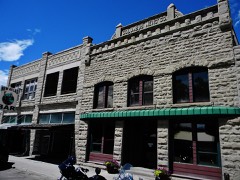 | Atlas Block | building | 2011 | 11000588 |
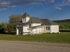 | Dean School | building | 2019 | 100004713 |
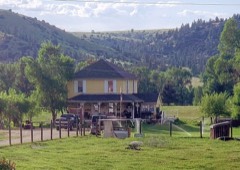 | Halfway House | building | 2002 | 02000047 |
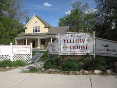 | Oliver H. Hovda House | building | 1984 | 84002506 |
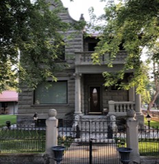 | Michael Jacobs House | building | 1987 | 86003676 |
| Meyers Creek Work Center | district | 2023 | 100008876 | |
| Mountain View Cemetery | site | 1987 | 87001200 | |
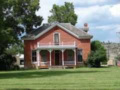 | W. H. Norton House | building | 1982 | 82000597 |
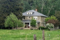 | Charles and Gladys Pelton House | building | 2017 | 100000916 |
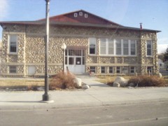 | Sandstone and Cobblestone Schools | building | 1987 | 86002949 |
| Stillwater County Courthouse | building | 2019 | 100004277 | |
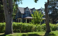 | Stoltz House | building | 1991 | 91000422 |
| Torgrimson Place | building | 2001 | 01000921 | |
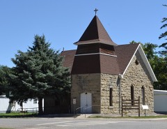 | United Methodist Episcopal Church | building | 2010 | 10000497 |
Every wildfire the federal occurrence database records inside this county: 199 of them, burning about 41,890 acres. 54 started naturally and none was recorded as arson. Each settlement page carries the fires within five miles of it.
| Reported cause | Fires |
|---|---|
| Missing data/not specified/undetermined | 95 |
| Natural | 54 |
| Recreation and ceremony | 17 |
| Equipment and vehicle use | 13 |
| Debris and open burning | 8 |
| Smoking | 4 |
| Power generation/transmission/distribution | 4 |
| Fireworks | 2 |
| Railroad operations and maintenance | 1 |
| Other causes | 1 |
The five largest, by the area the report gives. None of them was recorded as arson.
| Date | Cause | Size | Reported by | Name on the report |
|---|---|---|---|---|
| 21 August 2010 | Missing data/not specified/undetermined | 9,870 acres | Southern Land Office | STUMP GULCH |
| 28 March 2015 | Debris and open burning | 5,086 acres | Southern Land Office | PINECREST |
| 26 August 2005 | Natural | 3,485 acres | Southern Land Office | COTTONWOOD CREEK |
| 25 July 2012 | Equipment and vehicle use | 3,348 acres | Southern Land Office | SKIBSTAD |
| 10 July 2006 | Debris and open burning | 3,000 acres | Custer Gallatin National Forest | SAUNDERS |
| 2 August 2020 | Equipment and vehicle use | 2,271 acres | Stillwater County | FALLING STAR |
| 2 September 2004 | Natural | 2,022 acres | Southern Land Office | PINE HILL |
| 14 August 2003 | Natural | 1,973 acres | Custer Gallatin National Forest | CATHEDRAL PEAK |
Every settlement page carries the fires within five miles of it - see the settlement index below.
The NOAA Storm Events Database holds 287 reports for this county, causing no deaths, no injuries and about $2,914,000 in recorded property damage. Each settlement page carries the reports that name it.
| Kind of event | Reports |
|---|---|
| Hail | 185 |
| Thunderstorm Wind | 76 |
| Flash Flood | 12 |
| Flood | 5 |
| Heavy Rain | 5 |
| Wildfire | 2 |
| Tornado | 1 |
| Funnel Cloud | 1 |
The most serious of them, by death, then injury, then recorded damage. The accounts are quoted exactly as the forecast office filed them.
| When | Event | Place named | Harm | What the report says |
|---|---|---|---|---|
| May 2011 | Flood | Rapelje | $2,000,000 | Significant flooding occurred all across Stillwater County, including streams and creeks emerging from the Beartooth Foothills. This resulted in numerous road closures and significant damage in spots to rural roads. Specifically; Whitebird, Benbow, and the Stillwater River roads were closed. During the height of the flooding, a couple of families were stranded by the flood waters. A bridge was washed out on Whitebird Creek. Subsequent flooding on the Stillwater River was observed the May 24-25th. Damage estimates based on FEMA reviews and Individual Assistance approvals. |
| March 2019 | Flood | Absarokee | $804,000 | Many roads along the foothills were washed out or severely damaged due to rain and snowmelt on top of ground that remained frozen. Approximately 12 roads were damaged, 9 of which had to be closed. The county applied for a disaster declaration due to the extent of the damage. Damage amounts totaled $804,387.00. |
| May 2001 | Wildfire | Reed Pt | $55,000 | Svenson wildfire burned 1500 acres of land after a prescribed burn ignited by a private land owner got out of control. |
| July 1998 | Thunderstorm Wind | Absarokee | $25,000 | A strong microburst knocked down two 50 foot cottonwood trees. One tree hit power lines and cut power to two houses. The gusty winds caused considerable crop damage near Absarokee. Some minor damage was sustained by homes and businesses. |
| July 2000 | Thunderstorm Wind | Rapelje | $20,000 | Wind damage with large trees downed. Roof blown off. |
| June 1994 | Thunderstorm Wind | of Billings | $5,000 | no account filed |
| June 1994 | Hail | Park City | $5,000 | no account filed |
| May 2025 | Thunderstorm Wind | Absarokee | - | Winds gusted to 58 mph near Fishtail. |
| August 2025 | Hail | Molt | - | Large hail lasted 10 minutes. |
| August 2025 | Thunderstorm Wind | Fishtail | - | Mesonet station flsm8 at Fishtail. |
| June 2025 | Hail | Columbus | - | One inch hail reported. |
| June 2025 | Hail | Columbus | - | One and a quarter inch hail reported. |
| June 2025 | Hail | Columbus | - | Report from mping. |
| June 2025 | Hail | Columbus | - | One and a half inch hail reported. |
| June 2023 | Flash Flood | Reed Pt | - | Heavy rainfall and standing water was reported. |
| June 2023 | Flash Flood | Columbus | - | County Road 306 was washed out and North Ridge Road was closed due to Keyser Creek overflowing. |
| June 2023 | Flash Flood | Columbus | - | Flowing water was reported on the sidewalks and up to the doors of businesses in downtown Columbus. |
| June 2023 | Flash Flood | Absarokee | - | Law enforcement reported flooding in Absarokee. |
| June 2023 | Flash Flood | Columbus | - | Law enforcement reported flooding along Keyser Creek. |
| June 2023 | Flash Flood | Rapelje | - | Law enforcement reported flooding near Rapelje. |
| August 2023 | Hail | Columbus | - | The time was estimated. Some damage to decking and a few dents to vehicles was noted. |
| July 2020 | Thunderstorm Wind | Fishtail | - | A wind gust of 59 mph was recorded 3 miles west of Fishtail. |
| July 2020 | Thunderstorm Wind | Absarokee | - | A wind gust of 58 mph was recorded 12 miles south of Columbus. |
| July 2020 | Thunderstorm Wind | Columbus | - | A wind gust of 58 mph was recorded 6 miles east of Columbus. |
| August 2020 | Thunderstorm Wind | Columbus | - | A wind gust of 60 mph was reported 6 miles east of Columbus. |
| June 2019 | Thunderstorm Wind | Reed Pt | - | The strong winds lasted 2 to 3 minutes. |
| May 2019 | Flash Flood | Rapelje | - | Sixshooter Creek in Rapelje flooded up to a foot deep and 200 yards wide over Highway 306. |
| July 2019 | Thunderstorm Wind | Park City | - | Tree limbs 1-1.5 inches in diameter were broken. Pea-sized hail also occurred. |
| August 2019 | Hail | Wheat Basin | - | Car windshields were broken along with four house windows. |
| July 2018 | Hail | Reed Pt | - | Trees were stripped of leaves and small branches. |
| July 2018 | Hail | Reed Pt | - | The hail and strong winds broke windows and caused damage to roofs and aluminum trailers. |
| July 2018 | Hail | Molt | - | Large hail combined with strong winds resulted in significant crop damage. |
| May 2018 | Flash Flood | Absarokee | - | Very heavy thunderstorms produced 2 to 4 inches of rain in a short period of time across the area. There were numerous reports of water flowing down and across roads, as well as a mud slide along portions of the Stillwater River Road between Columbus and Absarokee. |
| June 2015 | Hail | Rapelje | - | Hail accumulated to around one inch on the ground. Some property damage was reported. |
| March 2014 | Flood | Rapelje | - | County officials and the Montana Department of Transportation reported that small stream and low land flooding occurred across the area. Water flowed over Highway 12 near Two Dot and Highway 191 between Harlowton and Judith Gap. Water also flowed across some of the roads along the Beartooth Foothills south of Reed Point and Columbus. |
| March 2014 | Flood | Absarokee | - | County officials reported that some streams and creeks were running high, and in some areas, water was running over roadways and flooding fields. Some roads became impassable. |
| July 2014 | Thunderstorm Wind | Aosarokee | - | Power lines and trees were down in portions of Absarokee. |
| July 2014 | Thunderstorm Wind | Park City | - | There were a couple of reports of trees down in Park City. A homeowner had a tree down on their house. Another tree took a power line down across the roadway. |
| July 2014 | Thunderstorm Wind | Columbus | - | There were numerous reports of trees down on houses, power lines and across roads in the town of Columbus. |
| June 2013 | Thunderstorm Wind | Fishtail | - | Thunderstorm winds blew down three 15-18 diameter Cottonwood trees and damaged an outbuilding. |
| June 2013 | Hail | Rapids | - | Hail was peal to quarter size and it shredded the leaves off trees. |
| June 2013 | Thunderstorm Wind | Columbus | - | An estimated wind gust of 60 mph was reported just northwest of Columbus. |
| September 2013 | Thunderstorm Wind | Rapelje | - | A wind gust of 60 mph was estimated in Rapelje. |
| June 2013 | Hail | Rapids | - | Hail was dime to quarter size. |
| May 2012 | Thunderstorm Wind | Rapids | - | Estimated 6-8 inch diameter tree limbs were reported downed. In addition, an irrigation piping was moved and an old shed was moved off its foundation slightly. |
| June 2011 | Hail | Columbus | - | One inch hail fell in the city of Columbus. |
| June 2011 | Hail | Columbus | - | There was heavy damage to a car windshield. |
| June 2011 | Flash Flood | Columbus | - | A thunderstorm producing 0.63 inches of rain in 20 minutes resulted in water over some roads just northwest of Columbus. |
| August 2011 | Thunderstorm Wind | Rapids | - | A wind gust estimated at 63 mph was reported 7 miles east of Columbus. |
| May 2011 | Flash Flood | Columbus | - | Extreme flooding reported on Keiser Creek, north of Columbus. A dramatic rise in water levels occurred in the region, estimated 6-7 foot rise in a matter of minutes. Local bridge washed out along with damage to a shop. Flooding worsened as a result of debris collection at a bridge. Several houses flooded in the area. |
| June 2010 | Hail | Pryor | - | Golf ball size hail lasted for about 12 minutes. |
| June 2010 | Hail | Columbus | - | Ping pong ball size hail was reported along with 30 mph winds. |
| June 2009 | Thunderstorm Wind | Columbus | - | Several 8 inch diameter trees were snapped off several feet off the ground. Several other tree limbs were blown down. |
| August 2009 | Thunderstorm Wind | Rapelje | - | An estimated thunderstorm wind gust of 61 mph was reported in Rapelje. |
| July 2008 | Thunderstorm Wind | Columbus | - | Estimated wind gust of 70 mph was reported 7 miles Northeast of Columbus. A large 30 diameter tree was downed, landing on a power line and building. |
| May 2007 | Thunderstorm Wind | Rapelje | - | Numerous tree branches were knocked down. |
| May 2007 | Thunderstorm Wind | Rapelje | - | Numerous windows were broken out in Rapelje from the hail and winds. |
| May 2007 | Hail | Rapelje | - | Numerous windows were broken out in Rapelje from the hail and winds. |
| August 2007 | Thunderstorm Wind | Rapelje | - | Winds just south of Rapelje gusted to 64 mph. |
| August 2007 | Thunderstorm Wind | Park City | - | Winds just to the northeast of Park City gusted to 60 mph. |
The Survey's mineral resources record lists 50 workings inside this county. 4 still produce and 46 are closed or unrecorded. Each settlement page carries the workings within five miles of it.
| Commodity | Workings |
|---|---|
| Sand and Gravel, Construction | 14 |
| Chromium | 8 |
| Copper, Nickel | 6 |
| Cobalt | 6 |
| Nickel, Copper | 4 |
| PGE, Silver, Gold | 4 |
| Platinum, Chromium | 3 |
| Platinum | 3 |
| Silver | 3 |
| Nickel | 3 |
| Gold, Silver, PGE | 2 |
| Platinum, Palladium, Rhodium | 2 |
| Gold | 2 |
| Copper, Cobalt | 2 |
The least common of them first, because a county's hundredth gravel pit says nothing its first ten did not.
| Where | Site | Commodity | Status | Recorded |
|---|---|---|---|---|
| (Facility) Stillwater Pgm Smelter | PGE | Plant | ||
| Benbow Cr-Pt | Platinum, Chromium, Nickel, Copper | Occurrence | ||
| Blitz | Platinum, Palladium, Rhodium, Gold, Copper, Nickel | Occurrence | ||
| Fishtail Creek Mine | Copper | Past Producer | ||
| Fishtail Creek Ni-Cu | Copper, Nickel, Palladium, Platinum, Cobalt, Gold, Silver, PGE | Occurrence | Chalcopyrite, Pentlandite, Pyrrhotite | |
| Mouat Iron-Titanium Group | Iron, Titanium | Occurrence | ||
| Mouat Nickel-Copper | Nickel, Copper, Cobalt, Sulfur | Prospect | 1883 | |
| Mountain View Mine | Chromium, Rhodium, Palladium, Platinum | Past Producer | 1886, 1943 | |
| Nye Basin Big Seven | Chromium, Platinum | Occurrence | Chromite | |
| Nye Basin Cr-Pt | Chromium, PGE | Occurrence | ||
| Nye Basin Lip | Platinum, Palladium, Rhodium, Chromium | Occurrence | Chromite | |
| Nye Basin Ni-Cu East | Cobalt, Copper, Nickel, Gold, Silver, Palladium, Platinum | Occurrence | Stillwater Ni-Cu | |
| Nye Basin Ni-Cu Lip | Nickel, Copper, Cobalt, Gold, PGE, Silver | Occurrence | Chalcopyrite, Pentlandite, Pyrrhotite | |
| Rosebud | Molybdenum | Occurrence | ||
| Stillwater Calcite Deposits | Calcium | Occurrence | ||
| Stillwater Mine | Platinum, Palladium, PGE, Gold, Rhodium, Copper, Ruthenium, Osmium, Iridium, Nickel | Producer | 1971, 1986 | |
| Benbow Mine | Chromium, Platinum, Palladium, Rhodium | Past Producer | 1905, 1941 | |
| Benbow Mine | Chromium, Iron | Past Producer | 1918, 1941 | |
| Benbow Ni/Cu | Nickel, Copper, Cobalt | Prospect | ||
| Hawkes Lode | Gold, Silver | Prospect | ||
| Little Rocky Creek Ni-Cu | Copper, Nickel, Cobalt, Gold, Silver, PGE | Occurrence | 1883 | |
| Pyramid Mountain Group | Gold, Silver | Occurrence | ||
| Rocky Claims | Nickel, Copper, Cobalt | Prospect | ||
| Chrome Lake Cr-Pt | Platinum, Chromium, Copper, Nickel | Occurrence | ||
| Jim Hawkes | Silver | Prospect | ||
| Mountain View Cr-Pt | Platinum, Chromium, Copper, Nickel | Occurrence | ||
| Nye Basin Alice Cr-Pt | Platinum, Chromium, Copper, Nickel | Occurrence | Chromite | |
| Nye Basin, Alice | Chromium, Platinum | Prospect | ||
| Nye Basin, Big Seven Fault | Chromium, Platinum | Prospect | ||
| Nye Basin, Lip | Chromium, Platinum | Prospect | ||
| Benbow Ni-Cu | Nickel, Copper, Cobalt, PGE, Silver, Gold | Occurrence | Chalcopyrite, Pentlandite, Pyrrhotite | |
| Chrome Lake Ni-Cu | Nickel, Copper, Cobalt, PGE, Silver, Gold | Occurrence | Chalcopyrite, Pentlandite, Pyrrhotite | |
| Mouat Ni-Cu South | Copper, Nickel, Cobalt, PGE, Silver, Gold | Occurrence | 1967 | |
| Mouat Ni-Cu Verdegris Creek | Nickel, Copper, Cobalt, PGE, Silver, Gold | Prospect | 1883 | |
| (Facility) Columbus Smelter | Chromium | Plant | ||
| Stillwater Complex Chromite Deposit | Chromium | Past Producer | Underground | |
| Gravel Pit | Sand and Gravel, Construction | Past Producer | ||
| Park City Pit and Plant | Sand and Gravel, Construction | Producer | ||
| Richardson Sand and Gravel | Sand and Gravel, Construction | Past Producer | ||
| Unnamed Gravel Pit | Sand and Gravel, Construction | Unknown | ||
| Unnamed Gravel Pit | Sand and Gravel, Construction | Unknown | ||
| Unnamed Gravel Pit | Sand and Gravel, Construction | Unknown | ||
| Unnamed Gravel Pit | Sand and Gravel, Construction | Unknown | ||
| Unnamed Gravel Pit | Sand and Gravel, Construction | Unknown | ||
| Unnamed Gravel Pit | Sand and Gravel, Construction | Unknown | ||
| Unnamed Gravel Pit | Sand and Gravel, Construction | Unknown | ||
| Unnamed Gravel Pit | Sand and Gravel, Construction | Unknown | ||
| Unnamed Gravel Pit | Sand and Gravel, Construction | Unknown | ||
| Unnamed Gravel Pit | Sand and Gravel, Construction | Unknown | ||
| Unnamed Gravel Pits | Sand and Gravel, Construction | Unknown |
Named settlements recorded in the Geographic Names Information System, each with the topographic sheets covering it. Villages, hamlets and abandoned places alike. Each is shown with the nearest named watercourse or landform and the survey quadrangle it falls on.
Absarokee census division · 59001 · On Rosebud Creek · Absarokee quadrangle
14 sheets, 1892 to 1979
Absarokee census division · 59061 · On Bad Canyon Creek · Beehive quadrangle
14 sheets, 1898 to 1996
Columbus census division · 59019 · On Keyser Creek · Columbus West quadrangle
14 sheets, 1892 to 1979
Columbus census division · 59019 · Near Stump Gulch · Springtime quadrangle
14 sheets, 1892 to 1979
Absarokee census division · 59028 · Near Fishtail Butte · Beehive quadrangle
14 sheets, 1898 to 1996
Absarokee census division · 59028 · On Fishtail Creek · Fishtail quadrangle
12 sheets, 1898 to 1989
Absarokee census division · 59061 · On Limestone Butte · Meyer Mountain quadrangle
17 sheets, 1898 to 1996
Absarokee census division · 59061 · On Woodbine Creek · Cathedral Point quadrangle
17 sheets, 1898 to 1996
No longer a settlement
Absarokee census division · 59061 · On Mountain View Creek · Meyer Mountain quadrangle
17 sheets, 1898 to 1996
North Stillwater census division · 59067 · On Mills Creek · Rapelje quadrangle
14 sheets, 1892 to 1979
North Stillwater census division · 59067 · Hailstone Basin SE quadrangle
11 sheets, 1889 to 1993
No longer a settlement
Columbus census division · 59019 · On Berry Creek · Springtime quadrangle
14 sheets, 1892 to 1979
The vanished settlements of Stillwater County: the places named above that are no longer on the map.