 Block
Froid, Montana
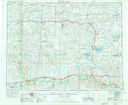
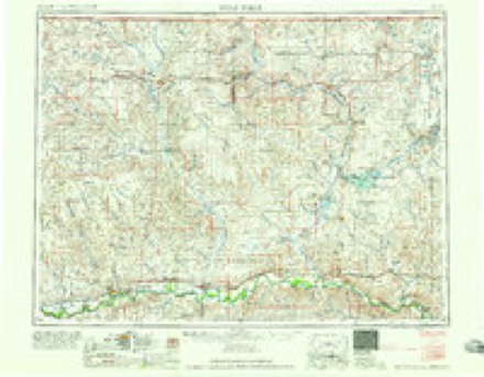
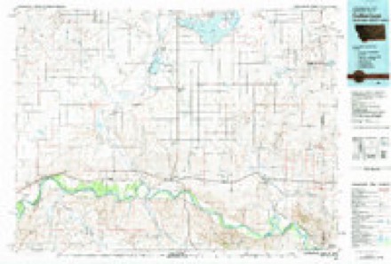
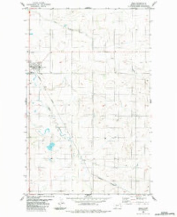
5 topographic sheets cover this place, the earliest surveyed in 1954 and the latest in 1983. It stands in the East Roosevelt census division. It lies in ZIP code area 59226. The Survey maps it on the Froid quadrangle. 195 people lived here at the 2020 count. It stands 2,031 feet above sea level.
Population over time
2 figuresFroid grew from 185 to 195 between 2010 and 2020. These are the recorded population figures Wikidata holds for this place, reached through the Geographic Names Information System number this page is keyed on rather than by name, so they belong to this place and not to another of the same name. Most are census counts, but not all are: an early figure may be a founding or settlement estimate, and an estimate published within five years of a census is left out. The change column is computed, and is left blank where more than 20 years separate a figure from the one before it, because a gap that long is not a change between two counts.
| Year | People | Change |
|---|---|---|
| 2010 | 185 | |
| 2020 | 195 | +10 (+5%) |
Topographic sheets covering this place
4 surveys from 5 printed sheetsMatched by testing this settlement's coordinate against the published boundary of every sheet in the United States Geological Survey's historical collection. Each opens the scanned sheet at the Survey.
- 1954 USGS Wolf Point quadrangle1:250000, 2 printings
- 1958 USGS Wolf Point quadrangle1:250000
- 1982 USGS Culbertson quadrangle1:100000
- 1983 USGS Froid quadrangle1:24000
Fires near this place
6 since 2004Regional context, not property-specific evidence. The federal wildfire occurrence database lists 6 fires within 5 miles of Froid between 2004 and 2018, burning about 1,833 acres in total. None started naturally. 1 was recorded as arson. Distance is straight-line from the map coordinates, so a fire counted here may appear on a neighbouring settlement's page as well.
| Reported cause | Fires |
|---|---|
| Equipment and vehicle use | 2 |
| Debris and open burning | 2 |
| Smoking | 1 |
| Arson/incendiarism | 1 |
The most recent of them, most recent first, with the day each was reported and the service that recorded it.
| Date | Cause | Size | Reported by | Name on the report |
|---|---|---|---|---|
| 18 July 2018 | Arson/incendiarism | under an acre | Fort Peck Agency | STENTOFF |
| 18 July 2018 | Debris and open burning | 29 acres | Northeast Montana Wetland Management District | BUFFLEHEAD |
| 24 June 2017 | Smoking | under an acre | Northeastern Land Office | not named |
| 9 May 2006 | Debris and open burning | 35 acres | Medicine Lake National Wildlife Refuge | FROID |
| 29 April 2008 | Equipment and vehicle use | 1,464 acres | Medicine Lake National Wildlife Refuge | YELLOWSTONE COMPLEX |
| 2 November 2004 | Equipment and vehicle use | 305 acres | Fort Peck Agency | 3MIWFROID |
Storms near this place
59 since 1997Regional context, not property-specific evidence. The National Weather Service names Froid in 59 storm reports between 1997 and 2025: 29 hail, 27 thunderstorm wind, 2 flash flood, 1 flood. The reports record 1 death and 1 injury. Each account below is quoted exactly as the forecast office filed it, from the NOAA Storm Events Database, and each date opens the federal record of that event.
| When | Event | Place named | Harm | What the report says |
|---|---|---|---|---|
| June 2010 | Thunderstorm Wind | Froid | 1 killed, 1 hurt, $250,000 | Severe thunderstorms across the region had widespread reports of winds in the 60 to 75 mph range, but a microburst 3 miles west of the town of Froid produced winds estimated based off of the damage survey at 110 to 125 mph. The winds hit just after 9 pm MDT. A modular home that was strapped to the ground had the straps snapped, and it was lifted from its foundation, thrown 30 feet to the north-northeast and flipped over. Two people were in the home at the time and a female ended up approximately 250-280 feet north-northeast of the main debris area. The female victim died shortly afterwards and the male victim was hospitalized with injuries including a broken arm and collarbone. The home was a total loss. A garage next to the home had damage to the garage doors, the siding on the west side of the home, and some of the roofing shingles torn off. |
| July 2005 | Thunderstorm Wind | Froid | $250,000 | There was significant tree damage in the town of Froid. Some grain bins were blown over, and there was significant crop damage with crops blown down. The grain elevator in town had some metal siding peeled off and it also shifted slightly. |
| September 2014 | Thunderstorm Wind | Froid | $50,000 | Damage was found at a new home site with a modular home and a large metal pole barn located 2.4 miles east of the intersection of Highway 16 and County Road 496. There were two other home sites west of this home, with no obvious damage. The newer home had a few missing shingles, but the new pole barn had the south door blown in with the south wall blown out to the southeast. There were a few trees that were snapped or cracked and dropped about 2-3 feet off the ground, including older Russian olive trees. The damage to the pole barn was estimated to have been caused by 70-75 mph winds. The homeowners were home and said the wind came from the west-northwest and there was a lot of dirt and gravel kicked up and thrown at them prior to their seeking shelter in a safe room in the pole barn. The garage door was blown in and the south wall was blown out. The garage door blew through the side wall and landed on a trailer near a tree row. All the insulation and debris from the side wall collapse were blown eastward. ||Another third of a mile east is the town site of McCabe, where there are a few homes, sheds and outbuildings. This area had a large older Russian olive tree uprooted as well as a two healthy spruce trees uprooted that were at least 25 feet tall. There was a shed damaged as well, but the two garage doors on it were open directly to the microburst winds, and the wood at the concrete footing was over 30 years old. All the debris was blown eastward. ||There was a lot of minor damage as well through the townsite. |
| July 2001 | Thunderstorm Wind | Froid | $25,000 | no account filed |
| August 2010 | Hail | Froid | $5,000 | Public report in a newspaper clipping of 2.5 to 3 inch hail occurred at 1310 MST. At 1312 MST 2 miles NNE of Froid, nickel size hail fell. Spotter reported 1.5 inch hail 2 miles NNE of Froid at 1315 MST. At 1320 MST Froid 1.00 to 1.75 inch hail fell mixed with 60 mph winds, denting a camper. |
| July 2008 | Hail | Froid | $1,500 | The hail ranged from pea to golf ball size and broke some windows out of the home. Several acres of crop damage was also reported. |
| August 2010 | Thunderstorm Wind | Froid | $1,000 | Winds combined with hail and dented a camper. |
| July 2001 | Thunderstorm Wind | Froid | $1,000 | Strong downburst winds broke 12-15 inch limbs off of cottonwood trees, and damaged shingles on a roof. |
| June 2025 | Hail | Froid | - | A trained spotter reported pea to quarter size hail. |
| June 2025 | Thunderstorm Wind | Froid | - | Public reported this wind gust on Facebook. |
| July 2022 | Thunderstorm Wind | Froid | - | A trained spotter estimated a thunderstorm wind gust of 60 mph, along with pea size hail. |
| July 2021 | Hail | Froid | - | Public reported, via Facebook, quarter size hail. |
| July 2020 | Thunderstorm Wind | Froid | - | Public reported, via Facebook, damage to an outdoor shed and loss of power. Wind speed is estimated. |
| July 2019 | Hail | Froid | - | Trained spotter reported hail up to the size of quarters. Time estimated by radar. |
| September 2019 | Hail | Froid | - | Trained spotter reported hail up to the size of quarters, along with heavy rain and standing water in their yard. |
| September 2019 | Hail | Froid | - | Public reported, via social media, quarter size hail. |
| July 2018 | Hail | Froid | - | Public reported, via social media, ping pong ball size hail and broken windows on the north side of their house. |
| July 2018 | Thunderstorm Wind | Froid | - | Public reported, via social media, 87 mph wind gusts measured by a personal weather station, and heavy rain. |
| July 2018 | Hail | Froid | - | Public reported, via social media, hen egg size hail and extensive tree damage. |
| July 2018 | Thunderstorm Wind | Froid | - | Public estimated 60 mph wind gusts. |
| July 2018 | Hail | Froid | - | Public reported quarter size hail. |
| July 2018 | Hail | Froid | - | Public reported ping pong ball size hail. |
| July 2018 | Thunderstorm Wind | Froid | - | Public measured sustained winds of 87 mph and a peak wind gust of 103 mph at a trusted an accurate personal weather station. Time estimated from radar. |
| July 2018 | Hail | Froid | - | Public reported, via social media, golf ball size hail. |
| June 2018 | Hail | Froid | - | Trained spotter reported half dollar size hail. |
| June 2016 | Thunderstorm Wind | Froid | - | Trained spotter reported 70 mph wind gusts. |
| September 2015 | Hail | Froid | - | Public reported golf ball sized hail. |
| July 2015 | Thunderstorm Wind | Froid | - | Public reported 63 mph winds. |
| June 2014 | Hail | Froid | - | Trained spotter reported hail up to the size of half dollars. |
| June 2014 | Hail | Froid | - | Trained spotter reported hail stone sizes ranging from quarters to ping pong balls. |
| June 2012 | Hail | Froid | - | Law enforcement reported penny sized hail covering the ground 9 miles northwest of Froid in Roosevelt County. |
| July 2012 | Thunderstorm Wind | Froid | - | Spotter estimated wind gusts up to 60 mph. |
| July 2012 | Thunderstorm Wind | Froid | - | Spotter estimated wind gusts up to 60 mph and reported a broken 6-inch diameter tree limb. |
| August 2012 | Thunderstorm Wind | Froid | - | Spotter estimated 60-mph wind gusts. |
| June 2012 | Hail | Froid | - | A trained spotter reported nickel sized hail covering the ground, and also heavy rain with the storm about 2 miles northeast of Froid in Roosevelt County. |
| August 2011 | Thunderstorm Wind | Froid | - | Spotter esitmated 60 mph winds. |
| July 2011 | Hail | Froid | - | Hail covered the ground, and lasted for 15 minutes. |
| June 2011 | Flood | Froid | - | Runoff from a period of heavy rain resulted in flooding of mainly the Big Muddy River and smaller streams in the area. |
| July 2010 | Thunderstorm Wind | Froid | - | Tree blown over by thunderstorm winds fell on roof and knocked off some shingles. |
| June 2010 | Hail | Froid | - | Spotter reported strong winds and heavy rain with the storm. |
| August 2010 | Hail | Froid | - | One inch hail fell along with heavy rain. |
| June 2005 | Thunderstorm Wind | Froid | - | A barn roof collapsed and several trees were down. |
| July 2005 | Thunderstorm Wind | Froid | - | Numerous trees down. |
| August 1997 | Flash Flood | Froid | - | Rain falling at the rate of 5 inches in one hour incombination of 3 to 6 inches of hail caused flooding in the town of Froid. Highway 16, which runs through the middle of town, was under 2 feet of water. |
| August 1997 | Hail | Froid | - | One inch hail covered the ground to a depth of 3-6 inches. |
| June 2008 | Hail | Froid | - | no account filed |
| July 2008 | Hail | Froid | - | no account filed |
| July 2008 | Hail | Froid | - | no account filed |
| July 2008 | Hail | Froid | - | no account filed |
| July 2007 | Hail | Froid | - | no account filed |
| July 2005 | Thunderstorm Wind | Froid | - | no account filed |
| July 2004 | Thunderstorm Wind | Froid | - | no account filed |
| July 2004 | Thunderstorm Wind | Froid | - | no account filed |
| July 2001 | Thunderstorm Wind | Froid | - | no account filed |
| June 1999 | Thunderstorm Wind | Froid | - | no account filed |
| July 1998 | Hail | Froid | - | no account filed |
| July 1998 | Hail | Froid | - | no account filed |
| August 1997 | Thunderstorm Wind | Froid | - | no account filed |
| August 1997 | Flash Flood | Froid | - | no account filed |
Nearest settlements
The eight closest, with where each one stands in the county. Distances are straight-line, computed from the Geographic Names Information System coordinates.
| Map | Place | Distance | Sheets |
|---|---|---|---|
| McCabe | 8.9 miles | 5 | |
| Slab Crossing | 11.2 miles | 8 | |
| Boyd (historical) | 12.5 miles | 7 | |
| Culbertson | 13.2 miles | 6 | |
| Blair | 14.7 miles | 7 | |
| Lanark | 15.1 miles | 5 | |
| Fort Kipp | 17.4 miles | 7 | |
| Bainville | 19.7 miles | 5 |
Elsewhere
Matched on this settlement's Geographic Names Information System number rather than its name, so it cannot be a different place of the same name in another state.
| Wikipedia article on Froid | An encyclopaedic summary. Its text is share-alike, so it is linked here rather than copied. |
| Wikidata item Q956243 | The structured record the population and elevation above come from. Public domain (CC0). |
Provenance
This settlement is recorded in the Geographic Names Information System as feature 771647. The sheet list is computed by point-in-boundary test against the United States Geological Survey's historical topographic inventory. Both are works of the United States government and carry no copyright under 17 U.S.C. 105.
Wildfire. Short, Karen C. 2022. Spatial wildfire occurrence data for the United States, 1992-2020 [FPA_FOD_20221014]. 6th Edition. Fort Collins, CO: Forest Service Research Data Archive. https://doi.org/10.2737/RDS-2013-0009.6 Collected with United States Government funding and usable without additional permissions or fees.
Storms. NOAA National Centers for Environmental Information, Storm Events Database https://www.ncei.noaa.gov/stormevents/ A work of the United States government, no copyright under 17 U.S.C. 105. Narratives are quoted verbatim from the National Weather Service report and are not edited or summarised.