 Block
Hoyt, Montana
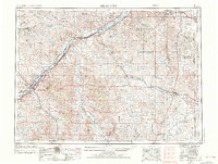
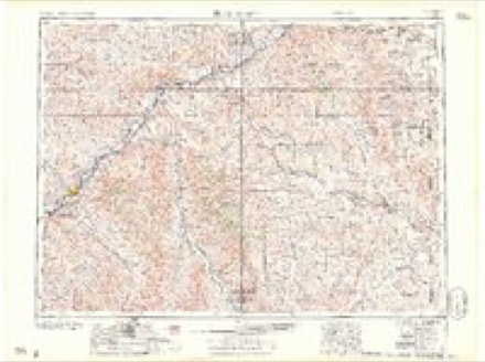
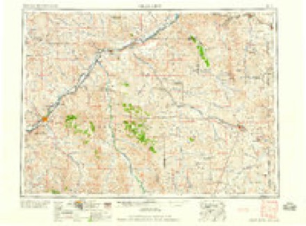
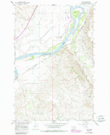
9 topographic sheets cover this place, the earliest surveyed in 1953 and the latest in 1981. It stands in the Glendive census division. It lies in ZIP code area 59326. It stands on Cabin Creek. The Survey maps it on the Hoyt quadrangle.
Topographic sheets covering this place
5 surveys from 9 printed sheetsMatched by testing this settlement's coordinate against the published boundary of every sheet in the United States Geological Survey's historical collection. Each opens the scanned sheet at the Survey.
- 1953 USGS Miles City quadrangle1:250000, 4 printings
- 1957 USGS Miles City quadrangle1:250000
- 1958 USGS Miles City quadrangle1:250000
- 1967 USGS Hoyt quadrangle1:24000, 2 printings
- 1981 USGS Wibaux quadrangle1:100000
Fires near this place
4 since 2017Regional context, not property-specific evidence. The federal wildfire occurrence database lists 4 fires within 5 miles of Hoyt between 2017 and 2020, burning about 252 acres in total. None started naturally. None was recorded as arson. Distance is straight-line from the map coordinates, so a fire counted here may appear on a neighbouring settlement's page as well.
| Reported cause | Fires |
|---|---|
| Missing data/not specified/undetermined | 2 |
| Equipment and vehicle use | 1 |
| Railroad operations and maintenance | 1 |
The most recent of them, most recent first, with the day each was reported and the service that recorded it.
| Date | Cause | Size | Reported by | Name on the report |
|---|---|---|---|---|
| 15 July 2017 | Equipment and vehicle use | 246 acres | Eastern Land Office | CRACKER BOX |
| 10 July 2018 | Railroad operations and maintenance | 1.2 acres | Eastern Land Office | FORSYTH SUB |
| 9 June 2019 | Missing data/not specified/undetermined | under an acre | Dawson County | ASCHE - DAWSON |
| 26 June 2020 | Missing data/not specified/undetermined | 4.4 acres | Dawson County | ROADSIDE - DAWSON |
Settlements close enough to share some of these fires:
Storms near this place
33 since 2001Regional context, not property-specific evidence. The National Weather Service names Hoyt in 33 storm reports between 2001 and 2024: 14 hail, 12 thunderstorm wind, 6 flood, 1 heavy rain. No death or injury is recorded in these reports. Each account below is quoted exactly as the forecast office filed it, from the NOAA Storm Events Database, and each date opens the federal record of that event.
| When | Event | Place named | Harm | What the report says |
|---|---|---|---|---|
| June 2024 | Thunderstorm Wind | Hoyt | - | The BLM Glendive mesonet site (MTM28) measured a 63 mph thunderstorm wind gust. |
| June 2024 | Thunderstorm Wind | Hoyt | - | The BLM Glendive mesonet site (MTM28) measured a 64 mph thunderstorm wind gust. |
| June 2024 | Thunderstorm Wind | Hoyt | - | The meso site (BRTM) measured a 64 mph thunderstorm wind gust. |
| August 2024 | Thunderstorm Wind | Hoyt | - | The BLM Glendive mesonet station (MTM28) measured a 67 mph thunderstorm wind gust. |
| July 2023 | Hail | Hoyt | - | A trained spotter reported hail up to the size of quarters. |
| July 2023 | Hail | Hoyt | - | The public reported hail up to the size of quarters. |
| August 2023 | Thunderstorm Wind | Hoyt | - | The BLM Glendive Mesonet site (MTM28) measured a 58 mph thunderstorm wind gust. |
| April 2020 | Thunderstorm Wind | Hoyt | - | At the mesonet site 5 ESE Hoyt (MTM28), a wind gust of 60 mph was recorded at 2:30 PM MST. |
| September 2019 | Flood | Hoyt | - | Dawson County Law Enforcement reported 2 inches of standing water on I-94, located 8 miles southwest of Glendive. |
| June 2016 | Hail | Hoyt | - | Dawson County Emergency Manager reported baseball sized hail. |
| July 2016 | Hail | Hoyt | - | Trained spotter reported quarter sized hail lasting for 15 minutes along with 35 mph winds. |
| July 2015 | Thunderstorm Wind | Hoyt | - | Trained spotter reported open front-end pole barn blown apart, an older building moved off its foundation, and broken tree limbs up to 6 inches in diameter. |
| July 2015 | Thunderstorm Wind | Hoyt | - | The Buffalo Rapids agrimet mesonet site reported 64 mph winds. |
| June 2014 | Hail | Hoyt | - | Trained spotter reported quarter-sized hail. |
| July 2013 | Hail | Hoyt | - | Trained spotter reported hail up to the size of golf balls. |
| July 2013 | Thunderstorm Wind | Hoyt | - | Trained spotter estimated wind gusts up to 70 mph along with heavy rain and a small amount of pea-sized hail. |
| July 2013 | Thunderstorm Wind | Hoyt | - | Trained spotter estimated wind gusts up to 60 mph with branches falling out of their trees. |
| July 2013 | Hail | Hoyt | - | Trained spotter reported quarter-sized hail and heavy rain. |
| August 2013 | Thunderstorm Wind | Hoyt | - | Trained spotter reported wind gusts up to 60 mph. |
| June 2012 | Hail | Hoyt | - | A trained spotter reported quarter sized hail 9 miles north-northwest of Marsh in Dawson County. |
| March 2011 | Flood | Hoyt | - | On March 14th, an ice jam on the Interstate 94 bridge near Glendive caused some low land flooding. On March 15th, West Glendive beginning a threat from the Yellowstone. On March 16th, equipment such as tractor and cars had to be moved to higher ground as the Interstate 94 bridge made the ice jamming problem much worse. On March 17th, water was flowing around an ice jam on the north side of Glendive resulting in flooding of lowland close to the river. On March 18th, Dawson County commissioners passed a resolution of emergency declaration due to the flooding. |
| March 2011 | Flood | Hoyt | - | On March 16th, small creeks and streams that feed the Yellowstone River were swollen. On March 18th, an ice jam near the Dawson County line were causing minor flooding of low lying areas. On the afternoon of the 18th, the ice jam that was causing flooding in the Glendive area, moved out of the area. This ice jam flooding caused an estimated $400 thousand worth of damage to irrigation pumps at the Buffalo Rapids Irrigation pump house. The water level was the highest that the employees had seen since 1972. |
| March 2011 | Flood | Hoyt | - | Small creeks, streams and the Yellowstone River are flooding surrounding fields and low lying areas. |
| May 2011 | Flood | Hoyt | - | Many gravel roads became impassible due to the extremely wet conditions. On May 21st, the Barry Underpass had 4 to 5 feet of water in it. |
| May 2011 | Flood | Hoyt | - | Runoff from recent heavy rain has brought flooding to several creeks and streams that feed the Yellowstone River. |
| May 2010 | Hail | Hoyt | - | A law enforcement officer reported one inch hail. |
| August 2010 | Hail | Hoyt | - | Also estimated 40 mph wind. |
| August 2009 | Hail | Hoyt | - | Nickel size hail, heavy rain, no strong wind. |
| July 2007 | Heavy Rain | Hoyt | - | Two and a quarter inches of rain was measured in 3 hours. |
| July 2007 | Hail | Hoyt | - | no account filed |
| August 2005 | Thunderstorm Wind | Hoyt | - | no account filed |
| August 2005 | Hail | Hoyt | - | no account filed |
| July 2001 | Hail | Hoyt | - | no account filed |
Nearest settlements
The eight closest, with where each one stands in the county. Distances are straight-line, computed from the Geographic Names Information System coordinates.
| Map | Place | Distance | Sheets |
|---|---|---|---|
| Marsh | 5.0 miles | 9 | |
| Colgate | 7.7 miles | 7 | |
| Pleasant View | 8.4 miles | 7 | |
| Forest Park | 13.1 miles | 7 | |
| West Glendive | 13.7 miles | 8 | |
| Landtsheim (historical) | 13.8 miles | 7 | |
| Glendive | 14.3 miles | 8 | |
| Curry | 16.4 miles | 8 |
Provenance
This settlement is recorded in the Geographic Names Information System as feature 772594. The sheet list is computed by point-in-boundary test against the United States Geological Survey's historical topographic inventory. Both are works of the United States government and carry no copyright under 17 U.S.C. 105.
Wildfire. Short, Karen C. 2022. Spatial wildfire occurrence data for the United States, 1992-2020 [FPA_FOD_20221014]. 6th Edition. Fort Collins, CO: Forest Service Research Data Archive. https://doi.org/10.2737/RDS-2013-0009.6 Collected with United States Government funding and usable without additional permissions or fees.
Storms. NOAA National Centers for Environmental Information, Storm Events Database https://www.ncei.noaa.gov/stormevents/ A work of the United States government, no copyright under 17 U.S.C. 105. Narratives are quoted verbatim from the National Weather Service report and are not edited or summarised.