 Block
Livingston, Montana
21 topographic sheets cover this place, the earliest surveyed in 1891 and the latest in 1992. It stands in the Livingston census division. It lies in ZIP code area 59047. It stands on Livingston Island. The Survey maps it on the Livingston quadrangle. 8,040 people lived here at the 2020 count. It stands 4,501 feet above sea level.
Research this city
On record in Livingston
Buildings and businesses the archive holds for this place. Each opens its own page, with the source record it came from.
On the National Register 12 of 19 shown
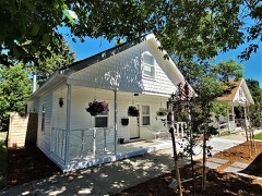 B Street Districtlisted 1979
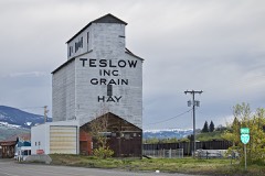 Billy Miles & Bros. Grain Elevatorlisted 2020
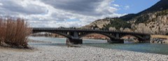 Carter Bridgelisted 2011
 Detention Hospitallisted 1979
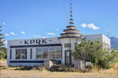 KPRK Radiolisted 1979
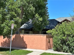 Krohne Spring Houselisted 1979
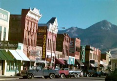 Livingston Depotlisted 1979
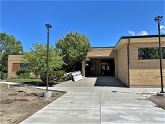 Livingston Memorial Hospitallisted 2018
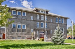 Northside Schoollisted 1979
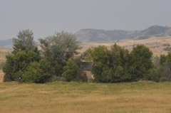 Rolfson Houselisted 1979
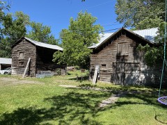 Trowbridge Dairylisted 1979
 US Post Office-Livingston Mainlisted 1986
Population over time
2 figuresLivingston grew from 7,044 to 8,040 between 2010 and 2020. These are the recorded population figures Wikidata holds for this place, reached through the Geographic Names Information System number this page is keyed on rather than by name, so they belong to this place and not to another of the same name. Most are census counts, but not all are: an early figure may be a founding or settlement estimate, and an estimate published within five years of a census is left out. The change column is computed, and is left blank where more than 20 years separate a figure from the one before it, because a gap that long is not a change between two counts.
| Year | People | Change |
|---|---|---|
| 2010 | 7,044 | |
| 2020 | 8,040 | +996 (+14%) |
Topographic sheets covering this place
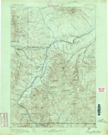
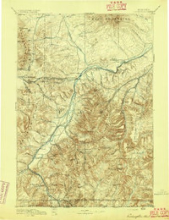
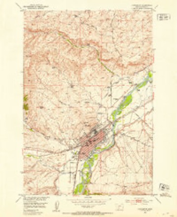
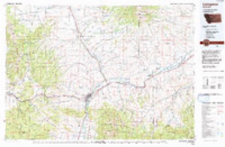
9 surveys from 21 printed sheetsMatched by testing this settlement's coordinate against the published boundary of every sheet in the United States Geological Survey's historical collection. Each opens the scanned sheet at the Survey.
- 1891 USGS Livingston quadrangle1:250000
- 1893 USGS Livingston quadrangle1:250000, 5 printings
- 1947 USGS Bozeman quadrangle1:250000
- 1948 USGS Bozeman quadrangle1:250000
- 1951 USGS Livingston quadrangle1:24000, 7 printings
- 1955 USGS Bozeman quadrangle1:250000
- 1958 USGS Bozeman quadrangle1:250000, 3 printings
- 1965 USGS Bozeman quadrangle1:250000
- 1992 USGS Livingston quadrangle1:100000
Fires near this place
16 since 1996Regional context, not property-specific evidence. The federal wildfire occurrence database lists 16 fires within 5 miles of Livingston between 1996 and 2020, burning about 2,239 acres in total. 4 started naturally. None was recorded as arson. Distance is straight-line from the map coordinates, so a fire counted here may appear on a neighbouring settlement's page as well.
| Reported cause | Fires |
|---|---|
| Missing data/not specified/undetermined | 5 |
| Natural | 4 |
| Equipment and vehicle use | 3 |
| Power generation/transmission/distribution | 2 |
| Fireworks | 1 |
| Railroad operations and maintenance | 1 |
The most recent of them, most recent first, with the day each was reported and the service that recorded it.
| Date | Cause | Size | Reported by | Name on the report |
|---|---|---|---|---|
| 4 September 2019 | Railroad operations and maintenance | under an acre | Park County | RAILROAD |
| 3 September 2019 | Natural | under an acre | Park County | BENNET ST |
| 11 September 2018 | Equipment and vehicle use | 1.0 acres | Central Land Office | not named |
| 20 August 2020 | Power generation/transmission/distribution | under an acre | Park County | CONVICT GRADE |
| 2 August 1996 | Natural | 15 acres | Central Land Office | TROWBRIDGE PARK CO ASST |
| 14 August 2018 | Equipment and vehicle use | under an acre | Central Land Office | not named |
| 10 August 2018 | Equipment and vehicle use | under an acre | Central Land Office | not named |
| 8 July 2016 | Missing data/not specified/undetermined | under an acre | Southern Land Office | IRON HOURSE |
Settlements close enough to share some of these fires:
Mines and quarries near this place
7 within 5 milesRegional context, not property-specific evidence. The federal mineral resources record lists 7 workings within 5 miles of Livingston: 4 producers, 2 occurrences, 1 past producer. 4 still produce. What was taken out: Sand and Gravel, Construction, Stone, Dimension, Geothermal, Limestone, Dimension. Distance is straight-line from the map coordinates, so a quarry counted here may appear on a neighbouring settlement's page as well.
| Where | Site | Commodity | Status | Recorded |
|---|---|---|---|---|
| Carter Bridge Warm Springs | Geothermal | Producer | ||
| Limestone Occurrence | Limestone, Dimension | Occurrence | ||
| Meigs Property | Calcium | Occurrence | ||
| Travertine Quarry | Stone, Dimension | Producer | ||
| Mission Pit | Sand and Gravel, Construction | Producer | ||
| Ninth Street Island Pit | Sand and Gravel, Construction | Past Producer | ||
| Zook # 2 | Sand and Gravel, Construction | Producer |
Storms near this place
60 of 63 shownRegional context, not property-specific evidence. The National Weather Service names Livingston in 63 storm reports between 1994 and 2025: 44 thunderstorm wind, 15 hail, 2 flood, 1 flash flood. The reports record 4 injuries. Each account below is quoted exactly as the forecast office filed it, from the NOAA Storm Events Database, and each date opens the federal record of that event.
| When | Event | Place named | Harm | What the report says |
|---|---|---|---|---|
| August 2001 | Wildfire | Livingston | 3 hurt | Fridley Fire--Gallatin National ForestDate Started: August 19, 2001Cause of Ignition: LightningLocation: 12 miles southwest of Livingston, MontanaSize: 26,373 acres; 12 miles long, and 3 to 5 miles wideContained: September 13th, 2001Number of Personnel: 1,261 totalAircraft: 15 helicoptersEquipment: 46 engines; 2 bulldozers; 2 timber forwarders modified for firefightingCost: $11.4 millionDeaths: Shortly after 9:00 am on the morning of August 31, 2001, a Kawasaki Vertol 107-II helicopter assigned to the Fridley fire went down, resulting in three fatalities. The aircraft was on a maintenance check flight several miles east of the fire perimeter. |
| August 1995 | Thunderstorm Wind | Livingston | 1 hurt | Several large trees were blown down in a thunderstorm. One falling tree injured a person. Campers were trapped due to trees having been blown across a road. |
| July 1994 | Thunderstorm Wind | Livingston | $5,000 | Strong winds blew down trees in the Pine Creek Camp Ground. One vehicle was damanged by a falling tree. |
| July 2025 | Thunderstorm Wind | Livingston | - | Mesonet station mtlwm at 2.0 SW Livingston. |
| May 2020 | Thunderstorm Wind | Livingston | - | A roof was torn off a building. |
| July 2020 | Thunderstorm Wind | Livingston | - | A wind gust of 63 mph was recorded 2 miles west/southwest of Livingston. |
| May 2014 | Flood | Livingston | - | Park County DES reported that there was erosion damage to the rip-rap levee on the north side of the Yellowstone River, approximately 1000 feet south of the Park County High School in the city of Livingston. An area 40' long eroded into 10' into the levee. The levee eroded parallel to the river to a length of 100' along the north bank. |
| June 2012 | Thunderstorm Wind | Livingston | - | The thunderstorm resulted in sustained winds of 56 mph for a brief time with a gust of 69 mph. |
| July 2011 | Thunderstorm Wind | Livingston | - | Local law enforcement reported downed trees and power lines in Livingston. |
| June 2011 | Flood | Livingston | - | Warm temperatures combined with scattered showers and thunderstorms resulted in continued high elevation snowmelt. As a result, the Yellowstone River at Livingston fluctuated above and below flood stage from the 23rd through the end of the month. The river crested at 9.85 feet on the 24th and 10.15 feet on the 30th. This 10.15 foot crest was the second highest crest on record at Livingston, only surpassed by the 1997 record flood. The persistent high flows resulted in significant erosion along the river. Some damage occurred to the island road as water overtopped the road. However, no major impacts were reported. |
| July 2008 | Thunderstorm Wind | Livingston | - | Winds gusted to 61 mph at the Livingston Airport. |
| August 2008 | Thunderstorm Wind | Livingston | - | A thunderstorm wind gust of 60 mph was recorded at the Livingston Airport. |
| August 2008 | Thunderstorm Wind | Livingston | - | A thunderstorm wind gust of 61 mph was measured at the Livingston Airport. |
| August 2008 | Thunderstorm Wind | Livingston | - | A thunderstorm wind gust of 60 mph was reported at the Livingston Airport. |
| June 2005 | Thunderstorm Wind | Livingston | - | Wind gusts over 60 mph recorded from 850 pm MDT until 935 pm MDT |
| June 2005 | Thunderstorm Wind | Livingston | - | Livingston law enforcement reported extensive damage to roofs...semi trailers blown over and fires started due to the strong winds. Power was out to much of the town. |
| August 2005 | Thunderstorm Wind | Livingston | - | Tree 1.5 feet in diameter knocked down across a driveway by a strong wind gust. |
| July 2001 | Flash Flood | Livingston | - | Four feet of water in the B Street underpass. Several streets with 6 inches of water flowing like a river. |
| August 2001 | Thunderstorm Wind | Livingston | - | 60 mph thunderstorm wind gust |
| April 1994 | Thunderstorm Wind | Livingston | - | The airport east of Livingston reported a wind gust to 63 mph. |
| June 2022 | Thunderstorm Wind | Livingston | - | no account filed |
| July 2022 | Hail | Livingston | - | no account filed |
| July 2021 | Thunderstorm Wind | Livingston | - | no account filed |
| August 2021 | Thunderstorm Wind | Livingston | - | no account filed |
| July 2019 | Thunderstorm Wind | Livingston | - | no account filed |
| June 2019 | Thunderstorm Wind | Livingston | - | no account filed |
| July 2017 | Thunderstorm Wind | Livingston | - | no account filed |
| April 2014 | Thunderstorm Wind | Livingston | - | no account filed |
| May 2014 | Hail | Livingston | - | no account filed |
| June 2013 | Thunderstorm Wind | Livingston | - | no account filed |
| June 2013 | Thunderstorm Wind | Livingston | - | no account filed |
| August 2013 | Thunderstorm Wind | Livingston | - | no account filed |
| September 2013 | Thunderstorm Wind | Livingston | - | no account filed |
| July 2013 | Thunderstorm Wind | Livingston | - | no account filed |
| August 2013 | Hail | Livingston | - | no account filed |
| July 2012 | Thunderstorm Wind | Livingston | - | no account filed |
| June 2011 | Thunderstorm Wind | Livingston | - | no account filed |
| August 2011 | Thunderstorm Wind | Livingston | - | no account filed |
| July 2010 | Thunderstorm Wind | Livingston | - | no account filed |
| July 2010 | Thunderstorm Wind | Livingston | - | no account filed |
| August 2009 | Hail | Livingston | - | no account filed |
| August 2009 | Hail | Livingston | - | no account filed |
| September 2009 | Thunderstorm Wind | Livingston | - | no account filed |
| June 2006 | Thunderstorm Wind | Livingston | - | no account filed |
| August 2006 | Hail | Livingston | - | no account filed |
| August 2006 | Hail | Livingston | - | no account filed |
| August 2006 | Hail | Livingston | - | no account filed |
| August 2006 | Hail | Livingston | - | no account filed |
| June 2005 | Hail | Livingston | - | no account filed |
| June 2005 | Thunderstorm Wind | Livingston | - | no account filed |
| June 2005 | Thunderstorm Wind | Livingston | - | no account filed |
| July 2005 | Thunderstorm Wind | Livingston | - | no account filed |
| May 2002 | Hail | Livingston | - | no account filed |
| July 1998 | Hail | Livingston | - | no account filed |
| July 1997 | Hail | Livingston | - | no account filed |
| July 1997 | Thunderstorm Wind | Livingston | - | no account filed |
| July 1997 | Thunderstorm Wind | Livingston | - | no account filed |
| July 1997 | Hail | Livingston | - | no account filed |
| August 1997 | Hail | Livingston | - | no account filed |
| August 1995 | Thunderstorm Wind | Livingston | - | no account filed |
Nearest settlements
The eight closest, with where each one stands in the county. Distances are straight-line, computed from the Geographic Names Information System coordinates.
| Map | Place | Distance | Sheets |
|---|---|---|---|
| Branding Iron Addition | 0.0 miles | 21 | |
| Five Acre Tracts/Acreville Addition | 0.0 miles | 21 | |
| Green Acres Addition | 0.0 miles | 21 | |
| High Ground Addition | 0.0 miles | 21 | |
| Minnesota Addition | 0.0 miles | 21 | |
| Palace Addition | 0.0 miles | 21 | |
| Park Addition | 0.0 miles | 21 | |
| Riverside Addition | 0.0 miles | 21 |
Elsewhere
Matched on this settlement's Geographic Names Information System number rather than its name, so it cannot be a different place of the same name in another state.
| Wikipedia article on Livingston | An encyclopaedic summary. Its text is share-alike, so it is linked here rather than copied. |
| Wikidata item Q960253 | The structured record the population and elevation above come from. Public domain (CC0). |
Provenance
This settlement is recorded in the Geographic Names Information System as feature 773511. The sheet list is computed by point-in-boundary test against the United States Geological Survey's historical topographic inventory. Both are works of the United States government and carry no copyright under 17 U.S.C. 105.
Wildfire. Short, Karen C. 2022. Spatial wildfire occurrence data for the United States, 1992-2020 [FPA_FOD_20221014]. 6th Edition. Fort Collins, CO: Forest Service Research Data Archive. https://doi.org/10.2737/RDS-2013-0009.6 Collected with United States Government funding and usable without additional permissions or fees.
Mines and quarries. USGS Mineral Resources Data System (MRDS) https://mrdata.usgs.gov/mrds/ A work of the United States government, no copyright under 17 U.S.C. 105.
Storms. NOAA National Centers for Environmental Information, Storm Events Database https://www.ncei.noaa.gov/stormevents/ A work of the United States government, no copyright under 17 U.S.C. 105. Narratives are quoted verbatim from the National Weather Service report and are not edited or summarised.