 Block
Savage, Montana
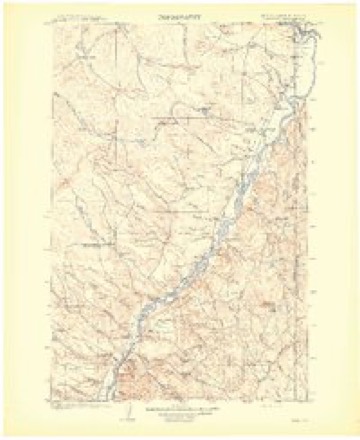
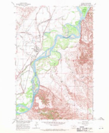
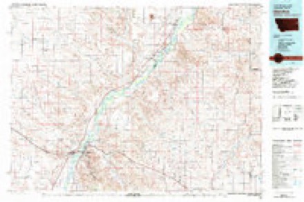
8 topographic sheets cover this place, the earliest surveyed in 1909 and the latest in 1981. It stands in the Savage-Crane census division. It lies in ZIP code area 59262. It lies near Peabody Coulee. The Survey maps it on the Savage quadrangle. 303 people lived here at the 2020 count. It stands 1,985 feet above sea level.
Topographic sheets covering this place
6 surveys from 8 printed sheetsMatched by testing this settlement's coordinate against the published boundary of every sheet in the United States Geological Survey's historical collection. Each opens the scanned sheet at the Survey.
- 1909 USGS Glendive quadrangle1:250000
- 1954 USGS Glendive quadrangle1:250000, 2 printings
- 1957 USGS Glendive quadrangle1:250000
- 1958 USGS Glendive quadrangle1:250000
- 1966 USGS Savage quadrangle1:24000, 2 printings
- 1981 USGS Glendive quadrangle1:100000
Fires near this place
8 since 2016Regional context, not property-specific evidence. The federal wildfire occurrence database lists 8 fires within 5 miles of Savage between 2016 and 2017, burning about 20 acres in total. 2 started naturally. None was recorded as arson. Distance is straight-line from the map coordinates, so a fire counted here may appear on a neighbouring settlement's page as well.
| Reported cause | Fires |
|---|---|
| Equipment and vehicle use | 3 |
| Missing data/not specified/undetermined | 2 |
| Natural | 2 |
| Debris and open burning | 1 |
The most recent of them, most recent first, with the day each was reported and the service that recorded it.
| Date | Cause | Size | Reported by | Name on the report |
|---|---|---|---|---|
| 2 September 2016 | Natural | under an acre | Eastern Land Office | MCKEAN - MCCONE |
| 2 September 2016 | Natural | 14 acres | Eastern Land Office | DENWOODY - MCCONE |
| 29 August 2016 | Missing data/not specified/undetermined | under an acre | Eastern Land Office | WATER PLANT - MCCONE |
| 22 August 2017 | Equipment and vehicle use | 1.0 acres | Eastern Land Office | BEEF SLOUGH |
| 11 August 2017 | Equipment and vehicle use | 1.0 acres | Eastern Land Office | PEABODY |
| 1 August 2017 | Equipment and vehicle use | 1.0 acres | Eastern Land Office | ELK ISLAND |
| 20 July 2016 | Missing data/not specified/undetermined | under an acre | Eastern Land Office | CIRCLE - MCCONE |
| 8 March 2016 | Debris and open burning | 2.8 acres | Eastern Land Office | BECKER- MCCONE |
Settlements close enough to share some of these fires:
Storms near this place
60 of 64 shownRegional context, not property-specific evidence. The National Weather Service names Savage in 64 storm reports between 1995 and 2026: 32 thunderstorm wind, 24 hail, 3 flash flood, 3 flood. No death or injury is recorded in these reports. Each account below is quoted exactly as the forecast office filed it, from the NOAA Storm Events Database, and each date opens the federal record of that event.
| When | Event | Place named | Harm | What the report says |
|---|---|---|---|---|
| July 2011 | Thunderstorm Wind | Savage | $500,000 | Some light damage consisting of tree branches down and fence damage was noted south of Lambert. More significant damage was found about 9 miles southeast of Lambert on Rd. 115. At this location, numerous trees were uprooted or snapped, and there was damage to homes and vehicles. Residents reported hail up to 2.5 inches breaking windows in homes.||Major to minor crop damage was seen over a large area from 9 southeast of Lambert to Savage. An irrigation system was destroyed just north of Savage. There was some damage to structures in and near the town of Savage, with the most significant structural damage surveyed occurring on a ranch 6 miles west-northwest of Savage. At this location, an attached garage was destroyed with the garage door torn off and a wall blown out. The garage door and wall, which were blown 200 feet down wind of the house. Also, this ranch had a grain bin torn off its foundation and blown a half mile down wind, where it was found in a mining pit.||About 4 miles of power poles were blown down or snapped along Rd. 107 west of Lambert. Poles on the south side of the road were blown down, while those on the north side were not, even though those on the south side were thicker poles. The poles that were blown down were a little taller than those that did not get blown down, and had cross members near the top.||In the town of Savage, numerous trees were uprooted or snapped. The cemetery at Savage had the most trees blown down.||Crop damage occurred as far south as County Road 107, with hail also being reported. However, significant structural and tree damage was reported by the public (not surveyed) further south, without hail also being reported. A dairy 2.4 miles west-southwest of Savage had considerable damage, including the roof. All of the debris from the dairy was blown down wind towards the south.||The perception of the residents of Savage was that they experienced a tornado. This is a reasonable perception as the residents first received a tornado warning form the NWS, then lost power, and then experienced powerful damaging winds. However, all of the damage surveyed flowed primarily in one direction, towards the south. Also, the damage extended over a wide area exceeding 4 miles in width, and tornadoes are much more localized. In fact, this wide area of damage is more significant than that produced by most tornadoes.||As all of the observed damage implied flow from the north, it was concluded that the damage was caused by a strong macroburst. A macroburst is defined as a strong downdraft from a thunderstorm affecting a path of greater than 2.5 miles. A macroburst forms when hail and rain aloft fall and entrain air, forming a downdraft. As large hail has a high fall speed, strong downdrafts can develop in storms with a lot of large hail (which this storm had). When the downdraft impacts the ground, the flow spreads out horizontally, creating strong straight line winds which radiate out from the center of the downdraft along a gust front. The rotation of the storm can add to the downdraft effect, creating a large area of uniform wind direction. Radar indications did not show large hail approximately south of County Road 107, which agrees with surveyed crop damage and public reports. However, significant damage still occurred for at least several miles south of Rd. 107. It is not unusual for gust fronts to travel considerable distances away from the storms which produce them, which evidently happened in this case.||The maximum wind speeds with this event are estimated from the resulting damage. Uprooted and snapped hardwood trees, building damage, and broken power poles are all consistent with winds above 95 mph over a wide area, with winds up to about 110 mph for the most significant damage.||The survey team did not find any damage from a tornado at any location, though one was conclusively observed and photographed. This is not surprising as the time the tornado was observed, when combined with radar indications of a possible tornado, place the tornado in an empty area just southwest of Fox Lake near Lambert. A tornado in this location would not have left behind any damage for the survey team to catalog. |
| July 2004 | Thunderstorm Wind | Savage | $50,000 | Two buildings were damaged in Savage. A portion of a roof was blown off of one building and the entrance door to a second building was damaged. |
| August 1997 | Thunderstorm Wind | Savage | $30,000 | Thunderstorm winds downed power lines and large trees. |
| July 1997 | Thunderstorm Wind | Savage | $20,000 | Thunderstorm winds left a 6 mile wide path of damage with tree limbs as great as 4 inches in diameter felled by the wind. |
| August 1995 | Hail | Savage | $10,000 | Golf ball-size hail broke windows in a home and damaged vehicles. A wheat field was flattened. |
| July 1997 | Thunderstorm Wind | Savage | $5,000 | no account filed |
| April 2026 | Thunderstorm Wind | Savage | - | The Savage MT-16 DOT site (MTSVG) recorded a 59 mph wind gust. |
| April 2026 | Thunderstorm Wind | Savage | - | The Savage CWOP mesonet site (F8536) recorded a 60 mph wind gust. |
| July 2025 | Thunderstorm Wind | Savage | - | A wind gust of 62 mph was measured at the Savage MT-16 DOT site (MTSVG). |
| June 2024 | Thunderstorm Wind | Savage | - | Public reported near Savage a 58 mph thunderstorm wind gust. |
| June 2024 | Thunderstorm Wind | Savage | - | The Savage MT-16 DOT site measured a 61 mph thunderstorm wind gust. |
| May 2023 | Flash Flood | Savage | - | A CoCoRaHS observer reported 8 to 10 inches of water over Highway 16 at 2 miles south of Savage. They also reported 2 County Road bridges washed out in the same area. |
| June 2023 | Thunderstorm Wind | Savage | - | A trained spotter in the town of Savage estimated thunderstorm wind gusts of at least 60 mph. |
| June 2021 | Thunderstorm Wind | Savage | - | The mesonet site near Crane (D8634), recorded a 62 mph thunderstorm wind gust. |
| June 2021 | Thunderstorm Wind | Savage | - | The mesonet site (FW8536), located northwest of Savage, measured a 66 mph thunderstorm wind gust. |
| June 2021 | Thunderstorm Wind | Savage | - | The mesonet site (DW8636), 2 N Savage, measured a 66 mph thunderstorm wind gust. |
| July 2016 | Hail | Savage | - | Public reported, via social media, quarter sized hail. |
| March 2014 | Flood | Savage | - | A series of ice jams caused moderate flooding along the river in Richland County. One farm house had water two feet over the basement window wells, and in the worst flood in 1979, it was only 2 inches over the window wells. The ice caused rapid rises of water, and two volunteer firefighters from Savage, MT got caught as the ice came up behind them while checking the river after dark. It took a rescue helicopter from Minot Air Force Base to come and rescue them off of the ice island they were stranded on for 5 hours. Several propane tanks were reported to have been pulled off their stands and floated downstream. There was a lot of farmland and low lying areas that experienced flooding all the way from the Dawson/Richland County line to the confluence with the Missouri River a few miles into North Dakota. |
| August 2013 | Hail | Savage | - | Trained spotter reported hail up to size of nickels, lasting for 15 minutes in the town of Savage. |
| August 2013 | Hail | Savage | - | Trained spotter reported hail up to the size of quarters, lasting for 5 minutes. |
| May 2013 | Hail | Savage | - | Public reported nickel-sized hail and estimated wind gusts of 30 mph. |
| August 2011 | Hail | Savage | - | Public estimated golf ball-sized hail and zero visibility with winds up to 50 mph along highway 16. |
| July 2011 | Heavy Rain | Savage | - | Over a period of 30 minutes, 1.92 inches of rain was measured. |
| July 2011 | Thunderstorm Wind | Savage | - | Measured wind speeds in excess of 60 mph downed several large trees up to and exceeding 2 feet in diameter. |
| July 2011 | Thunderstorm Wind | Savage | - | Richland County Dispatch reported downed trees blocking traffic 6 to 8 miles south of Savage along highway 16. |
| July 2011 | Hail | Savage | - | Spotter reported ping pong ball-sized hail stones and estimated 60 mph wind gusts and half an inch of rain. |
| July 2011 | Hail | Savage | - | Spotter reported golf ball-sized hail stones and estimated 60 mph wind gusts. |
| July 2011 | Thunderstorm Wind | Savage | - | Spotter reported a 35-foot tall tree was blown over which also downed some power lines. |
| July 2011 | Thunderstorm Wind | Savage | - | Lots of tree damage and power lines down. A facility lost part of its roof. An official NWS Damage Survey estimated the highest winds in this storm at 110 mph. |
| March 2011 | Flood | Savage | - | On March 16th, small creeks and streams that feed the Yellowstone River were swollen. On March 18th, an ice jam near Savage was causing some low land flooding. Also ice jams near Sidney were fluctuating river levels and causing flooding near Richland Park. |
| March 2011 | Flood | Savage | - | Small creeks, streams and the Yellowstone River are flooding surrounding fields and low lying areas. |
| June 2009 | Hail | Savage | - | Pea to penny-sized hail was reported. Winds were estimated at around 30 mph. |
| July 2008 | Hail | Savage | - | A measured wind gust of 45 mph accompanied the hail. |
| June 2007 | Thunderstorm Wind | Savage | - | A portable basketball goal filled with water was knocked over and damaged. |
| May 2007 | Hail | Savage | - | The hail cracked a windshield. |
| May 2004 | Flash Flood | Savage | - | 5 miles north of Savage law enforcement reported a foot of water over Montana Highway 16. The water stretched nearly 100 yards. They closed the road until the water receded. |
| July 2004 | Flash Flood | Savage | - | Water reported over highway 16. |
| June 1995 | Tornado (F0) | Savage | - | Four large cottonwood trees were uprooted and a large grain auger was knocked over. |
| July 2011 | Hail | Savage | - | no account filed |
| July 2008 | Hail | Savage | - | no account filed |
| August 2008 | Hail | Savage | - | no account filed |
| August 2008 | Thunderstorm Wind | Savage | - | no account filed |
| May 2007 | Hail | Savage | - | no account filed |
| May 2007 | Hail | Savage | - | no account filed |
| August 2006 | Hail | Savage | - | no account filed |
| June 2005 | Hail | Savage | - | no account filed |
| June 2005 | Thunderstorm Wind | Savage | - | no account filed |
| May 2004 | Hail | Savage | - | no account filed |
| July 2004 | Thunderstorm Wind | Savage | - | no account filed |
| July 2003 | Thunderstorm Wind | Savage | - | no account filed |
| August 2003 | Thunderstorm Wind | Savage | - | no account filed |
| July 2001 | Thunderstorm Wind | Savage | - | no account filed |
| July 2001 | Thunderstorm Wind | Savage | - | no account filed |
| July 2001 | Thunderstorm Wind | Savage | - | no account filed |
| July 2001 | Thunderstorm Wind | Savage | - | no account filed |
| July 2000 | Thunderstorm Wind | Savage | - | no account filed |
| August 2000 | Thunderstorm Wind | Savage | - | no account filed |
| August 2000 | Thunderstorm Wind | Savage | - | no account filed |
| June 1999 | Hail | Savage | - | no account filed |
| June 1997 | Hail | Savage | - | no account filed |
Nearest settlements
The eight closest, with where each one stands in the county. Distances are straight-line, computed from the Geographic Names Information System coordinates.
| Map | Place | Distance | Sheets |
|---|---|---|---|
| Knife River | 0.1 miles | 8 | |
| Midway | 4.4 miles | 7 | |
| Hoffmanville | 4.5 miles | 7 | |
| Burns | 6.2 miles | 8 | |
| Sears (historical) | 6.7 miles | 7 | |
| Crane | 9.4 miles | 7 | |
| Piche | 12.2 miles | 7 | |
| Newlon Junction | 16.1 miles | 8 |
Elsewhere
Matched on this settlement's Geographic Names Information System number rather than its name, so it cannot be a different place of the same name in another state.
| Wikipedia article on Savage | An encyclopaedic summary. Its text is share-alike, so it is linked here rather than copied. |
| Wikidata item Q14704767 | The structured record the population and elevation above come from. Public domain (CC0). |
Provenance
This settlement is recorded in the Geographic Names Information System as feature 776236. The sheet list is computed by point-in-boundary test against the United States Geological Survey's historical topographic inventory. Both are works of the United States government and carry no copyright under 17 U.S.C. 105.
Wildfire. Short, Karen C. 2022. Spatial wildfire occurrence data for the United States, 1992-2020 [FPA_FOD_20221014]. 6th Edition. Fort Collins, CO: Forest Service Research Data Archive. https://doi.org/10.2737/RDS-2013-0009.6 Collected with United States Government funding and usable without additional permissions or fees.
Storms. NOAA National Centers for Environmental Information, Storm Events Database https://www.ncei.noaa.gov/stormevents/ A work of the United States government, no copyright under 17 U.S.C. 105. Narratives are quoted verbatim from the National Weather Service report and are not edited or summarised.