 Block
Van Norman, Montana
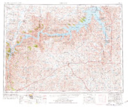
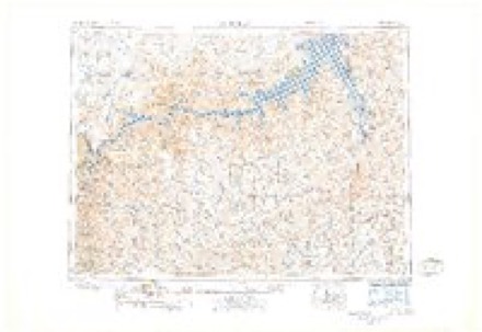
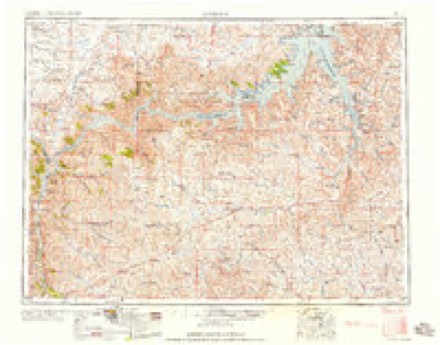
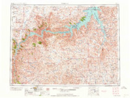
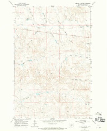
7 topographic sheets cover this place, the earliest surveyed in 1954 and the latest in 1983. It stands in the South Garfield census division. It lies in ZIP code area 59337. It stands on Little Dry Creek. The Survey maps it on the Maxwell Coulee quadrangle.
Topographic sheets covering this place
6 surveys from 7 printed sheetsMatched by testing this settlement's coordinate against the published boundary of every sheet in the United States Geological Survey's historical collection. Each opens the scanned sheet at the Survey.
- 1954 USGS Jordan quadrangle1:250000, 2 printings
- 1956 USGS Jordan quadrangle1:250000
- 1958 USGS Jordan quadrangle1:250000
- 1964 USGS Jordan quadrangle1:250000
- 1967 USGS Maxwell Coulee quadrangle1:24000
- 1983 USGS Jordan quadrangle1:100000
Fires near this place
5 since 2006Regional context, not property-specific evidence. The federal wildfire occurrence database lists 5 fires within 5 miles of Van Norman between 2006 and 2019, burning about 34 acres in total. None started naturally. None was recorded as arson. Distance is straight-line from the map coordinates, so a fire counted here may appear on a neighbouring settlement's page as well.
| Reported cause | Fires |
|---|---|
| Equipment and vehicle use | 4 |
| Missing data/not specified/undetermined | 1 |
The most recent of them, most recent first, with the day each was reported and the service that recorded it.
| Date | Cause | Size | Reported by | Name on the report |
|---|---|---|---|---|
| 9 August 2016 | Equipment and vehicle use | under an acre | Miles City Field Office | 233 |
| 8 July 2006 | Equipment and vehicle use | 33 acres | Miles City Field Office | JOCK COULEE |
| 25 July 2017 | Equipment and vehicle use | under an acre | Miles City Field Office | LITTLE DRY CREEK |
| 20 July 2006 | Missing data/not specified/undetermined | under an acre | Miles City Field Office | HOVERSON HAY |
| 31 May 2019 | Equipment and vehicle use | under an acre | Miles City Field Office | JOCK COULEE |
Storms near this place
44 since 2000Regional context, not property-specific evidence. The National Weather Service names Van Norman in 44 storm reports between 2000 and 2024: 20 hail, 19 thunderstorm wind, 3 flash flood, 2 heavy rain. No death or injury is recorded in these reports. Each account below is quoted exactly as the forecast office filed it, from the NOAA Storm Events Database, and each date opens the federal record of that event.
| When | Event | Place named | Harm | What the report says |
|---|---|---|---|---|
| June 2002 | Flash Flood | Van Norman | $100,000 | 3 to 9 inches of rain fell over eastern Garfield County in less than 5 hours. Flooding closed Highway 200 from Jordan to the junction of Highway 24 for most of the night and caused some damage along bridges on Highway 200. |
| May 2010 | Flash Flood | Van Norman | $50,000 | Heavy rain during the evening brought the failure of a local dam. The dam's name was 7-Tree and the gash or hole made was 50-60 feet wide by 40-50 feet deep. |
| July 2013 | Hail | Van Norman | $5,000 | Public reported hail up to the size of hen eggs fell for 10 minutes, breaking a skylight and several windows. |
| June 2024 | Thunderstorm Wind | Van Norman | - | The Jordan E mesonet site (MTM88) measured a 60 mph thunderstorm wind gust. |
| June 2024 | Thunderstorm Wind | Van Norman | - | The Jordan E mesonet site (MTM88) recorded a thunderstorm wind gust of 67 mph. |
| August 2024 | Thunderstorm Wind | Van Norman | - | The Jordan E mesonet station (MTM88) measured a 67 mph thunderstorm wind gust. |
| August 2023 | Thunderstorm Wind | Van Norman | - | The Jordan E. Mesonet site (MTM88) measured a 59 mph thunderstorm wind gust. |
| May 2022 | Thunderstorm Wind | Van Norman | - | The mesonet site (MTM88) Jordan E, measured a 59 mph thunderstorm wind gust. |
| June 2021 | Hail | Van Norman | - | Trained spotter reported golf ball size hail. |
| May 2020 | Thunderstorm Wind | Van Norman | - | Public measured a 67 mph wind gust. |
| May 2020 | Thunderstorm Wind | Van Norman | - | Public reported several power poles were blown down near the Flowing Wells Rest Area. |
| May 2020 | Heavy Rain | Van Norman | - | Public measured a storm total rainfall amount of 3.23 inches. |
| July 2017 | Thunderstorm Wind | Van Norman | - | A trained spotter reported sustained winds of approximately 40 mph with gusts to approximately 60 mph. Blowing dust was reducing visibility to less than 1/2 mile with the stronger gusts. |
| June 2016 | Hail | Van Norman | - | Off-duty NWS employee reported quarter to golf ball sized hail along with damaging winds. |
| June 2016 | Thunderstorm Wind | Van Norman | - | Off-duty NWS employee reported 60 mph wind gusts along with large hail. |
| June 2015 | Thunderstorm Wind | Van Norman | - | Trained spotter estimated 60 mph wind gusts. |
| July 2015 | Thunderstorm Wind | Van Norman | - | Trained spotter reported a roof blown off an old shed due to 60 mph wind gusts. |
| July 2014 | Hail | Van Norman | - | Public reported golf ball-sized hail causing damage to a window on a house. Hail also destroyed a garden. Hail created a swath of total crop damage measuring one-half to one mile wide and at least three miles long. Information was relayed from Garfield County extension agent and then from property owners. Hail duration of 5 minutes. |
| July 2014 | Hail | Van Norman | - | Public reported ping pong ball-sized hail damaged a garden and some plants. Hail caused more significant drop damage south and west of this location. |
| July 2014 | Hail | Van Norman | - | Trained spotter reported penny-sized hail with heavy rain and winds up to 40 mph. |
| May 2014 | Hail | Van Norman | - | Trained spotter reported quarter-sized hail. |
| July 2013 | Hail | Van Norman | - | Trained spotter reported quarter-sized hail and estimated wind gusts up to 50 mph. |
| July 2013 | Hail | Van Norman | - | Trained spotter reported walnut-sized hail. |
| July 2013 | Hail | Van Norman | - | Trained spotter reported tea cup sized hail. |
| August 2013 | Thunderstorm Wind | Van Norman | - | Public reported wind gusts up to 60 mph. |
| August 2012 | Hail | Van Norman | - | Spotter reported quarter-sized hail stones and wind gusts up to 50 mph. |
| July 2012 | Thunderstorm Wind | Van Norman | - | Spotter estimated wind gusts up to 60 mph. |
| June 2012 | Thunderstorm Wind | Van Norman | - | A trained spotter reported a 60 MPH wind gust 10 miles south of Van Norman in Garfield County. |
| July 2011 | Hail | Van Norman | - | Estimated nickel-sized hail with a quarter-inch of rain. |
| July 2011 | Thunderstorm Wind | Van Norman | - | Heavy rain was also reported. |
| May 2010 | Hail | Van Norman | - | Trained Spotter and Coop Observer reported quarter-size hail. |
| June 2010 | Heavy Rain | Van Norman | - | Rainfall of 2.5 inches fell with thunderstorms that caused small streams to rise out of their banks. Ponding and overflow on area roadways were observed too. |
| August 2009 | Flash Flood | Van Norman | - | A portion of the Van Norman Road was washed out due to heavy rain that accompanied a bow echo storm system. Hell Creek Rd was partially washed out in several places. Woody Creek went from being empty to having 7 feet of water in it, and the county commissioner had never seen it that high before. At 12 miles southeast of Cohagen, 3.0 inches of rain fell, along with pea size hail and a 30 to 40 mph wind. |
| June 2005 | Thunderstorm Wind | Van Norman | - | 50 to 60 foot cottonwood trees downed. |
| May 2007 | Hail | Van Norman | - | no account filed |
| June 2007 | Hail | Van Norman | - | no account filed |
| July 2004 | Thunderstorm Wind | Van Norman | - | no account filed |
| June 2003 | Thunderstorm Wind | Van Norman | - | no account filed |
| July 2002 | Thunderstorm Wind | Van Norman | - | no account filed |
| July 2000 | Hail | Van Norman | - | no account filed |
| July 2000 | Hail | Van Norman | - | no account filed |
| July 2000 | Hail | Van Norman | - | no account filed |
| July 2000 | Hail | Van Norman | - | no account filed |
| July 2000 | Hail | Van Norman | - | no account filed |
Nearest settlements
The eight closest, with where each one stands in the county. Distances are straight-line, computed from the Geographic Names Information System coordinates.
| Map | Place | Distance | Sheets |
|---|---|---|---|
| Keplerville (historical) | 11.3 miles | 7 | |
| Purewater (historical) | 12.2 miles | 7 | |
| Phon (historical) | 14.7 miles | 8 | |
| Watson Flats (historical) | 19.4 miles | 7 | |
| Allen (historical) | 20.1 miles | 7 | |
| Cohagen | 24.0 miles | 8 | |
| Jordan | 27.8 miles | 8 | |
| Haxby | 28.8 miles | 8 |
Elsewhere
Matched on this settlement's Geographic Names Information System number rather than its name, so it cannot be a different place of the same name in another state.
| Wikidata item Q122555082 | The structured record the population and elevation above come from. Public domain (CC0). |
Provenance
This settlement is recorded in the Geographic Names Information System as feature 767932. The sheet list is computed by point-in-boundary test against the United States Geological Survey's historical topographic inventory. Both are works of the United States government and carry no copyright under 17 U.S.C. 105.
Wildfire. Short, Karen C. 2022. Spatial wildfire occurrence data for the United States, 1992-2020 [FPA_FOD_20221014]. 6th Edition. Fort Collins, CO: Forest Service Research Data Archive. https://doi.org/10.2737/RDS-2013-0009.6 Collected with United States Government funding and usable without additional permissions or fees.
Storms. NOAA National Centers for Environmental Information, Storm Events Database https://www.ncei.noaa.gov/stormevents/ A work of the United States government, no copyright under 17 U.S.C. 105. Narratives are quoted verbatim from the National Weather Service report and are not edited or summarised.