 Block
Volt, Montana
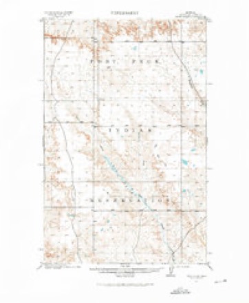
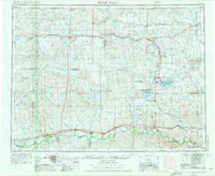
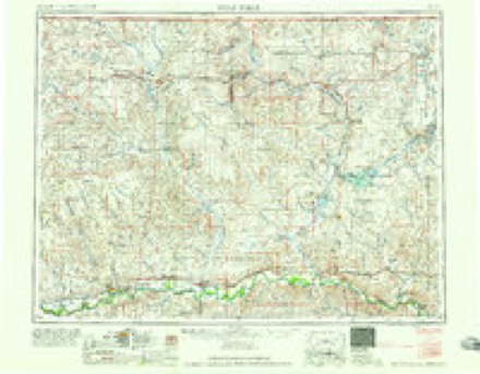
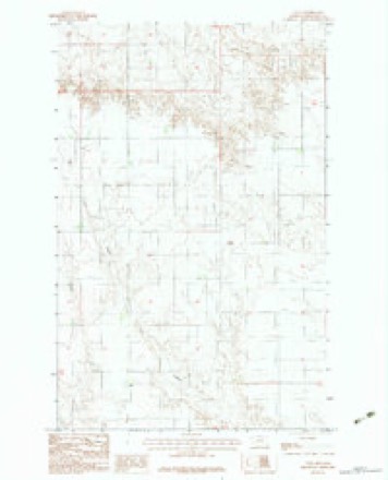
6 topographic sheets cover this place, the earliest surveyed in 1915 and the latest in 1983. It stands in the Fort Peck Reservation census division. It lies in ZIP code area 59201. The Survey maps it on the Volt quadrangle.
Topographic sheets covering this place
4 surveys from 6 printed sheetsMatched by testing this settlement's coordinate against the published boundary of every sheet in the United States Geological Survey's historical collection. Each opens the scanned sheet at the Survey.
- 1915 USGS Tule Valley quadrangle1:62500, 2 printings
- 1954 USGS Wolf Point quadrangle1:250000, 2 printings
- 1958 USGS Wolf Point quadrangle1:250000
- 1983 USGS Volt quadrangle1:24000
Fires near this place
8 since 1996Regional context, not property-specific evidence. The federal wildfire occurrence database lists 8 fires within 5 miles of Volt between 1996 and 2020, burning about 4,295 acres in total. None started naturally. None was recorded as arson. Distance is straight-line from the map coordinates, so a fire counted here may appear on a neighbouring settlement's page as well.
| Reported cause | Fires |
|---|---|
| Equipment and vehicle use | 4 |
| Smoking | 1 |
| Debris and open burning | 1 |
| Power generation/transmission/distribution | 1 |
| Missing data/not specified/undetermined | 1 |
The most recent of them, most recent first, with the day each was reported and the service that recorded it.
| Date | Cause | Size | Reported by | Name on the report |
|---|---|---|---|---|
| 2 September 2020 | Equipment and vehicle use | 3,448 acres | Fort Peck Agency | BULL |
| 18 September 2017 | Equipment and vehicle use | 823 acres | Fort Peck Agency | CURVE |
| 1 September 1998 | Smoking | 2.0 acres | Fort Peck Agency | TOAVS |
| 22 July 1996 | Power generation/transmission/distribution | 3.0 acres | Fort Peck Agency | TRANSFORMR |
| 19 July 2014 | Missing data/not specified/undetermined | 13 acres | Fort Peck Agency | MM 22 |
| 18 July 2017 | Equipment and vehicle use | under an acre | Fort Peck Agency | PEPSI |
| 17 July 2014 | Equipment and vehicle use | under an acre | Fort Peck Agency | DITCH |
| 9 June 2014 | Debris and open burning | 5.2 acres | Fort Peck Agency | TOAVS |
Storms near this place
27 since 1996Regional context, not property-specific evidence. The National Weather Service names Volt in 27 storm reports between 1996 and 2024: 12 hail, 10 thunderstorm wind, 2 flood, 1 flash flood. No death or injury is recorded in these reports. Each account below is quoted exactly as the forecast office filed it, from the NOAA Storm Events Database, and each date opens the federal record of that event.
| When | Event | Place named | Harm | What the report says |
|---|---|---|---|---|
| July 2013 | Tornado (EF2) | Volt | $500,000 | The tornado was first spotted about 19 miles north of Wolf Point and the NWS Storm Damage Team found downed tree limbs and a de-barked tree trunk. As it moved eastward, the tornado rolled heavy hay bails, snapped a road-sign post and flipped a loose yard shed. A few miles west of the Poplar River and just north of County Road 2042, the Beck Farm sustained the most damage involving roofs peeled away and blown off of several farm and storage buildings. Winds here were estimated at 115 to 120 mph. After crossing over the Poplar River, the tornado downed a large cottonwood tree, lifted and moved irrigation pipes, and snapped 9 power poles, then dissipated near the intersection of County Roads 2041 and 1041, about 17 miles north of Poplar. |
| August 2024 | Thunderstorm Wind | Volt | - | A trained spotter measured a 60 mph thunderstorm wind gust. |
| July 2022 | Thunderstorm Wind | Volt | - | A trained spotter estimated thunderstorm wind gusts of 60 mph. |
| July 2022 | Thunderstorm Wind | Volt | - | Public reported, via Facebook, a thunderstorm wind gust estimated at 60 mph. |
| July 2021 | Thunderstorm Wind | Volt | - | A trained spotter estimated wind gusting to 70mph. |
| May 2020 | Heavy Rain | Volt | - | Trained spotter reported heavy rain from a thunderstorm, measuring 2.00 inches in 45 minutes, as well as 50 mph wind gusts. |
| July 2020 | Thunderstorm Wind | Volt | - | Trained spotter reported multiple tree limbs downed. |
| July 2020 | Thunderstorm Wind | Volt | - | At the Lustre mesonet site (FW0464), a 61 mph wind gust was recorded. |
| July 2020 | Thunderstorm Wind | Volt | - | A trained spotter reported a 61 mph wind gust. |
| July 2019 | Hail | Volt | - | Trained spotter reported quarter size hail. |
| July 2019 | Hail | Volt | - | Trained spotter reported quarter size hail. Time estimated. |
| June 2018 | Hail | Volt | - | Public reported quarter size hail. Time estimated by radar. |
| June 2015 | Hail | Volt | - | Trained spotter reported ping pong ball-sized hail. |
| July 2013 | Thunderstorm Wind | Volt | - | Public reported crop damage from a severe thunderstorm. |
| August 2013 | Hail | Volt | - | Trained spotter reported penny-sized hail. |
| June 2012 | Hail | Volt | - | A trained spotter reported penny sized hail along with an inch of rain 9 miles east-southeast of Volt in Roosevelt County. |
| June 2011 | Flood | Volt | - | Two to three inches of rain resulted flooding of Wolf, Tule, Chelsea and Box Elder Creeks. Street flooding was reported in Wolf Point. During the afternoon of June 12th, water continued to flow over fields and streets on the north side of Wolf Point. |
| July 2011 | Thunderstorm Wind | Volt | - | Spotter reported 60 mph winds and heavy rain. |
| May 2011 | Flood | Volt | - | Small streams rose out their banks due to heavy rains and above normal wet spring. |
| August 2010 | Thunderstorm Wind | Volt | - | At Volt at 1604 MST, water was being pushed into the basement with the wind. At 1 mile north of Volt, wind shook the house and an 80 year old tree with a diameter of 16 inches snapped in half. Several large branches broke off in a tree grove. Another batch of trees 20 inches in diameter were all snapped at the base. All debris was blown southeast of the originating point. |
| July 2009 | Hail | Volt | - | Pea to quarter-sized hail covered the ground. 0.50 inches of rain also fell. |
| May 2006 | Hail | Volt | - | 1.30 inches of rain accompanied the hail. |
| July 2007 | Hail | Volt | - | no account filed |
| July 2007 | Hail | Volt | - | no account filed |
| July 1998 | Hail | Volt | - | no account filed |
| July 1998 | Flash Flood | Volt | - | no account filed |
| June 1996 | Hail | Volt | - | no account filed |
Nearest settlements
The eight closest, with where each one stands in the county. Distances are straight-line, computed from the Geographic Names Information System coordinates.
| Map | Place | Distance | Sheets |
|---|---|---|---|
| Benrud (historical) | 10.7 miles | 6 | |
| Wolf Point | 21.0 miles | 6 | |
| Macon | 22.0 miles | 6 | |
| Bredette | 23.6 miles | 5 | |
| Chelsea | 26.8 miles | 6 | |
| Poplar | 33.5 miles | 6 | |
| Sprole | 39.8 miles | 6 | |
| Deertail Indian Village (historical) | 40.4 miles | 6 |
Provenance
This settlement is recorded in the Geographic Names Information System as feature 767921. The sheet list is computed by point-in-boundary test against the United States Geological Survey's historical topographic inventory. Both are works of the United States government and carry no copyright under 17 U.S.C. 105.
Wildfire. Short, Karen C. 2022. Spatial wildfire occurrence data for the United States, 1992-2020 [FPA_FOD_20221014]. 6th Edition. Fort Collins, CO: Forest Service Research Data Archive. https://doi.org/10.2737/RDS-2013-0009.6 Collected with United States Government funding and usable without additional permissions or fees.
Storms. NOAA National Centers for Environmental Information, Storm Events Database https://www.ncei.noaa.gov/stormevents/ A work of the United States government, no copyright under 17 U.S.C. 105. Narratives are quoted verbatim from the National Weather Service report and are not edited or summarised.