 Block
From the record
One of 33 National Register listings published here for Deer Lodge County · listed in 2000 · category: Structure.
Sources: the case file at the National Archives · the National Register database, National Park Service
Listed on the National Register of Historic Places in 2000.
One of 33 National Register listings published here for Deer Lodge County · listed in 2000 · category: Structure.
Sources: the case file at the National Archives · the National Register database, National Park Service
Regional context, not property-specific evidence. The federal wildfire occurrence database lists 11 fires within 5 miles of Morel Bridge between 1992 and 2020, burning about 144 acres in total. 2 started naturally. None was recorded as arson. Distance is straight-line from the map coordinates, so a fire counted here may appear on a neighbouring settlement's page as well.
| Reported cause | Fires |
|---|---|
| Missing data/not specified/undetermined | 4 |
| Natural | 2 |
| Smoking | 2 |
| Equipment and vehicle use | 1 |
| Railroad operations and maintenance | 1 |
| Debris and open burning | 1 |
The most recent of them, most recent first, with the day each was reported and the service that recorded it.
| Date | Cause | Size | Reported by | Name on the report |
|---|---|---|---|---|
| 8 September 2017 | Smoking | under an acre | Southwestern Land Office | not named |
| 26 September 2017 | Smoking | under an acre | Southwestern Land Office | not named |
| 31 August 1998 | Railroad operations and maintenance | under an acre | Southwestern Land Office | WARM SPRINGS |
| 3 August 2019 | Missing data/not specified/undetermined | 33 acres | Deer Lodge County | PINTLER VISTA |
| 14 August 2018 | Equipment and vehicle use | under an acre | Southwestern Land Office | PERKINS |
| 11 August 2003 | Natural | under an acre | Southwestern Land Office | not named |
| 11 August 2003 | Missing data/not specified/undetermined | under an acre | Southwestern Land Office | not named |
| 1 August 1999 | Natural | under an acre | Southwestern Land Office | PERKINS GULCH |
Regional context, not property-specific evidence. The federal mineral resources record lists 12 workings within 5 miles of Morel Bridge: 11 occurrences, 1 producer. 1 still produces. What was taken out: Pumice, Copper, Gold, Limestone, Dimension. Distance is straight-line from the map coordinates, so a quarry counted here may appear on a neighbouring settlement's page as well.
| Where | Site | Commodity | Status | Recorded |
|---|---|---|---|---|
| Jackpot Mine | Copper, Molybdenum | Occurrence | ||
| Last Resort Claim | Lead, Copper, Silver | Occurrence | ||
| Limestone Occurrence | Limestone, Dimension | Occurrence | ||
| St Louis Mine | Gold, Copper, Lead, Silver | Occurrence | ||
| Unnamed Minerals | Gold, Lead, Molybdenum, Silver, Copper | Occurrence | ||
| Warm Springs | Geothermal | Producer | ||
| Yellow Jacket Mine | Copper | Occurrence | ||
| Pumice Deposit | Pumice | Occurrence | ||
| Unnamed Pumice | Pumice | Occurrence | ||
| Unnamed Pumice | Pumice | Occurrence |
Regional context, not property-specific evidence. The National Weather Service names Anaconda, the town this property stands in, in 30 storm reports between 1994 and 2023: 16 hail, 4 thunderstorm wind, 3 heavy rain, 2 flood. The reports record 5 injuries. Each account below is quoted exactly as the forecast office filed it, from the NOAA Storm Events Database, and each date opens the federal record of that event.
| When | Event | Place named | Harm | What the report says |
|---|---|---|---|---|
| September 2005 | Lightning | Anaconda | 3 hurt | no account filed |
| July 1998 | Thunderstorm Wind | Anaconda | 2 hurt | no account filed |
| July 2017 | Flash Flood | Anaconda | $685,000 | There were several reports of very heavy rainfall including one that came from the NWS COOP observer at the golf course: 0.75 of rain in 20 to 25 minutes. Multiple homes experienced flooded basements, man hole covers were lifted off and floated down roads, and Westhill Park road was flooded with a depth of up to 4 feet. The Old Works Golf Course in Anaconda reported the cost to repair flood damage to be $660,000. |
| June 2015 | Heavy Rain | Anaconda | $15,000 | A cluster of thunderstorms brought heavy rain just west of Anaconda. Edward from Anaconda reported 0.59 inches of rain and his friend who lives to the west recorded 1.13 inches of precipitation. The intense rain caused mud run off into a basement. |
| July 2009 | Lightning | Anaconda | $1,000 | Lightning from a thunderstorm that rolled through Anaconda started a roof on fire that was put out by the fire department before extensive damage occurred. The fire burned though the exterior of the roof and down into the insulation, about 20 square feet of the roof. |
| July 2023 | Hail | Anaconda | - | There were two reports of quarter sized hail, one on the west side of Anaconda and another 2 miles north of Warm Springs as the storm moved northeastward. |
| April 2012 | Heavy Rain | Anaconda | - | A spotter measured 0.46 inches of rain in Anaconda. |
| June 2011 | Flood | Anaconda | - | Warm Springs Creek flooded the Cedar Street bridge in Anaconda. Homes and Cedar Street bridge were sand bagged. Washoe Park was flooded. Water flooded the foundation of 4 homes. |
| August 2010 | Heavy Rain | Anaconda | - | A trained spotter reported that 0.78 inches of precipitation fell in 40 to 50 minutes. |
| August 2010 | Thunderstorm Wind | Anaconda | - | The Deer Lodge County emergency manager reported tin roof and shingle damage in Anaconda. Storm drains were also having difficulty keeping up with the heavy rainfall amounts. |
| July 2008 | Hail | Anaconda | - | Trained spotter in Anaconda reported 1.00 inch hail. |
| July 2008 | Hail | Anaconda | - | Trained spotter in Anaconda reported 0.75 inch hail. |
| July 2009 | Hail | Anaconda | - | no account filed |
| July 2009 | Hail | Anaconda | - | no account filed |
| August 2006 | Hail | Anaconda | - | no account filed |
| June 2005 | Hail | Anaconda | - | no account filed |
| June 2005 | Hail | Anaconda | - | no account filed |
| July 2004 | Thunderstorm Wind | Anaconda | - | no account filed |
| July 2002 | Flash Flood | Anaconda | - | no account filed |
| June 2002 | Funnel Cloud | Anaconda | - | no account filed |
| August 2002 | Hail | Anaconda | - | no account filed |
| August 2001 | Hail | Anaconda | - | no account filed |
| August 1999 | Hail | Anaconda | - | no account filed |
| August 1998 | Thunderstorm Wind | Anaconda | - | no account filed |
| August 1998 | Hail | Anaconda | - | no account filed |
| July 1998 | Hail | Anaconda | - | no account filed |
| June 1997 | Flood | Anaconda | - | no account filed |
| April 1996 | Hail | Anaconda | - | no account filed |
| April 1996 | Hail | Anaconda | - | no account filed |
| June 1994 | Hail | Anaconda | - | no account filed |
No historic map-sheet match is published for this property yet. That does not mean no map exists. This record needs a coordinate-quality review before it can be joined to a sheet boundary. Browse the county's mapped places while that work is pending.
Other National Register properties close enough to walk or drive between, ordered by distance from this one. Both positions come from the same geocoding pass that matched these properties to their map sheets.
| Photograph | Property | Distance | Listed |
|---|---|---|---|
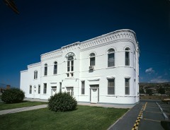 | Butte, Anaconda and Pacific Railway Historic District | 6.0 miles | 1988 |
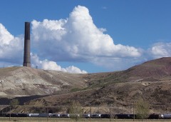 | Anaconda Copper Mining Company Smoke Stack | 7.6 miles | 1987 |
| National Archives record | The nomination case file for reference 00001491 in Record Group 79. |
| Deer Lodge County | All 33 listed properties in this county. |