 Block
From the record
One of 82 National Register listings published here for Lewis and Clark County · listed in 1997 · category: Building.
Sources: the case file at the National Archives · the National Register database, National Park Service
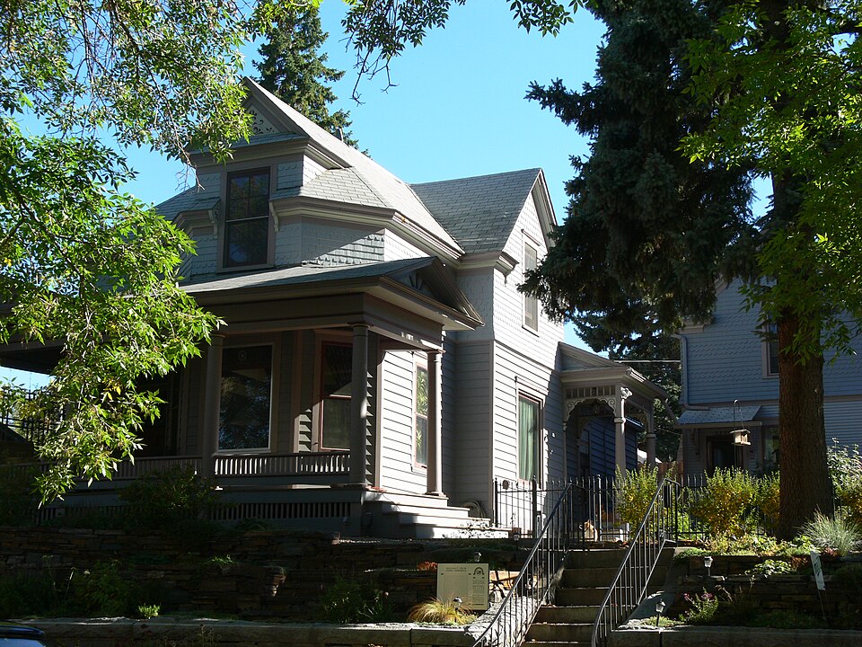
Listed on the National Register of Historic Places in 1997.
One of 82 National Register listings published here for Lewis and Clark County · listed in 1997 · category: Building.
Sources: the case file at the National Archives · the National Register database, National Park Service
Regional context, not property-specific evidence. The federal wildfire occurrence database lists 174 fires within 5 miles of William C. Crum House between 1992 and 2020, burning about 1,200 acres in total. 43 started naturally. 3 were recorded as arson. Distance is straight-line from the map coordinates, so a fire counted here may appear on a neighbouring settlement's page as well.
| Reported cause | Fires |
|---|---|
| Natural | 43 |
| Missing data/not specified/undetermined | 43 |
| Recreation and ceremony | 29 |
| Debris and open burning | 24 |
| Equipment and vehicle use | 10 |
| Fireworks | 8 |
| Power generation/transmission/distribution | 6 |
| Railroad operations and maintenance | 5 |
| Arson/incendiarism | 3 |
| Misuse of fire by a minor | 2 |
| Smoking | 1 |
The most recent of them, most recent first, with the day each was reported and the service that recorded it.
| Date | Cause | Size | Reported by | Name on the report |
|---|---|---|---|---|
| 7 September 1995 | Natural | under an acre | Helena - Lewis and Clark National Forest | TUCKER GULCH/ |
| 7 September 1995 | Railroad operations and maintenance | under an acre | Central Land Office | FORT HARRISON |
| 30 September 2011 | Recreation and ceremony | under an acre | Central Land Office | RODNEY RIDGE |
| 30 September 1992 | Missing data/not specified/undetermined | under an acre | Central Land Office | GLORY HOLE |
| 27 September 1992 | Recreation and ceremony | under an acre | Helena - Lewis and Clark National Forest | not named |
| 19 September 2010 | Debris and open burning | under an acre | Central Land Office | GRIZZLY GULCH |
| 17 September 2017 | Debris and open burning | 98 acres | Central Land Office | ELK RIDGE |
| 17 September 1998 | Railroad operations and maintenance | under an acre | Central Land Office | MRL MMP #4 |
Regional context, not property-specific evidence. The federal mineral resources record lists 76 workings within 5 miles of William C. Crum House: 31 past producers, 15 unknowns, 13 occurrences, 10 producers. 10 still produce. What was taken out: Gold, Gold, Silver, Silver, Limestone, General. Distance is straight-line from the map coordinates, so a quarry counted here may appear on a neighbouring settlement's page as well.
| Where | Site | Commodity | Status | Recorded |
|---|---|---|---|---|
| Blue Bird Mine | Copper, Gold, Iron, Silver | Prospect | ||
| Franklin Mine | Silver, Gold, Copper, Lead, Silica, Zinc | Past Producer | Galena, Gold | |
| Franklin and Sam Gaty | Copper, Gold, Lead, Silver | Past Producer | ||
| Grizzly Gulch | Limestone, General, Dolomite | Unknown | ||
| Helena District | Gold, Silver, Copper, Lead, Zinc, Stone, Tungsten, Arsenic, Marble, Dimension, Dolomite | Past Producer | 1864 | |
| Helena Hot Spring | Geothermal | Producer | ||
| Independent Mine | Gold, Copper, Tungsten, Uranium, Zinc | Past Producer | ||
| Independent Prospect | Gold, Silver, Tungsten | Past Producer | Gold, Scheelite, Silver | |
| Limestone Occurrence | Limestone, Dimension | Occurrence | ||
| Maybesto & Try Claims | Gold, Lead, Mercury, Silver | Unknown |
Regional context, not property-specific evidence. The National Weather Service names Helena, the town this property stands in, in 70 storm reports between 1994 and 2022: 29 hail, 16 thunderstorm wind, 10 flash flood, 10 heavy rain. The reports record 4 injuries. Each account below is quoted exactly as the forecast office filed it, from the NOAA Storm Events Database, and each date opens the federal record of that event.
| When | Event | Place named | Harm | What the report says |
|---|---|---|---|---|
| July 2000 | Wildfire | Helena | 2 hurt, $2,500,000 | Canyon Ferry Complex - includes Broadwater County, 38570 acres burned, 13 residences destroyed, 37 outbuildings destroyed, unknown cause, continued past July 31. |
| August 2000 | Wildfire | Helena | 2 hurt, $2,500,000 | Continued Canyon Ferry Complex - includes Broadwater County, 38570 acres burned, cause unknown, 13 residents destroyed, 37 outbuildings destroyed. |
| July 2022 | Flash Flood | Helena | $700,000 | Significant flash flooding across downtown and Last Chance Gulch area. Severe businesses sustained damage, including Helena YWCA and the Lewis and Clark Library. 1 to 2 feet of water flowing up against business doors. Flood waters up to bumpers of vans. Moviegoers at the Helena Cinemark report the movie theater being evacuated, with water draining into the lobby area. Some vehicles were also initially stranded in the lower level of the Great Northern Parking Garage. Several streets in the Capitol area saw rapid flooding with a number of homeowners reporting basement flooding. |
| July 2000 | Thunderstorm Wind | Helena | $10,000 | Roof blown off mobile home. |
| August 1999 | Flash Flood | Helena | $4,000 | no account filed |
| June 1997 | Tornado (F0) | Helena | $2,000 | no account filed |
| May 2008 | Dust Devil | Helena | $1,000 | Dust devil blew off roof of shed and blew other objects around. |
| July 2022 | Heavy Rain | Helena | - | Rainfall of 1.11 INCHES recorded in 15 min per Ambient Weather station. |
| July 2022 | Heavy Rain | Helena | - | Rainfall amount fell in 10 min per Ambient Weather station. |
| July 2022 | Heavy Rain | Helena | - | Report via trained spotter. |
| July 2022 | Heavy Rain | Helena | - | Event total of 2.1 inches. |
| July 2022 | Flash Flood | Helena | - | Pictures of water up to homes near winnie and sanders avenues. Significant flooding of intersections with fast moving water. |
| July 2022 | Heavy Rain | East Helena | - | Trained spotter reported 1.98 inches of rainfall per hour. Winds gusting 32 mph. |
| July 2022 | Flash Flood | Helena | - | Law enforcement closed portions of neill and fuller avenues due to flooding. Water flooded down Last Chance Gulch and impacted numerous businesses. |
| June 2020 | Thunderstorm Wind | Helena | - | A large tree blown down on Madison/Gilbert Street in Helena. Wind speed and gust estimate not reported. |
| August 2019 | Hail | East Helena | - | A trained spotter reported mixed nickle and quarter sized hail (.88 to 1 inch in diameter). |
| August 2019 | Heavy Rain | Helena | - | COCORAHS reported a 24 hour rainfall total of 1.05 inches, with .72 inches falling within 10 minutes. |
| September 2019 | Heavy Rain | Helena | - | A rainfall total of 2.22 inches was reported by the public at 10 NNE East Helena. Rainfall total began on the evening of Friday, September 6th and ended Monday evening, September 9th. |
| September 2019 | Heavy Rain | Helena | - | A COCORAHS station at 2 NW of Helena reported 1 inch of rain. |
| September 2019 | Heavy Rain | Helena | - | A trained spotter at 2 SE Helena reported a 24 hour total rainfall 1.8 inches, based on surrounding observations, most of it fell since 4PM September 8th. |
| September 2019 | Heavy Rain | Helena | - | A trained spotter at 11 W Helena reported 1.19 inches of rain since 7PM September 8th, and a three day total of 1.96 inches. |
| May 2018 | Flash Flood | Helena | - | KTVH reported flash flooding at intersection of 11th Ave and N. Montana Ave in Helena. |
| June 2017 | Hail | Helena | - | Retired NWS employee reported ping pong ball-size hail just north of MacDonald Pass. |
| August 2017 | Thunderstorm Wind | Helena | - | Reports of uprooted trees, as well as trees that broke in half at the Treasure State Acres Subdivision in northern Helena. |
| July 2017 | Thunderstorm Wind | Helena | - | Facebook photos were submitted during an outdoor event, showing mangled and destroyed tents along with porta-potties blown over. A stage also suffered minor damage. Time estimated. |
| July 2016 | Thunderstorm Wind | East Helena | - | A thunderstorm produced a wind gust to 58 mph at East Helena 4NNW. |
| July 2013 | Hail | Helena | - | Hail measuring 1.25 inches (half dollar sized) was reported 2 mi SE of Helena, MT. |
| July 2013 | Flash Flood | Helena | - | Flash flooding reported around the Corral Fire burn scar. Water and debris covered the intersection of Green Meadow Drive and Norris Road. No injuries or damage were reported. |
| July 2013 | Hail | Helena | - | Hail measuring 1.75 inches was reported 9 mi NNE of Helena, MT. |
| July 2013 | Hail | Helena | - | Hail measuring 1.00 inches was reported by a trained spotter 5 mi NNE of Helena, MT. |
| July 2011 | Hail | Helena | - | A thunderstorm dropped 1 inch diameter hail at Helena 10N. |
| June 2010 | Hail | East Helena | - | A thunderstorm dropped 1 inch diameter hail at East Helena 5E. |
| August 2008 | Thunderstorm Wind | Helena | - | A severe thunderstorm produced a wind gust to 58 mph at Helena 15N. |
| May 2008 | Hail | Helena | - | A thunderstorm dropped 1 inch diameter hail at Helena 6NE. |
| June 2007 | Hail | Helena | - | A severe thunderstorm dropped 1.5 inch diameter hail at Helena 6N. |
| June 2007 | Thunderstorm Wind | East Helena | - | A severe thunderstorm produced a wind gust to 65 mph at East Helena. The wind damaged numreous trees. A possible funnel cloud was also reported by the public. |
| June 2007 | Hail | Helena | - | A severe thunderstorm dropped 1 inch diameter hail at Helena. |
| July 2002 | Thunderstorm Wind | Helena | - | A severe thunderstorm produced a 59 mph wind gust at Helena. |
| July 2002 | Hail | Helena | - | A severe thunderstorm moved through the Helena area on the 14th. Hail generally ranged from 1 inch to 1.75 inches in diameter. Wind gusts between 60 and 70 mph were common throughout the Helena area. Numerous trees and power lines were knocked down. |
| May 2001 | Hail | Helena | - | Helena spotter. |
| July 2001 | Flash Flood | Helena | - | Actual event location is Cave Creek at marina on northern shore of Canyon Ferry Lake (approximately 20 E of Helena)...Rainfall onto scorched earth (from wildfire in 2000) caused flowing water and mud to wash out road...Monetary damage unknown. |
| July 2001 | Thunderstorm Wind | Helena | - | Actual spotter location Helena 8 N...Street signs blown over...Shingles blown off roof...Trees blown down...Monetary damage unknown. |
| July 2001 | Hail | Helena | - | Reported by spotter in Helena. |
| July 2001 | Flash Flood | Helena | - | Actual event location is Cave Creek (approximately 20 E of Helena - Cave Creek is the creek that runs down Cave Gulch where soil was scorched by wildfire in 2000)...Driveway washed out by flowing water and mud...Monetary damage unknown. |
| July 2001 | Hail | Helena | - | Actual spotter location Helena 10 NE. |
| August 2001 | Hail | Helena | - | Former NWS employee reported 1 inch diameter hail in the city of Helena. |
| August 2001 | Hail | Helena | - | Actual spotter location Helena 12 NE. |
| August 2001 | Hail | Helena | - | Actual spotter location Helena 10 N. |
| August 2001 | Flash Flood | Helena | - | Actual event location is Cave Creek at marina on northern shore of Canyon Ferry Lake (approximately 20 E of Helena)...Brief heavy rainfall onto scorched earth (from wildfire in 2000) caused flooding on roadway...Monetary damage unknown. |
| August 2001 | Hail | Helena | - | NWS off-duty employee reported 1 1/2 inch diameter hail in the city of Helena. |
| July 2001 | Flash Flood | Helena | - | Actual event location is Magpie Creek at the point it empties into the north end of Canyon Ferry Lake (location is approximately 20 E of Helena)...Flowing water and mud washed out road at event location...No other damage reported. |
| January 1994 | Thunderstorm Wind | Helena | - | The roof was blown off the city maintenance shop and electric power was lost on the west side when a transmission line was blown down. |
| June 2005 | Hail | Helena | - | no account filed |
| June 2005 | Hail | Helena | - | no account filed |
| July 2005 | Thunderstorm Wind | East Helena | - | no account filed |
| August 2004 | Hail | Helena | - | no account filed |
| August 2004 | Thunderstorm Wind | Helena | - | no account filed |
| July 2003 | Thunderstorm Wind | Helena | - | no account filed |
| August 2003 | Thunderstorm Wind | Helena | - | no account filed |
| August 2003 | Hail | Helena | - | no account filed |
No historic map-sheet match is published for this property yet. That does not mean no map exists. This record needs a coordinate-quality review before it can be joined to a sheet boundary. Browse the county's mapped places while that work is pending.
Other National Register properties close enough to walk or drive between, ordered by distance from this one. Both positions come from the same geocoding pass that matched these properties to their map sheets.
| Photograph | Property | Distance | Listed |
|---|---|---|---|
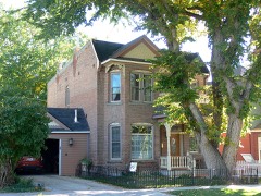 | Huseby, John H,. House | under 500 feet | 2012 |
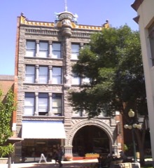 | Helena Historic District (Boundary Increase II) | 0.1 miles | 1993 |
| Lyman-Neel Residence | 0.1 miles | 2019 | |
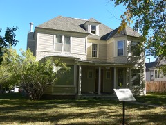 | Robert and Elizabeth Fisk House | 0.1 miles | 2007 |
 | Francis and Hannah Pope House | 0.1 miles | 2007 |
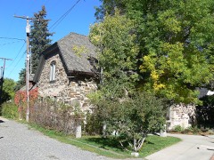 | Childs Carriage House | 0.2 miles | 1995 |
| National Archives record | The nomination case file for reference 97000502 in Record Group 79. |
| Lewis and Clark County | All 82 listed properties in this county. |