 Block
From the record
3 National Register listings published here.
Sources: the National Register database, National Park Service
39 topographic sheets cover 22 settlements here, and 3 properties are on the National Register of Historic Places.
3 National Register listings published here.
Sources: the National Register database, National Park Service
Every property in this county listed on the National Register of Historic Places, with the year it was listed and the federal nomination document.
| Photograph | Property | Type | Listed | Reference |
|---|---|---|---|---|
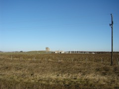 | RSL-3 | structure | 2018 | 100003053 |
 | Roxy Theatre | building | 1998 | 98001341 |
| US Post Office-Langdon | building | 1989 | 89001752 |
Every wildfire the federal occurrence database records inside this county: 144 of them, burning about 14,010 acres. None started naturally and 43 were recorded as arson. Each settlement page carries the fires within five miles of it.
| Reported cause | Fires |
|---|---|
| Debris and open burning | 65 |
| Arson/incendiarism | 43 |
| Missing data/not specified/undetermined | 30 |
| Other causes | 2 |
| Equipment and vehicle use | 2 |
| Railroad operations and maintenance | 1 |
| Power generation/transmission/distribution | 1 |
The five largest, by the area the report gives. Two of them were set deliberately.
| Date | Cause | Size | Reported by | Name on the report |
|---|---|---|---|---|
| 24 October 2018 | Debris and open burning | 2,500 acres | North Dakota State Forest Service | GRASS FIRE EAST OF MUNICH |
| 24 October 2018 | Debris and open burning | 2,000 acres | North Dakota State Forest Service | MUNICH ASSIST |
| 28 April 1993 | Arson/incendiarism | 440 acres | Devil's Lake Wetland Management District | WENGARSN93 |
| 29 May 2019 | Missing data/not specified/undetermined | 420 acres | Devil's Lake Wetland Management District | WEAVER |
| 9 December 1999 | Arson/incendiarism | 360 acres | Devil's Lake Wetland Management District | ULLYOTT |
| 9 May 2008 | Missing data/not specified/undetermined | 320 acres | North Dakota State Forest Service | PEMBINA |
| 15 April 2015 | Missing data/not specified/undetermined | 300 acres | North Dakota State Forest Service | SOUTH OF CALIO |
| 28 September 2012 | Missing data/not specified/undetermined | 300 acres | North Dakota State Forest Service | KIETH GUN FIRE |
Every settlement page carries the fires within five miles of it - see the settlement index below.
The NOAA Storm Events Database holds 428 reports for this county, causing 1 death, 3 injuries and about $7,012,700 in recorded property damage. Each settlement page carries the reports that name it.
| Kind of event | Reports |
|---|---|
| Hail | 229 |
| Thunderstorm Wind | 126 |
| Tornado | 43 |
| Funnel Cloud | 11 |
| Flood | 10 |
| Flash Flood | 7 |
| Lightning | 2 |
The most serious of them, by death, then injury, then recorded damage. The accounts are quoted exactly as the forecast office filed them.
| When | Event | Place named | Harm | What the report says |
|---|---|---|---|---|
| June 1966 | Tornado (F1) | not stated | 1 killed, 1 hurt, $25,000 | no account filed |
| September 1994 | Thunderstorm Wind | Langdon | 2 hurt, $10,000 | no account filed |
| June 2005 | Thunderstorm Wind | Langdon | $2,000,000 | Many 100 foot tall evergreen trees were uprooted. A pole barn was blown down and the roof was blown off a mobile home. Many other trees were snapped, with their trunks laying toward the northeast. The grain elevator sustained some minor damage. |
| June 2017 | Tornado (EF2) | Easby | $1,500,000 | This tornado was partially engulfed in downburst winds and hail along its nearly 20 mile path. Large wooden power poles were snapped, roofing was stripped off of homes, steel pole sheds were totally dismantled, numerous steel grain bins were crushed, and large metal segments were carried for a mile or more downwind. Bean and grain fields were completely stripped. Peak winds were estimated at 120 mph. |
| April 2006 | Flood | Countywide | $632,000 | Due to the quick snowmelt, water quickly drained into low areas, damaging many roads and bridges around the county. Cavalier County received a Presidential Disaster Declaration for damages caused by spring flooding. |
| June 2017 | Thunderstorm Wind | Milton | $500,000 | Large portions of Alma and East Alma townships were stripped of small grain and bean crops by extreme downburst winds and wind driven hail. |
| June 1991 | Tornado (F1) | not stated | $250,000 | no account filed |
| June 1985 | Tornado (F2) | not stated | $250,000 | no account filed |
| June 1985 | Tornado (F1) | not stated | $250,000 | no account filed |
| July 1978 | Tornado (F1) | not stated | $250,000 | no account filed |
| May 2013 | Flood | Olga | $200,000 | Several farm fields and farm access roads were flooded in south Olga Township. |
| June 2017 | Tornado (EF1) | Langdon | $100,000 | A weak tornado blew the doors off a seed company elevator and spread door and roof panels around the grounds in a circular pattern. Further downstream, the tornado snapped 6 power poles along 96th avenue northeast, a quarter mile east of highway 1. Peak winds were estimated at 105 mph. |
| June 2017 | Thunderstorm Wind | Sarles Weston Arpt | $100,000 | The wind gust was measured by a sensor along the Canadian border. Nearby corn and small grain fields were stripped of their leaves by wind driven hail. Evergreen and poplar trees were uprooted and steel grain bins were damaged in various farmsteads across Byron Township. |
| June 2008 | Hail | Sarles | $100,000 | A brief funnel cloud was reported to be about four miles north of the Canadian border in southern Manitoba. Hail damaged roofs and decks in town. Several large tree branches were blown down by the strong winds. |
| July 2008 | Tornado (EF1) | Calio | $100,000 | This tornado originated in Towner County and tracked intermittently for an additional 7 miles before ending about 1 mile north-northeast of Munich by 428 pm CDT. This tornado tipped three steel hopper bottom bins and tore siding and roofing off a pole shed. Maximum wind speeds were estimated at 100 mph. |
| June 1996 | Thunderstorm Wind | Clyde | $100,000 | no account filed |
| August 2001 | Thunderstorm Wind | Osnabrock | $75,000 | Trees were blown down and a grain elevator was damaged. |
| August 2000 | Tornado (F0) | Milton | $50,000 | A brief touchdown destroyed a barn and tore the roof off a shop. |
| August 2000 | Lightning | Langdon | $50,000 | A fire, ignited by a lightning strike, destroyed a barn and its contents. |
| March 2017 | Flood | Sarles | $50,000 | no account filed |
| April 2017 | Flood | Sarles | $50,000 | no account filed |
| June 1996 | Thunderstorm Wind | Wales | $50,000 | no account filed |
| July 2008 | Hail | Calvin | $30,000 | The hail fell near the Towner County line. |
| August 2000 | Thunderstorm Wind | Osnabrock | $30,000 | Three grain bins were destroyed in Osnabrock and a tree fell through a roof. |
| June 2017 | Thunderstorm Wind | Milton | $25,000 | Granite slabs at the veteran's memorial were blown over and shattered by the strong winds. |
| August 2001 | Thunderstorm Wind | Langdon | $25,000 | A 58 mph wind gust was measured at an NDAWN site. The wind knocked down trees onto vehicles and powerlines. A fire started when a tree fell on a powerline near a house. |
| June 1971 | Tornado (F2) | not stated | $25,000 | no account filed |
| July 2004 | Tornado (F1) | Vang | $20,000 | Large evergreens were uprooted or snapped in half. A 10x25 foot metal shed was destroyed. A piece of tin was peeled off a barn and thrown 200 yards downstream. |
| July 2003 | Thunderstorm Wind | Milton | $20,000 | Engineers for United Telephone estimated a 125 mph wind gust (at 400 feet AGL) broke off a 7 inch diameter fiberglass antenna mounted on a tower. |
| October 1997 | Thunderstorm Wind | Olga | $20,000 | A barn roof and a truck were damaged in the strong winds. The farmer, who was inside the barn at the time, dove out the doorway as the barn collapsed. |
| August 1994 | Hail | Langdon | $20,000 | no account filed |
| August 2006 | Thunderstorm Wind | Langdon | $15,000 | Strong wind gusts flipped over 5 grain augers and dented two 4,000 bushel steel grain bins. |
| August 1997 | Thunderstorm Wind | Munich | $15,000 | Trees and power lines were blown down, cutting power in Munich for 5 hours. A large door was torn off the Munich elevator, which damaged 3 grain bins. |
| August 2002 | Flash Flood | Vang | $12,500 | A driveway was washed out and roads and culverts were damaged. |
| August 2002 | Thunderstorm Wind | Milton | $10,000 | Many trees were blown down which knocked out power. |
| July 1997 | Flash Flood | Wales | $10,000 | no account filed |
| April 2013 | Flood | Sarles | $5,000 | A 51 year old man from the Hannah, N.D., area is believed to have died from exposure while walking home after his pickup got stuck on a flooded road late Tuesday night, April 30th. His vehicle was left partially submerged in a ditch nearly 8 miles east of his home. |
| June 2009 | Flash Flood | Vang | $5,000 | Farm fields flooded up to four feet deep in places in south Olga township. |
| May 2007 | Lightning | Langdon | $5,000 | Lightning struck the steeple of a church in Langdon, causing some shingle and brick damage. |
| May 1998 | Thunderstorm Wind | Nekoma | $5,000 | A grain bin and several 6 inch diameter tree limbs were blown down. |
| May 2013 | Flood | Sarles | $5,000 | no account filed |
| March 2009 | Flood | Sarles Weston Arpt | $5,000 | no account filed |
| April 2009 | Flood | Sarles Weston Arpt | $5,000 | no account filed |
| June 1970 | Tornado (F1) | not stated | $2,500 | no account filed |
| June 1999 | Thunderstorm Wind | Langdon | $2,000 | A greenhouse was destroyed by the wind. |
| September 2024 | Flash Flood | Langdon | $1,000 | Trained Spotter reports flash flooding, with storms that produced 3 inches of rain in a short period of time. |
| July 1999 | Hail | Calvin | $1,000 | Windows were broken by the hail. |
| July 2001 | Thunderstorm Wind | Nekoma | $500 | Large branches were blown down. |
| August 2000 | Thunderstorm Wind | Milton | $500 | Trees were blown down in Milton. |
| August 1972 | Tornado (F0) | not stated | $250 | no account filed |
| August 1970 | Tornado (F1) | not stated | $250 | no account filed |
| August 2002 | Thunderstorm Wind | Calio | $200 | Tree branches were blown down. |
| June 2025 | Hail | Hannah | - | Report of quarter size hail. |
| July 2025 | Tornado (EF0) | Calio | - | A large dusty tornado was reported near Calio ND with no damage conveyed from any sources who witnessed it. This tornado started in Towner County and traveled 0.50 miles to the Cavalier county line, where it traveled an additional 1.04 miles. It is suspected that this was spawned out of land spout processes which likely contributed to its dusty tubelike appearance as seen on social media. UPDATE 7/22/25: Adjusted track based on Sentinel-2 satellite imagery. |
| September 2025 | Thunderstorm Wind | Wales | - | Reported near Cavalier. |
| September 2025 | Hail | Hannah | - | Hailed about 15 minutes, with sizes ranging from under a quarter to near/slightly larger then a quarter. Significant damage to fields in the area, especially canola. |
| July 2024 | Thunderstorm Wind | Easby | - | Mesonet station reports 71 mph gust east of Langdon. |
| June 2022 | Tornado (EF0) | Milton | - | Tornado was filmed by at least 2 individuals, one just south of Milton and one west of Milton on highway 66. It slowly tracked for about one half mile to the northeast, to around 2.5 wsw of Milton by 258 pm cdt. The tornado produced a fairly wide dust plume as it moved across and open field. Peak winds estimated to 75 mph. Maximum width to 10 yards. Videos and reports posted via social media. |
| July 2022 | Thunderstorm Wind | Hannah | - | Received a public report of grain bins damaged, with debris scattered and blown northward. |
| July 2022 | Thunderstorm Wind | Sarles | - | Received a public report of a large cottonwood tree uprooted near Sarles. This report was received, along with photos, via social media. Time estimated based on radar and nearby wind sensor reports. Fencing was blown down around a swimming pool. |
Named settlements recorded in the Geographic Names Information System, each with the topographic sheets covering it. Villages, hamlets and abandoned places alike. Each is shown with the nearest named watercourse or landform and the survey quadrangle it falls on.