 Block
From the record
5 National Register listings published here.
Sources: the National Register database, National Park Service
22 topographic sheets cover 11 settlements here, and 5 properties are on the National Register of Historic Places.
5 National Register listings published here.
Sources: the National Register database, National Park Service
Every property in this county listed on the National Register of Historic Places, with the year it was listed and the federal nomination document.
| Photograph | Property | Type | Listed | Reference |
|---|---|---|---|---|
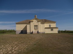 | Alkabo School | building | 2010 | 10000997 |
 | Divide County Courthouse | building | 1980 | 80002910 |
 | Niels Nielsen Fourteen-Side Barn Farm | building | 1986 | 86002743 |
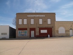 | Travelers Hotel | building | 2010 | 10000423 |
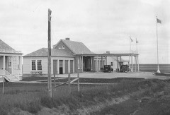 | U.S. Inspection Station-Ambrose, North Dakota | building | 2014 | 14000587 |
Every wildfire the federal occurrence database records inside this county: 21 of them, burning about 1,481 acres. 2 started naturally and 1 was recorded as arson. Each settlement page carries the fires within five miles of it.
| Reported cause | Fires |
|---|---|
| Debris and open burning | 7 |
| Equipment and vehicle use | 4 |
| Missing data/not specified/undetermined | 3 |
| Power generation/transmission/distribution | 3 |
| Natural | 2 |
| Arson/incendiarism | 1 |
| Fireworks | 1 |
The five largest, by the area the report gives. None of them was recorded as arson.
| Date | Cause | Size | Reported by | Name on the report |
|---|---|---|---|---|
| 4 May 2018 | Debris and open burning | 485 acres | North Dakota State Forest Service | COUNTY LINE |
| 14 April 2015 | Power generation/transmission/distribution | 400 acres | North Dakota State Forest Service | KNUDSON |
| 10 August 2005 | Missing data/not specified/undetermined | 250 acres | North Dakota State Forest Service | not named |
| 11 August 2015 | Equipment and vehicle use | 200 acres | North Dakota State Forest Service | WILDROSE ASSIST |
| 20 May 2018 | Debris and open burning | 40 acres | North Dakota State Forest Service | BRODAL FIELD |
| 10 August 2005 | Missing data/not specified/undetermined | 30 acres | North Dakota State Forest Service | not named |
| 4 April 2007 | Debris and open burning | 26 acres | Crosby Wetland Management District | BRATLEINWF |
| 3 May 2016 | Debris and open burning | 20 acres | North Dakota State Forest Service | NYGAARD |
Every settlement page carries the fires within five miles of it - see the settlement index below.
The NOAA Storm Events Database holds 170 reports for this county, causing no deaths, no injuries and about $1,306,530 in recorded property damage. Each settlement page carries the reports that name it.
| Kind of event | Reports |
|---|---|
| Hail | 94 |
| Thunderstorm Wind | 58 |
| Tornado | 12 |
| Funnel Cloud | 4 |
| Flood | 2 |
The most serious of them, by death, then injury, then recorded damage. The accounts are quoted exactly as the forecast office filed them.
| When | Event | Place named | Harm | What the report says |
|---|---|---|---|---|
| June 2016 | Thunderstorm Wind | Crosby | $250,000 | Emergency management reported that the strong winds combined with large hail of 1.5 inches in diameter to cause damage from about three miles west of Crosby to three miles east of Crosby. Vinyl siding was peeled off the west side of homes, windows were broken, and vehicles were damaged. |
| July 1990 | Tornado (F1) | not stated | $250,000 | no account filed |
| July 2018 | Thunderstorm Wind | Fortuna | $150,000 | The top of the local grain elevator main annex where the leg was located was blown off, damaging additional parts of the elevator. |
| June 2014 | Flood | Westby | $150,000 | Radar estimated three to five inches of rain in parts of Divide and northwest Williams counties. Damage was reported to culverts and roads. Deep water was standing in farm yards but the National Weather Service received no reports of water in homes. Crops were damaged. |
| June 2014 | Flood | Ambrose | $148,000 | Flooding occurred over eastern Divide County. Damage occurred to roads and culverts with many wash outs along township roads. There was crop damage as well. Rain amounts ranged from 2.50 inches in Bottineau County to as much as 7.00 inches in Renville County. |
| August 1997 | Hail | Fortuna | $100,000 | late season hail storm moved from Fortuna to Noonan destroying everything in its path. 180 thousand acres of crops were either severely damaged or destroyed. |
| June 2007 | Tornado (EF1) | Crosby | $75,000 | Tornado tore the roof off of an outbuilding on a farm about 21 miles southwest of Crosby and tore down part of a corral fence. It then crossed open rangeland and did no other damage. Estimated wind speed based on the EF scale was 100 mph. A second tornado was occurring closer to Crosy, Divide County, at around the same time. |
| August 2007 | Thunderstorm Wind | Crosby | $65,000 | Tree limbs 10 to 12 inches in diameter were snapped. Part of a pool hall roof was blown off. Several buildings doors were torn off. |
| June 2010 | Hail | Noonan | $30,000 | The large hail knocked holes in camper vents. The large hail also busted out the windows on a bus traveling near Noonan. |
| June 1950 | Tornado (F3) | not stated | $25,000 | no account filed |
| July 2009 | Thunderstorm Wind | Crosby | $20,000 | Severe thunderstorm wind gusts resulted in broken tree branches, tipped over grain bins, and some broken windows. |
| August 2017 | Hail | Noonan | $10,000 | Damage occurred to vehicles. |
| August 1994 | Hail | Noonan | $10,000 | no account filed |
| May 2012 | Thunderstorm Wind | Fortuna | $8,000 | This storm report stated that tree branches up to six inches in diameter were broken off by the strong winds. |
| August 2013 | Thunderstorm Wind | Alkabo | $5,000 | Large tree limbs were snapped due to the strong winds. |
| June 2007 | Thunderstorm Wind | Fortuna | $5,000 | Shingles were blown off roofs. |
| July 2009 | Hail | Fortuna | $3,000 | A vehicle was dented. |
| August 1962 | Tornado | not stated | $2,500 | no account filed |
| July 1982 | Tornado (F0) | not stated | $30 | no account filed |
| June 2025 | Thunderstorm Wind | Crosby | - | Thunderstorm wind gusts were estimated by a trained spotter. |
| August 2025 | Thunderstorm Wind | Crosby | - | Winds combined with copious amounts of small hail, along with some hail the size of quarters, to cause crop damage in the area. |
| August 2025 | Hail | Alkabo | - | Crops were severely damaged, including an entire canola field which was totaled. |
| July 2022 | Thunderstorm Wind | Fortuna | - | Thunderstorm wind gusts were estimated by a trained spotter. |
| July 2022 | Thunderstorm Wind | Noonan | - | Small tree branches were broken. |
| July 2020 | Hail | Noonan | - | A flowering canola field was damaged. |
| July 2019 | Thunderstorm Wind | Fortuna | - | The public estimated thunderstorm wind gusts of 60 mph. |
| June 2013 | Funnel Cloud | Crosby | - | A funnel cloud was reported one mile west of Crosby. |
| June 2013 | Thunderstorm Wind | Crosby | - | Pea size hail accompanied the strong winds. |
| August 2013 | Thunderstorm Wind | Ambrose | - | Very heavy rain accompanied the strong winds. |
| September 2013 | Thunderstorm Wind | Noonan | - | Heavy rain accompanied the strong winds. |
| May 2012 | Tornado (EF0) | Ambrose | - | This tornado touched down in the open country of Divide County, along the international border. There were no reports of damage associated with this tornado. |
| July 2012 | Tornado (EF0) | Noonan | - | This tornado briefly touched down in the open country of Divide County. There were no reports of damage associated with this tornado and it was rated EF0. |
| July 2012 | Thunderstorm Wind | Westby | - | An estimated peak wind report was received in rural western Divide County. |
| August 2011 | Hail | Alkabo | - | Strong winds up to 55 miles per hour were also reported. |
| August 2010 | Thunderstorm Wind | Crosby | - | Estimated winds of 60 mph were reported along with small hail and very heavy rain. |
| July 2010 | Thunderstorm Wind | Noonan | - | Very heavy rain and frequent lightning accompanied the strong winds. |
| July 2010 | Funnel Cloud | Noonan | - | This funnel cloud was short lived and never reached the surface. |
| June 2008 | Thunderstorm Wind | Fortuna | - | In addition to the severe thunderstorm winds, pea size hail was covering the ground. |
| June 2008 | Hail | Crosby | - | The hail was reported to have lasted 20 minutes. |
| August 2008 | Thunderstorm Wind | Westby | - | Thunderstorm wind gusts were measured at the Crosby Remote Automated Weather Station site. |
| August 2008 | Thunderstorm Wind | Westby | - | Thunderstorm wind gusts were measured at the Crosby Remote Automated Weather Station site. |
| June 2007 | Tornado (EF0) | Crosby | - | Tornado remained west and northwest of Crosby. The tornado hit no structures and no damage was reported to the National Weather Service. A second tornado was occurring in Divide County around the same time 21 miles southwest of Crosby. |
| July 2005 | Thunderstorm Wind | Crosby | - | Roof blown off a shed. One foot diameter limbs snapped off trees. |
| July 2005 | Hail | Ambrose | - | Reported by a NWS cooperative observer. |
| August 2004 | Hail | Crosby | - | A one mile swath of large hail damaged or destroyed 10,000 acres of crops. Estimated damage of 75 to 100 percent loss. |
| July 2004 | Hail | Alkabo | - | Wind gust to 52 knots accompanied the storm. |
| July 2003 | Tornado (F1) | Crosby | - | Tornado touched down just northwest of Crosby ripping a 40 foot wide streak through a forest area where no trees were left standing. Trees on either side were still standing. The tornado skipped through Crosby tearing portions of roofs off a couple of buildings. Large trees were either damaged or toppled. A 1,800 pound bail of hay was lifted over a 4 foot fence and dropped on the other side. Additional minor damage was reported in and around the city before the tornado lifted just southeast of town. |
| June 2002 | Thunderstorm Wind | Crosby | - | Tree's uprooted and suspension bridge destroyed. |
| June 2002 | Thunderstorm Wind | Crosby | - | Suspension bridge destroyed and several trees uprooted. |
| July 2001 | Hail | Noonan | - | The hail storm leveled 250 acres of crops, ripped down tree branches and heavily damaged farm vehicles. Rainfall measured at 2.6 inches following the hail storm. |
| July 1995 | Hail | Wildrose | - | 75 mph winds also reported. Winds destroyed steel grain bins and crops. Several hail swaths with 100 percent crop damage. |
| June 2025 | Hail | Alkabo | - | no account filed |
| June 2025 | Hail | Fortuna | - | no account filed |
| June 2025 | Hail | Crosby Muni Arpt | - | no account filed |
| June 2025 | Hail | Crosby | - | no account filed |
| July 2025 | Thunderstorm Wind | Alkabo | - | no account filed |
| July 2024 | Thunderstorm Wind | Noonan | - | no account filed |
| August 2023 | Thunderstorm Wind | Alkabo | - | no account filed |
| July 2022 | Hail | Crosby | - | no account filed |
| July 2022 | Thunderstorm Wind | Alkabo | - | no account filed |
The Survey's mineral resources record lists 3 workings inside this county. None of them still produces: all are closed or unrecorded. Each settlement page carries the workings within five miles of it.
| Commodity | Workings |
|---|---|
| Sodium | 2 |
| Sand and Gravel, Construction | 1 |
The least common of them first, because a county's hundredth gravel pit says nothing its first ten did not.
| Where | Site | Commodity | Status | Recorded |
|---|---|---|---|---|
| Peterson Pit & Plant | Sand and Gravel, Construction | Past Producer | ||
| Grenora Lake | Sodium | Unknown | ||
| North and Miller Layes | Sodium | Unknown |
Named settlements recorded in the Geographic Names Information System, each with the topographic sheets covering it. Villages, hamlets and abandoned places alike. Each is shown with the nearest named watercourse or landform and the survey quadrangle it falls on.