 Block
From the record
3 National Register listings published here.
Sources: the National Register database, National Park Service
54 topographic sheets cover 22 settlements here, and 3 properties are on the National Register of Historic Places.
3 National Register listings published here.
Sources: the National Register database, National Park Service
Every property in this county listed on the National Register of Historic Places, with the year it was listed and the federal nomination document.
| Photograph | Property | Type | Listed | Reference |
|---|---|---|---|---|
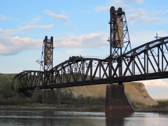 | Fairview Lift Bridge | structure | 1997 | 97000239 |
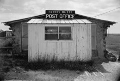 | Grassy Butte Post Office | building | 1980 | 80002919 |
| Sandstone School | building | 2008 | 08000278 |
Every wildfire the federal occurrence database records inside this county: 798 of them, burning about 75,963 acres. 224 started naturally and 12 were recorded as arson. Each settlement page carries the fires within five miles of it.
| Reported cause | Fires |
|---|---|
| Natural | 224 |
| Equipment and vehicle use | 157 |
| Missing data/not specified/undetermined | 120 |
| Debris and open burning | 97 |
| Fireworks | 84 |
| Recreation and ceremony | 30 |
| Power generation/transmission/distribution | 28 |
| Misuse of fire by a minor | 19 |
| Smoking | 14 |
| Arson/incendiarism | 12 |
| Firearms and explosives use | 10 |
| Other causes | 3 |
The five largest, by the area the report gives. None of them was recorded as arson.
| Date | Cause | Size | Reported by | Name on the report |
|---|---|---|---|---|
| 31 October 1999 | Debris and open burning | 51,627 acres | Custer Gallatin National Forest | GAP/ROUGH CREEK |
| 31 October 1999 | Power generation/transmission/distribution | 7,979 acres | Custer Gallatin National Forest | ROUGH CRK |
| 14 April 2015 | Equipment and vehicle use | 3,328 acres | Dakota Prairie National Grasslands | RIDGE ROAD |
| 24 August 2012 | Natural | 3,317 acres | Dakota Prairie National Grasslands | DEEP CREEK 2 |
| 22 February 1998 | Debris and open burning | 1,500 acres | Custer Gallatin National Forest | BENNIE PEER |
| 17 September 2007 | Equipment and vehicle use | 750 acres | Fort Berthold Agency | MANN |
| 21 September 2012 | Equipment and vehicle use | 542 acres | Dakota Prairie National Grasslands | COTTONWOOD CREEK |
| 15 October 2002 | Debris and open burning | 350 acres | Fort Berthold Agency | LISBON |
Every settlement page carries the fires within five miles of it - see the settlement index below.
The NOAA Storm Events Database holds 413 reports for this county, causing 2 deaths, 47 injuries and about $15,567,560 in recorded property damage. Each settlement page carries the reports that name it.
| Kind of event | Reports |
|---|---|
| Hail | 222 |
| Thunderstorm Wind | 142 |
| Tornado | 24 |
| Funnel Cloud | 15 |
| Flood | 7 |
| Heavy Rain | 2 |
| Frost/Freeze | 1 |
The most serious of them, by death, then injury, then recorded damage. The accounts are quoted exactly as the forecast office filed them.
| When | Event | Place named | Harm | What the report says |
|---|---|---|---|---|
| July 2018 | Tornado (EF2) | Watford City | 1 killed, 28 hurt, $3,500,000 | About 135 people were displaced from their homes. One fatality occurred and 28 people were injured, about 13 of them seriously. Based on the damage the tornado was rated EF2 and from that winds were estimated to have been around 127 mph.||This tornado developed just to the west of a large recreational vehicle, camper, and mobile home park on the southwest side of Watford City. The tornado passed through the park causing extensive and severe damage to over 100 recreational vehicles, campers, and single wide manufactured homes. Power poles were snapped and other non-occupied buildings were damaged and some destroyed, including a well-built pole barn. Many vehicles were damaged, some totaled. |
| November 1997 | Frost/Freeze | Mandaree | 1 killed, 3 hurt, $15,000 | Frosty roads were the blame for this accident. A pickup lost control on the slick roads and hit the deceased's van head on. The driver of the pickup was injured as well as 2 passengers in the van. |
| May 2014 | Tornado (EF2) | Watford City | 9 hurt, $2,500,000 | Thirteen campers, serving as homes, were completely destroyed and two more were damaged by this tornado. Other damage included a snapped wooden power line pole, automobiles, and fences, both wooden and metal. One automobile was tossed sixty feet and flipped onto its roof, with a trailer parked next to its initial location also flipped and completely destroyed. About a dozen other vehicles were damage, some destroyed. Eye witness reports indicated two other funnel clouds in the immediate area.||Of all the damage surveyed by the National Weather Service the absolute worst corresponded to EF2 on the Enhanced Fujita Scale. From that it was determined that the peak wind speeds in the tornado were on the order of 120 mph. ||There were nine direct injuries. |
| August 1995 | Hail | Keene | 5 hurt, $2,000,000 | Softball-size hail reported by Department of Emergency Services. Eighty-five sections in NE McKenzie County affected with nearly $7 million damage to crops and buildings. |
| July 1990 | Tornado (F0) | not stated | 1 hurt, $25,000 | no account filed |
| July 2000 | Hail | Watford City | 1 hurt | One person injured at a horse ranch at the north unit of the Theodore Roosevelt National Park. |
| March 2019 | Flood | Fairview | $4,000,000 | Significant ice jam related high waters created flooding along the Yellowstone River through McKenzie County in northwest North Dakota from March 21 to March 28. Homes and infrastructure that had not been inundated in over a generation were impacted. In addition, farm equipment was either damaged or destroyed by the flood waters. A portion of Highway 200 between Cartwright, North Dakota and Fairview, Montana, which is a major route through the region, was closed due to deep water over the highway. |
| August 2014 | Flood | Alexander | $1,300,000 | Upwards of three inches of rain in parts of McKenzie County led to significant overland flooding. There was significant damage to roads and crops. A county emergency declaration was issued. |
| June 2015 | Thunderstorm Wind | Watford City | $250,000 | Two trailers of around 50 feet in length were turned over one mile north of Watford City. One trailer was moved 150 feet. In the Watford City area, a pole barn was destroyed. The debris from the barn was lifted and thrown a thousand feet. |
| June 2016 | Hail | Watford City | $250,000 | no account filed |
| September 2014 | Thunderstorm Wind | Charlson | $200,000 | Three recreational vehicles in Tobacco Garden Bay sustained significant damage, with one being toppled. No injuries were reported. It was originally speculated that the damage was caused by a tornado. Local emergency management conducted a survey and determined the damage was caused by strong straight line winds. |
| June 2016 | Hail | Watford City | $150,000 | no account filed |
| July 2025 | Thunderstorm Wind | Charlson | $100,000 | A single wide manufactured home was blown off its cinder block foundation, displaced approximately 50 to 60 feet, and completely destroyed. A livestock trailer was flipped onto its roof, a metal storage container was shifted and tipped onto its side and a large dumpster was blown approximately 100 feet. |
| August 2023 | Hail | Arnegard | $100,000 | A supercell thunderstorm passed through the Arnegard and surrounding areas, resulting in an extended period of large hail. The largest hail was the size of golf balls. Vehicles were damaged. |
| July 2011 | Tornado (EF0) | Grassy Butte | $100,000 | A brief tornado occurred and resulted in a traffic accident with injuries (indirect). A local newpaper article stated that a semi truck hit a downed power line which cut into the cab of the truck. The line then snapped, sending it into a parked vehicle. The semi truck then collided with a third vehicle. Two people were injured (indirect) during this accident. This chain of events occurred after the tornado had passed, leaving the downed line in its wake. The tornado damage to the power line corresponded to EF0 on the Enhanced Fujita Scale. |
| July 1999 | Thunderstorm Wind | Watford City | $100,000 | Light to moderate damage to homes and business. Numerous uprooted trees and power lines. |
| March 2009 | Flood | Fairview | $94,000 | Overland flooding damaged county and township roads. Several homes were flooded around Watford City as Cherry Creek spilled along with the Little Missouri River. |
| July 1996 | Thunderstorm Wind | Williston | $75,000 | no account filed |
| June 2008 | Hail | East Fairview | $60,000 | Hail up to the size of golf balls caused a swath of damage in this area of McKenzie County. Damage was sustained to vehicles, homes, crops, and trees. |
| August 2013 | Thunderstorm Wind | Rawson | $55,000 | The severe thunderstorm winds combined with large hail to result in damage to the siding on homes and businesses. In addition, a trailer was overturned by a severe wind gust. |
| June 2016 | Thunderstorm Wind | Keene | $50,000 | Emergency management estimated winds to be gusting around 80 mph. |
| May 2011 | Flood | Fairview | $50,000 | See the event episode narrative for details. |
| August 1993 | Hail | Alexander | $50,000 | no account filed |
| August 1993 | Hail | Alexander | $50,000 | no account filed |
| July 2014 | Thunderstorm Wind | Charlson | $45,000 | Severe thunderstorm winds destroyed a garage, blowing it off of its foundation. Based on the position of the storm and this report, these winds were likely associated with the rear flank downdraft of this severe thunderstorm that also produced a tornado as well in McKenzie County. See the McKenzie County tornado entry. |
| July 2020 | Thunderstorm Wind | Alexander | $30,000 | Half of the roof was blown off a large barn. |
| May 2014 | Hail | Arnegard | $30,000 | A McKenzie County Deputy Sheriff reported between golf ball and baseball size hail with damage in the area. |
| July 2010 | Thunderstorm Wind | Grassy Butte | $30,000 | The strong thunderstorm winds resulted in widespread tree damage, with numerous tree limbs broken off. |
| September 1996 | Hail | Keene | $30,000 | no account filed |
| July 2025 | Thunderstorm Wind | Charlson | $25,000 | Several panels on the roof of a metal industrial building were displaced, and a couple were completely blown off. |
| June 2020 | Thunderstorm Wind | Charlson | $25,000 | A boat was blown off a trailer onto the parking lot at Four Bears Casino. |
| May 2018 | Thunderstorm Wind | Watford City | $25,000 | A dual-axle camper was destroyed. Another building nearby suffered some damage. |
| June 2016 | Hail | Fairview | $25,000 | no account filed |
| June 1990 | Tornado (F0) | not stated | $25,000 | no account filed |
| July 1952 | Tornado (F2) | not stated | $25,000 | no account filed |
| July 2025 | Thunderstorm Wind | Charlson | $20,000 | A pull-behind camper was tipped onto its side. |
| May 2018 | Thunderstorm Wind | Arnegard | $20,000 | A 240 square foot anchored shed was destroyed with debris spread for about a quarter-mile towards the east. Twenty chickens and ten rabbits that lived in the shed perished. A single axle covered snowmobile trailer was blown about 200 yards from its original location and was severely damaged. A large pole barn and home on the site were not damaged. |
| July 2015 | Thunderstorm Wind | Mandaree | $15,000 | An off-duty police officer estimated the wind speed. The officer was in his vehicle which was blown off the road. |
| July 2015 | Thunderstorm Wind | Grassy Butte | $15,000 | A roof was blown off a small building. |
| July 2008 | Thunderstorm Wind | Arnegard | $15,000 | Damage to trees and a few structures were reported in Arnegard, McKenzie County from severe thunderstorm wind gusts. Several trees were blown down, causing some minor structural damage. |
| June 2016 | Hail | Watford City | $15,000 | no account filed |
| May 2014 | Hail | Charbonneau | $10,000 | Most of the hail that fell was pea size, with the largest golf ball size. There was some damage. |
| July 2011 | Thunderstorm Wind | Grassy Butte | $10,000 | Strong thunderstorm winds blew down several trees. |
| September 1996 | Hail | Arnegard | $10,000 | no account filed |
| September 1996 | Hail | Watford City | $10,000 | no account filed |
| August 2021 | Hail | Watford City | $7,000 | A pickup truck was damaged by the hail. |
| August 2023 | Thunderstorm Wind | Watford City | $5,000 | Large cottonwood tree branches were blown down. |
| August 2009 | Thunderstorm Wind | Watford City | $5,000 | Severe thunderstorm winds resulted in broken tree branches. |
| July 1997 | Thunderstorm Wind | Watford City | $5,000 | tree fell on car |
| May 1994 | Hail | Grassy Butte | $5,000 | no account filed |
| August 2023 | Thunderstorm Wind | Charlson | $3,000 | A large tree was blown down and uprooted. |
| July 2010 | Thunderstorm Wind | Alexander | $3,000 | The strong thunderstorm winds resulted in a thirty foot elm tree blown down. |
| June 1975 | Tornado (F1) | not stated | $2,500 | no account filed |
| July 2020 | Thunderstorm Wind | Watford City | $2,000 | A chicken coop was damaged. |
| May 2018 | Thunderstorm Wind | Mandaree | $1,000 | A locked door was blow open by the thunderstorm wind gust. |
| July 1983 | Tornado (F0) | not stated | $30 | no account filed |
| July 1983 | Tornado (F0) | not stated | $30 | no account filed |
| September 2025 | Tornado (EFU) | Arnegard | - | The tornado touched down in an open field northwest of Arnegard and moved south-southeast. The tornado impacted no structures, thus there was no damage to evaluate. By National Weather Service policy the tornado is rated EF-U (Unknown). |
| May 2024 | Hail | Keene | - | The hail combined with wind to lay down five inch tall wheat, but most of it was expected to recover. |
| August 2023 | Thunderstorm Wind | Fairview | - | Thunderstorm wind gusts were estimated by a trained spotter. |
The Survey's mineral resources record lists 54 workings inside this county. 31 still produce and 23 are closed or unrecorded. Each settlement page carries the workings within five miles of it.
| Commodity | Workings |
|---|---|
| Stone, Crushed/Broken | 27 |
| Sand and Gravel, Construction | 26 |
| Aggregate, Light Weight | 1 |
The least common of them first, because a county's hundredth gravel pit says nothing its first ten did not.
| Where | Site | Commodity | Status | Recorded |
|---|---|---|---|---|
| Unnamed Prospect | Aggregate, Light Weight | Producer | ||
| County Gravel Pit | Sand and Gravel, Construction | Producer | ||
| County Gravel Pit | Sand and Gravel, Construction | Producer | ||
| County Gravel Pit | Sand and Gravel, Construction | Producer | ||
| County Scoria Pit | Sand and Gravel, Construction | Producer | ||
| Fitzgerald Ranch Sand Pit | Sand and Gravel, Construction | Prospect | ||
| Gravel Pit | Sand and Gravel, Construction | Producer | ||
| Gravel Pit | Sand and Gravel, Construction | Producer | ||
| Gravel Pit | Sand and Gravel, Construction | Producer | ||
| Gravel Pit | Sand and Gravel, Construction | Past Producer | ||
| Gravel Pit | Sand and Gravel, Construction | Producer | ||
| Gravel Pit | Sand and Gravel, Construction | Past Producer | ||
| Gravel Pit | Sand and Gravel, Construction | Past Producer | ||
| Gravel Pit | Sand and Gravel, Construction | Past Producer | ||
| Gravel Pit | Sand and Gravel, Construction | Past Producer | ||
| Gravel Pit | Sand and Gravel, Construction | Producer | ||
| Gravel Pit | Sand and Gravel, Construction | Producer | ||
| Gravel Pit | Sand and Gravel, Construction | Past Producer | ||
| Gravel Pit | Sand and Gravel, Construction | Producer | ||
| Gravel Pit | Sand and Gravel, Construction | Producer | ||
| Norstag Pit | Sand and Gravel, Construction | Producer | ||
| Redwing Creek Deposit | Sand and Gravel, Construction | Prospect | ||
| Sand Creek Gravel | Sand and Gravel, Construction | Prospect | ||
| State Gravel Pit | Sand and Gravel, Construction | Producer | ||
| Unnamed Prospect | Sand and Gravel, Construction | Producer | ||
| Unnamed Prospect | Sand and Gravel, Construction | Producer | ||
| Unnamed Prospect | Sand and Gravel, Construction | Producer | ||
| County Scoria Pit | Stone, Crushed/Broken | Past Producer | ||
| County Scoria Pit 2 | Stone, Crushed/Broken | Producer | ||
| Pennzoil Scoria Pit | Stone, Crushed/Broken | Producer | ||
| Scoria Pit | Stone, Crushed/Broken | Past Producer | ||
| Scoria Pit | Stone, Crushed/Broken | Producer | ||
| Scoria Pit | Stone, Crushed/Broken | Past Producer | ||
| Scoria Pit | Stone, Crushed/Broken | Past Producer | ||
| Scoria Pit | Stone, Crushed/Broken | Past Producer | ||
| Scoria Pit | Stone, Crushed/Broken | Producer | ||
| Scoria Pit | Stone, Crushed/Broken | Producer | ||
| Scoria Pit | Stone, Crushed/Broken | Producer | ||
| Scoria Pit | Stone, Crushed/Broken | Past Producer | ||
| Scoria Pit | Stone, Crushed/Broken | Past Producer | ||
| Scoria Pit | Stone, Crushed/Broken | Producer | ||
| Scoria Pit | Stone, Crushed/Broken | Past Producer | ||
| Scoria Pit | Stone, Crushed/Broken | Producer | ||
| Scoria Pit | Stone, Crushed/Broken | Past Producer | ||
| Scoria Pit | Stone, Crushed/Broken | Past Producer | ||
| Scoria Pit | Stone, Crushed/Broken | Producer | ||
| Scoria Pit | Stone, Crushed/Broken | Producer | ||
| Scoria Pit | Stone, Crushed/Broken | Producer | ||
| Scoria Pit | Stone, Crushed/Broken | Past Producer | ||
| Scoria Pit | Stone, Crushed/Broken | Past Producer | ||
| Scoria Pit | Stone, Crushed/Broken | Past Producer | ||
| Scoria Pit | Stone, Crushed/Broken | Past Producer | ||
| Scoria Pit | Stone, Crushed/Broken | Producer | ||
| Scoria Pit | Stone, Crushed/Broken | Producer |
Named settlements recorded in the Geographic Names Information System, each with the topographic sheets covering it. Villages, hamlets and abandoned places alike. Each is shown with the nearest named watercourse or landform and the survey quadrangle it falls on.
Sioux township · 58838 · Near Sheep Coulee · Cartwright quadrangle
7 sheets, 1953 to 1997
Charbon township · 58838 · On Lonesome Creek · Charbonneau quadrangle
7 sheets, 1953 to 1997
Fort Berthold unorganized territory · 58763 · Sanish quadrangle
8 sheets, 1953 to 1982
Southeast McKenzie unorganized territory · 58634 · On Grassy Butte · Grassy Butte quadrangle
8 sheets, 1953 to 1997
Southwest McKenzie unorganized territory · 59270 · West of Flat Rock Butte quadrangle
8 sheets, 1953 to 1997
North McKenzie unorganized territory · 58847 · Johnsons Corner quadrangle
8 sheets, 1953 to 1997
Fort Berthold unorganized territory · 58757 · On Spotted Horn Creek · Mandaree quadrangle
7 sheets, 1953 to 1982
Central McKenzie unorganized territory · 58854 · On Northfork Creek · Schafer quadrangle
7 sheets, 1953 to 1997
Southwest McKenzie unorganized territory · 58621 · On North Fork Smith Creek · Skaar quadrangle
8 sheets, 1909 to 1997
Fort Berthold unorganized territory · 58757 · On Spotted Horn Creek · Mandaree quadrangle
7 sheets, 1953 to 1982