 Block
From the record
11 National Register listings published here.
Sources: the National Register database, National Park Service
64 topographic sheets cover 33 settlements here, and 11 properties are on the National Register of Historic Places.
11 National Register listings published here.
Sources: the National Register database, National Park Service
Every property in this county listed on the National Register of Historic Places, with the year it was listed and the federal nomination document.
| Photograph | Property | Type | Listed | Reference |
|---|---|---|---|---|
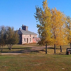 | Stephen William Brown Stone House | building | 2004 | 03001545 |
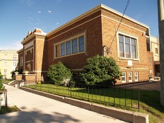 | Alfred E. Dickey Free Library | building | 1980 | 80004545 |
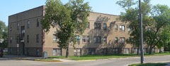 | Elizabeth Apartments | building | 1986 | 86000871 |
 | Franklin School | building | 2002 | 02000474 |
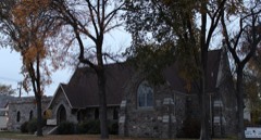 | Grace Episcopal Church | building | 1992 | 92001606 |
| Jamestown Historic District | district | 1989 | 88000987 | |
| Midland Continental Overpass | structure | 1997 | 97000194 | |
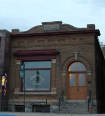 | Seiler Building | building | 1986 | 86000080 |
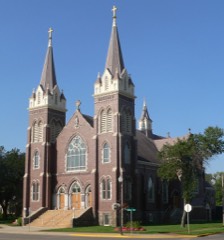 | St. James Catholic Church | building | 1982 | 82001346 |
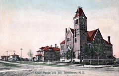 | Stutsman County Courthouse and Sheriff's Residence/Jail | building | 1976 | 76001356 |
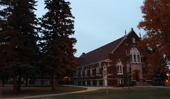 | Voorhees Chapel | building | 1977 | 77001030 |
Every wildfire the federal occurrence database records inside this county: 215 of them, burning about 12,376 acres. 13 started naturally and 12 were recorded as arson. Each settlement page carries the fires within five miles of it.
| Reported cause | Fires |
|---|---|
| Debris and open burning | 65 |
| Missing data/not specified/undetermined | 61 |
| Equipment and vehicle use | 32 |
| Natural | 13 |
| Arson/incendiarism | 12 |
| Smoking | 11 |
| Power generation/transmission/distribution | 6 |
| Recreation and ceremony | 6 |
| Railroad operations and maintenance | 5 |
| Fireworks | 3 |
| Misuse of fire by a minor | 1 |
The five largest, by the area the report gives. None of them was recorded as arson.
| Date | Cause | Size | Reported by | Name on the report |
|---|---|---|---|---|
| 16 April 1994 | Missing data/not specified/undetermined | 4,690 acres | Chase Lake Prairie Project Wetland Management District | CHICAGOLAK |
| 12 April 2003 | Debris and open burning | 1,760 acres | Arrowwood National Wildlife Refuge | KENSEL 1 |
| 7 April 2008 | Equipment and vehicle use | 1,680 acres | Chase Lake Prairie Project Wetland Management District | GRADER |
| 4 May 2008 | Missing data/not specified/undetermined | 500 acres | North Dakota State Forest Service | JIM ODENBACH |
| 2 May 2004 | Missing data/not specified/undetermined | 400 acres | North Dakota State Forest Service | SAGESSAR |
| 8 April 2017 | Missing data/not specified/undetermined | 269 acres | Arrowwood National Wildlife Refuge | EAST MUD LAKE |
| 8 April 2010 | Recreation and ceremony | 258 acres | Chase Lake Prairie Project Wetland Management District | KAUTZMAN |
| 22 July 2017 | Equipment and vehicle use | 170 acres | North Dakota State Forest Service | CAMDEN HOFMANN FIRE |
Every settlement page carries the fires within five miles of it - see the settlement index below.
The NOAA Storm Events Database holds 577 reports for this county, causing 1 death, 10 injuries and about $47,247,500 in recorded property damage. Each settlement page carries the reports that name it.
| Kind of event | Reports |
|---|---|
| Hail | 256 |
| Thunderstorm Wind | 218 |
| Tornado | 57 |
| Flash Flood | 18 |
| Funnel Cloud | 11 |
| Heavy Rain | 6 |
| Flood | 5 |
| Lightning | 4 |
| Winter Weather | 1 |
| Wildfire | 1 |
The most serious of them, by death, then injury, then recorded damage. The accounts are quoted exactly as the forecast office filed them.
| When | Event | Place named | Harm | What the report says |
|---|---|---|---|---|
| November 1997 | Winter Weather | Spiritwood | 1 killed, 1 hurt, $15,000 | Freezing drizzle made bridges and overpasses extremely slick. The deceased's Jeep hit an icy overpass on the Spiritwood interchange on I-94. The Jeep rolled numerous times down the embankment. The passenger was also injured in the accident. |
| August 1968 | Tornado (F3) | not stated | 3 hurt, $250,000 | no account filed |
| June 1983 | Tornado (F1) | not stated | 2 hurt, $250,000 | no account filed |
| June 1970 | Tornado (F1) | not stated | 2 hurt, $25,000 | no account filed |
| June 2000 | Tornado (F1) | Cleveland | 1 hurt | Tornado remained in open county. damage to fences. One pickup towing a trailer were blown into ditch as the driver drove into the tornado. |
| August 1959 | Tornado (F2) | not stated | 1 hurt | no account filed |
| September 2018 | Thunderstorm Wind | Cleveland | $12,000,000 | Nine single legged aluminum and steel electrical towers covering approximately one-quarter mile were damaged by strong thunderstorm winds. Seven of the towers were completely destroyed and had to be replaced. The remaining two towers were partially taken down, but were salvageable. Five spans of high-voltage electrical wire had to be replaced with each span being approximately one-quarter mile in length. Winds were estimated to have been around 120 mph. |
| June 2025 | Hail | Jamestown | $10,000,000 | Hail to three inches in dimameter caused significant damage throughout the city of Jamestown and surrounding areas. Many roofs were damaged, with a few having holes punched through the sheathing. Vehicles throughout the city were severely damged. |
| August 1997 | Hail | Jamestown | $10,000,000 | hail fell in Jamestown for 70 minutes, with hail ranging in size from marble to softball. Extensive damage done |
| June 1999 | Thunderstorm Wind | Edmunds | $2,000,000 | Damage to 200 farm dwellings, including elevators, dams and silos. |
| June 2025 | Thunderstorm Wind | Jamestown | $1,000,000 | The Jamestown area was struck by the derecho during the late night hours, with estimated winds around 90 mph. Many trees throughout the city were blown over, causing additional damage to areas that were struck by very large hail earlier in the evening. Lakeside campground to the north of the city had to be closed for an extended period of time due to widespread tree damage and broken water lines. |
| June 2025 | Tornado (EF1) | Medina | $750,000 | This is the second event entry for one tornado that passed through two counties, Kidder and Stutsman. This Quasi-Linear Convective System (QLCS) tornado started northwest of Crystal Springs in Kidder County and moved to the east-southeast. The tornado then shifted towards the east-northeast near the Stutsman County line, and continued into Stutsman County before it lifted to the north-northwest of Medina. Near the point of touchdown, a machine shed was completely destroyed, with the roof laying in a pasture about 350 feet away. Approximately five miles to the south-southeast, two additional farmsteads in close proximity were struck. The first one had an older barn along with a pole barn completely destroyed. The second farmstead had an older barn collapse, and an empty 18 foot diameter grain bin lifted and moved approximately 400 feet. Along the grain bin's path it hit a building, two vehicles, and a camper before it came to rest in front of the collapsed barn. Shortly thereafter, the tornado turned north-northeast and then struck another farmstead approximately 3 miles away. At this farm, a quonset building was moved off its foundation, and boards from the inside were sucked out and laying a few feet away. Additional buildings were damaged, with debris from a children's play house blown a half mile away and a picnic table blown a quarter mile. Mature trees were snapped and fully de-leafed with numerous large branches broken off. The tornado then continued to the north-northeast and twisted multiple smaller metal high-voltage power towers. Further to the north-northeast before it lifted, the tornado struck another farmstead where a farm outbuilding was destroyed, the shingles, siding, and gutters were severely damaged on a house, and trees were snapped about half way up. Based on the damage done this tornado was rated EF-1, and from that wind speeds were estimated to be around 110 mph. |
| August 2025 | Thunderstorm Wind | Jamestown | $750,000 | Significant damage, primarily to trees, occurred over the southern part of Jamestown. The area with the greatest damage was generally between Foxtrot Road on the west and and 10th Avenue East on the east, resulting in a path length of approximately |two miles. The width of the greatest damage stretched from near 17th Street on the south end to around 11th Street on the north, approximately one-half mile. At the start of the greatest damage in the vicinity of Meidinger Park and areas south, a pontoon boat was flipped, a tree was uprooted, multiple smaller trees were either snapped or had significant branches broken off, and a camper was pushed off its blocks. Towards the east near the intersection of 14th Avenue SW and 17th Street SW, a manufactured home had its roofing material uplifted, and large spruce trees were uprooted. Continuing east passing over the Interstate 94 Business Loop, multiple trees were uprooted including spruce trees along the loop. Further east along 17th Street SE, the metal roof panels blew off the east side of a building towards the northeast and across the road. At McElroy Park and areas surrounding, many trees were uprooted, with some|smaller to medium size trees snapped. To the east near the intersection of 14th Street SE and 8th Avenue SE, an L-shaped building had its east side roofing panels blown off. |
| August 2025 | Thunderstorm Wind | Courtenay | $750,000 | Significant damage occurred to buildings and grain handling equipment. Two newer pole-barn buildings had a significant portion of the structure destroyed with collapsed walls and roofs. The damage was primarily on the west side of both buildings, with farm equipment damaged inside. Another large building had multiple roof panels on its east side blown off. Multiple grain bins were damaged, one suffering very significant damage to its roofing structure. A large grain dryer was toppled when the grain leg system collapsed. |
| August 2002 | Tornado (F4) | Medina | $650,000 | no account filed |
| June 2024 | Hail | (Jms)Jamestown Muni | $600,000 | Large hail combined with strong wind gusts to cause damage to homes and vehicles through the city of Jamestown. |
| April 2009 | Flood | Woodworth | $502,000 | Heavy overland flooding and flooding along the James River and Pipestem Creek due to snowmelt resulted in damage to numerous state, county, and local roads. Damage was also reported to local infrastructure in the city of Jamestown along with ten homes. |
| June 2025 | Thunderstorm Wind | Courtenay | $500,000 | Multiple power poles were broken and power lines were down, resulting in an extended power outage. One indirect death occurred near Courtenay. A 76-year-old man died when the power to his home was cut off during the storm, causing his breathing machine to fail while he slept. |
| June 2024 | Flash Flood | (Jms)Jamestown Muni | $500,000 | Between three and five inches of rain fell in the Jamestown area leading to flash flooding in and around the city. Streets had running water, several feet deep in some cases, stranding vehicles. Low areas became flooded. The local viaduct was closed due to deep water. Multiple fields outside of Jamestown were also flooded causing crop damage. |
| September 2019 | Thunderstorm Wind | (Jms)Jamestown Muni | $500,000 | Multiple vehicles were overturned on Interstate 94 in the Jamestown area including semi-trucks and campers. This led to Interstate 94 being closed due to debris on the roadway. Tree branches breaking and falling on power lines led to multiple fire reports, along with widespread power outages. Also, many roadways were blocked by fallen trees and branches. A brick wall that was being constructed as part of a school expansion project collapsed as a result of the strong winds. |
| July 2011 | Flash Flood | Woodworth | $500,000 | Local area law enforcement reported deep water over Highway 36 west of Pingree. Railroad tracks between Pingree and Woodworth were washed out in several locations. |
| July 2001 | Tornado (F2) | Cleveland | $500,000 | The tornado moved southeast out of Kidder county. Numerous sources reported the tornado ranged to 1/2 mile wide at times. The tornado was on the ground for 66 minutes with a total storm path of 29 miles. The tornado remained in open country flattening a total of 64 metal and double high power line towers. |
| May 2014 | Flash Flood | Jamestown | $400,000 | Heavy rain, estimated up to four inches, occurred just east of Jamestown. Deep water was flowing over roads, with numerous county and township roads flooded and washed out. Fire trucks, returning to Jamestown from a fire, had to find another way around due to the deep water. No damage to structures was reported. |
| June 2025 | Thunderstorm Wind | Courtenay | $300,000 | Multiple large grain bins were either severely damaged or blown off their pads. This location was struck again with another storm on August 8, 2025, causing much more additional damage. |
| June 2015 | Thunderstorm Wind | Kensal | $300,000 | An insulated pole barn style shop building was destroyed at a farmstead east-northeast of Kensal. Additional damage included a collapsed portion of a steel grain bin roof and a grain auger blown over. Several large tree limbs were snapped. |
| March 2009 | Flood | Woodworth | $268,000 | Flooding of the James River and Pipestem Creek, along with overland flooding, damaged county and township roads. Several homes were flooded in March. Flooding continued and worsened into April. |
| June 2007 | Flood | Streeter | $250,000 | A wet week due to thunderstorms, then showers and even some steady rain, led to flooding in southwest Stutsman County. County roads were closed due to water over them. For a time Interstate 94 was down to one lane in each direction due to flood waters. Low lying areas were flooded with water standing in fields. The hardest hit areas were Griffin, Alexander, Sinclair, Bloomenfield, and Chicago townships. Newspaper articles indicated 7 to 8 inches of rain over the one week period. |
| August 1997 | Tornado (F1) | Jamestown | $250,000 | a tornado picked up 33 empty aluminium coal cars and set them on their side about 5 feet from the track. Each car weighed about 22 tons. |
| July 1982 | Tornado (F2) | not stated | $250,000 | no account filed |
| August 1974 | Tornado (F2) | not stated | $250,000 | no account filed |
| July 1952 | Tornado (F2) | not stated | $250,000 | no account filed |
| July 2024 | Hail | Cleveland | $200,000 | Wind-driven very large hail caused extensive damage. On two houses, multiple windows were taken out with the siding completely destroyed. All vehicles were dented. In addition, crops throughout the area were destroyed. |
| June 2015 | Hail | Pingree | $200,000 | no account filed |
| August 2016 | Thunderstorm Wind | Jamestown | $150,000 | Many trees were damaged throughout Jamestown. |
| June 2025 | Thunderstorm Wind | Buchanan | $100,000 | Half of the roof on a shop was blown off, and siding was blown off the house. |
| June 2022 | Thunderstorm Wind | Montpelier | $100,000 | Extensive tree damage occurred with many evergreen and deciduous trees blown down. |
| July 2016 | Hail | Jamestown | $100,000 | no account filed |
| June 2018 | Thunderstorm Wind | Streeter | $90,000 | Numerous trees were uprooted and other snapped in Streeter. Damage also occurred to buildings. |
| September 2019 | Thunderstorm Wind | Eldridge | $80,000 | A semi-truck and a camper were overturned by the strong thunderstorm wind gusts. |
| July 2010 | Flash Flood | Streeter | $80,000 | Several low lying areas of County Highway 67 from north of Gackle to Interstate 94 showed signs of recent flash flooding. Water was flowing freely over one area, with severe erosion noted at other low lying areas along the highway. |
| August 1999 | Tornado (F2) | Streeter | $80,000 | A supercell thunderstorm developed over Emmons county in south central North Dakota and moved northeast producing an F1 tornado in open county 12 miles northeast of Napoleon in Logan county. The tornado continued northeast increasing to an F2 tornado 3 miles southwest of Streeter then lifted 3 miles north of Streeter. The tornado narrowly missed the city of Streeter but inflicted damage to a farmstead destroying a pickup truck...garage and quonset. |
| August 2025 | Thunderstorm Wind | Buchanan | $75,000 | Power lines were down in the yard. Parts of a shop roof that was recently installed were torn off. Other items were blown around throughout the yard. |
| July 2019 | Hail | Windsor | $75,000 | Extensive crop and tree damage occurred, with almost all leaves in the tree row shredded. Holes were punched in gutters and wood shake siding was shredded. |
| June 2018 | Thunderstorm Wind | Streeter | $75,000 | Multiple large evergreen trees were blown over and power lines were down. A house was damaged from a fallen tree. A wall was blown in on a storage building used as a greenhouse at the grocery store. |
| July 2016 | Thunderstorm Wind | Medina | $75,000 | Multiple large trees were uprooted throughout the city of Medina. |
| August 2011 | Thunderstorm Wind | Kensal | $75,000 | Numerous trees were uprooted in the city of Kensal. Two grain hoppers were blown over at the Kensal Farmers Elevator. |
| August 1997 | Hail | Windsor | $75,000 | property damage estimated |
| June 2018 | Thunderstorm Wind | Cleveland | $60,000 | Two grain bins were blown over. |
| June 2024 | Thunderstorm Wind | Montpelier | $50,000 | Numerous tree limbs were down in Montpelier, some up to four inches in diameter. |
| May 2010 | Flash Flood | Jamestown | $50,000 | Flash flooding was reported in and around the Jamestown area due to very heavy thunderstorm rains. Several streets had several feet of water and minor damage was done to buildings by flood waters. Some county roads outside the city had water over them. Significant damage was not reported. |
| August 1997 | Hail | Medina | $50,000 | property damage estimated |
| August 1994 | Tornado (F1) | Near Buchanan | $50,000 | The path was estimated. |
| May 1993 | Thunderstorm Wind | Medina | $50,000 | The winds blew over a barn. |
| June 2015 | Hail | Pingree | $50,000 | no account filed |
| May 1996 | Thunderstorm Wind | Jamestown | $50,000 | no account filed |
| June 2011 | Flash Flood | (Jms)Jamestown Muni | $45,000 | Four separate rain events on June 26th, with officially 2.32 inches of rain, resulted in flash flood conditions over eastern Stutsman County including the city of Jamestown. Several Jamestown city streets were flooded, the railroad viaduct was flooded, and portions of the city storm sewer and sanitary sewer systems were overwhelmed. |
| April 2023 | Flood | Woodworth | $40,000 | Flooding from snow melt runoff caused significant damages to county infrastructure. |
| August 2019 | Thunderstorm Wind | Cleveland | $30,000 | A large tree snapped and fell on a pickup truck. |
| July 2010 | Thunderstorm Wind | Montpelier | $30,000 | The strong straight line thunderstorm winds resulted in a tree uprooted, a grain bin tipper over, a small wooden building destroyed, and crop damage. |
| June 2024 | Flood | Medina | $25,000 | Heavy rain of three to five inches fell on southwest Stutsman County, causing flooding of low lying areas. Interstate 94 was closed for a period of time near Cleveland as water covered the road and some vehicles hydroplaned and went into the ditch. |
The Survey's mineral resources record lists 7 workings inside this county. None of them still produces: all are closed or unrecorded. Each settlement page carries the workings within five miles of it.
| Commodity | Workings |
|---|---|
| Sand and Gravel, Construction | 7 |
The least common of them first, because a county's hundredth gravel pit says nothing its first ten did not.
| Where | Site | Commodity | Status | Recorded |
|---|---|---|---|---|
| Hansted Pit | Sand and Gravel, Construction | Past Producer | ||
| Jamestown | Sand and Gravel, Construction | Past Producer | ||
| Jamestown Pit and Plant | Sand and Gravel, Construction | Past Producer | ||
| Klose Pit & Plant | Sand and Gravel, Construction | Past Producer | ||
| Krapp Pit | Sand and Gravel, Construction | Past Producer | ||
| Mcelroy Moran | Sand and Gravel, Construction | Past Producer | ||
| Scherbenski Excavting Pit | Sand and Gravel, Construction | Past Producer |
Named settlements recorded in the Geographic Names Information System, each with the topographic sheets covering it. Villages, hamlets and abandoned places alike. Each is shown with the nearest named watercourse or landform and the survey quadrangle it falls on.
Jamestown city · 58401 · On Pipestem Creek · Jamestown quadrangle
13 sheets, 1896 to 1990
Montpelier township · 58472 · On Beaver Creek · Montpelier quadrangle
10 sheets, 1896 to 1986
Eldridge township · 58401 · Eldridge NW quadrangle
12 sheets, 1896 to 1990
No longer a settlement
Homer township · 58401 · Near Sevenmile Coulee · Ypsilanti quadrangle
10 sheets, 1896 to 1986
The vanished settlements of Stutsman County: the places named above that are no longer on the map.