 Block
From the record
15 National Register listings published here.
Sources: the National Register database, National Park Service
53 topographic sheets cover 28 settlements here, and 15 properties are on the National Register of Historic Places.
15 National Register listings published here.
Sources: the National Register database, National Park Service
Every property in this county listed on the National Register of Historic Places, with the year it was listed and the federal nomination document.
| Photograph | Property | Type | Listed | Reference |
|---|---|---|---|---|
| District No. 70-Hoff Rural School | building | 2008 | 08000233 | |
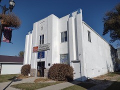 | Edinburg WPA Auditorium | building | 2013 | 13000863 |
| Elmwood | building | 1985 | 85000339 | |
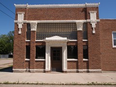 | Forest River State Bank | building | 2019 | 100004715 |
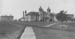 | Grafton State School | district | 1996 | 96001191 |
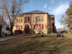 | Minto School | building | 1992 | 91002002 |
| Nordre Trefoldegheds Menigheds | building | 2004 | 04000058 | |
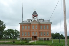 | Pisek School | building | 1994 | 94000220 |
 | St. Catherine's Church of Lomice, North Dakota | building | 2006 | 06000249 |
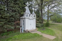 | St. Joseph's Chapel | building | 1994 | 94000556 |
 | St. Stanislaus Church Historic District | district | 1979 | 79001776 |
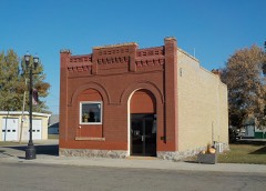 | State Bank of Edinburg | building | 2001 | 01000588 |
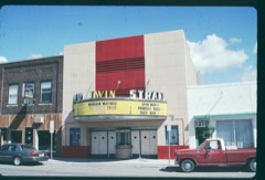 | Strand Theatre | building | 2004 | 04000299 |
 | US Post Office-Grafton | building | 1989 | 89001756 |
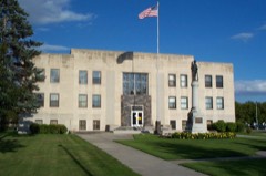 | Walsh County Courthouse | building | 1985 | 85002992 |
Every wildfire the federal occurrence database records inside this county: 58 of them, burning about 1,200 acres. None started naturally and 3 were recorded as arson. Each settlement page carries the fires within five miles of it.
| Reported cause | Fires |
|---|---|
| Debris and open burning | 24 |
| Missing data/not specified/undetermined | 23 |
| Smoking | 4 |
| Arson/incendiarism | 3 |
| Railroad operations and maintenance | 3 |
| Equipment and vehicle use | 1 |
The five largest, by the area the report gives. None of them was recorded as arson.
| Date | Cause | Size | Reported by | Name on the report |
|---|---|---|---|---|
| 21 May 2018 | Debris and open burning | 250 acres | North Dakota State Forest Service | LANDFILL |
| 3 December 2015 | Missing data/not specified/undetermined | 200 acres | North Dakota State Forest Service | DAHL FIRE |
| 7 December 2020 | Debris and open burning | 130 acres | North Dakota State Forest Service | VERNON SECTION 7 |
| 31 July 2017 | Smoking | 100 acres | North Dakota State Forest Service | GILLESPIE FIRE |
| 19 September 2015 | Missing data/not specified/undetermined | 100 acres | North Dakota State Forest Service | PISEK MUTUAL AID |
| 30 April 2018 | Equipment and vehicle use | 80 acres | North Dakota State Forest Service | 201801 |
| 6 November 2020 | Debris and open burning | 80 acres | North Dakota State Forest Service | CTY 9 |
| 10 November 2016 | Debris and open burning | 58 acres | Devil's Lake Wetland Management District | GREENWING |
Every settlement page carries the fires within five miles of it - see the settlement index below.
The NOAA Storm Events Database holds 514 reports for this county, causing 1 death, 2 injuries and about $6,762,730 in recorded property damage. Each settlement page carries the reports that name it.
| Kind of event | Reports |
|---|---|
| Hail | 234 |
| Thunderstorm Wind | 166 |
| Tornado | 54 |
| Flood | 25 |
| Flash Flood | 17 |
| Funnel Cloud | 14 |
| Lightning | 2 |
| Heavy Rain | 2 |
The most serious of them, by death, then injury, then recorded damage. The accounts are quoted exactly as the forecast office filed them.
| When | Event | Place named | Harm | What the report says |
|---|---|---|---|---|
| April 2013 | Flood | Fairdale | 1 killed, $20,000 | A 55 year old Walsh County man is believed to have died after his pickup was swept away from a water-covered gravel road Monday evening, April 29th, about 3 miles southwest of Minto, N.D.. The pickup was recovered but the man's body has yet to be found. |
| July 1971 | Tornado (F1) | not stated | 1 hurt, $25,000 | no account filed |
| May 2006 | Lightning | Grafton | 1 hurt | Lightning struck an apartment complex, causing roof and electrical-system damage to one apartment unit. A man who was working near the apartment unit was also struck, knocking him briefly unconscious. When he awoke, he reported numbness to the right side of his body and a severe headache. |
| August 1994 | Thunderstorm Wind | Grafton | $1,300,000 | Strong winds caused widespread damage. Uprooted trees fell on and damaged cars. A hangar at the airport was destroyed damaging four airplanes. Other damage occurred to a 70 ft. trailer and to many homes. |
| April 2023 | Flood | Poland | $1,000,000 | Oslo - Crest of 36.27 feet occurred on 4/24. Flooding extended into May.|NOTE: Damages dollar amount is for the entire county. Not separated by specific river basin or damage type. |
| April 2023 | Flood | Minto | $1,000,000 | Minto gage, on the Forest River. Crested at 9.25 ft, on April 17th at 08:30.||NOTE: Damages dollar amount is for the entire county. Not separated by specific river basin or damage type. |
| April 2006 | Flood | Countywide | $975,000 | The Red River at Oslo (MN) rose above flood stage around 1 AM CST on April 1st and remained above flood stage until around 10 AM CST on April 26th. The river peaked at roughly 37.70 feet around 8 PM CST on April 6th. Unofficially, 37.70 feet would be the fourth highest modern-day river stage recorded. The Red River spread well out of it banks from around Oslo (MN) northward, essentially becoming a lake. Overland flooding also occurred in addition to the river flooding, with around 200 sites (34 miles of township and county roads) around the county closed due to flooding. Water covered a portion of Interstate 29 at the Oslo/Ardoch interchange and completely filled the ditches on either side. U.S. Highway 81 was closed through Minto, because of high water along the Forest River. The Red River bridge at Oslo was closed at the peak of the flood as was the Red River bridge east of Grafton. Emergency officials encouraged residents who lived near the Red River to evacuate. Flooding also knocked out power to 12 farms. Several Coast Guard units were brought in to assist residents with emergencies through the use of airboats and helicopters. Walsh County received a Presidential Disaster Declaration for damages caused by spring flooding.In summary, the total public and private flood losses experienced within the Red River of the North basin through late March and April 2006 were likely in excess of $20 million. This includes the following amounts. For Minnesota state and local infrastructure (this total includes the damages listed for each county), $8.5 million. For North Dakota state and local infrastructure (this total includes the damages listed for each county), $8 million. For Federal agencies (USACE, USGS, and USCG), $1.5 million. For the transportation industry costs due to traffic diversions caused by prolonged road and bridge closures, $1.5 million. For personal property losses due to floodwaters surrounding more than 500 individual farmsteads and rural homesteads, $1.0 million. |
| July 2003 | Thunderstorm Wind | Fairdale | $750,000 | Four 75 foot tall 30,000 bushel grain bins were crushed by the strong wind. These bins were about half full at the time. A roof was also blown off a fertilizer plant and numerous trees were uprooted. Several trees fell on rooftops and power was out in town for several hours. |
| June 2009 | Tornado (EF1) | Kellogg | $250,000 | The tornado lifted a barn from its foundation and destroyed it while uprooting numerous trees in the farmyard. Later the tornado broke down three power poles and snapped off numerous other trees along its route. Peak winds were estimated to 105 mph. |
| June 1999 | Tornado (F2) | Lankin | $250,000 | A 54x108 foot building and a shed were destroyed by the tornado. One tractor inside was moved and the building doors were wrapped around the cab. Shingles from the barn were impaled in the swather. Some of the farm equipment was overturned and some boards were driven into the ground. Debris was picked up and tossed in a nearby slough. |
| June 2017 | Thunderstorm Wind | Nash | $200,000 | Extensive tree damage extended from eastern Farmington into Martin township. Numerous large poplar, ash, and cottonwoods were snapped in field and farm shelterbelts. |
| May 2013 | Flood | Hoople | $100,000 | Township roads were closed and culverts washed out near Hoople in Dundee Township. |
| August 2000 | Thunderstorm Wind | Grafton | $100,000 | Two potato warehouse roofs were blown off in Grafton. |
| July 2020 | Flash Flood | Ardoch | $50,000 | Fields and farm access roads were flooded across portions of Ardoch and Walshville townships. |
| July 2003 | Thunderstorm Wind | Adams | $50,000 | Two steel 3,500 bushel hopper bins were blown over and numerous large trees were uprooted. The city park reported about $3,000 in damages. Scattered power outages also occurred. |
| July 2003 | Thunderstorm Wind | Fairdale | $50,000 | Two 4,000 bushel steel grain bins were ripped off their anchor bolts. A roof was also torn off a 35x70 foot steel shed and the debris was carried one-half mile into the adjacent fields. |
| June 2002 | Thunderstorm Wind | Lankin | $50,000 | Strong winds from a heat burst destroyed a metal pole barn and tossed it in some trees nearby. Three grain bins were damaged as well as a well and smoke house. Several trees in the yard were also flattened. |
| August 2002 | Flash Flood | Park River | $50,000 | Highways 32 and 17 were under water and closed. The county emergency manager estimated that 36 total road sites were damaged at a cost of $50,000. |
| May 1993 | Hail | Minto | $50,000 | A coal shed was blown down in Ardoch. |
| May 1993 | Thunderstorm Wind | Ardoch | $50,000 | A coal shed was blown down in Ardoch. |
| April 2019 | Flood | Auburn | $50,000 | no account filed |
| August 1993 | Thunderstorm Wind | Hoople | $50,000 | no account filed |
| June 2009 | Flash Flood | Fairdale | $40,000 | Flooding washed out portions of the railroad bed near Lankin. Street flooding and some building flooding also occurred in Lankin. |
| August 1968 | Tornado (F1) | not stated | $25,000 | no account filed |
| May 2013 | Flood | Park River | $20,000 | Significant street flooding was noted in the city of Park River with ditches and field flooding outside of town. The city storm sewer lift stations were unable to keep up with water due to closed sewer flap gates and ongoing river flooding. A report of 4.85 inches of rain was received from Park River. |
| July 1999 | Thunderstorm Wind | Ardoch | $20,000 | An estimated 500 trees were destroyed by the wind and 2 barns were damaged. |
| June 2013 | Flood | Park River | $20,000 | no account filed |
| July 2003 | Thunderstorm Wind | Edinburg | $15,000 | Large mature trees were blown down by the strong wind, causing scattered power outages. $5,000 in damages occurred to phone lines. |
| July 2003 | Thunderstorm Wind | Fairdale | $15,000 | One 5,000 bushel steel grain bin was torn off its anchor bolts and portions of it were scattered for 200 yards into an adjacent field. |
| June 1999 | Tornado (F2) | Lankin | $15,000 | Several large trees were snapped off and light poles were bent over. Several metal grain bins were blown off their concrete foundations and thrown 200 feet. An old shed was also tossed 150 feet. |
| August 1999 | Thunderstorm Wind | Minto | $15,000 | The north wall and a west facing garage door were blown down by the wind and a tree fell on a garage. |
| June 2013 | Flood | Conway | $15,000 | no account filed |
| June 2016 | Flash Flood | Grafton | $10,000 | Heavy rain flooded fields and farm access roads across several townships in central and eastern Walsh County. |
| July 2011 | Lightning | Grafton | $10,000 | A lightning strike was presumed to have been the source of a house fire. The time was estimated. |
| July 2003 | Thunderstorm Wind | Fairdale | $10,000 | One 4,000 bushel steel grain bin was ripped off its anchor bolts and flattened in a field. |
| August 1997 | Thunderstorm Wind | Adams | $10,000 | A strong wind broke several windows and blew down several 130 foot tall trees. The strong wind pushed large round hay bales 400 feet across a field. |
| April 2014 | Flood | Nash | $10,000 | no account filed |
| June 2009 | Tornado (EF1) | Warsaw | $7,000 | The tornado snapped off numerous large tree limbs and blew down a 3000 bushel steel grain bin along its path. Peak winds were estimated at 90 mph. |
| August 2008 | Thunderstorm Wind | Herrick | $5,000 | The wind knocked down five inch diameter tree branches. |
| August 2002 | Thunderstorm Wind | Park River | $5,000 | Power lines were blown down. |
| August 2000 | Thunderstorm Wind | Fordville | $5,000 | A grain dryer was tipped and trees were blown down. |
| July 1997 | Thunderstorm Wind | Voss | $5,000 | A metal shed was blown down in Voss. |
| May 2013 | Flood | Fairdale | $5,000 | no account filed |
| April 2013 | Flood | Hoople | $5,000 | no account filed |
| April 2013 | Flood | Fairdale | $5,000 | no account filed |
| March 2009 | Flood | Fairdale | $5,000 | no account filed |
| April 2009 | Flood | Fairdale | $5,000 | no account filed |
| May 2009 | Flood | Fairdale | $5,000 | no account filed |
| May 1996 | Thunderstorm Wind | Lawton | $5,000 | no account filed |
| July 2017 | Tornado (EF1) | Fairdale | $4,000 | This rope tornado tracked for roughly seven miles to the east-southeast and eventually produced a substantial dust swirl. It was viewed and photographed from multiple locations. Though it remained over largely open country, it did snap a few hardwood tree trunks at a couple of locations. Peak winds were estimated at 105 mph. |
| May 1998 | Thunderstorm Wind | Park River | $3,000 | A parked car was blown into a van. |
| August 1968 | Tornado (F1) | not stated | $2,500 | no account filed |
| August 1962 | Tornado | not stated | $2,500 | no account filed |
| July 2017 | Tornado (EF1) | Veseleyville | $2,000 | A partially rain wrapped tornado ripped down large branches and snapped a few trees in shelterbelts. It also damaged the trim on a farmstead house. Peak winds were estimated at 95 mph. |
| June 2002 | Thunderstorm Wind | Park River | $2,000 | Trees were blown down in Park River. |
| June 1999 | Tornado (F0) | Lankin | $2,000 | A large pine tree was sheared off, a tin roof torn off a school shed, a glass patio door was blown out, and a large metal dumpster was flipped over. |
| May 1998 | Thunderstorm Wind | Park River | $2,000 | Several 12 inch diameter trees were blown down and a roof was damaged. |
| June 2014 | Thunderstorm Wind | Grafton | $1,000 | A few large tree branches and limbs were broken down around the Grafton area. One tree limb fell across a parked pickup truck. |
| May 2010 | Flash Flood | Park River | $1,000 | Ditches were flooded along a county road and briefly covered the road. |
| August 2001 | Thunderstorm Wind | Grafton | $1,000 | Trees were blown down. |
The Survey's mineral resources record lists 11 workings inside this county. 10 still produce and 1 is closed or unrecorded. Each settlement page carries the workings within five miles of it.
| Commodity | Workings |
|---|---|
| Sand and Gravel, Construction | 10 |
| Clay | 1 |
The least common of them first, because a county's hundredth gravel pit says nothing its first ten did not.
| Where | Site | Commodity | Status | Recorded |
|---|---|---|---|---|
| Hebron Brick Co Hebron B | Clay | Producer | ||
| Armond Narlock Pit | Sand and Gravel, Construction | Producer | ||
| Cudmore Gravel Supply Pit | Sand and Gravel, Construction | Producer | ||
| Donald Pit and Plant | Sand and Gravel, Construction | Producer | ||
| Edindurg Pit and Plant | Sand and Gravel, Construction | Producer | ||
| Ellingson Pit and Plant | Sand and Gravel, Construction | Producer | ||
| Fordville Pit and Plant | Sand and Gravel, Construction | Producer | ||
| Fordville State Pit | Sand and Gravel, Construction | Producer | ||
| Lankin Sand & Gravel Pit | Sand and Gravel, Construction | Past Producer | ||
| Lankin State Pit | Sand and Gravel, Construction | Producer | ||
| Walsh County Pit | Sand and Gravel, Construction | Producer |
Named settlements recorded in the Geographic Names Information System, each with the topographic sheets covering it. Villages, hamlets and abandoned places alike. Each is shown with the nearest named watercourse or landform and the survey quadrangle it falls on.
Fordville city · 58231 · On Middle Branch Forest River · Fordville quadrangle
9 sheets, 1952 to 1985