 Block
Finley, North Dakota
8 topographic sheets cover this place, the earliest surveyed in 1952 and the latest in 1985. It stands in Finley City. It lies in ZIP code area 58230. The Survey maps it on the Finley quadrangle. 401 people lived here at the 2020 count. It stands 1,453 feet above sea level.
On record in Finley
Buildings and businesses the archive holds for this place. Each opens its own page, with the source record it came from.
On the National Register 2 records
 Steele County Courthouselisted 1985
- Beaver Creek Bridgelisted 1997
Population over time
2 figuresFinley fell from 445 to 401 between 2010 and 2020. These are the recorded population figures Wikidata holds for this place, reached through the Geographic Names Information System number this page is keyed on rather than by name, so they belong to this place and not to another of the same name. Most are census counts, but not all are: an early figure may be a founding or settlement estimate, and an estimate published within five years of a census is left out. The change column is computed, and is left blank where more than 20 years separate a figure from the one before it, because a gap that long is not a change between two counts.
| Year | People | Change |
|---|---|---|
| 2010 | 445 | |
| 2020 | 401 | -44 (-10%) |
Topographic sheets covering this place
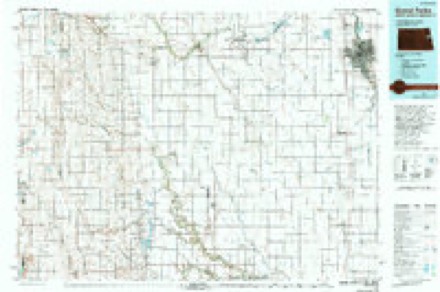
5 surveys from 8 printed sheetsMatched by testing this settlement's coordinate against the published boundary of every sheet in the United States Geological Survey's historical collection. Each opens the scanned sheet at the Survey.
- 1952 USGS Grand Forks quadrangle1:250000, 3 printings
- 1956 USGS Grand Forks quadrangle1:250000
- 1966 USGS Grand Forks quadrangle1:250000
- 1967 USGS Finley quadrangle1:24000
- 1985 USGS Grand Forks quadrangle1:100000, 2 printings
Storms near this place
60 of 82 shownRegional context, not property-specific evidence. The National Weather Service names Finley in 82 storm reports between 1994 and 2025: 43 hail, 23 thunderstorm wind, 7 flash flood, 4 tornado. The reports record 3 injuries. Each account below is quoted exactly as the forecast office filed it, from the NOAA Storm Events Database, and each date opens the federal record of that event.
| When | Event | Place named | Harm | What the report says |
|---|---|---|---|---|
| May 1994 | Thunderstorm Wind | Finley | 3 hurt, $500,000 | A woman taped several minutes of a multiple vortex tornado that passed south of her farm. As the tornado went out of view of the video, she and her two children took cover in their mobile home. At the end of the tape, as the tornado moved out of view, the video showed a microburst to the west of the farm. This is what did most of the damage. After the microburst, she looked up and saw blue sky. She and the children were in the limbs of a tree with mobile home debris covering her legs. They were treated for scratches and bruises. The woman and one child were kept overnight at the hospital for observation. Some of the damage included destruction of the mobile home and other farm buildings as well as farm machinery and trees. The path and length of the tornado were estimated. |
| July 2007 | Thunderstorm Wind | Finley | $2,000,000 | Fully grown trees were uprooted. Some trees fell on power poles and powerlines, causing power outages in Finley. Trees also fell on cars and damage was reported at the grain elevator. On one house porch, the windows were blown out and the screens were torn off. Extensive wind driven hail produced crop damage across portions of Finley Township. |
| July 2007 | Thunderstorm Wind | Finley | $2,000,000 | Five wooden double post high voltage power towers were snapped off by downburst winds. The utility company estimated winds around 100 mph. Large hail and damaging winds produced extensive crop damage across portions of Easton and Melrose Townships. |
| July 2004 | Tornado (F2) | Finley | $250,000 | The tornado tore the roof off a barn and impaled a tree branch in the wooden door of a granary. Many trees were damaged and a high voltage power tower was knocked over. The tornado tracked mainly along the Goose River (about 4 miles west of Hatton) to about 4 miles south-southwest of Hatton. |
| August 2011 | Flash Flood | Finley | $25,000 | State highway 32 was closed to traffic both north and south of Finley due to water overtopping the roadway. The sheriff reported that many sections of county roads were washed out. |
| August 1999 | Hail | Finley | $25,000 | The hailstorm hit one farmstead particularly hard. The large hailstones punched holes in the house siding, broke windows, and dented cars and several tractors. |
| July 2001 | Hail | Finley | $15,000 | The hail battered a farmhouse, denting the siding and putting holes in the gutters. Several windows were broken and the shingles were damaged. |
| August 2011 | Flood | Finley | $10,000 | Overland flooding continued around Finley after 3 to 6 inches of rain fell. |
| April 2002 | Lightning | Finley | $10,000 | Lightning struck a house southeast of Finley, knocking out power and phone service to the house. The strike also ruptured a propane line near the home shooting flames up into the air. The lightning hit also left a hole in the roof. |
| July 2001 | Hail | Finley | $10,000 | The hail damaged a pickup. County extension agents estimated that 10,000 acres were destroyed along a strip from highway 200 along the Steele/Griggs line to near Blabon. |
| June 1999 | Thunderstorm Wind | Finley | $5,000 | A portion of the roof of a large shed was destroyed by the wind. |
| July 2001 | Thunderstorm Wind | Finley | $2,000 | Trees were blown down. |
| August 1999 | Hail | Finley | $2,000 | Hail broke several windows. |
| August 1999 | Hail | Finley | $1,000 | The large hail broke the windows in a pickup truck. |
| July 2001 | Thunderstorm Wind | Finley | $500 | Branches were blown down. |
| August 2002 | Thunderstorm Wind | Finley | $300 | Branches were blown down. |
| August 2025 | Thunderstorm Wind | Finley | - | Damage to a shop from strong winds. |
| June 2024 | Thunderstorm Wind | Finley | - | Public reports large trees down in Steele county. |
| June 2023 | Hail | Finley | - | Local Law Enforcement relayed report of windshield damage to vehicle from quarter-size hail. |
| June 2023 | Hail | Finley | - | Report of nickel to quarter-size hail by sheriff department. |
| June 2022 | Hail | Finley | - | Received a public report of ping pong ball sized hail that lasted for a couple minutes. Time estimated based on radar. |
| July 2022 | Thunderstorm Wind | Finley | - | The roofing system of a large 80x160 ft. The machine shed was partially lifted and dropped, resulting in its partial collapse into the building. Area wind sensors and radar suggest that winds were sustained at 40 mph or higher, with frequent gusts ranging from 55 to 75 mph for at least 10 minutes. |
| June 2021 | Thunderstorm Wind | Finley | - | Large tree branches were broken and one tree was snapped. |
| July 2019 | Hail | Finley | - | Dime to nickel sized hail fell. |
| May 2019 | Thunderstorm Wind | Finley | - | Large tree branches and a couple of trees were snapped in a farm shelterbelt. |
| June 2019 | Thunderstorm Wind | Finley | - | Strong wind gusts damaged several barns and an old garage. A nearby NDSU NDAWN mesonet station measured a 57 mph wind gust. |
| August 2018 | Hail | Finley | - | The hail started ahead of the rain. |
| September 2017 | Hail | Finley | - | Large hail fell with very heavy rain. Some of the hailstones were the size of golf balls. |
| June 2016 | Thunderstorm Wind | Finley | - | A large tree and several smaller branches were blown down. |
| July 2015 | Funnel Cloud | Finley | - | A helicopter pilot reported the funnel cloud. |
| June 2015 | Tornado (EF0) | Finley | - | The tornado touchdown was brief and in an open field. |
| July 2014 | Thunderstorm Wind | Finley | - | Several trees were blown down around town. One eight inch diameter tree fell on a deck, which resulted in some damage to the fencing. An automobile with attached trailer were moved and the trailer was twisted and collapsed. |
| June 2010 | Tornado (EF0) | Finley | - | The tornado report was relayed by an off duty Dodge City NWS meteorologist chasing the storm. The tornado tracked northward intermittently for about 4 miles. Damage was not noticed as the tornado remained largely over open fields and rangeland. Peak winds were estimated at 80 mph. |
| July 2007 | Hail | Finley | - | Pea to golfball sized hail fell and covered the ground. |
| July 2007 | Hail | Finley | - | Several trees were blown down and area crops were destroyed. |
| June 2006 | Funnel Cloud | Finley | - | A persistent wall cloud produced a brief funnel. |
| August 2006 | Hail | Finley | - | The hail fell 3 miles east of Golden Lake. |
| May 2005 | Hail | Finley | - | The hail fell 6 miles northeast of Golden Lake. |
| May 2005 | Tornado (F0) | Finley | - | Intermittent touchdowns occurred about 1.5 miles west of Hatton to the Traill county line 1 mile northwest of Hatton. |
| June 2005 | Flash Flood | Finley | - | Water flowed over highway 32 about 7 miles south of Finley. |
| June 2005 | Flash Flood | Finley | - | Excessive runoff from heavy rains washed out a bridge. |
| June 2005 | Thunderstorm Wind | Finley | - | Large trees were blown down. |
| June 2005 | Flash Flood | Finley | - | Four inches of rain fell in less than 2 hours on top of already saturated ground. One bridge was washed out. |
| June 2005 | Thunderstorm Wind | Finley | - | The FAA radar station northwest of Finley recorded a 100 mph wind gust. |
| July 2005 | Thunderstorm Wind | Finley | - | Wind damage occurred at Golden Lake in northeast Steele county. Many people were at the lake for the holiday weekend. One tree fell on a parked vehicle. The wind flipped a boat and a pontoon from their trailers. |
| July 2005 | Thunderstorm Wind | Finley | - | Trees and signs were blown over. |
| July 2003 | Thunderstorm Wind | Finley | - | A large tree was snapped off. |
| August 2002 | Thunderstorm Wind | Finley | - | Strong winds blew down a building under construction near the city elevator. Trees were also blown down in town. |
| July 2001 | Flash Flood | Finley | - | Water was reported over highways 200 and 32 with many fields and ditches also flooded. |
| June 2000 | Hail | Finley | - | 3,000 acres were affected by the hail. |
| July 1997 | Hail | Finley | - | A 4 mile swath of hail damage was reported along with broken windows. |
| June 2013 | Hail | Finley | - | no account filed |
| July 2011 | Heavy Rain | Finley | - | no account filed |
| July 2011 | Hail | Finley | - | no account filed |
| June 2007 | Hail | Finley | - | no account filed |
| June 2006 | Hail | Finley | - | no account filed |
| August 2006 | Hail | Finley | - | no account filed |
| June 2005 | Hail | Finley | - | no account filed |
| June 2005 | Hail | Finley | - | no account filed |
| June 2004 | Hail | Finley | - | no account filed |
Nearest settlements
The eight closest, with where each one stands in the county. Distances are straight-line, computed from the Geographic Names Information System coordinates.
| Map | Place | Distance | Sheets |
|---|---|---|---|
| Pickert | 5.1 miles | 8 | |
| Sharon | 6.5 miles | 8 | |
| Sherbrooke | 7.2 miles | 8 | |
| Blabon | 8.2 miles | 8 | |
| Interlaken (historical) | 11.6 miles | 8 | |
| Hope | 14.5 miles | 8 | |
| Luverne | 18.9 miles | 8 | |
| Colgate | 20.9 miles | 8 |
Elsewhere
Matched on this settlement's Geographic Names Information System number rather than its name, so it cannot be a different place of the same name in another state.
| Wikipedia article on Finley | An encyclopaedic summary. Its text is share-alike, so it is linked here rather than copied. |
| Wikidata item Q2089827 | The structured record the population and elevation above come from. Public domain (CC0). |
Provenance
This settlement is recorded in the Geographic Names Information System as feature 1028959. The sheet list is computed by point-in-boundary test against the United States Geological Survey's historical topographic inventory. Both are works of the United States government and carry no copyright under 17 U.S.C. 105.
Storms. NOAA National Centers for Environmental Information, Storm Events Database https://www.ncei.noaa.gov/stormevents/ A work of the United States government, no copyright under 17 U.S.C. 105. Narratives are quoted verbatim from the National Weather Service report and are not edited or summarised.