 Block
From the record
12 National Register listings published here.
Sources: the National Register database, National Park Service
72 topographic sheets cover 25 settlements here, and 12 properties are on the National Register of Historic Places.
12 National Register listings published here.
Sources: the National Register database, National Park Service
Every property in this county listed on the National Register of Historic Places, with the year it was listed and the federal nomination document.
| Photograph | Property | Type | Listed | Reference |
|---|---|---|---|---|
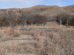 | Adamson Bridge | structure | 1992 | 92000749 |
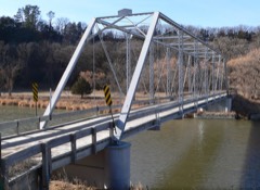 | Bell Bridge | structure | 1992 | 92000752 |
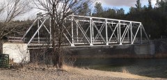 | Berry State Aid Bridge | structure | 1992 | 92000753 |
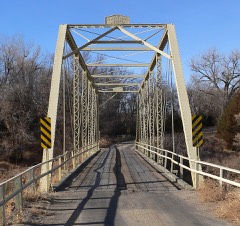 | Borman Bridge | structure | 1992 | 92000751 |
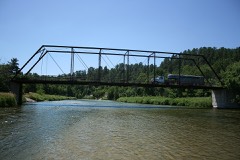 | Brewer Bridge | structure | 1992 | 92000754 |
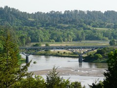 | Bryan Bridge | structure | 1988 | 88000912 |
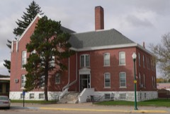 | Cherry County Courthouse | district | 1990 | 89002229 |
| County Line Bridge | structure | 2018 | 100002660 | |
 | Twin Bridge | structure | 1992 | 92000750 |
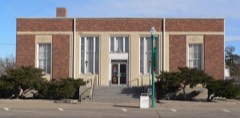 | US Post Office-Valentine | building | 1991 | 91001750 |
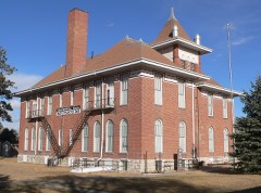 | Valentine Public School | building | 1984 | 84002454 |
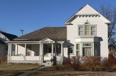 | F. M. Walcott House | building | 1982 | 82000599 |
Every wildfire the federal occurrence database records inside this county: 479 of them, burning about 188,316 acres. 280 started naturally and 1 was recorded as arson. Each settlement page carries the fires within five miles of it.
| Reported cause | Fires |
|---|---|
| Natural | 280 |
| Equipment and vehicle use | 88 |
| Missing data/not specified/undetermined | 51 |
| Debris and open burning | 28 |
| Power generation/transmission/distribution | 16 |
| Smoking | 8 |
| Recreation and ceremony | 4 |
| Railroad operations and maintenance | 2 |
| Fireworks | 1 |
| Arson/incendiarism | 1 |
The five largest, by the area the report gives. None of them was recorded as arson.
| Date | Cause | Size | Reported by | Name on the report |
|---|---|---|---|---|
| 16 March 1999 | Equipment and vehicle use | 74,500 acres | Valentine National Wildlife Refuge | THEDFORD |
| 17 September 2000 | Natural | 45,768 acres | Nebraska National Forest | POWDERHORN |
| 17 September 2000 | Natural | 13,903 acres | Valentine National Wildlife Refuge | VAL COMP |
| 17 September 2000 | Natural | 4,952 acres | Valentine National Wildlife Refuge | PONY |
| 28 September 2020 | Missing data/not specified/undetermined | 3,972 acres | Nebraska Forest Service | not named |
| 18 March 2011 | Equipment and vehicle use | 3,650 acres | Nebraska Forest Service | not named |
| 10 April 1998 | Debris and open burning | 3,600 acres | Fort Niobrara National Wildlife Refuge | TNC |
| 16 July 2006 | Missing data/not specified/undetermined | 3,100 acres | Fort Niobrara National Wildlife Refuge | VALENTINE |
Every settlement page carries the fires within five miles of it - see the settlement index below.
The NOAA Storm Events Database holds 1,463 reports for this county, causing no deaths, 10 injuries and about $6,736,910 in recorded property damage. Each settlement page carries the reports that name it.
| Kind of event | Reports |
|---|---|
| Hail | 940 |
| Thunderstorm Wind | 375 |
| Tornado | 103 |
| Funnel Cloud | 17 |
| Flash Flood | 14 |
| Heavy Rain | 8 |
| Lightning | 3 |
| Flood | 3 |
The most serious of them, by death, then injury, then recorded damage. The accounts are quoted exactly as the forecast office filed them.
| When | Event | Place named | Harm | What the report says |
|---|---|---|---|---|
| June 1962 | Tornado (F3) | not stated | 6 hurt, $250,000 | no account filed |
| June 1980 | Tornado (F1) | not stated | 2 hurt, $25,000 | no account filed |
| August 1996 | Lightning | Wood Lake | 1 hurt | no account filed |
| September 1989 | Thunderstorm Wind | not stated | 1 hurt | no account filed |
| July 1975 | Tornado (F2) | not stated | $2,500,000 | no account filed |
| July 2013 | Hail | Valentine | $400,000 | Media reported nearly 300 cars damaged at a car dealership on the west side of Valentine. |
| July 1977 | Tornado (F2) | not stated | $250,000 | no account filed |
| July 1974 | Tornado (F1) | not stated | $250,000 | no account filed |
| May 1961 | Tornado (F0) | not stated | $250,000 | no account filed |
| June 2014 | Thunderstorm Wind | (Vtn)Miller Fld Vale | $150,000 | Two hangars were destroyed and six airplanes sustained damage at the Valentine Airport. |
| June 2010 | Flood | Elsmere | $125,000 | Thunderstorms with prolonged heavy rain caused widespread flooding across southeast Cherry County. Several rural roads along Goose Creek were severely damaged from flooding. |
| July 2001 | Tornado (F0) | Merriman | $115,000 | A tornado touched down 2 miles southeast of Merriman and moved southeast to 7 miles south of Eli before lifting. Trees were uprooted and windows were broken out of a house. Extensive damage was done to popcorn crops and alfalfa hay fields. Nine center pivot irrigation systems were destroyed. A stretch of power lines was snapped off along highway 20 and also along a road south of Eli as the tornado moved southeast. |
| August 2011 | Thunderstorm Wind | Kilgore | $100,000 | Damage occurred to grain bins, outbuildings, windmills and pivots. Also, power lines and trees were blown down at a location five miles south of Kilgore. One of these trees fell on a house causing damage to the home. |
| June 2006 | Tornado (F1) | Merriman | $100,000 | A supercell thunderstorm produced a tornado that touched down over an open field approximately 1/4 mile to the southeast of a farmstead. As the tornado moved northeast, it destroyed a shed used for storing agricultural machinery, damaged a horse trailer, and snapped off several power poles. The tornado continued moving northeast across another open field before hitting another farmstead where it rolled a moble home, lifted a two-story 2 car garage and dropped it 20 feet north of its foundation totalling the pickup truck in the garage. The tornado also snapped off numerous trees in a shelter belt to the north of the farmstead and several power poles. Seconds before the tornado hit, the male occupant of the home took shelter in a concrete shed to the west of the home. |
| July 1997 | Hail | Merriman | $100,000 | Thunderstorm winds and hail broke windshields and blew large tree limbs down. |
| June 2007 | Tornado (EF1) | Cody | $75,000 | A tornado touched down a few miles north of Cody and moved south. In the path, the tornado tore the roof off a shop, destroyed a barn, twisted iron feed bunks, and snapped trees in a wind break. The main household was not damaged and no injuries were reported. |
| June 2014 | Tornado (EF0) | Merriman | $60,000 | At 1728MST, a tornado briefly touched down near Mile Marker 194 on Highway 61. A semi truck and trailer was overturned and a car was blown off the road. Peak winds were estimated at 80 mph and the tornado rated and EF-0. Maximum path width was 40 yards. |
| June 2016 | Tornado (EF2) | Irwin | $50,000 | At 1852MST the tornado touched down and was intermittently on the ground for almost one mile. The tornado destroyed a four stall calving shed, took down a power line, snapped or twisted several large trees, and moved approximately 25 three quarter ton hay bales in various directions. A pole barn sustained damage with debris found a half a mile away. An empty 500 gallon fiberglass tank was found up to a mile east of this location. |
| June 2011 | Thunderstorm Wind | Nenzel | $50,000 | Public estimated winds gusted to 80 mph for up to 45 minutes. Power lines were down in the Nenzel area. |
| June 1999 | Tornado (F1) | Merriman | $50,000 | A tornado destroyed several windmills and damaged trees. |
| June 1999 | Tornado (F2) | Brownlee | $50,000 | This was a continuation of the Thomas county tornado that initially touched down 3 miles north north west of Thedford and traveled into Cherry county. |
| June 1999 | Tornado (F1) | Brownlee | $50,000 | The tornado touched down west of highway 83, crossed the highway and destroyed a scale house at a cattle handling facility. |
| July 2003 | Hail | Valentine | $48,000 | A supercell thunderstorm moved across Big Alkali Lake camping area, as well as other smaller nearby lakes, producing strong winds and large hail. Numerous windshields and windows were broken in campers, pickup trucks, and cabins. The hail also damaged the bodies of vehicles and the siding on the campers. |
| July 2016 | Tornado (EF1) | Irwin | $45,000 | At 1725 CST a trained weather spotter reported a multi-vortex tornado. A damage survey concluded the tornado moved roughly west to east. The tornado damaged a horse barn and several outbuildings at two different residences, as well as snapping several large trees before lifting at 1735 CST. The tornado was rated an EF-1 on the Enhanced Fujita Scale with a peak wind of 100 MPH. |
| June 2011 | Thunderstorm Wind | Cody | $45,000 | Public estimated wind gusts to 80 mph with significant damage to trees and structures. Part of the roof was torn off the house with a 20 by 40 foot wooden structure destroyed. |
| May 2010 | Tornado (EF0) | Sparks | $42,000 | At 845 PM CDT, the tornado touched down over an open field west of Sparks and traveled east where it struck a metal building tearing off the southwest facing roof. The tornado destroyed a portion of a grandstand and completely demolished a concession stand before lifting 200 yards east of the concession stand. |
| June 2015 | Hail | Brownlee | $40,000 | Windows were broken out on north side of house, damaged vehicles, stripped tree leaves and hay crop damage. |
| July 2000 | Tornado (F1) | Wood Lake | $40,000 | A tornado touched down 7 miles northwest of Johnstown and was intermittently on the ground producing tree damage in Brown county. The tornado continued to touch down intermittently and grew to a width of a quarter mile near the Brown and Cherry county line. This is where the tornado caused the most extensive damage, destroying a large grove of trees, a calving shed, and moving a barn from its foundation, 8 miles southwest of Johnstown. The tornado proceeded to move nearly straight south in Cherry county and continued to cause extensive tree damage, and moved and destroyed several 1500 lb hay bales, 17 miles north of Elsmere. The tornado last touched down 10 miles north of Elsmere causing tree damage. |
| July 2001 | Flash Flood | Eli | $39,000 | An extended period of rainfall resulted in flash flooding along Calf Creek located in Southwest Cherry county as runoff increased. Storm total precipitation for the period indicated 7.1 inches of rainfall on the North Platte radar. The public reported a total of 7 inches with several culverts washed out. |
| June 2010 | Flood | Elsmere | $35,000 | The Department of Roads reported several roadways had water running across them across southeast Cherry County. At one location west of Elsmere, Goose Creek was reported still rising at 10 AM CDT, some 6 hours after the rain began. Rainfall in the area was reported to be in excess of 3 inches. |
| June 2007 | Hail | Valentine | $35,000 | no account filed |
| May 2022 | Thunderstorm Wind | Merritt Res | $25,000 | Wind driven hail of unknown size, broke windows out of cars and houses in this area. Report taken via social media. Time estimated from radar. |
| July 2009 | Tornado (EF2) | Crookston | $25,000 | The tornado touched down briefly on the north side of the Bob Kruger ranch. The tornado lifted an old trailer home south southwestward about 20 yards and destroyed it. It also moved a hay baler 10 yards and turned it around. It snapped off numerous tree limbs, tore metal siding off a quonset, and destroyed a metal wind break. Numerous storm chasers captured the intense supercell on video. Chasers reported inflow winds into the supercell of up to 70 mph. |
| August 2007 | Hail | Kilgore | $25,000 | Baseball size hail was reported at the west end of Merritt reservoir. |
| June 2002 | Hail | Valentine | $25,000 | Hail broke windshields in vehicles and damaged siding on homes. |
| May 2000 | Thunderstorm Wind | Valentine | $25,000 | Semi truck blown over |
| June 2007 | Hail | Valentine | $25,000 | no account filed |
| July 2001 | Hail | Merriman | $25,000 | no account filed |
| August 1996 | Hail | Merriman | $25,000 | no account filed |
| July 1987 | Tornado (F1) | not stated | $25,000 | no account filed |
| June 1978 | Tornado | not stated | $25,000 | no account filed |
| May 1977 | Tornado | not stated | $25,000 | no account filed |
| May 1977 | Tornado (F2) | not stated | $25,000 | no account filed |
| July 1977 | Tornado (F1) | not stated | $25,000 | no account filed |
| August 1975 | Tornado (F1) | not stated | $25,000 | no account filed |
| August 1974 | Tornado (F0) | not stated | $25,000 | no account filed |
| May 1962 | Tornado (F2) | not stated | $25,000 | no account filed |
| May 2025 | Thunderstorm Wind | Brownlee | $20,000 | Thunderstorm wind gusts, estimated at 80 MPH, overturned a semi on highway 83 at mile marker 174. |
| June 2003 | Hail | Eli | $20,000 | Golf ball size hail covered the ground. |
| May 2004 | Hail | Merriman | $20,000 | no account filed |
| August 2002 | Hail | Merriman | $20,000 | no account filed |
| August 2002 | Hail | Merriman | $20,000 | no account filed |
| August 2001 | Hail | Elsmere | $20,000 | no account filed |
| June 2000 | Hail | Merriman | $20,000 | no account filed |
| June 2000 | Hail | Merriman | $20,000 | no account filed |
| June 2000 | Hail | Merriman | $20,000 | no account filed |
| June 2000 | Hail | Merriman | $20,000 | no account filed |
| August 2011 | Tornado (EF3) | Wood Lake | $15,000 | A tornado developed five miles south-southeast of Wood Lake and traveled to the south. It was on the ground for approximately 20 minutes and was up to a maximum of a half mile wide with maximum winds of 140 m.p.h. The tornado caused damage to two tree groves. One tree was debarked, uprooted, and moved while several other trees were uprooted. Additionally, a windmill was destroyed and another three were damaged; a steel culvert from Plum Creek washed out and was broken and displaced three-quarters a mile downstream. Also, two miles of barb wire fencing was destroyed. |
| October 2010 | Thunderstorm Wind | Valentine | $15,000 | Law enforcement reported a roof ripped off a trailer and large tree limbs down approximately 10 inches in diameter. |
| July 2010 | Thunderstorm Wind | Brownlee | $15,000 | A trained spotter estimated wind speeds of 60 mph or greater that caused apples to be blown off trees, shingles to be blown off roofs, a chimney cap blown off, and large branches to be downed from live trees. |
Named settlements recorded in the Geographic Names Information System, each with the topographic sheets covering it. Villages, hamlets and abandoned places alike. Each is shown with the nearest named watercourse or landform and the survey quadrangle it falls on.