 Block
From the record
12 National Register listings published here.
Sources: the National Register database, National Park Service
25 topographic sheets cover 9 settlements here, and 12 properties are on the National Register of Historic Places.
12 National Register listings published here.
Sources: the National Register database, National Park Service
Every property in this county listed on the National Register of Historic Places, with the year it was listed and the federal nomination document.
| Photograph | Property | Type | Listed | Reference |
|---|---|---|---|---|
| Baumert & Bogner | building | 2022 | 100007938 | |
| Baumert & Bogner | building | 2022 | 100007938 | |
 | Colfax County Courthouse | building | 1981 | 81000369 |
 | John Janecek House | building | 1982 | 82003185 |
| Merchant Park | structure | 2022 | 100008313 | |
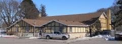 | Oak Ballroom | site | 1983 | 83001082 |
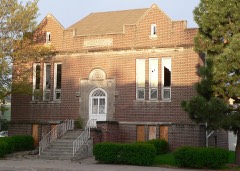 | Schuyler Carnegie Library | building | 2001 | 01001275 |
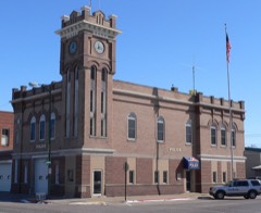 | Schuyler City Hall | building | 1981 | 81000370 |
| Schuyler Downtown Historic District | district | 2016 | 16000478 | |
 | US Post Office-Schuyler | building | 1992 | 92000476 |
 | Z.C.B.J. Opera House | building | 1988 | 88000948 |
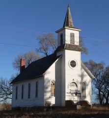 | Zion Presbyterian Church | building | 1988 | 87002071 |
Every wildfire the federal occurrence database records inside this county: 17 of them, burning about 154 acres. 1 started naturally and none was recorded as arson. Each settlement page carries the fires within five miles of it.
| Reported cause | Fires |
|---|---|
| Missing data/not specified/undetermined | 8 |
| Debris and open burning | 4 |
| Equipment and vehicle use | 3 |
| Railroad operations and maintenance | 1 |
| Natural | 1 |
The five largest, by the area the report gives. None of them was recorded as arson.
| Date | Cause | Size | Reported by | Name on the report |
|---|---|---|---|---|
| 12 October 2015 | Equipment and vehicle use | 120 acres | Nebraska Forest Service | not named |
| 21 May 2007 | Railroad operations and maintenance | 20 acres | Nebraska Forest Service | not named |
| 8 March 2012 | Debris and open burning | 3.0 acres | Nebraska Forest Service | not named |
| 26 March 2003 | Missing data/not specified/undetermined | 3.0 acres | Nebraska Forest Service | not named |
| 30 April 2005 | Missing data/not specified/undetermined | 2.0 acres | Nebraska Forest Service | not named |
| 19 January 2012 | Debris and open burning | 1.0 acres | Nebraska Forest Service | not named |
| 15 April 2012 | Natural | 1.0 acres | Nebraska Forest Service | not named |
| 20 December 2017 | Missing data/not specified/undetermined | 1.0 acres | Nebraska Forest Service | not named |
Every settlement page carries the fires within five miles of it - see the settlement index below.
The NOAA Storm Events Database holds 264 reports for this county, causing no deaths, no injuries and about $31,767,500 in recorded property damage. Each settlement page carries the reports that name it.
| Kind of event | Reports |
|---|---|
| Hail | 128 |
| Thunderstorm Wind | 76 |
| Tornado | 33 |
| Flash Flood | 13 |
| Flood | 9 |
| Funnel Cloud | 4 |
| Heavy Rain | 1 |
The most serious of them, by death, then injury, then recorded damage. The accounts are quoted exactly as the forecast office filed them.
| When | Event | Place named | Harm | What the report says |
|---|---|---|---|---|
| March 1990 | Tornado (F4) | not stated | $25,000,000 | no account filed |
| July 2008 | Hail | Schuyler | $3,000,000 | Hail up to golfball-size fell in the Schuyler area for around 20 minutes. The hail caused considerable damage to houses, vehicles and trees in town. The ground was almost completely covered white with hail and hail fragments. An insurance agent stated the damage was in the millions of dollars. |
| June 2010 | Flood | Leigh | $1,500,000 | Heavy rain from roughly June 7th into the 14th produced prolonged flooding along Shell Creek and its tributaries from near Lindsay in Platte county downstream to around Schuyler in Colfax county. The high water flooded many county roads and forced the closure of Highway 15 north of Schuyler for a while. Shell Creek or one of its tributaries also flooded sections of northeast Schuyler prompting homes and businesses to sandbag to try to limit the damage. Nonetheless, some damage to about 200 homes and businesses occurred anyway, mostly to basements. Damage was also noted to county roads and crops because of the prolonged period of high water. Emergency management reported that at one time as many as 40 county roads and 40 bridges were under water in the county. Shell Creek near Columbus crested around 21.6 feet for a prolonged period from late morning on June 12th until early morning on the 13th. Flood stage is 20 feet. The creek near Columbus was above flood stage from the evening of June 11th until the late afternoon hours of June 14th, although flooding probably lasted longer than the 14th downstream of the gauge in Colfax county. |
| May 2008 | Flood | Schuyler | $1,000,000 | Heavy rain which fell on May 29th eventually worked its way down Shell Creek to just northeast of Schuyler overflowing into a tributary which flooded the northeast section of town late on May 30th. The flooding continued into Saturday, May 31st and forced the evacuation of some people in town. The water mostly flooded basements and garages, but it also affected the main floors of a few homes and several businesses. In all 250 homes and buildings were damaged and 8 families were permanently displaced. The water reached 4 to 5 feet deep on a few streets. Just north of town the flood waters crossed Highway 15 for a while. The dollar damage due to flooding in town and the surrounding rural areas of Colfax county exceeded $1 million. |
| April 1999 | Tornado (F1) | Schuyler | $540,000 | Damage to 10 farmsteads and a 100 year old historic church. |
| May 1977 | Tornado (F3) | not stated | $250,000 | no account filed |
| March 2019 | Flash Flood | Rogers | $170,000 | A levee on Shell Creek was topped by waters from heavy rain and fast snow melt. This caused the town of Rogers to be flooded. The town was evacuated in anticipation that water would enter the town. |
| August 2017 | Flash Flood | Richland | $50,000 | Flash flooding occurred along Highway 30 near Richland and along Highway 15 near Schuyler. |
| August 2017 | Flash Flood | Richland | $50,000 | Highway 15 was closed near the Platte River Bridge along with several county roads. |
| May 1996 | Thunderstorm Wind | Richland | $50,000 | no account filed |
| August 1990 | Tornado (F0) | not stated | $25,000 | no account filed |
| June 1983 | Tornado (F1) | not stated | $25,000 | no account filed |
| October 1973 | Tornado (F0) | not stated | $25,000 | no account filed |
| April 1963 | Tornado (F2) | not stated | $25,000 | no account filed |
| June 2010 | Flash Flood | Howells | $20,000 | Rainfall of 2 to 3 inches fell in an hour or so producing flash flooding along Maple Creek and it's tributaries near and north of Howells. Water covered 4th Street and both approaches over Maple Creek near town. The rain fell on saturated soils due to heavy rain that fell earlier in the week. Damage from this flooding consisted mainly of gravel washed off county roads and some crop damage. |
| June 1996 | Tornado (F0) | Howells | $20,000 | no account filed |
| May 2024 | Flash Flood | Leigh | $10,000 | This is a continuation of the flash flood that occurred in Platte County. The office received a report from the public that county roads in far northwest Colfax County were impassable due to water. 6 inches of rain had already fallen with rain continuing at the time of the report. |
| June 1991 | Tornado (F0) | not stated | $2,500 | no account filed |
| May 1982 | Tornado (F2) | not stated | $2,500 | no account filed |
| May 1960 | Tornado | not stated | $2,500 | no account filed |
| March 2026 | Hail | Schuyler | - | Public mPING report of hail estimated at 1.00 inch in diameter. |
| April 2026 | Hail | Schuyler Muni Arpt | - | Trained spotter report of hail estimated at 1.00 inch in diameter. |
| April 2026 | Hail | Schuyler | - | Public report of hail estimated at 1.00 inch in diameter. |
| April 2026 | Hail | Schuyler | - | Trained spotter report of hail estimated at 1.00 inch in diameter. |
| April 2026 | Hail | Rogers | - | Trained spotter report of hail estimated at 1.00 inch in diameter. |
| May 2025 | Thunderstorm Wind | Clarkson | - | Delayed public report of porch and roof damage. Time estimated based on radar. |
| May 2025 | Hail | Richland | - | Public report of hail measured up to 1.75 in diameter. |
| May 2025 | Hail | Richland | - | Public report of hail estimated up to 1 in diameter. |
| May 2025 | Hail | Richland | - | Public report of hail estimated up to 1.25 in diameter. Report received via mPING. |
| May 2025 | Hail | Schuyler | - | Trained spotter report of hail estimated up to 1.5 in diameter. |
| May 2025 | Hail | Schuyler | - | Delayed report of hail estimated at baseball-sized hail via a picture relayed by emergency management. Time estimated based on radar. |
| April 2024 | Tornado (EF0) | Howells | - | Detailed reports from a combination of emergency management, eyewitnesses, and video evidence from storm spotters indicate this as the path of the tornado. Eyewitness accounts indicate that the final 1.5 miles of the track were intermittent, with occasional debris and dust at the ground level. These reports also indicate that the tornado began at 1:39 PM and lasted for approximately 10 minutes, which aligns well with the storm's motion. There were at least 2 center pivots damaged along the track and some minor damage to small outbuildings where tin roofing material was removed. These damage indicators and the degree of damage indicate that the tornado was an EF-0 with maximum winds of approximately 75 mph. Video evidence of the dust field suggests a width of approximately 40 yards. |
| April 2024 | Funnel Cloud | Leigh | - | The Colfax County EM reported multiple funnel clouds in the Leigh area. |
| April 2024 | Tornado (EF0) | Clarkson | - | Eyewitness reports and photo and video evidence show that the long-lived funnel cloud formed a ground circulation that began at approximately 118 local time and lasted for approximately 5 minutes. It slowly traveled northeast during this time, with the only damage being some minor damage to tree branches. |
| April 2024 | Thunderstorm Wind | Howells | - | A severe wind gust was measured on a personal weather station sometime between 545 and 600 am in the morning. The time was estimated based on radar. |
| April 2024 | Thunderstorm Wind | Howells | - | A severe wind gust was measured on a personal weather station sometime between 555 and 600 am in the morning. The time was estimated based on radar. |
| August 2024 | Thunderstorm Wind | Schuyler | - | Law enforcement reported a tree down on Highway 15 just north of the Platte River bridge. |
| May 2024 | Tornado (EF1) | Howells | - | This tornado developed 3 miles southwest of Howells, where it damaged a grain bin and flipped a center pivot. It moved northeast across agricultural fields between County Road T and County Road U. As it crossed County Road 14 it snapped several wood power poles. The tornado continued tracking northeast crossing near the intersection of County Road 15 and County Road V, about 1.5 miles southeast of Howells. The tornado's width varied from from one-tenth to one-third of mile along its track. Straight line wind damage from the descending rear inflow jet was found south of the track. Peak estimated winds for this tornado were at 100 miles per hour. The maximum width was measured at 400 yards, with an average width estimated at 150 yards. |
| May 2024 | Tornado (EF0) | Richland | - | This tornado touched down on a farmstead 200 yards west of Road 6 about a quarter-mile south of Road H. Here, the roof was blown off of a farm outbuilding. As it moved northeast and crossed Road 6, the wind caused a wooden power pole to lean about 45 degrees from the ground. The tornado then continued to another farmstead on the south side of Road H, a quarter-mile east of Road 6. Here, an empty grain silo was pushed over. The tornado then dissipated just short of crossing Road H. Peak winds in this tornado were estimated at 82 miles per hour, with a max width of 50 yards and an estimated mean width at 40 yards. |
| May 2024 | Thunderstorm Wind | Howells | - | A 60 miles per hour wind gust was recorded on a personal weather station. |
| May 2024 | Tornado (EF1) | Leigh | - | This is a continuation of the EF-1 tornado from Platte County. After moving into Colfax County, the roof of a large livestock barn was damaged, producing EF-1 damage. The tornado dissipated in an agricultural field about 5.5 miles southeast of Leigh. The peak winds and width of the tornado in this segment were 107 miles per hour and 250 yards respectively. The average width was estimated to be 100 yards for this segment as well. |
| May 2024 | Thunderstorm Wind | Richland | - | This is a continuation of the swath of straight-line damaging winds from southern Platte County. Across much of Colfax County, widespread tree damage and overturned center pivots were observed. The most intense damage was focused along a corridor along and just north of US Highway 30. 1 miles east-northeast of Richland, Nebraska, the Colfax County Emergency Manager reported numerous outbuildings with their roofs blown off including a machine shed and 2 hog units. Peak wind gusts in the county were estimated at 95 miles per hour. This was determined from significant damage to large trees on Road G between Road 4 and Road 5. A trained spotter also recorded a wind gust of 79 miles per hour in Howells, Nebraska. |
| June 2024 | Hail | Leigh | - | The office received a public report of quarter sized hail. |
| June 2024 | Thunderstorm Wind | Leigh | - | A 58 miles per hour wind gust was measured by a personal weather station. |
| July 2023 | Thunderstorm Wind | Howells | - | Trained spotter reported a measured peak wind gust of 78 mph. |
| July 2023 | Tornado (EF1) | Howells | - | A likely tornado embedded within a broader area of downburst winds appears to have impacted homes and trees on the west side of Howells, causing roof damage and shifting the walls of a garage. Beyond this area, it was difficult to discern any particular tornado damage from straight line wind damage, but there was additional damage to trees, fences, and a power substation on the south side of Howells as well. |
| July 2023 | Hail | Leigh | - | Public reported 1.75-inch hail. |
| July 2023 | Hail | Rogers | - | Public reported 1-inch hail. |
| October 2023 | Thunderstorm Wind | Schuyler | - | The office received a public report of a tree blown down across Highway 15. The time was estimated by radar. |
| June 2022 | Hail | Schuyler | - | Public reported 1.25 inch hail. |
| April 2022 | Thunderstorm Wind | Leigh | - | Trained spotter reported 60 mph winds. |
| April 2022 | Tornado (EF1) | Schuyler | - | A brief tornado developed west of Schuyler and moved east northeast before dissipating northeast of Schuyler. Damage along the track consisted of approximately 20 broken power poles and several overturned center pivot irrigation systems. |
| July 2022 | Thunderstorm Wind | Howells | - | COOP Observer measaured a peak wind gust of 62 mph. |
| December 2021 | Thunderstorm Wind | Howells | - | Emergency manager reported a partial roof blown off. |
| December 2021 | Thunderstorm Wind | Schuyler | - | Public reported large tree down in front yard via Twitter. |
| July 2021 | Thunderstorm Wind | Schuyler | - | Law enforcement reported sporadic damage to trees north of Schyuler. |
| July 2021 | Thunderstorm Wind | Schuyler | - | Public reported a measured wind gust of 77 mph. |
| June 2021 | Thunderstorm Wind | Howells | - | Trained spotter measured a peak wind gust of 71 mph. |
| December 2021 | Tornado (EF1) | Howells | - | An intermittent tornado tracked from south to north through Howells. The initial damage point was roof damage to a home on the south side of town along with moderate tree damage. The tornado then skipped several blocks before removing a portion of the building attached to the feed and seed. Nearby security cameras provided video evidence of the brief tornadic circulation on the north side of town. The tornado remained intermittent as it travelled into an open field to the northeast, depositing debris in the field. |
| June 2021 | Thunderstorm Wind | Schuyler | - | Public reported small tree limbs damaged by wind. |
Named settlements recorded in the Geographic Names Information System, each with the topographic sheets covering it. Villages, hamlets and abandoned places alike. Each is shown with the nearest named watercourse or landform and the survey quadrangle it falls on.