 Block
From the record
5 National Register listings published here.
Sources: the National Register database, National Park Service
16 topographic sheets cover 3 settlements here, and 5 properties are on the National Register of Historic Places.
5 National Register listings published here.
Sources: the National Register database, National Park Service
Every property in this county listed on the National Register of Historic Places, with the year it was listed and the federal nomination document.
| Photograph | Property | Type | Listed | Reference |
|---|---|---|---|---|
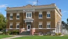 | Deuel County Courthouse | building | 1990 | 89002239 |
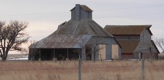 | Menter Farmstead | building | 2011 | 11000886 |
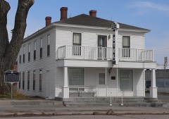 | Phelps Hotel | building | 1970 | 70000370 |
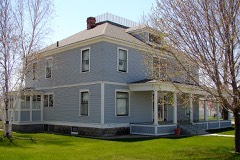 | Fred and Minnie Meyer Sudman House | building | 1990 | 90001770 |
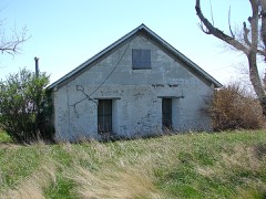 | Wallace W. Waterman Sod House | building | 1995 | 95000096 |
Every wildfire the federal occurrence database records inside this county: 53 of them, burning about 1,090 acres. 3 started naturally and none was recorded as arson. Each settlement page carries the fires within five miles of it.
| Reported cause | Fires |
|---|---|
| Debris and open burning | 21 |
| Equipment and vehicle use | 15 |
| Missing data/not specified/undetermined | 8 |
| Natural | 3 |
| Smoking | 2 |
| Railroad operations and maintenance | 2 |
| Recreation and ceremony | 1 |
| Power generation/transmission/distribution | 1 |
The five largest, by the area the report gives. None of them was recorded as arson.
| Date | Cause | Size | Reported by | Name on the report |
|---|---|---|---|---|
| 7 July 2007 | Equipment and vehicle use | 350 acres | Nebraska Forest Service | not named |
| 7 July 2007 | Equipment and vehicle use | 350 acres | Nebraska Forest Service | not named |
| 11 March 2007 | Power generation/transmission/distribution | 104 acres | Nebraska Forest Service | not named |
| 4 March 2009 | Debris and open burning | 50 acres | Nebraska Forest Service | not named |
| 21 October 2018 | Missing data/not specified/undetermined | 35 acres | Nebraska Forest Service | not named |
| 17 July 2015 | Equipment and vehicle use | 30 acres | Nebraska Forest Service | not named |
| 3 October 2018 | Railroad operations and maintenance | 30 acres | Nebraska Forest Service | not named |
| 14 July 2015 | Equipment and vehicle use | 23 acres | Nebraska Forest Service | not named |
Every settlement page carries the fires within five miles of it - see the settlement index below.
The NOAA Storm Events Database holds 340 reports for this county, causing no deaths, 3 injuries and about $1,074,480 in recorded property damage. Each settlement page carries the reports that name it.
| Kind of event | Reports |
|---|---|
| Hail | 210 |
| Thunderstorm Wind | 89 |
| Tornado | 25 |
| Funnel Cloud | 7 |
| Flash Flood | 4 |
| Flood | 4 |
| Heavy Rain | 1 |
The most serious of them, by death, then injury, then recorded damage. The accounts are quoted exactly as the forecast office filed them.
| When | Event | Place named | Harm | What the report says |
|---|---|---|---|---|
| June 2004 | Tornado (F1) | Chappell | 2 hurt, $70,000 | Shortly after the tornado touched down 10 miles ESE of Chappell, it hit a farmstead near the intersection of Highway 27 and Interstate 80. Three old, unanchored trailer homes were picked up and moved with two of them completely destroyed. A metal shed was tossed 40 yards and numerous trees were broken or uprooted. As the tornado crossed Interstate 80, it overturned a vehicle pulling a U-Haul trailer. Two children in the automobile were taken to an area hospital, treated for minor injuries and released. The tornado width increased to 1/8 of a mile as it moved northeast of the interstate. Approximately 8 miles WNW of Big Springs, a center pivot irrigation system was overturned, power poles were broken and a couple of old outbuildings lost their roofs. Baseball size hail also fell on the west side of the storm damaging 2 law enforcement vehicles about 12 miles west of Big Springs. |
| September 2013 | Flood | Big Spgs | 1 hurt, $2,000 | Flooding occurred along the South Platte River from September 18th through September 26th as water from the historic rains in Colorado moved through the river system. Cropland and pastureland along the river was flooded. Near Big Springs, two businesses sustained minor flood damage, while two truck stops and a motel were closed and evacuated for 48 hours. Road closures included U.S. Highway 138 and Nebraska Link 25B between Interstate 80 and the city of Big Springs. With roads leading into Big Springs being closed, the South Platte Public School was closed on Thursday, September 19th. Two men were rescued from the river near Big Springs as they were canoeing and capsized. One of the individuals sustained minor injuries. |
| June 2018 | Tornado (EF1) | Big Spgs | $125,000 | A tornado touched down and damaged two farmsteads along its path. The first farmstead had a livestock shed which lost its roof. Wooden beams were tossed 30 yards, piercing the side of a garage. Shingles were ripped off of nearby outbuildings. The tornado then passed onto another farmstead where two full irrigation pivots were flipped, the first by the tornado, and a second by straight line winds. Large branches were also broken off of trees at this location. |
| May 2000 | Hail | Chappell | $100,000 | Extensive damage done to houses and vehicles in Chappell. |
| May 2019 | Hail | Big Spgs | $50,000 | Numerous vehicle windows were reported broken out by golf ball sized hail from the junction of I76/I80 to south of Big Springs. Heavy damage to semi tractor windows reported at a truck stop at exit 107 on Interstate 80. |
| July 2003 | Thunderstorm Wind | Big Spgs | $50,000 | The thunderstorm outflow winds snapped off or uprooted numerous large trees. One tree fell on a vehicle parked across the street from the fire hall. 15 to 20 homes received roof damage due to trees that fell on the roofs. A porch roof was also ripped off and thrown into a nearby football field. Numerous power poles were also snapped off. |
| June 1998 | Hail | Big Spgs | $50,000 | Hail stripped bark from trees and paint from houses. Hail piled in drifts with some street flooding. |
| August 1993 | Thunderstorm Wind | not stated | $50,000 | Strong thunderstorm winds and hail damaged crops. Two tractor-trailer trucks also jackknifed on Interstate 80. |
| May 1999 | Hail | Big Spgs | $50,000 | no account filed |
| June 1998 | Hail | Chappell | $50,000 | no account filed |
| May 2008 | Flash Flood | Chappell | $25,000 | Heavy rain from thunderstorms caused flash flooding to roads on the west side of Chappell and to roads near the fairgrounds. Lodgepole Creek flowed out of its banks and caused lowland flooding. |
| September 2000 | Hail | Big Spgs | $25,000 | no account filed |
| June 1975 | Tornado (F1) | not stated | $25,000 | no account filed |
| June 1975 | Tornado (F1) | not stated | $25,000 | no account filed |
| October 1971 | Tornado (F0) | not stated | $25,000 | no account filed |
| June 1960 | Tornado (F0) | not stated | $25,000 | no account filed |
| June 2014 | Hail | Big Spgs | $20,000 | Deuel County EM reported golf ball size hail and estimated winds at 50 to 60 mph. |
| August 2002 | Hail | Chappell | $20,000 | Hail broke several windows at two farmsteads. |
| August 2002 | Tornado (F0) | Big Spgs | $20,000 | The tornado made a brief touchdown which damaged some out buildings and overturned a center pivot irrigation system. |
| September 2022 | Thunderstorm Wind | Big Spgs | $15,000 | Shop damaged by high winds. Time estimated from radar. |
| July 2011 | Thunderstorm Wind | Big Spgs | $15,000 | A semi truck was blown off of Interstate 80 near mile marker 95. Wind speeds were estimated at 80 MPH. |
| August 2002 | Hail | Big Spgs | $15,000 | Hail had to be removed by snow plows on Interstate 80 at mile marker 100 and on Highway 30 between Road 182 and 189. |
| May 2010 | Thunderstorm Wind | Chappell | $12,000 | Strong thunderstorm wind gusts overturned a semi trailer on Interstate 80 near Chappell. |
| June 2018 | Thunderstorm Wind | Chappell | $10,000 | Wind gusts estimated at 80 MPH flipped a camper along Interstate 80 near mile marker 92. |
| June 2015 | Thunderstorm Wind | Big Spgs | $10,000 | Trees were blown down and center pivot irrigation systems blown over in the area. |
| July 2015 | Thunderstorm Wind | Big Spgs | $10,000 | Thunderstorm wind gusts estimated at 60 MPH, along with hail of an unknown size reported. The strong winds and hail stripped corn, led to roof damage and injured livestock at this location. |
| June 2013 | Thunderstorm Wind | Chappell | $10,000 | Tractor trailer blown over on Interstate 80. |
| June 2013 | Thunderstorm Wind | Chappell | $10,000 | Damage to outbuildings and pole barns. |
| August 2013 | Hail | Big Spgs | $10,000 | All windows on north side of house broken out. |
| July 2004 | Hail | Chappell | $10,000 | Windows were broken, siding on homes was damaged, and crops were shredded by the large hail. |
| August 2002 | Hail | Chappell | $10,000 | no account filed |
| August 2002 | Hail | Chappell | $10,000 | no account filed |
| July 2001 | Hail | Chappell | $10,000 | no account filed |
| July 1999 | Hail | Chappell | $10,000 | no account filed |
| June 1999 | Hail | Big Spgs | $10,000 | no account filed |
| June 1999 | Hail | Chappell | $10,000 | no account filed |
| June 2009 | Hail | Big Spgs | $8,000 | no account filed |
| May 1999 | Hail | Chappell | $8,000 | no account filed |
| May 1999 | Hail | Big Spgs | $8,000 | no account filed |
| September 2004 | Hail | Chappell | $6,000 | no account filed |
| June 2018 | Thunderstorm Wind | Big Spgs | $5,000 | Power lines and 6 inch diameter tree limbs reported down at this location. Winds estimated at 60 MPH. |
| June 2009 | Hail | Chappell | $5,000 | The large hail was accompanied by strong winds. |
| July 2003 | Thunderstorm Wind | Big Spgs | $5,000 | Some outbuildings were damaged extensively by the thunderstorm outflow winds. |
| June 2009 | Hail | Chappell | $5,000 | no account filed |
| June 2009 | Hail | Chappell | $5,000 | no account filed |
| June 2009 | Hail | Big Spgs | $5,000 | no account filed |
| June 2003 | Hail | Big Spgs | $5,000 | no account filed |
| May 2019 | Hail | Big Spgs | $3,000 | Window damage reported at this location from wind driven hail. |
| June 2014 | Hail | Big Spgs | $2,000 | Cooperative observer reported golf ball size hail and winds estimated at 40 mph. |
| September 2004 | Hail | Chappell | $2,000 | no account filed |
| May 1998 | Hail | Chappell | $2,000 | no account filed |
| June 2018 | Thunderstorm Wind | Big Spgs | $1,000 | Thunderstorm wind gusts estimated at 60 MPH, blew shingles off of a roof at this location. |
| July 2013 | Hail | Big Spgs | $1,000 | A car windshield was broken by golf ball sized hail while traveling on Interstate 80 near Big Springs. |
| May 2008 | Hail | Chappell | $1,000 | no account filed |
| April 2007 | Hail | Big Spgs | $1,000 | no account filed |
| September 2001 | Hail | Chappell | $1,000 | no account filed |
| June 2015 | Thunderstorm Wind | Chappell | $500 | Thunderstorm wind gusts downed 6 to 8 inch diameter tree branches. |
| September 1994 | Thunderstorm Wind | Great Falls | $500 | no account filed |
| June 1953 | Tornado | not stated | $250 | no account filed |
| May 2008 | Thunderstorm Wind | Big Spgs | $200 | Thunderstorm outflow winds tore an awning off a house. |
Named settlements recorded in the Geographic Names Information System, each with the topographic sheets covering it. Villages, hamlets and abandoned places alike. Each is shown with the nearest named watercourse or landform and the survey quadrangle it falls on.
Big Springs precinct · 69122 · Near Trailer House Gulch · Big Springs quadrangle
12 sheets, 1900 to 1985