 Block
From the record
6 National Register listings published here.
Sources: the National Register database, National Park Service
26 topographic sheets cover 8 settlements here, and 6 properties are on the National Register of Historic Places.
6 National Register listings published here.
Sources: the National Register database, National Park Service
Every property in this county listed on the National Register of Historic Places, with the year it was listed and the federal nomination document.
| Photograph | Property | Type | Listed | Reference |
|---|---|---|---|---|
| Dupee Music Hall | building | 1985 | 85002484 | |
 | First Congregational Church, U.C.C. | building | 1982 | 82003188 |
 | Franklin Bridge | structure | 1992 | 92000764 |
 | Franklin County Courthouse | building | 1990 | 90000962 |
 | Lincoln Hotel | building | 89000799 | |
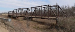 | Republican River Bridge | structure | 1992 | 92000765 |
Every wildfire the federal occurrence database records inside this county: 103 of them, burning about 1,942 acres. 2 started naturally and none was recorded as arson. Each settlement page carries the fires within five miles of it.
| Reported cause | Fires |
|---|---|
| Debris and open burning | 51 |
| Missing data/not specified/undetermined | 21 |
| Equipment and vehicle use | 18 |
| Smoking | 5 |
| Power generation/transmission/distribution | 4 |
| Natural | 2 |
| Recreation and ceremony | 1 |
| Railroad operations and maintenance | 1 |
The five largest, by the area the report gives. None of them was recorded as arson.
| Date | Cause | Size | Reported by | Name on the report |
|---|---|---|---|---|
| 5 February 2011 | Debris and open burning | 300 acres | Nebraska Forest Service | not named |
| 18 February 2017 | Debris and open burning | 252 acres | Nebraska Forest Service | not named |
| 25 February 2012 | Debris and open burning | 250 acres | Nebraska Forest Service | not named |
| 15 March 2006 | Debris and open burning | 203 acres | Rainwater Basin Wetland Management District | MACON NORTHEAST |
| 1 April 1999 | Debris and open burning | 160 acres | Rainwater Basin Wetland Management District | QUADHAMMER |
| 1 August 2004 | Equipment and vehicle use | 100 acres | Nebraska Forest Service | not named |
| 22 April 2009 | Debris and open burning | 100 acres | Nebraska Forest Service | not named |
| 6 October 2007 | Equipment and vehicle use | 60 acres | Nebraska Forest Service | not named |
Every settlement page carries the fires within five miles of it - see the settlement index below.
The NOAA Storm Events Database holds 331 reports for this county, causing no deaths, 1 injury and about $14,477,000 in recorded property damage. Each settlement page carries the reports that name it.
| Kind of event | Reports |
|---|---|
| Hail | 186 |
| Thunderstorm Wind | 83 |
| Tornado | 31 |
| Heavy Rain | 19 |
| Flash Flood | 5 |
| Flood | 3 |
| Lightning | 2 |
| Funnel Cloud | 2 |
The most serious of them, by death, then injury, then recorded damage. The accounts are quoted exactly as the forecast office filed them.
| When | Event | Place named | Harm | What the report says |
|---|---|---|---|---|
| May 1985 | Tornado (F4) | not stated | 1 hurt, $2,500,000 | no account filed |
| May 2023 | Hail | Franklin | $4,000,000 | Hail up to the size of tennis balls was reported across Franklin. There were numerous reports of shredded trees, broken siding and windows and damage to vehicles. |
| June 2014 | Thunderstorm Wind | Upland | $1,500,000 | A line of thunderstorms with damaging wind gusts up to 80 MPH resulted in very large tree branches being downed in Upland, causing power outages. |
| May 2002 | Hail | Franklin | $700,000 | no account filed |
| June 2023 | Thunderstorm Wind | Naponee | $500,000 | A weakening cluster of thunderstorms sliding east just north of the Nebraska-Kansas state line produced severe weather across southwestern portions of Franklin County. The NWS Cooperative Observer in Naponee reported hail around golf ball size and wind gusts exceeding 60 MPH. |
| June 2023 | Hail | Naponee | $500,000 | A weakening cluster of thunderstorms sliding east just north of the Nebraska-Kansas state line produced severe weather across southwestern portions of Franklin County. The NWS Cooperative Observer in Naponee reported hail around golf ball size and wind gusts exceeding 60 MPH. |
| June 2011 | Thunderstorm Wind | Hildreth | $500,000 | Wind gusts were estimated at 65 MPH. Roof damage was reported in Hildreth, and a large tree was uprooted in the Campbell park and fell on a gazebo roof, with many other tree limbs up to 3 to 4 inches in diameter blown down around town. Small hail also accompanied these winds, and together resulted in a swath of crop damage approximately 3 to 4 miles wide, with the path running along and near Highway 4. |
| June 2024 | Thunderstorm Wind | Hildreth | $350,000 | A social media report noted a flipped irrigation pivot four miles southwest of Hildreth. A wind gust of 59 MPH was measured by a mesonet station located five miles south-southwest of Hildreth. |
| May 2023 | Hail | Naponee | $250,000 | Hail up to the size of golf balls was reported in the area. Hail up to nickel size was reported starting around 530 PM CDT, with the larger hail starting approximately 15 minutes later. |
| September 1985 | Tornado (F1) | not stated | $250,000 | no account filed |
| May 1999 | Tornado (F1) | Macon | $200,000 | no account filed |
| May 2011 | Thunderstorm Wind | Franklin | $150,000 | Damage reports included tree limbs knocked down, a couple power poles knocked over resulting in power outages, roof and carport damage in town, and a storage unit damage approximately 2 miles south of town. |
| May 2019 | Tornado (EF1) | Macon | $125,000 | This tornado was embedded within a fast moving line of thunderstorms. While it was just a brief tornado, it resulted in the complete destruction of a detached garage and minor damage to at least one rural home. There was tree damage and flipped irrigation pivot along its path. The maximum wind speed was estimated to be 100 MPH. |
| June 2021 | Thunderstorm Wind | Franklin | $100,000 | Multiple trees blown down in Franklin. Multiple power lines blown down across Franklin County and several transformers knocked out. |
| May 2019 | Flood | Riverton | $100,000 | Heavy rainfall caused the flooding of area creeks, including the Thompson Creek, and portions of the Republican River. County roads in the area and bridges crossing the waterways were affected. Buildings in Riverton were threatened by rising waters of Thompson Creek. The Thompson Creek gauge at Riverton crested at 13.27 feet the morning of May 27th, and that was the 2nd highest crest on record. The Republican River gauge at Riverton crested at 9.45 feet the morning of the 27th, and that was the 2nd highest crest on record. |
| September 2007 | Thunderstorm Wind | Franklin | $100,000 | Nickel size hail fell with the wind. |
| July 2019 | Flash Flood | Bloomington | $100,000 | no account filed |
| July 2000 | Flash Flood | Countywide | $100,000 | no account filed |
| July 2011 | Thunderstorm Wind | Franklin | $75,000 | Wind gusts estimated at 65 MPH resulted in a roof being partially peeled back on a shed north of town and tree damage in Franklin. One tree in Franklin fell and landed on a building. |
| June 2009 | Hail | Hildreth | $75,000 | Hail accompanied by strong winds, and damage to a grain bin was reported. |
| May 2012 | Hail | Franklin | $75,000 | no account filed |
| June 2000 | Hail | Hildreth | $75,000 | no account filed |
| June 1999 | Thunderstorm Wind | Franklin | $75,000 | no account filed |
| July 1997 | Hail | Riverton | $75,000 | no account filed |
| December 2021 | Tornado (EF0) | Campbell | $50,000 | This tornado touched down just inside Franklin County south of Campbell, moved through northwestern Webster County and into southern Adams County. As this tornado tracked northeast, some power poles, and irrigation pivot, and an outbuilding were damaged east of Campbell. Once it crossed into Adams County, a few more pivots were tipped and a home sustained minor damage. The maximum wind gust was estimated to be 85 MPH. |
| August 2018 | Lightning | Naponee | $50,000 | There was a lightning strike to an area of oil storage tanks, resulting in a fire. This fire destroyed 4 of the 5 storage tanks located at the facility. The time was estimated from radar data. |
| December 2016 | Thunderstorm Wind | Macon | $50,000 | An overturned center pivot occurred from straight-line winds. |
| December 2016 | Thunderstorm Wind | Upland | $50,000 | Straight-line thunderstorm winds blew over a center pivot. |
| May 2012 | Thunderstorm Wind | Upland | $50,000 | Wind gusts estimated at 70 mph resulted in a grain bin being destroyed. |
| August 2011 | Flood | Macon | $50,000 | Rainfall totals ranging from 2 to as high as 6 inches were reported across the area. Just south of the intersection of Highways 10 and 4 north of Macon, water was reported over the road, causing one car to go into the ditch. Several county roads around the area were affected by running water, causing some minor damage and gravel loss. This heavy rain eventually ran into the Thompson Creek basin, and the gauge near Riverton rose above flood stage during the morning hours of the 30th. |
| May 2008 | Flash Flood | Naponee | $50,000 | Numerous areas in Franklin County picked up 3 to 4 inches of rain. This caused many rural roads to flood. |
| September 2007 | Hail | Franklin | $50,000 | Winds estimated at 60 mph came along with the hail. |
| May 2012 | Hail | Riverton | $50,000 | no account filed |
| June 2002 | Hail | Riverton | $50,000 | no account filed |
| June 2002 | Hail | Campbell | $50,000 | no account filed |
| June 2000 | Hail | Macon | $50,000 | no account filed |
| August 1999 | Thunderstorm Wind | Franklin | $50,000 | no account filed |
| May 1999 | Thunderstorm Wind | Franklin | $50,000 | no account filed |
| May 1999 | Thunderstorm Wind | Naponee | $50,000 | no account filed |
| June 1997 | Thunderstorm Wind | Franklin | $50,000 | no account filed |
| May 2002 | Hail | Franklin | $45,000 | no account filed |
| March 2006 | Hail | Franklin | $30,000 | no account filed |
| May 2017 | Thunderstorm Wind | Hildreth | $25,000 | Multiple trees were downed in town. Wind gusts were estimated, a nearby mesonet station recorded a gust of 63 MPH. |
| October 2017 | Hail | Macon | $25,000 | Quarter to golf ball sized hail occurred. |
| May 2019 | Hail | Hildreth | $25,000 | no account filed |
| May 2019 | Hail | Upland | $25,000 | no account filed |
| May 2019 | Hail | Macon | $25,000 | no account filed |
| September 2019 | Hail | Macon | $25,000 | no account filed |
| June 2018 | Hail | Franklin | $25,000 | no account filed |
| June 2018 | Hail | Franklin | $25,000 | no account filed |
| June 2017 | Hail | Riverton | $25,000 | no account filed |
| May 2015 | Hail | Hildreth | $25,000 | no account filed |
| April 2014 | Hail | Franklin | $25,000 | no account filed |
| May 2012 | Hail | Campbell | $25,000 | no account filed |
| May 2012 | Hail | Riverton | $25,000 | no account filed |
| May 2012 | Hail | Naponee | $25,000 | no account filed |
| June 2012 | Hail | Hildreth | $25,000 | no account filed |
| September 2012 | Hail | Franklin | $25,000 | no account filed |
| August 2007 | Thunderstorm Wind | Macon | $25,000 | no account filed |
| June 2005 | Heavy Rain | Macon | $25,000 | no account filed |
Named settlements recorded in the Geographic Names Information System, each with the topographic sheets covering it. Villages, hamlets and abandoned places alike. Each is shown with the nearest named watercourse or landform and the survey quadrangle it falls on.
Turkey Creek township · 68960 · On Turkey Creek · Republican City quadrangle
13 sheets, 1896 to 1986