 Block
From the record
9 National Register listings published here, 1 of them a National Historic Landmark.
Sources: the National Register database, National Park Service
49 topographic sheets cover 20 settlements here, and 9 properties are on the National Register of Historic Places.
9 National Register listings published here, 1 of them a National Historic Landmark.
Sources: the National Register database, National Park Service
Every property in this county listed on the National Register of Historic Places, with the year it was listed and the federal nomination document.
| Photograph | Property | Type | Listed | Reference |
|---|---|---|---|---|
 | Fort McPherson National Cemetery | district | 2012 | 12000075 |
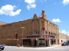 | Fox Theatre | building | 1985 | 85000957 |
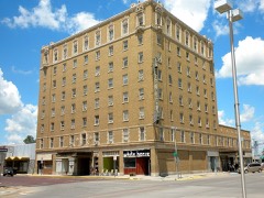 | Hotel Yancey | building | 1985 | 85000956 |
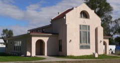 | Johnston Memorial Building | building | 1986 | 86000473 |
 | Lincoln County Courthouse | district | 1990 | 89002224 |
| North Platte Commercial Historic District | district | 2020 | 100005338 | |
 | North Platte US Post Office and Federal Building | building | 2009 | 09000071 |
 | Scout's Rest Ranch | building | 1978 | 78001705 |
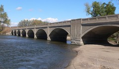 | Sutherland State Aid Bridge | structure | 1992 | 92000705 |
Every wildfire the federal occurrence database records inside this county: 333 of them, burning about 70,428 acres. 27 started naturally and 1 was recorded as arson. Each settlement page carries the fires within five miles of it.
| Reported cause | Fires |
|---|---|
| Missing data/not specified/undetermined | 110 |
| Equipment and vehicle use | 68 |
| Debris and open burning | 60 |
| Natural | 27 |
| Power generation/transmission/distribution | 25 |
| Railroad operations and maintenance | 12 |
| Smoking | 12 |
| Fireworks | 9 |
| Recreation and ceremony | 5 |
| Misuse of fire by a minor | 4 |
| Arson/incendiarism | 1 |
The five largest, by the area the report gives. None of them was recorded as arson.
| Date | Cause | Size | Reported by | Name on the report |
|---|---|---|---|---|
| 5 September 1995 | Missing data/not specified/undetermined | 33,000 acres | Nebraska Forest Service | not named |
| 9 February 1999 | Missing data/not specified/undetermined | 14,000 acres | Nebraska Forest Service | not named |
| 18 November 1999 | Missing data/not specified/undetermined | 6,400 acres | Nebraska Forest Service | not named |
| 18 August 1995 | Missing data/not specified/undetermined | 3,500 acres | Nebraska Forest Service | not named |
| 22 March 1994 | Missing data/not specified/undetermined | 2,500 acres | Nebraska Forest Service | not named |
| 8 March 2020 | Missing data/not specified/undetermined | 1,920 acres | Nebraska Forest Service | not named |
| 16 March 2015 | Equipment and vehicle use | 1,500 acres | Nebraska Forest Service | not named |
| 16 April 1994 | Missing data/not specified/undetermined | 1,280 acres | Nebraska Forest Service | not named |
Every settlement page carries the fires within five miles of it - see the settlement index below.
The NOAA Storm Events Database holds 1,868 reports for this county, causing no deaths, 19 injuries and about $68,938,640 in recorded property damage. Each settlement page carries the reports that name it.
| Kind of event | Reports |
|---|---|
| Hail | 1102 |
| Thunderstorm Wind | 567 |
| Tornado | 105 |
| Flash Flood | 39 |
| Funnel Cloud | 22 |
| Flood | 19 |
| Lightning | 10 |
| Heavy Rain | 4 |
The most serious of them, by death, then injury, then recorded damage. The accounts are quoted exactly as the forecast office filed them.
| When | Event | Place named | Harm | What the report says |
|---|---|---|---|---|
| June 1989 | Tornado (F3) | not stated | 2 hurt, $2,500,000 | no account filed |
| August 1999 | Flash Flood | Southwest Portion | 2 hurt, $1,000,000 | Roads and culverts were washed out by flash flooding in the southwest part of Lincoln County. A Madrid couple was unable to stop their Buick before hitting a washed out road 1 mile west of Wallace on Highway 23. The car was swept away. Both people escaped the car and one person was able to get to dry land and call for help. The other was rescued after clinging to a tree for more than two hours. Both individuals were treated at Grant Community Hospital and released. |
| March 2012 | Tornado (EF3) | North Platte | 2 hurt, $750,000 | A tornado touched down four and a half miles west of North Platte just south of west Front street and traveled north northeast. The tornado damage was extensive to include two homes destroyed and two additional homes with significant damage from trees blown over and windows blown out. Two residents were injured in their homes. As the tornado traveled north across the Union Pacific Bailey Yards, an estimated 15 tanker cars were blown over and debris was scattered northeast for one and a half miles. A center pivot irrigation system was overturned north of Highway 30 before the tornado lifted five and a half miles northwest of North Platte. |
| May 2000 | Tornado (F3) | Brady | 2 hurt, $750,000 | The same supercell thunderstorm that had earlier produced the twin tornadoes 20 miles south of Brady produced a large tornado that touched down 6 miles south of Brady and moved toward the northwest lifting 4 miles south of Maxwell. Two women were injured when their home blew down around them. The tornado destroyed three homes and heavily damaged three others. Numerous outbuildings were damaged or destroyed. Four center pivot irrigation systems were destroyed and extensive damage was done to agricultural equipment. Over 75 power and telephone poles were destroyed along with miles of wire. The tornado reached it's maximum intensity of F3 shortly after touchdown when it heavily damaged a brick home and completely destroyed a large steel building. Later in it's path, the tornado leveled a frame home and blew several vehicles over and around the home. The path of the tornado was clearly visible where crops had been stripped from the ground. This tornado received extensive national coverage because of great video taken from chasers. |
| March 2012 | Tornado (EF3) | North Platte | 2 hurt, $500,000 | A tornado touched down 10 miles southwest of North Platte and traveled north and destroyed a large metal transmission tower. Two homes were damaged, several outbuildings and garages were damaged or destroyed. Two center pivot irrigation systems were overturned with one wood transmission tower destroyed and extensive power line damage along the path in addition to tree damage. The tornado dissipated while moving north of Walker road. |
| October 1956 | Tornado (F4) | not stated | 2 hurt, $250,000 | no account filed |
| April 2007 | Tornado (EF3) | Brady | 2 hurt, $180,000 | This tornado formed 4 miles southeast of Moorefield in Frontier County and entered Lincoln County about 23 miles south southeast of Brady at 8:25 PM CST. The tornadic supercell continued for another 12 miles before dissipating 14 miles south of Brady at 8:46 PM CST. In addition to power poles and trees being snapped off, the tornado hit 2 farmsteads. At the first farmstead, it completely destroyed one large storage building and took off the roof and northeast exterior wall of the home. At the farmstead across the road, the tornado completely destroyed an unanchored farm house and 3 storage sheds. The 2 occupants in the home were on the main floor of the home when the tornado hit and were carried with the debris 50 feet. The tornado was rated F2 in Frontier County and F3 in Lincoln County. |
| July 2003 | Hail | North Platte | 1 hurt, $7,050,000 | Ping-pong ball to baseball size hail struck the east side of town. Hail damaged the bodies of nearly every vehicle and broke some windshields at an auto dealership and in residential areas on the east side of North Platte. Then the storm moved into the southeast section of town and continued to do damage to vehicles at retail shopping center parking lots. The hail also damaged 8 skylights in the Wal-Mart Super Center store. One middle aged woman was struck in the head by a hailstone in the Wal-Mart parking lot. She was taken to the hospital for stitches. Then the storm severely damaged nearly every vehicle at 2 more auto dealerships as it moved south of Interstate 80. |
| March 2012 | Tornado (EF1) | North Platte | 1 hurt, $250,000 | A tornado touched down 5 miles west southwest of North Platte just south of Interstate 80. The tornado moved north where a semi tractor and trailer was destroyed and driver injured. Extensive debris spread north and northwest as the tornado tracked northwest damaging a garage, overturning a center pivot irrigation system, destroying fence line and producing extensive tree damage along a one and a half mile long path before lifting just south of the South Platte river. |
| May 1990 | Tornado (F1) | not stated | 1 hurt, $250,000 | no account filed |
| June 2016 | Hail | Sutherland | 1 hurt | A small child received minor injuries from the hail while heading to a storm shelter. |
| June 1991 | Thunderstorm Wind | not stated | 1 hurt | no account filed |
| April 2012 | Hail | North Platte | $30,000,000 | Tennis ball size hail fell on the west side of North Platte, with a few pieces that large also falling on the east side of the city. Golf ball size hail also fell across much of the city and lasted until 6:50 p.m. CDT. In some parts of the city large hail fell off and on for almost two hours. |
| May 2012 | Hail | Wellfleet | $5,000,000 | Considerable damage done to a new convertible from the hail. |
| April 2012 | Hail | North Platte | $4,000,000 | no account filed |
| April 2012 | Hail | North Platte | $2,000,000 | Golf ball size hail fell just south of the city of North Platte, at the junction of U.S. Highway 83 and Dodge Hill Road. |
| June 1997 | Hail | Wallace | $1,500,000 | Thunderstorms with large hail and 60 mph winds damaged crops and property in a path across Southwest Nebraska. |
| June 1997 | Hail | Wellfleet | $1,500,000 | Scattered thunderstorms with large hail and winds in excess of 60 mph destroyed crops and property in a path across Southwest Nebraska. |
| August 2013 | Thunderstorm Wind | North Platte | $1,000,000 | Storm damage survey observed damage to homes, business and schools as numerous trees were uprooted, large tree limbs snapped or broken. The downed trees brought down numerous power lines that caused power outages between Buffalo Bill to Poplar streets. The Nebraska State Patrol closed Interstate 80 temporarily as several semi-trucks were over turned or had gone into the ditch from the strong winds. |
| July 2007 | Hail | Sutherland | $550,000 | An intense supercell storm produced very large hail and strong winds as it moved south from north of Sutherland to Wallace. The quarter to baseball size hail severely damaged roofs, broke numerous windows, shredded corn crops, and totaled vehicles. |
| June 1999 | Thunderstorm Wind | North Platte | $500,000 | A severe thunderstorm with damaging wind squalls moved through Lincoln and Custer Counties causing extensive loss and damage of trees. Several trees were uprooted and many more were broken in the city of North Platte. Reports from Callaway in southwest Custer County indicated that branches of ten inches in diameter were broken in that area. A few of the fallen trees in North Platte damaged roofs and fences. |
| May 2007 | Flash Flood | Dickens | $400,000 | Thunderstorms produced very heavy rainfall of 2 to 6 inches across southeast Lincoln County. Houses north of the railroad tracks in Maxwell flooded with 2 1/2 feet of water. Small mudslides onto the railroad tracks occurred at the Newberry Access overpass in North Platte. Highways 23, 25 and 83 were under water in several locations. Numerous secondary roads were severely damaged due to water over the roads. |
| June 2009 | Thunderstorm Wind | Wallace | $350,000 | Very strong winds overturned 12 center pivot irrigation systems west of Wallace and then broke off numerous trees and damaged roofs in Wallace. It also damaged the roof of the school gymnasium. |
| June 2024 | Thunderstorm Wind | North Platte | $250,000 | Emergency management reports numerous trees down all over the city of North Platte. Several power lines down and power is out across all of North Platte. |
| August 1999 | Thunderstorm Wind | North Platte | $250,000 | A severe thunderstorm packing 75 mph wind and 3/4 inch hail moved through Lincoln County. Several trees were uprooted and broken in North Platte and numerous limbs were broken with the greatest damage on the east side of the city of North Platte. At a residence on the east side, a 55 foot tall Colorado blue spruce was blown down against the house causing minor damage to the house. |
| June 1998 | Tornado (F1) | Maxwell | $250,000 | Tornado was on the ground intermittently for a distance of 4 miles from 5 miles south southwwest of Maxwell (2 miles southwest of Ft McPherson Cemetery) to 2 miles west southwest of Maxwell near the Platte river. It struck the Marantha Bible Camp downing approximately 160 trees, destroying a small shed, and damaging several vehicles in the parking lot. Tornado then crossed Interstate 80, blew down two large billboards and struck a house 1 mile north of I-80 where a camper was also destroyed. Tornado then did minor damage to another home approximately 1 mile to the north northeast. |
| May 1990 | Tornado (F2) | not stated | $250,000 | no account filed |
| October 1980 | Tornado (F0) | not stated | $250,000 | no account filed |
| July 1977 | Tornado | not stated | $250,000 | no account filed |
| July 2025 | Flash Flood | North Platte | $200,000 | Heavy rainfall, up to 3 inches, fell in a short time over North Platte, leading to water over numerous streets. There were reports of cars submerged at the District 177 Shopping Area. |
| March 2012 | Tornado (EF2) | North Platte | $200,000 | A tornado touched down five miles west northwest of North Platte, just south of Platte Valley Road, where a two story barn was destroyed with several outbuildings damaged. The tornado tracked northeast where a field of boards from the barn were driven into the ground, along with other debris. As the tornado tracked northeast, two homes were damaged, a garage had structural damage, and an outbuilding was destroyed. Extensive tree damage occurred before the tornado dissipated five miles northwest of North Platte. |
| May 2007 | Flash Flood | Wallace | $200,000 | Thunderstorms produced very heavy rainfall of 2 to 6 inches across Lincoln County. The heaviest rainfall occurred across the southwestern portion of the county. Asher Road 4 miles southwest of Wellfleet washed out creating a crater of 1/2 mile long by 4 feet deep. A bridge washed out south of Wellfleet on the Hayes Center Road. Numerous secondary roads were severely damaged due to water over the roads. |
| July 1999 | Thunderstorm Wind | North Platte | $200,000 | A severe thunderstorm produced wind of at least 70 mph in and around North Platte. At the Union Pacific Railroad's Bailey Yard, the wind damaged several rail cars. Despite having air brakes set, six railroad cars were displaced for a considerable distance and derailed. In the process, minor damage was sustained by the tracks. |
| June 2000 | Hail | Brady | $200,000 | no account filed |
| September 2013 | Flood | Sutherland Res | $180,000 | Flooding occurred along the South Platte River from September 20th through September 26th as water from the historic rains in Colorado moved through the river system. Cropland and pastureland along the river was flooded. In North Platte, several homes had minor damage and 14 roads were closed as storm drains backed up in parts of the city. Southeast of North Platte, at least two roads were closed, with one business and an unknown number of outbuildings being flooded near and east of Nebraska Link 56G. |
| June 2009 | Tornado (EF1) | North Platte | $152,000 | A tornado developed on the northwest corner of a bow echo and touched down very briefly over Union Pacific Railroad Bailey Yard and was witnessed by numerous railroad workers. The tornado derailed 14 empty coal cars and overturned a semi in Bailey Yard. It also snapped off large trees on the north edge of Bailey Yard before lifting. The storm had produced another brief tornado previous to this one. |
| July 2007 | Hail | North Platte | $150,000 | An intense supercell storm produced very large hail as it moved south across Lincoln County. The ping pong ball to baseball size hail destroyed numerous roofs and totaled vehicles. |
| May 2000 | Hail | Wallace | $150,000 | Extensive damage to homes and cars in Wallace. |
| July 2000 | Hail | Wallace | $150,000 | no account filed |
| June 2025 | Tornado (EF2) | Dickens | $140,000 | Tornado developed and tracked approximately 3 miles to the south where it dissipated almost 45 minutes later. Along the tornado path, numerous power poles were snapped, a center pivot was overturned, and severe tree damage was reported to shelterbelts. |
| June 2010 | Flood | Sutherland | $125,000 | Thunderstorms with prolonged heavy rain falling on already saturated ground caused widespread flooding across northwest Lincoln County. Up to 6 inches of rain fell with severely damaged rural roads. The intersection of Range and Walker Road was washed out. |
| May 2004 | Tornado (F1) | Brady | $125,000 | The tornado destroyed two center pivot irrigation systems, overturned farm machinery, and destroyed 2 grain bins. |
| July 2025 | Hail | Keith | $100,000 | Fire department reports window damage to several buildings in northeastern Lincoln and southern Logan County. |
| March 2019 | Flood | Brady | $100,000 | Numerous roads in eastern Lincoln County near Maxwell and Brady are flooded. |
| September 2019 | Hail | North Platte | $100,000 | Numerous cars with hail damage in Indian Hills Subdivision. |
| July 2013 | Thunderstorm Wind | North Platte | $100,000 | Three metal buildings were destroyed northwest of North Platte, the largest of which was 70 by 90 feet. Power lines reported down on Suburban road along with numerous large trees down. A house sustained major damage to siding and shingles on the north side of the structure. |
| May 2013 | Thunderstorm Wind | North Platte | $100,000 | Straight line winds between 65 and 90 mph destroyed a pole barn that measured 73 by 30 feet. That debris hit a second building, damaging the roof, south wall, and windows. |
| June 2009 | Flash Flood | Sutherland | $100,000 | Nearly stationary storms produced up to 5 inches of rain in Sutherland and flooded streets and buildings. Approximately 20 to 30 homes had water in their basement. About 2 inches of water rain into the Sutherland school music and weight rooms and into the Sutherland Care Center hallways. The volunteer fire department sandbagged around the school, the retirement home, and several residences in Sutherland. Interstate 80 and Highway 30 between Sutherland and Hershey were closed for a short period of time because of the heavy rain and hail. |
| July 2008 | Thunderstorm Wind | North Platte | $100,000 | The winds brought down large tree branches throughout North Platte. The frame of a new pharmacy being built near the hospital collapsed in the wind. Corn crops were also damaged. |
| July 2007 | Hail | Hershey | $100,000 | The large hail damaged numerous roofs and vehicles. |
| May 2000 | Tornado (F1) | Wallace | $100,000 | An F1 tornado touched down 1 mile northeast of Wallace, was on the ground for 5 minutes and lifted 3 miles north of Wallace. The tornado damaged or destroyed three center pivot irrigation systems and destroyed crops in its path. |
| June 2000 | Hail | Brady | $100,000 | no account filed |
| July 1996 | Hail | Sutherland | $100,000 | no account filed |
| May 2004 | Thunderstorm Wind | North Platte | $95,000 | A storage shed at a lumber yard on the east side of North Platte was severely damaged by outflow thunderstorm winds. Gravel picked up by the strong winds broke 10 car windows at a restaurant on the south side of town. A detached garage and the 2nd story of a house, both under construction about 4 miles south of town, were destroyed. Numerous trees were uprooted and large branches were down in several locations. |
| July 2001 | Thunderstorm Wind | Brady | $80,000 | Strong winds to near 90 mph caused a Union Pacific train derailment on the Lincoln and Dawson county line. The derailment of 13 cars caused 200 feet of track to be destroyed with bedrock damaged on the north tracks. Large tree limbs were also down. |
| July 2007 | Flash Flood | Dickens | $75,000 | A large slow moving thunderstorm produced 3 to 6 inches of rainfall. The rainfall drained into canyons in southeast Lincoln County causing flash flooding with roads under water in several locations. |
| June 1996 | Hail | Wellfleet | $75,000 | no account filed |
| June 2015 | Hail | Dickens | $70,000 | Softball size hail put holes in roof and living room ceiling. All vehicles sustained significant damage. |
| June 2009 | Thunderstorm Wind | Wallace | $70,000 | The intense winds broke off large tree limbs, overturned a center pivot irrigation system, and snapped off a large power pole. |
| April 2005 | Hail | North Platte | $65,000 | Nickel to ping pong size hail fell in North Platte and eastward 2 miles to the NWS office. The hail did minor damage to siding and roofs on homes and businesses, broke windows in a few vehicles, and did body damage to numerous vehicles at car dealerships on the east and south sides of North Platte. |
The Survey's mineral resources record lists 5 workings inside this county. All of them still produce. Each settlement page carries the workings within five miles of it.
| Commodity | Workings |
|---|---|
| Sand and Gravel, Construction | 5 |
The least common of them first, because a county's hundredth gravel pit says nothing its first ten did not.
| Where | Site | Commodity | Status | Recorded |
|---|---|---|---|---|
| Albrecht Pit & Plant | Sand and Gravel, Construction | Producer | ||
| Mccain Pit & Plant | Sand and Gravel, Construction | Producer | ||
| N.P.P.D. Gravel Pit | Sand and Gravel, Construction | Producer | ||
| North Platte Pit & Plant | Sand and Gravel, Construction | Producer | ||
| Sutherland Pit | Sand and Gravel, Construction | Producer |
Named settlements recorded in the Geographic Names Information System, each with the topographic sheets covering it. Villages, hamlets and abandoned places alike. Each is shown with the nearest named watercourse or landform and the survey quadrangle it falls on.
North Platte precinct · 69101 · On Beer Slough · North Platte West quadrangle
14 sheets, 1899 to 1985
Hall precinct · 69163 · Stapleton SE quadrangle
13 sheets, 1899 to 1985
No longer a settlement
North Platte precinct · 69101 · North Platte West quadrangle
14 sheets, 1899 to 1985
North Platte precinct · 69101 · On Beer Slough · North Platte West quadrangle
14 sheets, 1899 to 1985
Brady precinct · 69138 · Near Wild Horse Valley · Jeffrey Reservoir NE quadrangle
10 sheets, 1902 to 1979
The vanished settlements of Lincoln County: the places named above that are no longer on the map.