 Block
From the record
5 National Register listings published here.
Sources: the National Register database, National Park Service
37 topographic sheets cover 20 settlements here, and 5 properties are on the National Register of Historic Places.
5 National Register listings published here.
Sources: the National Register database, National Park Service
Every property in this county listed on the National Register of Historic Places, with the year it was listed and the federal nomination document.
| Photograph | Property | Type | Listed | Reference |
|---|---|---|---|---|
 | Camp Clarke Bridge Site | site | 1974 | 74001129 |
 | Chimney Rock National Historic Site | site | 1966 | 66000116 |
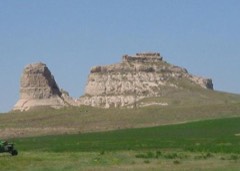 | Courthouse and Jail House Rocks | site | 1973 | 73001067 |
 | Morrill County Courthouse | district | 1990 | 89002227 |
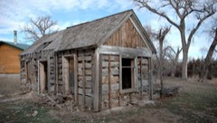 | Schuetz Log Cabin | building | 2011 | 11000105 |
Every wildfire the federal occurrence database records inside this county: 157 of them, burning about 20,776 acres. 21 started naturally and 2 were recorded as arson. Each settlement page carries the fires within five miles of it.
| Reported cause | Fires |
|---|---|
| Debris and open burning | 66 |
| Missing data/not specified/undetermined | 27 |
| Natural | 21 |
| Railroad operations and maintenance | 14 |
| Equipment and vehicle use | 12 |
| Power generation/transmission/distribution | 10 |
| Arson/incendiarism | 2 |
| Misuse of fire by a minor | 2 |
| Smoking | 1 |
| Recreation and ceremony | 1 |
| Fireworks | 1 |
The five largest, by the area the report gives. None of them was recorded as arson.
| Date | Cause | Size | Reported by | Name on the report |
|---|---|---|---|---|
| 4 November 1999 | Missing data/not specified/undetermined | 11,520 acres | Nebraska Forest Service | not named |
| 3 July 2002 | Missing data/not specified/undetermined | 5,000 acres | North Platte National Wildlife Refuge | BIRD |
| 12 March 2020 | Equipment and vehicle use | 2,000 acres | Nebraska Forest Service | not named |
| 25 July 2013 | Natural | 350 acres | Nebraska Forest Service | not named |
| 4 September 2014 | Natural | 250 acres | Nebraska Forest Service | not named |
| 7 November 2014 | Power generation/transmission/distribution | 250 acres | Nebraska Forest Service | not named |
| 27 July 2014 | Railroad operations and maintenance | 202 acres | Nebraska Forest Service | not named |
| 12 September 2017 | Power generation/transmission/distribution | 200 acres | Nebraska Forest Service | not named |
Every settlement page carries the fires within five miles of it - see the settlement index below.
The NOAA Storm Events Database holds 466 reports for this county, causing no deaths, 1 injury and about $10,149,900 in recorded property damage. Each settlement page carries the reports that name it.
| Kind of event | Reports |
|---|---|
| Hail | 292 |
| Thunderstorm Wind | 87 |
| Tornado | 50 |
| Flash Flood | 21 |
| Heavy Rain | 11 |
| Funnel Cloud | 2 |
| Flood | 2 |
| Winter Weather | 1 |
The most serious of them, by death, then injury, then recorded damage. The accounts are quoted exactly as the forecast office filed them.
| When | Event | Place named | Harm | What the report says |
|---|---|---|---|---|
| July 1994 | Tornado (F2) | to 9 NE | 1 hurt, $5,000,000 | A tornado destroyed three homes and damaged two others as it moved northeast. One person was injured. The tornado also killed three horses, damaged an airplane, downed power lines and damaged crops in the area. Storm damage totals were around $570 thousands. |
| June 2017 | Tornado (EF2) | Bayard | $2,500,000 | A long-track discontinuous tornado path was surveyed by the NWS damage team, initially touching down northwest of the Highway 26 and L62A intersection, 4 miles north-northwest of Bayard, NE. The tornado continued east along and north of L62A. Significant damage consistent of EF-2 tornadic damage was surveyed at a farmhouse approximately 6 miles northeast of Bayard. The house was severely damaged with the roof taken off and numerous exterior walls destroyed (DI 4, DOD 8). A detached garage was swept clean (DI 1, DOD 8) with several trucks slid from their original location. A flat bed and horse trailer were lofted 100 yards from their original position. Trees to the west of the residence were denuded. This storm produced additional damage some of which was due to straight-line winds along L62A. This damage included damage to a steel farm outbuilding, rolled mobile home, rolled semi tractor trailer, rolled center pivots, and continued tree denuding. The storm lifted northeast near Highway 385 with additional damage surveyed at Angora, including downed power poles and a train derailment. The discontinuous tornado continued northeast exiting Morrill County near Highway 385 by 1904 MST. This storm continued and produced additional damage in Box Butte County. |
| April 2008 | Hail | Bridgeport | $750,000 | Hail from 3/4 inch to around 2 inches in diameter fell over and around Bridgeport, Nebraska, with large hail reported to have fallen in Bridgeport for almost one half hour. The hail damaged cars and windows. |
| June 1997 | Flash Flood | Countywide | $500,000 | Widespread flash flooding followed by flooding along tributaries of the North Platte River caused crop, road and bridge damage. Several culverts and bridges were washed out on county roads. 100 people were briefly evacuated in Northport due to flooding. |
| July 2010 | Thunderstorm Wind | Bridgeport | $300,000 | Two 70 foot tall grain bins blown off and away from their foundations. A 100 foot tall radion tower blown over. Two to three foot diameter trees blown over and snapped off. Power poles snapped off, primarily in the center of town. |
| April 2008 | Tornado (EF1) | Bridgeport | $300,000 | A tornado moved in a northwesterly direction primarily over open country, but did severely damage or destroy a house and outbuildings along county road 78 west of U.S. Highway 385. |
| May 2003 | Tornado (F1) | Angora | $100,000 | Tornado destroyed mobile home, damaged a wind mill and damaged an irrigation center pivot. Power lines also blown down along track. |
| July 2024 | Hail | Mohler | $100,000 | no account filed |
| June 2010 | Tornado (EF1) | Bayard | $60,000 | An RV was completely destroyed. Estimated duration, path length and width. |
| April 2000 | Thunderstorm Wind | Bridgeport | $50,000 | High winds damaged roofs and irrigation equipment in and near Bridgeport, NE. |
| June 2025 | Thunderstorm Wind | Bridgeport | $40,000 | Wind-driven hail event with widespread damage across the Bridgeport area. Broken windows, crops stripped, large trees and power poles downed. |
| July 2001 | Hail | Broadwater | $40,000 | no account filed |
| July 2003 | Thunderstorm Wind | Bridgeport | $30,000 | Wind gusts up to 65 mph damaged trees and blew down power lines in Bridgeport, NE. |
| April 2000 | Thunderstorm Wind | Bridgeport | $25,000 | no account filed |
| August 1996 | Thunderstorm Wind | Bridgeport | $25,000 | no account filed |
| June 1984 | Tornado (F0) | not stated | $25,000 | no account filed |
| June 1980 | Tornado (F1) | not stated | $25,000 | no account filed |
| August 1977 | Tornado | not stated | $25,000 | no account filed |
| May 1960 | Tornado (F1) | not stated | $25,000 | no account filed |
| August 1951 | Tornado (F1) | not stated | $25,000 | no account filed |
| June 1996 | Tornado (F1) | Bridgeport | $20,000 | no account filed |
| July 2009 | Thunderstorm Wind | Bayard | $15,000 | Numerous trees were damaged or uprooted with two trees falling onto a house and damaging the roof. An outbuilding was destroyed along with some power outages. |
| June 2005 | Hail | Broadwater | $15,000 | Mainly 1-2 inch diameter hailstones, a few up to softball sized. |
| July 2010 | Flash Flood | Bridgeport | $10,000 | Three to four feet of water over steets in south part of town. Water entering homes, primarily due to poor storm darianage. |
| June 2009 | Flash Flood | Bayard | $10,000 | Heavy rainfall caused flooding which covered some roads and caused Indian Creek north of Bridgeport to overflow its banks, necessitating some evacuations. |
| June 2009 | Tornado (EF0) | Bayard | $10,000 | Narrow tornado flipped a center pivot. |
| May 1998 | Hail | Bayard | $10,000 | A storm produced golf ball size hail in Bayard. |
| June 2003 | Hail | Broadwater | $10,000 | no account filed |
| May 2003 | Hail | Angora | $10,000 | no account filed |
| May 2000 | Hail | Broadwater | $10,000 | no account filed |
| May 2000 | Hail | Broadwater | $10,000 | no account filed |
| June 1999 | Hail | Broadwater | $10,000 | no account filed |
| June 1998 | Hail | Broadwater | $6,000 | A storm produced golf ball size hail 5 miles north of Broadwater. |
| June 2010 | Flash Flood | Bridgeport | $5,000 | The following roads were reported flooded and closed, CR94, CR98, CR100, CR101, 104 and 106. |
| June 2010 | Flash Flood | Angora | $5,000 | Law enforcement reported U.S. Highway 385 between Angora Junction and Bridgeport closed due to flooding. |
| May 1998 | Hail | Bridgeport | $5,000 | A storm produced baseball size hail 8 miles southwest of Bridgeport. |
| July 1994 | Hail | Bridgeport | $5,000 | Large hail and strong thunderstorm winds damaged the siding and roof of a home and broke numerous windows in vehicles. |
| July 1994 | Thunderstorm Wind | Bridgeport | $5,000 | Large hail and strong thunderstorm winds damaged the siding and roof of a home and broke numerous windows in vehicles. |
| December 1997 | Winter Weather | Countywide | $5,000 | no account filed |
| May 1998 | Hail | Redington | $3,000 | A storm produced golf ball to baseball size hail in the Redington area. |
| June 1998 | Hail | Broadwater | $3,000 | A storm produced quarter size hail 3 miles west of Broadwater. |
| June 1989 | Tornado (F1) | not stated | $2,500 | no account filed |
| August 1988 | Tornado (F1) | not stated | $2,500 | no account filed |
| August 1978 | Tornado | not stated | $2,500 | no account filed |
| August 1960 | Tornado (F0) | not stated | $2,500 | no account filed |
| June 1958 | Tornado (F2) | not stated | $2,500 | no account filed |
| June 1955 | Tornado (F4) | not stated | $2,500 | no account filed |
| June 2010 | Flash Flood | Bridgeport | $2,000 | Emergency manager reported the North Platte River at Bridgeport Bridge was overflowing its banks and there was massive flooding at the Bridgeport Dam and bridge. |
| August 1997 | Hail | Bridgeport | $2,000 | no account filed |
| June 2010 | Flash Flood | Bridgeport | $1,000 | Flash flooding reported on County Road 106. |
| June 2010 | Flash Flood | Bridgeport | $1,000 | County Road 104 north of Bridgeport flooded along with low lying areas of Dugout Creek. |
| April 2000 | Thunderstorm Wind | Broadwater | $1,000 | High winds blew a garage door out in Broadwater, NE. |
| May 2010 | Thunderstorm Wind | Bridgeport | $500 | A 5 inch diameter tree blown over. |
| June 1989 | Tornado (F0) | not stated | $250 | no account filed |
| May 1990 | Tornado (F0) | not stated | $30 | no account filed |
| May 1990 | Tornado (F0) | not stated | $30 | no account filed |
| May 1990 | Tornado (F0) | not stated | $30 | no account filed |
| May 1990 | Tornado (F0) | not stated | $30 | no account filed |
| May 1982 | Tornado (F1) | not stated | $30 | no account filed |
| July 2025 | Hail | Broadwater | - | Trained spotter reports golf ball size hail in the main core of the storm. |
Named settlements recorded in the Geographic Names Information System, each with the topographic sheets covering it. Villages, hamlets and abandoned places alike. Each is shown with the nearest named watercourse or landform and the survey quadrangle it falls on.
East Bayard precinct · 69334 · On Camp Clarke Drain · Bridgeport NW quadrangle
13 sheets, 1898 to 1985
West Bayard precinct · 69334 · Near Wildhorse Canyon · Bayard quadrangle
13 sheets, 1898 to 1985
East Camp Clarke precinct · 69336 · On Upper Dugout Creek · Bridgeport quadrangle
14 sheets, 1898 to 1985
Broadwater precinct · 69125 · On Deep Holes Creek · Broadwater quadrangle
14 sheets, 1896 to 1985
North Camp Clarke precinct · 69331 · Near Reilly Hill · Camp Lake quadrangle
16 sheets, 1896 to 1986
East Bayard precinct · 69334 · On Red Willow Creek · Bridgeport NW quadrangle
13 sheets, 1898 to 1985
North Camp Clarke precinct · 69336 · On Upper Dugout Creek · Bridgeport quadrangle
14 sheets, 1898 to 1985
East Bayard precinct · 69334 · On West Water Creek · Angora quadrangle
13 sheets, 1898 to 1985