 Block
From the record
5 National Register listings published here.
Sources: the National Register database, National Park Service
34 topographic sheets cover 8 settlements here, and 5 properties are on the National Register of Historic Places.
5 National Register listings published here.
Sources: the National Register database, National Park Service
Every property in this county listed on the National Register of Historic Places, with the year it was listed and the federal nomination document.
| Photograph | Property | Type | Listed | Reference |
|---|---|---|---|---|
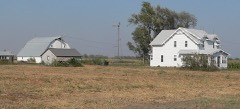 | Brenstrom Farmstead | building | 2011 | 11000104 |
 | C B & Q Holdrege Depot | building | 1997 | 97000131 |
| Farmers State Bank | building | 2013 | 13001022 | |
 | Kinner House | building | 2004 | 04000294 |
 | Phelps County Courthouse | building | 1990 | 89002242 |
Every wildfire the federal occurrence database records inside this county: 48 of them, burning about 443 acres. 1 started naturally and none was recorded as arson. Each settlement page carries the fires within five miles of it.
| Reported cause | Fires |
|---|---|
| Equipment and vehicle use | 14 |
| Debris and open burning | 14 |
| Smoking | 7 |
| Missing data/not specified/undetermined | 6 |
| Railroad operations and maintenance | 3 |
| Power generation/transmission/distribution | 2 |
| Natural | 1 |
| Recreation and ceremony | 1 |
The five largest, by the area the report gives. None of them was recorded as arson.
| Date | Cause | Size | Reported by | Name on the report |
|---|---|---|---|---|
| 18 February 2014 | Debris and open burning | 300 acres | Nebraska Forest Service | not named |
| 29 March 2016 | Natural | 20 acres | Nebraska Forest Service | not named |
| 30 September 2020 | Equipment and vehicle use | 20 acres | Nebraska Forest Service | not named |
| 12 October 2020 | Equipment and vehicle use | 20 acres | Nebraska Forest Service | not named |
| 11 April 2017 | Debris and open burning | 20 acres | Nebraska Forest Service | not named |
| 13 April 2006 | Equipment and vehicle use | 19 acres | Nebraska Forest Service | not named |
| 14 January 2014 | Equipment and vehicle use | 12 acres | Nebraska Forest Service | not named |
| 13 September 2000 | Missing data/not specified/undetermined | 3.0 acres | Nebraska Forest Service | not named |
Every settlement page carries the fires within five miles of it - see the settlement index below.
The NOAA Storm Events Database holds 470 reports for this county, causing 1 death, 5 injuries and about $20,239,000 in recorded property damage. Each settlement page carries the reports that name it.
| Kind of event | Reports |
|---|---|
| Hail | 225 |
| Thunderstorm Wind | 181 |
| Tornado | 36 |
| Heavy Rain | 13 |
| Flash Flood | 9 |
| Flood | 4 |
| Funnel Cloud | 2 |
The most serious of them, by death, then injury, then recorded damage. The accounts are quoted exactly as the forecast office filed them.
| When | Event | Place named | Harm | What the report says |
|---|---|---|---|---|
| June 1960 | Tornado (F1) | not stated | 1 killed, 3 hurt, $2,500 | no account filed |
| July 1958 | Tornado (F2) | not stated | 2 hurt, $250,000 | no account filed |
| May 2024 | Hail | Holdrege | $3,000,000 | Hail ranging in size from quarters to two inches in diameter was reported across Holdrege. |
| June 1988 | Tornado (F1) | not stated | $2,500,000 | no account filed |
| June 2024 | Thunderstorm Wind | Funk | $1,000,000 | Wind gusts estimated to be near 85 MPH resulted in a swath of damage running from approximately 5-6 miles north of Funk to approximately 3-4 miles south-southeast of Funk. Emergency management reported numerous flipped irrigation pivots and several damaged or snapped power poles along this path. The only building damaged noted was an old barn which was destroyed north of Funk. |
| July 2024 | Thunderstorm Wind | Holdrege | $1,000,000 | Peak wind gusts were estimated to be around 70 MPH, with measured gusts of 66 MPH from a mesonet station located three miles south-southwest of Holdrege and 60 MPH from the Holdrege Airport AWOS. The strongest winds were south-southwest of Holdrege, where a number of irrigation pivots were flipped, a flag pole was bent at a home, and minor tree damage was noted. |
| June 2018 | Hail | Loomis | $1,000,000 | Satellite imagery reveals a swath of golf ball size to isolated baseball size hail that stretched from extreme southeastern Gosper County to central Phelps County on the afternoon of June 30th. The path was about 2 to 3 miles wide. Within this swath, law enforcement reported baseball size hail 3 miles southeast of Loomis at 3:12 p.m. CST. |
| May 2005 | Flash Flood | Countywide | $1,000,000 | no account filed |
| May 1998 | Hail | Holdrege | $1,000,000 | no account filed |
| May 2024 | Tornado (EF1) | Holdrege | $500,000 | This tornado developed very close to, or over, the fairgrounds area, then moved north. The most concentrated area of damage occurred between 4th Street and 6th Avenue, between Sherman Street and Lincoln Street, which included snapped wooden poles, an overturned pivot, and varying degrees of damage to manufactured homes. It appears the tornado briefly lifted as it moved north of 6th Avenue, sparing neighborhoods in northeast Holdrege more significant damage, before touching back down in a field just northwest of the intersection of 18th Avenue and Lincoln Street. The tornado reached peak intensity and width near Lincoln Street and 25th Avenue just northeast of Holdrege where significant damage to outbuildings, some newer and well-built, was noted. Damage also occurred to roofs of a few homes. The tornado would go on to overturn numerous pivots and snap a few more power poles as it curved northeast. Damage ceased near the intersection of Q Road and 736 Road, which coincides with substantial weakening of the circulation on radar. The estimated peak wind was 110 MPH. |
| August 2023 | Thunderstorm Wind | Atlanta | $500,000 | Emergency management reported a few overturned pivots, tree damage and grain bin damage in the area, including one grain bin that was blown across the road from a farmstead. A wind gust of 78 MPH was measured by a mesonet station located three miles south-southwest of Holdrege and a wind gust of 60 MPH was measured by a mesonet station located three miles south of Holdrege. |
| June 2011 | Tornado (EF0) | Westmark | $500,000 | This tornado touched down in northern Phelps County, approximately 6 miles south-southwest of Elm Creek, and moved north into southern Buffalo County, dissipating just south of Elm Creek. This tornado lifted and touched back down several times along its path, with the main damage coming from overturned irrigation pivots. The maximum wind speed of this tornado was estimated to be 80 MPH. |
| July 2000 | Hail | Holdrege | $400,000 | no account filed |
| October 1998 | Tornado (F2) | Loomis | $400,000 | no account filed |
| December 2016 | Tornado (EF1) | Sacramento | $375,000 | This tornado touched down just south of the town of Funk. Along its short path, at least 6 power poles and 4 irrigation pivots were damaged. The maximum wind speed was estimated to be 100 MPH. |
| June 2019 | Thunderstorm Wind | Holdrege | $250,000 | Power was out in part of the community of Holdrege. Sparks were reported at a substation. Four power poles were damaged near 18th Avenue and Lincoln Street. A large tree was downed at the cemetery, and blocked part of 18th Avenue. Irrigation pipe was moved onto the road approximately a half mile south of town. Part of an irrigation pivot was blown onto J Road between 732 and 733 Road. |
| May 2005 | Tornado (F0) | Holdrege | $250,000 | A tornado hit two farmsteads and the airport near Holdrege causing minor damage along its path. |
| October 1994 | Tornado (F2) | Holdrege to | $250,000 | A tornado moved across the western and northern parts of Holdrege. The roof of one business was removed. One residence was destroyed and three others were damaged. At the golf course, the clubhouse roof was damaged while the maintenance building and two golf cart sheds were destroyed. Sixty golf carts were damaged. Other brief tornado touchdowns were reported in Phelps County. |
| May 2003 | Hail | Holdrege | $250,000 | no account filed |
| May 2024 | Tornado (EF1) | Holdrege | $200,000 | An EF1 tornado tracked catty-corner from southwest to northeast across Holdrege. Much of the damage was noted in trees throughout town. Some large trees were uprooted or snapped. A handful of garages sustained damage. The tornado winds initially damaged the garage door, after which some structural wall damage occurred. The peak wind speed was estimated to be 95 MPH, based on the damage to both trees and structures along its nearly two mile path. |
| July 2023 | Hail | Funk | $200,000 | no account filed |
| May 2016 | Thunderstorm Wind | Bertrand | $175,000 | Wind gusts estimated to be as high as 70 MPH resulted in blowing dust and visibility dropping to near zero. A few large tree branches were downed in town, while just outside of town, a few irrigation pivots suffered damage. |
| May 2024 | Tornado (EF0) | Sacramento | $150,000 | This weak and somewhat intermittent tornado touched down near the intersection of Highway 183 and Highway 4, then moved northeast. Damage was limited to trees, pivots, and a a few power poles along its roughly seven mile track. The estimated peak wind was 85 MPH. The tornado lifted just north of the Harlan and Phelps County line between T Road and U Road. |
| May 2024 | Tornado (EF1) | Holdrege | $150,000 | A ground survey of the damage, in conjunction with radar and Sentinel satellite imagery, indicate a tornado touched down just north of the golf course on the north side of Holdrege, then moved east and northeast. The majority of the damage occurred shortly after the tornado touched down and included tree damage, overturned pivots, and, most notably, several snapped power poles along Highway 183. This tornado was short lived and appeared to lift just northeast of the intersection of O Road and 734 Road. The estimated peak wind was 110 MPH. |
| June 2016 | Thunderstorm Wind | Loomis | $150,000 | Six power poles and several trees were reported down, along with irrigation pivots, in an area north of Loomis near the intersection of G and 739 Roads. |
| June 2016 | Thunderstorm Wind | Loomis | $150,000 | This wind gust was measured 5 miles north of Loomis. |
| June 2014 | Hail | Funk | $150,000 | no account filed |
| July 2000 | Hail | Loomis | $150,000 | no account filed |
| July 2000 | Flash Flood | Countywide | $150,000 | no account filed |
| July 2024 | Hail | Holdrege | $125,000 | Quarter to golf ball size hail was reported. |
| July 2024 | Hail | Funk | $125,000 | no account filed |
| July 2024 | Hail | Loomis | $125,000 | no account filed |
| July 2024 | Hail | Funk | $125,000 | no account filed |
| July 2024 | Hail | Bertrand | $125,000 | no account filed |
| May 2022 | Thunderstorm Wind | Bertrand | $100,000 | A wind gust of 64 MPH was measured by a mesonet station located in Bertrand. There was an irrigation pivot tipped over near the county line west of town. |
| July 2021 | Thunderstorm Wind | Holdrege | $100,000 | Wind gusts estimated to be near 65 MPH resulted in tree damage and power outages in Holdrege. The outages were reported by emergency management to be due to damaged power poles and lines. Other area measured wind gusts included 59 MPH, recorded by a mesonet station located four miles north-northeast of Holdrege, and 58 MPH, recorded by a mesonet station 2 miles north of Atlanta. |
| September 2005 | Hail | Bertrand | $100,000 | 70 mph winds were also reported by local law enforcement in this area. |
| May 2024 | Hail | Bertrand | $100,000 | no account filed |
| July 2019 | Flash Flood | Atlanta | $100,000 | no account filed |
| June 2000 | Thunderstorm Wind | Atlanta | $100,000 | no account filed |
| May 1999 | Tornado (F1) | Holdrege | $100,000 | no account filed |
| October 2023 | Tornado (EF0) | Bertrand | $90,000 | A brief tornado occurred in northwest Phelps County and was on the ground just shy of two miles. The tornado upset the end of one center irrigation pivot before rolling across |a cattle feed lot. At the feed lot, the tornado damaged some trees, caused minor roof damage, blew out vehicle winds and lifted the cover from a small generator shed. The tornado likely lifted northeast of the feed lot. The estimated maximum wind speed of 80 MPH was based upon the tree damage and pivot damage. |
| July 2019 | Thunderstorm Wind | Holdrege | $75,000 | Emergency management reported that 36 power poles were damaged or destroyed over a 2 mile stretch of Road 729 between Road O and Road Q. |
| May 2008 | Tornado (EF2) | Funk | $75,000 | This tornado started in northeast Phelps County and crossed into Buffalo County. The tornado did damage a couple of outbuildings and grain silos near the start of the damage path. |
| June 2014 | Hail | Atlanta | $75,000 | no account filed |
| June 2014 | Hail | Holdrege | $75,000 | no account filed |
| April 2007 | Flash Flood | Holdrege | $75,000 | no account filed |
| July 2004 | Thunderstorm Wind | Holdrege | $75,000 | no account filed |
| June 1999 | Thunderstorm Wind | Atlanta | $75,000 | no account filed |
| May 1999 | Hail | Holdrege | $75,000 | no account filed |
| June 2002 | Thunderstorm Wind | Holdrege | $60,000 | no account filed |
| July 2024 | Hail | Holdrege | $50,000 | Wind gusts were estimated to be near 75 MPH, and was accompanied by hail as large as half dollars. At least one irrigation pivot was flipped, and severe crop damage was reported. |
| July 2024 | Thunderstorm Wind | Holdrege | $50,000 | Wind gusts were estimated to be near 75 MPH, and was accompanied by hail as large as half dollars. At least one irrigation pivot was flipped, and severe crop damage was reported. |
| April 2013 | Thunderstorm Wind | Holdrege | $50,000 | A semi tractor trailer was blown over by a severe wind gust. |
| December 2011 | Thunderstorm Wind | Loomis | $50,000 | A 60 foot tall empty grain bin, which was not well secured to the ground, was destroyed by wind gusts estimated at 55 mph. |
| May 2011 | Flood | Atlanta | $50,000 | Storm total rainfall totals reaching as high as 3 to 6 inches resulted in flooding across portions of the county. Street flooding was reported in Holdrege, and a number of county roads in central and northern portions of the county were covered with water. Some road closures lasted well into the day on May 25th. |
| July 2011 | Hail | Bertrand | $50,000 | Hail up to the size of ping pong balls was covering Highway 23 between Bertrand and Loomis. |
| July 2004 | Thunderstorm Wind | Loomis | $50,000 | Penny size hail was also reported with the strong winds. |
| March 1993 | Thunderstorm Wind | Holdrege | $50,000 | Dime-size hail fell in Holdrege. Thunderstorm winds blew the roof off a house and damaged some vehicles. |
| May 2013 | Hail | Funk | $50,000 | no account filed |
The Survey's mineral resources record lists 1 working inside this county. It still produces. Each settlement page carries the workings within five miles of it.
| Commodity | Workings |
|---|---|
| Sand and Gravel, Construction | 1 |
The least common of them first, because a county's hundredth gravel pit says nothing its first ten did not.
| Where | Site | Commodity | Status | Recorded |
|---|---|---|---|---|
| Elm Creek Pit | Sand and Gravel, Construction | Producer |
Named settlements recorded in the Geographic Names Information System, each with the topographic sheets covering it. Villages, hamlets and abandoned places alike. Each is shown with the nearest named watercourse or landform and the survey quadrangle it falls on.