 Block
From the record
17 National Register listings published here.
Sources: the National Register database, National Park Service
35 topographic sheets cover 11 settlements here, and 17 properties are on the National Register of Historic Places.
17 National Register listings published here.
Sources: the National Register database, National Park Service
Every property in this county listed on the National Register of Historic Places, with the year it was listed and the federal nomination document.
| Photograph | Property | Type | Listed | Reference |
|---|---|---|---|---|
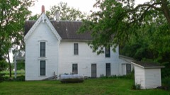 | Jesse C. Bickle House | building | 1977 | 77000838 |
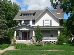 | College Hill Historic District | district | 1983 | 83001101 |
| Crete Downtown Historic District | district | 2016 | 16000482 | |
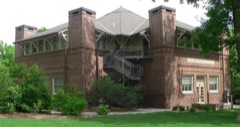 | Doane College Historic Buildings | building | 1977 | 77000836 |
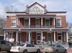 | Hotel Wilber | building | 1978 | 78001709 |
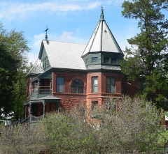 | Johnston-Muff House | building | 1977 | 77000837 |
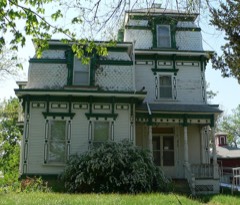 | Richard R. Kiddle House | building | 1985 | 85002143 |
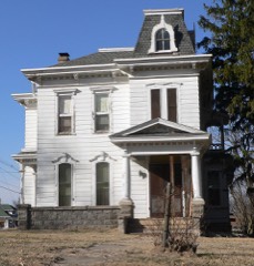 | Mann-Zwonecek House | building | 1978 | 78001710 |
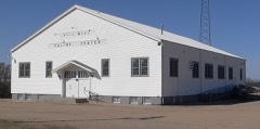 | Rad Saline Center cis. 389 Z. C. B. J. | building | 1996 | 95001483 |
 | Frank J. Rademacher House | building | 1980 | 80002460 |
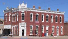 | Saline County Bank | building | 1990 | 90000568 |
 | Saline County Courthouse | district | 1990 | 90000967 |
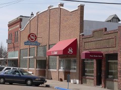 | Sokol Pavilion | building | 1998 | 98000892 |
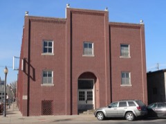 | Sokol, Telocvicna Jednota "T.J.", Hall | building | 2003 | 03001214 |
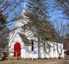 | Trinity Memorial Episcopal Church | building | 1979 | 79001453 |
| Warren's Opera House | building | 1988 | 88000945 | |
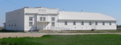 | Z.C.B.J. Rad Tabor No. 74 | building | 1985 | 85001798 |
Every wildfire the federal occurrence database records inside this county: 120 of them, burning about 752 acres. 1 started naturally and none was recorded as arson. Each settlement page carries the fires within five miles of it.
| Reported cause | Fires |
|---|---|
| Debris and open burning | 62 |
| Missing data/not specified/undetermined | 21 |
| Equipment and vehicle use | 14 |
| Power generation/transmission/distribution | 7 |
| Fireworks | 6 |
| Railroad operations and maintenance | 5 |
| Recreation and ceremony | 2 |
| Smoking | 2 |
| Natural | 1 |
The five largest, by the area the report gives. None of them was recorded as arson.
| Date | Cause | Size | Reported by | Name on the report |
|---|---|---|---|---|
| 11 April 2014 | Debris and open burning | 250 acres | Nebraska Forest Service | not named |
| 7 April 2020 | Missing data/not specified/undetermined | 60 acres | Nebraska Forest Service | not named |
| 29 February 2020 | Debris and open burning | 60 acres | Nebraska Forest Service | not named |
| 20 April 2018 | Debris and open burning | 60 acres | Nebraska Forest Service | not named |
| 1 January 2017 | Debris and open burning | 27 acres | Nebraska Forest Service | not named |
| 2 April 2019 | Debris and open burning | 20 acres | Nebraska Forest Service | not named |
| 17 October 2012 | Recreation and ceremony | 20 acres | Nebraska Forest Service | not named |
| 6 March 2017 | Debris and open burning | 20 acres | Nebraska Forest Service | not named |
Every settlement page carries the fires within five miles of it - see the settlement index below.
The NOAA Storm Events Database holds 536 reports for this county, causing no deaths, 8 injuries and about $154,649,000 in recorded property damage. Each settlement page carries the reports that name it.
| Kind of event | Reports |
|---|---|
| Hail | 284 |
| Thunderstorm Wind | 151 |
| Flood | 41 |
| Tornado | 25 |
| Flash Flood | 23 |
| Funnel Cloud | 5 |
| Heavy Rain | 4 |
| Lightning | 3 |
The most serious of them, by death, then injury, then recorded damage. The accounts are quoted exactly as the forecast office filed them.
| When | Event | Place named | Harm | What the report says |
|---|---|---|---|---|
| May 2004 | Tornado (F2) | Western | 8 hurt, $20,000,000 | See description below |
| May 2015 | Flood | Shestak | $100,000,000 | Extremely heavy rainfall of 5 to 10 inches fell along the Turkey Creek basin. This allowed for the creek to swell into moderate flood levels. Flooding along the Creek resulted in numerous rural road closures and significant low-land flooding. The combination of the Turkey Creek and Big Blue river led to nearly the entire town of De Witt to be flooded on the 7th of May resulting in a voluntary evacuation of the city. The creek at Wilber crested at 17.89 feet, or 5.39 feet above flood stage. |
| August 2025 | Thunderstorm Wind | Friend | $16,130,000 | A strong line of severe thunderstorms swept across Saline County, Nebraska, on the morning of August 9th, 2025, producing a swath of damaging straight-line winds, particularly impactful across the northern portion of the county. The damage swath extended from the area around Friend eastward toward Dorchester and then southeast to Crete.||The most intense winds were reported in Friend, where an emergency manager documented widespread damage including trees down, power outages, roof damage to businesses, and estimated winds gusting between 80 to 90 mph. A separate measured report from an emergency manager in Friend measured a wind gust of 84 mph. Further impressive damage was reported east of Friend, near Dorchester, where emergency management noted wooden power poles snapped for approximately 10 miles, with winds estimated at 90 mph in this area.||Moving southeast, the damaging winds continued to affect the Crete area, where a measured gust of 64 mph was recorded by a public weather station 6 miles south-southwest of Friend. Other public reports from Crete included a large tree down around the intersection of 8th or 9th Street and Grove Avenue, as well as large tree branches falling onto a house. Winds in the Crete area were estimated to be between 70 to 80 mph. A less damaging, measured gust of 58 mph was also reported south-southeast of Dorchester.||The collective property damage to public infrastructure from this damaging wind swath is estimated to be $16,129,296.00. This figure reflects only the costs associated with repairing public assets and does not account for the extensive damage sustained by private and commercial properties throughout Saline County. |
| July 1994 | Hail | Friend | $5,000,000 | Baseball-size hail was reported on the east side of Friend. The hail covered the ground and produced moderate damage to trees and vehicles. Crop damage in some fields was up to 70 percent. Power was out in Friend for several hours. Many homes received roof damage. Some windows were also broken. |
| May 2015 | Flood | Crete | $4,500,000 | Heavy rainfall of 3 to 7 inches across the Big Blue River basin led to minor flooding along the river near Crete. The flooding was even more significant to the south of the river gauge near DeWitt where the entire town was inundated with flooding leading to evacuations. The Big Blue River created near Crete at 24.21 feet, or 3.21 feet above flood stage during the afternoon of the 7th. |
| June 1992 | Tornado (F3) | not stated | $2,500,000 | no account filed |
| June 1989 | Tornado (F0) | not stated | $2,500,000 | no account filed |
| June 2015 | Flood | De Witt | $500,000 | This was the second significant flood of June along Turkey Creek, and the third of the year. The river crested over 4 feet above flood stage, and although briefly feel below flood stage on the 13th, additional heavy rain on the 14th allowed the creek to stay above flood stage until the 18th. Significant flooding of row crops in the flood plain was observed from Wilbur downstream to De Witt where some structures near town were again flooded. |
| April 2001 | Thunderstorm Wind | Friend | $500,000 | A line of fast moving thunderstorms bowed across southeast Nebraska and southwest Iowa this day bringing thunderstorm wind gusts of 60 to 80 mph. This was the first report of damage in the Omaha/Valley NWS coverage area with this line. As the storm went through Friend, more than 10 farmsteads sustained damage to outbuildings and equipment. At one farm a roof was blown off of a horse barn and machine shed, and a horse trailer was destroyed injuring 2 horses, also a fifth-wheel camper trailer was rolled. Irrigation pivots were also overturned, damaged and/or destroyed. |
| June 2001 | Thunderstorm Wind | Friend | $400,000 | A thunderstorm microburst with winds estimated at over 70 mph destroyed outbuildings and caused extensive tree and vehicle damage near Friend. |
| March 2019 | Flood | Crete | $325,000 | Flooding occurred countywide along creeks and rivers. Notably, for flooding along the Big Blue River, the river gage at Crete, operated by the USGS, peaked at 30.68 feet at 6 pm on March 15th. Major flood stage is 29 feet. Preliminarily this peak is the highest on record. One home was confirmed impacted by the flooding. Several homes in the 20th and Main Street area had water in basements due to storm drains backing up. Flooding reported on the north side of Crete with numerous roads closed due to flooding. Swan Creek was out of its banks and inundated numerous roads across southern Saline county. Property loss amounts are for the entire county. |
| June 1982 | Tornado (F2) | not stated | $250,000 | no account filed |
| June 1977 | Tornado (F1) | not stated | $250,000 | no account filed |
| April 1975 | Tornado (F1) | not stated | $250,000 | no account filed |
| July 1958 | Tornado | not stated | $250,000 | no account filed |
| March 2006 | Thunderstorm Wind | Wilber | $125,000 | Thunderstorm wind gusts were measured at 66 mph by emergency management in Wilber. The winds destroyed a machine shed northeast of Wilber and caused some equipment damage at the Wilber-Claytonia High School. |
| June 2015 | Flood | Crete | $100,000 | Several heavy rain events in early to mid June brought the the Big Blue River near Crete into flood. The combination of the repeated events allowed for each crest of the river to be a bit higher than the last, finally crested in moderate flood stage at 26.05 feet on June 12th. Besides significant agricultural flooding along both sides of the river, some areas on the east side of Crete near Tuxedo Park on the north side of Highway 33. |
| June 2015 | Flood | Shestak | $100,000 | Repeated heavy rainfall during the month of June brought Turkey Creek above flood stage with 3 main crests. This was the first, and most significant of the crests with the creek reaching 16.82 feet on the 5th of June, which is 4.52 feet above flood stage. Although the flooding near Wilbur was mainly confined to agricultural low-lands, more significant flooding was observed down stream near De Witt where there were road closures and some structural flooding. |
| May 2007 | Flood | Crete | $100,000 | Rainfall of 4 to 6 inches fell over much of the Big Blue River basin in Saline county from Friday May 4th through Sunday May 6th. Wilber reported 6.3 inches and Crete measured 5.9 inches for two of the heaviest. The heavy rain caused the Big Blue River to flood with the gage near Crete reaching a 21.3 foot crest around 3 pm on May 6th. Flood stage is 18 feet. The river near Crete was above flood stage from around 9 am on May 6th until 430 am on the 7th.|Due to flooding from the Big Blue River and Turkey Creek, 20 county roads were closed with 100 washouts reported. Agricultural bottomlands were also flooded. Besides washing out newly planted crops, some farm outbuildings and irrigation equipment were damaged by flood waters. Total damage from flooding from both the Big Blue River and Turkey Creek was estimated at $100,000. |
| May 2007 | Flood | Friend | $100,000 | Heavy rain over 3 days caused Turkey Creek to flood across much of Saline county. The creek at Wilber crested at 16.44 feet during the morning hours of May 7th, flood stage is 11 feet. The creek at Wilber first crossed flood stage around 745 pm CDT on the 5th and didn't drop below flood stage until a little after noon on the 8th.| |The Creek flooded across Highway 103 causing its closure near Wilber. Flooding from Turkey Creek and the Big Blue River also caused 100 county road washouts and closed 20 county roads. Flooding of agricultural lowlands also occurred. Flood damage from both Turkey Creek and the Big Blue River was estimated at $100,000. |
| June 2000 | Flash Flood | Crete | $100,000 | Heavy rain producing thunderstorms dropped 3 inches of rain on Crete in less than 1 hour with 3.75 inches falling in 3 hours. This caused flash flooding in the downtown Crete area with numerous businesses basements flooded. The flooding was in part due to a new storm drainage system that was not operating correctly according to newspaper reports. |
| July 1997 | Lightning | Crete | $70,000 | Lightning struck a police communications antenna causing significant damage to police radio equipment. |
| March 2010 | Flood | Crete | $60,000 | Melting snow combined with several periods of rain caused minor lowland flooding along the Big Blue River near Crete. The river at Crete remained above its 18 foot flood stage for about 5 days reaching a crest near 20.5 feet during the morning of March 12th. The flooding mainly affected agricultural lowlands but did encroach a few county roads. Over $60,000 worth of gravel was washed from county roads. |
| June 1998 | Thunderstorm Wind | Western | $60,000 | Strong winds downed trees. One trees feel onto a pickup truck causing significant damage. A center pivot irrigation system was damaged two miles south of Western. |
| June 2015 | Flash Flood | Crete | $50,000 | Spotters reported water multiple roads near the town of Crete. |
| May 2007 | Flash Flood | Dorchester | $50,000 | Rainfall of 2 to 4 inches in a several hour period produced flash flooding in the streets of Dorchester and Crete. In the Crete area several cars were flooded up door level and some roads were damaged by flood waters. Several basements were also flooded. |
| July 1998 | Flash Flood | Countywide | $50,000 | Thunderstorm produced 5 to 7 inches of rain along the Turkey Creek just west of Wilber resulting in extensive agricultural damage and a number of secondary road closures. Some roads, bridges, and culverts were damaged. |
| July 2008 | Flood | Crete | $25,000 | Rainfall of 2 to 4 inches fell across sections of the Blue River basin on July 15-16. This caused the Blue River to flood from near Crete to the confluence with Turkey Creek, which was also in flood. The stage of the Big Blue at Crete reached around 23 feet at 2am CDT on July 17, flood stage is 18 feet. Although the river dropped to around flood stage during the morning hours of July 18th, additional heavy rain that fell over part of the basin on the 17th brought a second crest to the river of around 22 feet during the afternoon of July 19th. The flooding affected mainly agricultural lowlands but also flooded a few county roads. |
| July 2008 | Flood | Wilber Muni Arpt | $25,000 | Rainfall of 2 to 4 inches fell across much of the Turkey Creek basin on July 15-16. This caused Turkey Creek to flood from near Wilber toward its confluence with the Blue River. The stage at Wilber reached a little over 14 feet around 5pm CDT on July 16, flood stage is 11 feet. The creek briefly dropped below flood stage during the evening of July 17th, but additional heavy rain producing thunderstorms caused a second crest of around 12.5 feet during the afternoon of July 18th before the creek fell below flood stage early on the 19th. The flooding affected mainly agricultural lowlands but also flooded a few county roads. |
| June 1987 | Tornado (F1) | not stated | $25,000 | no account filed |
| May 1978 | Tornado | not stated | $25,000 | no account filed |
| June 1975 | Tornado (F1) | not stated | $25,000 | no account filed |
| June 1964 | Tornado (F2) | not stated | $25,000 | no account filed |
| May 1957 | Tornado (F2) | not stated | $25,000 | no account filed |
| May 2015 | Flash Flood | Shestak | $20,000 | Rainfall of 6 to 10 inches across the county lead to significant flash flooding. In addition to street flooding in the communities of Wilber, De Witt, and Western, State highways 103 and 41 were also closed due to water over the road. At least one water rescue was performed due to the flooding. |
| June 2010 | Flood | Crete | $15,000 | Rainfall of 3 to 5 inches on 6/20 and 6/21 and additional rain the next few days caused the Blue River to flood in Saline County. The river at Crete crested at a little over 22.5 feet around noon CDT on the 26th, flood stage is 18 feet. The river at Crete was above flood stage from around midnight on the 22nd until the early morning of 6/29. Farmland and county roads near the river flooded. |
| July 2000 | Thunderstorm Wind | Friend | $15,000 | Thunderstorm wind gusts over 60 mph blew over several telephone poles 3 miles east of Friend. Large tree branches were also downed. |
| October 2008 | Flood | De Witt | $10,000 | Rainfall of 2 to 3 inches fell over much of the Turkey Creek basin on October 21 and October 22. The rain caused Turkey Creek to flood from near DeWitt to near and upstream of Wilber. Turkey Creek near Wilber reached its first crest of around 12.7 feet during the late morning hours of October 23. Due to heavy rains that fell on the 21st and 22nd across the upper reaches of the basin, the creek remained near that elevated level through mid afternoon on the 26th. Flood stage is 11 feet. Although a few county roads were flooded, the flooding mainly affected agricultural farmland. |
| October 2008 | Flood | Crete | $10,000 | Rainfall of 2 to 3 inches fell over much of the middle and upper sections of the Big Blue River basin on October 21 and October 22. The rain caused the Big Blue River to flood for a prolonged period from Crete downstream to near DeWitt. The river near Crete crested at 21.7 feet around 915pm CDT on 10/24, flood stage is 18 feet. The flooding affected agricultural farmland and also closed a few county roads in the area. |
| August 2006 | Flash Flood | Wilber | $10,000 | Heavy rains produced flash flooding and washouts across several county roads southwest of Wilber. |
| September 2014 | Flash Flood | Dorchester | $5,000 | Emergency management and spotters reported flash flooding across Saline County. The area received between 4 to 7 inches of rainfall and this led to the flash flooding. The flooding caused several streets and highways to be closed, including Nebraska Highway 15 near the Dorchester. |
| August 2014 | Flood | Dorchester | $5,000 | Repeated thunderstorms on the 27th and 28th of August caused heavy rainfall and the West Fork of the Big Blue river to go into flood. The river rose above flood stage on the morning of the 29th, the river created and fell below flood stage in early early September. The flooding was generally minor and confined to low-lying areas along the river. |
| August 2014 | Flood | Crete | $5,000 | Repeated thunderstorms on the 27th and 28th of August caused heavy rainfall and the Big Blue River to go into flood. The river rose above flood stage on the afternoon of the 28th, the river created on the 31st, and fell below flood stage in early early September. The flooding was generally minor and confined to low-lying areas along the river. |
| October 2014 | Flood | Shestak | $5,000 | Heavy rainfall at the end of September caused the Turkey Creek to go into flood. The river rose above flood stage in the early morning on the 1st, crested in the early afternoon on the 1st, and fell below flood stage in the morning of the 2nd. The river flooding was minor and mainly confined to low-lying areas along the river. |
| October 2014 | Flood | Crete | $5,000 | Heavy rainfall at the end of September caused the Big Blue River to go into flood. The river rose above flood stage in the early morning on the 1st, crested that morning, and fell below flood stage in the afternoon. The river flooding was minor and mainly confined to low-lying areas along the river. |
| September 2014 | Flood | Crete | $5,000 | Flooding from late August continued into early September along the Big Blue River. The river crested in late August, but continued in minor flooding until the early morning on the 4th. The flooding was confined to low-lying areas along the river. |
| September 2014 | Flood | Dorchester | $5,000 | The West Folk of the Big Blue began to flood in late August and continued above flood stage into early September. The river crested in late August and fell below flood stage early on the morning on the 3rd. The flooding was minor and mainly confined to low-lying areas along the river. |
| May 2014 | Flood | Shestak | $5,000 | Heavy rain caused flooding along the Big Blue River near Crete and most likely upstream through it's confluence with the West Fork of the Big Blue. The river level near Crete reached a little over 23 feet during this time, flood stage is 18 feet. The flooding impacted county roads and farmland near the river. |
| May 2011 | Flood | Wilber | $5,000 | Rainfall of 3 to 4 inches during the evening and overnight hours of 5/19 and 5/20 over Saline county and upstream. This caused the Big Blue River to flood farmland and county roads around the Crete area. The river at Crete crested just under 20.5 feet in the morning of 5/22, flood stage is 18 feet. |
| May 2007 | Flash Flood | Wilber | $5,000 | Rainfall of another inch or two produced flash flooding of streets in the Wilber area. The rainfall was on top of the 2 to 4 inches which fell the previous day. |
| March 2006 | Thunderstorm Wind | Wilber | $5,000 | Thunderstorm winds blew a machine shed over near Wilber. |
| April 2006 | Lightning | Wilber | $5,000 | Lightning struck a tree next to a home west of Wilber. The tree went through a living room window and split a couch in half. |
| July 2024 | Thunderstorm Wind | Crete | $3,000 | Law enforcement reported a power line down and a large tree that had fallen across a road. |
| June 2014 | Flood | Crete | $2,000 | A few days of heavy rain caused the Big Blue River near Crete to flood for a little over 24 hours. The river near Crete crested at 20.8 feet late in the evening of June 5th, flood stage is 18 feet. The flooding impacted mainly farmland along the river. |
| June 2011 | Flood | Crete | $2,000 | Rainfall of up to 4 inches fell in less than 12 hours across parts of the Big Blue River basin near Crete. The heavy rain caused the Big Blue River near Crete to flood on June 27th. The river at Crete crested a little under 19 feet during the afternoon of June 27th, flood stage is 18 feet. The flooding mainly affected farmland adjacent to the river along with a few county roads briefly affected as well. |
| June 2010 | Flood | Wilber Muni Arpt | $2,000 | Heavy rain prior to June 23rd caused Turkey Creek to flood lowlands and a few roads near Wilber. A base camp of a film production crew was wiped out either by Turkey Creek or one of its tributaries. The creek at Wilber was near or a little above its 11 foot flood stage for almost 2 days. |
| June 2010 | Flood | Dorchester | $2,000 | Rainfall of 3 to 5 inches on 6/20 and 6/21 and additional rain the next few days eventually caused the West Fork of the Blue River to flood in Saline County. The river near Dorchester crested at a little over 16.5 feet during the evening of 6/26, flood stage is 15 feet. Farmland and county roads near the river flooded. |
| July 1997 | Lightning | Friend | $2,000 | Lightning struck a building and knocked out some bricks. |
| May 2011 | Flood | De Witt | $1,000 | Rainfall of around 2 to 3 inches fell across a large part of the Turkey Creek basin in the evening and overnight hours of 5/19 and 5/20. This water eventually caused Turkey Creek to flood in the Wilber area. The creek crested a little over 12 feet in the morning of 5/21, flood stage near Wilber is 11 feet. The flooding affected mainly agricultural lowlands along the river but a few county roads were also flooded. |
| August 2025 | Thunderstorm Wind | Dorchester | - | Delayed report from emergency management of roof damage to several structures in Dorchester, NE. Time estimated from radar. Wind speeds were estimated at 80 mph. |
Named settlements recorded in the Geographic Names Information System, each with the topographic sheets covering it. Villages, hamlets and abandoned places alike. Each is shown with the nearest named watercourse or landform and the survey quadrangle it falls on.
Pleasant Hill precinct · 68343 · On Spring Creek · Pleasant Hill quadrangle
14 sheets, 1935 to 1985