 Block
From the record
19 National Register listings published here, 1 of them a National Historic Landmark.
Sources: the National Register database, National Park Service
51 topographic sheets cover 35 settlements here, and 19 properties are on the National Register of Historic Places.
19 National Register listings published here, 1 of them a National Historic Landmark.
Sources: the National Register database, National Park Service
Every property in this county listed on the National Register of Historic Places, with the year it was listed and the federal nomination document.
| Photograph | Property | Type | Listed | Reference |
|---|---|---|---|---|
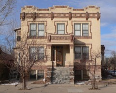 | Fontenelle Apartment House | building | 1998 | 98000891 |
 | Gering Courier Building | building | 2004 | 04000799 |
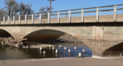 | Henry State Aid Bridges | structure | 1992 | 92000732 |
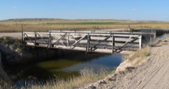 | Interstate Canal Bridge | structure | 1992 | 92000731 |
| Knorr-Holden Continuous Corn Plot | site | 1992 | 92000703 | |
 | Lincoln Hotel | building | 1998 | 98000187 |
 | Marquis Opera House | building | 1985 | 85003103 |
 | Midwest Theater | building | 1997 | 97000728 |
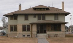 | M. B. Quivey House | building | 1983 | 83001105 |
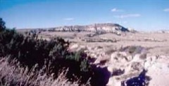 | Robidoux Pass | site | 1966 | 66000450 |
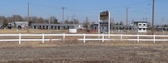 | Saddle Club | building | 2007 | 07001324 |
 | Sandford Hall | building | 1997 | 97000771 |
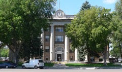 | Scotts Bluff County Courthouse | building | 1990 | 89002230 |
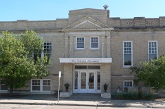 | Scottsbluff Carnegie Library | building | 1981 | 81000373 |
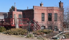 | Severin Sorensen House | building | 1983 | 83001106 |
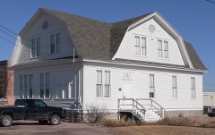 | Tri-State Land Company Headquarters Building | building | 1997 | 96001615 |
 | US Post Office-Scottsbluff | building | 1989 | 89001462 |
 | Western Public Service Building | building | 2004 | 04000798 |
Every wildfire the federal occurrence database records inside this county: 713 of them, burning about 26,463 acres. 35 started naturally and 27 were recorded as arson. Each settlement page carries the fires within five miles of it.
| Reported cause | Fires |
|---|---|
| Debris and open burning | 395 |
| Missing data/not specified/undetermined | 104 |
| Equipment and vehicle use | 50 |
| Fireworks | 50 |
| Natural | 35 |
| Arson/incendiarism | 27 |
| Smoking | 17 |
| Power generation/transmission/distribution | 13 |
| Recreation and ceremony | 9 |
| Railroad operations and maintenance | 8 |
| Misuse of fire by a minor | 5 |
The five largest, by the area the report gives. None of them was recorded as arson.
| Date | Cause | Size | Reported by | Name on the report |
|---|---|---|---|---|
| 23 July 2000 | Natural | 16,000 acres | Crescent Lake National Wildlife Refuge | SNAKE CRK |
| 9 September 1998 | Natural | 2,200 acres | North Platte National Wildlife Refuge | MURPHY |
| 23 July 2000 | Natural | 1,000 acres | Nebraska Forest Service | not named |
| 18 December 2012 | Missing data/not specified/undetermined | 640 acres | Nebraska Forest Service | not named |
| 25 July 2003 | Natural | 400 acres | Nebraska Forest Service | not named |
| 2 July 2004 | Natural | 300 acres | Nebraska Forest Service | not named |
| 22 March 2020 | Debris and open burning | 300 acres | Nebraska Forest Service | not named |
| 11 July 2008 | Fireworks | 288 acres | Scotts Bluff National Monument | OTD |
Every settlement page carries the fires within five miles of it - see the settlement index below.
The NOAA Storm Events Database holds 864 reports for this county, causing 2 deaths, 79 injuries and about $122,963,840 in recorded property damage. Each settlement page carries the reports that name it.
| Kind of event | Reports |
|---|---|
| Hail | 510 |
| Thunderstorm Wind | 235 |
| Tornado | 68 |
| Flash Flood | 34 |
| Heavy Rain | 9 |
| Funnel Cloud | 5 |
| Flood | 2 |
| Winter Weather | 1 |
The most serious of them, by death, then injury, then recorded damage. The accounts are quoted exactly as the forecast office filed them.
| When | Event | Place named | Harm | What the report says |
|---|---|---|---|---|
| June 1955 | Tornado (F4) | not stated | 2 killed, 29 hurt, $250,000 | no account filed |
| June 1999 | Hail | Scottsbluff | 25 hurt, $55,000,000 | no account filed |
| July 2001 | Hail | Scottsbluff | 12 hurt, $50,000,000 | Large hail fell over parts of Scottsbluff, NE, damaging many cars and buildings as well as causing some minor injuries from broken glass. |
| May 1951 | Tornado (F2) | not stated | 7 hurt | no account filed |
| June 2020 | Thunderstorm Wind | Mitchell | 2 hurt | Reports of tin being blown off a shed and rolling across US 26 striking two motorcyclists. Highway was shutdown and 2 injuries were reported. |
| August 1987 | Thunderstorm Wind | not stated | 2 hurt | no account filed |
| May 2022 | Thunderstorm Wind | Lake Minatare | 1 hurt | Male teenager at Lake Minatare was hit in the chest with a falling tree branch. Victim was reported to be in the hospital in good condition. Actual wind speed is unknown. |
| June 1994 | Tornado (F0) | not stated | 1 hurt | A tornado briefly touched down in the Minatare vicinity. Hail battered a boy who was caught outdoors and damaged over 4,400 acres of crops in the area. |
| June 2023 | Hail | Scottsbluff | $6,000,000 | Wind-driven baseball sized hail was reported in the city of Scottsbluff. Numerous reports of damaged vehicles. |
| June 2024 | Thunderstorm Wind | Mitchell | $4,000,000 | Numerous reports of wind gusts between 90 and 100 MPH near the town of Mitchell causing significant damage with downed trees, powerlines, and overturned center pivots. |
| June 1991 | Tornado (F3) | not stated | $2,500,000 | no account filed |
| May 1985 | Tornado (F3) | not stated | $2,500,000 | no account filed |
| June 2023 | Hail | Scottsbluff | $500,000 | Baseball sized hail was reported in the city Scottsbluff. Solar panel array just north of the city was destroyed. |
| June 1997 | Flash Flood | Countywide | $500,000 | Widespread flash flooding then flooding with crop, road and bridge damage. All county roads were closed from 1900 MST 6/2/97 until 0500 MST 6/3/97. Minor to heavy silt damage was recorded on 40% of county roads. |
| June 1977 | Tornado (F2) | not stated | $250,000 | no account filed |
| August 1996 | Hail | Scottsbluff | $200,000 | no account filed |
| June 2023 | Tornado (EF2) | Gering | $135,000 | A tornado tracked approximately 1 to 3 miles ENE of Gering, causing significant damage to a structure with debris scattered up to 1/2 mile to the west, including hazardous material. Vehicles on the property were thrown 50 feet. A small wooden trailer was thrown 1/4 mile away. Additionally, irrigation pivots were rolled numerous times and power lines were broken along Highway 26. Damage was consistent with an EF-2 tornado. Confirmed by official NWS Storm Survey. |
| May 2003 | Tornado (F1) | Mc Grew | $100,000 | Tornado moved north downing power lines and damaging or destroying numerous outbuildings. |
| April 2001 | Hail | Gering | $75,000 | no account filed |
| June 2009 | Flash Flood | Scottsbluff | $50,000 | Heavy rainfall washed out some county roads around Scottsbluuf as well as flooded some buildings at the campus of Western Nebraska Community College. |
| July 2008 | Thunderstorm Wind | Scottsbluff | $50,000 | Wind gusts from 64 to 79 mph recorded at the airport and near Scottsbluff, Nebraska. Winds blew down some power poles and trees, and caused some roof damage to a few outbuildings. |
| June 2006 | Flash Flood | Lyman | $50,000 | Very heavy rain fell over western Scotts Bluff county with rainfall amounts from 2 to 4 inches common...as high as 4.6 inches measured 6 miles south of Lyman, Neb. The rain producedsome flooding on the Stegall highway as well as washed out some county roads. |
| May 2003 | Tornado (F0) | Minatare | $50,000 | Nearly stationary tornado reported along Stonegate Road. Cow shed destroyed. |
| July 2001 | Hail | Minatare | $50,000 | 1 to 2 inch diameter hail reported. |
| June 2001 | Hail | Scottsbluff | $50,000 | no account filed |
| June 1999 | Hail | Mitchell | $50,000 | no account filed |
| April 2001 | Hail | Scottsbluff | $40,000 | 2 inch hail reported on the east side of Scottsbluff, NE. |
| June 2001 | Hail | Scottsbluff | $40,000 | no account filed |
| May 2000 | Hail | Scottsbluff | $40,000 | no account filed |
| June 2025 | Thunderstorm Wind | Scottsbluff | $35,000 | There were at least 10 large trees blown over at the Scottsbluff Country Club. Several homes had broken windows due to wind driven hail. |
| July 2008 | Flash Flood | Scottsbluff | $30,000 | Heavy rains caused some flooding of basements in about 9 homes, as well as washed out a few county roads. |
| June 1999 | Hail | Mc Grew | $30,000 | no account filed |
| September 2008 | Thunderstorm Wind | Scottsbluff | $25,000 | Numerous reports of winds estimated 60 to 80 mph with a gust of 81 mph recorded at the Scotts Bluff regional airport. |
| June 1999 | Hail | Melbeta | $25,000 | no account filed |
| June 1980 | Tornado (F1) | not stated | $25,000 | no account filed |
| July 1971 | Tornado (F0) | not stated | $25,000 | no account filed |
| May 1962 | Tornado (F1) | not stated | $25,000 | no account filed |
| May 1957 | Tornado (F2) | not stated | $25,000 | no account filed |
| June 2009 | Hail | Stegall | $20,000 | Hail from 1 to 2 inches in diameter with some windshields broken. |
| June 1999 | Tornado (F1) | Mc Grew | $20,000 | Tornado blew a roof off a house in Mc Grew, NE |
| April 2001 | Hail | Scottsbluff | $20,000 | no account filed |
| May 2000 | Hail | Mitchell | $20,000 | no account filed |
| August 1996 | Hail | Gering | $20,000 | no account filed |
| May 2000 | Hail | Morrill | $15,000 | no account filed |
| May 1998 | Tornado (F2) | Morrill | $15,000 | no account filed |
| June 2010 | Hail | Mitchell | $12,000 | Various hail size fell for 30 minutes causing broken windows and holes in roof. |
| June 2010 | Hail | Mitchell | $10,000 | Considerable damage to siding on west side. Several windows broken. Larges hail fell first followed by long duration of small hail. |
| July 1998 | Thunderstorm Wind | Scottsbluff | $10,000 | Trees were blown down by thunderstorm winds along county roads 10 miles northeast of Scottsbluff. |
| August 1996 | Hail | Scottsbluff | $10,000 | no account filed |
| June 2010 | Thunderstorm Wind | Melbeta | $9,000 | Sheet metal blown around, roof damage, and downed trees. |
| June 2010 | Hail | Mitchell | $5,000 | Lost beet and corn crops. Possible roof damage. Estimated time of report. |
| June 2003 | Hail | Mitchell | $5,000 | no account filed |
| December 1997 | Winter Weather | Countywide | $5,000 | no account filed |
| May 1998 | Tornado (F1) | Mitchell | $4,000 | A brief tornado touched down just to the north of Mitchell and uprooted several trees near the golf course. |
| August 1996 | Thunderstorm Wind | Minatare | $4,000 | no account filed |
| May 2010 | Thunderstorm Wind | Minatare | $3,600 | At 1120MST a power pole was reported down along Highway 26. |
| June 2010 | Hail | Mitchell | $3,000 | House siding damaged. |
| June 2010 | Hail | Mitchell | $3,000 | Lost 4 double pane windows. |
| May 1985 | Tornado (F1) | not stated | $2,500 | no account filed |
| May 1966 | Tornado (F1) | not stated | $2,500 | no account filed |
The Survey's mineral resources record lists 3 workings inside this county. All of them still produce. Each settlement page carries the workings within five miles of it.
| Commodity | Workings |
|---|---|
| Sand and Gravel, Construction | 3 |
The least common of them first, because a county's hundredth gravel pit says nothing its first ten did not.
| Where | Site | Commodity | Status | Recorded |
|---|---|---|---|---|
| Gritzfeld Pit & Plant | Sand and Gravel, Construction | Producer | ||
| Riverview Pit & Plant | Sand and Gravel, Construction | Producer | ||
| Scottsbluff Pit & Plant | Sand and Gravel, Construction | Producer |
Named settlements recorded in the Geographic Names Information System, each with the topographic sheets covering it. Villages, hamlets and abandoned places alike. Each is shown with the nearest named watercourse or landform and the survey quadrangle it falls on.
Dewey Tabor precinct · 69356 · On Alliance Drain · Bayard SW quadrangle
14 sheets, 1898 to 1985
Mitchell precinct · 69357 · Near Nansen Island · Scottsbluff South quadrangle
14 sheets, 1898 to 1985
Castle Rock precinct · 69355 · On Fairfield Seep · Minatare quadrangle
13 sheets, 1898 to 1985
Dewey Tabor precinct · 69356 · On Minatare Drain · Minatare quadrangle
13 sheets, 1898 to 1985
The vanished settlements of Scotts Bluff County: the places named above that are no longer on the map.